Download Agreement, Release, and Acknowledgement of Risk:
You (the person requesting this file download) fully understand mountain climbing ("Activity") involves risks and dangers of serious bodily injury, including permanent disability, paralysis, and death ("Risks") and you fully accept and assume all such risks and all responsibility for losses, costs, and damages you incur as a result of your participation in this Activity.
You acknowledge that information in the file you have chosen to download may not be accurate and may contain errors. You agree to assume all risks when using this information and agree to release and discharge 14ers.com, 14ers Inc. and the author(s) of such information (collectively, the "Released Parties").
You hereby discharge the Released Parties from all damages, actions, claims and liabilities of any nature, specifically including, but not limited to, damages, actions, claims and liabilities arising from or related to the negligence of the Released Parties. You further agree to indemnify, hold harmless and defend 14ers.com, 14ers Inc. and each of the other Released Parties from and against any loss, damage, liability and expense, including costs and attorney fees, incurred by 14ers.com, 14ers Inc. or any of the other Released Parties as a result of you using information provided on the 14ers.com or 14ers Inc. websites.
You have read this agreement, fully understand its terms and intend it to be a complete and unconditional release of all liability to the greatest extent allowed by law and agree that if any portion of this agreement is held to be invalid the balance, notwithstanding, shall continue in full force and effect.
By clicking "OK" you agree to these terms. If you DO NOT agree, click "Cancel"...
Starting Point: Clohesy Road: ~10,800' Peaks Climbed in order of ascent: Missouri Mountain (14,067'), Iowa Peak (13,831'), Emerald Peak (13,904') Route: West ridge ascent of Missouri, ridge traverse to Iowa and Emerald, west slopes descent of Emerald RT Distance: ~8.8 miles (from GPX file) Elevation Gain/Loss: ~4,450 feet (from Google Maps) Partners: Nick and Parth
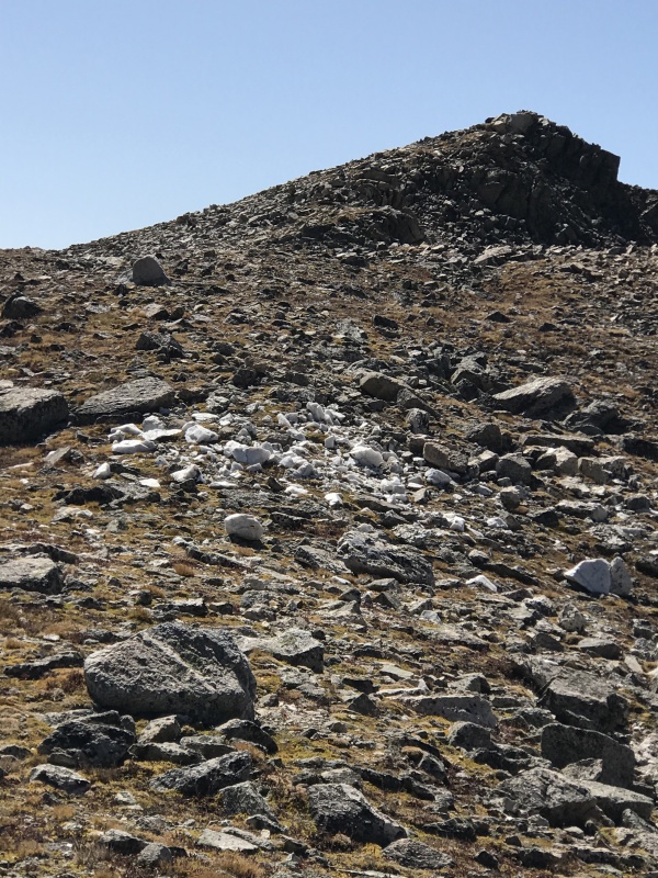
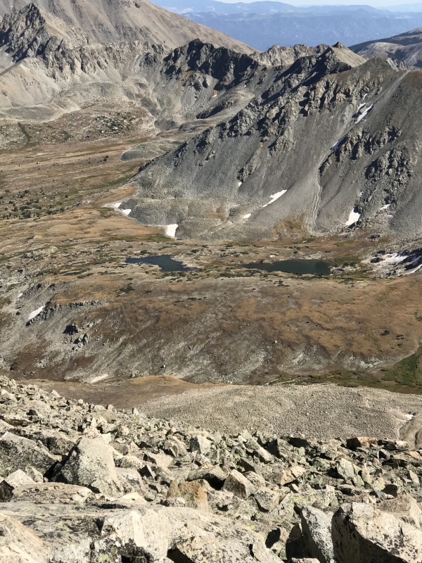
2012 was a banner year for me in terms of hiking. I climbed over 60,000 vertical feet that year completing solo ascents of all Sawatch and Front Range 14ers, and embarking on an endless journey of climbing 13ers and lesser loved peaks in the state. Needless to say, I was at the top of my game. Yet, I turned my back on at least one mountain that season; the most notable one that got away then was Emerald Peak.
My last look at one of the loveliest Sawatch Peaks (October 2012)
Over the ensuing seven years, I had contemplated climbing Emerald on more than one occasion but the the plans never materialized. As recently as last season, I set out for this Centennial and then changed my mind en route to tackle another Sawatch mountain instead, Rinker Peak. But Emerald was always on my mind...
Naturally, when one of my friends expressed a desire to climb a 14er this season, I offered up Missouri and a plan was brewed; Nick and Parth, my partners in crime would climb Missouri and return via the same route, while I would proceed to summit Iowa and finally, Emerald to satiate my unrequited desire. We chose Clohesy Lake for the brevity of its approach and for the variation over the oft-repeated standard approach from Missouri Gulch. Settled, then.
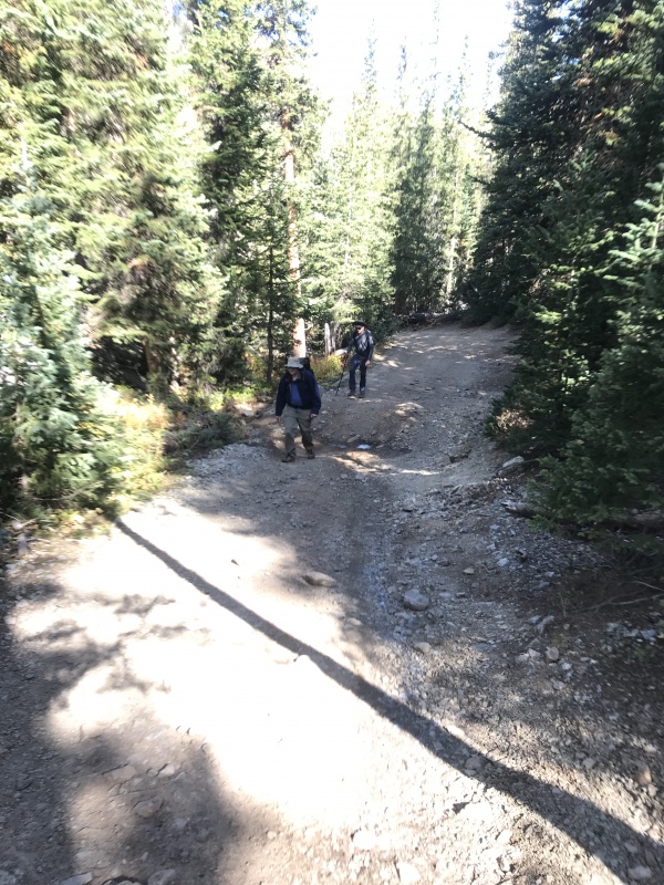
A word about Clohesy Road (CR 381). This drive on is not for the fainthearted. The road is riddled with ruts, sizable rocks and deep pockets that necessitate not only very good clearance but also careful approach angles to avoid damage even in a very capable four-wheel-drive vehicle. The 3-mile drive on this road was excruciatingly slow and took us an entire hour in a Jeep Trailhawk, throwing our planned timeline into complete disarray. We ended up parking at an excellent pullout about half a mile before the gate.
Starting up Lake Clohesy Road
Starting a 14er hike around 10:25 a.m. is rarely a good idea, but the weather forecast for the day was perfect - blue skies, mild winds and zero chance of precipitation. We proceeded past the gate, following the well-worn trail to Clohesy Lake.
Trail to Missouri climbs up the slope to the east (left) of Clohesy Lake
There are a several trails and trail segments from the lake but the main trail to Missouri climbs abruptly away from the lake and winds its way up the lower northwest slopes.
Trail climbs up the lower northwest slopesViews to the west
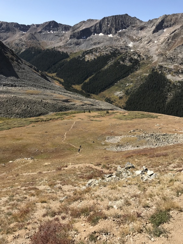
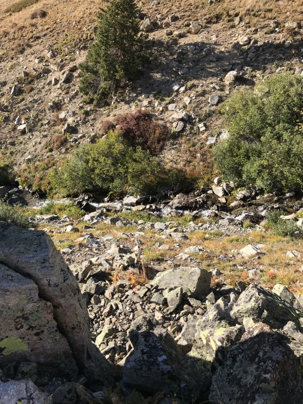
We encountered a fair amount of fallen logs and dead foliage but the route itself was obvious. The trail aims for the basin and then parallels the creek.
Trail approaching the creek
It was still a little early for fall colors but the signs of the season were definitely there.
Early Fall colors
At this point, we decided that it would be best for me to part ways with my friends. After all, they had a relatively straightforward hike to and from Missouri, while I had three peaks to climb and an unplanned descent from the third. Yes, as I've done on numerous occasions, I had not given the descent route much thought, if any, and this would come to haunt me later in the day...
Stepping up my pace
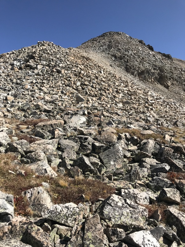
The trail climbs along the lower ridge with minimal switchbacks, making for a fairly direct if steep ascent.
Trail gains elevation very efficiently
We may have had a very late start but we couldn't have picked a better day for this outing; the temperature was perfect and there was nary a cloud in the sky. I made decent progress up the trail mindful that my day would still be much longer than my partners'.
My friends making their way up the trail
In my planning for this hike, I'd originally wanted to skip Missouri altogether and climb Iowa's west ridge and then traverse to Emerald. There were few, if any, documented trips of Iowa's west ridge. As I climbed out of the basin, I studied the saddle between Missouri and Iowa and then Iowa's rough west ridge.
Missouri's northwest ridge and saddle with IowaIowa's seldom climbed West Ridge
Views of the Sawatch behind me were definitely worth a gander.
Sawatchers to the west
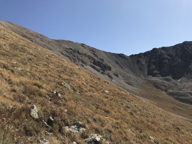
Back on the trail, all that was left between me and Missouri's upper northwest ridge was this grassy slope followed by a rocky pitch.
Grassy slope transitions to rocky ridgeFinal pitch to reach Missouri's NW ridge
At this point I turned and took stock of the route hoping to spot my friends on the trail. Indeed, they were not far behind me.
Spot my friends dead center in this shot
It was when I reached the rocky section that I realized that I had a major weakness in my arsenal, and it wasn't my physical ability. Sure, my conditioning was not what it was in 2012; add to that the questionable recovery from my recent knee surgery and I knew this would be a test of strength and endurance. The real issue, however, was that my shoes were now on their third season and traction was not easy to come by on their worn soles. Any loose rocks or sand under them would cause me to slide making my progress up this section much harder than it should've been.
These shoes have seen better days
When I made it to the ridge and could see Missouri's summit, I spotted a hiker on the peak. After all this was a 14er, so it should not have come as a surprise to me.
Missouri's summit was occupied
This route basically connects with Missouri's standard route from Missouri Gulch. The ridge to the summit should've been easy, but poor traction, thanks to my shoes, made it rather challenging. Coming down the section in the next shot proved to be a slip-and-slide exercise.
I slid down the last part of this section
I stopped for a bit on the first summit of the day, wondering if I should wait for my friends so I could coax them into joining me on the ridge traverse to Emerald. I knew that was wishful thinking, so after enjoying the views for a bit, I decided to march on.
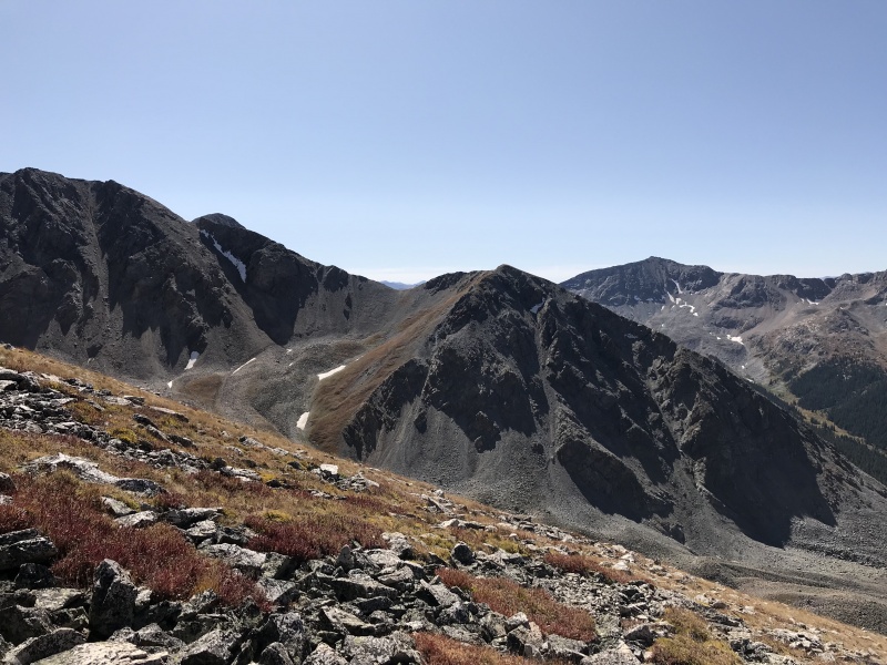
Looking back at Missouri's NW ridgeThe familiar sight of Harvard and ColumbiaUnnamed lake in the basin with Pine Creek
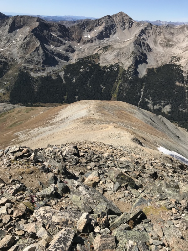
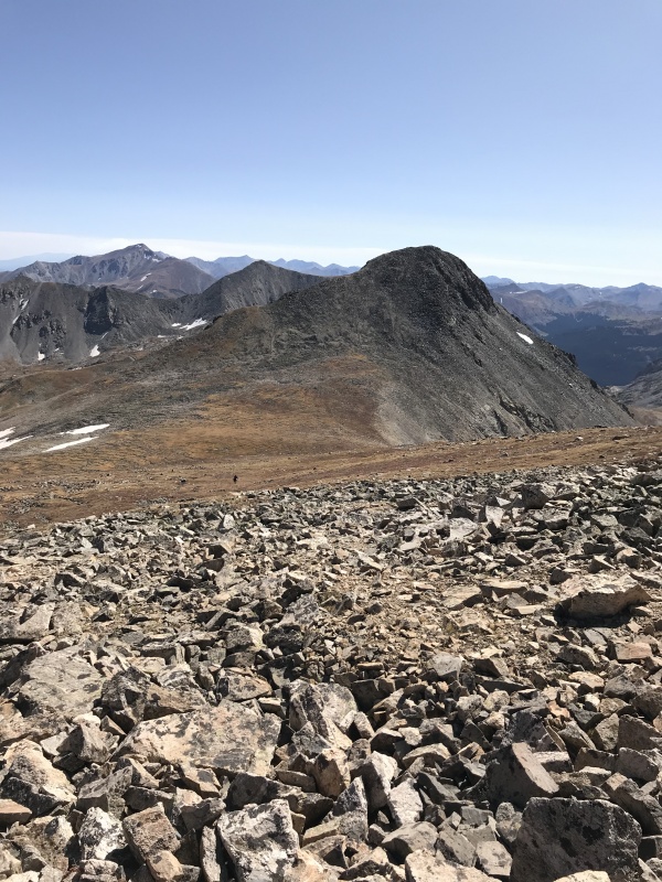
Once I'd sated my appetite for the scenery, I studied the ridge traverse to Iowa; of course, Emerald was all I really cared about, but gaining Iowa's summit en route would be an easy undertaking, much like Missouri.
One Down, two to go...
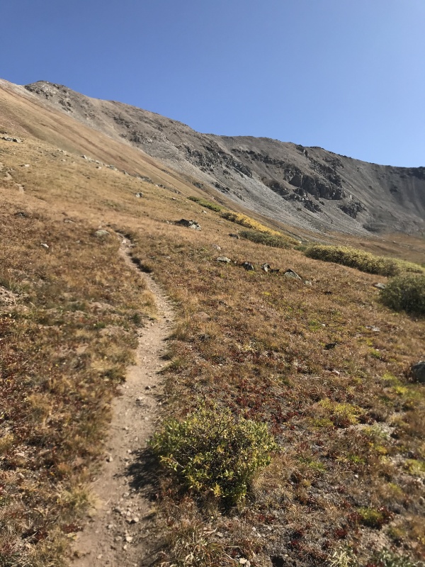
The saddle to Iowa is around 13,500' so this Centennial barely rises the requisite 300 feet to earn its ranking in this state (although it is unranked according to this site). The traverse was straightforward as I remembered, and en route I spotted two more hikers making their way back. I chatted with them briefly; one of them was making the same loop as I was but in the reverse direction.
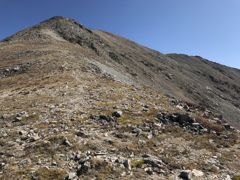
Final pitch to Iowa's summitLooking back at Missouri from Iowa
I didn't stay long on Iowa's summit. I was already over three hours into my trip and I knew my friends would be done long before I would, so I pressed on for what would be the last but certainly not the least. The one that I'd turned my back on, seven years ago. No sooner had I started my descent than I spotted another hiker making his way up from the saddle with Emerald. Boy, these Centennials must be all the rage these days!
Hiker at the saddle between Iowa and Emerald
My trip thus far had been uneventful just as I'd hoped. As always, I'd researched and planned my ascent well and hadn't put a foot wrong. As I mentioned earlier, all my woes would come on my descent. For now, I aimed toward the saddle...
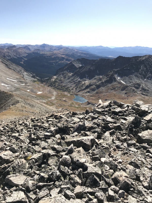
At Emerald's saddle
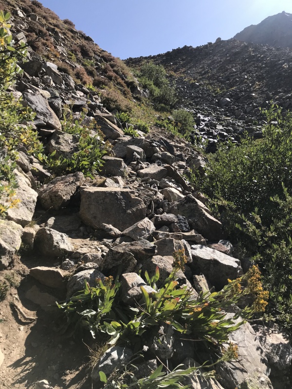
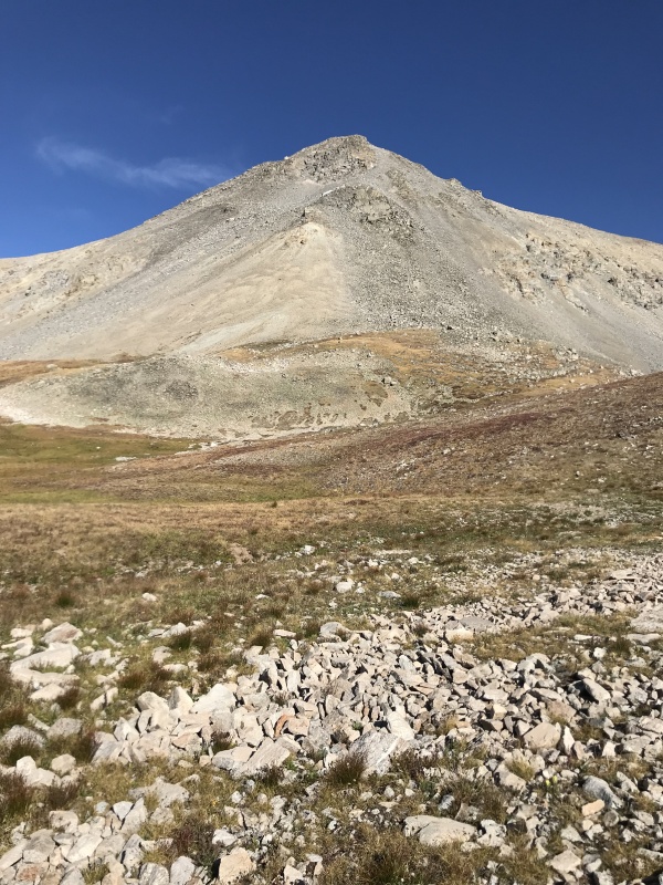
Emerald rises a good six hundred vertical feet above this saddle. I studied Emerald's north slope hoping to find the most expeditious route up its face; as it transpired, it wasn't hard to do at all. I found a trail that meandered up the lower grassy slope and then continued as the terrain transitioned into talus above 13,700'.
Looking down at the trail on Emerald's north slopeFinal rocky pitch to Emerald's summit
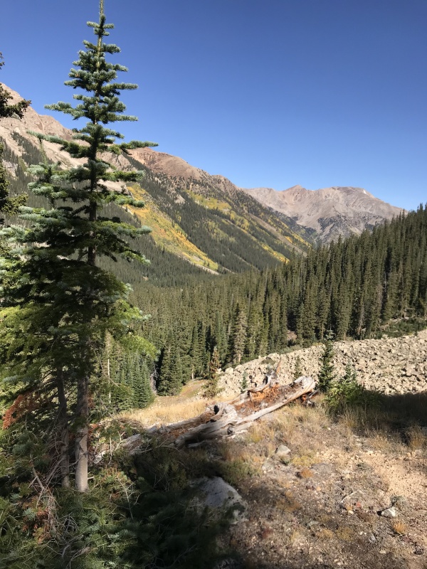
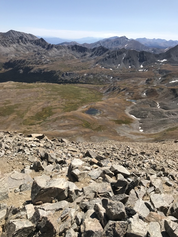
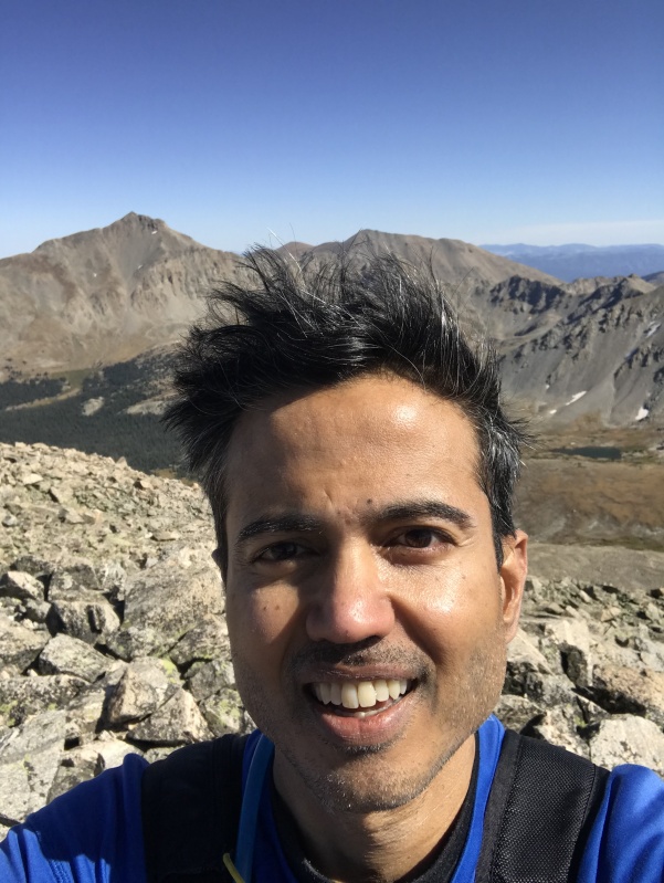
Nearly seven years after my failed attempt of Emerald, I was finally atop its summit, and it felt great. I was running late but I wanted to cherish this station for a bit.
Ice Mtn and North Apostle on the left, Huron on the rightTwin Lakes in the basin to the southeastPear Lake in the basin to the southwest
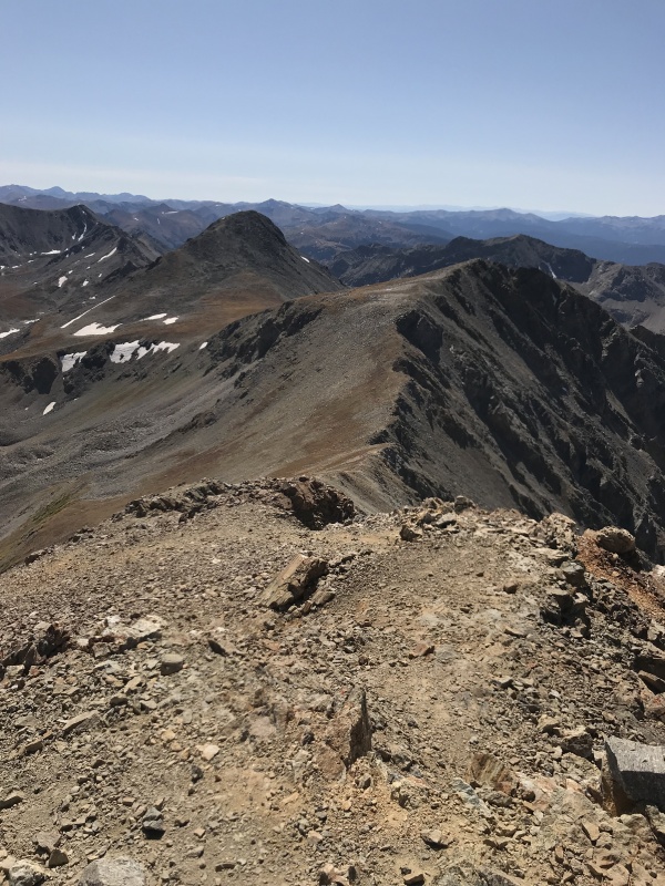
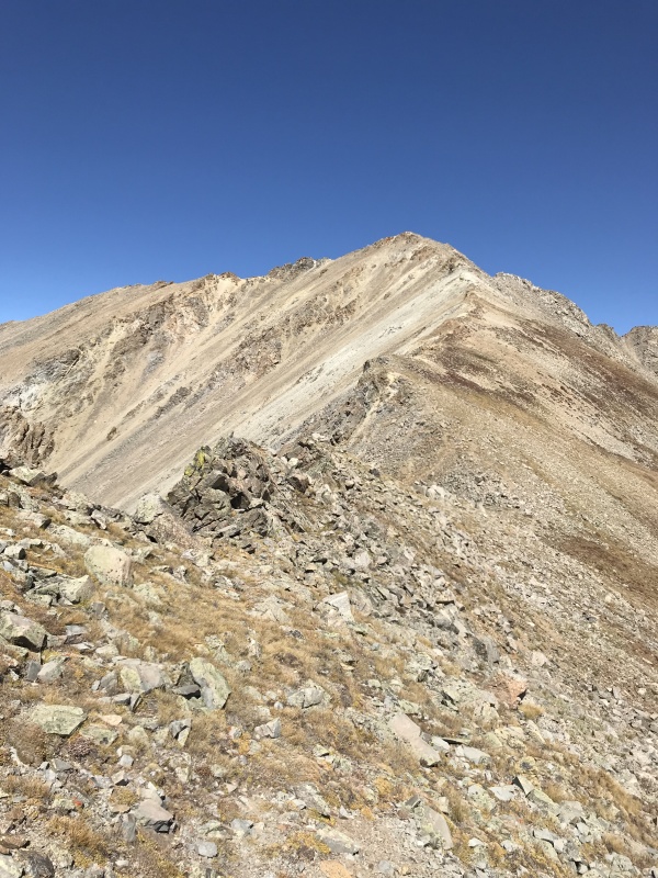
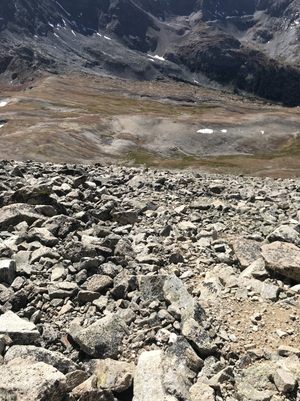
The easiest descent off Emerald is the south ridge. I started on this approach but changed my mind quickly in favor of descending the west slopes directly. "What could possibly go wrong with that", I told myself.
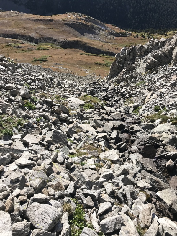
Emerald's south ridge would be the best descent choiceContrast the gentle south ridge with this - the loose west slope
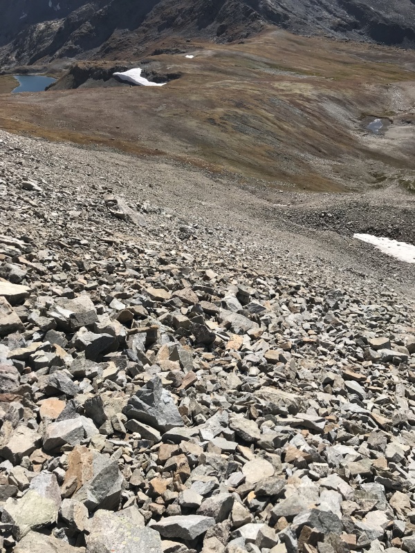
As went the best laid plans of mice and men, so did mine. I lost track of the number of times I slid on my derriere on this loose slope. My worn shoes were only partly to blame.
Looking back up my poor choice of descent routeDirect isn't always the best or even the quickest option
The short clips below show sections of the descent down the treacherous west slope. Over the last couple of decades, I've seen my share of nasty scree slopes; this one would rival any of those in my opinion.
When I finally made it down to the basin, I looked back at the slope I'd descended, relieved and elated that I'd made it down without mishap.
Emerald's treacherous west slope
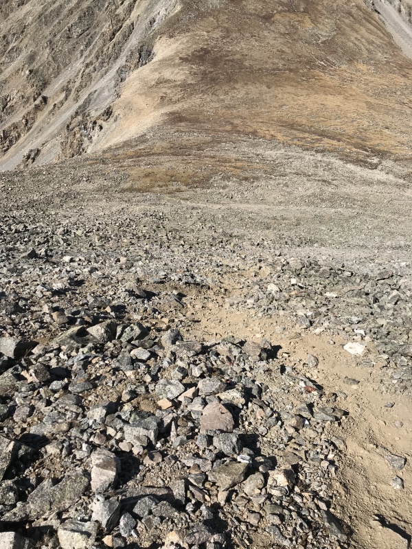
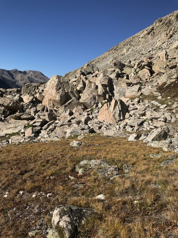
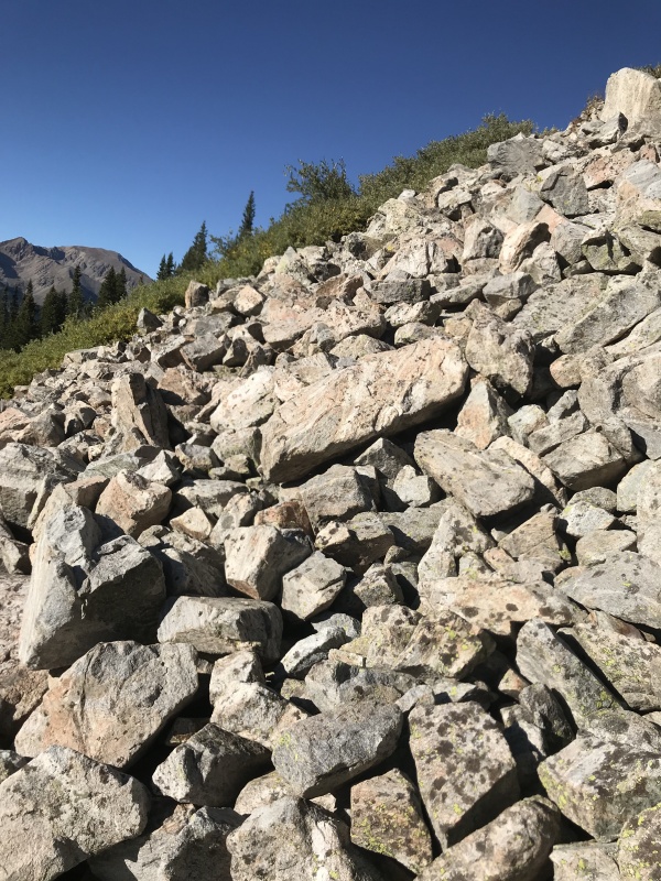
Little did I realize that my day was far from over. By descending directly off the west slope, I thought I'd shortened my return but I would shortly discover that there was no easy way to get down to the creek. Cliffs guarded the lower basin forcing me to sidehill across for what seemed like an eternity. I spent over an hour traversing across the slope, crossing boulder fields, bushwhacking through willows, descending gullies and re-climbing the slope to avoid cliffs below.
Descending a gully only to regain elevation on the other sideOne of many rock walls I had to climbThe boulder fields were endless...almost
In that time, I barely descended 200 vertical feet in what had to be the worst traverse in recent memory. This was no shortcut; far from it, in fact. Indeed, my mileage was less than it would have been had I descended the South ridge toward Peak Lake and taken the trail; but, I traded the joy of walking on that lovely trail for the tedium of sidehilling across difficult terrain and making little progress in losing elevation.
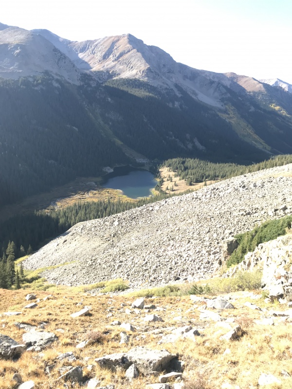
When I finally spotted Clohesy Lake, it seemed so near yet so far.
Clehesy Lake - so near yet so far
There was still some sidehilling to do but the sight of the familiar lake energized me. I wanted to feel the warmth of the trail underneath my feet, so I picked up my pace and aimed for the basin between Iowa and Missouri. One more gully to cross and the trail was mine for the taking.
Final gully between me and trail
As I hiked back to the car, all I could think of was the sight of Iowa Peak's west ridge that was etched in my mind. Why did I not climb this route? I don't exactly know, but maybe, just maybe I had given myself the excuse to come back to this special place for another variation. Perhaps, in another seven years?
Iowa's lower west ridgeYours Truly on Emerald's summit
My GPS Tracks on Google Maps (made from a .GPX file upload):
Yep, I've tried my share of 'shortcuts' in the past, and I'm much more careful about trying them unless I know for fact whether they will really serve me well or just cause a lot of slow and painful misery. If there's a good trail alternative, I now usually follow it even, if on paper, it's longer in distance. That west slope certainly does look nasty! Glad you made it down OK.
GreenhouseGuy and I did Emerald and Iowa from Clohesy Lake and made the mistake of descending from the Missouri/Iowa saddle. What a loose, painful descent! So, I know exactly what you went through. We finally picked up the trail you used to start up on our way down. Sure was nice to get out of that scree. You did us one better by getting Missouri. Nice one Raj. As your reports always are...
Doug: Word.
Jay: I did read GreenhouseGuy's TR and was surprised you guys didn't opt to descend via Iowa's west ridge. Again, I find myself following in your footsteps!
Caution: The information contained in this report may not be accurate and should not be the only resource used in preparation for your climb. Failure to have the necessary experience, physical conditioning, supplies or equipment can result in injury or death. 14ers.com and the author(s) of this report provide no warranties, either express or implied, that the information provided is accurate or reliable. By using the information provided, you agree to indemnify and hold harmless 14ers.com and the report author(s) with respect to any claims and demands against them, including any attorney fees and expenses. Please read the 14ers.com Safety and Disclaimer pages for more information.
Please respect private property: 14ers.com supports the rights of private landowners to determine how and by whom their land will be used. In Colorado, it is your responsibility to determine if land is private and to obtain the appropriate permission before entering the property.


")
")
")
")
")
")
")
")
")
")
")
")
")
")
")
")
")
")
")
")
")
")
")
")
")
")
")
")
")
")
")
")
")
")
")
")
")
")
")
")
")
")
")
")


