Download Agreement, Release, and Acknowledgement of Risk:
You (the person requesting this file download) fully understand mountain climbing ("Activity") involves risks and dangers of serious bodily injury, including permanent disability, paralysis, and death ("Risks") and you fully accept and assume all such risks and all responsibility for losses, costs, and damages you incur as a result of your participation in this Activity.
You acknowledge that information in the file you have chosen to download may not be accurate and may contain errors. You agree to assume all risks when using this information and agree to release and discharge 14ers.com, 14ers Inc. and the author(s) of such information (collectively, the "Released Parties").
You hereby discharge the Released Parties from all damages, actions, claims and liabilities of any nature, specifically including, but not limited to, damages, actions, claims and liabilities arising from or related to the negligence of the Released Parties. You further agree to indemnify, hold harmless and defend 14ers.com, 14ers Inc. and each of the other Released Parties from and against any loss, damage, liability and expense, including costs and attorney fees, incurred by 14ers.com, 14ers Inc. or any of the other Released Parties as a result of you using information provided on the 14ers.com or 14ers Inc. websites.
You have read this agreement, fully understand its terms and intend it to be a complete and unconditional release of all liability to the greatest extent allowed by law and agree that if any portion of this agreement is held to be invalid the balance, notwithstanding, shall continue in full force and effect.
By clicking "OK" you agree to these terms. If you DO NOT agree, click "Cancel"...
Trailhead Elevation at parking lot: about 14,990 Feet
Elevation at Refúgio Jose Rivas Hut: 15,950 Feet
Grade II PD- / YDS Class 2+ ice and snow
December 20th-21st, 2018
Guide: David Trujillo
Freak On a Leash
My adventure on Cotopaxi began with a rest day at the Tambopaxi Lodge in Cotopaxi National Park. Tambopaxi has private rooms available, but I stayed in the hostel portion which is quite reasonably priced. My room slept up to eight people, and had a picture window with a million-dollar view of Cotopaxi. Downstairs there was a restaurant with a limited menu of very good food, beer and soft drinks. There was also a living room with couches where people could gather to relax and chat, read, or watch television. The lodge is at about 12,028 feet, so altitude can be an issue for some people. Outside, there were hiking trails that led to lakes, waterfalls, and the ruins of an ancient Inca fortress. The overall atmosphere was very quiet and relaxing.
Cotopaxi Room at the Tambopaxi Lodge
Time to relax
I honestly can’t say whether or not the Ecuadorean beer was any good. I was taking Diamox (acetazolamide) for prevention of altitude sickness, and it affects the taste of beer and a few other things. It can also cause numbness in the fingertips, lips, and nose. I didn’t feel the side effects at rest, but I sometimes felt them under exertion at altitude. It’s not a great feeling, and many people choose not to take it. Many European doctors refuse to prescribe it, and it tends to cost about four times as much in the U.S. as it does in other countries. Ever get the feeling you’ve been cheated?
View of Cotopaxi from the living room at the Tambopaxi Lodge
It was raining on the morning of my rest day, so I put off my acclimatization hike until the afternoon. I used some camp suds to wash socks, underwear, and a shirt in the bathroom sink. Camp suds take up less luggage space than additional clothing. After a nice, hot shower, I went down for a breakfast of granola, fresh fruit, scrambled eggs, and juice. A Pop Tart would have been fine by me, but I rarely turn down good food when it’s available. I spent the rest of the morning reading and chatting with other guests while it rained sporadically. After a lunch of vegetable soup and a grilled chicken breast over rice, I finally got outside.
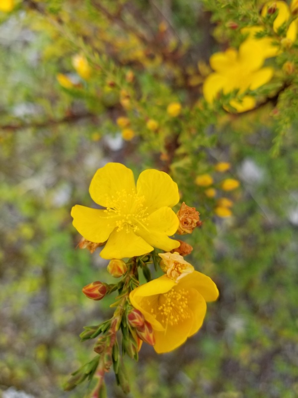
There is a trail behind the lodge that is supposed to be used as an evacuation route in the event of a volcanic eruption. It looked like an ideal hiking trail, so I got out and stretched my legs a little. There were plenty of wildflowers along the trail, so I stopped to get some pictures.
Hypericumlaricifolium, a type of St. John’s Wort
Looking down on the Tambopaxi Lodge from the evacuation route
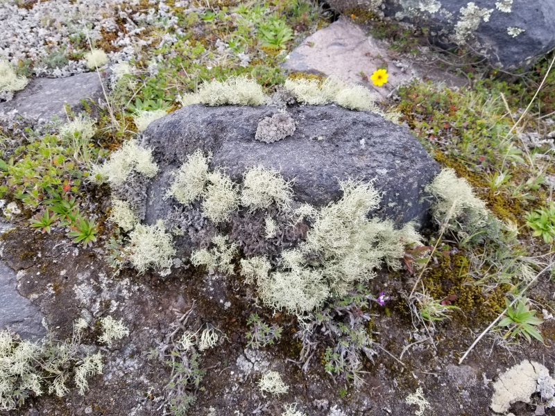
A lichen-covered rock
As I hiked through the short grass of the páramo (a type of tundra), I saw a few dark brown rabbits feeding. A few minutes later, I saw a fox that was apparently hunting for rabbits. I got the idea that I should try for some wildlife pictures, so I went up to the top of the hill to see if I could spot any wild horses. I saw some about a half mile away, and tried to keep a small knoll between us so they couldn’t see me approaching. I didn’t actually fool the horses, but they weren’t particularly frightened. I kept a respectful distance and got the best shot I could get with my point-and-shoot camera.
Wild horse on the páramo
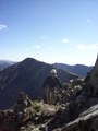
After stalking the horses, I followed the ridge back to a hill directly across from the lodge. Along the way, my entire face went numb. The weather was fine, so this was undoubtedly the Diamox at work again. I found a grassy spot on the hill and contemplated life while watching clouds float over Ruminahui. This is how one kills time on the páramo. After about half an hour, the rain chased me back inside.
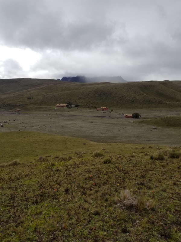
Tambopaxi Lodge from the hilltop, with Ruminahui partially visible in the background
A hiker from Washington named Olivia checked in that afternoon; she was the first American that I had spoken to in several days. We would be heading up to the refuge to hike Cotopaxi on the same day. Her guide Francisco and I shared the same room that night. I slept a little, dreamed a little, and spent most of the night staring at the ceiling again. Sleep doesn’t come easily to me at 12,000 feet.
The next day was “go day” for the Refúgio Jose Rivas. I sorted the gear that I needed to take with me, and left the rest for safe keeping with the mâitre Ä Patrício (for a nominal fee, of course). Forgetting anything important like crampons would have had dire consequences. David showed up at about 3:00, and we left for the refuge.
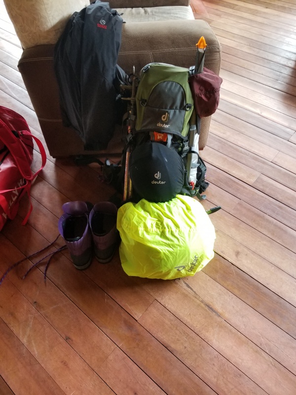
Geared up for Cotopaxi: helmet, crampons, ice axe, double plastic boots, sleeping bag, and more
The weather forecast wasn’t great, but I wasn’t concerned. The low temp was supposed to be about -6° C, which translates to about 21° F. Winds of 10-15 m.p.h. would bring the wind chill factor down to an uncomfortable level, but I had appropriate gear for those temperatures. There was a miniscule amount of snow in the forecast as well, but it didn’t sound like a deal breaker. I had been warned about the humidity in freezing weather, but the only way to really learn about it is to experience it.
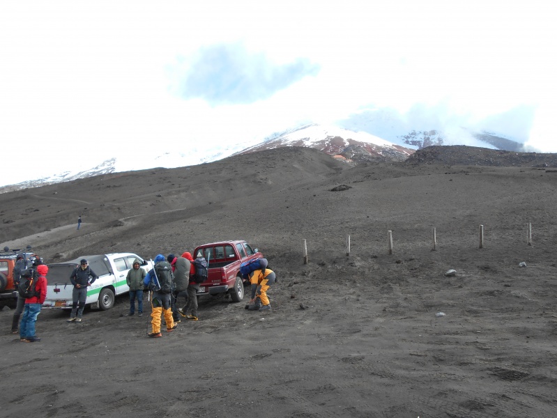
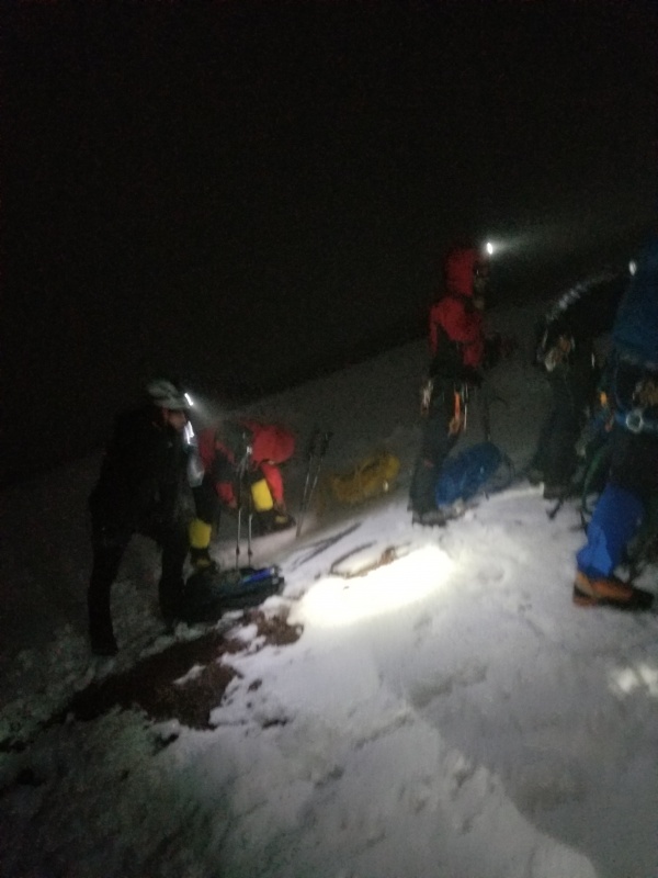
It was overcast and the wind was blowing steadily when we arrived at the parking lot for the refuge.
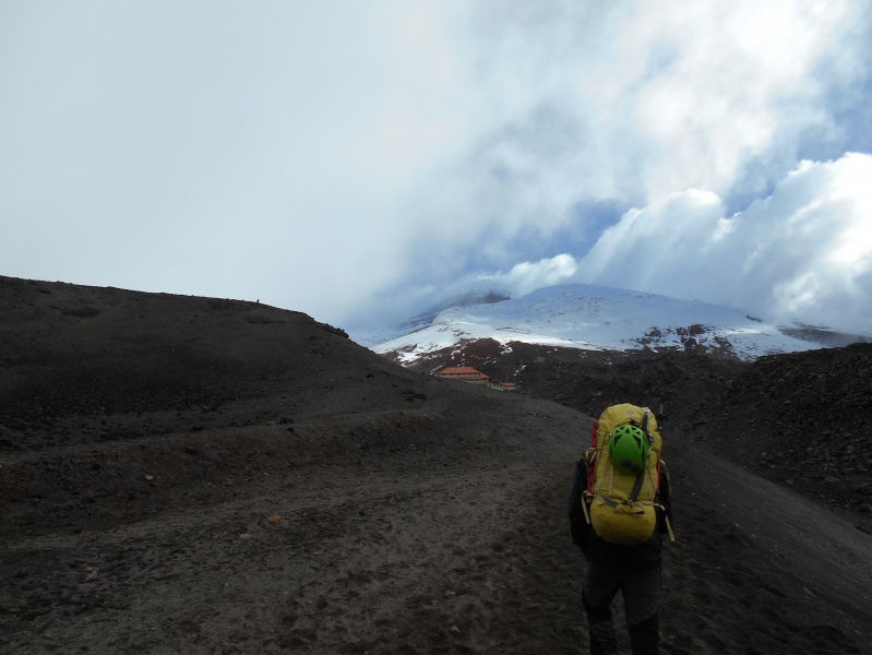
Trekkers at the parking lot getting ready to hike up to the refuge
Hiking from the lot to the refuge generally takes 45 minutes; we got there in half an hour. David’s personal best is 12 minutes. The only reliable way to get acclimated to hiking above 15,000 feet is to spend lots of time above 15,000 feet. David seems to be up there almost every week.
Hiking the main trail up to the refuge
On the trail
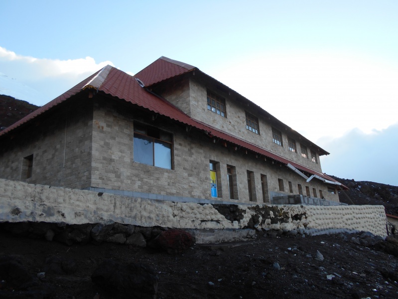
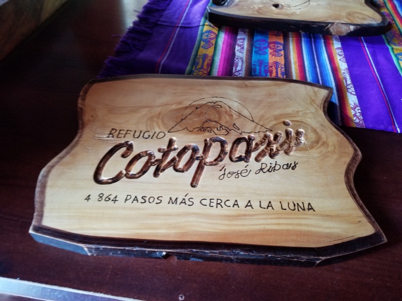
Sign for Refúgio Jose Rivas, 15,953 feet
The refúgio
The refuge was built in 1971. It is unheated, but has flush toilets and running water. There is a kitchen with a cook to prepare meals for the guests, and it’s possible to purchase bottled water and snacks there. The bunk beds have pillows, mattresses, and comforters. An avalanche of glacial ice partially buried the refuge in 1996, killing about a dozen hikers. With its location just below a glacier in a seismically active area, avalanches are always going to be a risk.
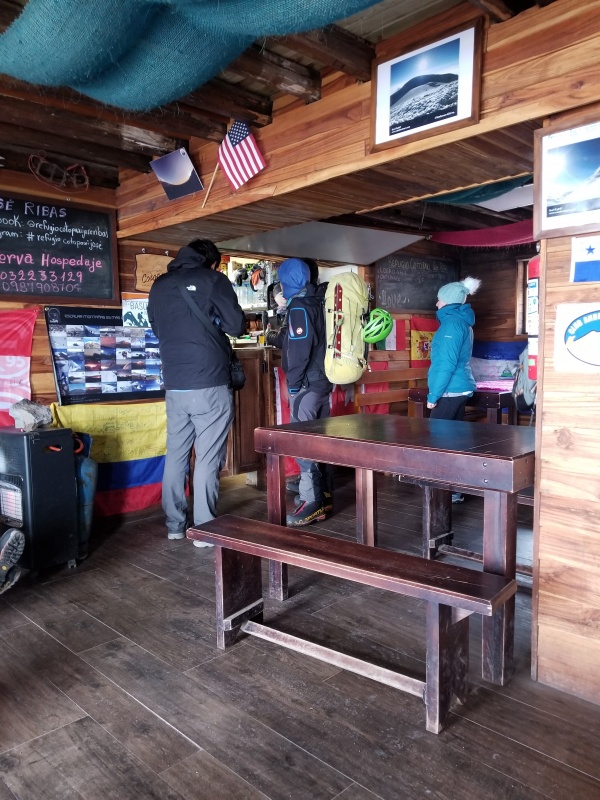
Customers at the kitchen inside the refuge
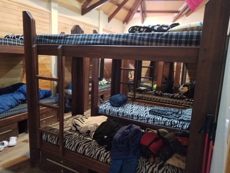
The bunk room where I stayed
We had hot tea and popcorn, and a dinner of quinoa soup was served not long afterwards. I saw Olivia from Tambopaxi, and Bacchus, who was one of the German hikers we met on Iliniza Norte. We hit the rack immediately after dinner, because the plan was to get up at 11:00 p.m. to start the climb at midnight. I was warm enough in my sleeping bag, but didn’t sleep at all. The lights came on promptly at 11:00, and somebody cranked Pink Floyd’s “Comfortably Numb” through their Bluetooth speaker. With so many layers of socks, shirts, pants, coats, and even two layers of boots, it wouldn’t have been much more difficult to have prepared for interplanetary travel. We had a pre-breakfast of rolls with butter and jam, and were out the door just a few minutes past midnight.
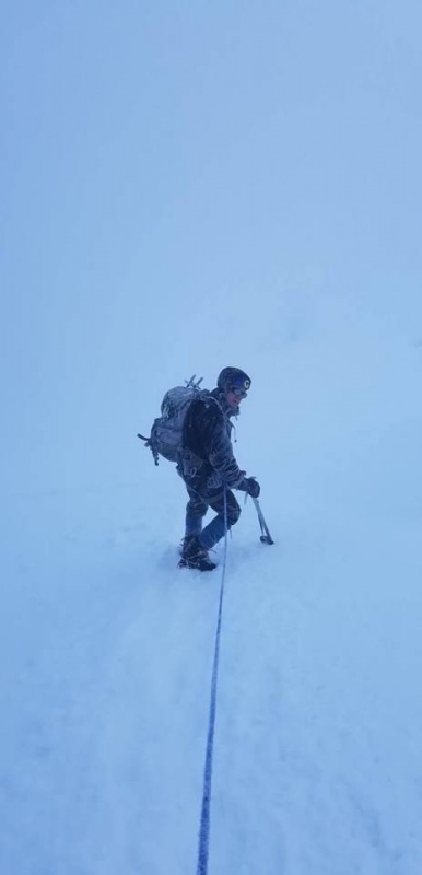
The first quarter mile was on deep volcanic sand, so trekking poles helped. After we stopped to put our crampons on, some people still used trekking poles while most of us switched to an ice axe. We were roped together for safety, but it still would have been difficult to self-arrest with trekking poles.
Stopping to put crampons on
Switchbacking up the glacier
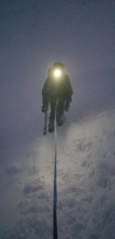
Photography was difficult in the dark, because it was tedious to remove several layers of gloves to tinker with electronics. While we were still tightly grouped together, stopping to take a photo would have held up the whole line. We kept moving for safety and to keep ourselves warm.
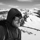
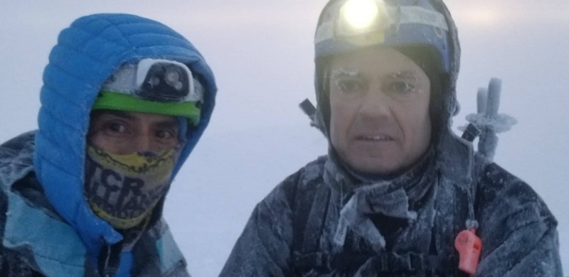
Feelin’ like a freak on a leash
Note that I’m holding my ice axe in my downhill hand in the above image; I should have been holding it in my uphill hand. Most of my previous ice axe experience has come from going straight up and down couloirs and a couple of easy glaciers. Switchbacking back and forth means having to change hands frequently, which was arduous and time-consuming with heavy mittens. This rendered my wrist leash virtually useless. A leash that hooked to my harness would have been far more useful. I noticed that not many of the climbers bothered to use a leash on their ice axe. Cotopaxi has some steep slopes, and a dropped ice axe could get away from a climber quickly.
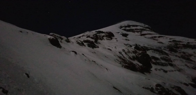
View of the upper glacier
The wind was almost strong enough to cause problems. The guides were considering cancelling the climb if the winds exceeded 20 k.p.h.; ordinarily, this would not be strong enough to cause many issues. Some parts of the icy track on the glacier consist of a shelf trail not much more than a foot wide above a steep slope. Getting blown off balance on these parts of the route would be potentially dangerous.
I’m not sure about the altitude, but I first noticed the smell of volcanic gases at about 3:30 a.m. Hydrogen sulfide gives off an unmistakable rotten egg odor, and can irritate lungs at higher concentrations. Some of the vents released stronger gases than others.
All told, about 80% of the climbers who attempt Cotopaxi make the summit. Some suffer minor injuries, some suffer from fatigue, and many suffer from acute mountain sickness (AMS). Some never leave the lodge because of AMS or food-borne illness. Most hikers of normal ability can make the summit if they pace themselves well. The guides on Kilimanjaro use the Swahili phrase “pole-pole” (slowly, slowly) to describe the appropriate pace. That same advice works well on Cotopaxi. Plodding along slowly and methodically without many breaks is the surest way to make the summit.
Another team behind us near the summit
There were steep inclines and relatively level traverses, but the slope seemed to steepen near the top. Double plastic boots are inflexible, and it can be painful to walk straight uphill with no flex in the ankles. French stepping or “flat footing” sideways up the slope relieved the pain and seemed to be a bit faster. It was safer as well, because I was able to keep 10 points of the crampons engaged in the ice instead of just the front points. A few meters below the rim, when I really needed oxygen the most, I inhaled deeply and filled my lungs with overwhelmingly potent volcanic gases. After a brief coughing fit, I finally topped out with a few of our fellow climbers.
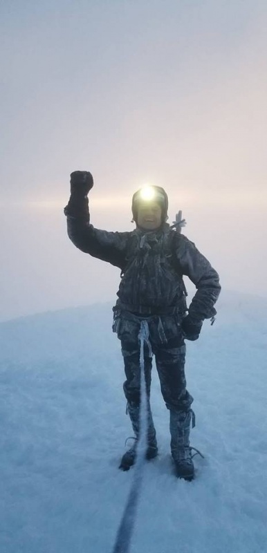
Cotopaxi summit just before sunrise
We summited at 5:30, just a few minutes before sunrise. As darkness waned, I could see how the humid breeze had frosted our coats. The rime was even thicker on anything metal, just like in the days before frost-free refrigerators. I literally had icicles on my eyebrows like Jack Nicholson in “The Shining,” and my eyelashes froze together when I blinked. As long as we were mobile, I was able to stay warm. After just a few minutes on the summit, I was ready for my down jacket. We only stayed on the summit for a few minutes, so I didn’t bother to layer up.
Frozen
Cotopaxi sunrise
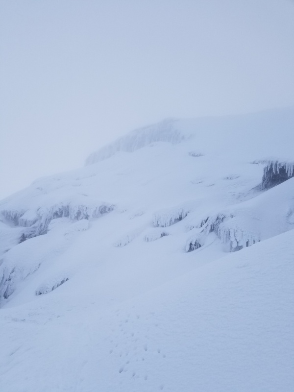
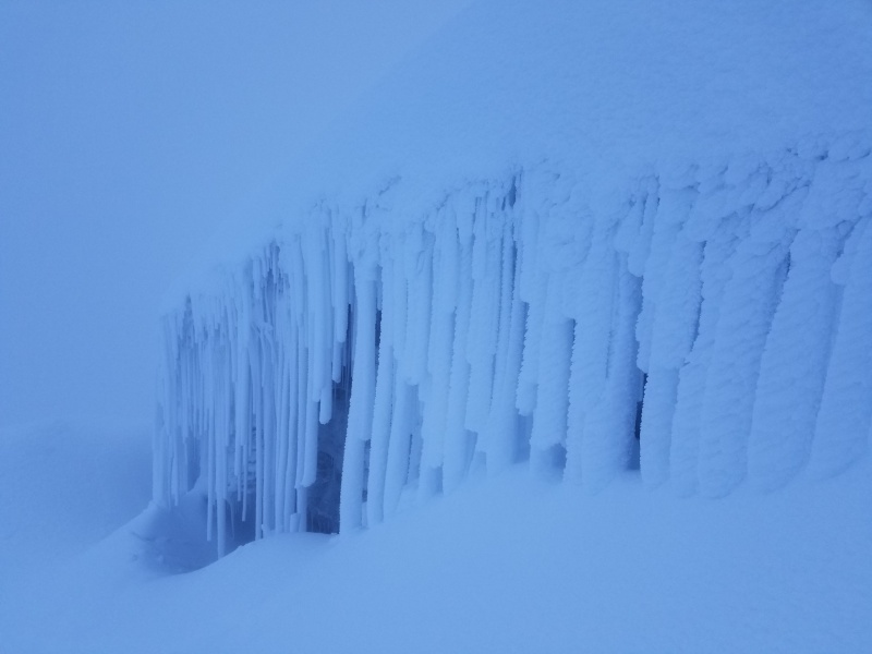
Visibility improved somewhat after sunrise, but not to the extent that I had hoped. We were still enveloped in the clouds, and it was like viewing everything through a foggy lens. Clear blue skies and sunshine would have been lovely, but the fog made this alien landscape of ice, snow, crevasses, and bergschrunds even more unforgettable. A journey to Mars couldn’t have been more surreal.
Descending into the mist
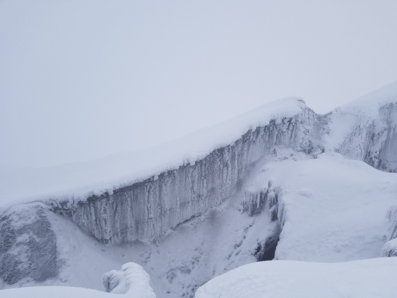
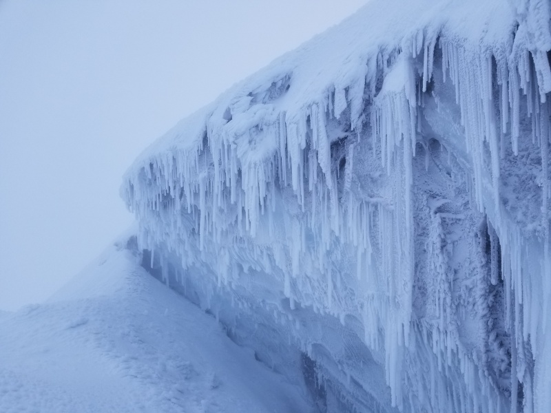
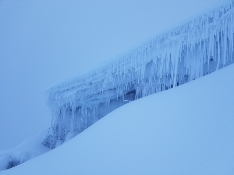
Cotopaxi’s many bergschrunds were an impressive sight to behold. A bergschrund is a cleft in the glacier that is caused by moving ice. The upper part of the ice (the firn) remains in place, while the lower part of the ice moves downhill and drops down the slope. This forms a structure like the mouth of a cave, and it can be very deep. Ice and snow melting on the upper part of the ice may drip down and form massive icicles. Bergschrunds can be formidable obstacles in a climber’s path.
Bergschrund on Cotopaxi
A fractured landscape
White fangs of ice
Frozen pillars
Crevasse attacking a bergschrund
Otherworldly
Dozens of hikers wearing crampons tend to leave an indelible mark on a glacier, so it was easy to retrace our steps back to the refuge. My preoccupation with wanting to find the best pizza in Quito motivated me to descend in less than half the time it took to summit. We broke free from the clouds shortly before we reached the edge of the glacier. We removed our frozen crampons at the glacier’s edge and returned triumphantly to the refuge. As the frost gradually melted, my backpack and every article of clothing became damp. Even some things inside my pack were soggy. There was no time to dry anything out, so I just layered down and stowed everything for the short trek back to the truck. Before we left, we had a proper meal of a sweet breakfast tamale, fresh fruit, granola, yogurt, and hot tea. I didn’t get my celebratory pizza and beer until well after dark, but it was worth the wait.
Serving tray at the refuge
I didn’t climb Cotopaxi on a whim. Since my wife’s passing, I’ve found it useful to set large goals to keep myself focused on living. As one of the most beautiful mountains on the planet, Cotopaxi was a worthy goal. To reach my objective, I logged hundreds of miles on my treadmill, tens of thousands of feet on my vertical trainer, and climbed more Colorado mountains than I would care to mention. Many non-mountaineers might question the sanity of becoming a “Conquistador of the Useless,” but the mountains actually are my sanity. Cotopaxi has propelled me into 2019 in good shape and ready to take on more challenges. I’m grateful for the encouragement from my friends and family, and special thanks to my guide David Trujillo for his friendship and assistance. He’s undoubtedly one of the most talented guides in Ecuador.
Thumbnails for uploaded photos (click to open slideshow):
Guiding is mandatory only on the glaciated peaks, but you may find it helpful elsewhere. My guide handled all of the meals, transportation, and accommodations, among other things. He knew the best restaurants, had training as a tour guide, and seemed to have connections everywhere. It was an excellent experience for me.
Yes, Cotopaxi is one of the coolest mountains around. I enjoyed the country, the people, and the food as well. I had an individual guide instead of going with a group tour. All transportation, accommodations, and most meals were included. I tipped the guide and anybody who helped in any way. All that was $2,300, plus airfare. I shopped around on Orbitz and got airfare for $900. They weren't great tickets, and I had a 20 hour layover in Mexico City on the way back because December 23rd is one of the busiest travel days of the year. I had an experienced guide, and everything went well, so it was worth it to me. Going with a group would have saved some money, but I didn't want to have to turn around if somebody else had issues with the altitude. That happens. If you love mountains, Ecuador should be high on your list. If I go back, I'll try to spend a few days unwinding at the beach afterwards.
Thanks for including pics of non mt things like the lodging and including food choices. Nice trip. Physical exertion I have found is good for grief. Keep on moving amigo
I was down there in November and got Rucu Pichincha, Cayambe, and Cotopaxi. The weather looked pretty similar to my trip. I'd like to head back at some point for Illiniza, Antisana, and Chimborazo. Way to go!
Your return trip sounds great - my guide said that Antisana is one of the prettiest mountains. Chimbo has its obvious appeal as the highest in Ecuador and the only 6,000 meter peak. I'd definitely want to hit those two peaks.
Thanks! We all live vicariously through these reports. I've received a lot of motivation from others in this group as well.
Caution: The information contained in this report may not be accurate and should not be the only resource used in preparation for your climb. Failure to have the necessary experience, physical conditioning, supplies or equipment can result in injury or death. 14ers.com and the author(s) of this report provide no warranties, either express or implied, that the information provided is accurate or reliable. By using the information provided, you agree to indemnify and hold harmless 14ers.com and the report author(s) with respect to any claims and demands against them, including any attorney fees and expenses. Please read the 14ers.com Safety and Disclaimer pages for more information.
Please respect private property: 14ers.com supports the rights of private landowners to determine how and by whom their land will be used. In Colorado, it is your responsibility to determine if land is private and to obtain the appropriate permission before entering the property.


")
")
")
")
")
")
")
")
")
")
")
")
")
")
")
")
")
")
")
")
")
")
")
")
")
")
")
")
")
")
")
")