| Report Type | Full |
| Peak(s) |
Rucu Pichincha - 15413 |
| Date Posted | 12/27/2018 |
| Date Climbed | 12/16/2018 |
| Author | Greenhouseguy |
| Where Eagles Dare: Paso de la Muerte Route |
|---|
|
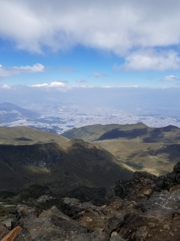
Rucu Pichincha 15,413 Feet (15th Highest in Ecuador) Paso de la Muerte Route Trailhead Elevation at Cruz Loma: 12,943 Feet Class 5.4 (?) December 16th, 2018 Guide: David Trujillo Where Eagles Dare: Paso de la Muerte Route The city of Quito, Ecuador lies in a valley surrounded by high mountains. One of these mountains, whose base is actually within the city limits, is Rucu Pichincha. The Incas assigned genders to mountains, and in the Quechua language, this one was the father Pichincha (as opposed to its neighboring peak Guagua Pichincha, which is the son). 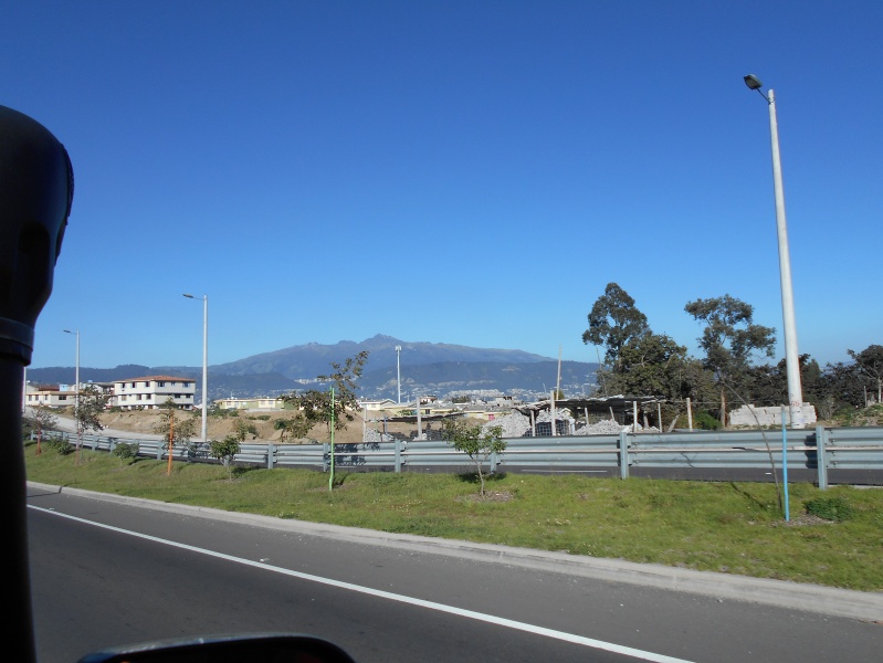
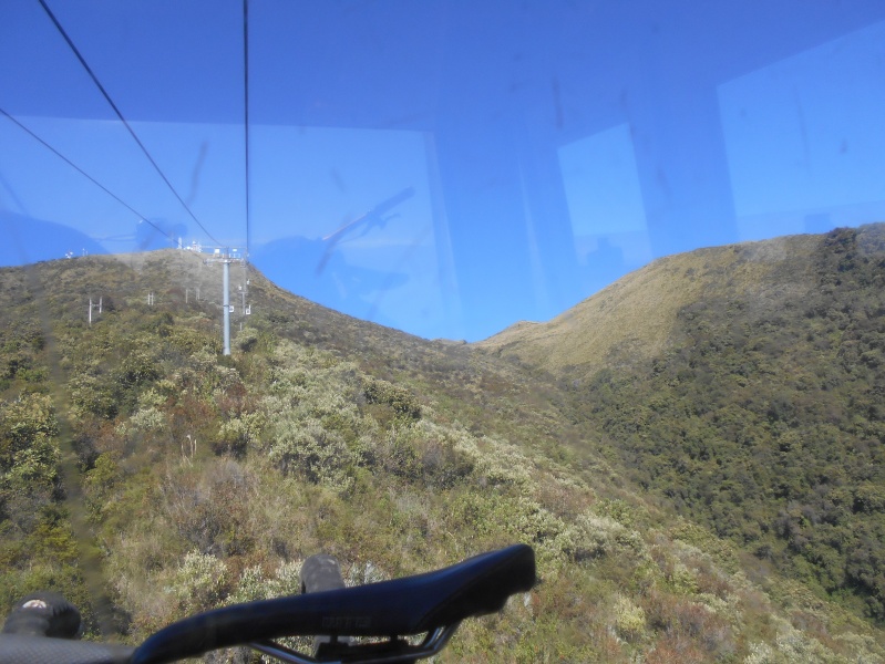
There is a Class 1/Class 2 trail to the summit that starts down low, but most people start the trek by taking the teleférico (gondola) to the upper station at Cruz Loma (12,943 feet). Cruz Loma is a tourist attraction in itself, with scenic overlooks, outdoor dining, and horse and llama rentals. From Cruz Loma, most people take the trail that traverses the east side of the mountain, and then ascend a moderately difficult sandy slope to reach the summit. The less-popular alternative route follows the ridge and is known as the “Paso de la Muerte” (pass of death) route. I was expecting to take the standard route, but my guide David thought that the Paso de la Muerte route would be better for acclimatization. Guides probably have a difficult time amusing themselves on the standard route. We drove up the winding road to the teleférico station and bought the tickets for the ride. The gondolas have racks on the outside to carry mountain bikes up to the upper station. There is a popular mountain bike trail that goes from Cruz Loma back to the lower teleférico station. 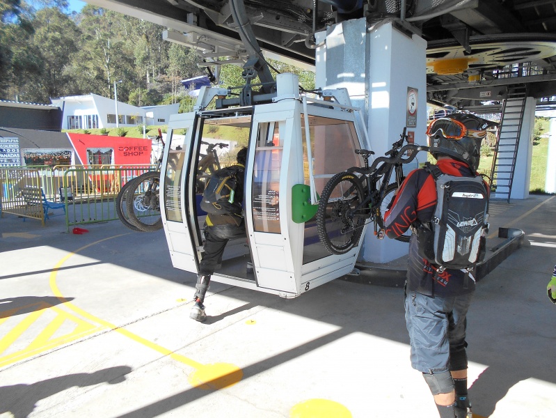
The scenic overlook at Cruz Loma is the final destination for many gondola riders, but some stay for short sightseeing hikes in the area. Only a small percentage of riders actually continue to Rucu Pichincha. 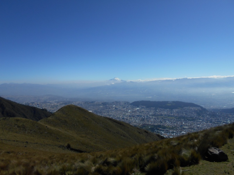
At the beginning of the hike, a sign advises hikers to use the services of a guide, and to carry food, water, rain gear, proper footwear, a first aid kit, and a whistle. The route should not be started after 11:00, and should be finished by 5:00. 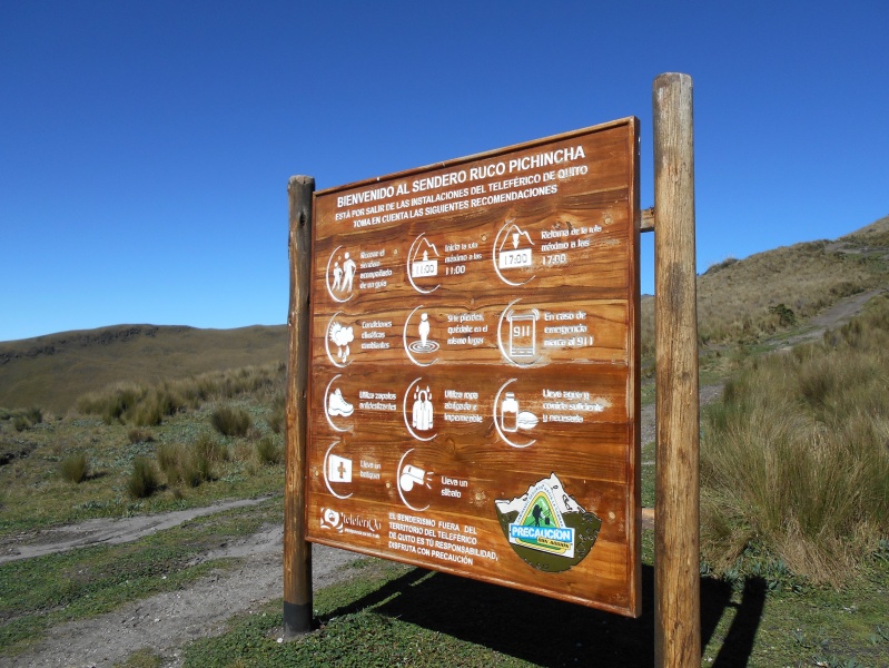
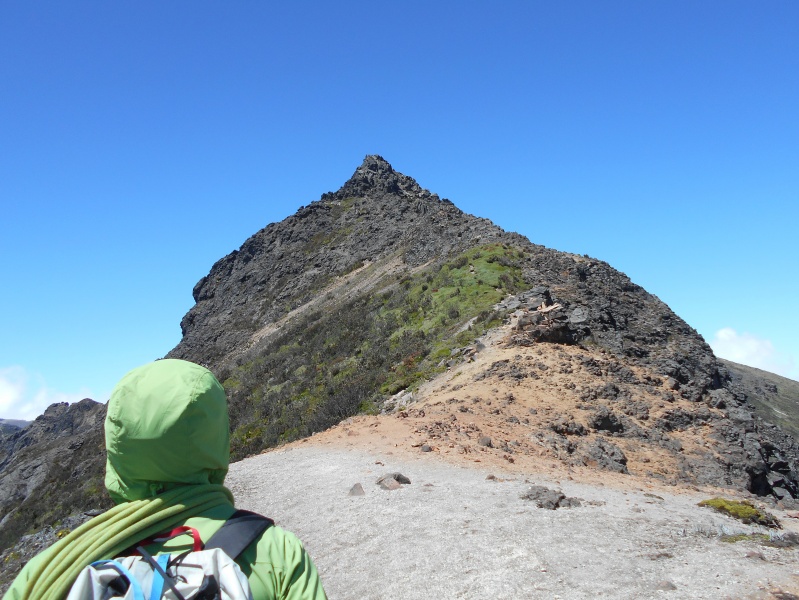
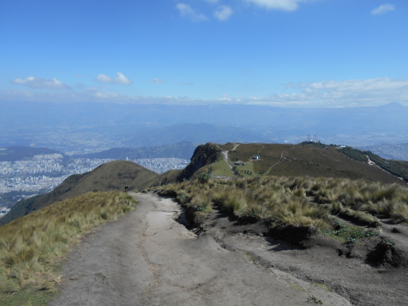
The lower trail is wide and well-defined; it goes up and over numerous bumps on the ridge. 
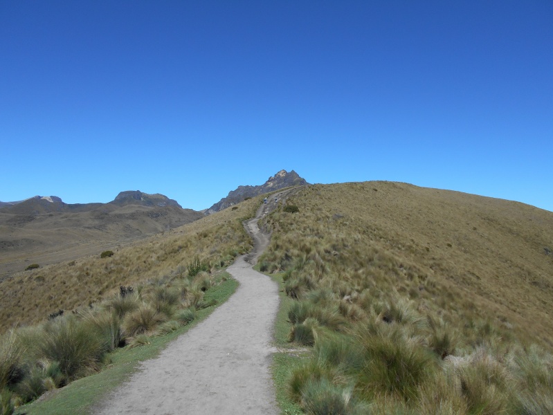
As we gained altitude, I got a closer look at our route. Routes always seem to look more difficult from a distance, but I could tell that this one was going to be rough. 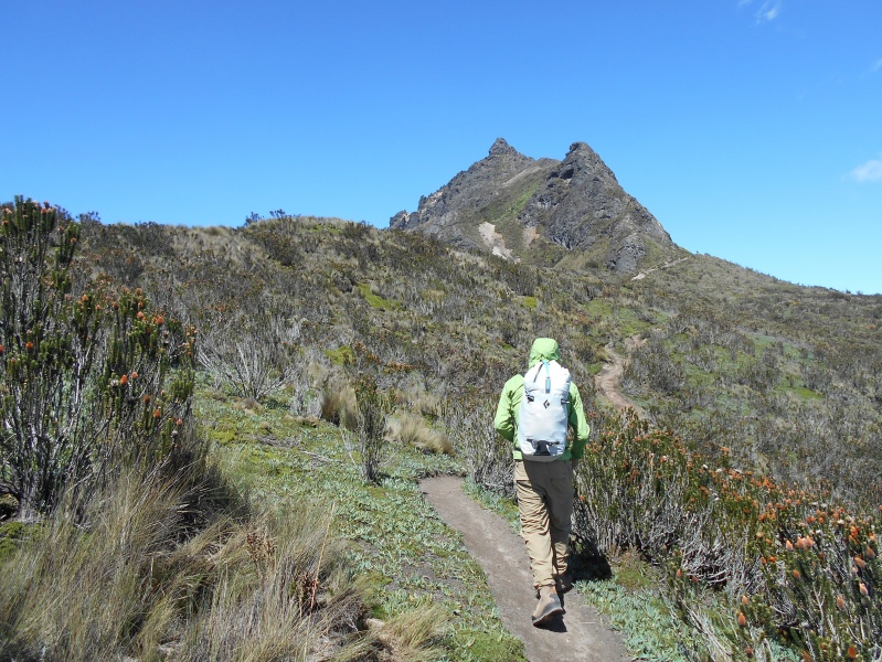
A journey of a thousand miles begins with a single step. We left the main trail, and a short spur trail took us directly to the rocky ridge crest. 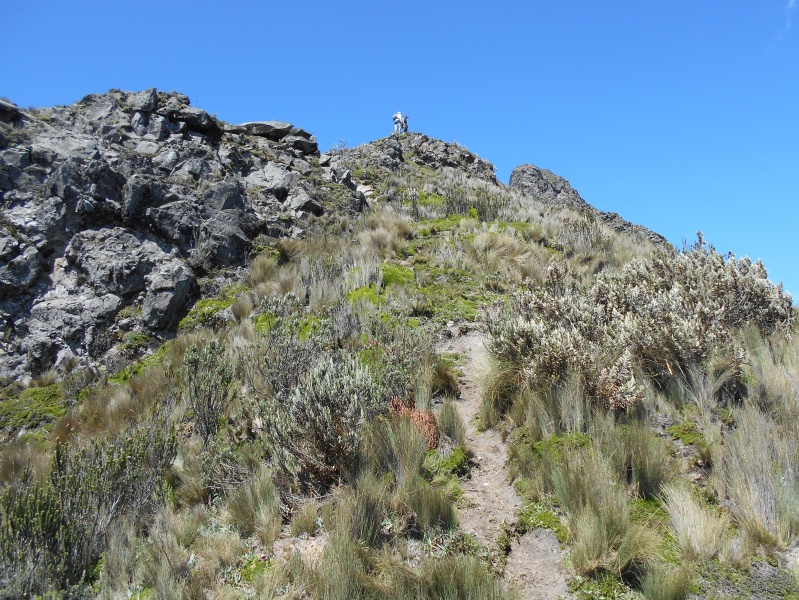
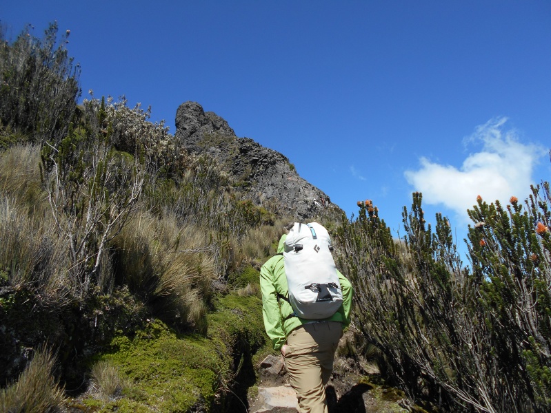
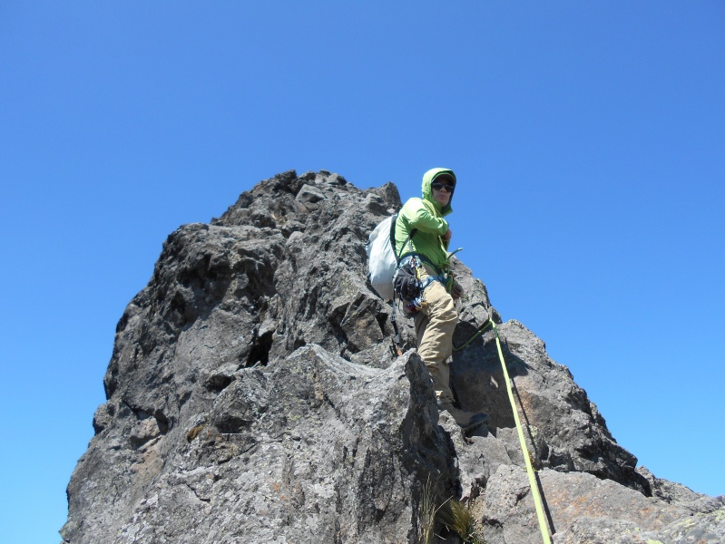
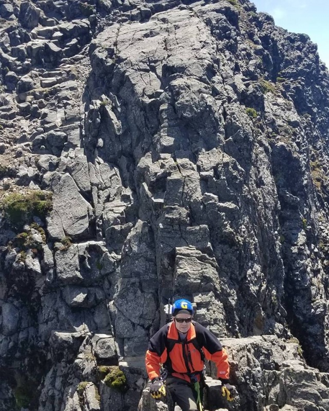
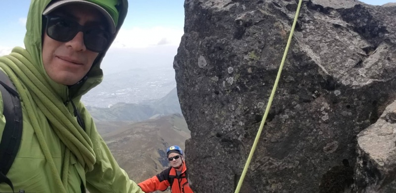
Before we started the serious part of the climb, we put on our helmets and harnesses and prepared to rope up. 
I don’t usually notice this sort of thing, but some Ecuadorean women prefer to hike in yoga pants. 
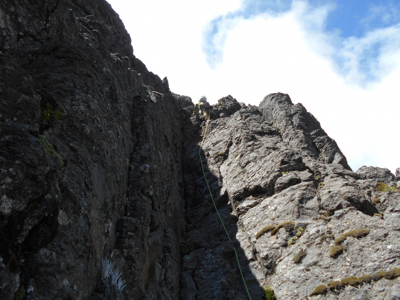
There were short breaks between technical sections, but the scrambling and climbing opportunities were never far away on this steep ridge. 

This is a different group of climbers, but here is a good look down the Paso de la Muerte route. 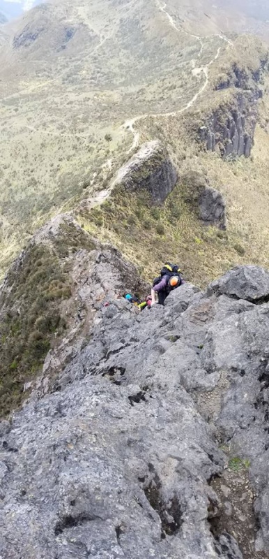

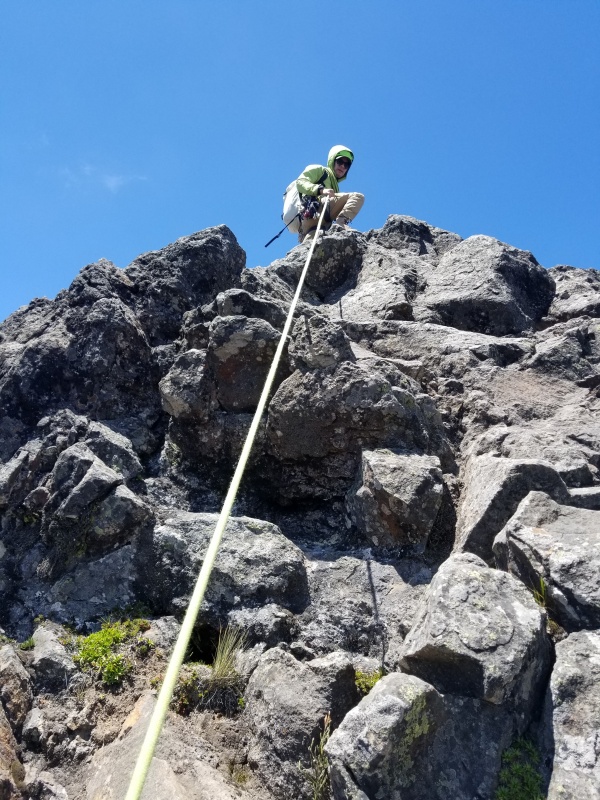
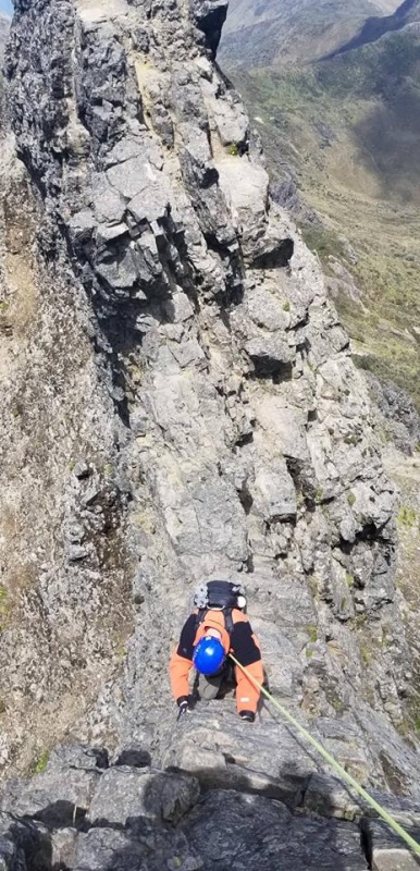
One of the more difficult sections was a nearly-vertical dihedral. I consider myself more of a hiker than a climber, but I wasn’t about to back down from this opportunity. It wasn’t as difficult as I thought it was going to be; there were good holds in the exceptionally solid rock, and only one of the holds was awkwardly spaced. 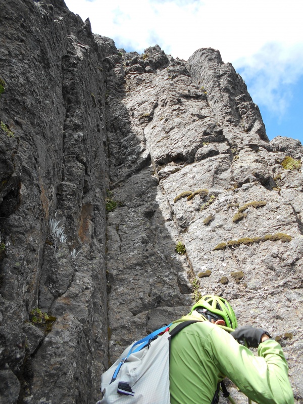

The next memorable section was like a catwalk/knife edge. It required a Class 5 downclimb to get to the catwalk. The catwalk itself was narrow, with plenty of exposure on both sides. To exit the catwalk there was a steep scramble followed by a narrow corner with extreme exposure, and another steep downclimb. I was roped, but the rope trailing behind me offered minimal protection. If I had fallen, I would have swung like a pendulum into the wall behind me before the rope could have stopped my fall. I could have walked across, but my guide wanted me to cross it à cheval (like riding a horse). Some people do this section in tennis shoes, without a rope or helmet. Some people leave the mountain in a body bag. The risks in this section are real, and my guide’s focus was on safety. 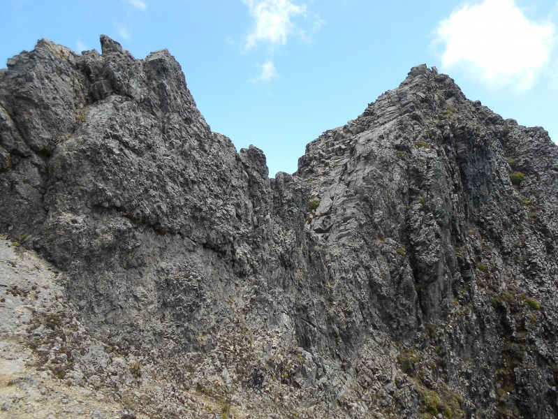

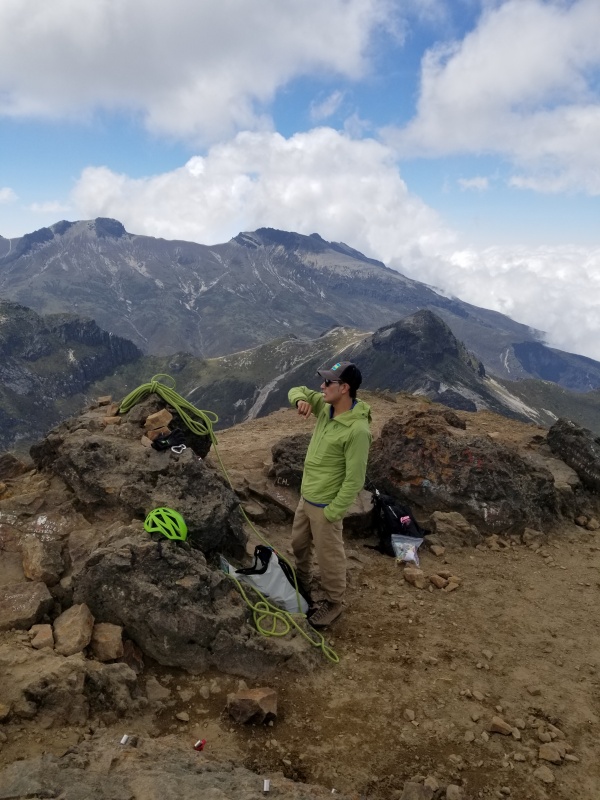
Officially, the summit elevation is given as 15,413 feet. My GPS reading was not far off. 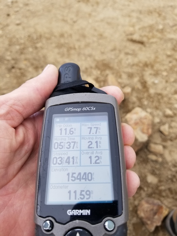
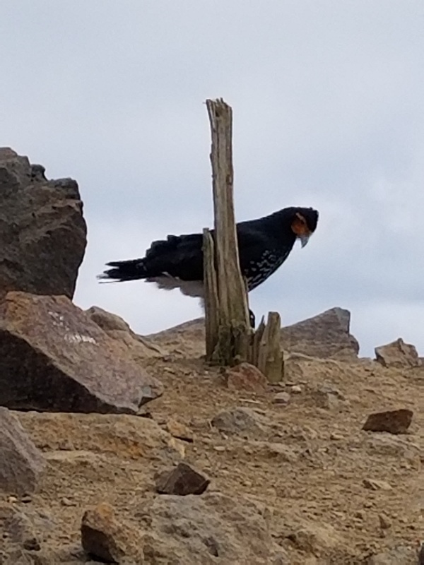
There were a number of unusual birds on the summit. The carunculated caracara is sacred to the Inca people, and is commonly known as the curiquingue. Its bald face makes it look like a vulture, but it is actually in the falcon family. 

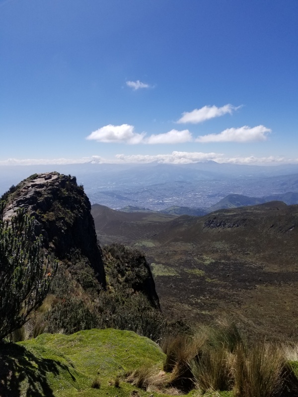
We could occasionally see the Ilinizas, Corazon, and Cotopaxi from the summit, but they mostly remained concealed in the clouds. 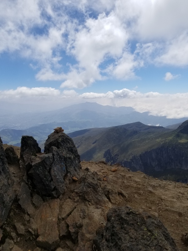
I spoke to a couple of Americans, a Norwegian, and a Spaniard from the Basque region while we were on the summit. We had a snack and a good, long break, then headed down the standard route to avoid the difficulties of a technical descent. 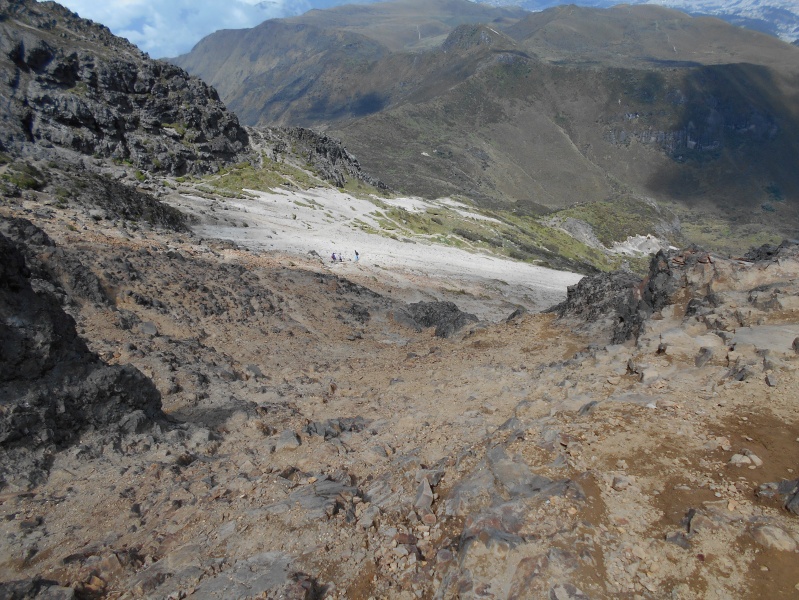
After a little complicated rock hopping, we were able to rapidly scree surf the volcanic sand back to the standard trail. 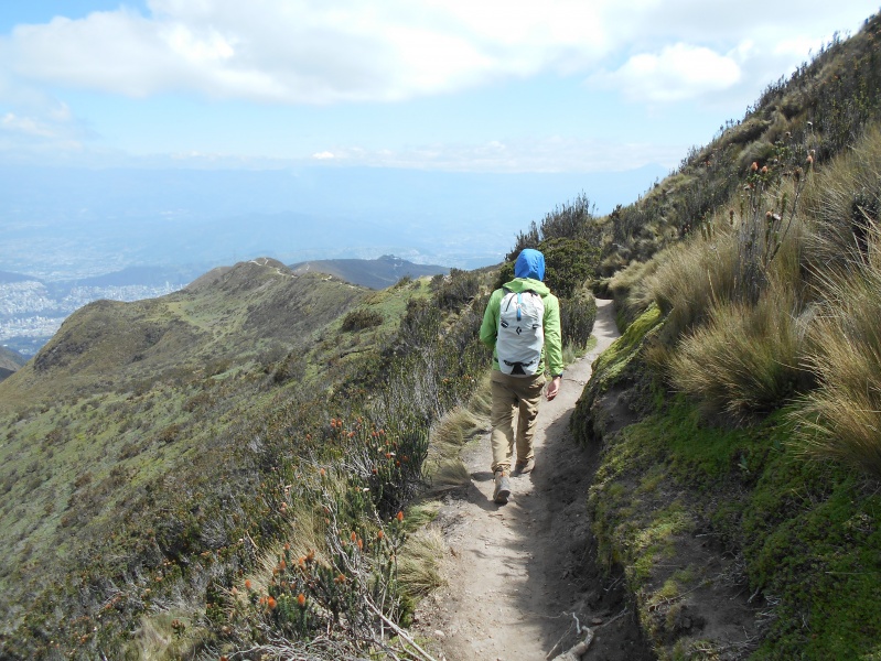
I’m not sure why there were llamas beside the trail, but they were either there for rental or for photo opportunities. 
The standard route on Rucu Pichincha is one of the easier hikes in the area, and the locals hike it frequently much like the Denver locals hike Mt. Bierstadt and Grays Peak. However, for those who are not acclimated to elevations of 15,000+ feet, the technical moves are enough to pump out your quads and leave you gasping for breath. Its easy accessibility by gondola makes it a favorite among guides as an acclimatization hike, and the unsurpassed beauty of the Andes leaves a lasting impression on the hikers and climbers. Lastly, the close proximity to Quito means that quality dining and refreshments are never far from the trailhead. Thumbnails for uploaded photos (click to open slideshow): ")
")
")
")
")
")
")
")
")
")
")
")
")
")
")
")
")
")
")
")
")
")
")
")
")
")
")
")
")
")
")
")
")
")
")
")
")
")
")
")
|
| Comments or Questions | |||||||||
|---|---|---|---|---|---|---|---|---|---|
|
Caution: The information contained in this report may not be accurate and should not be the only resource used in preparation for your climb. Failure to have the necessary experience, physical conditioning, supplies or equipment can result in injury or death. 14ers.com and the author(s) of this report provide no warranties, either express or implied, that the information provided is accurate or reliable. By using the information provided, you agree to indemnify and hold harmless 14ers.com and the report author(s) with respect to any claims and demands against them, including any attorney fees and expenses. Please read the 14ers.com Safety and Disclaimer pages for more information.
Please respect private property: 14ers.com supports the rights of private landowners to determine how and by whom their land will be used. In Colorado, it is your responsibility to determine if land is private and to obtain the appropriate permission before entering the property.


