| Report Type | Full |
| Peak(s) |
Peak Fifteen - 13,671 feet Coxcomb Peak - 13,663 feet Mt. Oso - 13,689 feet Storm King Peak - 13,753 feet Monitor Peak - 13,707 feet Pilot Knob - 13,746 feet Trinity Peak - 13,816 feet White Dome - 13,628 feet Arrow Peak - 13,817 feet Grizzly Peak - 13,700 feet |
| Date Posted | 09/13/2018 |
| Modified | 02/05/2019 |
| Date Climbed | 09/13/2018 |
| Author | illusion7il |
| SOLO Day Hiking the HIGH 200 |
|---|
|
SOLO Day Hiking the HIGH 200
!!! HOLD ON !!! This trip report is a continuation of SOLO Day Hiking the HIGH 100 so it won't make much sense without checking that one out first. This report includes peaks 110- 202 along with a few memorable side trips. SOLO Day Hiking the HIGH 100 includes peaks 1-109 also with a few memorable side trips. Every peak was completed going solo (by myself) and completing the routes as single day hikes from the trailheads in a single push, without the traditional method of backpacking and use of high camp. Enjoy! Link to SOLO Day Hiking the HIGH 100 trip report or https://www.14ers.com/php14ers/tripreport.php?trip=16628&cpgm=tripmine About the Bicentennials To complete the bicentennials would be to climb the highest ranked 200 peaks in the state, but because ranked peaks #199 Twin Peaks A, #200 Clark Peak A, #201 PT 13,580 A, and #202 PT 13,580 B all have an elevation 13,580... you actually have to climb the highest 202 peaks in the state to be considered a bicentennial finisher. Most people including myself start with the 14ers which are ranked peaks 1-53, then move on to the centennials which are ranked peaks 54-100, and then move on to the bicentennials which are ranked peaks 101-202. So out of ranked peaks 101-202, 49 of them are in the San Juan's which are always the farthest away and most difficult to get to. My average drive from Granby to the San Juan's is around 6 hours. Moving on to the Bicentennials Originally I had deemed this list impossible to do them all as day hikes because there were just too many peaks in the Weiminuche Wilderness, and many that required some difficult climbing. With this in mind, I figured I would just get started and see what happens. Most of the peaks in the Sawatch range were unexciting which caused me to lose motivation and I thought about calling this project quits several times, but I knew that the best was yet to come in the San Juan's. Reaching the summit of Capitol peak this past winter really helped inspire confidence that maybe the “hard ones” could be done as day hikes. You just don't know until you try. I'm not as fast as previous years but I noticed that my mental strength and endurance were both stronger. Bicentennials vs Centennials and 14ers Hands down...The Bicentennial list, ranked peaks 101-202 were much more difficult than the Centennials and 14er list. Most bicentennials don't have trails and involve an incredible amount of bushwhacking. Route finding can also be difficult as many of these peaks don't have a lot of cairns or markings along the way so I would always need to allow more time for these peaks and sometimes the routes would still take hours longer than what I was expecting. Without GPS, Backcountry Navigator and Hiking project apps on my phone, I would have defiantly been lost. There also isn't very much information out there on the bicentennials so if you're looking for solitude, these peaks are empty as I rarely saw anyone. The Weiminuche “Crux” Home to 16 bicentennial peaks the Weiminuche Wilderness is in the San Juan's and it's the most remote wilderness area in the state. Since I don't have a vehicle capable of making it to Beartown, I would have to access some of these peaks from different trailheads and any route to the Leviathan drainage would be excessively long. I think most people consider Mt. Oso to be the most remote peak in the state, but that's based on being able to access other peaks from Beartown. With Beartown not being an option, I would say peaks Six and Seven were probably the most remote for me. Then there was the question, How in the world am I going to get Peak 15? I asked myself that question hundreds of times, and the answer was I was just going to have to go for it. Calendar of climbs Just in case you missed it...This trip report is a continuation of SOLO Day Hiking the HIGH 100 so it won't make much sense without checking that one out first. Peaks 101-109 were mixed in along the way with Solo Day hiking the HIGH 100. I have listed the approximate elevation gain and mileage for each climb/hike using all of the information I could find. Due to a lack of information on many of these peaks, I did the best I could to estimate some of these figures. I have also added a people stat that says approximately how many people I actually saw on the mountain while I was up there. I do not count the people I see on the approach or hanging out in the basin below.
Notes: Starting from Hoosier Pass, I took the southeast shoulder to the summit of North Star. It's a time consuming traverse with route finding from North Star to Wheeler. Most of the difficulties can be bypassed on the left (south) side of the ridge. South ridge descent of Wheeler to Wheeler Lake. 
Notes: Excellent fall colors. Black Cloud Trail to Cosgriff and South Elbert, then it was an easy ridge walk to the summit of Bull Hill. Descended the southeast ridge of Bull Hill and connected a few social trails back to the Black Cloud trail. 
Notes: Took the south ridge from Independence Pass to PT 13,545, where I then abandoned the ridge into the basin and then ascended the south west ridge of PT 13,202 and continued along the ridge. On PT 13,300 A, most people say the crux is 5th class, but I was able to find a 3rd class option on the climbers left (west) side. I then descended to the North Fork Lake trailhead and walked the road back up to the top of the pass. 
Notes: Easy ridge walk from Square Top to Argentine and returned the same way. 
Notes: From Lower Boss Lake trailhead at 9,800 I took the southwest ridge to the summit of Taylor and then walked the east ridge to Aetna. Then it was a fast glissade down the south ridge and looped back to the trailhead. 
Notes: Standard route up Shavano &Tabeguache. Adding Espirit Point only added a few minutes. From the Shavano/Tabeguache saddle, it's a quick hike up PT 13,712 and traverse to Jones goes at class 2+. From the summit of Jones, I descended to Shavano Lake and then ascended the northeast slope of Shavano where I rejoined the trail at 11,800. 
Notes: Didn't make it as far up the road as I thought I would be able to so that added 4 miles each way. I took the south slope to the summit of Carbonate and traversed across the peaks. The real difficulties began on the traverse to Grizzly when it suddenly turns into loose class 3 scrambling. From the summit of Grizzly I descend the southwest ridge to 13,100 and then made a direct line to the basin below. 
Notes: I took the standard east ridge route up Spread Eagle, and traversed across the peaks to Eureka. From the summit of Eureka I backtracked to the saddle with Hermit where I then cut across the basin and descended CR 160 (Hermit Rd) to CR 173. 
Notes: Left the Rainbow trail around 10,200 then it's a short bushwhack up to treeline to the summit. 
Notes: This route is mostly a road walk (CR 279) up to the summit of Boulder Mtn, then its an easy ridge walk over to Mamma. South slope descent down to CR 277. 
Notes: From Grouse Canyon trailhead, I took the steep trail high into the basin to the east slope of PT 13,626 then followed the ridge line to PT 13,317. I had planned on continuing along the ridge to PT 13,078 but storms were building fast, so I had no choice but to bail down Sheep Canyon which went very quickly, and walk the road back to the trailhead. 
Notes: Took CR 198 at 8,700 all the way to Silver Lake where I then ascended the slope and ridge to the summit of Cottonwood. I then traversed across the peaks to the summit of Electric. I then backtracked to the saddle with Lakes Pk where I joined the North Brush Creek trail to CR 331 to CR 337 to the Rainbow trail. 
Notes: Started at the picnic area at Berthoud pass and CR 202 at 9,900 because I didn't take the time to find the road that leads to the mine. This added a couple miles each way. I hiked the Ruby Creek trail and ascended to the Parnassus/Woods saddle, traversed to Engelmann and then took a direct line down to the Ruby Creek trail. 
Notes: From the trailhead, I bushwhacked up to the ridge and over Twin Peaks to the summit of Rinker Peak. I attempted the northeast ridge of Blaurock and called it quits after about 20 minutes. I retreated down to the basin but then noticed a dirty couloir on the northeast face of Blaurock which I ascended to the summit. Wish I would of just went around to the Ervin/Blaurock saddle in the first place as this costed me at least an hour. From the saddle I descended and connected the the Big Willis Gulch trail. 
Notes: Took a direct line up the south slope to the summit of Mt. Champion, continued along the ridge and did an out and back to K49. From there it was class 3 up Deer Mountain and it was a quick descent down to the North Fork Lakes trail. 
Notes: So proud of my kids, ages 8 and 5 at the time for making the summit as this was there longest hike yet. My little girl was sleep walking on the last mile down so I had to carry her the rest of the way. 
Notes: Quick up and down in between thunderstorms. Cool summit experience with storms all around. 
Notes: Parked at the mine site with all the buildings and walked the road from there. Lots and lots of elk. 
Notes: I didn't want to risk driving up Cinnamon Pass, so I started at the junction with American basin and walked the 4x4 road and caught the ridge line to Wood Mtn A. From there I descended the ridge line and the scree slope into Hurricane Basin, where I defiantly climbed the wrong gully to the summit of PT 13,688 as it was extremely loose. The traverse to Gravel was uneventful. I then descended back down to Hurricane basin and joined the ridge line to PT 13,708 and Animas Forks Mtn. From the summit I took a direct line down to Cinnamon pass. 
Notes: Walked the road to the Cooper Creek trailhead, followed the trail to 11,900 and made direct ascent that brought me up to the ridge just west of Every Mtn. I followed the ridge line to Cooper Creek Pk and descended down to the Red Cloud trail. 
Notes: Quick run up after doing Every Mtn and Cooper Creek Pk. Slipped and cracked my phone screen on the ascent. 
Notes: Last time I attempted these peaks it rained the entire time so I had to settle for just Jones Mtn A as a stand alone. This time I had to wait out a snow shower at the Niagara/Jones saddle for about 20 mins. 
Notes: I probably could have made it farther up the road but when it comes to 4x4 roads, I give up easily. Left gully for the ascent, right gully for the descent. 
Notes: I took the La Plata Peak trail to 11,200 where I then left the trail, crossed the creek, and headed straight for the saddle of UN 13,330 and PT 12,601. I then followed the ridge line over PT 13,460 to the summit of Sayres BM. I then retraced my steps back to the old mining road that I descended to CR 399 back to the TH. 
Notes: Nice run on mostly great trail with lots of people. This peak defiantly wins for the most popular bicentennial. 
Notes: Easy route from Zapata Falls trailhead to the lake. From there it was a simple hike up to the summit. 
Notes: After 7 years of living in Colorado Springs that it was time for a change of scenery. The move really cut into my outdoor play time so this is why I was unable to get very much accomplished in the summer of 2017 as I got stuck doing tons of housework, but at least I could get in some mountain biking nearly every day at the Granby Ranch without ever having to drive.
Notes: First time ever in the Gore Range! 
Notes: From 9,900 on the Cross Creek trail it's a steep, loose, and time consuming ascent up to the lower basin at 10,900. 
Notes: Started at the bottom of the 4x4 rd to the fall creek trail, then ascended the south slope to the east ridge slabs to the summit. This is a beautiful area for the Sawatch. 
Notes: The willows in this area are never a fun place to be. 
Notes: This is the long way to “Magdalene Mtn. I got everything thrown at me on this route. Strong wind gusts on the peak, lots of thunder, hail, snow and rain while heading back to Elkhead pass. Once on top of the pass, the weather cleared and I had a nice jog back down to the trailhead. 
Notes: It was suppose to be just another day of climbing in Eldorado Canyon with beautiful fall weather. My climbing partner Steve, and I had been up many climbs this summer such as Spearhead, Sharkstooth, and many more. Neither one of us had climbed the Yellow Spur before. The first 4 pitches had went smooth and quickly and we were now getting to the crux of the climb. We were now on pitch five, Steve was leading, and I was belaying below a large roof and he was completely out of sight. Steve had not moved much over the past 5-10 mins, I was at the half way point in the rope, so I assumed he was building the anchor, when suddenly I heard “FALLING!!!” followed by several screams of fear. Then he shouted, “Call 911, Broken Ankle!” so I called and gave them our exact location. The time of the fall was 2pm. Trying to communicate with Steve was a screaming match, so about 45 minutes later he then turned off his airplane mode and called me. He told me that he had fallen about 25 feet, smashed his ankle on a ledge, flipped over backward and hit his head. His ankle bone was sticking out and he was loosing blood. He then asks, “So what do you think about working our way down?” My response was, “Based on your condition, I think getting down by ourselves is our last resort, we are waiting for rescue.” About an hour later, this would be about 2 hours after the fall, a local climber by the name of Jeremy from Denver had rappelled down to Steve from somewhere near the top of tower one of the Redgarden wall. Jeremy was actually planning on climbing yellow spur with his partner, but on their approach they heard Steve's screams, so they quickly climbed Icarus to get up there. It was now 6pm, this would be 4 hours after the fall, the first rescuer of Rock Mountain Rescue group had reached Steve. I was finally able to take him off belay as I had been holding most of his weight for the past 4 hours. The rescuer had basically put Steve in a human sling and they were both lowered from the top using a 600 foot rope. I wish I would have gotten a picture of the moment. Once they radioed that they were safely on the ground, Jeremy asked if I was okay with him belaying me up to him. As soon as I climbed around the roof, I noticed that there was blood all over the wall, but I couldn't help thinking, that this was actually the best climbing of the day, despite the circumstances. Jeremy and I rappelled together, and I must admit that rappelling nearly 400 feet in one shot was pretty awesome. The rescuers did a litter evacuation in the dark which also included getting him across the creek. There were so many people from Rocky Mountain Rescue group waiting on the road. I couldn't believe how supportive everyone was. Even the sheriff said, “I'm just thankful this is not a body recovery, We have had to do too many of those lately. Heal up an come back!” I was shocked as I couldn't believe the words I just heard. Steve was taken to Boulder Community Hospital and was treated by a doctor, who had also climbed the Yellow Spur. Even the doctor was very supportive and stated that he was confident Steve would make a full recovery and he will be able to climb again! More is explained in the video linked below.
The conclusion: Steve suffered from a bimalleolar fracture (compound fracture) of his ankle. He got eight screws and one plate put in. His leg was non-weight bearing for 6 weeks and even though he hit his head pretty good, there was no head trauma. It wasn't until months later when we figured out what went wrong. Steve clipped the pin and backed it up with a cam, just before the pin ladder and was doing an ascending traverse on a run out section heading towards 2 bolts that would have led to the arete. Steve was going for the “Robbins Traverse” but unfortunately the correct route would have been to traverse just above the pin ladder. 15 feet would have made all the difference. BIG thanks to Rocky Mountain Rescue Group and all who were involved. The doctors said that if he would not have got to hospital as soon as he did, Steve could have lost his foot completely due to blood loss and poor circulation. Here is a link to the video - https://vimeo.com/238883336
Notes: Late fall and winter is my work season so I spend a lot of time behind a desk. My body gets really out of shape, but Colorado was having an exceptionally low snow year so I really wanted to take advantage of this opportunity, and was able to reach the following summits; Sunshine, Red Cloud, Sneffels, Uncompahgre, El Diente, Mt Wilson, Missouri, Crestone Peak and Needle. At this time the snow pack was around 80% for the Elk range mountains, so I knew this would be a legit winter climb.
Out of all the 14ers, Capitol is considered by many the most difficult to summit in the winter as well as the summer. The peak had recently claimed five lives in the summer of 2017 so with that looming around in my head, I was very nervous about making this attempt. Most people choose to rope up on the ridge, so I brought some webbing and cord so I could rig up an emergency rappel if needed, which I never ended up using. I rolled up to the trailhead around midnight during a lite snow shower and rested my eyes for about an hour. Attempting this peak on no sleep didn't really help my confidence so I rolled up a $2 bill, snorted a line across the dashboard, chased that with some meth and I was ready to go! Just kidding, but really what is the difference between that and a Rock Star energy drink? This time of the year, the sun doesn't come up till around 7, so the sleep demons really bothered me on the approach to moon lake. My pace was slow, but I kept working my way into the upper basin walking under some dangerous steep slopes that could release at anytime. When I reached the base “K2” I geared up for the ridge; snowshoes off, crampons on, ice axe out. I noticed I had less than a liter of water, so I stuffed my water bladder full of snow. I made a few moves up “K2” but was having a difficult time as I was extremely exhausted and dealing with leg cramps, so I stepped back down thinking it was time to turn around due to exhaustion. I then popped a couple gels and gave it another shot reaching the summit of “K2” at noon. The ridge consists of mostly 3rd class mixed climbing with a few sections of 4th and 5th class climbing with a very high level of exposure. I slowly worked my way across the knife edge and up the ridge with a few brief passing snow showers, till I reached the crux, where I had to traverse across some very steep, sketchy, poorly bonded snow, and then do some low 5th class mixed climbing to regain the ridge. This is the section most people rope up for. Crossing that slope may have been the most dangerous thing I have ever done as it just felt like the snow was going to blow out beneath me, and send me tumbling 1,500 feet down the mountain. A little bit more 3rd and 4th class ridge climbing and I reached the summit at 2:40pm! The down climb went a little quicker and I was back at the base of “K2” at 5:00pm with just two hours of daylight remaining. My crampon straps were so frozen I had to use a lighter to melt the ice to get them off. The hike out was extremely slow. I was so tired my pace was down to just one mile an hour and the sleep demons were really persistent. At midnight, I had made it back to the car, and to this day, I don't think my body has ever felt so terrible in my entire life. 
Notes: Did I mention I like to Mountain Bike? This is usually an activity I like to do in the spring/early summer to get in shape for the summer climbing season. This route had been on my bucket list for years. I had done the monarch crest/rainbow trail loop without the shuttle a couple of times and I figured this would just be a step up from that. I started at first light on Mineral Rd just above the switchbacks and pedaled up Mineral Rd to Hwy 313 to the Canyon Lands entrance. I then descended the Shaffer switchbacks and proceeded clockwise around the loop. Felt great up to around mile 50, started to get tired around mile 75, and did a long hike a bike up the final switchbacks out of the canyon. 
Notes: With a low snow year it was time to get out and knock off a few peaks. I originally hiked this peak with Daryl (username DoubleDD) back in November of 2012 and he even put up a Trip Report, but I had to go back just to get the solo check mark. 
Notes: Since I had done the Cottonwood creek approach two times already this year for the Crestone Peak and Needle winter summits, I figured this approach would move quickly, but it's still slow, even without snow. After summiting Pico Aslido, I really didn't want to descend the way I came up, so without knowing the traverse to Milwaukee, I down climbed the ridge proper which really caught my attention as it goes at 4th class, maybe even low 5th class. Once I reached the summit of Milwaukee, How do you get off this thing? I saw a ledge on the east side, and any way down would involve kicking a few steps in the snow, but just when I thought I had solid footing, the snow gave away and slid down the the steep east face. My feet gave out from under me and I was hanging on by just my right arm. Good thing I had a solid right hand hold or I would not be writing this report today. This was by far the most serious “close call” I have ever had. Once I was down to the ledge there were a few more exposed moves and then it was down Milwaukee pass trail. I will admit that it was a bad decision to traverse to Milwaukee without having done the research. Remember to always do your research, and just when you think you know the route, do more research. 
Notes: This is the long way to Organ Mountain as it would be much shorter from Eddyville trailhead, but I didn't feel like driving the long road to get there and it just made more sense for me to start at the West Willow Creek trailhead. I took the Colorado Trail over Sun Luis pass, then ascended south slopes route. 
Notes: I wasn't sure if this route would workout as my only source of info on this route was looking at a topo map, but it did, and it actually worked very well. From CR 520 at 10,000 just before the road turns into 4wd in a meadow, I bushwhacked north and followed elk tracks up an unnamed creek till I reached the south ridge of Pole Creek Mountain. From summit it was an easy traverse to Northwest Pole and to reach the summit required some airy class 3 climbing. From there, I descended the south ridge to the Pole Creek trail to CR 520 over Timber Hill back to the car. 
Notes: Matterhorn was one of those peaks I had planned on combining with Wetterhorn and Uncompaghre but weather never allowed for this to happen so I had to go back. There wasn't even one person at the trailhead, and I didn't see anyone in the basin either. 
Notes: It's a really long way from Culebra to Putrgatorie. I returned the same way resummiting each peak. 
Notes: I took the Little Cimarron trail to 11,100 where I then left the trail and hiked up to the saddle of Silver and PT 13,681. From there it was an easy ridge walk to each summit. 
Notes: For the first time in approximately 350 summits 13,000 feet or higher, I have finally experienced failure! Just as I was gearing up I made a last minute decision to go with regular hiking shoes and micro spikes rather than my stiff hiking boots and crampons. I took the blue lakes pass to the ridge which also proved to be another bad decision as it would be much easier to leave the blue lakes trail around 12,400 and trek across the basin to a grassy slope that provides easy access to Gilpins north ridge. I climbed mixed snow and scree to 13,450 but was blocked by a wall of snow at the top of the couloir, that would have required crampons to get over. I spent over an hour trying to figure out another way around but was unable to find a safe route due to loose rock and scree. It was really hard for me to accept defeat, but it's also a very short route and without snow it would be just a simple walk up, so I finally made the decision to turn around as I still wanted to go for Cirque Mtn, which helped lift my spirits a little. 
Notes: I couldn't figure out what the standard route to the summit was. After spending at least an hour trying different options I finally found a way to the summit using a series of nasty gullies on the south side that were no harder than class 3. The weather was bluebird, so I might as well go for Potosi Pk. 
Notes: Steep hiking from the road up to the ridge. From the ridge it's a long scree traverse around the peak to reach the gully that leads to the summit. 
Notes: Started at the reservoir and walked the road. I ascended the east ridge of Petroleum and ridge walked to the summit of Anderson. From there I backtracked and descended the east ridge off the saddle to Lincoln Creek rd, where I then ascended directly up the west slope to the summit of Garfield Peak. The San Juan Forest Closure Oh no! Due to wildfires as a result of an incredibly low snow year, the forest service has made the decision to close down all of the San Juan national forest. This also includes the Weminueche Wilderness. I still had a bunch of peaks to get in this area, and finishing the bicentennials this year was starting to look impossible. However, I still had a few other peaks I could get done in the mean time that were not in this area. 
Notes: This had to be one of the worst routes I've ever done. The approach went quickly but ascending the scree felt very dangerous. During the entire ascent I was worried about starting a rock slide on myself. Of course there were a bunch of naked people in the hot springs on the way back and for some reason, they kept trying to make conversation and all I wanted to do was get out of there. 
Notes: Easy run on great trail all the way to the summit. 
Notes: Very cold creek crossing in the morning. I took the lightning couloir which had about 500 feet of snow climbing with one steep section in the choke. Then it was all scree and loose rock to the ridge with a short scramble to the summit. I descended the same way back down to the Len Shoemaker basin to 12,000, and worked my way farther up the basin and ascended the northwest slope to the northeast ridge to the summit of PT 13,631. 
Notes: The San Juan National forest was just reopened. Only one car at the Purgatory Trailhead. This would be my first and hopefully the last time hiking the Ruby Lake approach. I had a tough time with route finding. I ended up ascending the largest gully to the ridge next to Peak Thirteen and then traversed up to the summit of Monitor. I then traversed back to Peak Thirteen and ended up going a little too far on the northeast side and got myself into some difficult climbing. Probably stiff class 4. I was able to find the correct route up Animas and hit the summit at 3:45pm. The descent went quickly as I was able to locate the correct gully and then it was the long slog back to Purgatory and on the last couple miles around 11pm, I had the pleasure of waking up a sleeping bear. He didn't look to happy about me waking him up, so we took our separate ways and that was the end of it. 

Notes: With tired legs and bluebird sky's, I was able to start late and take my time. Spent nearly an hour on the summit as this peak offers some of the best views in the business. 
Notes: From West Trinity Pass, I took the west ridge to the summit of West Trinity. From there I decided to skip the class 4 section and dropped down to 12,800 where I traversed across grassy ledges to the southeast face route to the summit of Trinity Peak. Getting over to East Trinity was defiantly the crux of the day, as I got myself into some difficult terrain. From the summit of East Trinity, I descended the east ridge and picked my way down the loose scree slope into upper Vestal basin. There wasn't even one person in Vestal Basin, there were just a couple people on the Colorado Trail, but I did have the pleasure of running into 14ers.com user Wombat, on the out. 
Notes: At this point in my bicentennial journey, it was time to go for the big Peak Fifteen. I was getting tired of blowing off my rock climbing partners, and I was also needing some motivation to keep going, because if I can't get Peak Fifteen, there was no point in continuing. The forecast was calling for heavy smoke. With the low snow year, and the fact that it had only rained once in the last month, I had a good feeling that the couloir would be dry, so this was a good time to go for it. On the approach to the Needle Creek bridge, I was still undecided on the rest of the approach. Do I take the longer route up North Pigeon creek and traverse under Turret, or do I take the shorter rugged and steep New York Creek bushwhack? Usually I am able to reach the needle creek bridge in 2 hours 45 mins, but having to carry a 60 meter rope, harness, climbing shoes etc, put my day pack weight at a heavy 22 lbs and my pace was much slower. This was a good reminder of why I hate backpacking so much and also helped me decide to go with the shorter New York creek approach. From the New York creek bridge, I bushwhacked straight up the slope on the north side of the creek to about 10,600 traversing under and over many cliff bands, then kept that elevation while traversing high above the creek until the forest thinned out and the terrain mellowed out. 
I finally reached the base of the couloir at 11:30am. With the couloir being bone dry I blew past the first crux without even knowing. When I reached the second crux, I put on my rock shoes and continued up. It was now time to exit the couloir and do the exposed traverse across the southeast face. I put on my harness just to get some weight off my back and the traverse was a little easier than expected, but I'm now at the point of no return where the safest way is up. This is crazy, Am I really doing this? The climbing got steeper and steeper as I went up and the rock cannot be trusted . I couldn't believe how many holds just crumbled away so I was extremely nervous and triple checked every hold. When I reached the top of the 5.4 crux, it was like touching the summit because I knew that it was easier terrain to the top. The forecast was spot on and my summit views were not very good due to heavy smoke and I could smell it in the air. On the descent, I was so exhausted I had to rappel the first 3rd class section. It was a total of six rappels to the bottom of the couloir. The bushwhack down the New York creek didn't go as well as the ascent as I stayed a little lower and the terrain was rougher. Now all I had to do was slog all the way back to Purgatory. I once saw another trip report called, From Purgatory to Hell, and I can't think of a better way to describe this approach. 
Notes: Without snow this time around, this route was just a very loose 2+ walk up. 
Notes: These peaks are usually accessed via the Beartown trailhead but since I am unable to get there, I decided Molas Pass would be the best way for me to get these peaks. I took the Colorado trail 13 miles to the top of a pass where I then joined the northeast ridge route to the summit of White Dome. From there I took the connecting ridge to the summit of Peak One. I then descended the south ridge of Peak One, and then descended west down a scree slope to the basin below back to the Colorado Trail. Ran into ultra runner Joe Grant at the bottom of Molas Pass so it was nice to chat with him on the way back up. 
Notes: Stupid persistent porcupine kept me up half the night, but for as many nights as I spend sleeping in my car I was lucky for this to happen only once this summer. I didn't find the crux on US Grant too difficult and was able to get through it with just my regular hiking shoes. I then headed back down to Ice Lake and ascended the east slope of Pilot Knob. I then contoured around to the west side and ascended the 3rd class gully. The exposure up to the summit around the 2nd tower is amazing. The connecting ridge to Golden Horn went quickly and I descended west towards Fuller Lake. 
Notes: What a fun route! With a high chance of storms, I knew I really needed to make quick work of the approach. After getting the summit, I noticed some discomfort in my right leg. After descending down to the base of the peak, the pain was worse, and by the time I made it back to the Colorado Trail I was limping. By then I was popping Tylenol like candy and it was a slow and painful walk back to Molas Pass. Then it was off to Silverton to get some ice.
Notes: This is the long way to this Grizzly, but since I was already in Silverton, I didn't feel like driving the long Cascade Rd to access the standard approach. When I reached the top of Rolling Pass I nearly turned around due to leg pain but I figured I could just suffer through it. The skys were blue, and the peak didn't look too far away. Thunderstorms were in the forecast for the afternoon, and I knew that this could cause a problem getting back over Rolling Pass. I left the Colorado Trail at the bridge and took a direct line up to the basin climbing steep grassy slopes and some 3rd class rock bands. From the upper basin it was a short hike up the Couloir to the summit. My leg was hurting, clouds were building so I needed to move quickly. When I reached treeline at 12,000 feet going back over the pass, the sky looked gray, there was no rain or thunder it it seemed like it was safe to continue, when suddenly lightning shot across the sky and the hail immediately followed. I ran towards the nearest group of trees and waited out the storm for an hour and a half till it cleared. I had originally planned on staying in the San Juan's for a few more days, but by the time I got back to the car I could barely walk, so I had to cut my trip short. 
Notes: After dealing with leg pain for a few weeks, I needed a short peak to put my leg to the test and Bald Mtn was perfect. No Pain. After the hike, I drove down to the resort and got in a great 15 mile mountain bike loop. 
Notes: I took the Vallecito trail to the Johnson Creek trail up to 12,600 near Columbine Pass. I then crossed the slopes and joined the standard route up the ledges to the summit of Grizzly. I still had some energy so I figured I might as well get Hope Mtn on the way back to the trail. When I reached the Johnson/Vallecito junction I was starting to deal with some leg pain. I was making good time so I took many breaks on the hike out. 

Notes: Very smokey conditions but lots of big horn sheep 
Notes: I had originally planned on starting at midnight simply because I really wanted to start and finish on the same day, but due to getting stuck on Wolf Creek Pass for 3 hours due to an accident, this resulted in delayed start time. Starting at midnight would have meant no sleep and I had to at least close my eyes for a few hours. These peaks are also usually accessed via the beartown trailhead, but since I am unable to get there, Vallecito seemed like the best way to go. At 3 am. I was finally on the trail. I hate creek crossings. I had both of my ankles wrapped, and calf compression sleeves on, so taking all this off is kind of a big ordeal and very time consuming, so when I reached the Vallecito creek crossing where the 4th bridge use to be, I had put some Glad Force Flex trash bags on my legs with rubber bands and crossed the creek. Epic Fail! So I took off my shoes, wrung out my socks and continued on. When I reached the Leviathan drainage at 7:35am, I was able to find a spot to rock hop across the Vallecito. I felt I was making descent time but the big question of the day was, Will be able to get Peaks Seven and Six? It had taken about an hour more than planned but I finally reached the summit of The Guardian at 10:35am. Peak Seven looked really far away. The traverse to Silex also took a little longer than expected and now I am nearly 2 hours behind my estimated times. At this point I was starting to think that going for Peaks Seven and Six would be just too much of an undertaking. The Silex lake scree traverse also took a longer than expected but when I reached the Storm King/Peak Nine saddle, Peak Seven didn't look too far away and the hike over looked like it would move quickly. After summiting Storm King at 2:35, I was motivated and cruised across the basin to the base of Peak Seven and filtered some water. The ascent up Peak Seven went quickly and then it was on to the traverse to Peak Six. I was so exhausted that I took my time trying to find the easiest way to get around the difficulties and finally reached the summit of Peak Six at 6:10pm! 
The sun was beginning to set and Leviathan Lake was in the shadow. Descending that basin did not go very smooth as I kept running into cliffs and I never did find a trail in the upper basin. At one point I was bushwhacking through willows over my head in the dark by headlamp. At 9:30pm I finally made it back to the Vallecito creek crossing and I pretty much slept walked all the way back to the trail head. I saw a couple of tents along the Vallecito on the approach but there wasn't even one person in the Leviathan drainage and no sign of any tents. 
Notes: My legs still felt exhausted from the big route 2 days prior even though I took a day off to rest. Mt. Oso is considered among many to be the most remote 13er in the state. It is certainly a ways back there but the trail is mostly smooth with very gradual grade so it moved quickly. I took the Pine River trail to the Emerald Lake trail and continued on to Moon Lake. At Moon Lake I was able to find a few trail segments through the basin and then ascended a steep slope on the west side of the peak and then joined the south ridge route to the summit. 

Notes: I wanted to see what the moon lake approach looked like in the summer. After crossing the creek I couldn't find the trail and ended up bushwhacking a ways till I finally found it again, then when I left the main trail I must have been on the wrong side (south) of the creek because I was only able to find a few segments up to 10,400. The west ridge felt incredibly dangerous as the entire ridge looks like its going to collapse. Since I had never been down into Pierre Lakes basin, I descended the safer, but longer south slopes route into the Bear creek drainage where I was able to find a trail most of the way back down to the Maroon Snowmass trail. 
Notes: This may have been the most enjoyable route of the bicentennials. With a late start, I had to wait out a couple of snow showers on the way up Redcliff. I then took the long route back down to the basin and followed the trail over the pass and contoured around to Coxcomb's south slopes. For me the crux was the 4th class moves that were required to access the gully. I then put on my rock shoes and had a blast climbing the 5.2 chimney. I rappelled the notch, left my rope there and scrambled up to the summit at 5pm. When I got back to the notch, to protect the 5.6 section I used my MegaJul ATC and moved it up the rope as I was climbing. It was a total of two rappels back down to safe terrain. 
Notes: I think this route wins for the worst of the bicentennials. My route up San Miguel was moving quickly until the last 200 feet which took nearly an hour. When I reached the summit, it looked like there was another summit that was higher so I scrambled over to it, only to see that the first summit was probably the highest. I then descended the south ridge and picked my way down the steep slopes to hope lake. I picked up the trail to the top of the pass and scrambled up a horribly loose rotten ridge to the summit of V9. The first part of the ridge to Rolling was smooth but after the saddle is where the real misery began as the ridge turns rotten again. I finally reached the summit at 3:35pm, and had to retrace my steps back down to the saddle where I descended directly down to basin, and picked up the trail back over the pass. 
Notes: I can see the summit, I raise my hands with excitement, a shout for joy, it's over....But there was no summit party. I don't understand, I'm in the San Juan's, standing on an unofficially named peak on a weekday and there is nobody up here? Oh well. Other than a short 20 minute bushwhack and maybe 20 feet of easy class 3 climbing, this was a a rather enjoyable fast moving, stress free route. All I could think about on the descent was, what am I going to do now? 

Notes: My climbing partner Steve, said it was time to go back to Eldorado Canyon for a day of climbing. It had been nearly a year, 348 days to be exact since the accident which was also the last time we had climbed together. His recovery was much faster than I had anticipated and he had been climbing hard all summer long. We rolled up to Eldorado Canyon and I asked, “What are we climbing today?” His response was, “Nothing is off the table, but lets go warm up on the Wind Tower.” So we warmed up on Boulder Direct and Breezy and then he said, “Lets go take a look a the Yellow Spur.” So we geared up and started up the approach. We get up to the base of the climb and it is now 2pm and I'm trying to figure out how we are going to climb this route before dark, but there was just no way I could tell him no, as this climb has been haunting him for the past 348 days. This time around he didn't even want to bother with the “Robbins Traverse” and opted to take the “Original Finish” which goes at 5.10b. We topped out at 7:05pm just minutes before total darkness in a total of seven pitches. Descending the Vertigo Rappels by headlamp was a blast. 
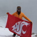
Notes: Now that I have completed all these peaks, I figured it was a worthy enough of an accomplishment to get a new tattoo. Two peaks for completing the highest 200 on my neck seemed appropriate.
A Special Thanks to my kids for supporting me and putting up with me being gone all the time. My parents for helping out with the kids. Steve Hurd for taking me up a bunch of difficult climbs helping me improve my climbing skills. Bill Middlebrook for once again creating the most amazing website ever. Without it, I don't know what I would do with my life. 14ers.com users SnowAlien, Stratosfearsome, Wombat and ScreeSurfer for responding to my private messages and providing useful beta on a some of these routes. Also gotta thank all the other 14ers.com users that have posted useful trip reports on many of these peaks. Conclusion and what's next? This has certainly been an amazing journey stretching my limits and redefining the word possible. I don't think I will be moving on to finish the 13ers. I've spent so much time alone, I'm starting to wonder if there is something wrong with me, so I probably need to get out and meet some other climbers. I have a long list of rock climbs, and mountain bike rides I would like to get done, and I also hope to be a winter 14er finisher someday. Live the Dream... Preston Dennis
|
| Comments or Questions | |||||||||||||||||||||||||||||||||||||||||||||||||||||||||
|---|---|---|---|---|---|---|---|---|---|---|---|---|---|---|---|---|---|---|---|---|---|---|---|---|---|---|---|---|---|---|---|---|---|---|---|---|---|---|---|---|---|---|---|---|---|---|---|---|---|---|---|---|---|---|---|---|---|
|
Caution: The information contained in this report may not be accurate and should not be the only resource used in preparation for your climb. Failure to have the necessary experience, physical conditioning, supplies or equipment can result in injury or death. 14ers.com and the author(s) of this report provide no warranties, either express or implied, that the information provided is accurate or reliable. By using the information provided, you agree to indemnify and hold harmless 14ers.com and the report author(s) with respect to any claims and demands against them, including any attorney fees and expenses. Please read the 14ers.com Safety and Disclaimer pages for more information.
Please respect private property: 14ers.com supports the rights of private landowners to determine how and by whom their land will be used. In Colorado, it is your responsibility to determine if land is private and to obtain the appropriate permission before entering the property.