Download Agreement, Release, and Acknowledgement of Risk:
You (the person requesting this file download) fully understand mountain climbing ("Activity") involves risks and dangers of serious bodily injury, including permanent disability, paralysis, and death ("Risks") and you fully accept and assume all such risks and all responsibility for losses, costs, and damages you incur as a result of your participation in this Activity.
You acknowledge that information in the file you have chosen to download may not be accurate and may contain errors. You agree to assume all risks when using this information and agree to release and discharge 14ers.com, 14ers Inc. and the author(s) of such information (collectively, the "Released Parties").
You hereby discharge the Released Parties from all damages, actions, claims and liabilities of any nature, specifically including, but not limited to, damages, actions, claims and liabilities arising from or related to the negligence of the Released Parties. You further agree to indemnify, hold harmless and defend 14ers.com, 14ers Inc. and each of the other Released Parties from and against any loss, damage, liability and expense, including costs and attorney fees, incurred by 14ers.com, 14ers Inc. or any of the other Released Parties as a result of you using information provided on the 14ers.com or 14ers Inc. websites.
You have read this agreement, fully understand its terms and intend it to be a complete and unconditional release of all liability to the greatest extent allowed by law and agree that if any portion of this agreement is held to be invalid the balance, notwithstanding, shall continue in full force and effect.
By clicking "OK" you agree to these terms. If you DO NOT agree, click "Cancel"...
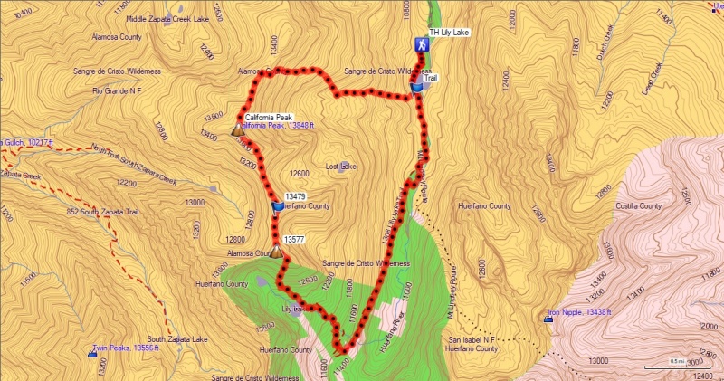
California Peak and Pt. 13,577 From Lily Lake Trailhead
California Peak
13,849 Feet (84th Highest in Colorado)
Pt. 13,577
13,577 Feet (205th Highest in Colorado)
South Ridge Route From Lily Lake Trailhead
Trailhead Elevation 10,240 Feet
Approximately 8 Miles Roundtrip
Approximately 4,300 Feet Elevation Gained
Class 2+
August 26th, 2018
Partner: SenadR
California Peak and Pt. 13,577 From Lily Lake Trailhead
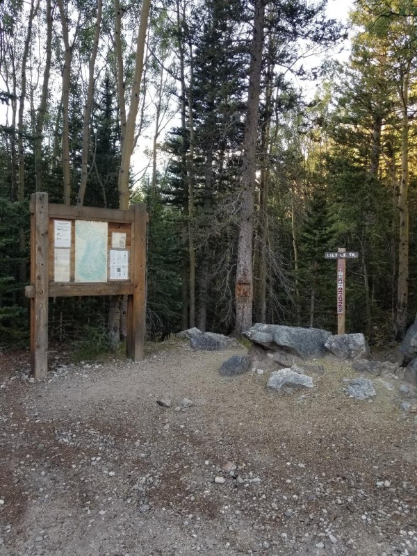
It takes a bit of effort to get to the Lily Lake trailhead. It is 22.5 miles from CO 69, and the last 15.5 miles are unpaved. Once you get past the Singing River and Aspen River ranches, the road gets significantly worse. Just when you think that the road couldn't get any worse, you start hitting the cow traffic jams. There are a lot of free range cattle back there, and they don't know much about road etiquette. There is plenty of room to park and/or camp near the trailhead, and it's a pretty serene spot. The standard route for Mt. Lindsey starts here, as well as alternative routes for California and Huerfano Peaks. I drove my Saturn SC2 coupe up here many years ago, but I won’t pretend that this is anything other than a 4WD trailhead. Sen and I have both had California Peak on our lists for years, so we finally decided to move this one into the "finished" column.
The Lily Lake trailhead
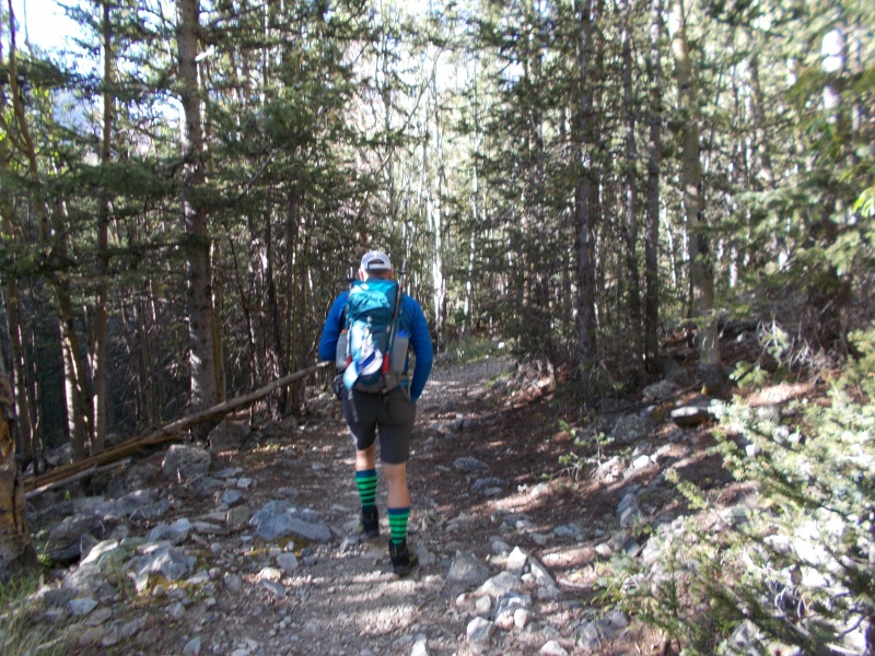
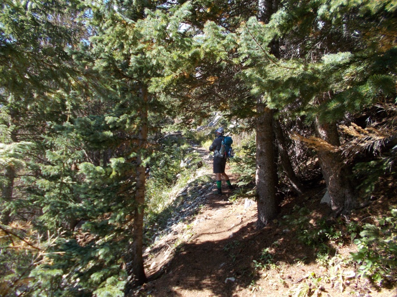
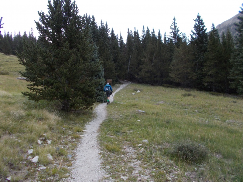
The Lily Lake trail sees a good bit of traffic because of its namesake lake at about 12,320 feet. Beautiful alpine lakes will probably always attract more visitors than the fourteeners will. We got a late start (8:45), and encountered several backpackers on their way back from camping at the lake.
Sen hiking the Lily Lake trail
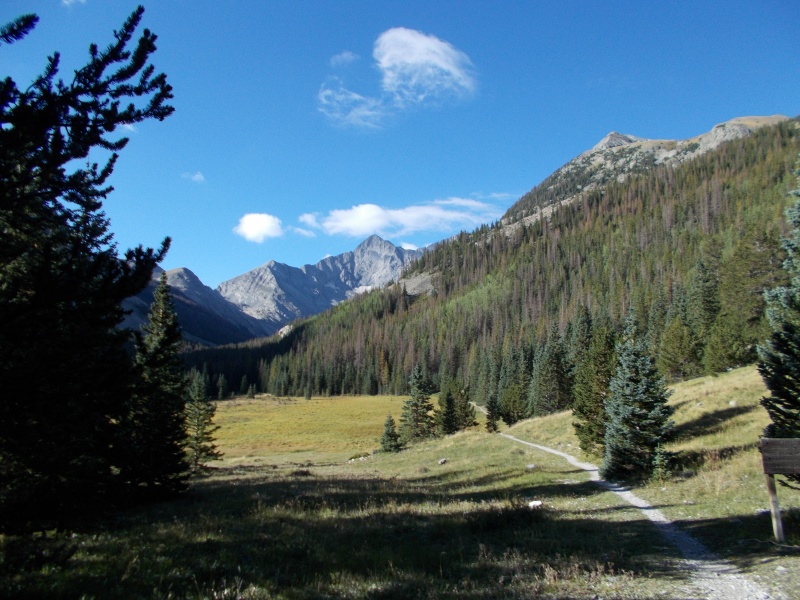
A subalpine meadow beside the trail shows up as a lake on my GPS software. It's too wet for trees to grow there, but not quite low enough to hold standing water. The north face of Blanca Peak makes a stunning backdrop.
First view of Blanca Peak
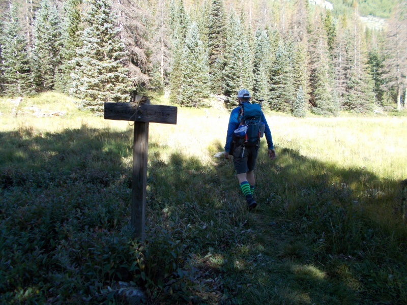
At the first junction, we turned right towards Lily Lake. The lefthand fork heads towards Mt. Lindsey.
The junction of the Mt. Lindsey and Lily Lake trails
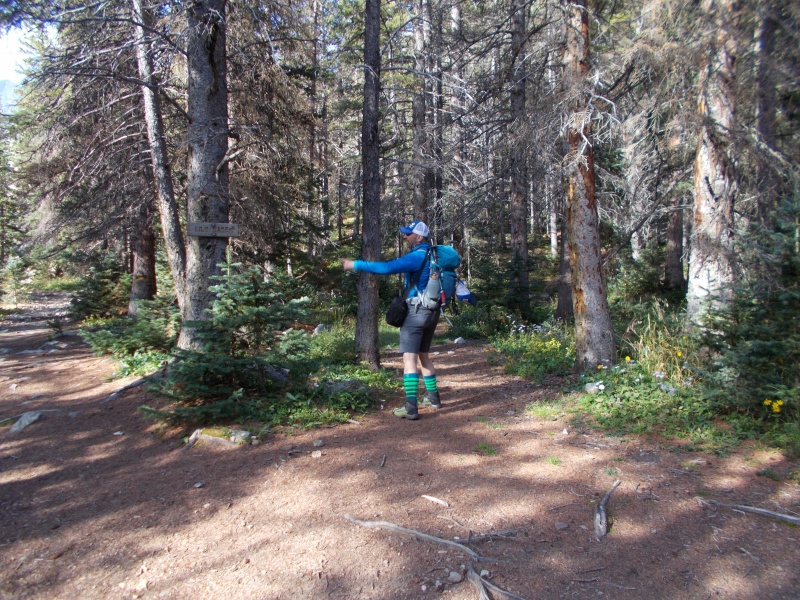
The trail takes a hard right not far past the junction with the Mt. Lindsey trail. A pair of switchbacks leads away from the Huerfano River and starts up the slope towards Lily Lake.
Sen turning right at the trail sign
The abnormally dry summer is reportedly causing an early mushroom crop. I didn’t see many mushrooms, but I saw a few fly agaric mushrooms (Amanita muscari). They are said to be hallucinogenic, but not highly recommended. This mushroom has been used as a fly poison in the past, so it's probably best to just leave it alone.
Fly agaric mushroom (Amanitamuscari)
At about 11,400 feet, we met a backpacker returning from his camp site at Lily Lake. He told us about some interesting mining ruins down in the valley below. Apparently there was a tramway to bring buckets of ore down to a stamping mill down by the river. My GPS map shows a mining claim at about 11,000 feet.
A narrow stretch higher up on the trail
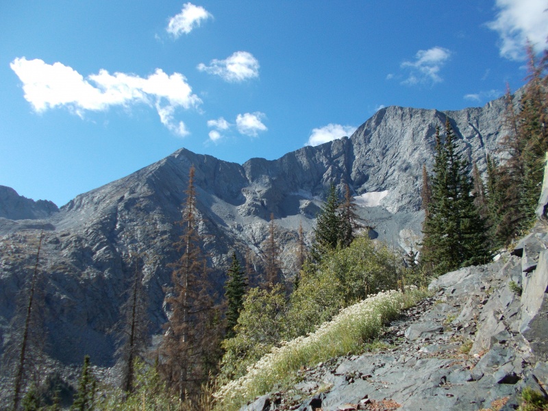
One of the perks of this route is the amazing views of Blanca Peak and Ellingwood Point. The north sides of these mountains are extremely rugged, and there are no easy routes to the summit.
The north face of Blanca Peak
The trail makes an abrupt right turn at about 11,520 feet, and starts the long series of switchbacks up to Lily Lake. There are several waterfalls in Lily Lake’s outlet stream.
Waterfall in the stream flowing out of Lily Lake
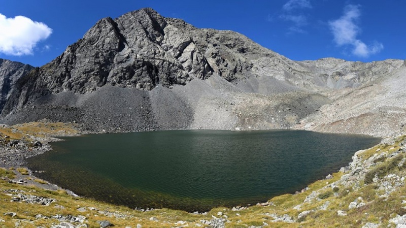
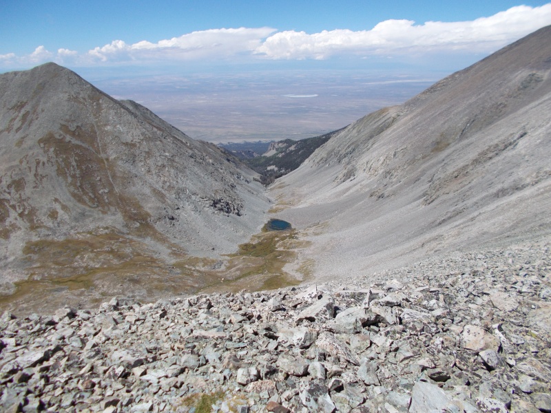
Lily Lake lies in a steep-walled cirque at about 12,320 feet. It would be hard to imagine a lovelier setting among rocks, rocks, and more rocks. We took a few minutes to let the scenery soak in, then headed to the far end of the lake. This is basically where the trail ends, and the route-finding begins.
Lily Lake (image by Senad Rizvanovic)
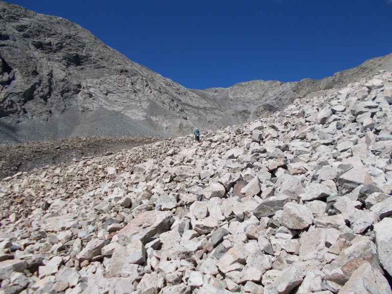
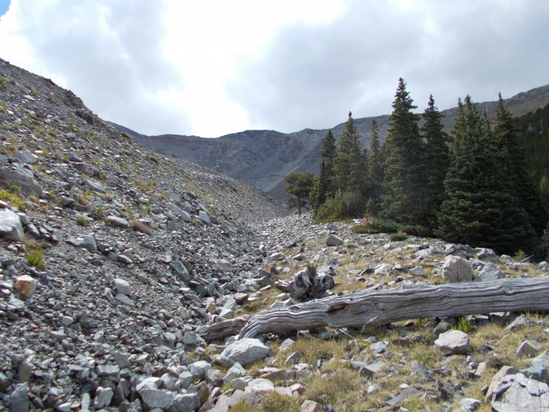
Above the lake, we had about 1,100 feet of rock-hopping to get to the 13,400-foot southeast ridge on Pt. 13,577. This turned out to be the most exhausting part of the hike.
Sen crossing the boulder field just above the lake
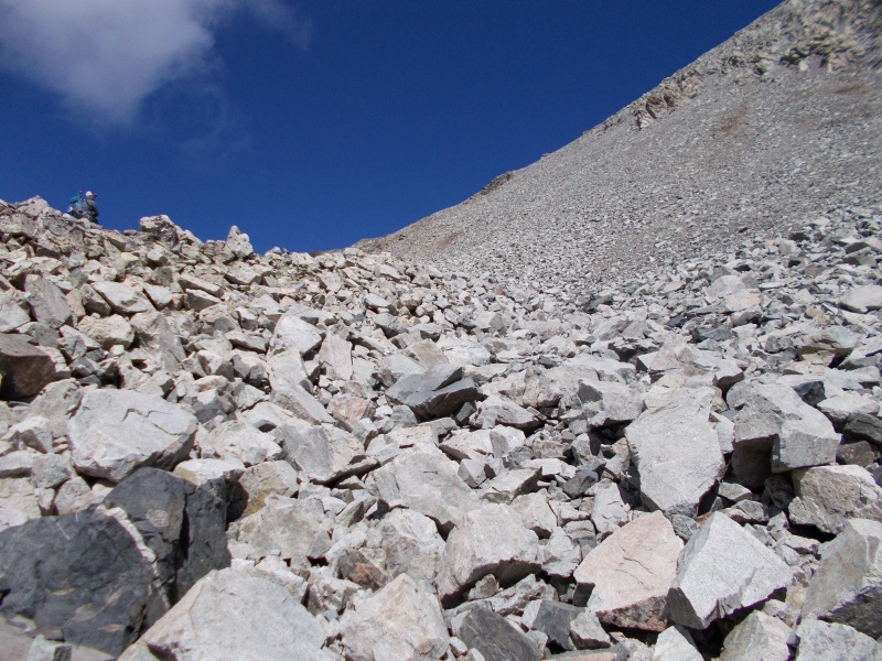
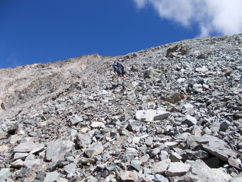
Pt. 13,577’s south slope is sketchy at best. Some of the large rocks rest on top of small rocks that act like ball bearings. It's difficult to predict which ones are ready to go, or how much force it will take to set them in motion. Small slides can trigger large slides, and I didn't feel safe until we were on top of the ridge. From that point onward, everything was much easier.
Inching my way up Pt. 13,577’s south slope with Lily Lake, Blanca Peak, and Ellingwood Point in the background (image by Senad Rizvanovic)
Angle of repose (noun): the steepest angle at which a sloping surface formed of a particular loose material is stable
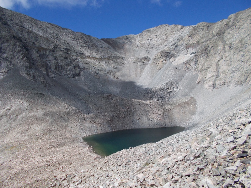
An unnamed lake above Lily Lake at about 12,600 feet
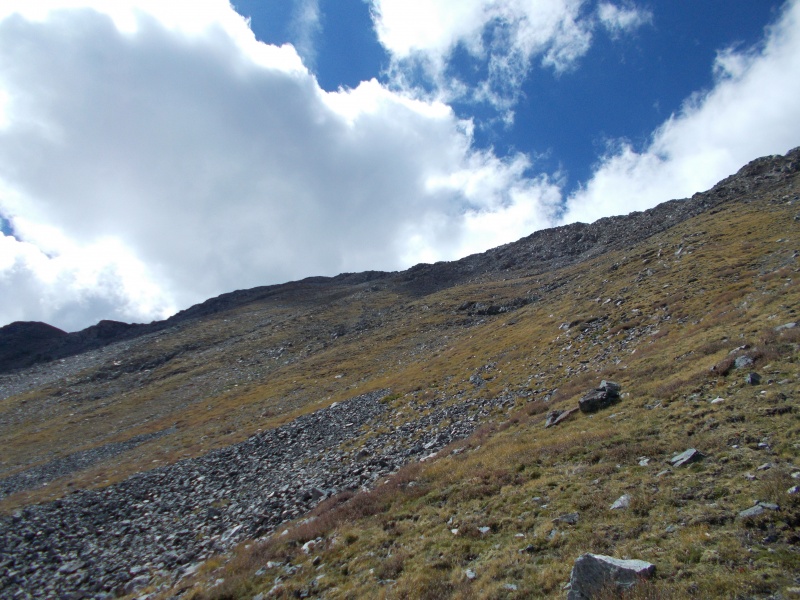
The angle of the slope relented as we approached the top of the ridge, and conditions were less hazardous.
Sen approaching the top of the south slope
When we topped out on Pt. 13,577’s southeast ridge, we were less than 150 vertical feet from the summit. It was an easy cruise over mostly small talus. The most strenuous part of the hike was now behind us.
Finishing up the last bit of ridge below Pt. 13,577's summit
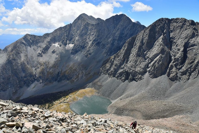
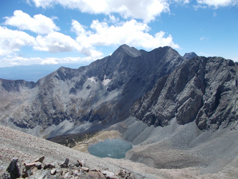
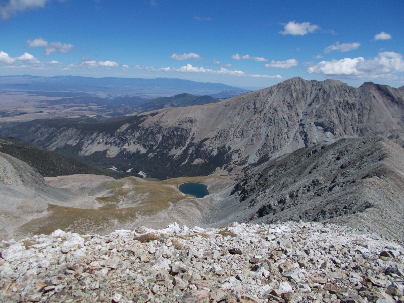
We had a world-class view of Blanca Peak and Ellingwood Point from Pt. 13,577’s summit. As I was slogging up the miserable talus slope, I wondered why we were doing this route instead of the Class 1 standard route. This view is part of the payoff. The other part of the payoff is getting an additional thirteener summit (Pt. 13,577) that isn't part of the standard route.
Blanca Peak, Ellingwood Point, and Lily Lake viewed from Pt. 13,577
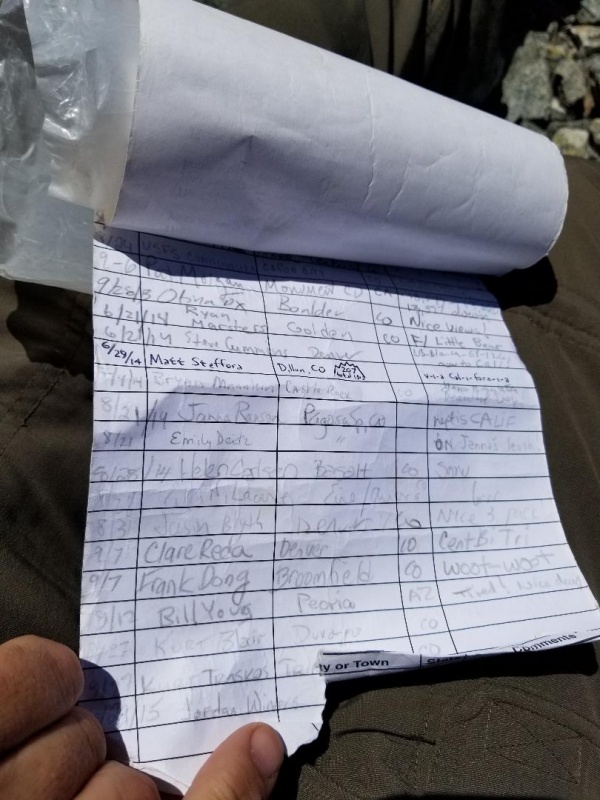
Summit register documenting visits from Otina Foxâ, Bryan Mannleinâ, CarpeDM, and many others from our 14ers community
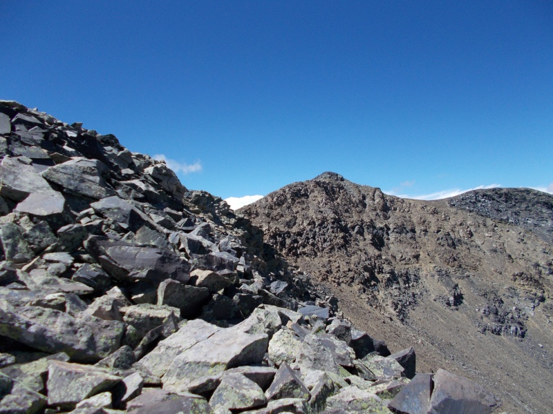
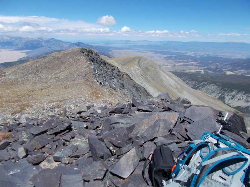
View of California Peak from Pt. 13,577
The weather was great, so we had plenty of time for a break on the summit. After we rested, we dropped down the north ridge to a 13,240-foot saddle. The talus here was stable, and it presented no problems.
Down in the low part of the saddle between Pt. 13,577 and California Peak
From the saddle, we made a quick trip up to a 13,479-foot subpeak. We could have sidehilled this subpeak on the west side, but there’s nothing in the world that we love more than unnecessary elevation gain. The views from this subpeak were not too shabby.
Looking down on Lost Lake at nearly 12,300 feet
Straight shot down California Gulch
A different view of fourteener Mt. Lindsey
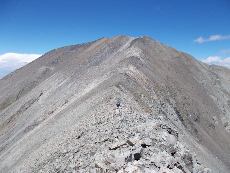
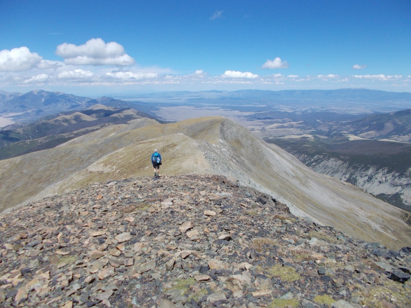
We only had to lose about 150 very easy feet on the north side of the subpeak. Before we knew it, we were on California Peak’s south ridge.
Starting up California's southwest ridge
Turning a corner on the ridge, with the summit in the background
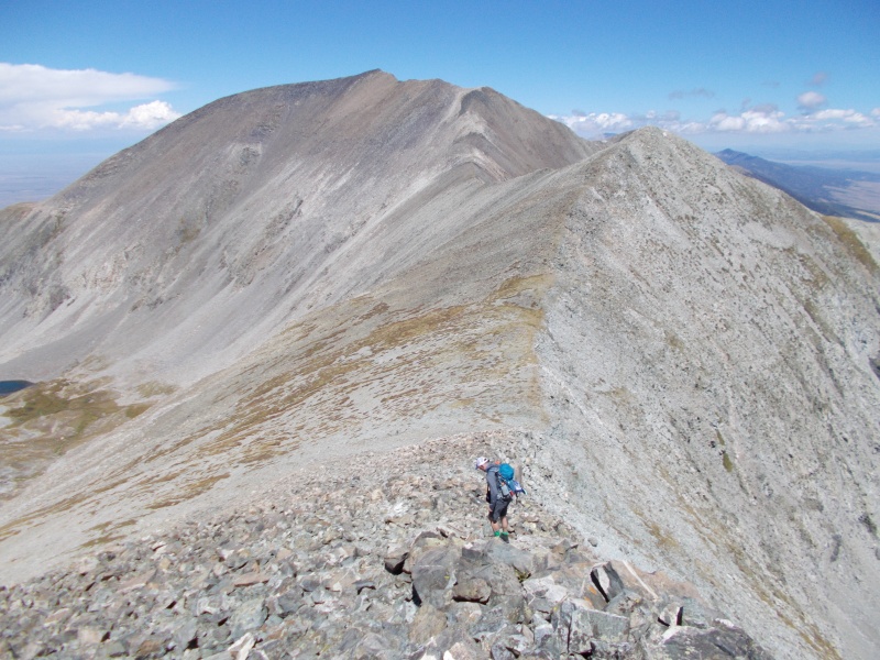
There was plenty of exposure on the right side of the ridge, and none on the left. The ridge between Pt. 13,577 and California Peak was fun, and not very difficult.
The final stretch of California Peak’s south ridge
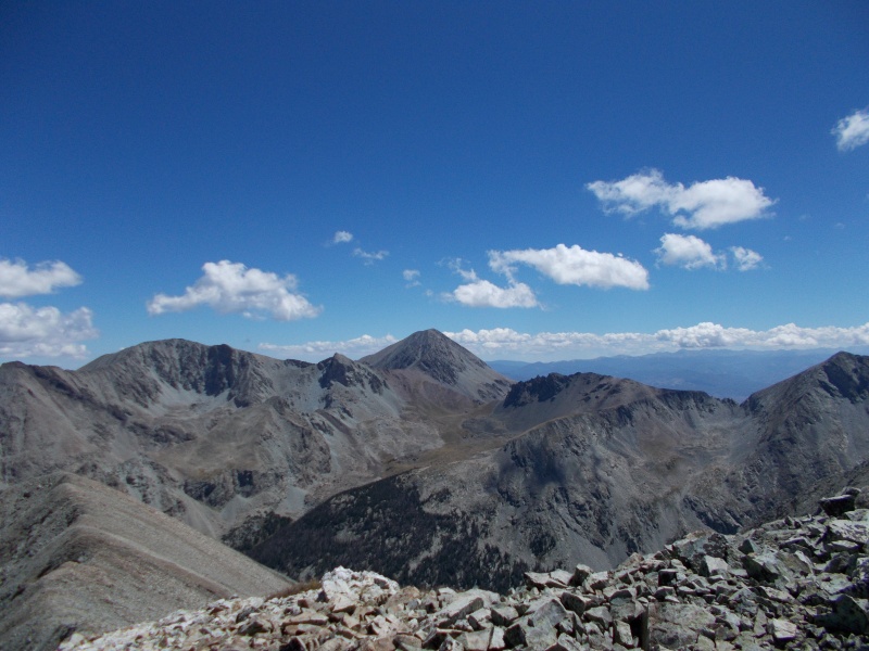
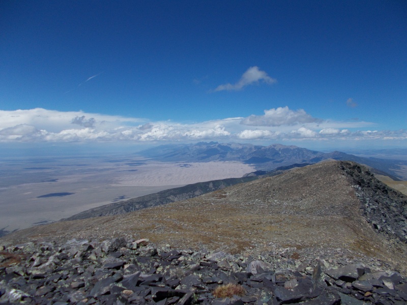
California Peak’s summit is surrounded by spectacular scenery. To the south, we could see Blanca Peak, Ellingwood Point, and Little Bear Peak. To the east, we could see Mt. Lindsey and Huerfano Peak. The Great Sand Dunes National Park was just a few miles to the north.
On California Peak's summit, looking northwest towards the Great Sand Dunes
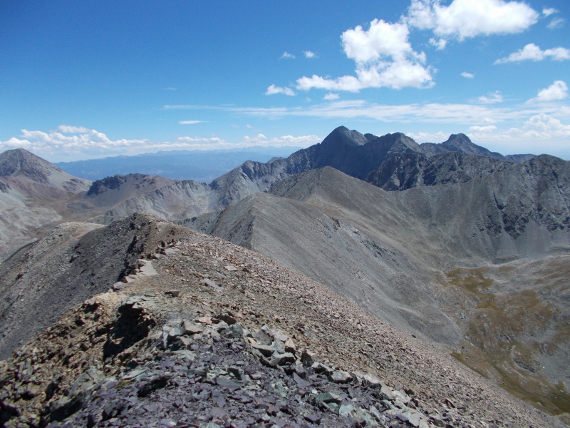
Looking south towards Blanca, Ellingwood, and Little Bear
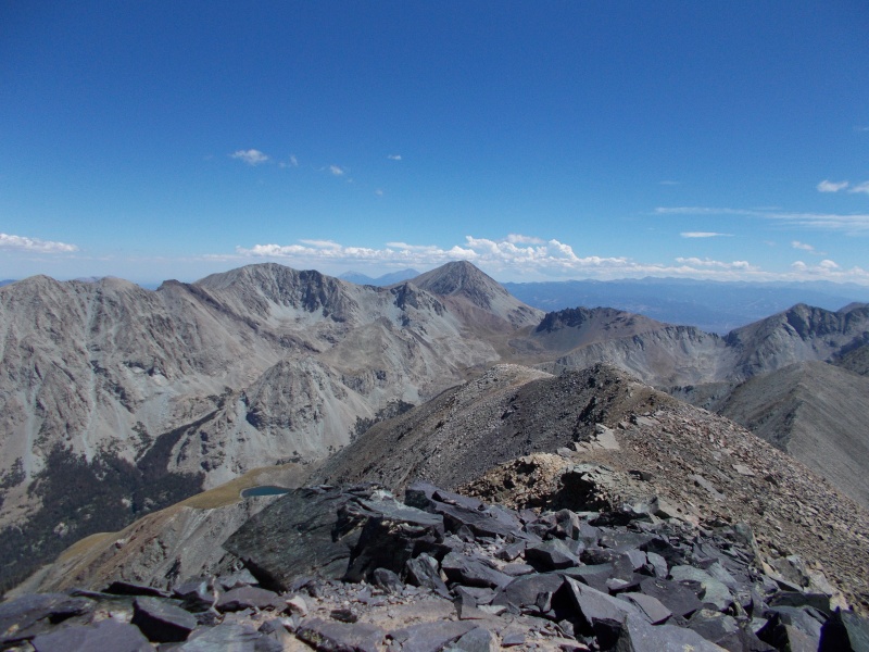
Lindsey and Huerfano viewed from California Peak's summit
We descended past the first bump on the north ridge, and headed towards a low saddle between the first and second bumps on the ridge. We dropped off of the ridge at 13,440 feet, and descended the east side on a steep grassy slope. The stability was a welcome contrast to the awful talus slope that we had ascended.
Looking up the north ridge towards our descent route
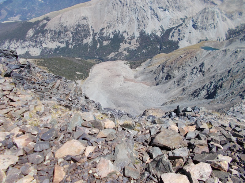
A massive rock glacier graces California Peak's east slopes. Ice and gravity have loosened rock from the face and pushed it down towards the base of the slope. The sheer volume of rock in the rock glacier was amazing; the edges must have been 50 feet high.
Massive rock glacier at the base of California Peak’s east slopes
Getting ready to drop down off of the ridge
Looking back up the first part of our descent
One of the easier parts of the descent
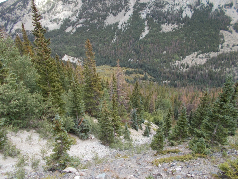
My goal was to descend to the east until we hit the Lily Lake trail at the large subalpine meadow; how we were to get there was anybody’s guess. I followed some waypoints that I had mapped out on the GPS, and it looked like the route would take us along the north side of the rock glacier. This turned out to be an excellent route.
Looking back up at California Peak, with the rock glacier on the left
Hustling down the grassy slope beside the rock glacier
Following the north side of the rock glacier funneled us into a shallow gully that led directly to the subalpine meadow. We found stretches of trail that I suspected had been made by wildlife; I was proven wrong when we found numerous “calling cards” of domestic cattle. There was plenty of grass in the gully for them to eat, but it seemed too steep to be worth the effort. The total descent from where we dropped off of the ridge to the point where we hit the Lily Lake Trail was about 2,800 feet.
Looking down on the meadow beside the Lily Lake trail
We made it back to the car under a light drizzle, but we welcomed the rain to cool us off. There was no thunder or lightning to be concerned about.
Heading back to the Jeep on the Lily Lake trail
We logged almost exactly eight miles and about 4,300 feet of elevation gain. Our route seemed to be unnecessarily strenuous at first, but it all made sense by the end of the day. Great views of Blanca and Ellingwood, a couple of alpine lakes, a bonus thirteener, and having a loop hike instead of an out-and-back all made this route more of a bargain.
GPS track of our route
My GPS Tracks on Google Maps (made from a .GPX file upload):
Always enjoy your reports. Wish there was a little more vegetation of note for you to report on. These peaks are on my list for this month.
Allow me to add to your definition with a bit of editorializing:
Angle of repose (noun): the steepest angle at which a sloping surface formed of a particular loose material is stable
Angle of Repose (proper noun): Wallace Stegner's masterpiece novel, set partially in CO.
I had to Google that novel, but it sounds interesting. Some of Stegner's other work sounds good as well. Vegetation isn't entirely over yet. We got out in the Elks today, and some asters and gentians are still blooming. What is more interesting at this time of year is the red foliage of the strawberries, geraniums, and fireweed. I can't predict whether or not it will be a good year for aspens, but some stands are already coloring up.
How about "Snow Peak" in the Gores? You'd like the trek up to Deluge Lake. The trail up to the Snow saddle is a few hundred feet of suck, but it wouldn't be a bad day.
Caution: The information contained in this report may not be accurate and should not be the only resource used in preparation for your climb. Failure to have the necessary experience, physical conditioning, supplies or equipment can result in injury or death. 14ers.com and the author(s) of this report provide no warranties, either express or implied, that the information provided is accurate or reliable. By using the information provided, you agree to indemnify and hold harmless 14ers.com and the report author(s) with respect to any claims and demands against them, including any attorney fees and expenses. Please read the 14ers.com Safety and Disclaimer pages for more information.
Please respect private property: 14ers.com supports the rights of private landowners to determine how and by whom their land will be used. In Colorado, it is your responsibility to determine if land is private and to obtain the appropriate permission before entering the property.


")
")
")
")
")
")
")
")
")
")
")
")
")
")
")
")
")
")
")
")
")
")
")
")
")
")
")
")
")
")
")
")
")
")
")
")
")
")
")
")