Download Agreement, Release, and Acknowledgement of Risk:
You (the person requesting this file download) fully understand mountain climbing ("Activity") involves risks and dangers of serious bodily injury, including permanent disability, paralysis, and death ("Risks") and you fully accept and assume all such risks and all responsibility for losses, costs, and damages you incur as a result of your participation in this Activity.
You acknowledge that information in the file you have chosen to download may not be accurate and may contain errors. You agree to assume all risks when using this information and agree to release and discharge 14ers.com, 14ers Inc. and the author(s) of such information (collectively, the "Released Parties").
You hereby discharge the Released Parties from all damages, actions, claims and liabilities of any nature, specifically including, but not limited to, damages, actions, claims and liabilities arising from or related to the negligence of the Released Parties. You further agree to indemnify, hold harmless and defend 14ers.com, 14ers Inc. and each of the other Released Parties from and against any loss, damage, liability and expense, including costs and attorney fees, incurred by 14ers.com, 14ers Inc. or any of the other Released Parties as a result of you using information provided on the 14ers.com or 14ers Inc. websites.
You have read this agreement, fully understand its terms and intend it to be a complete and unconditional release of all liability to the greatest extent allowed by law and agree that if any portion of this agreement is held to be invalid the balance, notwithstanding, shall continue in full force and effect.
By clicking "OK" you agree to these terms. If you DO NOT agree, click "Cancel"...
This is another busy weekend where I needed to be home by noon, so I was up at 1am and made it to the trailhead at 4:30am. I didn’t do much research on the trailhead in, and was surprised to find it was a little more 4WD than I’d anticipated. I’d forgotten about the mug of coffee I had in my cup holder, and after the first few yards of driving on Leavenworth Creek Road what was left in my coffee cup was all over the front seat of my truck. The road had a few 3 point turns and several small streams and large puddles to cross. High clearance and 4WD are a must.
Here’s a video of the way back down for those interested:
There weren’t any signs anywhere on this trail (except the continental divide one at the end), not even at the trailhead. No one else was at the trailhead when I arrived and I wondered if I was in the right spot? I parked my truck and got out my flashlight to try and find where the trail actually began. I had my GPS, so I tried to use it to find the start of the trail. I was aware of the general direction I needed to follow.
I made several failed attempts down paths that looked correct but weren’t. They all led me down animal trails that ended in creeks and willows. See this path here with the tree across it, which usually indicates it’s a closed trail? Well, that’s exactly what it was: closed and not the trail I was looking for. However, in the dark I couldn’t find a solid trail, so I took it, walked in circles trying to find a path, and ended up back at my truck.
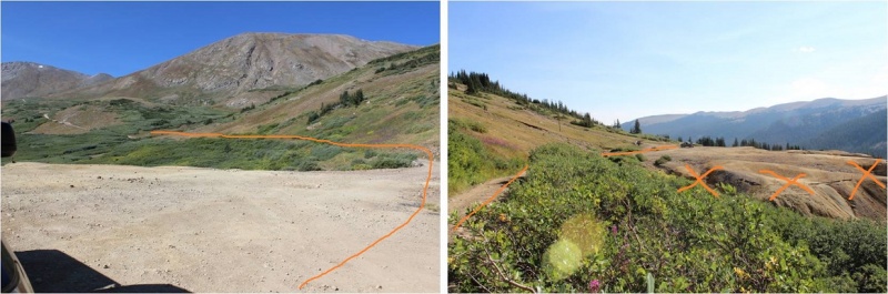
After quite a bit of frustration I realized there was actually a road I was supposed to follow. I felt dumb for missing it, but in the dark I’d had no idea it was there. So you don’t miss it and spend 20 minutes trying to find the correct start to this trail, here’s what you need to look for:
Ok, now I was on the correct trail and it was almost 5am. After walking for about 1/10th of a mile I came to a small stream. Here I left the road and turned right.
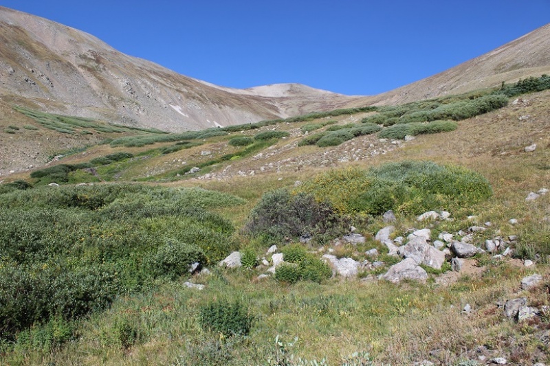
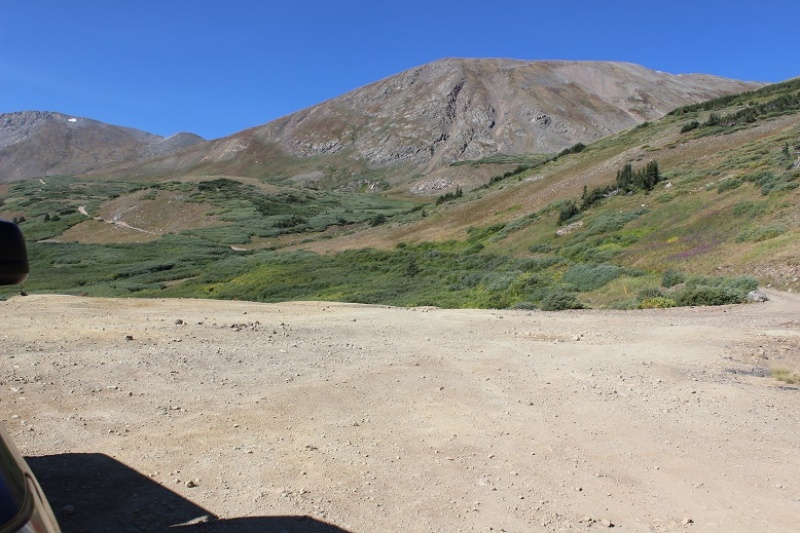
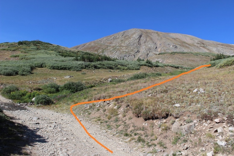
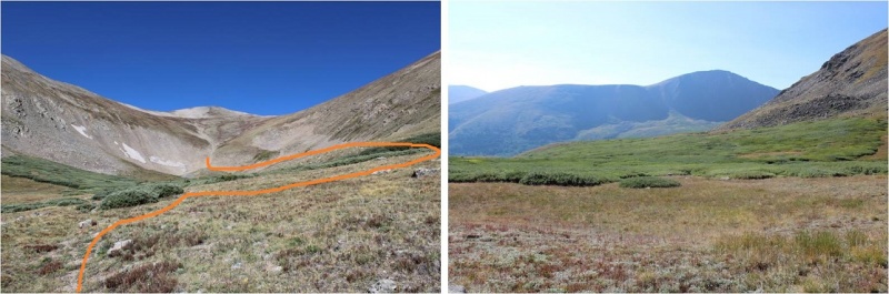
From this point on there was no solid trail. In the daylight you just head towards the mountain and try to find a path clear, but in the dark I struggled to find a path clear of willows. It seemed every time I tried to head towards the mountain I got stuck in willows with no trail. They were taller than I was and when I tried to see over them with my flashlight they seemed to never end. I had to keep going right, away from the mountain, but eventually I was able to curve back around to the left (and center of the basin). My advice if you’re hiking this in the dark: Stay to the right of the creek, and follow the line of willows to the right until they allow you to go left. Here’s what it looks like in the daylight (second picture is looking back down the basin)
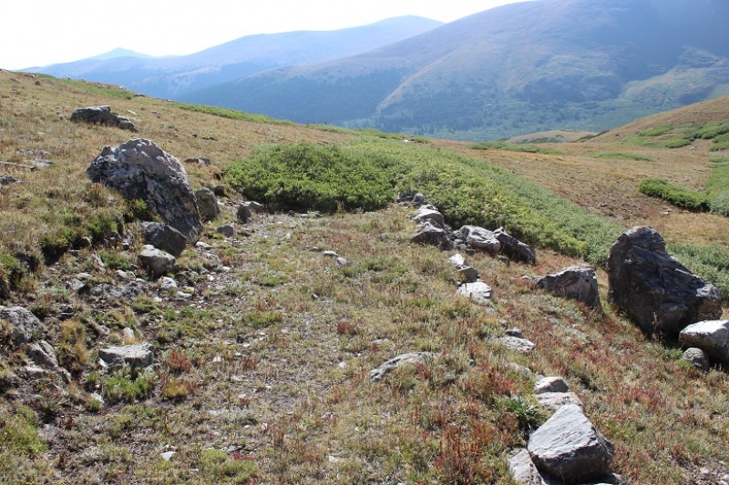
After skirting the willows you’ll find segments of a very, very old 4WD trail. Woohoo! The only problem with this trail is it has willows too: right in the middle of the path. This was confusing and frustrating at night as well, but no problem in the light of day. Just keep aiming towards the west and middle of the basin and you’ll be fine
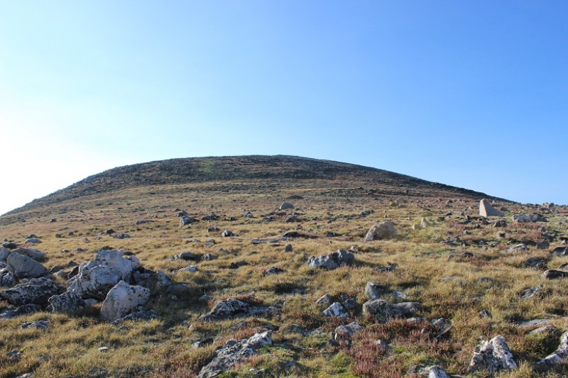
At the end of the basin your goal is to hike up towards the saddle of Mt Edwards and Mt McClellan. There is no established route to do this, but I’m assuming most people head straight up the gully. I started to, but I wanted to summit Mt McClellan first, and when I looked to the right I could tell the terrain had no trail either but was easily hiked. So I aimed up and right instead of towards the saddle.
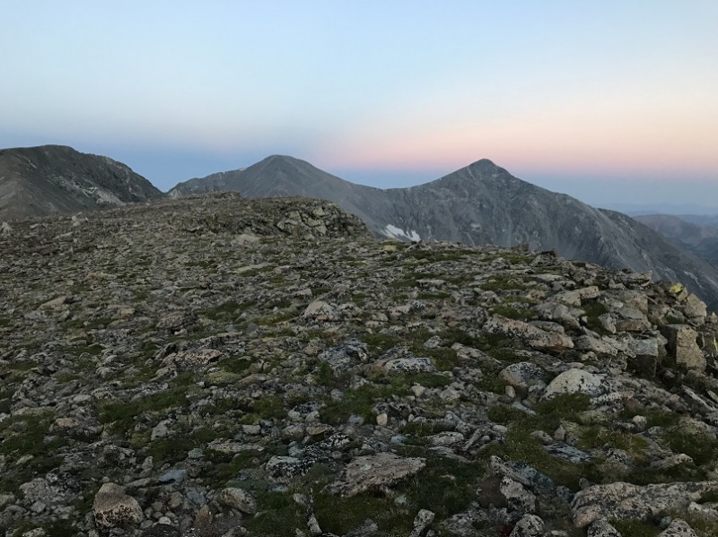
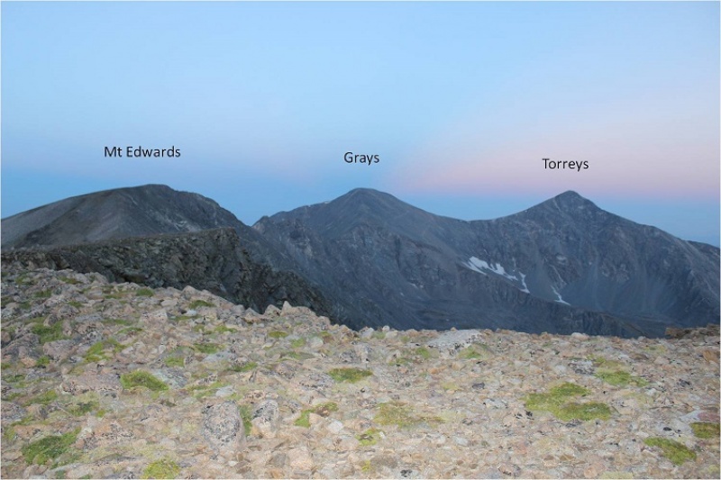
When I reached the first bump in the ridge I turned right again and followed the ridge to the summit. I summited at 6am. The summit was very long and had great views of Grays and Torreys.
I took a summit photo to prove I’d summited (McClellan is an unranked 13er)
And a video as I was hiking to the top:
I looked over to Grays and Torreys and saw a trail of headlights coming up the road, as well as a steady stream of people already on the trail. I was so glad I was on a 13er with no crowds! I hadn’t seen anyone all morning.
I turned and faced Mt Edwards. That was my next target.
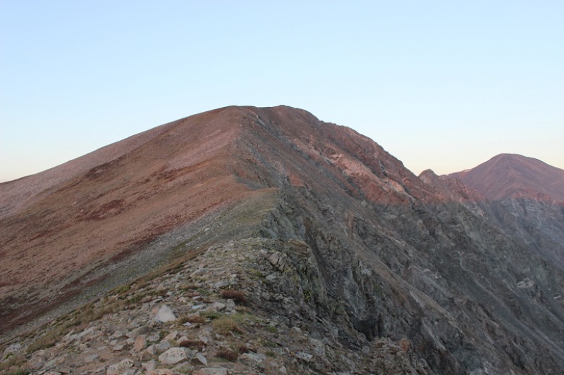
I followed the ridgeline back to the saddle, noting the drop off to the right
From the saddle I turned back towards McClellan to watch the sunrise
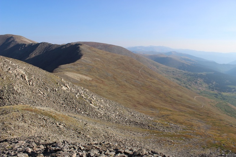
And then took a picture looking down the basin I’d just come up
From the summit of Mt McClellan to the summit of Mt Edwards took me half an hour to hike. I made it to the top of Mt Edwards at 6:30am
The reason I’d summited Mt McClellan first and then headed over to Mt Edwards (which is the reverse way most people summit the two together) was because if I had enough time I’d wanted to summit a nearby bicentennial (Argentine Peak) as well. Since it was only 6:30am I had plenty of time to head over to Argentine before trekking back down to my truck: Argentine was about a mile and a half away.
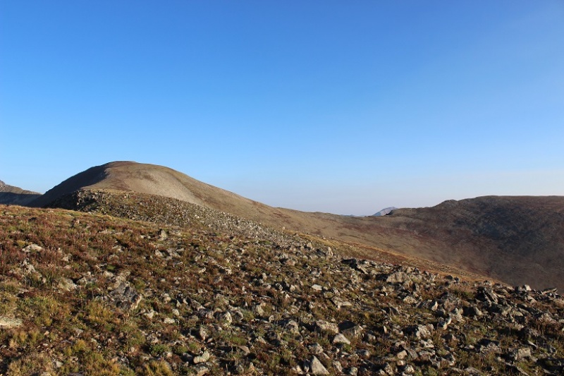
I turned and headed southeast down the ridge. The ridge follows the Continental Divide, has a faint trail at times, and a cairn every hundred yards or so. It’s an easy ridge to follow.
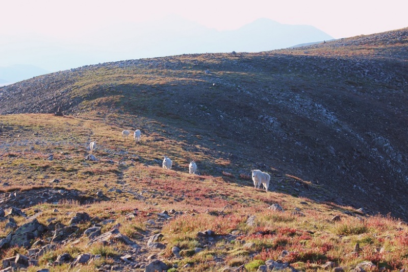
I saw a few skittish mountain goats. They ran down the slope when I was about 20 yards away from them.
About halfway to Argentine Peak I came to a saddle that was crossed by Argentine Pass (a 4WD road). From here I continued to follow the ridge. On the way up I decided to skip summiting point 13,449 because it didn’t seem necessary (but I climbed up and over it on the way back)
When I made it just below Point 13,449 I aimed for where the rocks end and skirted the mountain to the left.
I also took a shadow selfie because I do that kind of thing
The trail became a bit rocky going around the point, but it never exceeded class 2. The final trek to the summit was an easy hike up a steady slope.
It was still cold, and there was a bit of frost on the ground
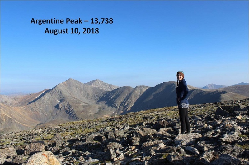
I summited at 7:45am
There was a continental divide sign on the summit
At this point I was in a hurry to get back to my truck by 9am to make it home by noon, so I turned and looked back at the route. I could hike back to the saddle and take Argentine Pass back down to my truck. That would be the quicker route, but that would also mean I wouldn’t get pictures of the trail I’d taken in. If I hiked fast I could most likely make it the 4 miles back in just over an hour. It only had about 400’ of elevation gain. I decided to go for it. Instead of aiming for the pass I followed the ridge back to Mt Edwards.
When I got to just before the final pitch for Mt Edwards I turned east and started down the slope. Here’s a picture of where I started back down to the basin (you’re looking at the Mt Edwards/Mt McClellan saddle). Check out the scree heart on Mt Edwards…
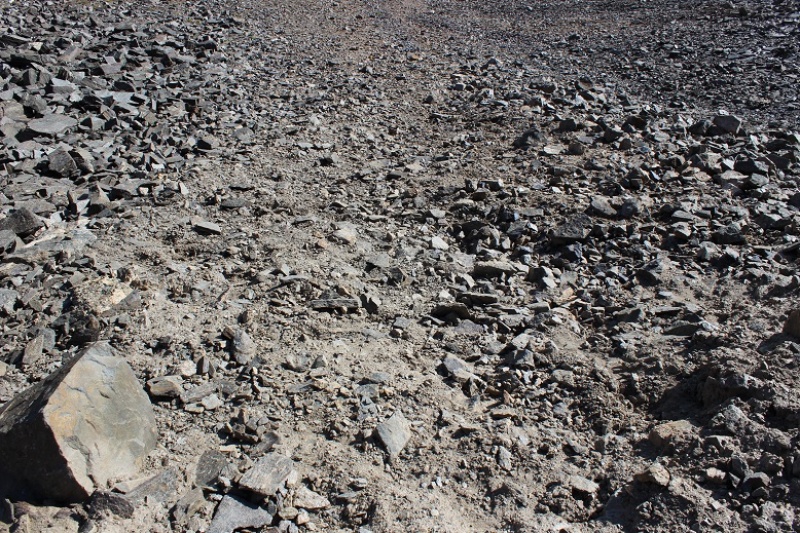
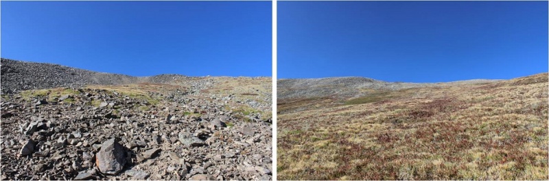
From here there was about 200’ of scree to get through before it turned to grass.
I stuck to the slope and aimed toward the gully in the middle of the mountains.
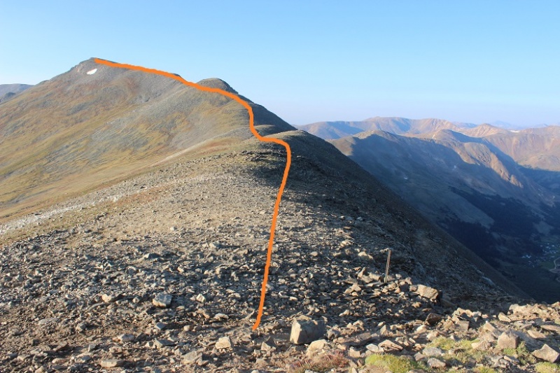
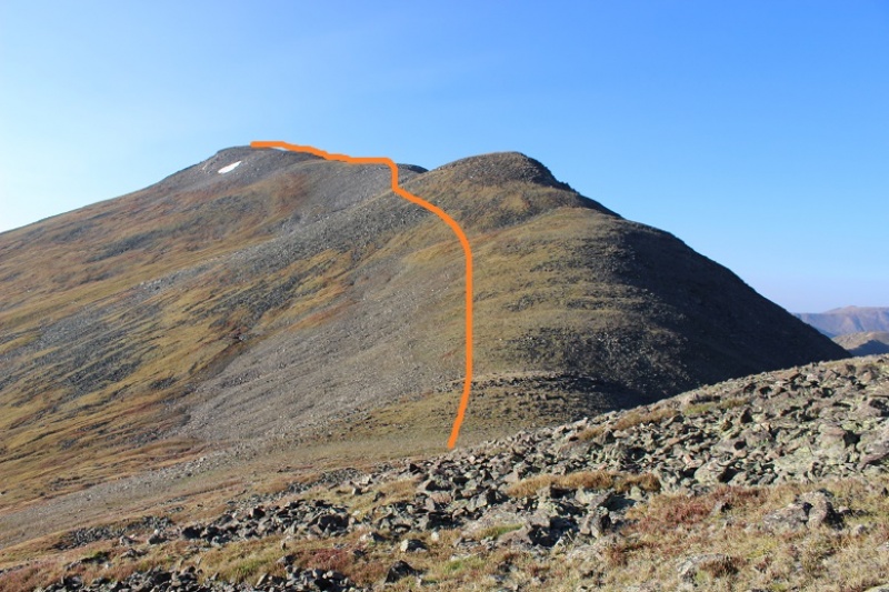
Here’s the route I took down
In the light of day the route back to my truck was clearly visible around the willows. I was even able to see faint trails and aim for them.
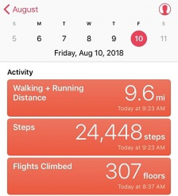
I made it back to my truck at 9am, making this a 9.6 mile hike in just over 4 hours with 3 new 13er summits and 3313’ in elevation gain. There still weren’t any other vehicles in the parking area.
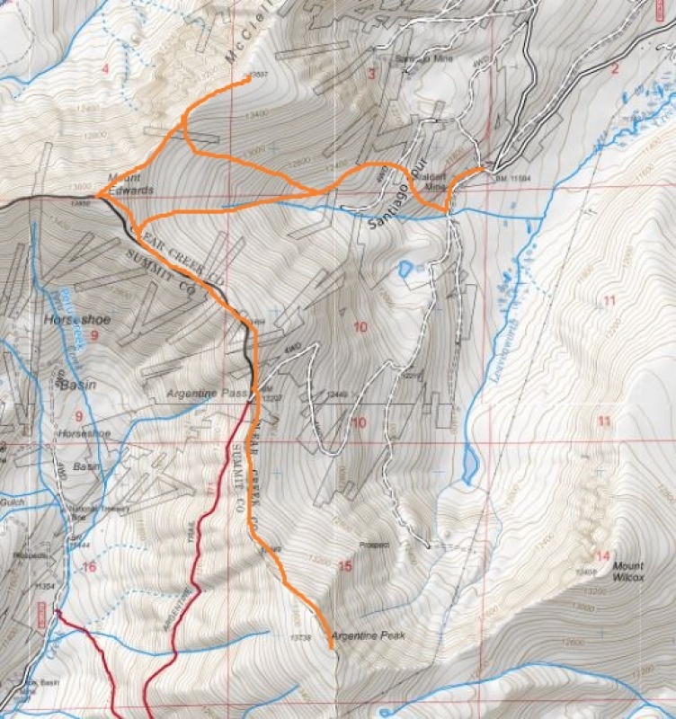
Here’s the route I took.
The best part? I didn’t see another person all day until I was driving back down the Leavenworth Creek Road. At that point I passed 1 person in a truck and 3 Forest Service jeeps, all heading up the road. We had to get creative to pass each other, but everyone was nice and we worked together to do so.
Thumbnails for uploaded photos (click to open slideshow):
I hiked the same loop (plus Wilcox) last summer and enjoyed it. I joined two other guys early during the ascent of McClellan. One, a recent transplant, had a pretty serious case of altitude sickness just after the Argentine/Wilcox saddle. It all turned out okay but that's a long time above 13,000' for a flatlander.
Oh, the willows... Just about the time I thought I had made it across the Leavenworth Creek willow-fest after coming down from Wilcox, I was hopping across the stones in the creek, slipped and went in head-first. Fortunately, I was only a quarter mile from the car. What a knucklehead, I am sometimes!
Yes, that road is rough - especially the early part. I went up McClellan's "ridge" rather than to the saddle; although steep, it was mostly grass/solid rock so a little shorter and relatively easy way up (it was light for me).
Post-14er completion, I enjoy the quiet of the 13ers but am repeating many 14ers with my daughters and wife and braving the crowds.
I read your report and in a few spots smiled: No one at the trailhead, little to no signage, weak or disappearing trails, etc. Yep, welcome to the 13ers! And those are in the heavily used Front Range....
Enjoy the adventure!
-Tom
Caution: The information contained in this report may not be accurate and should not be the only resource used in preparation for your climb. Failure to have the necessary experience, physical conditioning, supplies or equipment can result in injury or death. 14ers.com and the author(s) of this report provide no warranties, either express or implied, that the information provided is accurate or reliable. By using the information provided, you agree to indemnify and hold harmless 14ers.com and the report author(s) with respect to any claims and demands against them, including any attorney fees and expenses. Please read the 14ers.com Safety and Disclaimer pages for more information.
Please respect private property: 14ers.com supports the rights of private landowners to determine how and by whom their land will be used. In Colorado, it is your responsibility to determine if land is private and to obtain the appropriate permission before entering the property.