Download Agreement, Release, and Acknowledgement of Risk:
You (the person requesting this file download) fully understand mountain climbing ("Activity") involves risks and dangers of serious bodily injury, including permanent disability, paralysis, and death ("Risks") and you fully accept and assume all such risks and all responsibility for losses, costs, and damages you incur as a result of your participation in this Activity.
You acknowledge that information in the file you have chosen to download may not be accurate and may contain errors. You agree to assume all risks when using this information and agree to release and discharge 14ers.com, 14ers Inc. and the author(s) of such information (collectively, the "Released Parties").
You hereby discharge the Released Parties from all damages, actions, claims and liabilities of any nature, specifically including, but not limited to, damages, actions, claims and liabilities arising from or related to the negligence of the Released Parties. You further agree to indemnify, hold harmless and defend 14ers.com, 14ers Inc. and each of the other Released Parties from and against any loss, damage, liability and expense, including costs and attorney fees, incurred by 14ers.com, 14ers Inc. or any of the other Released Parties as a result of you using information provided on the 14ers.com or 14ers Inc. websites.
You have read this agreement, fully understand its terms and intend it to be a complete and unconditional release of all liability to the greatest extent allowed by law and agree that if any portion of this agreement is held to be invalid the balance, notwithstanding, shall continue in full force and effect.
By clicking "OK" you agree to these terms. If you DO NOT agree, click "Cancel"...
Report Type
Full
Peak(s)
Mount Jasper - 12923
UN12660
Skyscraper Peak - 12383
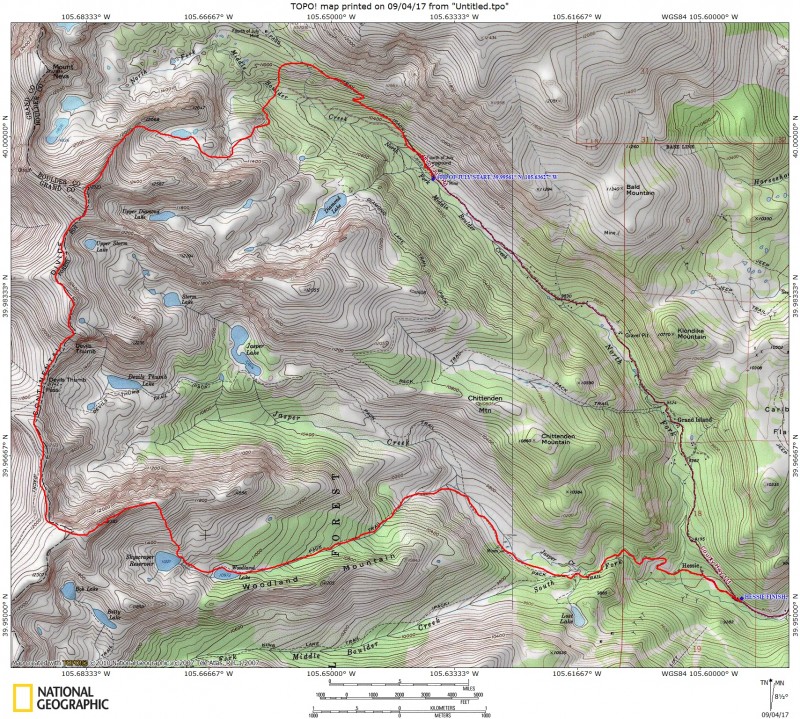
September 3rd, 2017
Start : 4th of July Trailhead
End : Hessie Trailhead
Approx 14 Miles
Approx 4,400' Elevation
It's always fun working on the Indian Peaks Wilderness "list" (I use the standard 37 ranked plus 1 for Iroquois) which is in my opinion one of the most enjoyable areas in the Front Range if not all of Colorado. So close to the city yet easy to find seclusion if you want it...especially from the west. For this trip, I planned to "clean up" two peaks at the far south end of the wilderness still remaining on the list with Skyscraper and Jasper, as well as a repeat of UN12660 that I hiked the previous fall. Making a large loop out of it kept it enjoyable (I love loops) and adding Mr. BThom to the day kept it tubular.
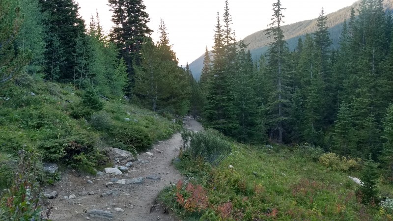
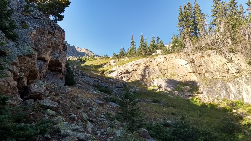
Approach to Mount Jasper Didn't plan a whole lot for the trip, but I originally planned on doing the loop starting AND ending at Hessie TH. The morning of (after doing a few quick calcs with the map) I decided that we could save some time and miles (and gain) by parking my car at Hessie, then hitchhiking up the road to 4th of July. With the busy TH it is, I didn't foresee issues thumbin it. True to the assumption, after only about a hundred yards we were picked up by a couple and their dog (named Jasper ironically enough) and they provided the lift 3 or so miles to 4th of July TH. We thanked them and headed out on the trail to Arapaho Pass. Now, I believe there may be a low trail that follows South Boulder Creek up the valley, however without really looking it up we just kept up high along the standard pass trail. (Probably added a few hundred feet to the day, but no biggy.) After a mile or so, we took a left on the Diamond Lake trail and headed back down into the valley. After a short descent, you reach the South Boulder Creek and leave the trail.
There are a number of great reports identifying the route up to the NE slopes and ridge of Jasper and where to leave the trail (vonmackle has a great one) but I will just note that our version was:
-Follow the Diamond Lake Trail under it crosses the main South Boulder Creek
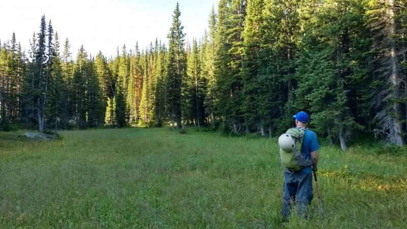
-Leave trail right AFTER the creek crossing and head up (right) 25-50 yards to an open meadow.
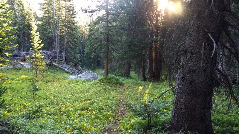
-Head south (left) across the meadow, and at the far end find a faint but followable use trail angling west (right).
We did our best to angle to the south of the large outcropping guarding the basin access up towards treeline. It was a bushwhack in some parts, but easy as bushwhacking goes.
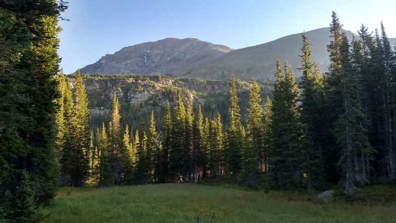
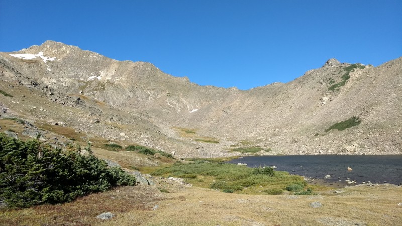
After reaching treeline, we just picked our way up the final hundred feet or so to the unnamed lake which sits between Jasper's NE Ridge and E Ridge. Nice lake, and we chose to take a short break and prepare for (what looked like) an annoying talus ascent up to the NE ridge.
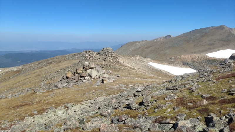
Starting up along the Arapaho Pass Trail, looking back to the east. Small set of falls near where you leave the Diamond Lake Trail and head off trail. Meadow just after leaving the trail. Cross to the other side and find the faint use trail. Looking back at South Arapaho Peak from the other side of the meadow. Following the faint use trail up towards tree line. Breaking treeline, a few minor bands to cross before reaching the unnamed lake near 11,600'. Unnamed Lake at 11600' with the NE ridge and Jasper in the distance.
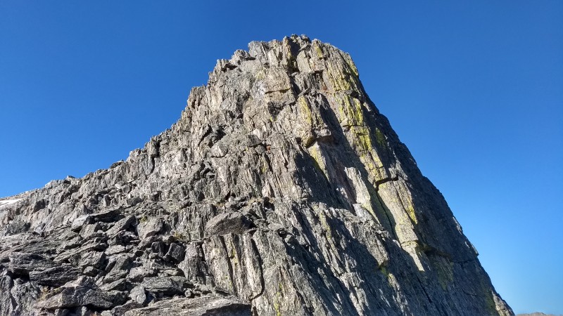
Mount Jasper (NE Ridge - Class 3)
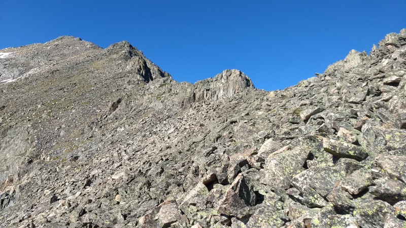
After taking 5 or 10 minutes, we circled the south side of the lake aiming for what looked like the easiest ascent. This involved passing by the well known (and well photographed) 1970's plane crash on the west side of the lake. From the plane crash, we ascended directly up the slope aiming for the climbers left of Pt 12068' which sits directly on the ledge. Thankfully, the ascent turned out not to be too bad...talus was solid and the ridge came quick.
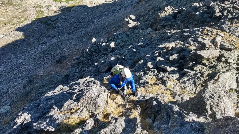
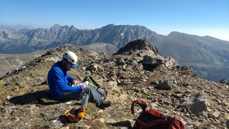
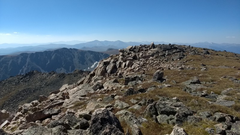
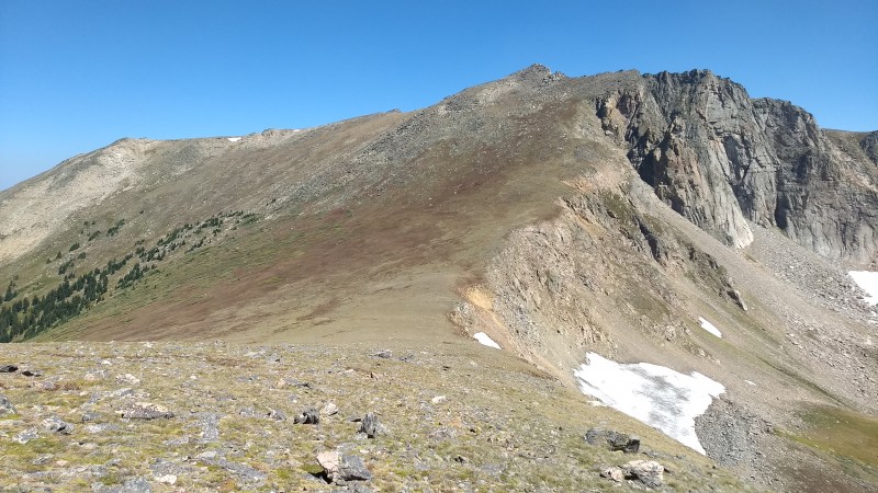
Once on the ridge, the route becomes clear the remaining way to the summit. There were no issues staying directly on the ridge top, although one step around 12,400' was exciting. While one is able to go around to the north (right) of the prominent rock step, climbing it head on ended up being very doable. About halfway up, a nice ledge angled from left to right slightly ascending. Once on the NE side of the face, a easy path to the top becomes obvious. Maybe a class 4 move here or there depending on the line, but mainly all class 3. Again, this is optional and going around the entire step works fine. Once past this, it's easy class 3 up to the false summit, then class 2 the remaining distance to the true summit. Plane wreckage on the west side of the lake. Looking down on the ascent from the lake up to the ridge near Pt 12068. Looking up the ridge to Jasper. Heading up the ridge. One step that can be passed to the right, or ascended straight on. A ledge about halfway up gives way to a reasonable direct Looking back at the ridge and South Arapaho Peak in the distance. From the false summit of Jasper looking west to the true summit. Signing those books.
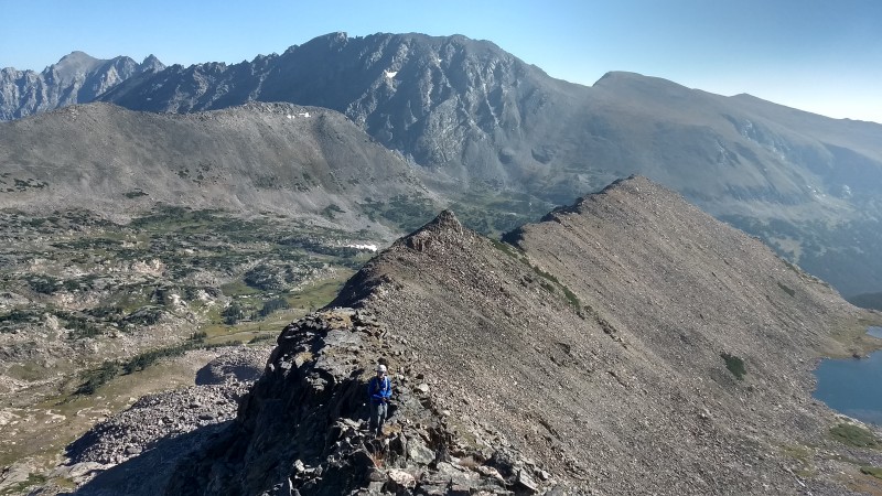
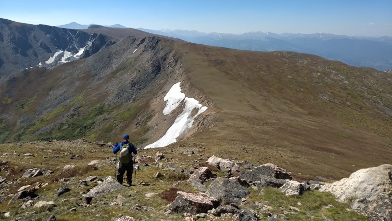
Mount Jasper to UN12660
After a short break on Jasper, we descended to wide open and mellow south slope along the Continental Divide. On the left is the drop off to Storm Lakes. I had long viewed this as a feasible option for ascent to Jasper, but walking by it up close it seemed that it would suck gaining the ridge here. Maybe I just didn't see the obvious route, but it all looked a bit gross and loose. After reaching the low point of the Jasper/UN12660 saddle, Brian continued along the divide while I kept to the right (west) and stayed a bit lower. Don't think there is much difference in choice as we both reached the summit of UN12660 around the same time, but my route may have been slightly less talus.
Our stay on UN12660 was brief. I looked for the "Mt. Chuck" engraved landscaping stone I had seen up there the previous year, but I guess "Mt Chuck" is no more. The next portion of route to Skyscraper was long, so we headed on without taking much of a break.
Descending to the saddle between Mount Jasper and UN 12660. Looking back along the continental divide. Summit of UN12660.
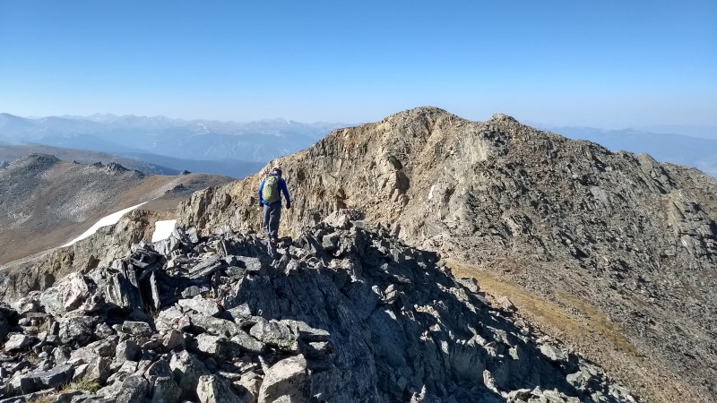
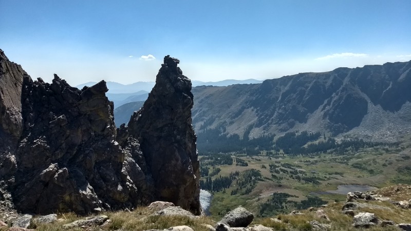
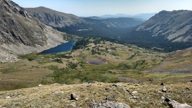
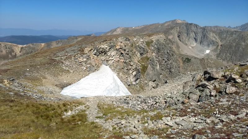
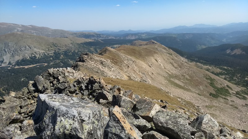
UN12660 to Skyscraper Peak The descent from UN12660 leads down towards the semi-popular Devils Thumb Pass. We came across the first people of the day here as they were headed up to see Devils Thumb itself. This impressive feature stands about halfway between the pass and the summit of UN12660. Not sure the difficulty of it, but it doesn't look too pleasant. Reaching the pass, we passed up the Devils Thumb Trail (which twists off to the west) and continued directly along the ridge. Again, pretty easy going however I think we could have saved some up and down hanging a bit further to the right (west) and bypassing the first high point.
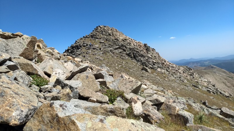
Slowly the ridge angles left (east) towards the summit of Skyscraper. The final quarter mile is over easy talus and there seems to be an annoying chunk of distance to gain the final few vertical feet. It was starting to warm up a bit, and Skyscraper Reservoir and Woodland Lake below were looking mighty refreshing. We stayed for about 5 minutes on our final summit of the day (under the still clear blue skies) and headed off.
Descending UN12660, Devils Thumb Pass below. Devils Thumb Looking back at Devils Thumb and UN12660 from the slopes headed up to Skyscraper Peak. Devils Thumb Lake to the east. Looking back at a portion of our day from the final ridge to Skyscraper. Skyscraper summit, Brian approaching. Summit of Skyscraper. The right descending slope in the distance was our descent route to Skyscraper Reservoir.
Descent from Skyscraper to Hessie Trailhead
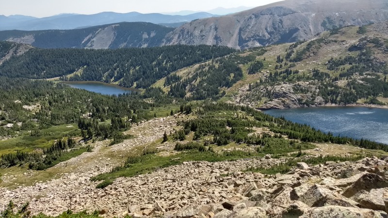
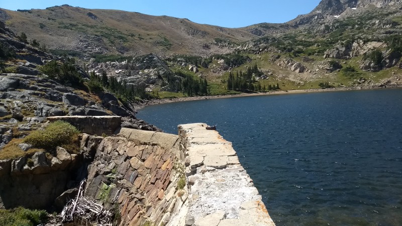
While Roach's book notes a direct line from the summit to the reservoir, we decided to continue on the ridge of Skyscraper eastward until a gentler ramp seemed to lead down to the dam area of the reservoir. This ended up being kind of a crappy decision, as although mellow in descent the footing was a bit loose all the way down. Then the final 100 feet to the reservoir treated us with swimming through some thick brush. I took a few moments to check out the dam. Its a pretty neat old dam, kinda surprising that it seems to be keeping so well.
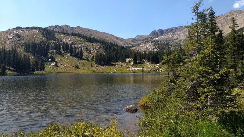
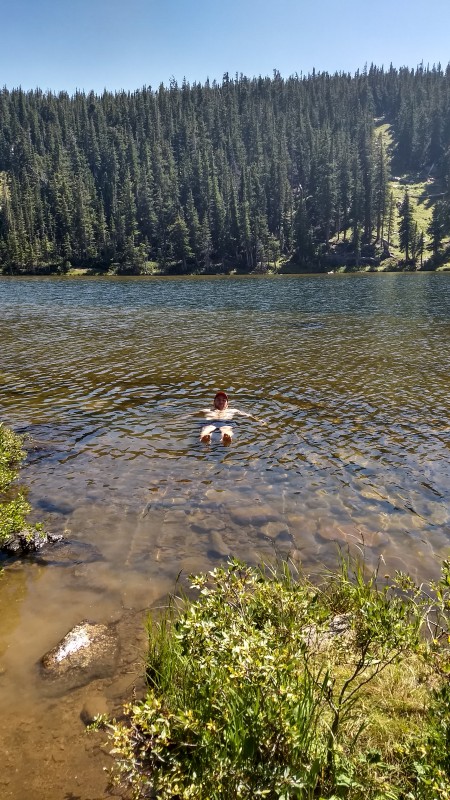
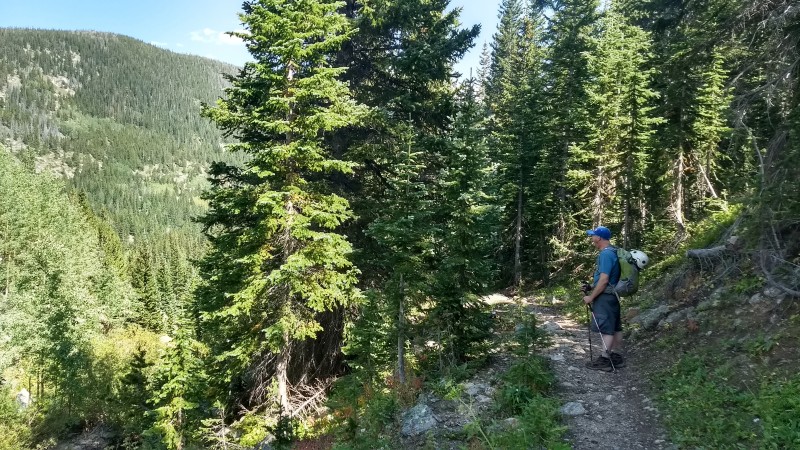
From the reservoir we picked up the Woodland Lake Trail as it led down a short ways to Woodland Lake. Here I took the opportunity to fill up on some water and cool off with a nice dip in the lake. Quite refreshing after a long day. After drying off, we jumped back on the Woodland Lake Trail and set autodrive the final 4.5 miles back to the Hessie Trailhead and the car. (Woodland Lake Trail to Devils Thumb Trail to Kings Lake Trail.) The trek out was quite populated with others enjoying the nice weather.
Nice day out in the always pleasant IPW.
Woodland Lake (left) and Skyscraper Reservoir (right) from our slope descent. Skyscraper Dam. Woodland Lake. Derek taking a dip. Scenes from Woodland Lake Trail. Nice scenes along the trail during the trek out to Hessie. Almost back to Hessie. Map of the day.
Thumbnails for uploaded photos (click to open slideshow):
Jasper brings back some memories! Took a few noobs on that one. I remember passing the prop for that plane crash on the slopes before we got to the crash site. Skipped off the northslopes and straight to that huge rock landing. Nice little peak, taught my friends how to glissade that day. It was a one and done for us. Nice Loop, need to get back in there, been a long time, what 12 years?
Nice report! You might have to go back for the basin just south of Jasper Peak (just head up from Jasper Lake). It stands out as one of the best I've been to.
Great idea to do that all as a loop. Those approaches from Hessie seem long for some reason.
Caution: The information contained in this report may not be accurate and should not be the only resource used in preparation for your climb. Failure to have the necessary experience, physical conditioning, supplies or equipment can result in injury or death. 14ers.com and the author(s) of this report provide no warranties, either express or implied, that the information provided is accurate or reliable. By using the information provided, you agree to indemnify and hold harmless 14ers.com and the report author(s) with respect to any claims and demands against them, including any attorney fees and expenses. Please read the 14ers.com Safety and Disclaimer pages for more information.
Please respect private property: 14ers.com supports the rights of private landowners to determine how and by whom their land will be used. In Colorado, it is your responsibility to determine if land is private and to obtain the appropriate permission before entering the property.