| Report Type | Full |
| Peak(s) |
Garfield Peak - 13,778 feet Truro Peak - 13,298 feet |
| Date Posted | 09/04/2017 |
| Modified | 09/05/2017 |
| Date Climbed | 08/30/2017 |
| Author | bergsteigen |
| Picking up the scrambling orphans |
|---|
Garfield Peak ATrailhead: McNasser Gulch 4x4 Mileage: 6.32 Elevation Gain: 2,452' Route: East ridge, class 3 Partners: Solo I didn't quite like the forecast for long ridge runs yet, and with some work requirements looming, I didn't quite get to do enough research on the routes I wanted to do. With Tues/Wed this week being the only decent days, I pretty much ran out my office door with the only peaks I could do quickly on short notice, my little scrambly Sawatch orphans. I missed Garfield 2 summers ago, when I attempted to go from Red Mtn, and found the scree on my recovering ankle and leg too heinous to try and claw my way up. And Truro got left behind because I hate steep exposed scree over cliffs, so I didn't combo it with West Truro. I drive up to a nice pull out campsite along the road, just before the first split. Decided I should tackle the 4x4 road up McNasser gulch after a nice sleep, and in the predawn light. Since I figured the weather would be good till early afternoon, I didn't need a stupid early start. I was packing up as sunrise hit, so I likely missed a nice sunrise shot, but oh well. There's a nice road to follow all the way up to the mine remains. Then from there is gentle tundra walking all the way to where the annoying steep talus and scree is to the saddle. Oh 500' of suck, but in 13erland, there is much worse out there!    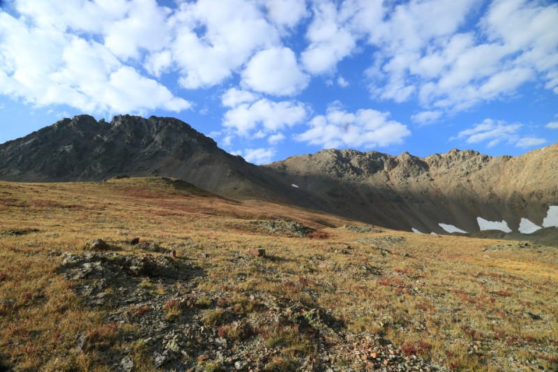 There are quite a few use trails in the area, and on the ascent I chose to go further up the ridge, and then traverse over to the saddle. Whereas on the descent, I took the more direct scree route down, and then traversed. The initial uphill was nice and stable and for the majority of the traverse it was as well. Was still happy to reach the saddle, as from there the ridge was just scree with a trail. 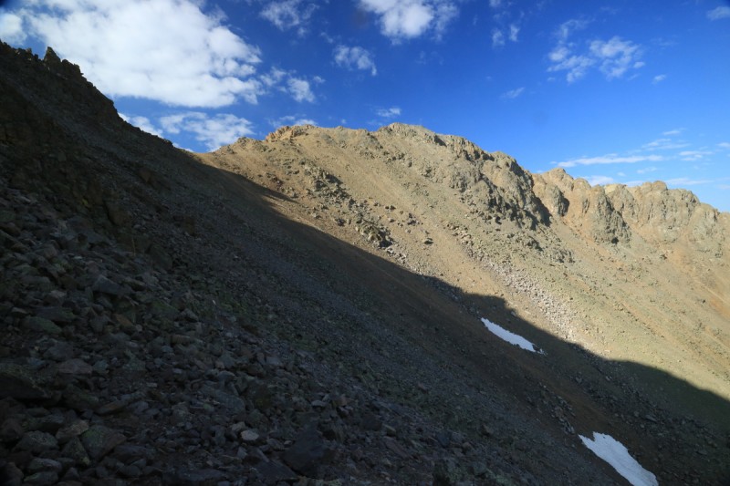  When I got up to the summit ridge area, I could see where the scrambling and route finding would play out. I didn't really look at any details or info, just knew that it went. So I had some fun working on my route finding skills, as I assessed the terrain. Dodge left, back up to ridge. Hmmm does that bench go around to the north to easier terrain (cause to the south looks a bit terrifyingly exposed). Oh, yeah. It does work. And there's the summit! That's what I consider fun about not knowing all the details going in. The joy of exploration. 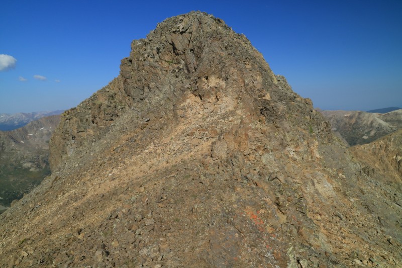    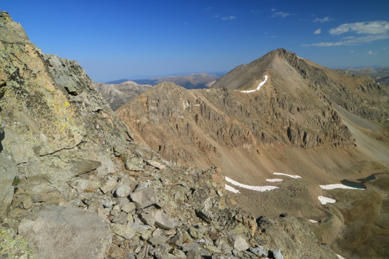 I got to the summit with near perfect bluebird skies. Nice to see all the familiar peaks, and my other peak for tomorrow. On the summit I had a minor debate with myself. I could go over to Grizzly A for a dry summer conditions repeat, or just hang out on Garfield for a longer time. More distance and elevation gain vs Just relax and enjoy a summit for once. But more! But enjoy! Too often in winter/spring it's a race to the summit, race to transition to ski down and then off the summit quickly. In summer ridge running, there just isn't time to savor the peaks as much. So after doing my summit rituals, the relax and enjoy part of me took over, and I hung out for an hour on the summit!  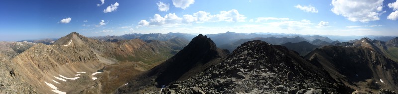  On the descent I snapped a photo of the class 4/5 option on the ridge. Looked fun, but I wasn't doing it solo. Plus the intimidating eastern ridge section was now lit up by the sun better, after waiting so long. Would have needed a partner for that adventure.   The scree descent wasn't too bad. No full plunge stepping, but it was a much faster descent than having to carefully pick ones way through the talus. Lower down I was able to get onto some game trails in the talus, to take me back to the nice tundra.  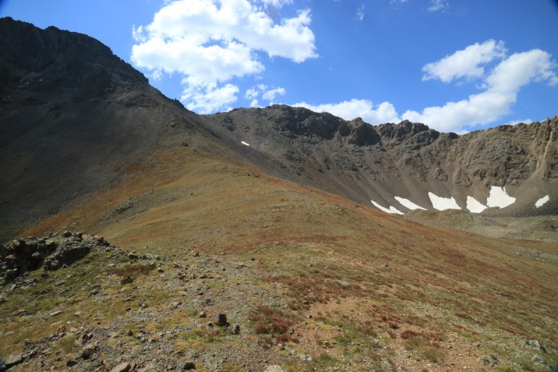 Enjoyed the nice easy walk back to the truck, enjoying the first color changes of fall    Truro PeakTrailhead: Galena and Lincoln creek Mileage: 3.93 Elevation Gain: 2,281' Route: West ridge, class 3/4 Partners: Solo After a nice lunch back at the truck, I made my way back to 82, over Inde Pass and then up Lincoln creek road for the 3rd time this year. Such a long bumpy dirt road! At least this would be my last time on it, at least until repeats or something. Based on the topo, I knew I wanted to get a little bit upstream from the Galena - Lincoln creek junction. There's a nice campsite well below the junction, right next to the road, and then nothing for quite a while. I started to worry I would have to choose from far options when I found the next campsite on the left. A bit high, but I had a great view of the peak above me. So I broke out a book (a memoir by our very own LynnKH Caged Eyes ), and enjoyed the afternoon and evening by the gushing stream. That night it became very difficult to put Lynn's book down, it is so captivating and well written. I even tried to go to bed at a decent hour, but ended up turning my headlamp back on, to read for a while longer. A sign of a good book, and one that maybe I shouldn't have when I want to hike the next day! Another post sunrise start for me! Though local sunrise wouldn't happen for a little while, because of Garfield and Grizzly to my east. I found a way to hop scotch across the mine polluted stream without having to take my boots off. All proud of myself, I then ran into a sea of willows. These were bad. Tall nasty willows. But at least they were short lived. I traversed over along the edge of the woods and found the barren avalanche slope with mini trees growing back again. Must be a lot of snow to create such damage! Might be a good ski... On top of the first slope, I stay just to the left of the stream on the gentle terrain. Some game trails seem to exist on this side. After a marshy meadow, I get tempted by the other side of the stream, so I cross over. But then I hear the cascading waterfall, and it draws me back to the other side of the stream and up to see it. Short day, why not? I snap a couple photos, knowing I'll be back on the return. 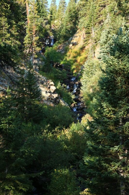  Right above the waterfall, I get a good view of the saddle I need to reach to access the west ridge. Looks steep, willowy and grassy! Better than barren talus and scree from the north side!   The willows are for the most part, easy to navigate and very short. Only one section where they get a bit tighter and taller, and that's where I started a young deer who went bounding off downhill. Funny how they seem to just bounce on all 4 legs, instead of articulating.  After the willows I walk directly to the green saddle above. The lower stretch is pretty nice, but the higher you go, the less grass and more scree there is. So the upper section is pretty slow going. Once on the saddle I note the lone cairn. Like someone would get lost here? Though I bet whomever made it, was happy to reach the saddle! 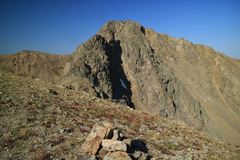 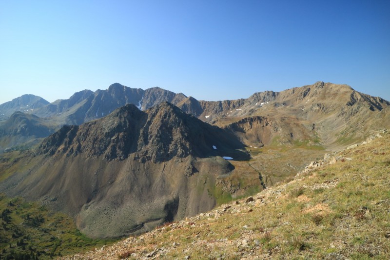 After the grass on the saddle, I make my way to the north/left of the first obstruction, and I find easy scrambling and class 2 terrain. I decided to stick mostly to the face, versus ridge proper, as the sun wasn't in my eyes then. Eventually you do have to join up with the ridge and get up the crux. 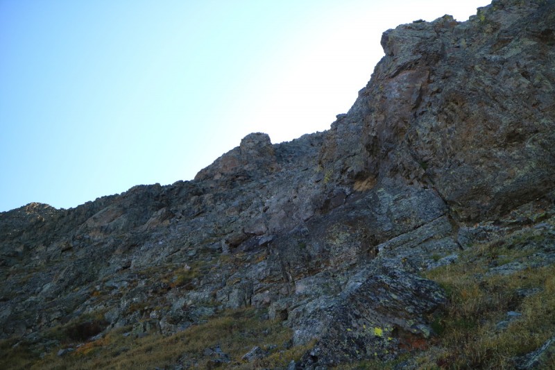 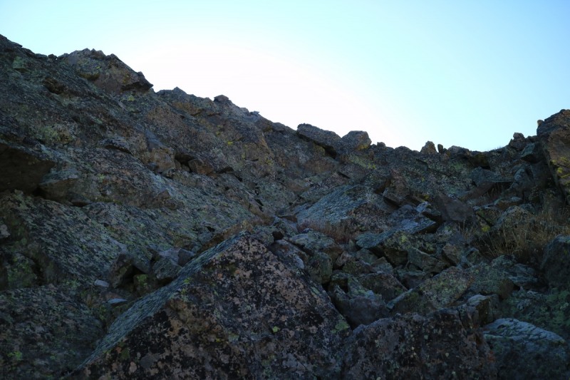 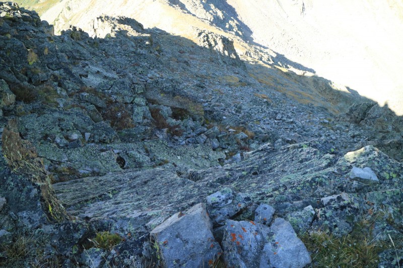 The crux isn't too bad. Left is for tall people, right for those who are shorter. Though the exposure is quite stiff to the right. 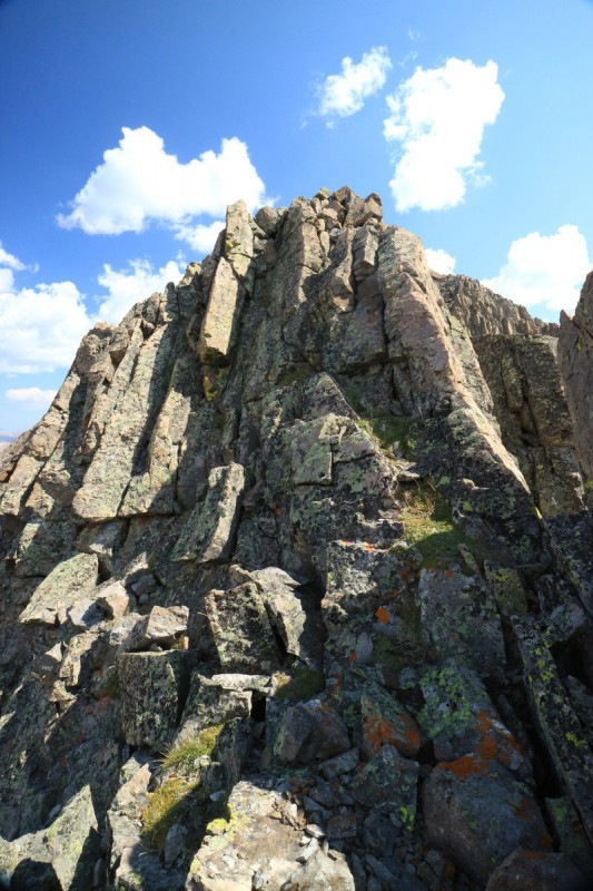 Above the crux, I can finally see the summit proper, as marked by a post. Once again I take to scrambling up the face, versus staying near the exposed edge. It gets a bit looser right below the summit, but the slope angle isn't that high. 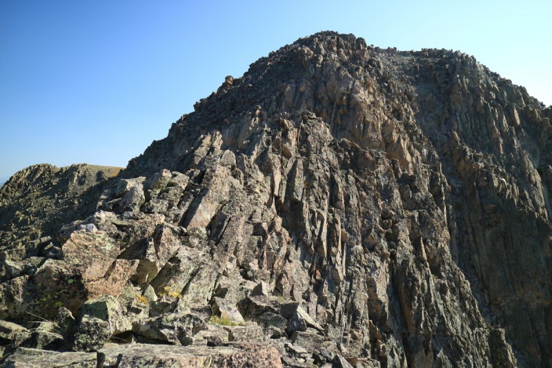  Once again, near perfect bluebird skies overhead! This time, there is no debate, I stay for an hour of viewing enjoyment!    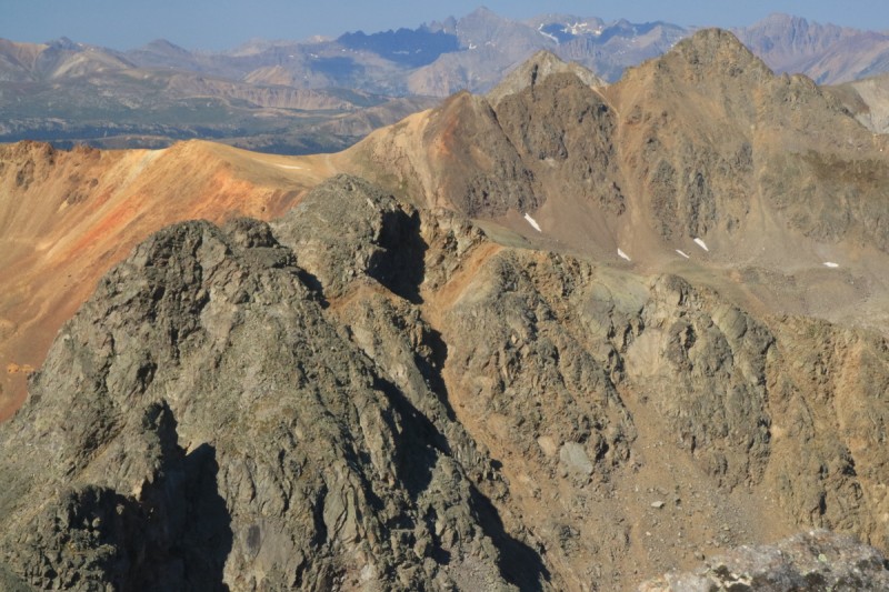  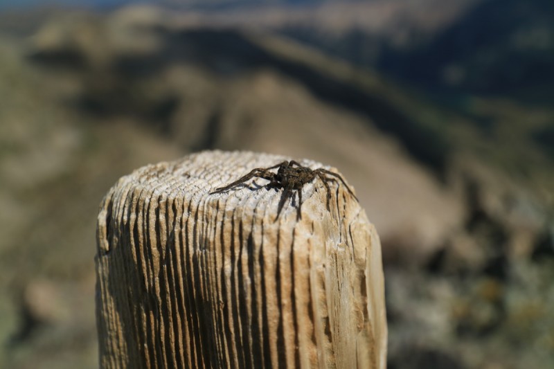 On the descent, the sun has now lit up the rocks I scrambled up in the shadows. The clouds are rapidly growing, now that I'm descending. Glad I didn't plan to do a 15-22mi ridge run today!  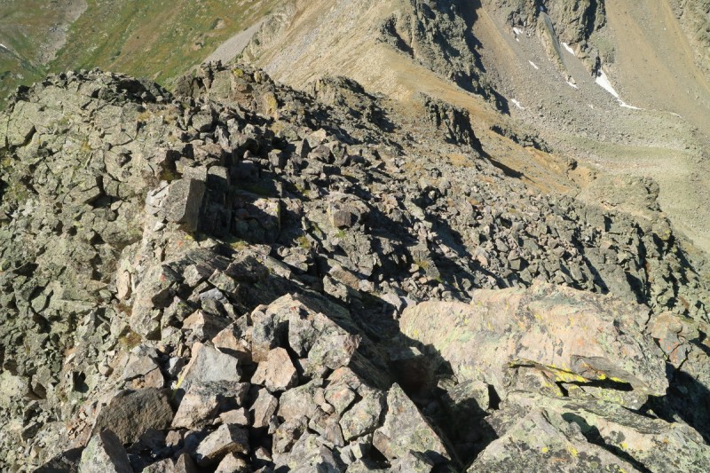 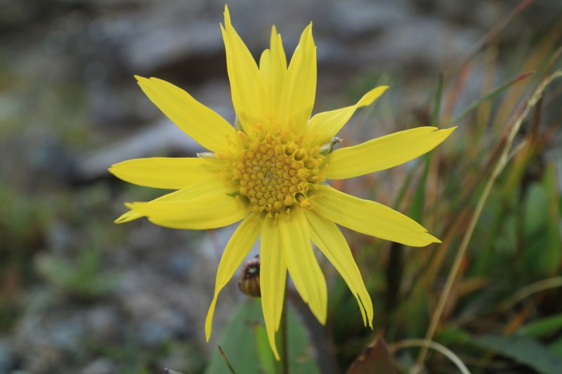  Back at the saddle I look back at the short but sweet scramble. Another nice one to get back into the habit of scramble route finding. Previous TR's had glossed over this ascent, as after that traverse... this would be a cake walk! But all by its self, it was quite a fun outing.     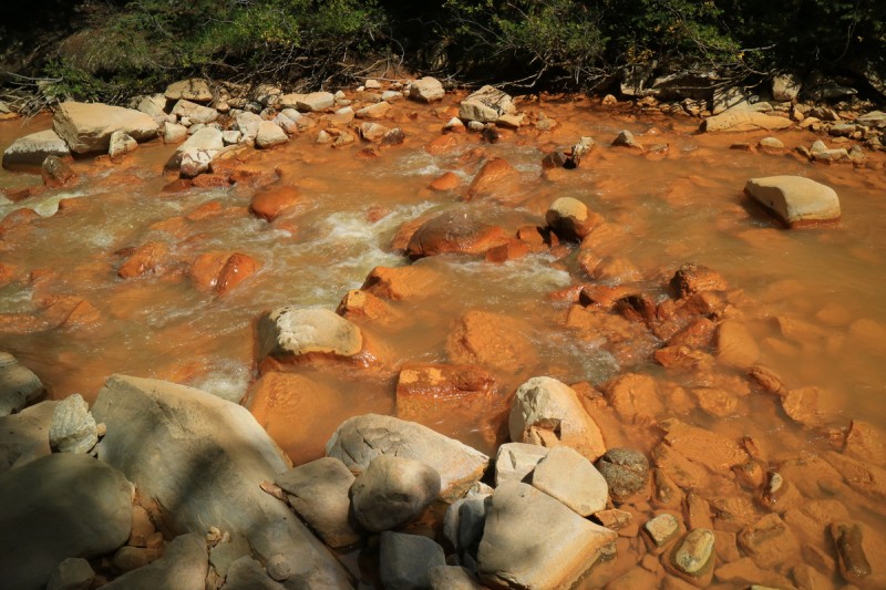 On the drive out, I decide to finally stop by the waterfalls along the busy road. 5 times I passed by, but on the 6th and possibly final one, it was time to see it. Quite worth the small amount of effort to see this one!  Back home that evening - I finished Lynn's book (Caged Eyes) My GPS Tracks on Google Maps (made from a .GPX file upload):
View on the Map
Thumbnails for uploaded photos (click to open slideshow):  Sunrise shadows")
 The intimidating eastern ridge")
 Route up coming into view")
 Looking at the talus and scree ascent")
 Taking the high traverse")
 Final ridge up to summit")
 Scramble time")
 First section")
 A ledge to the north")
 Looking back to ridge proper on ledge")
 Final summit push on left")
")
")
 Anderson and Petroleum")
 The ridge proper goes 5. Could be fun!")
 The class 4 eastern ridge - called a class 4 adventure")
 Looking down valley")
 Look back at Garfield")
 A mini waterfall")
 Tundra says it's fall!")
 Don't go chasing butterflies")
 Oh look, a big cascade waterfall!")
 Light and shadow")
 Truro is near")
 The willowy, grassy terrain up the south face of Truro")
 Bonus: who can spot the bouncy deer?")
 Cairn with West Truro")
 Anderson and Petroleum with Larson in front")
 Dodge left of first towers")
 Scramble upward at whim")
 Looking down")
 The crux. Class 3 (or 4 if you're short)")
 Looking at summit from above crux")
 Final ridge area")
")
")
 Tellurium, Tabor and West Truro")
 Zoom of West Truro and Tellurium")
 Summit spider...")
 ... can't get no higher")
 Looking back at summit")
 Looking down from on top of the crux")
 Flower hasn't heard about fall yet")
 Look up at ridge from saddle")
 Waterfall return")
 Truro's east face gully. Ski?")
 From the base of the avalanche cleared slope")
 Stream crossing to truck")
 Yep, that's mine polluted!")
 Lincoln creek waterfall I had passed by 5 other times")
|
| Comments or Questions | ||||||
|---|---|---|---|---|---|---|
|
Caution: The information contained in this report may not be accurate and should not be the only resource used in preparation for your climb. Failure to have the necessary experience, physical conditioning, supplies or equipment can result in injury or death. 14ers.com and the author(s) of this report provide no warranties, either express or implied, that the information provided is accurate or reliable. By using the information provided, you agree to indemnify and hold harmless 14ers.com and the report author(s) with respect to any claims and demands against them, including any attorney fees and expenses. Please read the 14ers.com Safety and Disclaimer pages for more information.
Please respect private property: 14ers.com supports the rights of private landowners to determine how and by whom their land will be used. In Colorado, it is your responsibility to determine if land is private and to obtain the appropriate permission before entering the property.


