Download Agreement, Release, and Acknowledgement of Risk:
You (the person requesting this file download) fully understand mountain climbing ("Activity") involves risks and dangers of serious bodily injury, including permanent disability, paralysis, and death ("Risks") and you fully accept and assume all such risks and all responsibility for losses, costs, and damages you incur as a result of your participation in this Activity.
You acknowledge that information in the file you have chosen to download may not be accurate and may contain errors. You agree to assume all risks when using this information and agree to release and discharge 14ers.com, 14ers Inc. and the author(s) of such information (collectively, the "Released Parties").
You hereby discharge the Released Parties from all damages, actions, claims and liabilities of any nature, specifically including, but not limited to, damages, actions, claims and liabilities arising from or related to the negligence of the Released Parties. You further agree to indemnify, hold harmless and defend 14ers.com, 14ers Inc. and each of the other Released Parties from and against any loss, damage, liability and expense, including costs and attorney fees, incurred by 14ers.com, 14ers Inc. or any of the other Released Parties as a result of you using information provided on the 14ers.com or 14ers Inc. websites.
You have read this agreement, fully understand its terms and intend it to be a complete and unconditional release of all liability to the greatest extent allowed by law and agree that if any portion of this agreement is held to be invalid the balance, notwithstanding, shall continue in full force and effect.
By clicking "OK" you agree to these terms. If you DO NOT agree, click "Cancel"...
I had been wondering how to do these last 2 peaks in the La Garitas for a little while. Most routes are long but typically gentle. I looked between Snowalien and Piper14ers routes up these two, and figured I could start with the easy Colorado trail and then go up the defunct trail in the Canon Diablo, and then decide wether to go down the long gentle way (extra 2.6 miles) that Piper14er did. With it still being monsoon season, having options is always nice.
I got started before civil twilight, as the horizon was just starting to not be pitch black. Within the first quarter mile, cows on the trail startle at my presence and run away, thereby scaring the shite out of me. Nothing like a little cortisol streaming through my body in the pre dawn dark! I take to clicking my trekking poles together, so that doesn't happen again!
Even in the low light, hiking the easy Colorado Trail is a breeze, and I'm making great time. I see the turn off for where Piper14er went, but the trail is nonexistent, as he mentions.
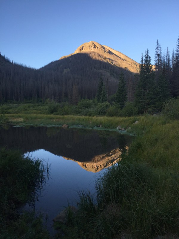
Moo cows on the Colorado Trail Pt 13,015 reflection
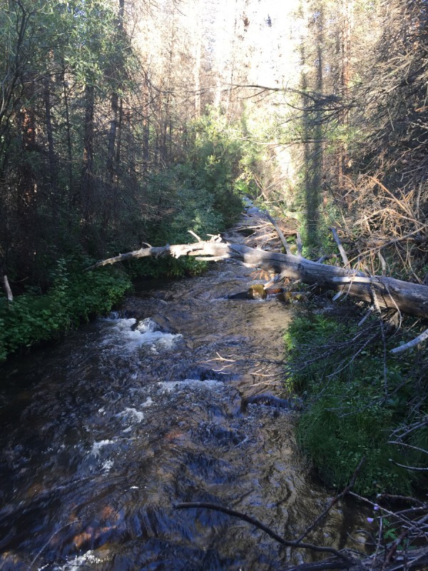
I get to the the junction with Canon Diablo, and note the canyon, so I backtrack the short distance and find a decent crossing below. The 3.9 miles only took me 1:38, even with taking a few photos, and realizing my last camera battery was about dead. Where I crossed got to about knee deep, and on the other side there was some flagging and a hint of a trail. Someone had crossed here before!
I semi follow the game trail, and find the beds of a few deer from the night before. I head up the drainage, and about the moment I say to myself - I'll just stay on the west side of the stream, if I don't see the trail - I run dead into the trail, and see it crosses to the east of Canon Diablo. There's a downed tree to aid in the crossing
Crossing the stream below the canyon Canon Diablo stream crossing
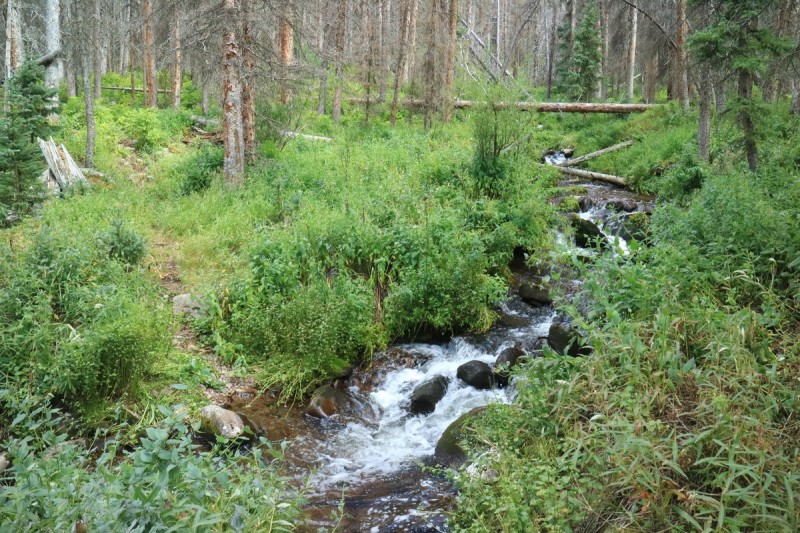
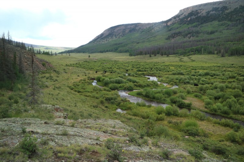
On the other side of the stream, the trail quickly takes on more of a game trail feel. Rather well used by animals, game trail. Most of the trail closely hugs the edge of the stream bank, but does go a bit further inland at times. Plenty of downed trees to clamber over.
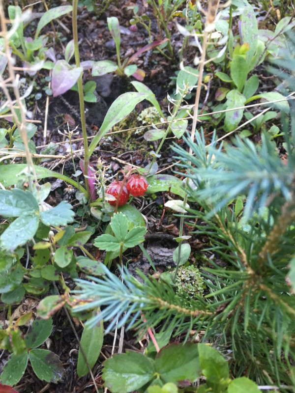
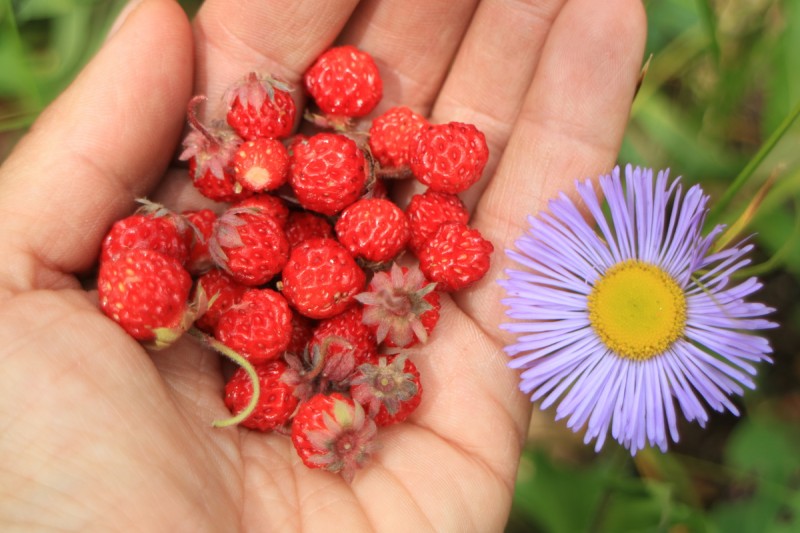
I noticed a couple strawberries on the way up, and had to pick a few. I hoped I could find them on the way down!
Strawberries??!?!?! Pt 13,402
About the time the trail dumped me into the stream, I decided to cross over and find my ascent route up 13,015. It would actually be better to stay on the east side of the stream for that last tenth of a mile, as the other side is very wet, marshy and willowy. I only got relief when I got to the trees, where I found another game trail.
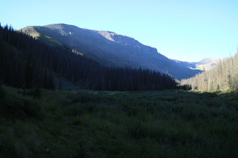
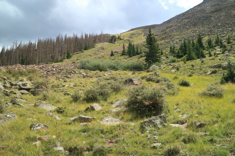
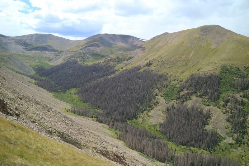
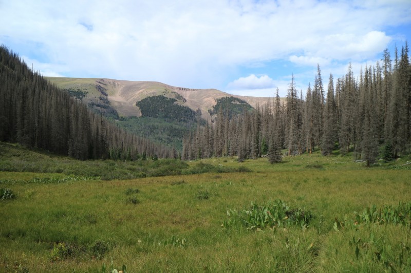
Looking up the Diablo valley
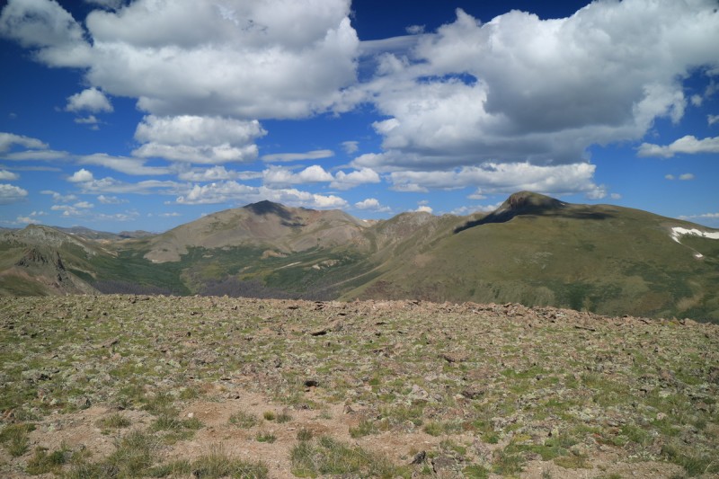
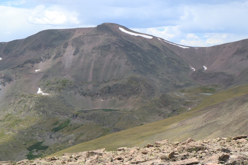
Since I saw puffies starting as I was making my way up 13,015, and my camera battery was near empty, I just booked it up the slope to get onto the summit. Nice perspective on San Luis and Organ Mountain, and I was sad that I couldn't spend longer looking at it. I had some decisions to make. Could I make the next summit before the clouds got bad? Should I go down and up or around on the ridge? Why didn't I research that possibility? Hindsight says running the ridge would not be faster. It's roughly 4 miles and the same amount of vertical gain as the closer way.
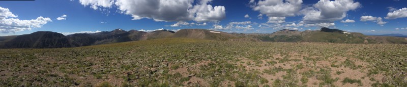
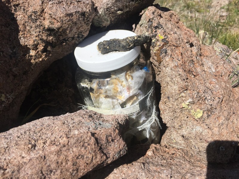
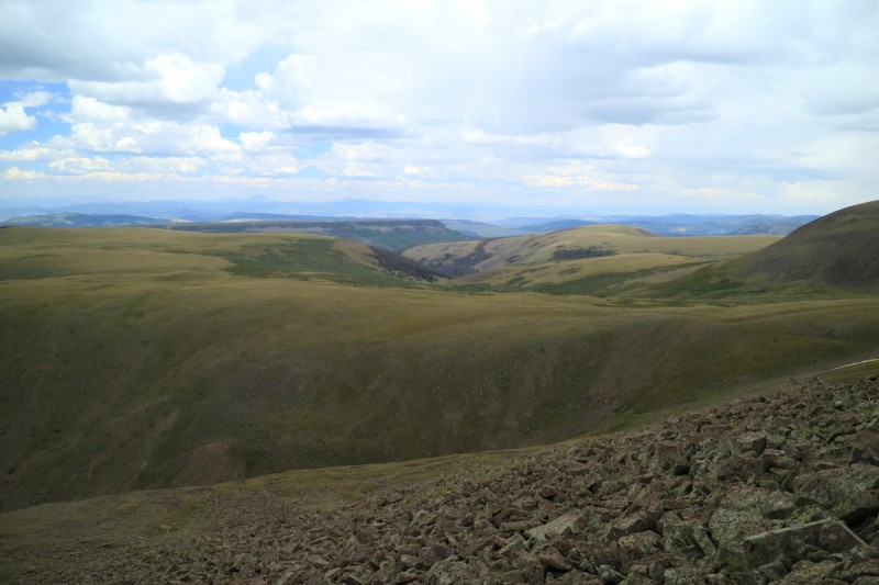
Summit pano What a marmot thinks of the soaked and moldy summit register can San Luis and Organ Mtn Pt 13,402
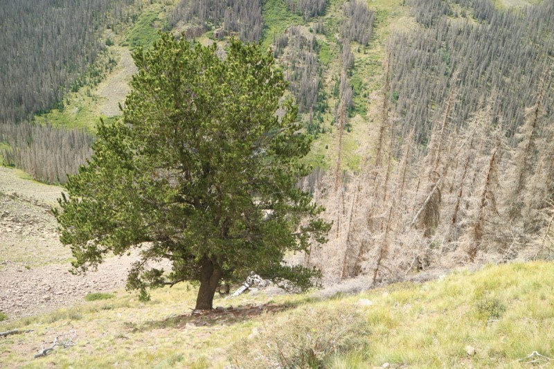
So like the hounds of hell were after me, I raced down 13,015, crossed the stream, bush whacked through pricker bushes and up the steeeep slope up 13,402. Pausing only to snap a few photos, and admire a really old lodgepole pine tree.
The route up 13,402 on left by rockslide Back in the valley Slope up 13,402 An old beautiful tree A look down the route Piper14er took up 13,402 The summit cairn!!!!
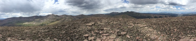
I kept eying the clouds, and going at my top pace, and reached the second summit 2:28 after leaving the first. Not too bad, considering the terrain. I arrived for a short sun halo in the clouds. I still didn't like being up there with the clouds, so I raced through the summit ritual, and headed back down.
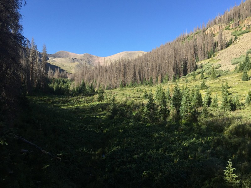
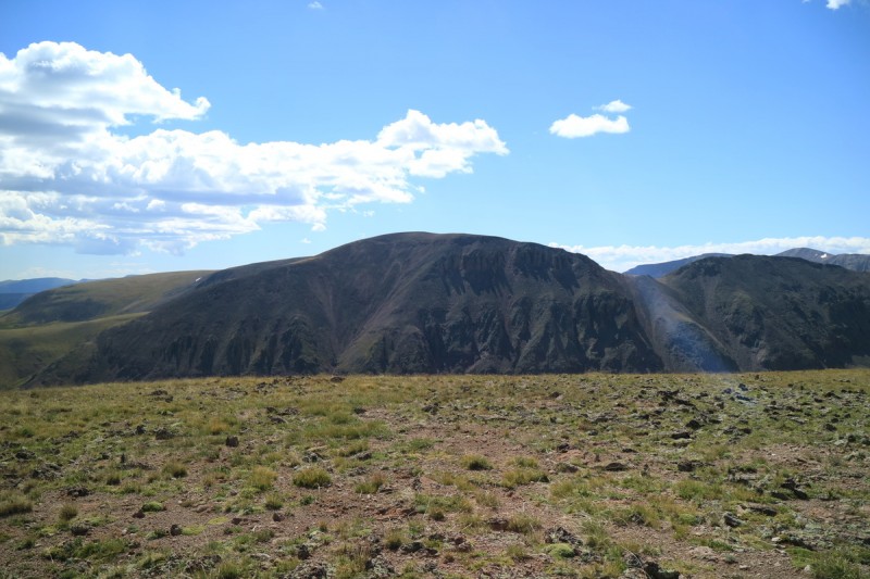
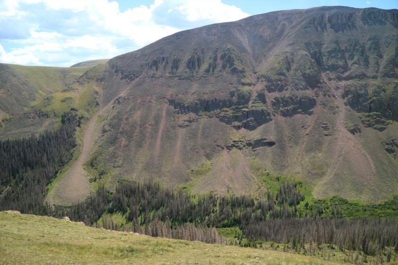
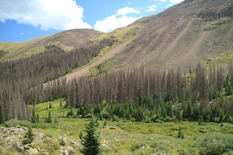
Summit pano Phoenix summit cairn is visible from here... Pt 13,015 and the 80% dead trees
Since I had skipped my summit snack, I decided to take a break on the roots of the old lodgepole pine. There the sun parted the clouds, and everything looked cheery again! With all the racing down and up and down again, I was pretty tired, and the remainder of the slope took awhile.
Life next to death. So many dead trees
Back on the Canon Diablo trail, I found a large patch of strawberries in the warm sunlight, and picked as many ripe ones as I could. They were quite warm and ever so delicious! So much flavor in such a small package! It reminded me of June summers at home in WNY picking wild strawberries in our rock garden. Those large commercial berries may look appealing, but have nothing on their wild counterparts. I left with all my fingers red and sticky!
Yummy strawberries in my belly! Through the marshy section Canon Diablo stream crossing
On the return to the CT, I decide to follow the trail as best I could. It ran into some willows before the stream, so I put on my water sandals and walked up the stream to the regular crossing. There's a campsite right at the trail juncture, if you're ever looking for this specific spot. From there it was an easy jaunt down the CT.
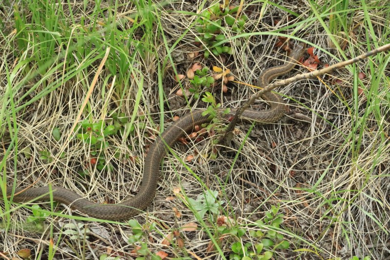
Where the original trail crossed near the CT The canyon A snake sunning itself The long trail back
A quarter mile from the trailhead, I ran into the only other person I was to see that day. A 75 yo guy from Oregon. We had a nice chat about the differences between Oregon and Colorado, and how he didn't really meet many Colorado locals on the CT trail. We are apparently obsessed with the 14ers so much, we ignore the pretty cool through hike in our state. It may not be the Appalachian Trail or the Pacific Coast, but it's still a great trail. It's something I hope to do once my vertical/peak goals subside in a few years (maybe a decade depending on pace). It was really good to see someone of his age still getting out there after it! Gives me hope of what I can still accomplish in life!
My GPS Tracks on Google Maps (made from a .GPX file upload):
wombat - I wish I could spent more time gathering them up! As to the trees, the whole La Garita area is dead. Not sure why, but it has to be some kind of disease. They're logging out the dead ones on NF land, which is a good idea. That area is a tinder box waiting to happen!
Trotter - I haven't found this profusion of strawberries before. I don't think I've had bearberries or chokecherries, as I don't know all my wild edible vs poisonous plants yet.
Caution: The information contained in this report may not be accurate and should not be the only resource used in preparation for your climb. Failure to have the necessary experience, physical conditioning, supplies or equipment can result in injury or death. 14ers.com and the author(s) of this report provide no warranties, either express or implied, that the information provided is accurate or reliable. By using the information provided, you agree to indemnify and hold harmless 14ers.com and the report author(s) with respect to any claims and demands against them, including any attorney fees and expenses. Please read the 14ers.com Safety and Disclaimer pages for more information.
Please respect private property: 14ers.com supports the rights of private landowners to determine how and by whom their land will be used. In Colorado, it is your responsibility to determine if land is private and to obtain the appropriate permission before entering the property.
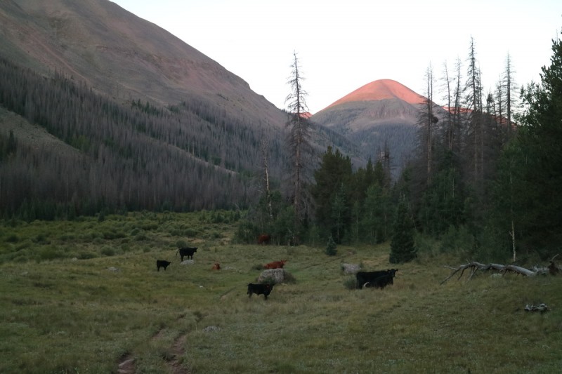


 Moo cows on the Colorado Trail")
 Pt 13,015 reflection")
 Crossing the stream below the canyon")
 Strawberries??!?!?!")
 Looking up the Diablo valley")
 Pt 13,402")
 Summit pano")
 San Luis and Organ Mtn")
 Pt 13,402")
 The route up 13,402 on left by rockslide")
 Back in the valley")
 Slope up 13,402")
 An old beautiful tree")
 A look down the route Piper14er took up 13,402")
 The summit cairn!!!!")
 Summit pano")
 Phoenix summit cairn is visible from here...")
 Pt 13,015 and the 80% dead trees")
 Life next to death. So many dead trees")
 Yummy strawberries in my belly!")
 Through the marshy section")
 Canon Diablo stream crossing")
 Where the original trail crossed near the CT")
 The canyon")
 A snake sunning itself")
 The long trail back")
 What a marmot thinks of the soaked and moldy summit register can")


