Download Agreement, Release, and Acknowledgement of Risk:
You (the person requesting this file download) fully understand mountain climbing ("Activity") involves risks and dangers of serious bodily injury, including permanent disability, paralysis, and death ("Risks") and you fully accept and assume all such risks and all responsibility for losses, costs, and damages you incur as a result of your participation in this Activity.
You acknowledge that information in the file you have chosen to download may not be accurate and may contain errors. You agree to assume all risks when using this information and agree to release and discharge 14ers.com, 14ers Inc. and the author(s) of such information (collectively, the "Released Parties").
You hereby discharge the Released Parties from all damages, actions, claims and liabilities of any nature, specifically including, but not limited to, damages, actions, claims and liabilities arising from or related to the negligence of the Released Parties. You further agree to indemnify, hold harmless and defend 14ers.com, 14ers Inc. and each of the other Released Parties from and against any loss, damage, liability and expense, including costs and attorney fees, incurred by 14ers.com, 14ers Inc. or any of the other Released Parties as a result of you using information provided on the 14ers.com or 14ers Inc. websites.
You have read this agreement, fully understand its terms and intend it to be a complete and unconditional release of all liability to the greatest extent allowed by law and agree that if any portion of this agreement is held to be invalid the balance, notwithstanding, shall continue in full force and effect.
By clicking "OK" you agree to these terms. If you DO NOT agree, click "Cancel"...
Trailhead: Tabor Creek
Mileage: 13.34
Elevation Gain: 4,866'
Partners: Solo
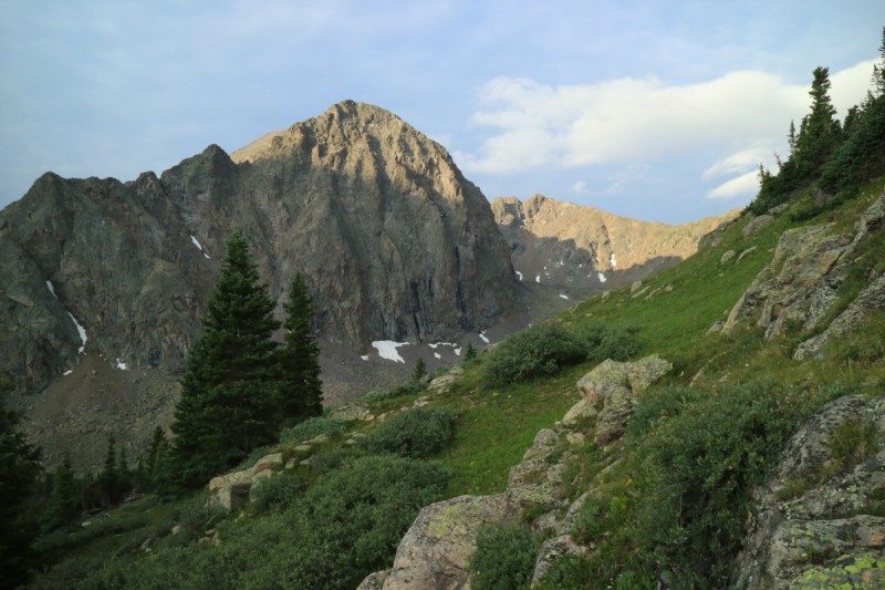
While I have been looking forward to hiking and scrambling this group of peaks, I really didn't want to just yet. I've been using up my close by peaks a bit too much, but the San Juans were in the rain clouds on these days, and for a while now. Next week... But, these were certainly a great consolation prize. There is some great scrambling in the Sawatch, it just tends to be hidden on the lower peaks. So 14er, Centennial and Bicentennial hikers pass these by. Their loss!
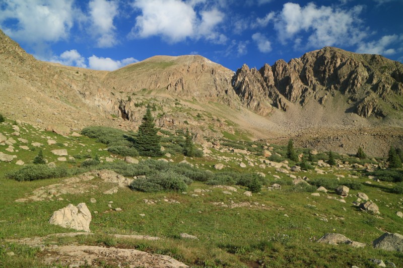
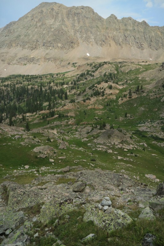
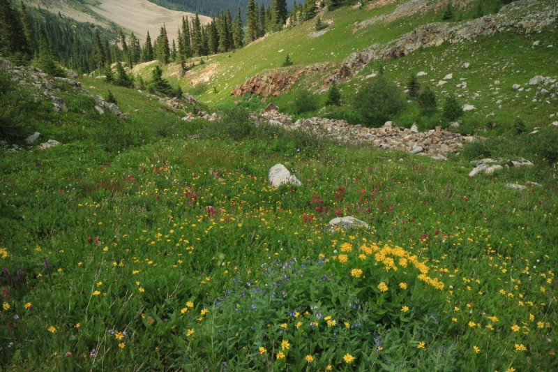
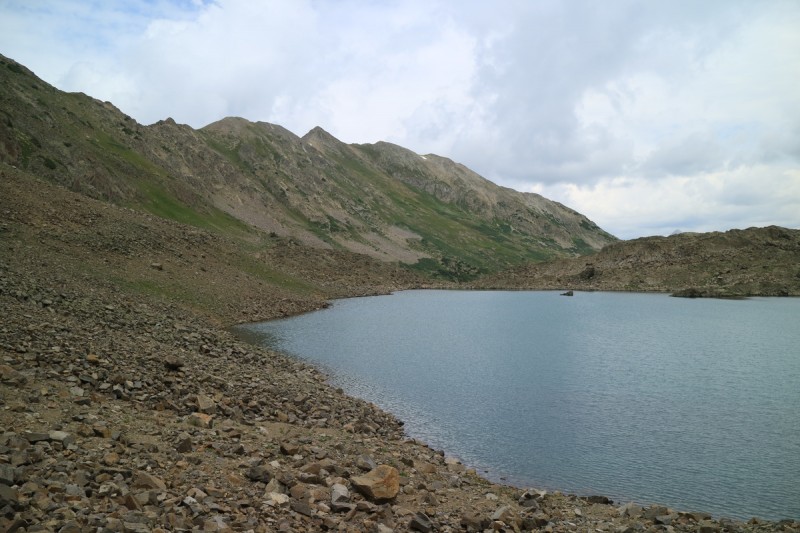
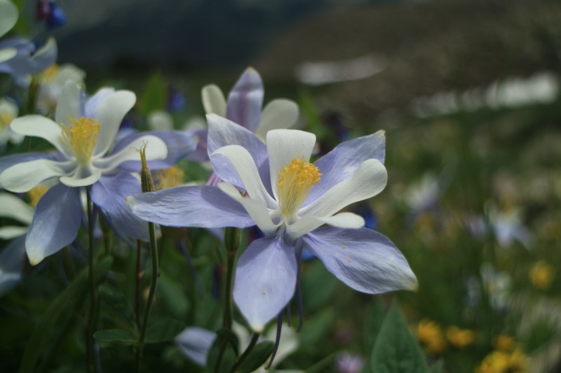
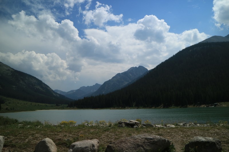
I drove up Thursday night, ready to jump on the 2-3 day morning weather window. Found a nice spot to truck camp at the trailhead, and got a short night's sleep. I didn't want to get out of the sleeping bag the next morning, so I delayed as long as I could. So I ended up starting off pretty late at civil twilight. There is no bridge over the creek, so immediately I had to transition to my sandals for a nice cold crossing. From there I made the mistake of going right, instead of left, up the dry creek bed. After a bit, I found the trail to the left/east of the dry creek bed. Soon after I crossed a service road, that would come in handy later in the day. It's a pretty decent trail all the way up into the valley above. About the time I started looking for a way to go up to Tabor lake, I spotted a cairn. A much more faint, but decent trail will take you all the way to the lake. It must get enough traffic, as the trail is pretty obvious through some thick and tall wild flowers too.
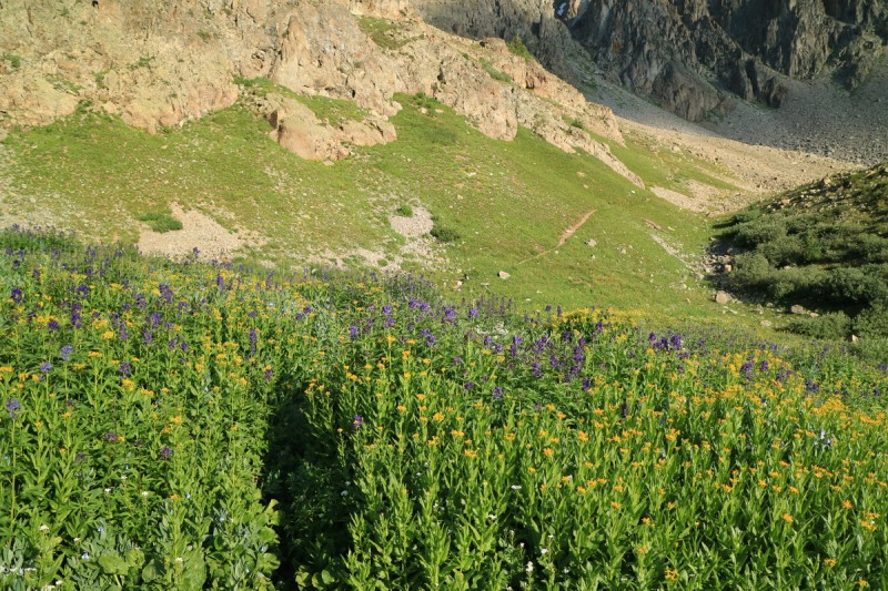
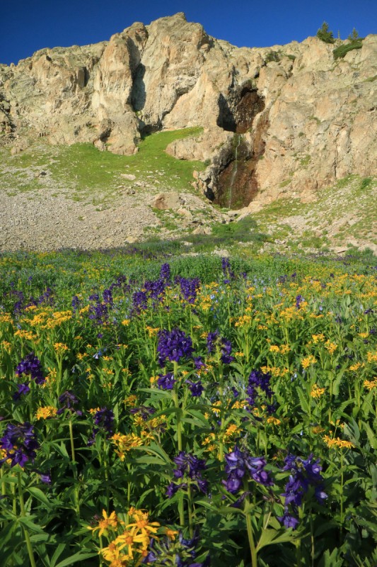
On the Tabor Creek Trail, Tellurium in the distance Approaching Tabor Lake Flower trail Waterfalls and flowers
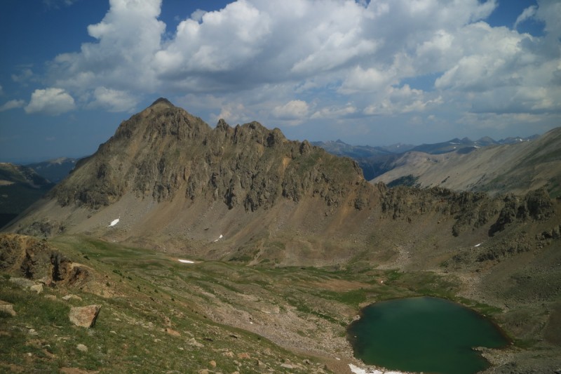
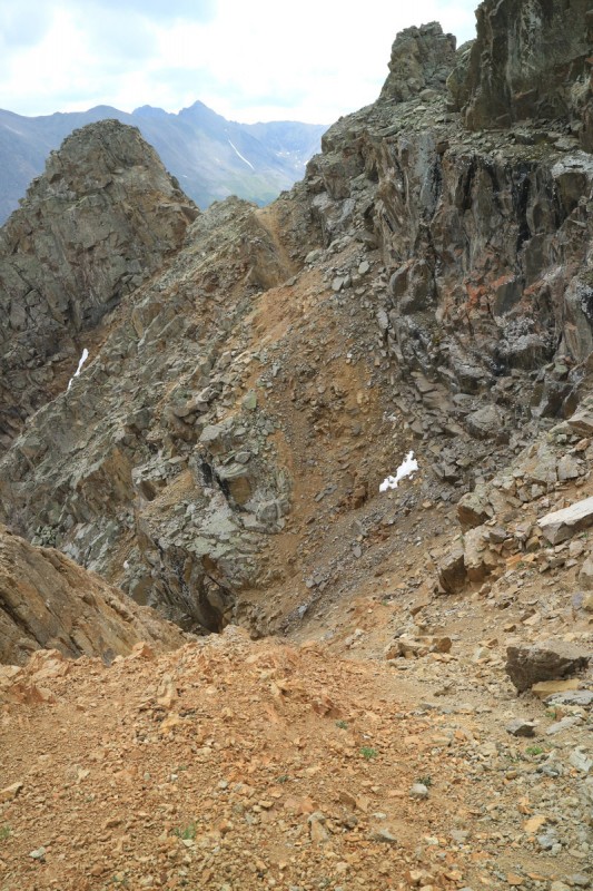
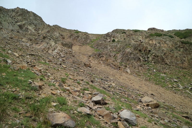
Once at the lake, I spot the scree ascent gully that cuts through the cliff band that blocks access. Oh fun, a scree gully. Where's the snow? I miss snow! I ended up ascending just to the right of the loose scree center, on some reasonably solid rock. Some minor scrambling ensued. Better to chose the scramble than the class 2 junk!
Tabor Peak and Tabor Lake The scree gully ascent
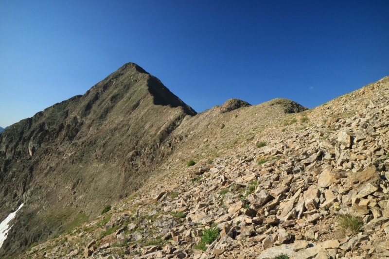
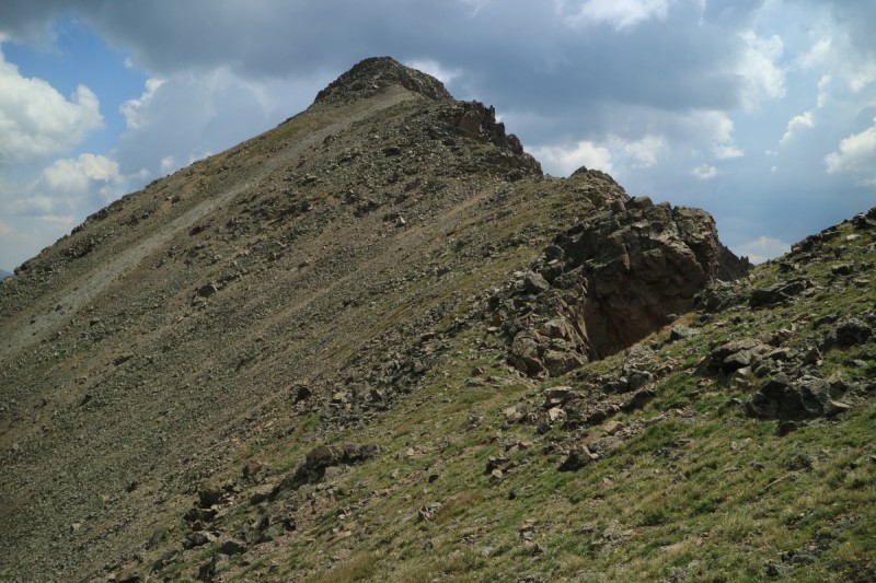
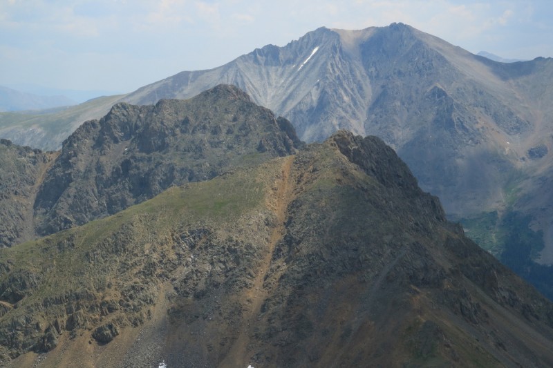
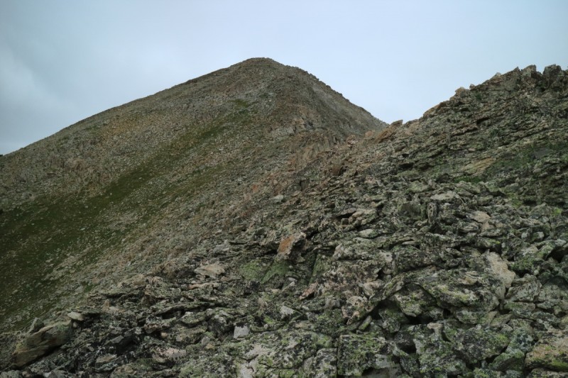
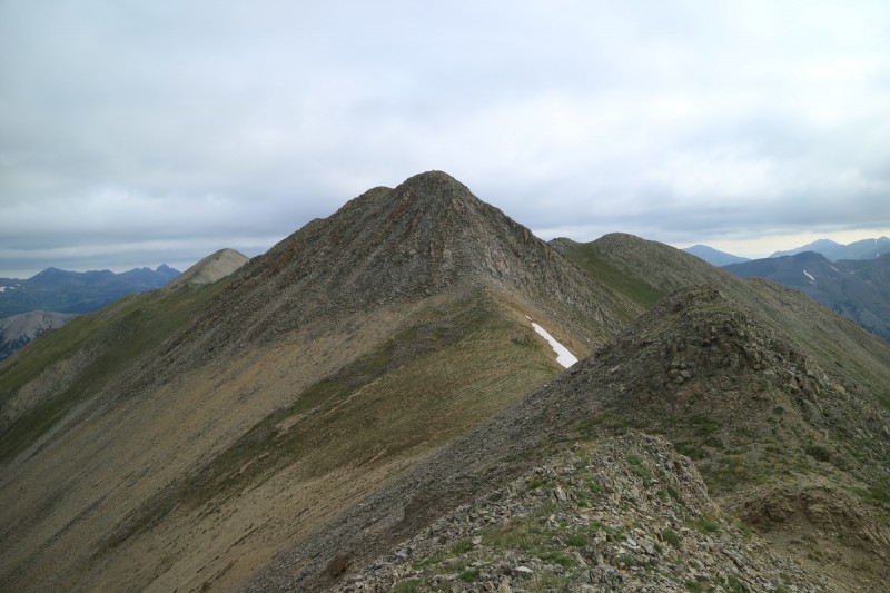
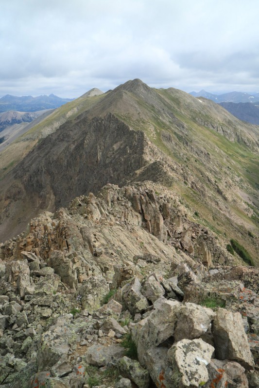
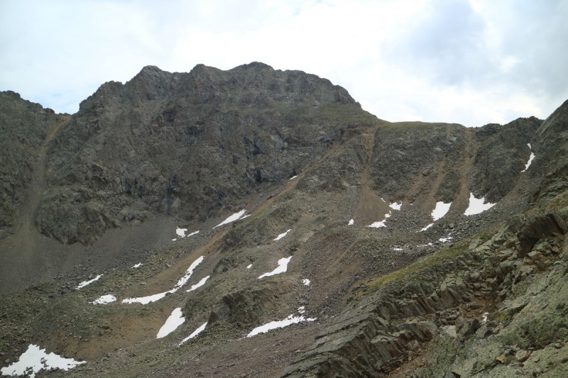
The ridge up and down to Tabor Peak was an easy talus jaunt. I looked down the south ridge of Tabor, but the gendarmes on this side of the saddle were just a bit too intimidating, that I decided to scrap the plans I had to explore that section. While the cloud build up wasn't bad, I knew I still had a long day ahead. So I went back down the way I came up.
Ridge to Tabor Tellurium from Tabor West Tellurium from Tabor Looking down the north ridge
As I was descending the boot scree skiable gully, I noted 2 guys on their way up! Wow, wasn't expecting to see other people. Now I know I got a really late start to the day! I advised them to take my route up to the side, to avoid the super loose scree. But as I started my high contour to the Tellurium - Tabor saddle, I still heard the call of "rock!" from the guys. Glad I was far away from the firing range by then!
The traverse to the saddle was reasonably uneventful. Only the last section up to the ridge was incredibly unpleasant, as Furthermore describes the other side as being. The west side of the saddle was just as loose as what I went up, and thoughts of doing a reascend at the end of the day, to have a trail to go down, were starting to flee my mind.
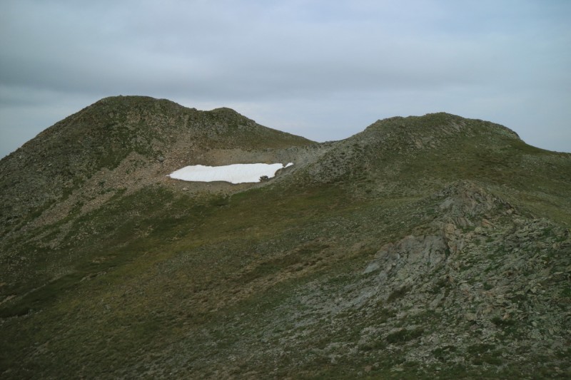
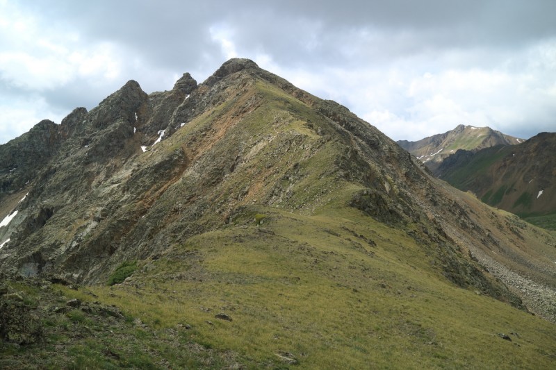
The clouds were building to the south, but to the north, where the wind was coming from, was bluebird. So while I thought I was safe enough, I didn't waste much time in running up the prominent grassy ridge up to Tellurium. I had thought to try the north ridge of Tellurium to see how good a scramble it was, as hinted by Furthermore, but I just didn't think I had the time. Plus there is a section just below the summit that looked a bit too cliffy. I guess someone else will have to go and explore and report back.
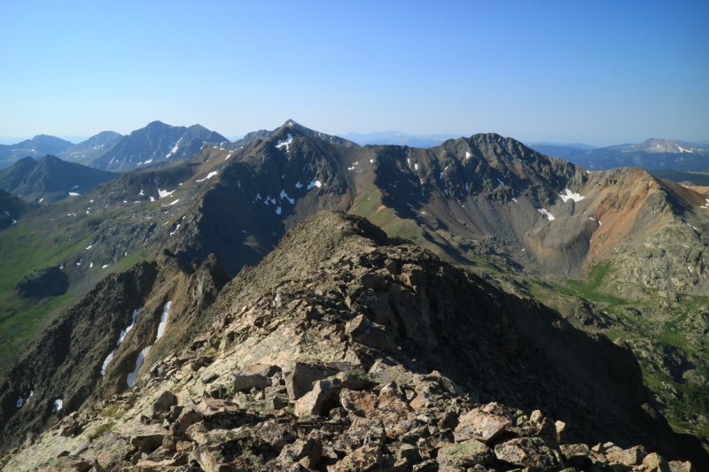
Tellurium from the Tellurium - Tabor saddle Tabor Final ridge up Tellurium
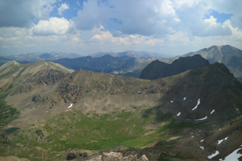
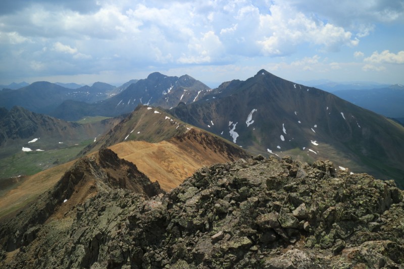
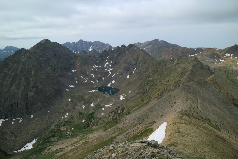
From the summit of Tellurium, I could see the clouds building pretty darkly over the Huron - Apostles area. Close enough to hear the booms when they started, but far enough away to feel "safe".
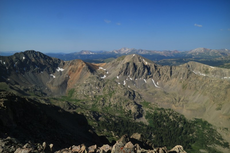
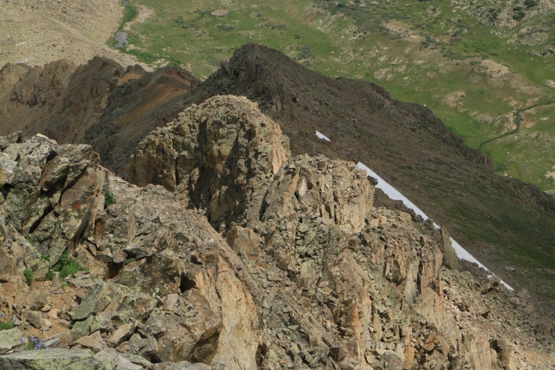
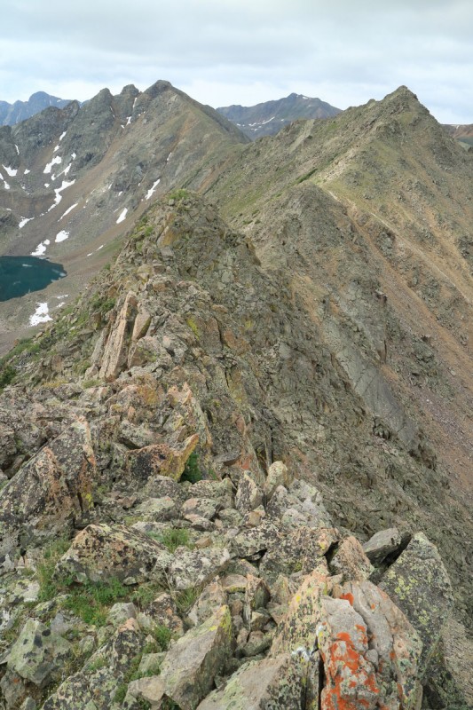
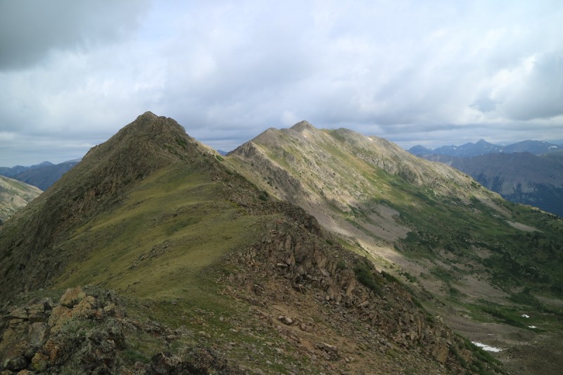
Looking down from the summit, the cliffy areas still looked pretty intimidating. Likely doable though. The remaining ridge over to West Tellurium looked reasonable, if annoying with the extra elevation gain.
North ridge of Tellurium - might go Tomorrow's peaks Truro and West Truro Anderson and Petroleum
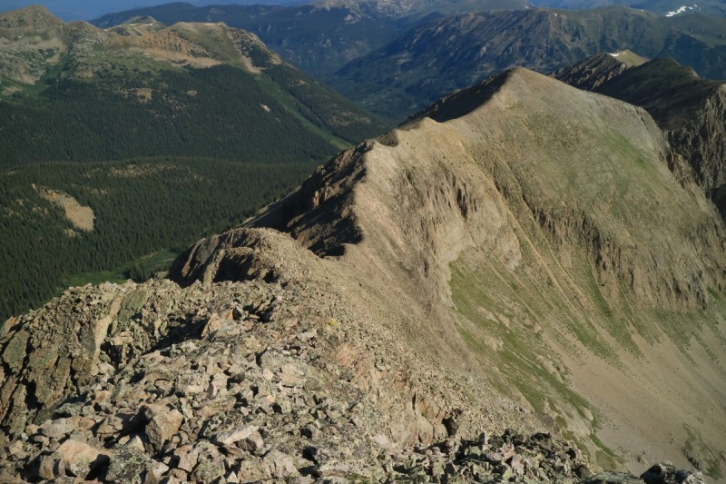
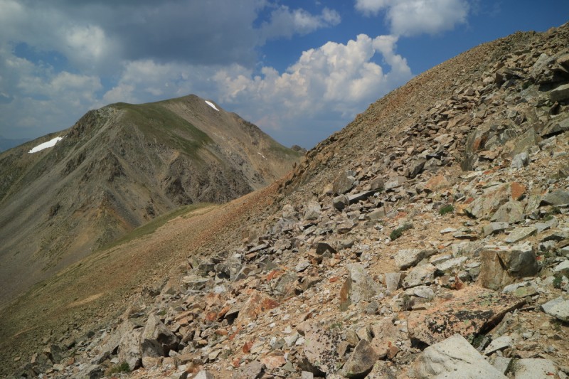
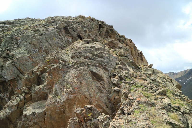
The ridge over to West Tellurium was a regular talus walk, except for one tiny section where I got some minor scrambling in. You could likely bypass it, if you want to. From Furthermore's report, I didn't bother to try and skirt the ridge bumps, and I could see why not as I made my way across. Steep talus is not fun to contour. Much faster to just go up and over.
Ridge to West Tellurium
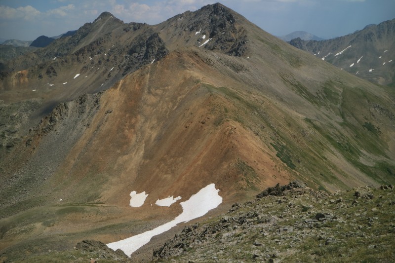
I didn't spend much time on West Tellurium, as I didn't like the clouds to the south (they were talking angrily), and the view upwind was mixed. So snap a photo and down. The drop from the ridge was enhanced by some late season snow that I could boot ski. Ahhh, my sore feet like snow travel!
Looking back to Tellurium
Down onto the grassy tundra, cairns were visible and lead me down to the lower basin. No real trail, except off the ridge, but faint hints along the way of others traveling in a similar way.
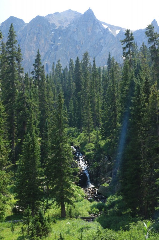
Once below the first set of waterfalls (pic #22), I stayed up high on the eastern/left side of the drainage, where I thought the trail should be. I followed game trails a lot, and managed to avoid the horrid bushwhacking for the most part.
A cairn with Tabor behind Flower explosion in basin, minor trail in sun Waterfall Another waterfall Looking back up the basin at West Tellurium
After I crossed the creek (pic 24), the bad bushwacking increased with almost every passing step. I had found a path through the willows above, but in the trees, the deadfall increased as I went downhill. I found game trails, and followed them, right into mutli tree deadfall zones. Not the worst I've seen, but I was getting really really tired and foot sore at this point. About the time I was looking for the NY Creek trail juncture, I noted a road below me. Oh yeah, the service road! I went down a steep embankment and found myself on a nice smooth flat road. The NY Creek trail actually follows the service road for a while, before dropping into the valley below. Since I didn't have a car shuttle set up, I was going to go down the NY trail and then walk the Lincoln Creek road. But why bother, I just walked the service road the mile or so over to the Tabor Creek trail and did the loop that way. Plus I got to soak my feet in the creek on the way back to my truck!
Pt 13,090, West Truro, (Truro bail)
Trailhead: Truro Creek
Mileage: 5.17
Elevation Gain: 2,880'
Partners:Solo
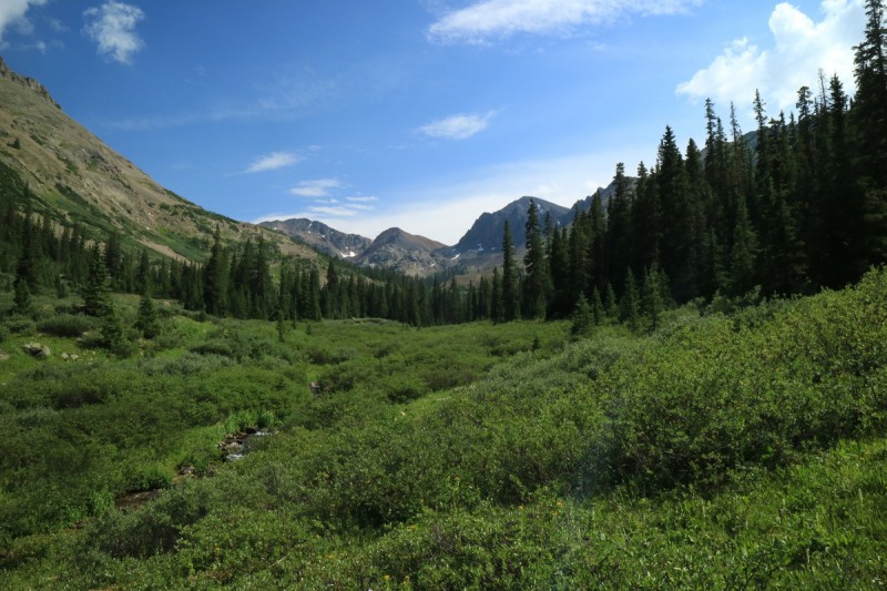
After the Tellurium hike, I drove the short distance up the road, to find the Truro creek junction. There's a meadow pullout to park, and a decent campsite I took advantage of, a few feet further up. Grilled some dinner and tried to rest and recover for a much shorter hike the next day. Managed to finish cooking, just in time for the rain to start. Good timing!
Woke up feeling pretty decent, but I knew the feet were going to hurt again by the end of it. Muscles were fine, but my poor soft feet were not used to off-trail talus pounding just yet.
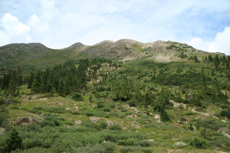
Found a decent stream crossing, but still had to transition to water sandals for it. Beyond, I found a well trod game trail. No dirt showing, but all the plants were bent down in the same direction. Since animals are usually pretty smart, I just followed it to the start of the steep ridge/bench. Here I went up to the right. On the way back (pic 49) I found that on the left side of the meadow/hill, were 2 cairns that lead you to the trail. But since I was going for the ridge, I didn't think the trail would help much. But in retrospect, you can gain the ridge to 13090 from just about anywhere you like, even all the way to the summit on a grassy slope.
The ascent in the trees was very steep, but I managed to avoid the rocky cliffs and downed trees on my path up. Once to treeline, I could see my way would be easy all the way to the summit. The brief sun at sunrise, had given way to grey rain clouds above. Wasn't too worried, as they looked pretty thin still. But at the same time, I wasn't going to take my time either.
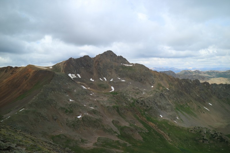
The Truro's in morning sunlight Ridge up to 13,090 Summit of 13090 from false summit
The summit came pretty quickly, even with the minor false summit along the way. With the clouds, the little bit of wind was cooling enough to require an extra jacket to be put on. I started down from the summit, and veered a bit to the left, as the rollover on the ridge looked a bit too steep. It goes, but I wanted speed over difficulty.
The ridge over to Truro Yesterday's Peaks
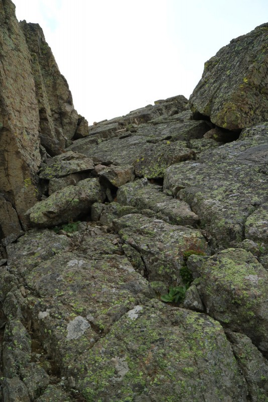
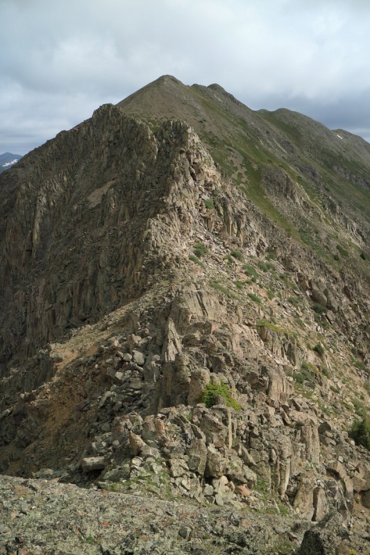
About the time my GPS batteries died, I had to put away my trekking poles. The ridge then became a scrambling paradise! Lots of fun times ahead! Precariously perched boulders on a narrow ridge. Slabby class 4 pitches too. The ridge didn't really let up until I was close to West Truro and the escape gully I was eying (pic 36 shows top), in case the weather came in, or I balked at the traverse to Truro.
Looking back on 13090 from first false summit Ridge to W Truro Some slabby scrambling Ridge back to 13090 Ridge back to 13090 Last bit of ridge to West Truro 13090 in the sun Tellurium
Before going up the final scramble up West Truro, I checked out the loose scree gully that Piper14er mentions in his TR. My first though was: "Oh HELL no!" (And since I've been a fan of Will Smith since I was a kid, of course I said it in my head/aloud like he does)
The "route" to Truro - Oh HELL no!
I've done some really loose scree dropping on many a 13er traverse before. But for some reason, this one just looked like a really bad idea. Yeah, it could be from a lack of practice on this kind of crap, but still - it looked like junky loose death fall zone! It wasn't just a down and up. It was going to be multiple down and ups, with 1 of them out of view. Piper14 called this careful "scrambling". It's not srambling unless there's some solid rock involved. That just looked like scree dirt clawing. Clawing my way up a slope and hoping to not slip off a cliff was not my idea of fun today. With the clouds building much closer to me today (almost over Truro itself), my mind saying no, and my feet were already crying at me (they knew how much clawing up and down steep scree is painful), it was a pretty easy decision to say I would be done for the day on West Truro.
At least the final scramble up to the summit was pretty fun. Got some almost class 4-ish dihedral action onto the slabby summit. Not bad for my 100th Sawatch 13er! Woohoo! On the summit I found the tiny baby food container summit register, where I noted that Jordan White had been up here in March. Hmmmm skiing Truro... now that's a great idea!
As I spent a little bit of time on the summit looking around, the thin rain clouds of the morning, had given way to puffies. As I went up West Truro, those puffies were starting to gain some elevation, and to the south was looking darker. Even if I wanted to do the traverse, I doubted I had the time.
Summit scramble Looking at the gendarmes to Truro Anderson and Petroleum Summit scramble close up
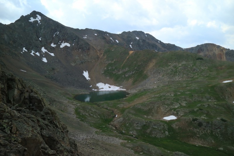
I went back down to my escape gully, and hoped it went. Tough to say with all the cliffs around, but I had a reasonable expectation it would work. As I went from steep grass, to loose scree, I could see that it went. Not all of it was boot scree skiable, but overall it was ok. One section of solid rock to work through, and I was down on talus by the lake.
Dirt route up Truro looks, not bad My escape gully Truro Lake with 13090 behind
Along the talus, I found some snow patches still left, and beelined to them. My feet are quite missing snow travel after all that rough scree and talus surfing! Back onto the lush grass of the valley, my feet sighed a bit of relief. It was a rather nice valley full of flowers. So while I was surprised to see a couple up on a talus glacier, I guess they were seeking out this valley too. With them making a lot of noise trying to get off the talus, they didn't notice me until they passed by me along the trail. When they passed, they exclaimed "People!" and waved as they quickly passed by.
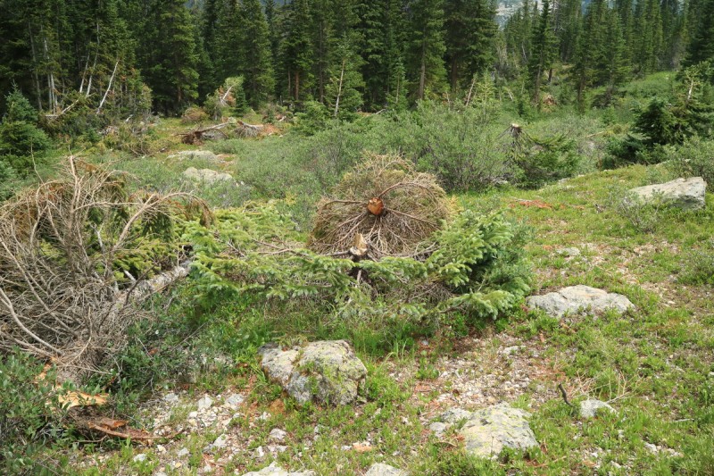
I followed their progress from the rock I was sitting on, and followed them along the broken trees from an avalanche this past spring. Seems like many areas got hit hard by avalanches this spring, after the late season heavy snow.
The ridge up to 13090 Avalanche debris
Once in the trees, the steep trail is pretty obvious. Lots of deadfall in the path made the descent interesting. My uphill path avoided deadfall, so I'm not sure the trail wins out. When I got to the steep meadow/hill where I went right, I could see a few cairns marking the entrance to the trail. So look left on the way up, and you should spot them (in pic 49)
Their are cairns that point the way to the trail on left of meadow Storms south of Truro from Grizzly Res
Overall, a decent couple days out, despite missing the last peak. But as I don't really want to use up all my close by peaks, having a fun orphan left isn't the end of the world!
My GPS Tracks on Google Maps (made from a .GPX file upload):
CarpeDM and I were up on Petroleum and Anderson Sunday looking at all those 13ers surrounding us, particularly the Turos....I'm looking forward to going back for them! Thanks for the TR! We ended up descending a Piper gully, it's bark was worse than its bite :D Us mortals can't just ski north coulies...
That's definitely one of my favorite places off of Independence Pass, and I need to get back there to attempt the Tellurrium's so thanks for the beta. Did you get to Anderson and Petroleum as well or you saving those for another trip? BTW that scree slope on Truro is worse than it looks, although there are a few moves above the gully/cliff that call for your full attention. :shock:
I know you miss the snow, but these are the TR's I really miss from you! A scramblin' paradise! And especially since my own trip was cut real short this year, I'll have to live them vicariously through you. Thanks for sharing it! :D
Great Trip Report too. Thanks so much for posting the quality 13er route beta consistently Otina. Excellent work with reaching these Sawatch Range peaks. Information on lesser traveled routes is very good. Keep climbing safe, smart, and strong
Rainer_wolfcastle - The north couloir I skied on Anderson, still has snow in it! Lots of good 13ers around there for sure!
kaiman - I skied Anderson and Petroluem at the end of June! Guess I'll go with the south grassy slope on Truro, unless I ski it too
MtnHub - Sorry to hear your trip was cut short, you'll have to email/pm me what happened. I was too exhausted after Yellowstone to see what you were up to.
Springshiker - Lots of hidden gems out there! Enjoy :)
jaysayrevt - I'm mostly down to the obscure ones now!
Caution: The information contained in this report may not be accurate and should not be the only resource used in preparation for your climb. Failure to have the necessary experience, physical conditioning, supplies or equipment can result in injury or death. 14ers.com and the author(s) of this report provide no warranties, either express or implied, that the information provided is accurate or reliable. By using the information provided, you agree to indemnify and hold harmless 14ers.com and the report author(s) with respect to any claims and demands against them, including any attorney fees and expenses. Please read the 14ers.com Safety and Disclaimer pages for more information.
Please respect private property: 14ers.com supports the rights of private landowners to determine how and by whom their land will be used. In Colorado, it is your responsibility to determine if land is private and to obtain the appropriate permission before entering the property.