Download Agreement, Release, and Acknowledgement of Risk:
You (the person requesting this file download) fully understand mountain climbing ("Activity") involves risks and dangers of serious bodily injury, including permanent disability, paralysis, and death ("Risks") and you fully accept and assume all such risks and all responsibility for losses, costs, and damages you incur as a result of your participation in this Activity.
You acknowledge that information in the file you have chosen to download may not be accurate and may contain errors. You agree to assume all risks when using this information and agree to release and discharge 14ers.com, 14ers Inc. and the author(s) of such information (collectively, the "Released Parties").
You hereby discharge the Released Parties from all damages, actions, claims and liabilities of any nature, specifically including, but not limited to, damages, actions, claims and liabilities arising from or related to the negligence of the Released Parties. You further agree to indemnify, hold harmless and defend 14ers.com, 14ers Inc. and each of the other Released Parties from and against any loss, damage, liability and expense, including costs and attorney fees, incurred by 14ers.com, 14ers Inc. or any of the other Released Parties as a result of you using information provided on the 14ers.com or 14ers Inc. websites.
You have read this agreement, fully understand its terms and intend it to be a complete and unconditional release of all liability to the greatest extent allowed by law and agree that if any portion of this agreement is held to be invalid the balance, notwithstanding, shall continue in full force and effect.
By clicking "OK" you agree to these terms. If you DO NOT agree, click "Cancel"...
Apache Peak 13,441 Feet (291st Highest in Colorado) East Face From Niwot Cutoff Trailhead Trailhead Elevation 10,360 Feet
Approximately 12.1 Miles Roundtrip
Approximately 3,400 Feet Elevation Gained
Class 3
August 5th, 2017
Partners: Derek
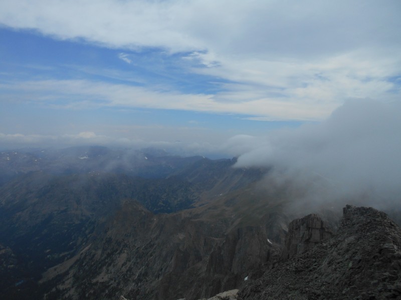
Apache Peak Under a Patchy Sky
The Indian Peaks Wilderness was established in 1978, and encompasses 76,711 acres. The James Peak Wilderness lies to the south, and Rocky Mountain National Parks adjoins it on the north. The area was included in Enos Mills' original plan for Rocky Mountain National Park, but mining interests lobbied to have it excluded. Only low-grade ore was found in the area, so mining scars are minimal. Subsequent attempts to annex the area to the national park have failed for bureaucratic reasons.
Naming the peaks for Indian tribes was Ellsworth Bethel's idea. Bethel was a Denver high school teacher and naturalist whose area of expertise was slime molds and fungi. The U. S. Board on Geographic Names rejected some of Bethel's suggestions, but the general theme persisted. As it stands today, seven of the named peaks are above 13,000 feet; many of the lower peaks offer outstanding mountaineering opportunities as well.
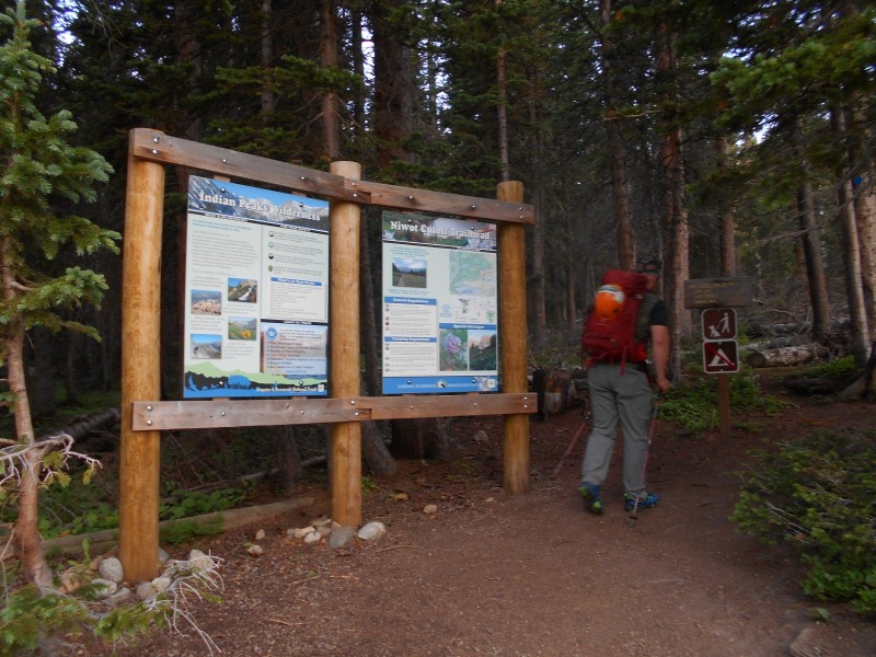
Apache Peak is the second-highest in the wilderness area, with the highest being North Arapaho Peak. The east face from Long Lake trailhead is generally considered the easiest summer route, but the Long Lake parking lot filled up just a few minutes prior to our arrival. The worker at the entrance suggested that we could use the Niwot Cutoff trailhead, which would add an easy mile to our roundtrip. We managed to grab the last spot. The Brainard Lake Recreation Area grows in popularity every year.
Derek leaving the Niwot Cutoff trailhead
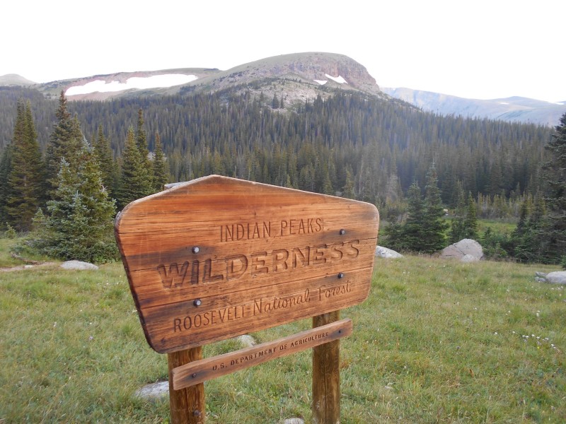
The first half mile was in the Roosevelt National Forest, but we entered the wilderness area shortly before we reached Long Lake. Because of its accessibility, Long Lake is one of the most popular destinations for tourists and fishermen. The relatively level terrain and decent trails make it ideal for hikers and trail runners.
Indian Peaks Wilderness boundary sign
Crossing South St. Vrain Creek as it flows out of Long Lake. Our destination is a nondescript bump on the ridge near the center of the image.
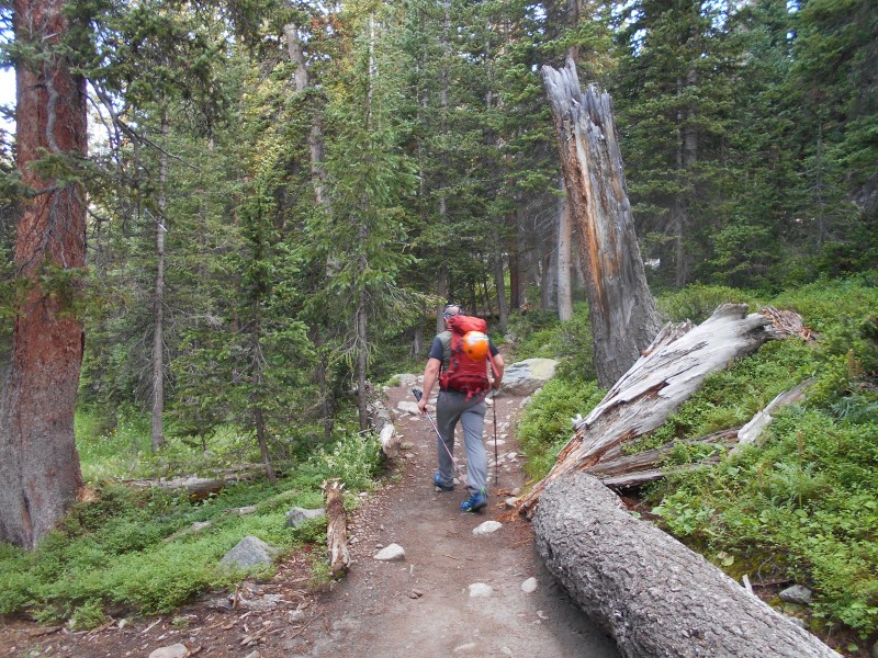
At the far end of the lake, there is a trail junction. The right branch of the trail becomes the Isabelle Glacier Trail, and the left branch loops back around the lake as the Jean Lunning Trail. We stayed right and headed towards Lake Isabelle.
Derek turning up the Isabelle Glacier Trail
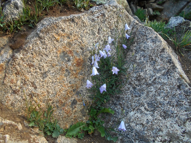
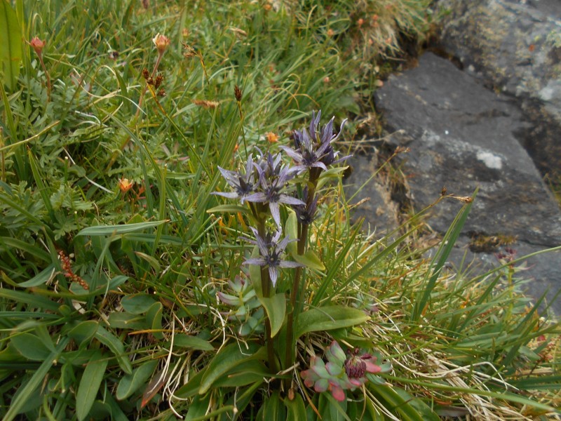
The Indian Peaks Wilderness receives an abundance of rainfall, and this translates to lakes and streams, lush vegetation, and mud. There were easily 50 different species of wildflowers blooming between the trailhead and summit.
Harebell (Campanularotundifolia).
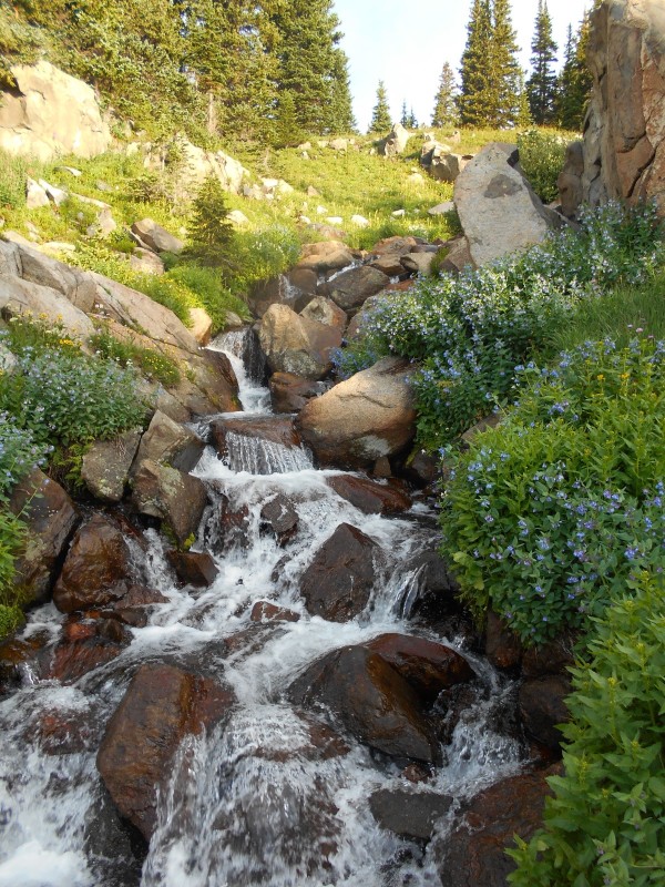
The trail follows the same general course as South St. Vrain Creek, and crosses it at least twice. Wildflower-lined waterfalls in the creek contribute to the outrageous scenery.
Waterfall lined with bluebells (Mertensiaciliata).
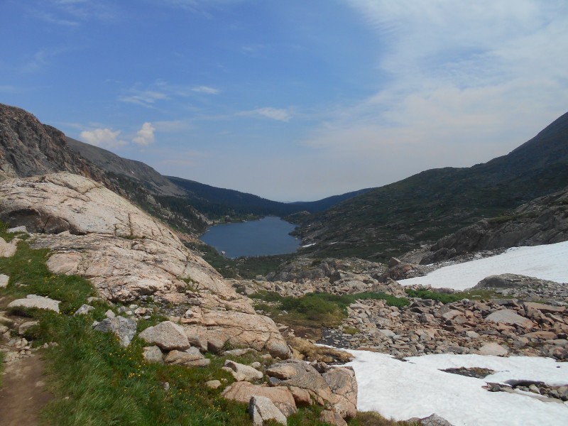
Lake Isabelle was another one of the visual treats on this hike. If this view isn't in one of John Fielder's coffee table books, it should be. It's a challenging snowshoe hike in winter, but it's just as incredible with a snowy backdrop.
Indian Peaks rising behind Lake Isabelle. Niwot Ridge is on the far left. The conical mountain on the left is Navajo Peak; the snowfield below it is the Navajo snowfield. Apache Peak has the Isabelle Glacier slanting across its face at a 45-degree angle. Shoshoni Peak is in the foreground on the right.
Alpine laurel (Kalmiamicrophylla) growing near Lake Isabelle
I like to see stars when I wake up on the morning of a hike; cloudy mornings frequently foreshadow a shortened hiking day. The sky didn't look great, but we were hoping that the cloud cover would burn off. To a certain extent, it did; we had good light conditions for photography, and we didn't have to wear sunglasses. Clouds were flying over the Continental Divide at a high rate of speed, driven by a chilly wind. There was no rain or thunder, but the mountains blocked our view of the incoming weather. We were prepared to turn back at the first sign of inclement weather.
Navajo Peak centered over another picturesque waterfall. The sky was a brilliant blue, for the time being.
Lake Isabelle lies at 10,873 feet; we really hadn't gained much altitude yet. We passed through a marshy area at the west end of the lake, and the slope gradually started to increase.
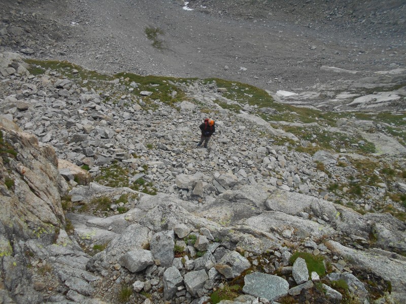
Derek crossing a fellfield beyond Lake Isabelle's western shore.
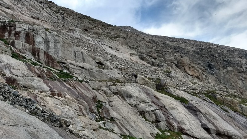
Gaining elevation on granite ledges.
At about 11,440 feet, we reached an unnamed tarn. The Isabelle Glacier trail followed the north shore, then started to switchback up a steep slope. We stayed on the trail up to about 11,800 feet, then started to angle off to the southwest.
Derek on the shore of the unnamed tarn. The upper end of the Isabelle Glacier is barely visible on the extreme upper right side of this image.
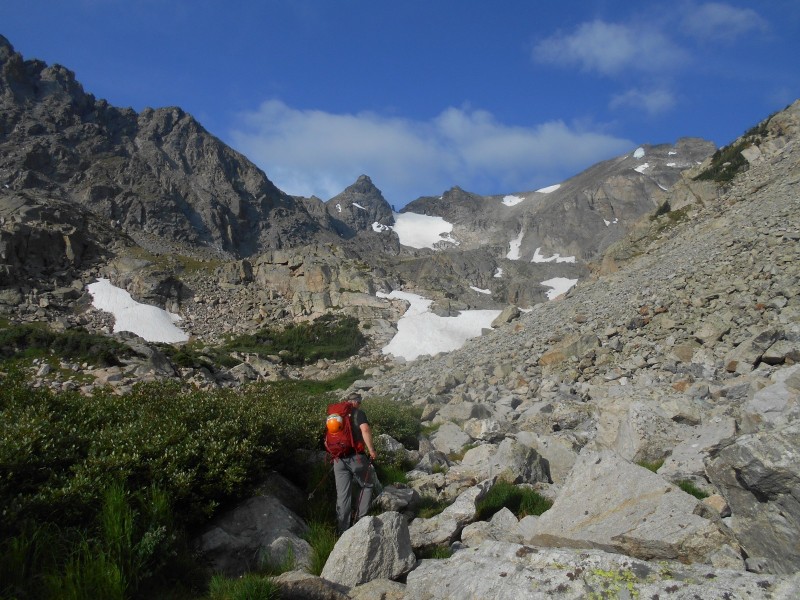
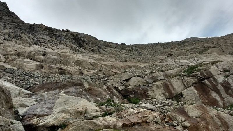
Above the tarn, we crossed South St. Vrain Creek below the Isabelle Glacier. The creek was entirely covered by a large snowfield. On the opposite side of the creek, we ascended more granite ledges and talus to reach a cirque at the base of the Navajo Snowfield at about 12,100 feet.
On the far edge of the snowfield, with the Three Chessmen behind me (image by Derek).
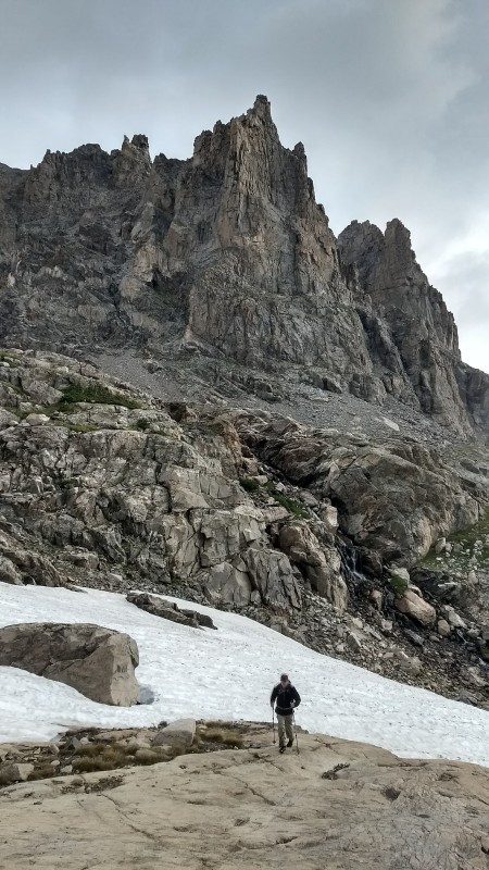
We found a good spot to take a break in the cirque. We watched a pair of hikers descending Navajo Peak's Airplane Gully, and we could see the wreckage near the top. Pieces of the wings were in the cirque at the base of the gully, probably carried down by avalanches. A pair of hikers were starting a technical climb up the Navajo Snowfield. The clouds racing over the divide gravely concerned us. A light rain could make the granite ledges dangerously slick. A heavy rain could cause hypothermia. Lightning could render those first two points moot. We wanted the summit badly, but not badly enough to make a rash decision based on summit fever. We've both had near-death experiences in lightning storms, and have a healthy respect for Mother Nature's fury. There was just enough blue sky to the west to give us hope; we decided to go for it.
Derek trying to capture an image of Navajo Peak's cloud-veiled summit
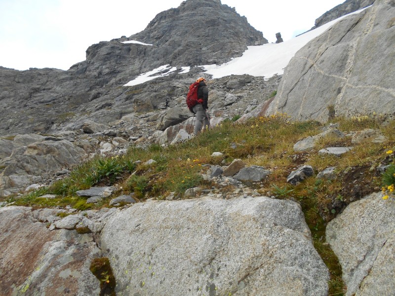
Our route up Apache's east face was too complex to adequately describe. In general terms, we loosely followed an established route. From our spot in the cirque, we headed southwest to the base of the Navajo Snowfield. Roach described some blue paint spots on rocks, but I certainly didn't see any. There were a few cairns, and stretches of obvious trail through absolutely miserable scree. A few incidents with wobbly talus got my attention. Wet granite slabs were as slick as ice. I took a few detours from the route for safety's sake or ease of travel.
Derek on a grassy ledge beneath the Navajo Snowfield, pondering his next move.
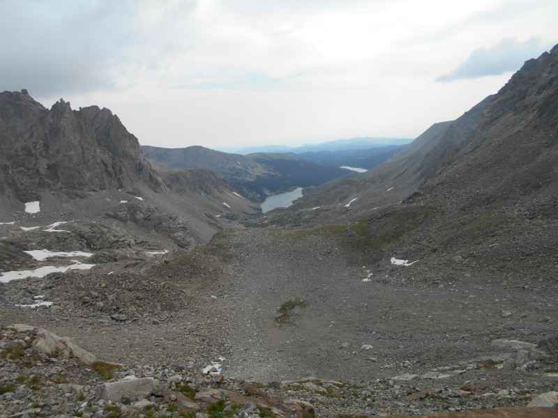
Looking back at the cirque, with Lake Isabelle in the center and Long Lake in the distance. Part of the wing of a C-47 cargo plane that crashed in 1948 is barely visible near the center right edge of the image.
From the base of the snowfield, we headed northwest over wet ledges. While the wet rock was incredibly slick, there always seemed to be cracks and holds to give me sufficient traction. There was no need to take risks with so many alternative routes through the ledges.
Slick granite ledges, with the summit barely visible on the upper right (image by Derek).
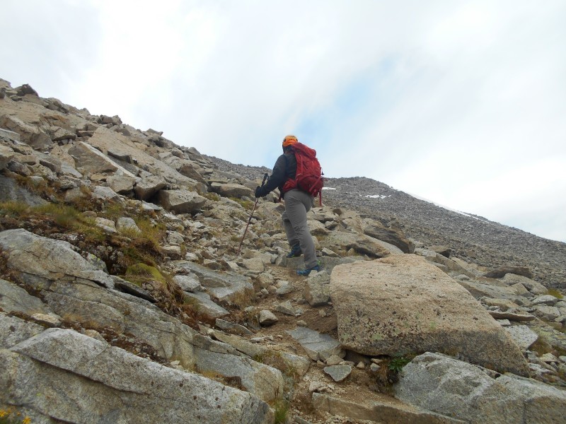
After we passed through the ledges, Derek expressed disappointment in the easiness of the route. The ledges are understood to be easy Class 3, and that's exactly what they are. Above the ledges, there is nothing but ankle-biting, shin-scraping, toe-jamming talus all the way to the summit.
Derek on a segment of trail above the ledges.
Above the ledges, we had a good view of the climbers in the Navajo Snowfield. I could hear the lead climber pounding snow stakes into the ice; it must have been pretty solid.
Snow climbers on the Navajo Snowfield
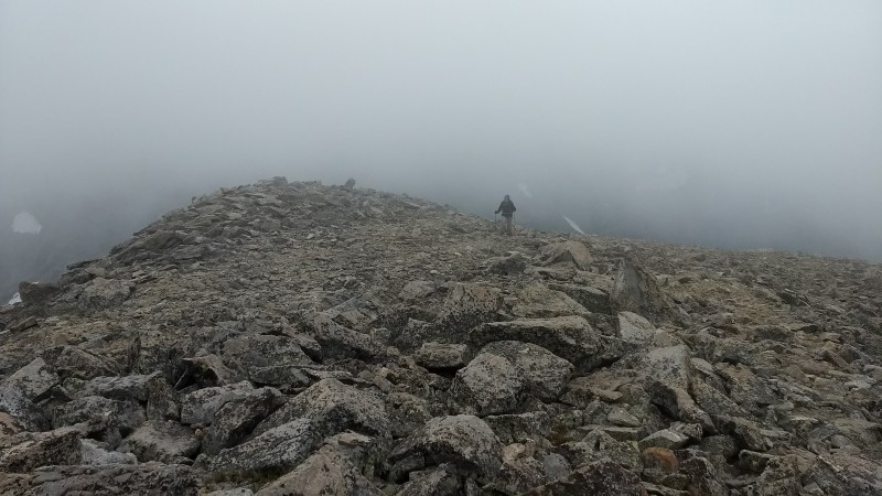
The established route heads northwest though the talus, and gains the ridge about 200 yards south of the summit. From there, it's an easy walk to the summit. Neither of us care much for steep scree, so we made no attempt to follow the route. We took what appeared to be the most logical route through the talus, and it really wasn't too bad. We were practically in the clouds at this point, so we weren't seeing much blue sky. I wasn't going to be turned around 200 feet from the summit.
Derek trying to guess how many rocks are between him and the summit.
A large snowfield pushed our course slightly to the north; the Apache Couloir kept us from straying too far to the north. We hit the ridge just south of the summit, pretty much as planned.
Coming up the summit ridge (image by Derek).
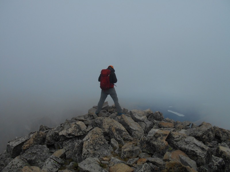
To say that we had poor visibility on the summit would be an understatement. The clouds were still moving rapidly, so we had brief windows of visibility. In spite of the clouds, we saw nothing about the weather that concerned us. No rain, no thunder, and no lightning. Above these harmless clouds was nothing but blue sky.
Derek bracing himself against the wind.
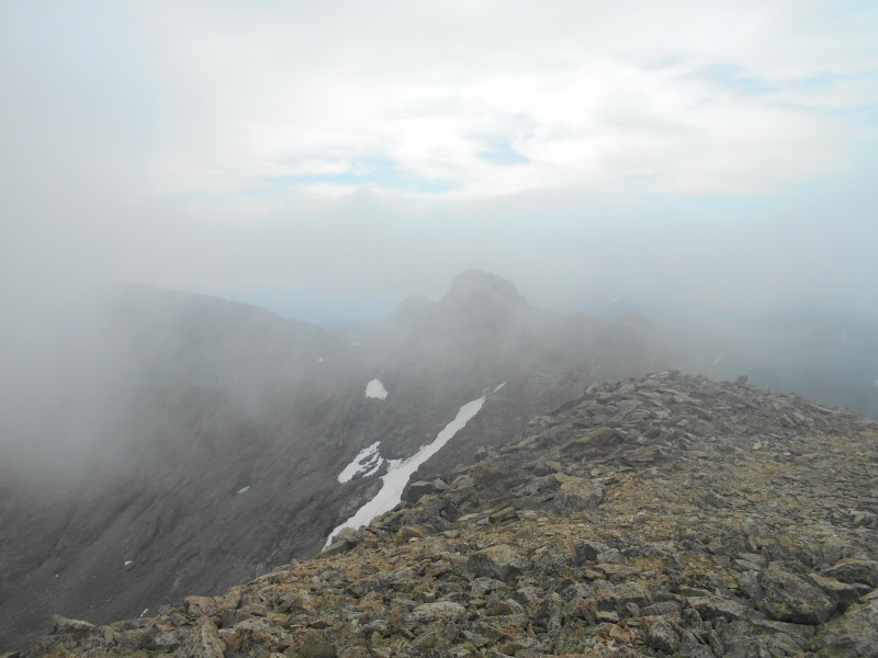
Looking southeast towards Navajo Peak
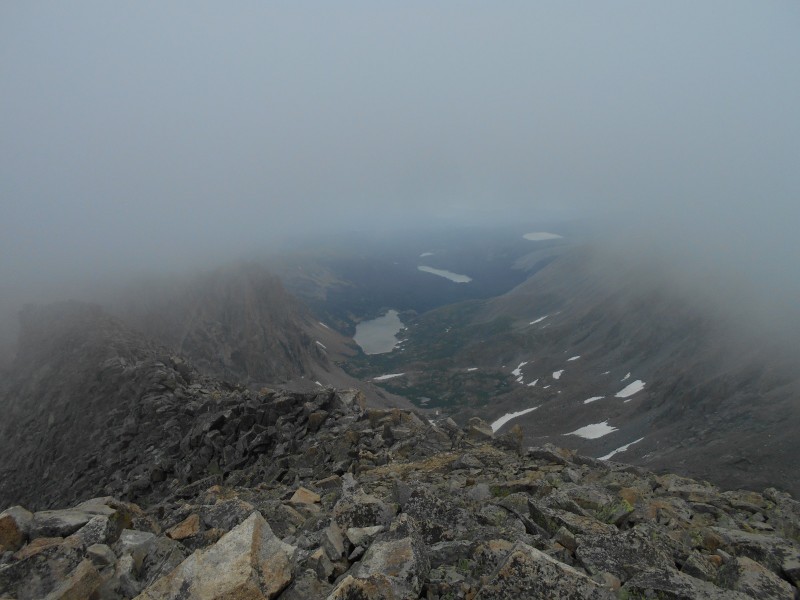
Looking northeast towards Shoshoni Peak, the unnamed tarn, Lake Isabelle, and Lefthand Reservoir.
I could see the flat top of Longs Peak to the north, but it doesn't show up well in this image
One of my friends has commented that I never smile in my photographs; that's probably because I only smile when I'm doing something incredibly stupid. Here I am singing the refrain from my favorite Sir Mix-a-Lot tune.
Summit pic (image by Derek)
When we had enough of staring off into foggy nothingness, we bailed off of the summit and made tracks for lower elevation. We had gotten a break with the weather, but it wasn't guaranteed to last forever.
Descending towards the cirque
Taking a very narrow ledge across a wet slab (image by Derek).
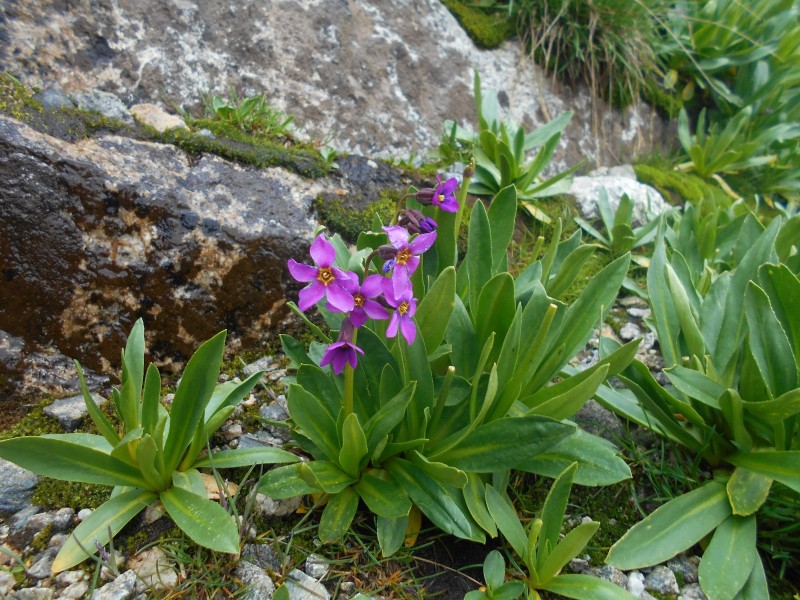
On the way down the east face, a couple of interesting plants got my attention. Parry's primrose needs no introduction; most alpine hikers have already noticed its hot pink color. Felwort is found throughout the northern hemisphere, but is not as common in Colorado. Its common name means âfield herbâ in Middle English; it allegedly has some medicinal value.
Parry's primrose (Primulaparryi).
Felwort (Swertiaperennis).
On the return, we took a slightly different route back to the unnamed tarn. We had to descend a snowfield that was steeper than it looked. Derek caught a glissade, but I thought that I could just jog down. The snow was slick, so I started to boot ski. When I built up some speed boot skiing, I just laid down and glissaded the rest of it. Having fun in the mountains is still legal.
Descending to the tarn.
Our glissade path
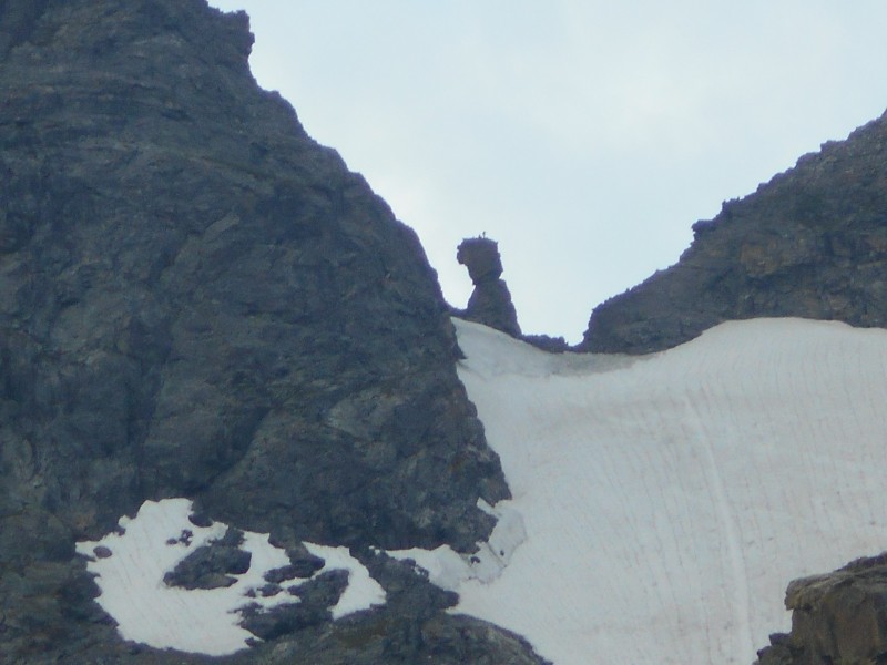
Somewhere near the tarn, we turned around and noticed that there were some climbers on the summit of âDicker's Peck,â They were probably the same technical snow climbers that we had seen earlier on the Navajo Snowfield.
Technical climbers on âDicker's Peck.â
We caught the trail again on the other side of the tarn, and made haste for Lake Isabelle. From my point of view, it looked just as long as Long Lake. I had never realized just how large it was. The weather just kept getting better, and I eventually had to layer down and put my sunglasses on.
Descending towards Lake Isabelle
From Lake Isabelle all the way back to the trailhead, we passed day hikers of every description and nationality. I heard several languages being spoken. It's tourist season in Colorado! Not a problem, because the dogs were leashed, people were respectful, and everybody was having a good time. Several people mentioned seeing three moose lounging around Long Lake, but I missed seeing them. It was a great hike, but fairly strenuous as far as most thirteeners go. My best guess is that it was about 12.1 miles and 3,400 feet in elevation gain. The scenery made every bump, bruise, and scrape worthwhile.
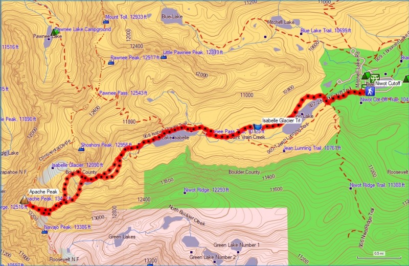
GPS track for Apache Peak, East Face from Niwot Cutoff Trailhead
Thumbnails for uploaded photos (click to open slideshow):
MtnHub, great minds Google alike! I used Wikipedia, Roach's IPW guide, Lisa Foster's RMNP guide, the Forest Service's IPW site, and a 1926 article about Bethel in the Journal Science. Our sources are probably slightly different (except for Wikipedia), but they all have different versions of the same basic information. I hadn't read the trip report to which you referred, but Derek and I both used your Apache Peak trip report and .gpx file for beta. Everything was spot on, and very useful. Thanks!
Yeah, I found and read most of those sources too! It's just interesting as most people don't bother much with historical data like that in their reports and then we come along barely a week apart and include it in our reports. But I think it's nice to get some background information on places and areas I've been. That was my 4th trip in the IPW and I've discovered it to be a really great place.
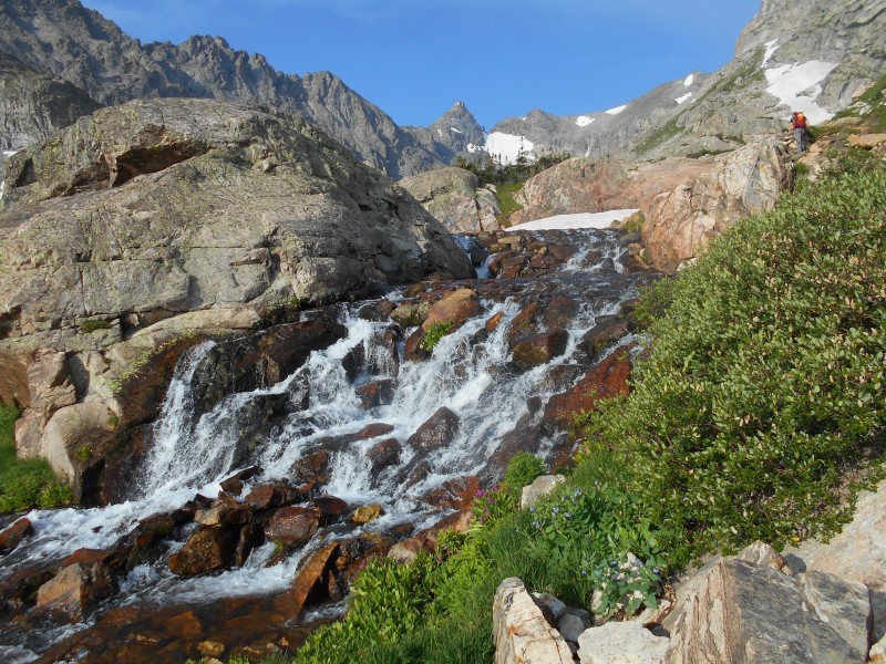
Always loved that little fall, almost as if it was hand made, carefully laying the stones in just the right place. Wish I could duplicate that in my yard. Thanks for sharing, it brought back memories of a beautiful valley and climb. I did something very similar to your climb, but hit some couloir on that face going up,tapped the summit and went over to Dicker's Peck for Navajo, but didn't know the route well enough to get it that day. Navajo Snowfield had a nice bergshrund at the top. I went down those slabs you went up. Either way, it was an awesome day in that valley. Even checked out the plane wreckage.
Good Trip Report too. Thanks so much for posting the quality 13er route beta Brian. Excellent work with this Indian Peak Wilderness classic. Apache's such a great mountain. Keep climbing safe, smart, and strong
Thanks, Jason, Koeffling, and Boudreaux. That waterfall really is perfect. I get out pretty much, and only a few places every year inspire me to write a full trip report. This is a special place that a lot of people would enjoy.
Caution: The information contained in this report may not be accurate and should not be the only resource used in preparation for your climb. Failure to have the necessary experience, physical conditioning, supplies or equipment can result in injury or death. 14ers.com and the author(s) of this report provide no warranties, either express or implied, that the information provided is accurate or reliable. By using the information provided, you agree to indemnify and hold harmless 14ers.com and the report author(s) with respect to any claims and demands against them, including any attorney fees and expenses. Please read the 14ers.com Safety and Disclaimer pages for more information.
Please respect private property: 14ers.com supports the rights of private landowners to determine how and by whom their land will be used. In Colorado, it is your responsibility to determine if land is private and to obtain the appropriate permission before entering the property.


")
")
")
")
")
")
")
")
")
")
")
")
")
")
")
")
")
")
")
")
")
")
")
")
")
")
")
")
")
")
")
")
")
")
")
")


