| Report Type | Full |
| Peak(s) |
Star Peak - 13,527 feet Taylor Peak - 13,438 feet Mt. Oklahoma - 13,843 feet "Anderson Peak" - 13,637 feet "Petroleum Peak" - 13,512 feet |
| Date Posted | 07/11/2017 |
| Date Climbed | 06/30/2017 |
| Author | bergsteigen |
| 13er skiing in June: From corn to suncups (Part 2) |
|---|
While these peaks are not current, I thought the info would be good for future skiers looking for spring/summer skis of varying difficulty. For more recent beta, you can always follow me on instagram @otinaStar Peak A & Taylor Peak ADate: June 14 Trailhead: End of County road 742 in Taylor Park Mileage: 8.1 Elevation Gain: 4,019' Route: NE Face of Star and Taylor Partners: Solo Finally skiing in the Elks! I had planned to ski in the San Juans and Elks all June long. Just drive around: see it, ski it. At least I'll get one trip into the Elks! Star Peak A makes the Dawson ski book, though the NE face is kind of an after thought, as the approach from Aspen is more involved since there is a reclimb involved. So I figured I could drive up the county road in the dark, and expect to find skiable snow on the NE face of both peaks. I hope! I wake up to find snow on the peaks, just no clue about their extent. So up the right side of the stream valley I go, booting up in the marsh and over solid snow in the trees. I stay pretty high up, and manage to get over the gushing streams with ease. I can even see hints of a trail on occasion between the snow drifts. Only one willow bashing section, and I start up the drainage to see how the snow fares on the NE face of Star Peak. 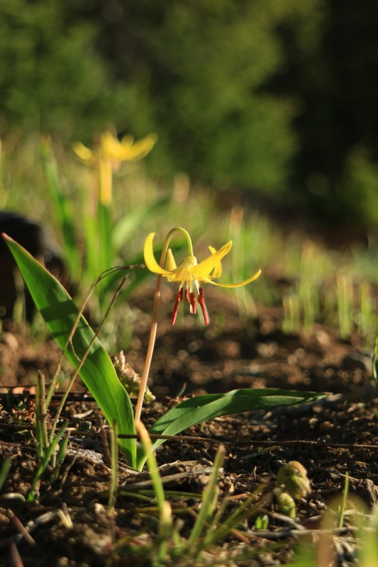 Once out of the shade of the trees the sun cups begin in earnest. Still solid, so I have plenty of time to summit both peaks. I had my skins, but there was no need to put them on. Plus the depth of sun cups would have made that a fools choice. Thankfully as I got closer to the steeper line, the suncups eased up and the snow became smooth once again.  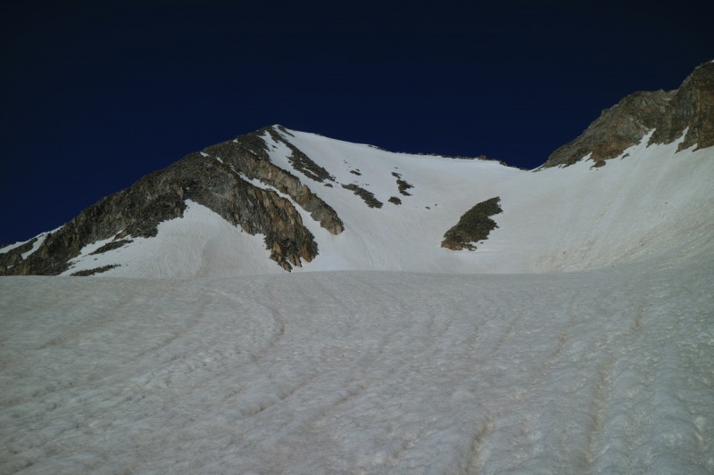 A pretty short ascent up the face and I found myself on the small summit. Thankfully the snow started within a few feet of the summit cairn, as I wanted no part of the loose rock of the Elks. Even if it was a bit thin up top, I could sneak from summit over to the line I wanted to take down the valley quite easily.  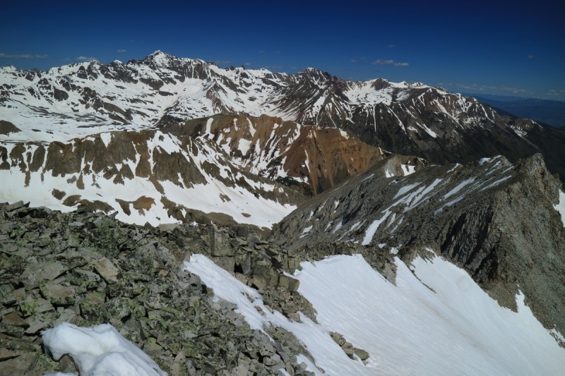 I chose to traverse over to the center of the line to have the best snow, and ripped all the way down to the basin below on pretty decent corn! 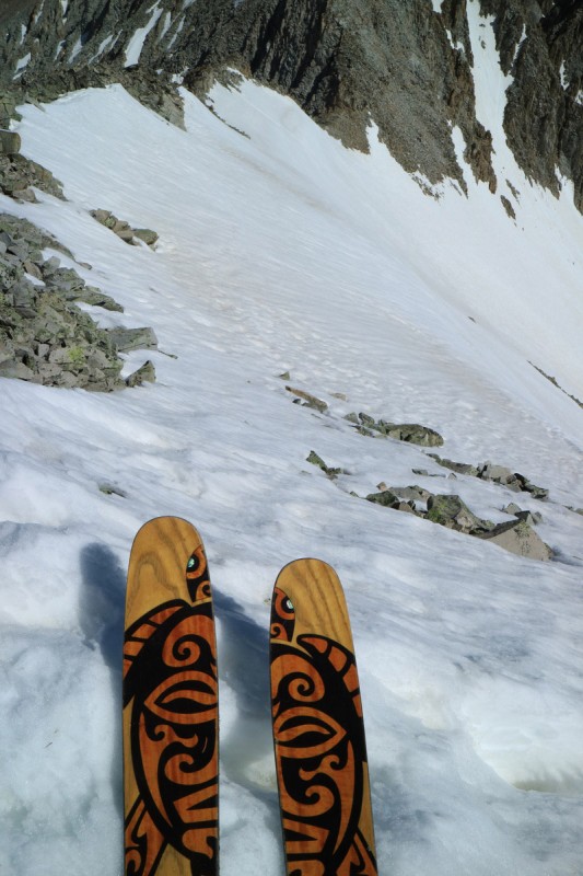   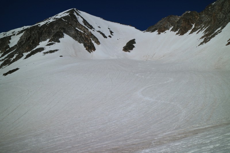 Since the lower snow was all suncupped, I saw no value in dropping any lower than I needed, so I did a high traverse over to the ridge with Taylor. 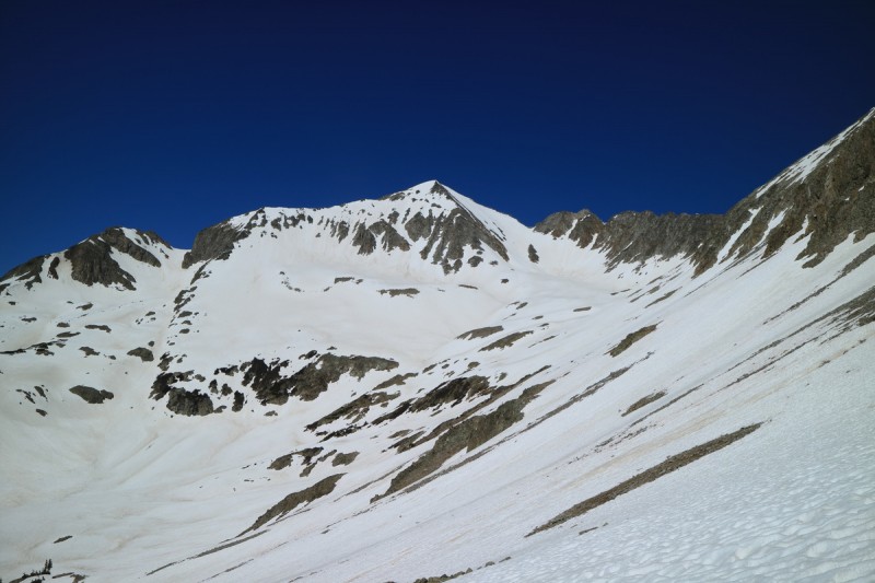 Once around the dry ridge, I could see my ascent up Taylor. It wasn't continuous snow, but I was able to get up to the summit ridge using the ease of my crampons. The snow on this face was getting pretty soft, so I was glad I chose the mellow NE face to descend. 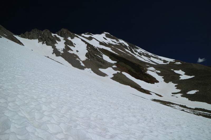 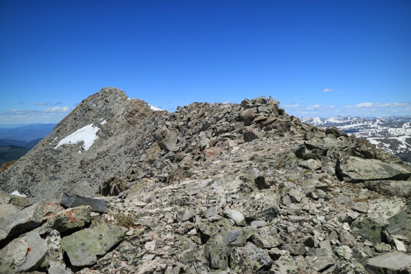 On the summit, I was pretty sad that I didn't get up here sooner. The east face direct looked quite fun. If I had a partner, I likely would have gone for it, but I decided to play it safe. Low angle slush is better than steep slush. Especially when you can't see the entire line properly. 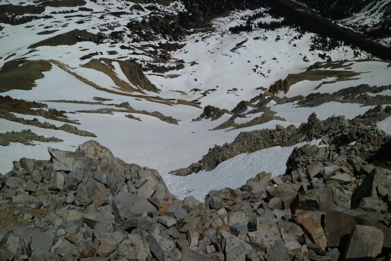 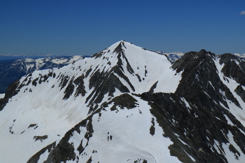 After a bit of sadness over skiing a more mellow line, I set up and skied down the smoothest section of snow I could find. The snow was still reasonably supportive, despite what the edges felt like as I got onto it above. I guess maybe that east face direct could have gone. Darn it! 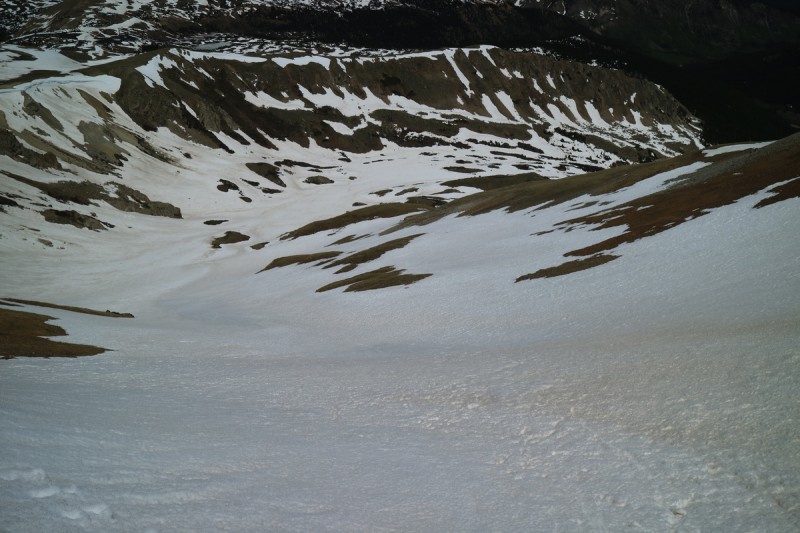 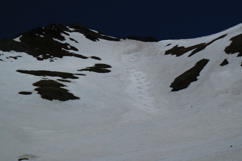  The lower I got, the sloppier the suncups. I managed to keep the skis on until the steep descent back to the car. This section was unpleasant. The approach to ski the east face direct of Taylor would be easy except for this section. I think I may return one day earlier in the season to hit this line up. 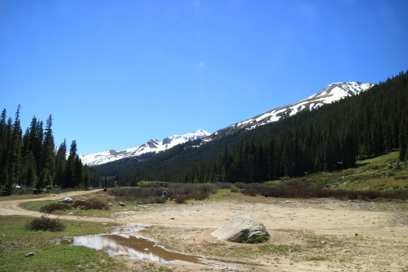 After admiring the view from the trailhead for a bit, and the unique views of the Sawatch from Taylor Park, I drove 4 hours around the Sawatch, and back into the Elks to go to the Cathedral Lake trailhead. Only in Colorado can you drive for 4 hours to go 10 miles! The next day I made my way up to attempt Malamute Peak, but before I even got to the lake, I realized that the line I wanted to ski was too thin to be safe. I spent some time thinking about things, since it was still early in the morning (about 6am). I figured even with the hike out and drive, I could make it up to Independence Pass and ski the unranked 12er as a consolation prize. Win some, lose some! Mt OklahomaDate: June 22 Trailhead: North Halfmoon Mileage: 7.87 Elevation Gain: 3,290 Route: South face Partners: Solo On my drive home from Inde Pass the previous week, I noticed that Oklahoma looked ripe for skiing still. Even some IG beta furthered that assumption. So not wanting to risk another shut down in the Elks after a long drive, Oklahoma and hopefully Pt 13,736 the next day it was. Fairly easy drive up to the trailhead for a short nights rest. I started up the trail around civil twilight, since I knew I wanted daylight for the stream crossings. On the way up I stayed a bit too close to the initial stream, instead of following the trail, but I went down the trail on the return. The crossings were stout, but doable without getting my hiking boots wet. The sunrising on the surrounding peaks and valleys was pretty nice. At this point I didn't realize any smoke in the vicinity. But the sunrise showed a peak that looked a bit dry around where the upper snowfield met the lower one. I remember hiking that steep slope in summer dry conditions and it was unpleasant. Did one week of melting destroy this line? 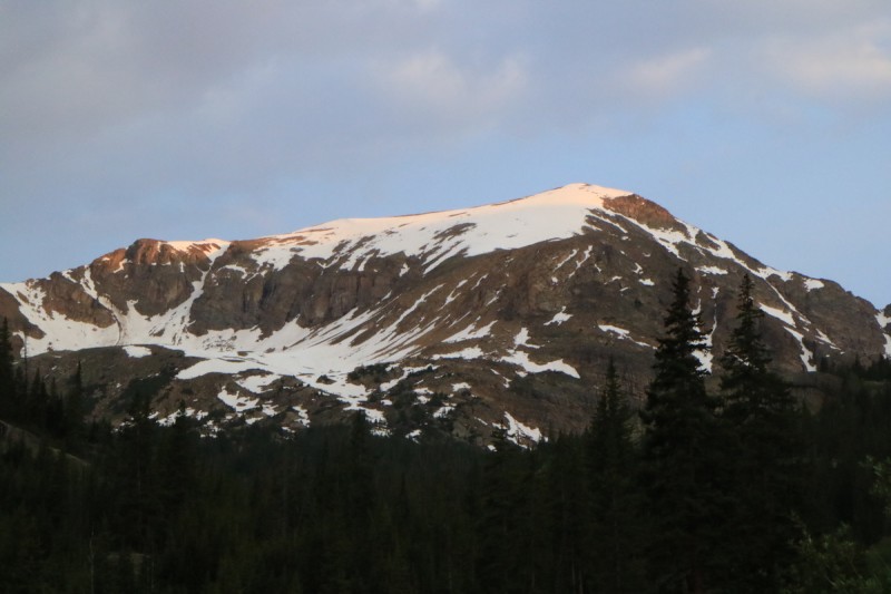 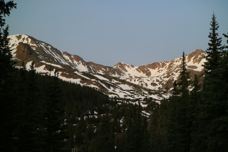 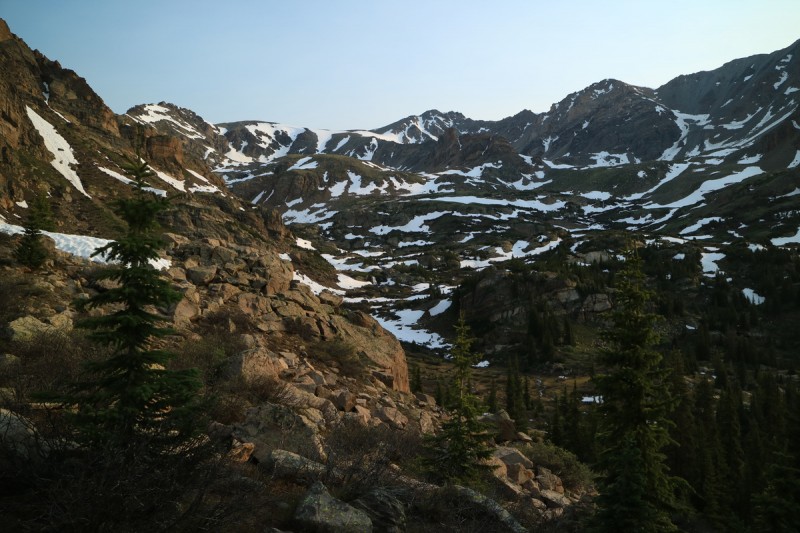 Thankfully as I made my way up the slowly warming suncups, I got a view of the snow filled gully. Phew! No walking up steep grass in ski boots. That would have sucked! 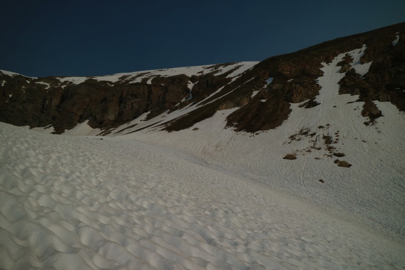 After the gully, it was a long ascent up to the hidden summit, where I noticed the views were pretty minimal. Wow, that's a lot of smoke around. Why don't I feel worse? Usually my allergies and asthma are off the charts at this level of particulates. I wasn't fast getting up the peak, but I also wasn't in a rush. Skiing hard suncups is no fun. 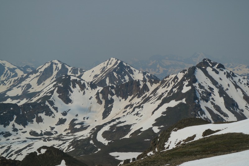 I made big sloppy turns on the suncups as I made my down to where I transitioned back into hiking boots. 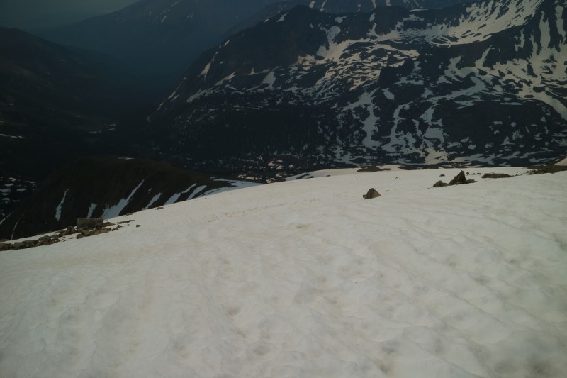 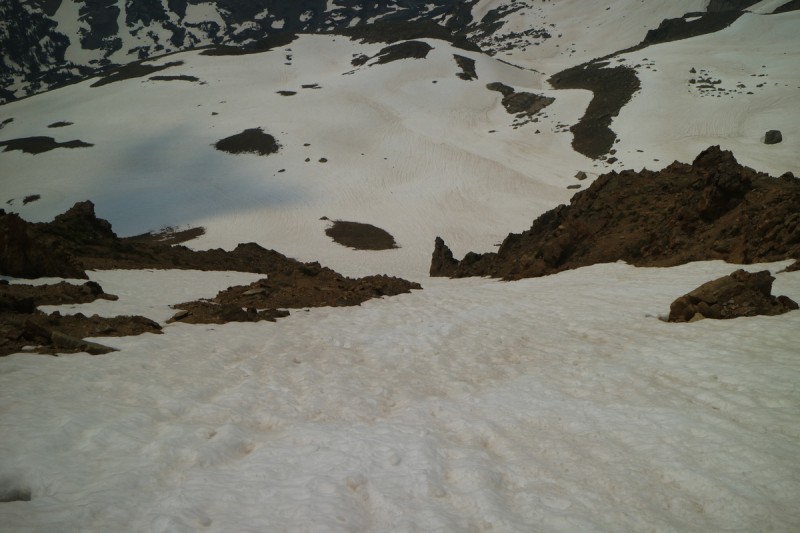 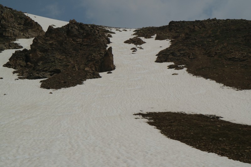 I decided to contour pretty high up into the valley below, and crossed the stream above the waterfall quite easily. The next 2 streams were a bit more exciting, but a dry crossing was found for both.   Back at the trailhead I assessed my desire to drive my truck across the stream to go for 13,736. I put on my sandals and started across. Before I even reached the gushing high velocity center of the stream, the water was at my knees. Since I don't have a snorkel on my truck (yet), I wasn't going to risk that crossing. Then would I do the crossing on foot, in the dark. Motivation tanked since I was solo. The high velocity section of stream was likely going to be thigh level. I didn't feel safe doing that solo in the dark. So I drove out to contemplate doing a similar trip to Champion, but a bit longer with 13,736. Then the headache from the smoke started. After a bit longer of indecision, I decided I didn't need to hike all the way up to the summit of a peak in hiking boots, to ski the east face and then have a lengthy return - all in smoke. Maybe next week will be better, and I'll break the win-lose streak.  This is how Texans park their yuge truck for the day. Don't mind me, I won't even bother to park at the side of the road, the center of the road will do just fine. See, I even flipped my side mirror in for you! Anderson & PetroleumDate: June 29 & 30 Trailhead: Anderson & Petroleum Lake TH off Lincoln Creek Rd Mileage: 4.86 & 5.62 Elevation Gain: 2,472' & 2,251' Route: Anderson couloir, and East face of Petroleum Partners: Solo I have been asking anyone nearby Grizzly or Inde, how these peaks looked all season. I hoped by waiting, the upper section of road would be open. Both Boggyb and Fritz had climbed/skied these peaks starting from the reservoir. I wanted no part of that extra 4 miles! Thankfully when I got there in the moon lighted dark, the road was open, but declared "damaged". Ok, that's why I have my truck, for damaged rough roads. The start wasn't bad, but further up, it certainly became a high clearance 4wd road. Plenty of water holes to cross and the willows on each side were just about the width of my truck. Full size, and your paint job will take a beating! Crossed the valley stream and drove up to near the gate at the end of the road for this trailhead. The Milky Way overhead, maybe I'll photograph that tomorrow night. The next morning, I waited till around sunrise to start up the short trail to Anderson Lake. I figured I would climb the couloir and decide about Petroleum. I didn't know if there was a skiable line or not, so I figured I could run the ridge and back, while I waited for the north facing Anderson couloir to warm up. 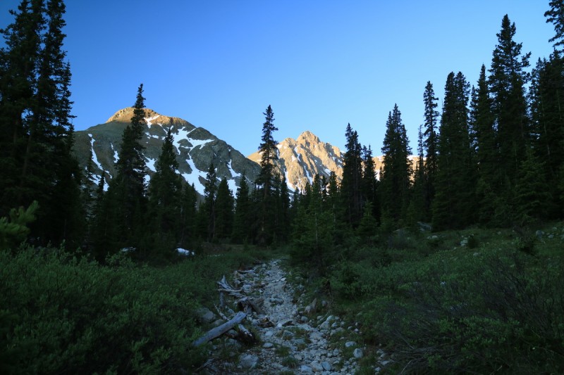 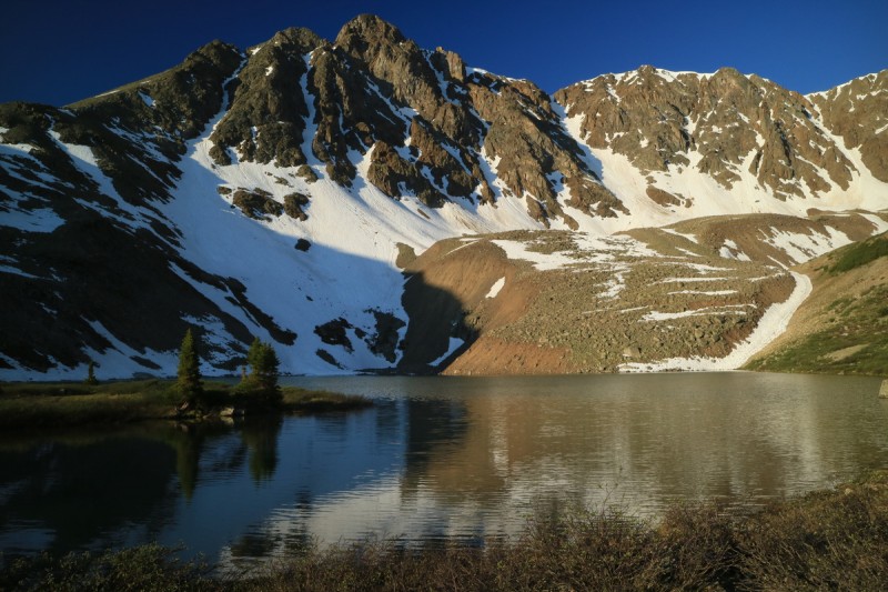 I made my way around the lake and up the icy firm suncupped snow to the base of the line. It looked dirty, rough and pitted with rock fall. It would be an interesting line to ski, depending on how long I gave it to warm up. With the shadows, the upper section of couloir was icy firm as I approached the corniced top. I wasn't sure how steep the top was, but I hoped there was an exit. The closer I got to it, the more mellow it became. It would still be an interesting entrance on skis, but doable. 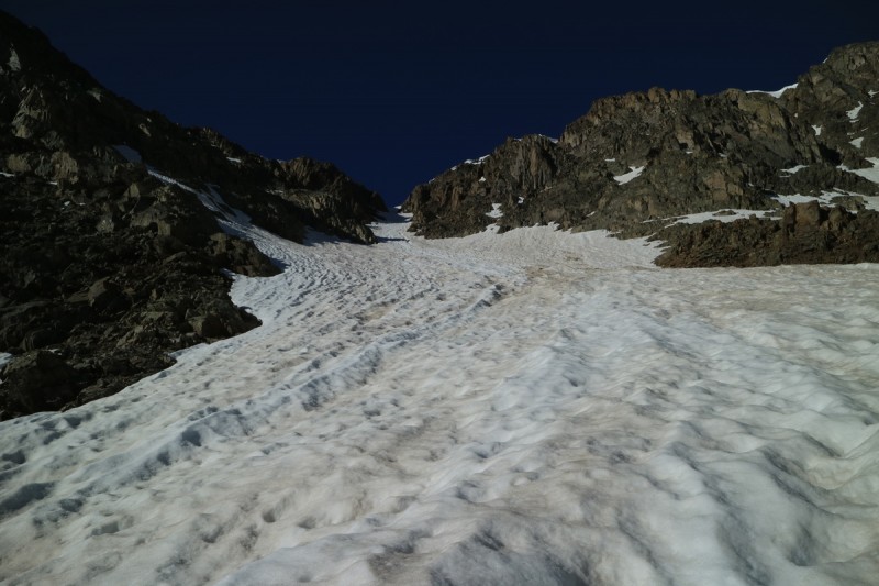 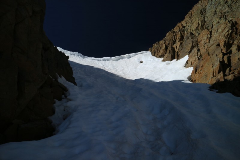 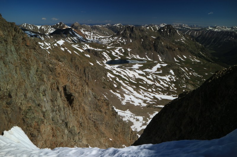 Once I peeked around the ridge, I saw the way was dry to the summit, as I expected. I doubt even in winter this wind blasted section of rock has much snow on it. Dropped gear and made my way up to the summit, where I could see some interesting Elks that were still skiable. Too bad I've already hiked them! 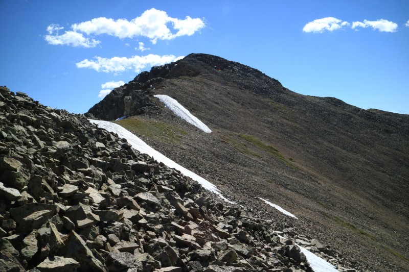 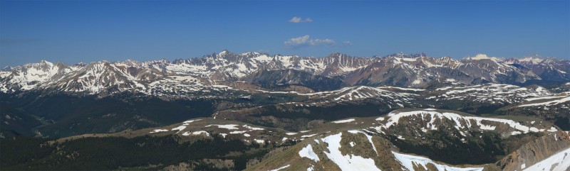 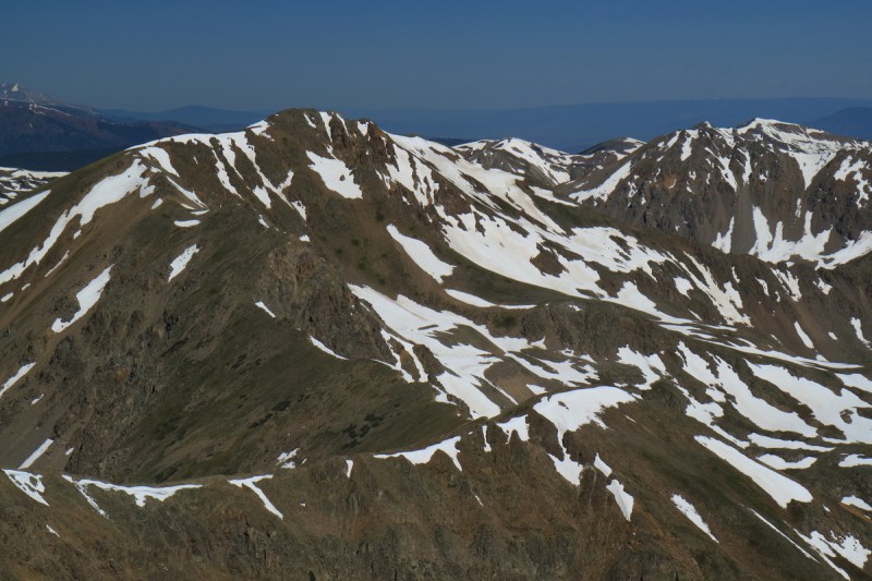 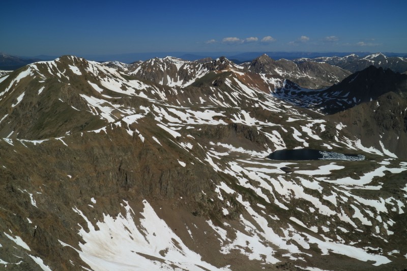 On the summit, I could see that Petroleum had a summit skiable line, so I decided to save it for tomorrow. I've been looking forward to an evening of reading and relaxing in a high valley camp, so take an easy weekend when you can! Back at the top of my line, I contemplated waiting for the snow to get warmer, but I also didn't like the amount of rockfall evidence I could see in the snow. Even on the way down I could see fresh pits in the couloir. So I eased my way into the couloir and jumped all over trying to find the best snow to ski on. I got a handful of good turns, but the whole couloir was like a compilation of many runnels, so I was happy when I was off the line. 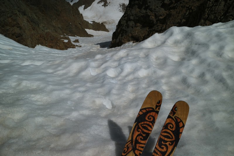 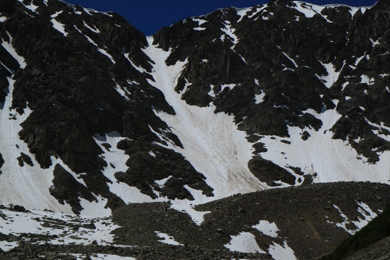 Back down at the lake, I took a leisurely lunch at the lake, soaking in the views. How strange to not be running back to the trailhead! I so rarely take time up in a spectacular place to really soak in the views. But this area certainly deserves the time spent! 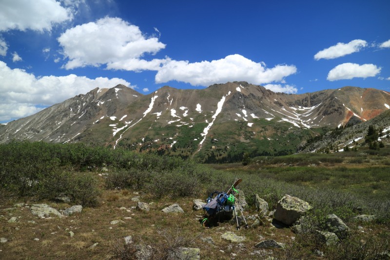 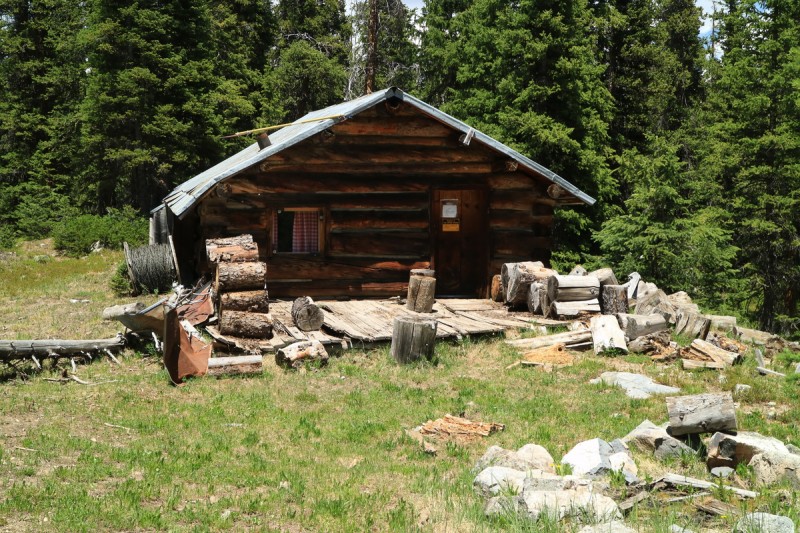 Back down at my truck, I settled into super leisure time with more food and a good book. About the time I was thinking of losing more layers for less tan lines, I heard the first hikers coming up the road. 20-30 minutes later another couple made their way up. A bit later in the afternoon, a jeep showed up with a young fisherman and his gal. Not bad, I get up "early" to ski a peak, and the only people I see are back at the trailhead. Next day I keep the same schedule, thinking the mellow east face of Petroleum could use enough warming to get the suncups skiable. I quickly reach Anderson Lake and turn up the slope trying to follow the advertised trail. Well the trail goes straight through the marshy wet bog. No thanks. So I contour a bit higher up the drainage on the slightly frozen ground to avoid the wet marsh. 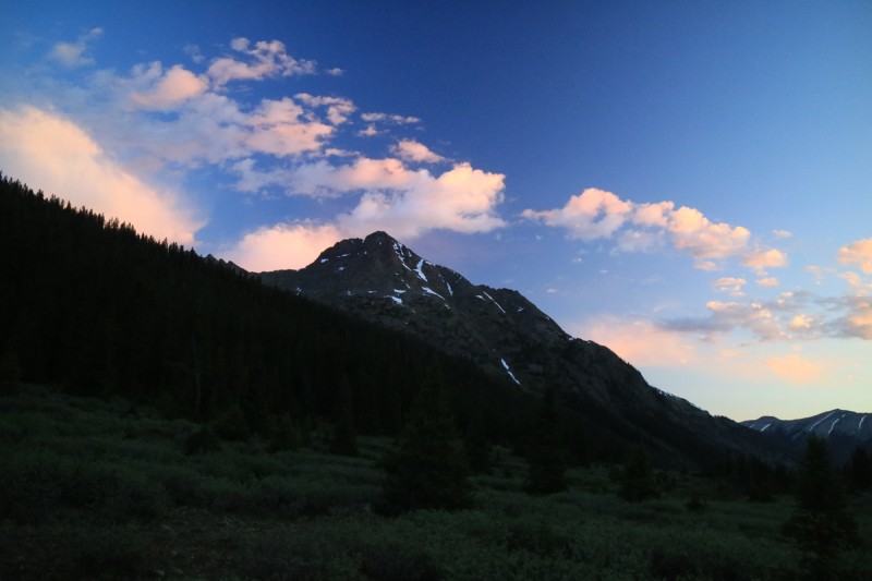 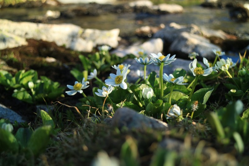 The view from Petroleum Lake is even better than the day before!  There are 2 game/human trails that contour up the benches beyond Petroleum Lake on the right. But once into the continuous snow, they disappear. From there I just follow the snow up multiple benches to the summit ridge. 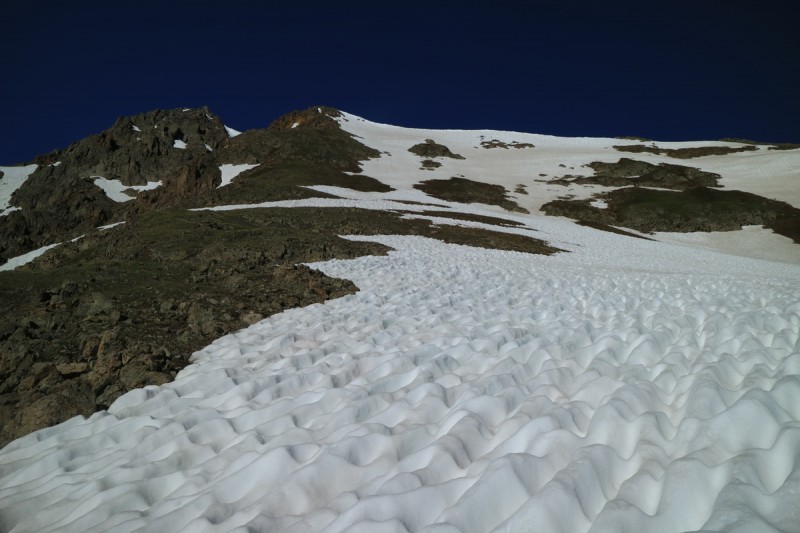 On the summit, I take the time to let the snow warm up. After yesterday's stiff ski, I wanted today to be better. So after a long time relaxing on the summit, I put the skis on for a just right snow descent!  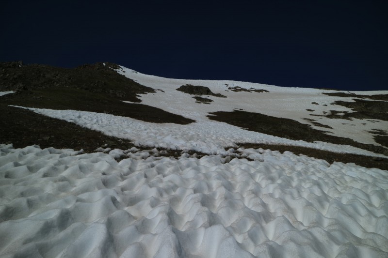 That is, until I enter the east face direct bowl, where the suncups are hard as a rock. The deep suncups are so hard, all I want to do is reach the end of the snow to take off my skis. Turning is almost impossible, as the suncups take up almost a third of my ski poles! 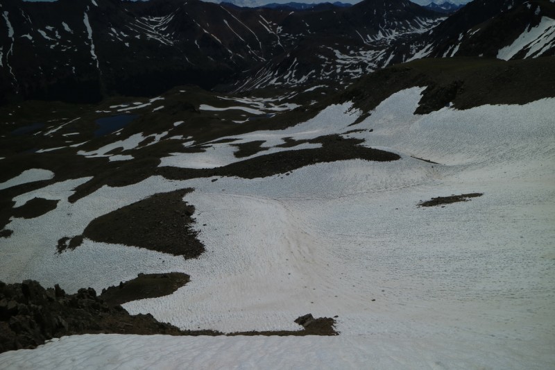 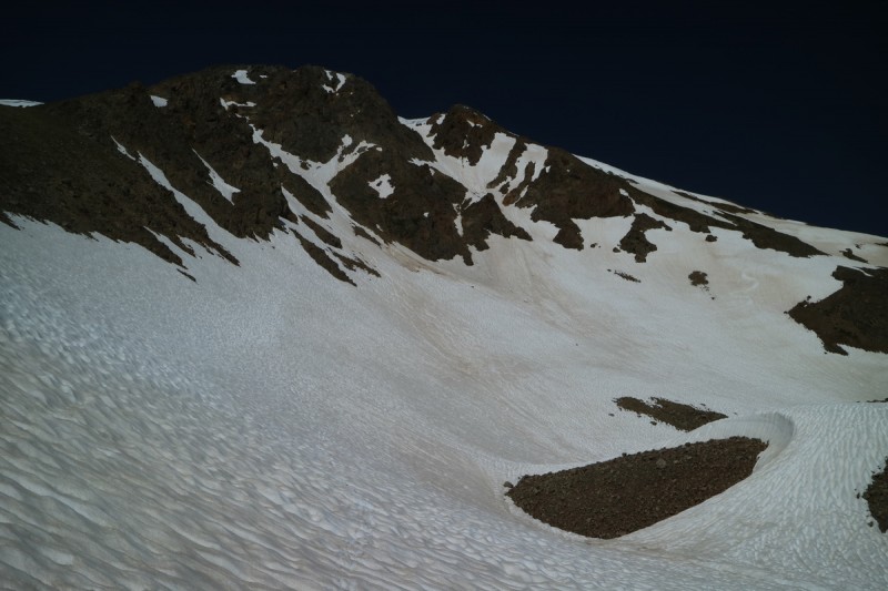 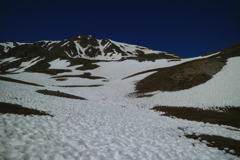 Back at the lake, I once again have a nice long leisurely lunch, and admire the views of the last peaks I'll ski this season. Some good, some bad, but at least I was out on skis! 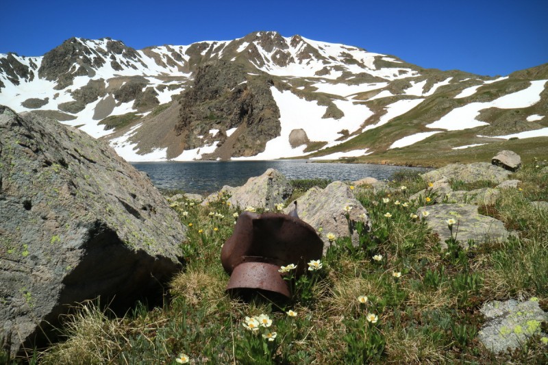 Instead of going down the way I came up, I decided to follow the old trail, that avoided the wet marsh. It no longer exists, but is tremendously more sustainable than crossing the marsh! A short bushwack and I was back on the trail.  Thumbnails for uploaded photos (click to open slideshow):  Spring in the mountains has prung")
 Suncuppy approach")
 NE face looking good!")
 The more famous Elk neighbors")
 About to drop in")
 Looking down the line and over to Taylor")
 My Turns")
 A look back from basin below")
 Star Peak from the traverse")
 Route up Taylor")
 Summit ridge of Taylor")
 Looking down from summit on east face")
 Star Peak from Taylor summit")
 Looking down my NE line")
 My Turns")
 East face of Taylor looks good")
 View of Star and Taylor from trailhead")
 Oklahoma sunrise")
 K49 and Deer")
 The OK- Massive saddle area")
 Oh thank goodness there's snow in the gully!!!")
 Champion, 13,736 and Deer")
 Looking down the flat summit line")
 Looking down the gully")
 My turns")
 Anderson in the sun along the trail")
 Anderson and Anderson Lake")
 Starting up the couloir")
 Top of couloir cornice area, pretty mellow, but still steep")
 View from top of line")
 Route to summit of Anderson")
 View to Petroleum")
 View of ski down Petroleum, to Petroleum Lake")
 About to drop the line")
 A look back on a junky steep line, pitted with rock fall")
 Grizzly and Garfield")
 A cabin along the trail")
 Sunrise over Truro, from camp")
 Flowers at a stream crossing")
 Pano from Petroleum Lake")
 A look up the east face of Petroleum")
 About to drop the east face")
 My turns")
 Hard suncups down valley")
 A look up the east couloirs of Petroleum")
 End of snow for me. Suncups still hard")
 Chilling at the lake")
 View of Anderson and Truro from Grizzly Reservoir")
 Summit Pano")
 Summit Pano")
|
| Comments or Questions | ||||||||||||
|---|---|---|---|---|---|---|---|---|---|---|---|---|
|
Caution: The information contained in this report may not be accurate and should not be the only resource used in preparation for your climb. Failure to have the necessary experience, physical conditioning, supplies or equipment can result in injury or death. 14ers.com and the author(s) of this report provide no warranties, either express or implied, that the information provided is accurate or reliable. By using the information provided, you agree to indemnify and hold harmless 14ers.com and the report author(s) with respect to any claims and demands against them, including any attorney fees and expenses. Please read the 14ers.com Safety and Disclaimer pages for more information.
Please respect private property: 14ers.com supports the rights of private landowners to determine how and by whom their land will be used. In Colorado, it is your responsibility to determine if land is private and to obtain the appropriate permission before entering the property.


