Download Agreement, Release, and Acknowledgement of Risk:
You (the person requesting this file download) fully understand mountain climbing ("Activity") involves risks and dangers of serious bodily injury, including permanent disability, paralysis, and death ("Risks") and you fully accept and assume all such risks and all responsibility for losses, costs, and damages you incur as a result of your participation in this Activity.
You acknowledge that information in the file you have chosen to download may not be accurate and may contain errors. You agree to assume all risks when using this information and agree to release and discharge 14ers.com, 14ers Inc. and the author(s) of such information (collectively, the "Released Parties").
You hereby discharge the Released Parties from all damages, actions, claims and liabilities of any nature, specifically including, but not limited to, damages, actions, claims and liabilities arising from or related to the negligence of the Released Parties. You further agree to indemnify, hold harmless and defend 14ers.com, 14ers Inc. and each of the other Released Parties from and against any loss, damage, liability and expense, including costs and attorney fees, incurred by 14ers.com, 14ers Inc. or any of the other Released Parties as a result of you using information provided on the 14ers.com or 14ers Inc. websites.
You have read this agreement, fully understand its terms and intend it to be a complete and unconditional release of all liability to the greatest extent allowed by law and agree that if any portion of this agreement is held to be invalid the balance, notwithstanding, shall continue in full force and effect.
By clicking "OK" you agree to these terms. If you DO NOT agree, click "Cancel"...
Starting Point: Graveline Gulch off CO-91: ~10,220'
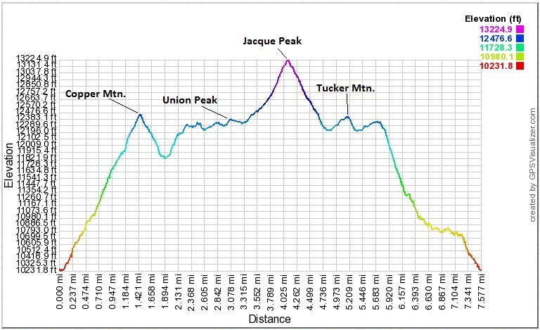
Peaks Climbed (in order of ascent): Copper Mountain (12,441'), Union Peak (12,313'), Jacque Peak (13,211'), Tucker Mountain (12,337'), Unnamed Peak (12,3XX')
Route: Southeast slopes ascent of Copper, ridge traverse to other peaks and descent via Copper Creek
RT Distance: ~7.6 miles
Elevation Gain/Loss: ~4,140 feet
Group: Solo
Lacking the services of a 4WD vehicle for the weekend, my choices of peaks to climb were rather limited. The 13ers phone app was helpful in isolating the peaks closest to a major highway. Jacque Peak won the vote and after researching trip reports, I decided to follow in the footsteps of piper14er by climbing Copper Mountain and a few other proximal 12,000-foot peaks.
Starting up the lower southeast slopes
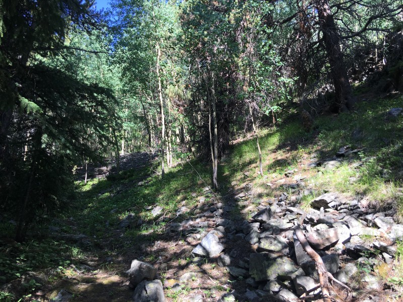
Climbing the southeast slopes of Copper Mountain was an excellent introduction to the generally steep nature of this hike. The ascent to Copper was direct, climbing some 2,200 vertical feet in a tad over 1.4 miles. Enough said.
Steep terrain through the trees
I stopped frequently to take in views of the Tenmile range behind me. Pacific Peak in particular was a fascinating sight as I got higher up the hillside.
Pacific reaches for the skies behind me
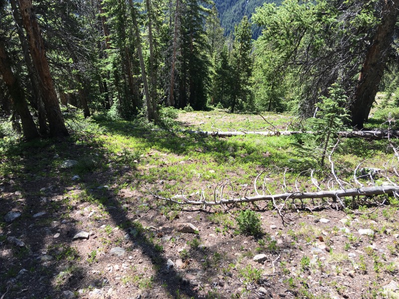
Bushwhacking was not necessary as there were sufficient breaks in the foliage to make passage easy.
No bushes were harmed during the making of this production
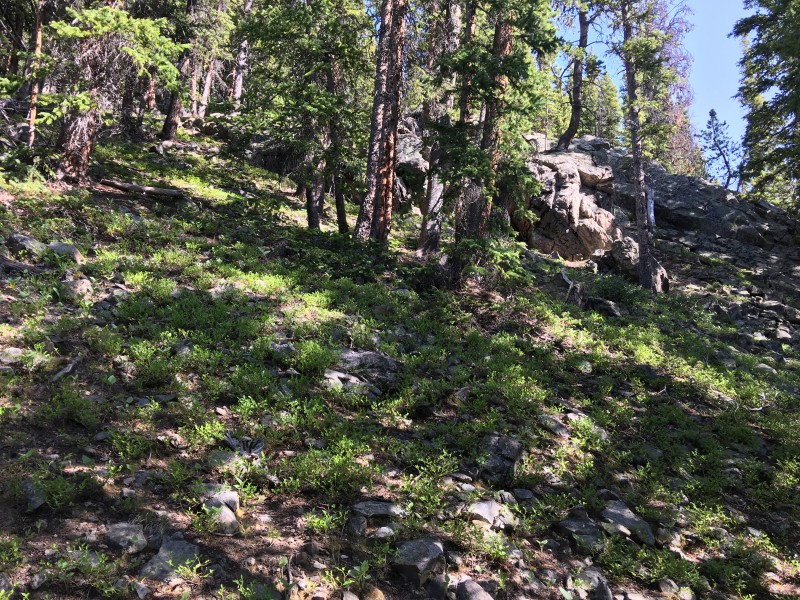
Approaching 11,000', I skirted around a prominent mound of scree and continued my ascent up through the rapidly thinning pine forest.
Scree mound
I mentioned steep, right?
Looking down the slope
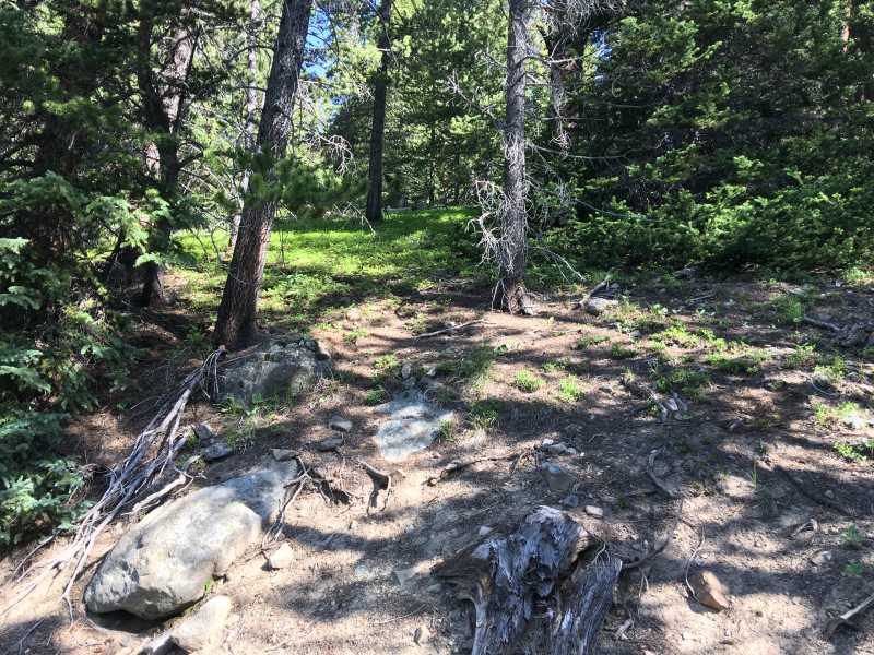
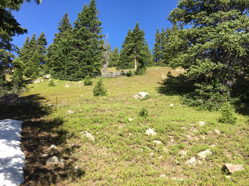
Treeline came at around 11,900', just under an hour after I'd abandoned the incessant roar of CO-91.
Approaching treeline
The last of the pines
I was making good time while still enjoying my first high country outing of the season, so I paused at this high station to take in the views.
The Tenmile Range
The astute reader may have already guessed that this report will have an inordinate number of views of the Tenmile range. What can I say, other than that I was simply mesmerized by those peaks!
More of the Tenmile peaks
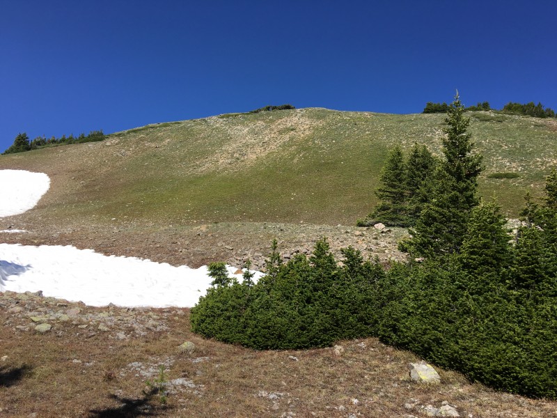
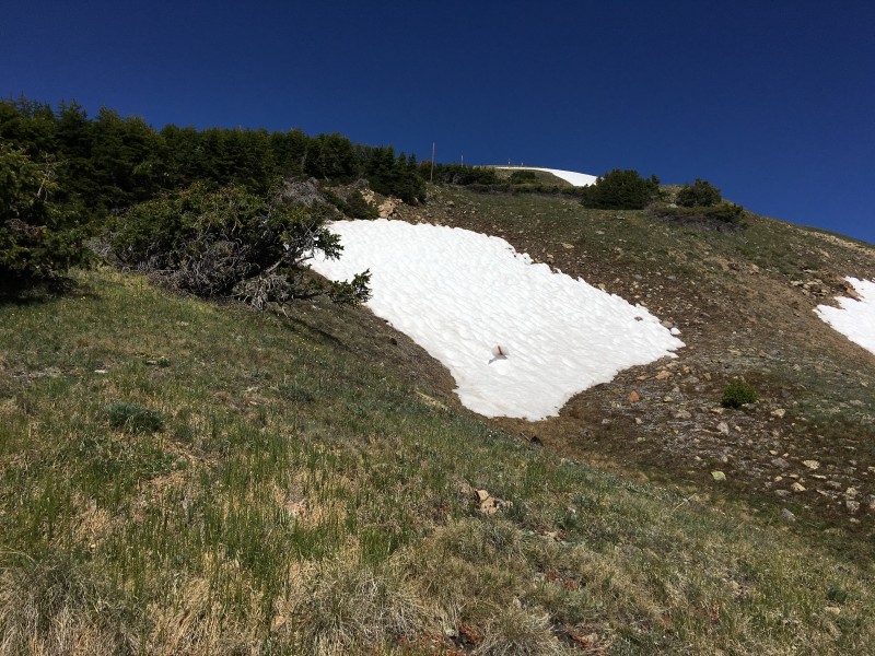
The striking views of the Tenmile peaks came as advertised, but the the relatively sparse snow cover on the slopes of Copper was a surprise, no doubt.
Not much snow on the slopes of Copper
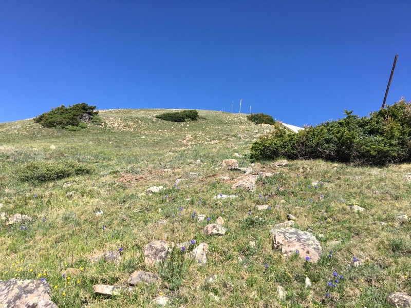
My winter backpack was replete with microspikes, gaiters, gloves, but I would have no need for any of them today. The final pitch up to the summit of Copper was on easy grassy terrain.
Final pitch to Copper
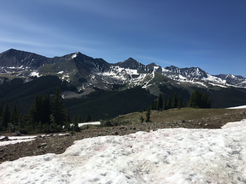
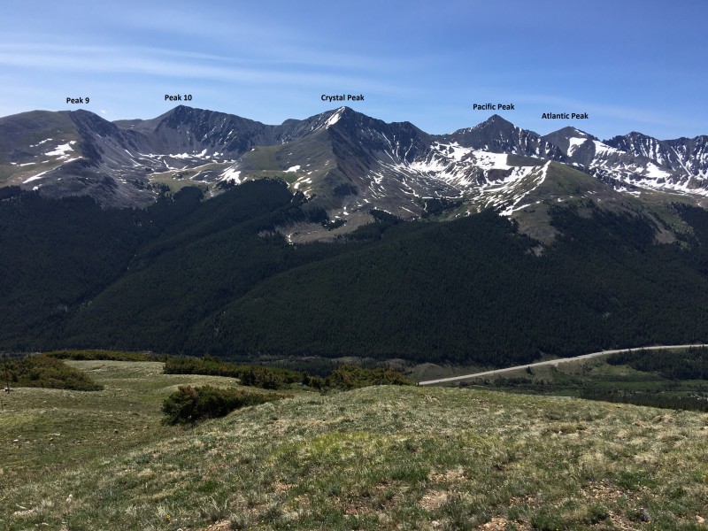
The summit was a good spot to take in more views of, you guessed it, the Tenmile Range! Peaks 9, 10, and Crystal had been part of a memorable outing from three year ago. Atlantic and Pacific was another adventure that I recalled fondly from this vantage.
Ahem - the Tenmile Range
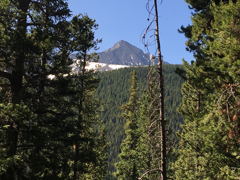
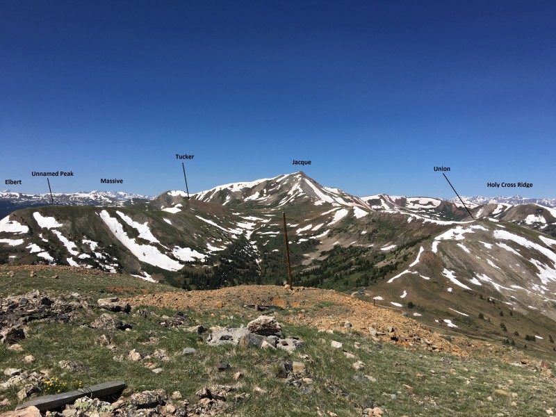
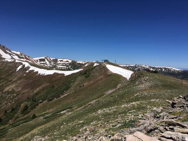
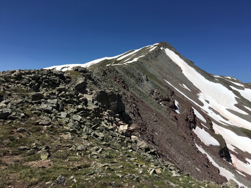
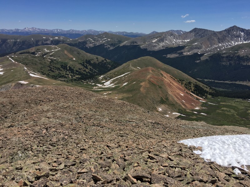
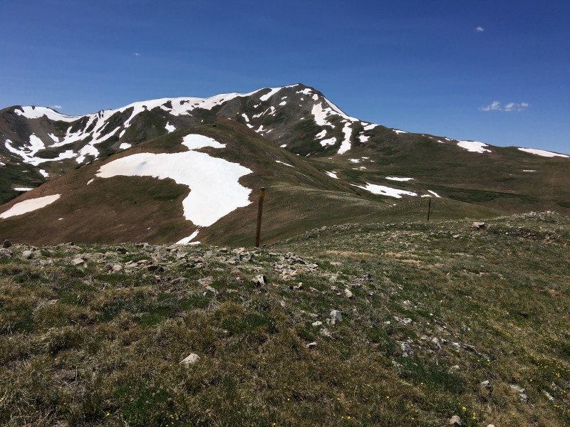
I then surveyed the ridge route to Jacque Peak: a steep 400 foot drop to the saddle followed by a climb up to Union Peak, and then a 900 foot ascent to the lone 13er of the day. Interesting shot this, as it shows the peaks remaining on the day's agenda, while being framed by the northernmost of the Sawatch peaks on the right, and Colorado's highest on the far left.
Jacque et amis
The descent from Copper was on similar grassy terrain, also mostly devoid of snow.
Dropping off the summit of Copper
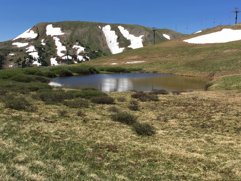
Lovely pond at the saddle
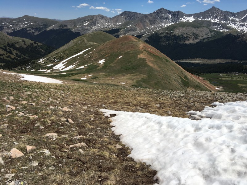
The last bit of the slope up to the top of Union Bowl was a bit rockier.
Ridge up to Union is a mix of grass and talus
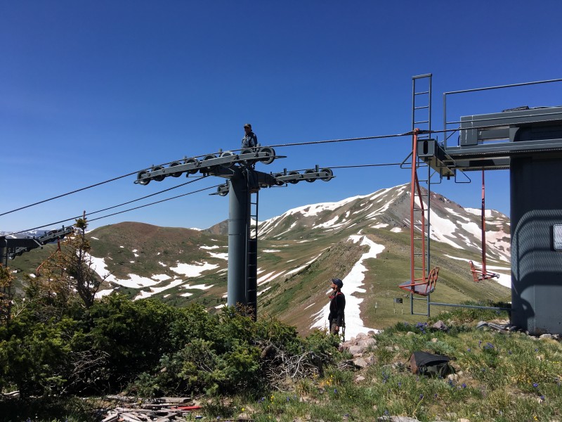
The westernmost of the ridge bumps is the highest point and as I approached it, I heard voices.
I wasn't alone
They were coming from the ski lift going to the top of "Mountain Chief". Could it be that there were other hikers besides me on this mountain? Perhaps, they were intending to climb Quandary and were lost, I thought to myself as I approached them.
Workers on Union, not Union workers, I hope!
I chatted with them for a bit and as it transpired, they were working on the lift. Phew, what a relief! I was beginning to fear that low 13ers were no longer the best kept secret in the hiking community.
Levity aside, this duo would spend the next two weeks on this mountain replacing the communication lines on the lifts. Indeed, we should all be grateful that someone was doing that job. I thanked them and set my sights on the highest peak of the day.
Long saddle to Jacque
As I made my way across the long saddle, I mentally mapped my route up its ridge, plotting the best path to avoid the scattered banks of snow. After bisecting a couple of snow fields, I found myself angling to the right of the ridge crest on rocky terrain.
Staying right of the crest
Terrain that wasn't any different from what I'd encountered on numerous high ridges; large boulders, some not so stable. But something was wrong, as my progress had slowed to a crawl. My breathing was labored and each step came at a price, which was odd considering how easily I'd dispatched the route so far.
Par for the course
Then it hit me. I hadn't refueled since the proverbial breaking of the fast some six hours ago. Maybe it was the excitement of the first hike of the season, or the joy of exploring the Gore range for the first time; whatever the reason for my forgetfulness, I was now literally running on fumes! I hastily dug into my backpack to fortify myself with a much needed snack.
Looking down Jacque's ridge
The final pitch was still a struggle, and when I reached the summit, I dropped everything including my derriere on to the summit block. Exhausted, I closed my eyes for what seemed like an eternity. Then I opened them to the glory of the Rockies.
The namesake snow feature on Mount of the Holy Cross was still intact.
Mount of the Holy Cross
Farther south in the Sawatch, Mt. Massive was still carrying a fair amount of snow on its northern bowl; also featured in this shot are two shapely Centennials - French and Casco, with Mt. Elbert and South Elbert to the far left.
Sawatch Afar
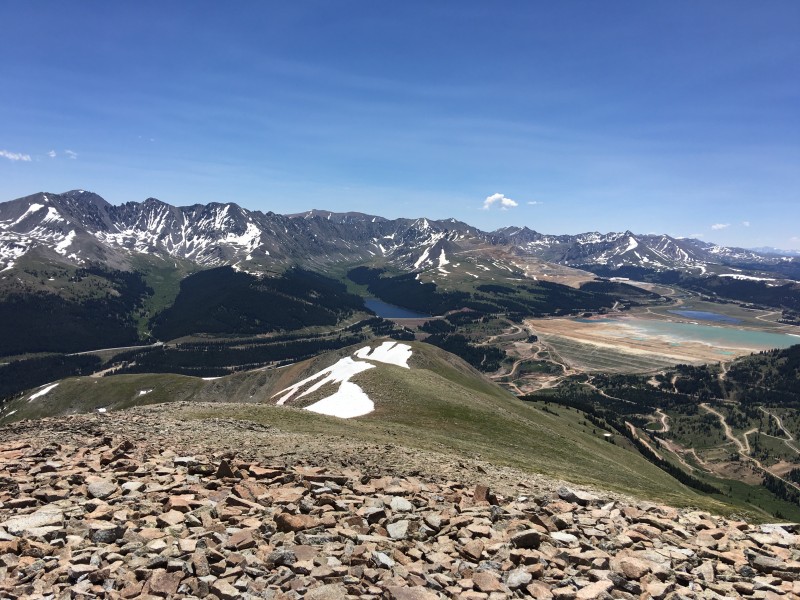
Closer to me, Clinton reservoir looked tranquil, nestled by the merging of peaks from two ranges: Tenmile and Mosquito.
Clinton Reservoir flanked by two ranges
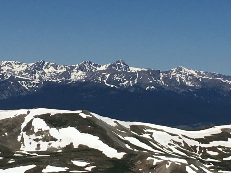
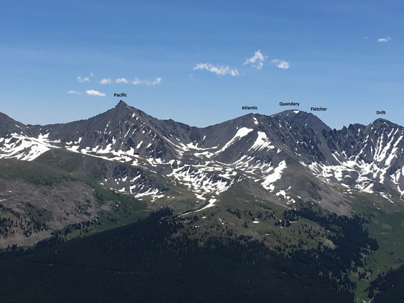
In the next picture, Quandary towers above the rugged, saw-toothed ridge connecting Drift, Fletcher and Atlantic. But none inspire awe quite like Pacific.
I think the real monarch of Tenmile is obvious
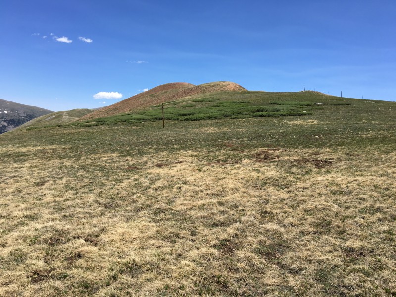
Then I surveyed my return route over Tucker Mountain and another unnamed mound along the ridge that too needed to be climbed.
Two more peaks to go
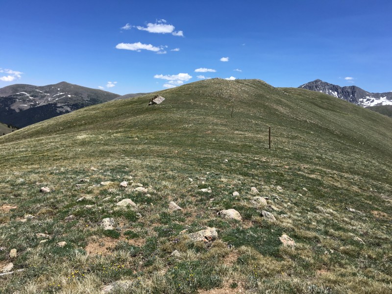
I retraced my path down Jacque's north ridge to the saddle and aimed straight for the ridge leading to Tucker.
Aiming for Tucker
The terrain was grassy and the pitch gentle, which was perfectly fine by me as I jogged up to Tucker and then down to the saddle with its easterly neighbor.
Jogging up gentle tundra to Tucker's summit
This one has no name but still needs loving
And then there were no more bumps to climb. I looked back at Jacque and Union and took stock of the day's work.
Looking back at Jacque and Tucker
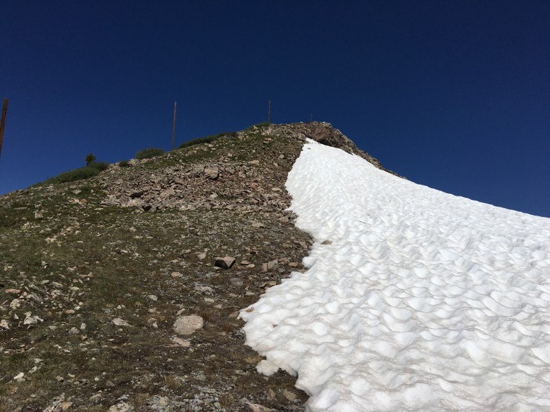
I was still some 2,100 vertical feet above my starting point, and the first part of the descent was on steep terrain.
Steep drop
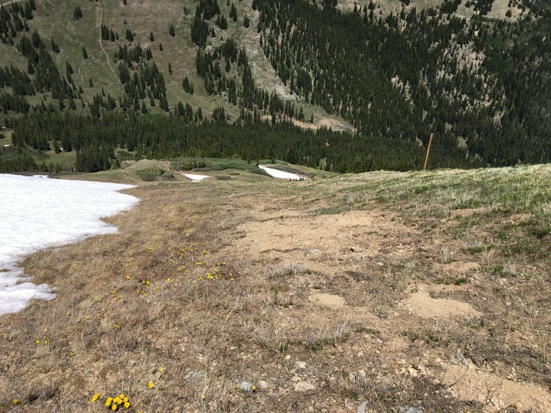
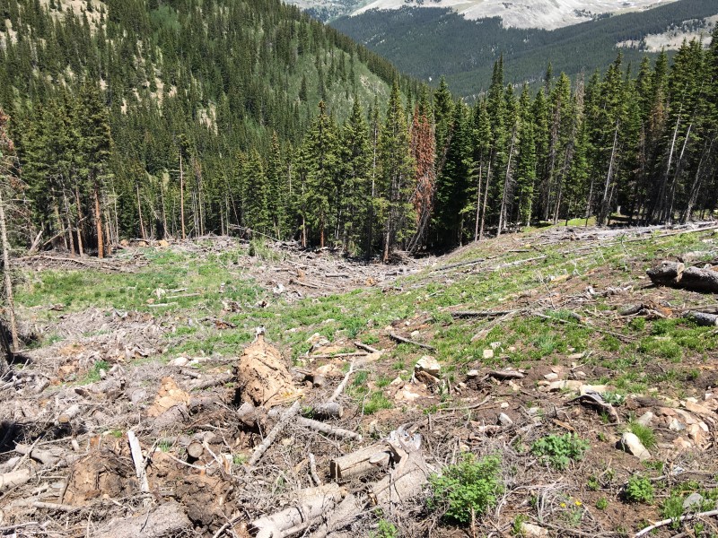
Approaching treeline, I sidehilled and dropped into the gully, managing to avoid the deadfall (mostly).
Into the gully we go
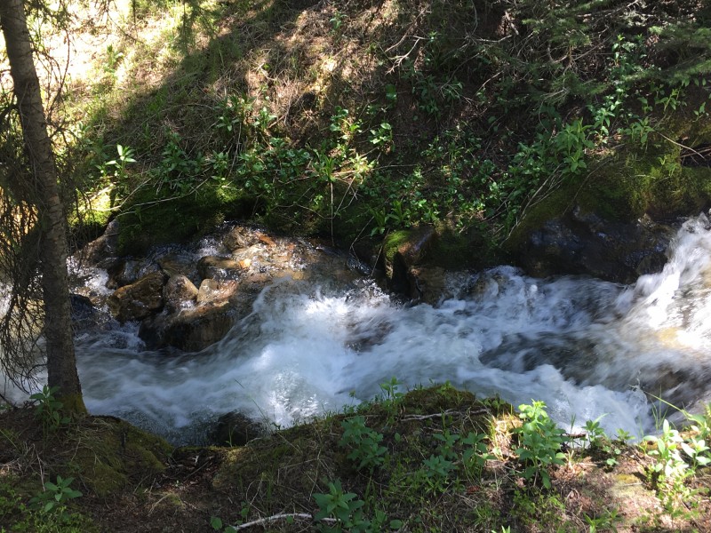
The inevitable crossing of Copper creek came, followed by another steep drop back to the road.
Crossing Copper Creek
Plummeting down the final pitch
And so, yet another season gets underway. Where it will take me and what adventures it will bring, only time will tell.
Elevation Profile
My GPS Tracks on Google Maps (made from a .GPX file upload):
It's been too long since I've seen a Raj report. Another nice one, for sure. And, I guess I know what I'm doing this coming weekend - hope you left breadcrumbs...
This is a lot of great info. I'll definitely have to add this route to my todo list.
Caution: The information contained in this report may not be accurate and should not be the only resource used in preparation for your climb. Failure to have the necessary experience, physical conditioning, supplies or equipment can result in injury or death. 14ers.com and the author(s) of this report provide no warranties, either express or implied, that the information provided is accurate or reliable. By using the information provided, you agree to indemnify and hold harmless 14ers.com and the report author(s) with respect to any claims and demands against them, including any attorney fees and expenses. Please read the 14ers.com Safety and Disclaimer pages for more information.
Please respect private property: 14ers.com supports the rights of private landowners to determine how and by whom their land will be used. In Colorado, it is your responsibility to determine if land is private and to obtain the appropriate permission before entering the property.


 Starting up the lower southeast slopes")
 Steep terrain through the trees")
 Pacific reaches for the skies behind me")
 No bushes were harmed during the making of this production")
 Scree mound")
 I mentioned steep, right?")
 Looking down the slope")
 Approaching treeline")
 The last of the pines")
 The Tenmile Range")
 More of the Tenmile peaks")
 Not much snow on the slopes of Copper")
 Final pitch to Copper")
 Ahem - the Tenmile Range")
 Jacque et amis")
 Dropping off the summit of Copper")
 Lovely pond at the saddle")
 Ridge up to Union is a mix of grass and talus")
 I wasn't alone")
 Workers on Union, not Union workers, I hope!")
 Long saddle to Jacque")
 Staying right of the crest")
 Par for the course")
 Looking down Jacque's ridge")
 Mount of the Holy Cross")
 Sawatch Afar")
 Clinton Reservoir flanked by two ranges")
 I think the real monarch of Tenmile is obvious")
 Two more peaks to go")
 Aiming for Tucker")
 Jogging up gentle tundra to Tucker's summit")
 This one has no name but still needs loving")
 Looking back at Jacque and Tucker")
 Steep drop")
 Into the gully we go")
 Crossing Copper Creek")
 Plummeting down the final pitch")
 Elevation Profile")


