| Report Type | Full |
| Peak(s) |
Mt. Eolus - 14,087 feet Sunlight Peak - 14,061 feet Windom Peak - 14,089 feet Jupiter Mountain - 13,838 feet Mt. Kennedy - 13,136 feet |
| Date Posted | 05/22/2017 |
| Modified | 05/23/2017 |
| Date Climbed | 05/14/2017 |
| Author | bergsteigen |
| Additional Members | joelmpaula |
| Putting Chicago Basin under seige |
|---|
Chicago Basin: Eolus, Jupiter, Sunlight, Windom, KennedyPartner: Joel Overall mileage: 35.69 Overall Elevation Gain: 25,481' Starting Pack Weight: 62.3 lbs Buckle up and grab a tall drink (if it's evening), or a large coffee (if you are at work) - this will be a long one! Joel and I have been talking Chicago Basin for about 3 years now. Planning it, cancelling due to weather, postponing due to weather - year after year. 6 years ago, Joel first went into this basin to ski. He got Eolus (and north) in powder, but then spent the next 4 days stuck in the tent during a long snowstorm event. I was last up here 7 years ago, and spent most of my time in the tent in the evening as it rained. Neither of us saw much surroundings due to the clouds and the rain/falling snow. So neither of us wanted a repeat of that! We wanted a weather window to beat all weather windows. Last trip I took barely over 100 photos for 4 days. This time: 600 for 5. If I'm not taking photos, I'm not happy. It's why I let Kieth write the previous TR, I had nothing good to say about this Basin. Now I do. Still painful, hard and exhausting - but at least I got the views this time! Of course, Joel being the dreamer, planned an epic traverse from Chicago to Ruby basin ala Davenport and the Mahons. Our friend Nate would bring the rope and be our 'professional guide', since he's already skied the basin before, and wanted the Centennial Peaks Plan 1: Day 2 - All 14ers Day 3 - Jupiter - traverse Day 4 - Jagged Day 5 - Pigeon and Turret I scoffed at Day 2.... Let alone the 'casual' inclusion of Jagged. Plan 2: Day 2 - Eolus, N Eolus and Windom Day 3 - Sunlight and Jupiter Day 4 - Traverse to Ruby Day 5 - Pigeon and Turret Oh, and Vermillion on Day 7. Though without Jagged, Nate was no longer interested and bowed out, just days before drive to Durango day. So much for our ideal team of 3... Both Joel and I refreshed weather forecasts almost hourly since the start of May (actually late April). We had wanted to go in on Train #1 on May 6, but the weather looked bad for the stretch of time we needed/wanted. We might get a day to ski them all, but that would be about it. So we waited and watched. Soon we found our window, Sat May 13 to hopefully Wed May 17. So we decided to pack in on the iffy day: May 12. No need for perfect weather if we are just hiking in! Turns out it was the first bluebird day after a week of snow. Note on some photos: There will be some filter effects on a bunch of photos. I put a UV filter on my wide angle for the first time (to help protect the lens), along with a polarizer. And as it happens - it creates a bit of a circle effect on the corners. So instead of cropping out content, I posted the un-cropped versions. Lesson learned Day 1: Pack inTrailhead: Needleton Mileage: 6.6 Elevation Gain: 2,518' Joel and I met at a NF dispersed campsite area to the east of Durango the night before. We had called and gotten our train tickets, so all we had to do was show up and get the paper tickets and drop my car off. We'd jump on the train at Rockwood, but due to scheduling, we would have to take the train into Durango. So at least we'd only have to pay for 7 days of parking for one car ($8/day). Now we could have a nice breakfast in town and go to Rockwood and slowly pack up, instead of being on the train for an hour and a half! We slowly packed up and waited for the train with another couple from NM who also didn't see the appeal of the first part of the train ride. I decided to not only put the skis into a double ski bag to protect them, but also my backpack and boots. With all my crap strapped to the outside, I didn't want to get off the train (or get to camp) and realize that my bivy or sleeping bag had been accidentally ripped off in the loading and unloading process. Overall, I'm quite pleased with the backpack in a bag plan. Much easier. Soon after getting on the train, the cool scenery happened and we both stuck our heads out the window to capture it.  Rockwood train station  Rockwood details  Our super heavy crap ready to be loaded 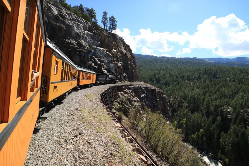 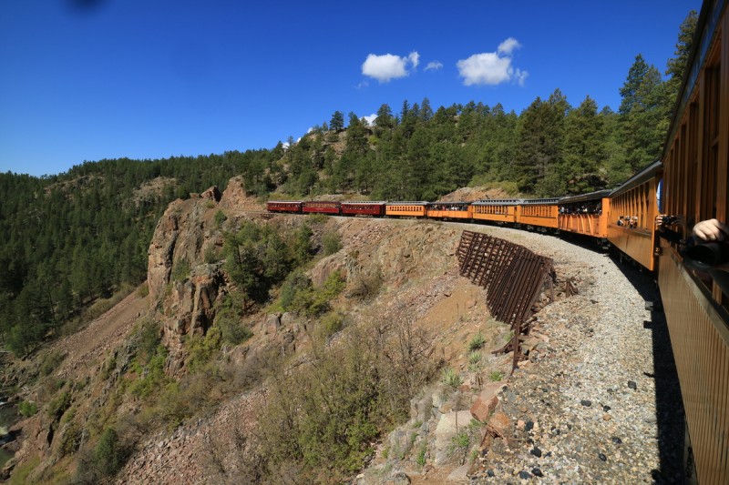 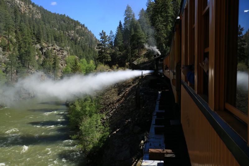  Welp, we've gone and done it now. The train is leaving us Once off the train, and waving to all the tourists, it was time to pack and stash gear. We both helped each other on with the packs for the first time. I needed help every time I took my pack off. It was just too heavy, bulky and awkward. My pack weighed 50 lbs without skis and boots attached. With everything on my back - a whopping 62.3 pounds!!! Or 54% of my body weight. Ugggg my shoulders and back will hurt! The first flat miles went fast, then came the start of the uphill. After the NY creek crossing, it was the steady steep uphill I had forgotten about. Around 9.7K was the first snow across the trail. 10K marked significant snow, and at 10.3K was when we were stupid enough to transition to skinning. Joel mentioned skinning too early last trip too, and then encountering numerous dry spots. The skinning only accomplished one thing: getting our skins soppy wet! No bueno!  Starting down the trail  We hiked for a really long time around snow  Then we started skinning, stupidly  Still skinning, Jupiter's SW face behind We had thought to camp higher up in the basin, but with the fading light, and the long day tomorrow, we decided that setting up camp lower would be the best option. At least this way we could get some drying of our gear and dinner in our bellies before the sun left us on Day 1. 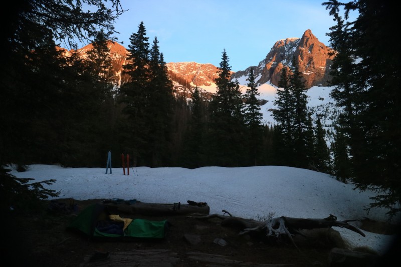 Day 2: Mt Eolus, Jupiter MtnMileage: 10 Elevation Gain: 4,899' Route: East Couloir and Europa Couloir After too short of a restful sleep, we were up at 3am and back to skinning up the drainage. Mistake #2 skinning in the lower basin, again. We wasted so much time trying to find continuous snow, that it became almost comical. Note to self: boot for the first 0.4 miles up the basin, then it's continuos snow. Or at least mostly continuous. We followed this rule the next 3 trips up and down. We were greeted by a bunch of horny grouse that puffed up their feathers as they strutted past us. Light was a bit low for good photos, but they are on my webpage. At the trail split, the route to the basin goes up a series of steep benches. We started skinning, but soon we transitioned to booting until after the trees. Of course after 0.25mi of skinning, we were back to booting, as the bench up to Eolus is also a bit too steep to skin. Day 1 is going slowly due to all the lovely learning curves of being the beta for the basin this year... The sun hits us as we get into the basin and approach the couloir. We skin up until the extent of the rollerballs, and transition to boot up. The snow is a bit soft, but we have just enough time to ski it before sloppy time (using past experience). Joel and I take turns booting up. At the top, we had to descend a bit before traversing over to the summit. No simple and easy ski off the summit this year, it would seem. Nor would it be Joel's knee deep powder experience either.  Out of the trees, looking at route up Eolus 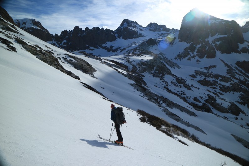  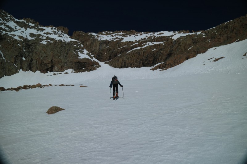 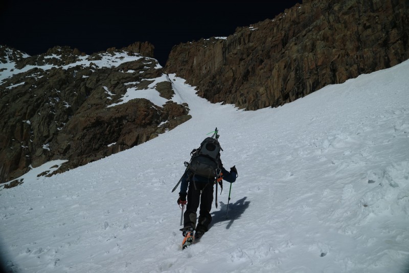  Cool view of the catwalk  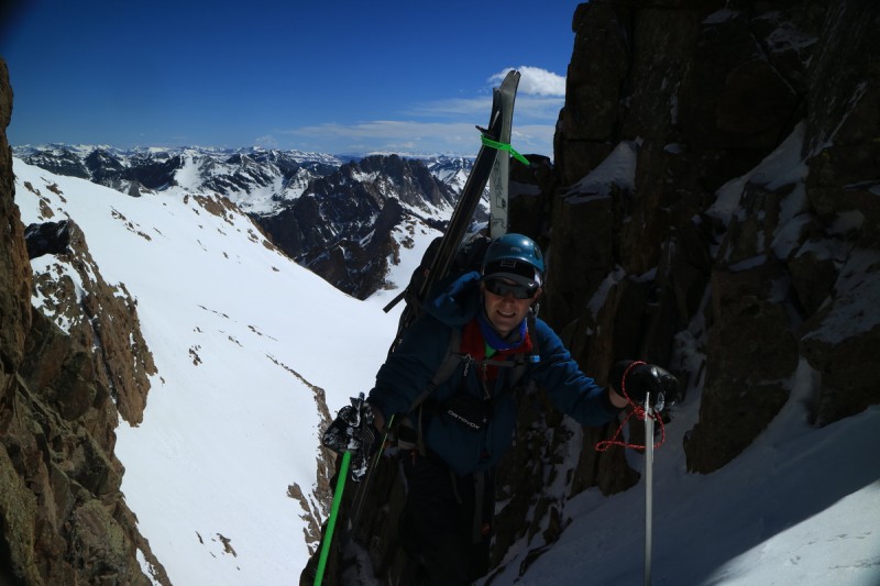  We quickly transition and take a bunch of photos, knowing how the sun is warming up the snow. After the annoying "14er skiing" off the summit, that reminded me of my first ski of Bierstadt for the first 5-10', we were on icy firm snow. A couple jump turns down the west face, and then it was traverse and drop, traverse and drop back over to where we needed to reclimb back up the west face. 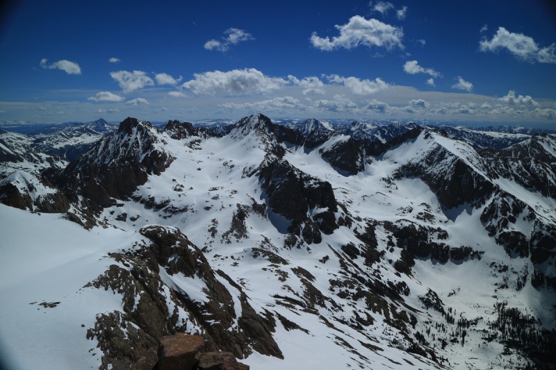  Summit pano  Pigeon, Turret and Peak 15  Animas, Monitor and Peak 12  Arrow and Vestal   Oh the summit walk/ski   Booting back up the west face The ski down the couloir was pretty good. The fresh snow made for semi sloppy conditions, but we made quick work of the couloir, and were soon below it.  Joel skiing down couloir  Jump  Another view of N Eolus and the catwalk with Joel below  Our tracks Below Eolus, we decide that we have to change the over all plan for the trip. It was obvious that N Eolus was out, and not really worth skiing. Especially as it's UNRANKED. We could climb up to the ridge, and scramble to the summit, but it seemed like a waste of precious time. Next on the plan was Windom, but going up into the upper basin 3 times over the next 3 days was just silly. So we changed from Windom to Jupiter. So how to get to Jupiter? We could ski down to the lower basin and climb back up. Or we can do a high traverse. The snow in the basin is actually firmer and still great, so the traverse won't be too bad. It didn't look too steep, from a distance... Up close, totally different. We were able to skin part of it, if too slowly, for much of it. Soon as I hit a slope approaching 40 deg, I was done with breaking trail skinning, and went to crampons. Much, much faster. How much time have we wasted today in the wrong mode of transport? Once through the cliff traverse, it was back to skinning, until we got to the base of the Europa couloir. Then back to crampons for some easy booting up the slope. 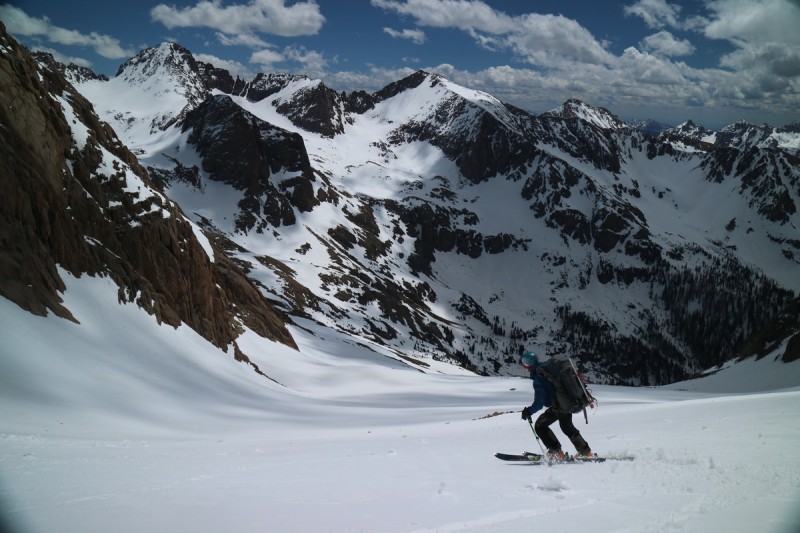  Peak 11 - could be skied, maybe  Starting the high traverse to Jupiter, with Eolus behind 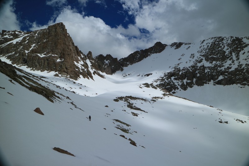 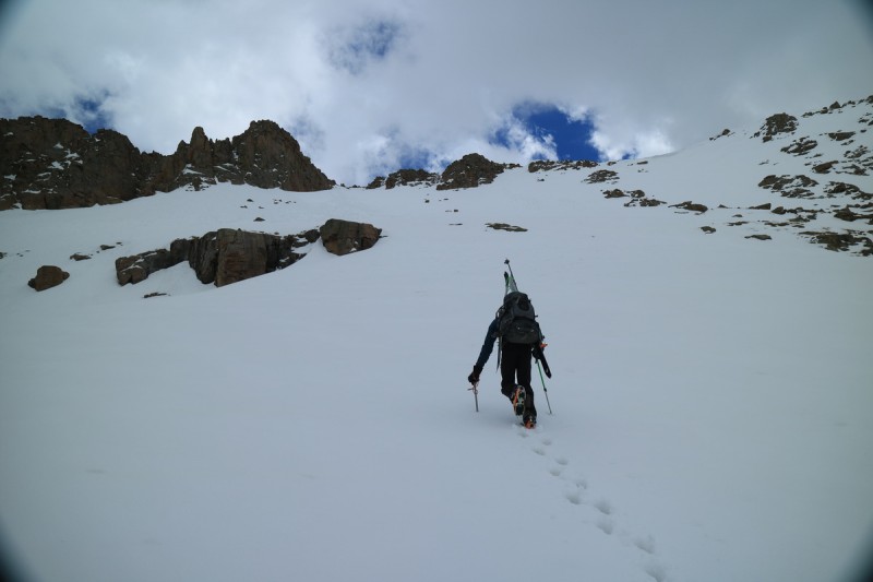 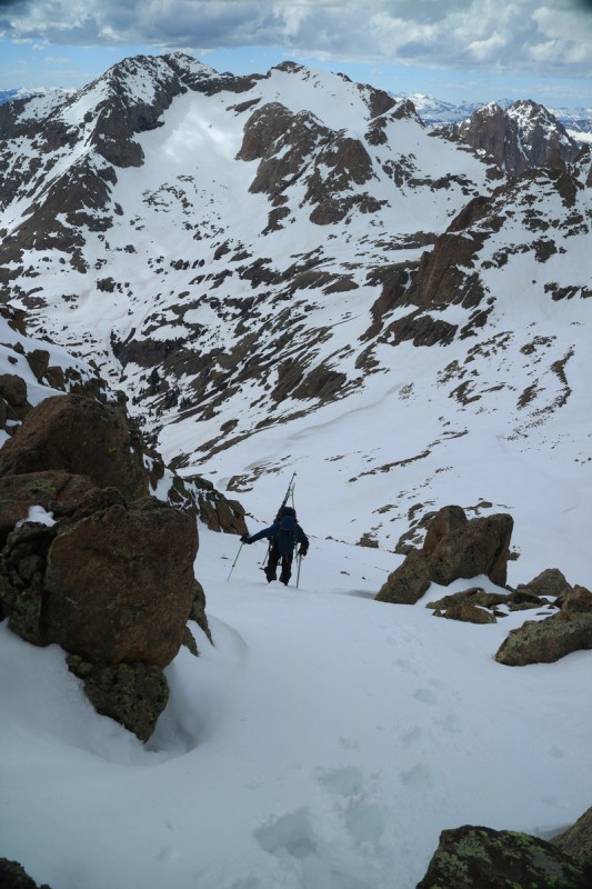 I get to the top of the couloir and peek around the corner. I see what I hope is not the summit, and wait for Joel. We boot around and go for the "summit" just to the left of the impossible not summit block. But then after transitioning to ski down, Joel now thinks the summit just above our tracks is the true summit. So we stomped up there in ski mode, and it turns out it was the real summit. Fun! At least we took the extra few minutes to check it out, even if it is now late afternoon! The next decision was to ski the north face, Europa couloir, or to climb over to the SW face which is being hammered by a very strong wind. The Io couloir was out at the very top, or at least too spicy for skis. The top looked dry on the SW route. So we opted to go down what we climbed.  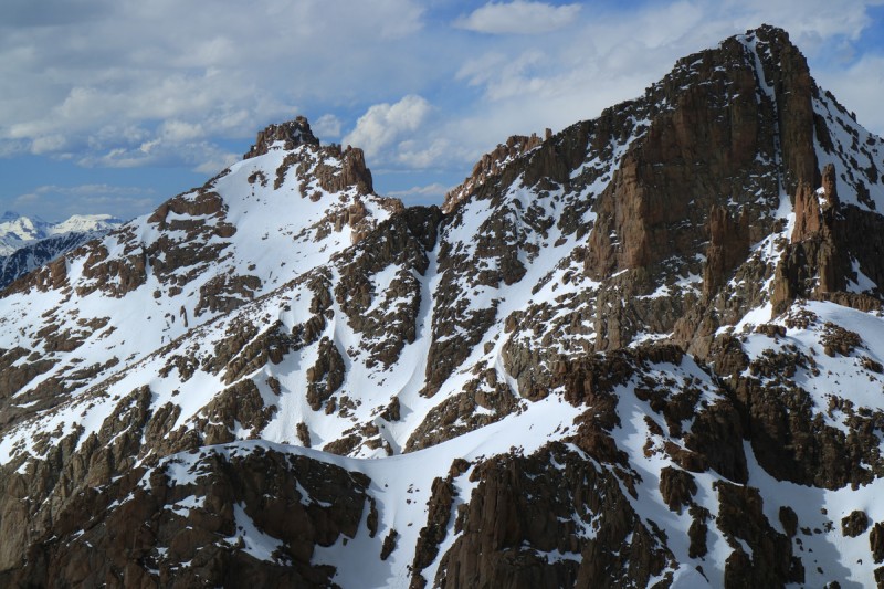  Summit pano south  Summit pano north  Our tracks in the sun I drop first down the top, through the rocks carefully. Lower down, it was fun to open it up a bit. Some great snow for late in the day! Also some great views while skiing! Then we just have to find our way down through the cliffs to the basin below. We found all the choice lines and left all the bad ones, thankfully. Quite a bit of luck today with perfect corn all day, and the routes all went continuously. 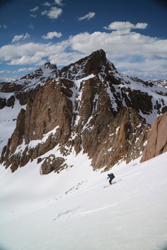   Our tracks off Jupiter We had originally thought to move camp higher up into the basin this evening, to make the next 2 days easier, but with the late return, eating and resting took precedence. Even at that, I still went to sleep an hour after sunset, since I like to make sure I have everything ready for the next day, and can prep from my bivy. Day 3: Sunlight and WindomMileage: 9.7 Elevation Gain: 4,030' Route: South Face and North Face (not Widowmaker) With all the knowledge gained yesterday, we wasted no time with skinning out of camp, or trying to skin up the steep headwall. Booting is frequently faster! It may be frowned upon by some skiers, but I go with what is most efficient! We quickly skinned up into the upper basin, via a route I had spied the day before, and looked at the snowy south face of Sunlight. We skinned up a bit too high up the slope, and had a tricky transition to crampons. Soon after taking over the lead on the way up, I took off with unmatched speed. Nice firm snow and I practically ran up the slope! Joel unfortunately didn't have it so easy. He seemed to punch through in places, and then had icy firm in others. So it took a while for him to get to the base of the scrambling section for the day.  Joel skiing with the moonset behind Aztec 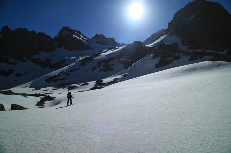 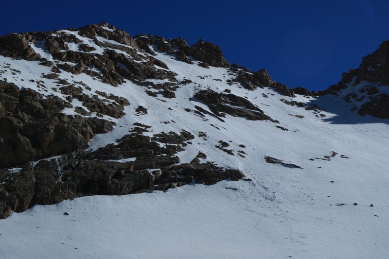 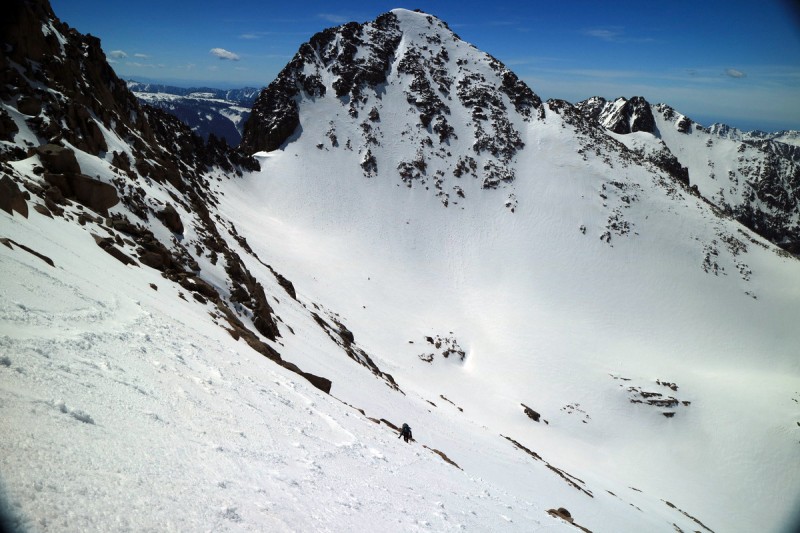 With the extra time, I decided to check out the Sunlight ramp off the summit, just to confirm that it really was out. Yup, all melted. So many rocks, so little snow. In fact, so many of the Weminuche peaks looked horribly dry. How could that be with all the snow the San Juans got, and its an average snow year too?! 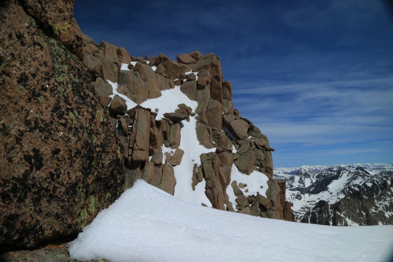  Joel booting up, with Eolus behind  Joel's glamor shot  Windom's north face I got back to the fun scramble section as Joel made it up. From there it was a bit interesting, as I was going to take my skis to the summit and "see". Joel dropped his skis, saw me going up with skis, picked them up, then saw the tunnel, turned around and dropped his skis, and came back. Meanwhile I was standing at the top of the tunnel waiting, wondering what was taking him so long. Joel is almost always faster than me on the way up! Today was quite strange. As soon as Joel got up and saw the exposure and the soft snow, he called it for himself. We had packed and carried my short alpine rope, harness and I brought my rock shoes for the summit block. Scaredy skiers, I know. Haven't really rock climbed since 2013 (that needs to change) But it's better to be safe. As it was, the wind was a bit too high to scramble the summit block anyway, so I only got to the base of blocks myself before calling it for safety. Don't need to be blown off the summit!  Up through the hole 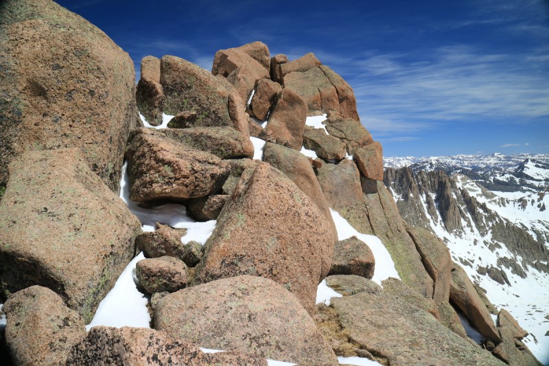  Joel in the hole  View from summit  Summit pano I spun around taking photos, as quickly as I could, but even then, Joel was yelling at me to hurry up. So I quickly finished up and retreated back down to the tunnel. It seemed almost pointless to skin this part, especially with Joel pressuring me to get down. Haste makes waste, as my grandmother said. Or, as I've learned: Hurry up and break your leg! This will be a 14er ski that I don't feel comfortable with. But based on the Dawson rules of average snow year and blocky summits, I'm counting it for now. But like Mt Wilson, which traditionally doesn't have summit snow either, what can we do? Repeat until it's right, I guess. Once below the summit rocks, the ski down is pretty uneventful. Not quite corn, despite being almost noon, and a lot of traversing. Not the greatest ski, overall. Not every 14er skis well, that's for sure! At least the snow had warmed enough to get some decent turns at least. The previous 3 skiers from weekend #1 did tear up the slope, so that was also a detractor from an enjoyable ski. 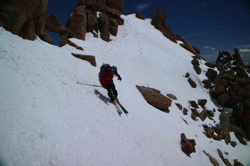   Joel skiing with Sunlight Spire and Windom behind 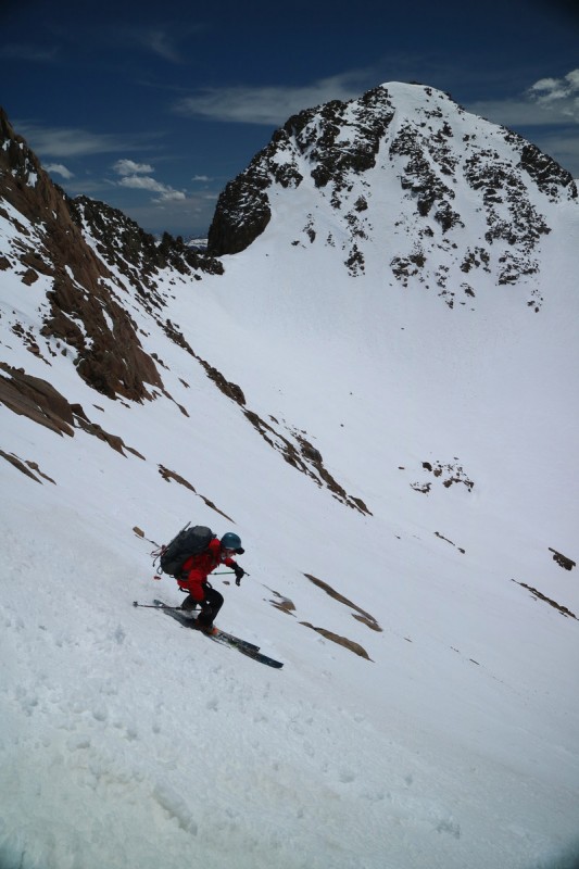 At the midpoint between Sunlight and Windom, we drop the rope, harness, skins, etc for the climb up Windom. We were going to climb the Widowmaker, but then decided it would be faster to take the couloir just to the right. Mainly in case the snow was soft and unconsolidated at the steep crux. No need to wallow and miss the corn window! Fed with a quick shot of Gu, we went up the nicely softening snow. Easy cramponing, as opposed to the mornings firm icy ascent of Sunlight. The coulouir felt almost never ending, and the clouds were coming in with a stiff breeze behind. We though it would help us slow the snow warming. Little did we know... 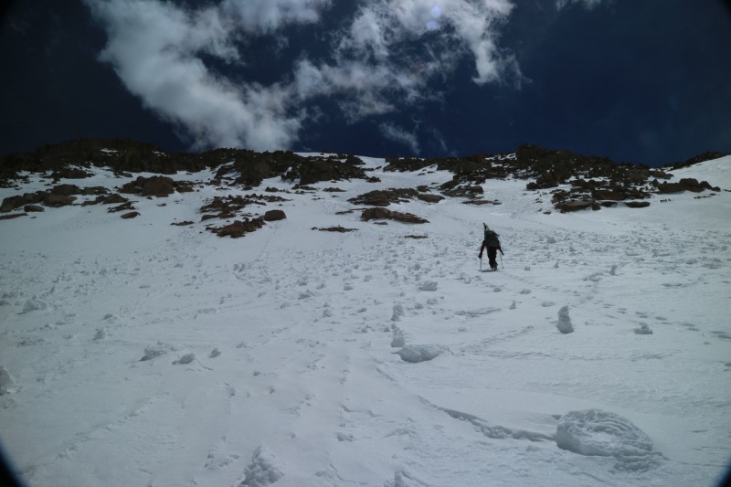 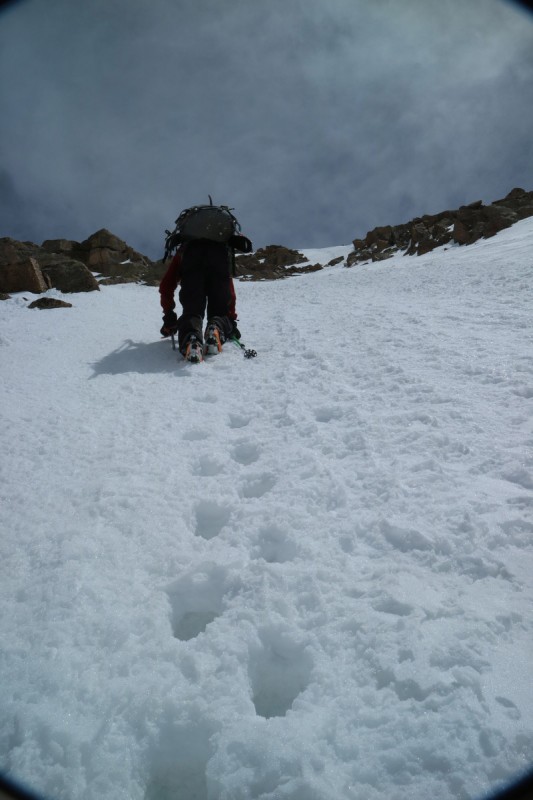 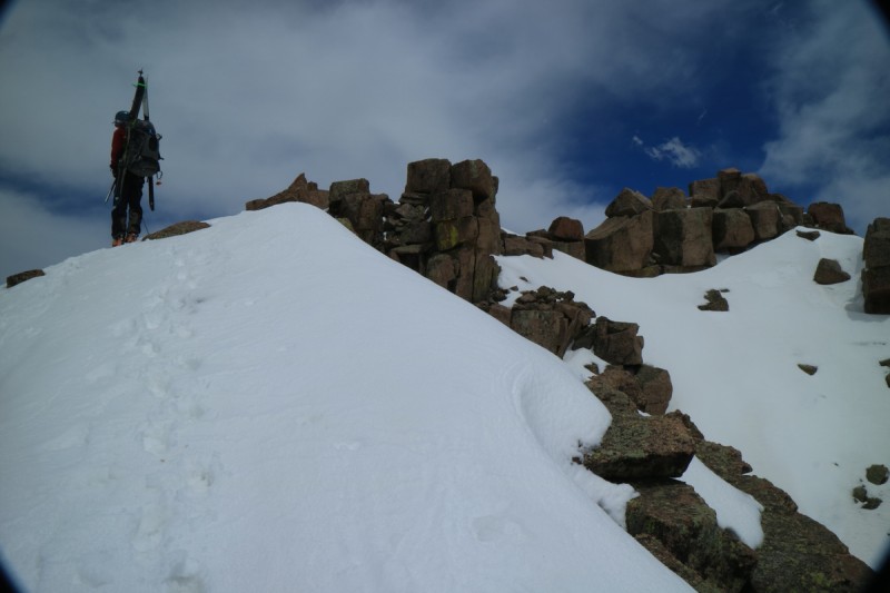 We got up to the summit proper, and scrambled up onto the blocks. Nice view of our tracks on Jupiter. Joel thought we'd have a half hour before perfect corn snow down the Widowmaker. So we took our time, and Joel fixed the leash on one of his skis, as I built the platform to ski from the summit, over to the Widowmaker. Quite spicy that transition! Good thing I've done that before, and have leashes! That western couloir on Windom looks *almost* continuous. Minus the cliffs at the bottom. 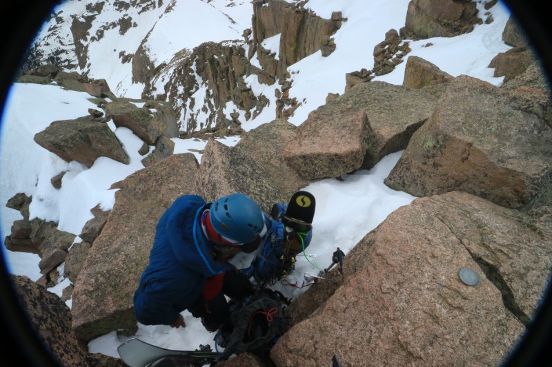  Our sunny tracks on Jupiter 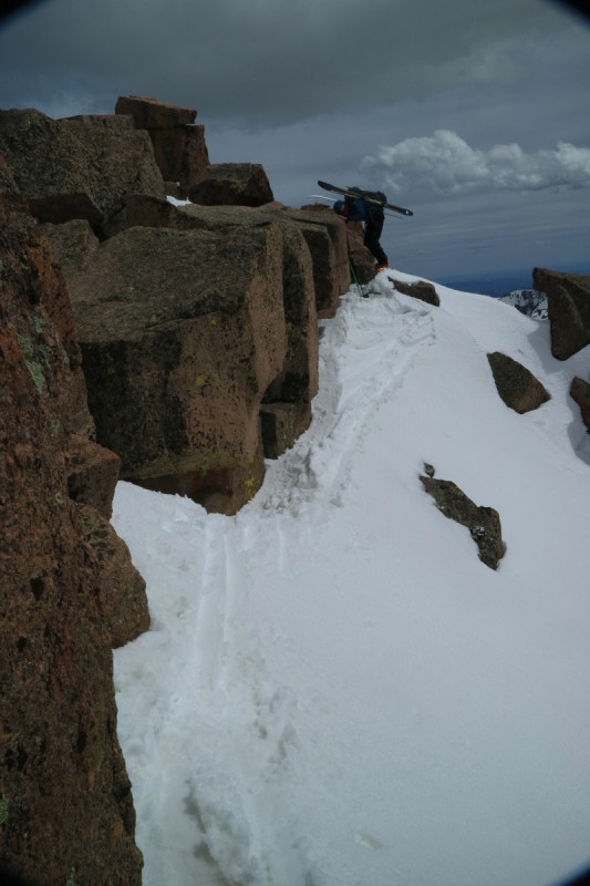 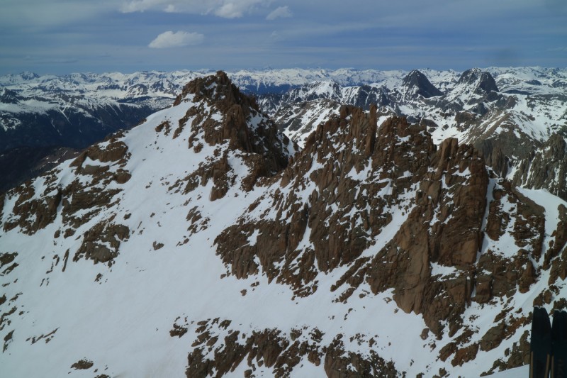 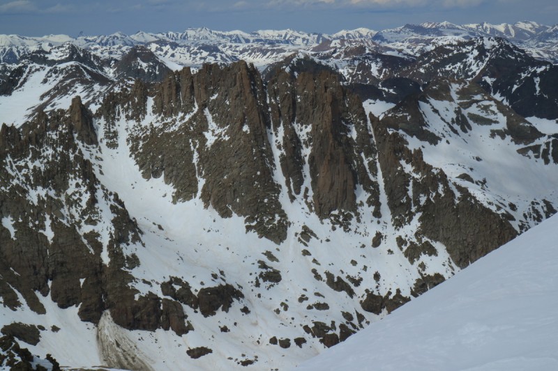 Joel takes the first jump turn on the Widowmaker, and sets up to photograph me. Great. I get to go first? Thankfully I peed on the summit, because as soon as I edged into the couloir and took my first jump turn..... bulletproof ice!!!!! Thankfully I tuned my skis myself before the trip, and they gripped just enough to stop me. I immediately throw my whippet into the ice snow, and breath. Did I almost fall down the north face of Windom? Glad my jump turns are becoming on point! After a very short discussion, we decide to retreat to the route we came up. From where I am, I can just traverse over into it. That half hour to corn up? Nope, refrozen! Even our ascent route was chunky and breakable crust. Some very tender and careful jump turns down this slope! At the base, we restowed our gear, and were thankful we got down that one safely. Even the ski down the upper basin was refrozen and very grabby! 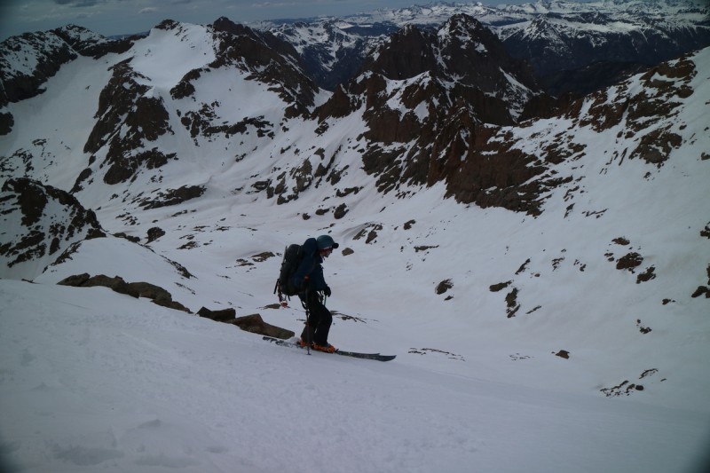 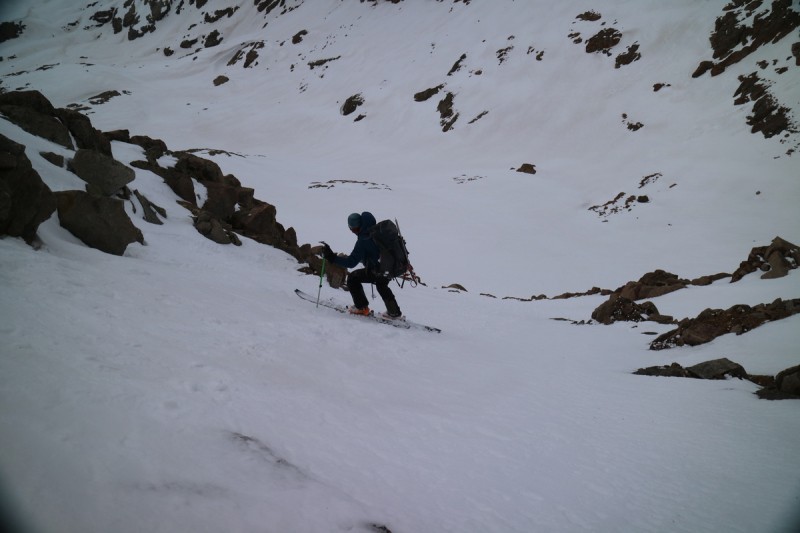  View of Widowmaker from ski down  Joel skiing refrozen corn out of basin While we had talked about this the day before, it had become quite apparent that moving camp higher, or even into Ruby basin was going to be foolish. The routes could be dry. Turret is not exactly a skiers dream, as even Devenport had lots of rocks in a good snow year. So at least now, we no longer had to have nightmares about skiing down the pass with 50lb packs! (There's some insight into my nightmares.) Day 4: Mt KennedyMileage: 3.7 Elevation Gain: 2,485' Route: Northeast Couloirs - where the fox went With me wanting to hike/ski all the 13ers, and Joel not wanting to go up into the upper basin again, it came down to Aztec or Kennedy for our final day. I had been able to get cell updated weather forecasts on the summits, and it looked like the weather window was going to start to shut on Tuesday, and slam shut on Wednesday. No need to stay longer and be in the tents, but leaving 2 days early wouldn't gain us anything either. So might as well cross the creek and ski the peaks we've been staring at from camp, and all trip long. I thankfully brought plastic shoes for camp, that were quite useful for the stream crossing. Joel used his new trail runners for the crossing, and they did dry out in time for the return and hike out. 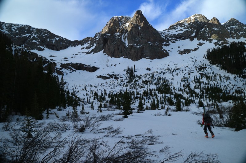 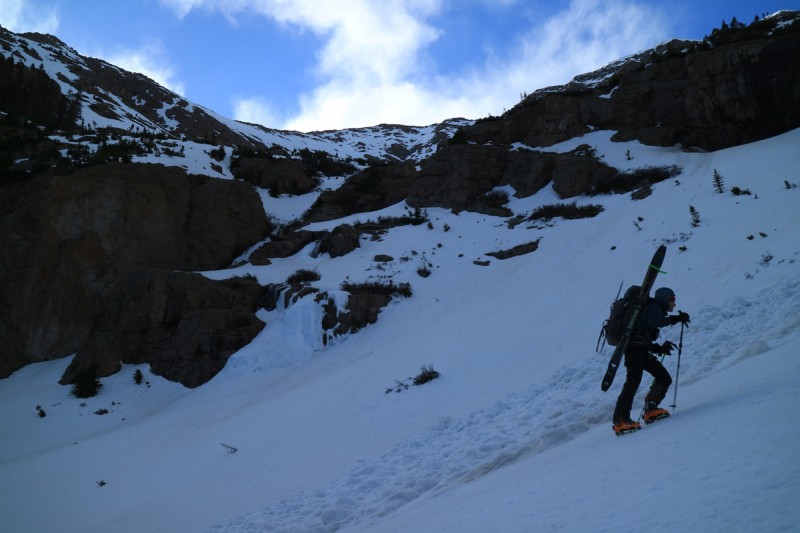 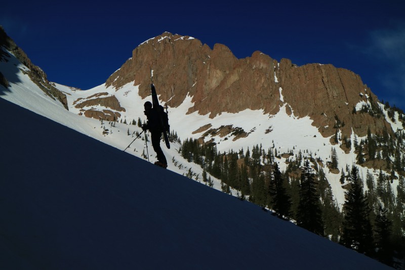 Aztec was a bit of a pipe dream, as it looked mostly dry, and the ski route would be boring and mostly a traverse. So after a bit of convincing, and watching a fox climb the route in front of us, I relented to Joel's pressure and we went up the more skiable route on Kennedy. Though, if we had gotten up earlier, skinning/walking the ridge to Aztec and back would have been easily doable.  The fox 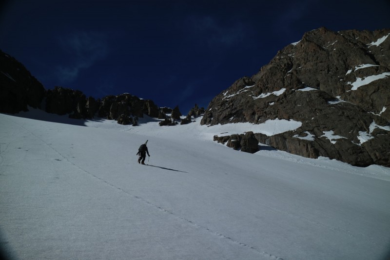  Aztec's west flank, not so enjoyable ski The snow in the left most couloir, while the most gradual, also has been getting the most sun. It became a bit of a post hole nightmare until we got a bit higher, where the next gully connected and provided a slightly different aspect. From there, it was a short jaunt to the ridge and then onto the gentle flat summit. We knew there were huge cornices at the edge, so we stayed far away. One of the best views of the entire trip. You can see the entire basin and all peaks. Well worth the extra day! 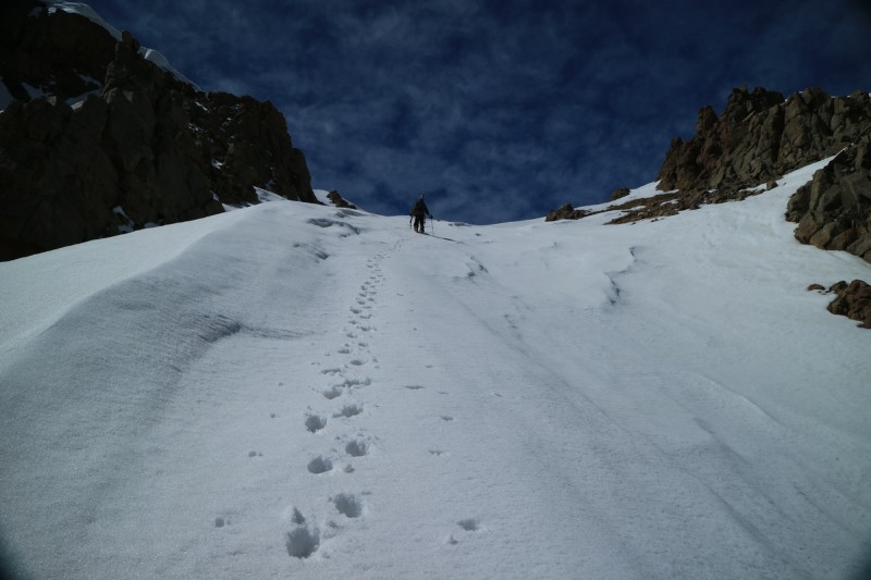 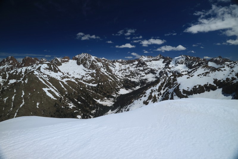  summit selfie 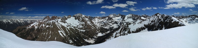  Pigeon Peak 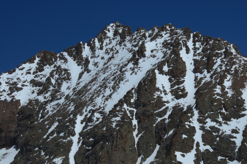 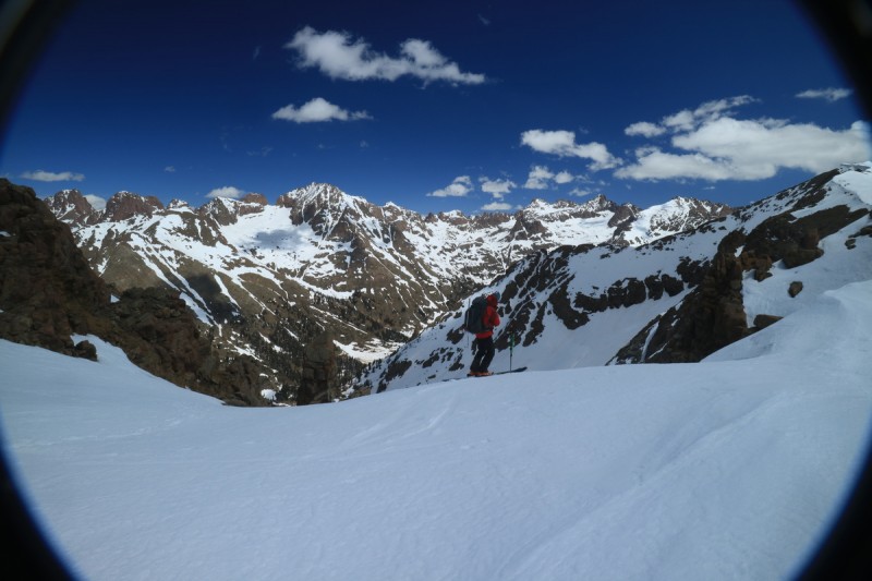 The ski down was pretty good, though the center gully had a lot more debris in it. But once below, it was smooth. With a few marginal descents this trip, I decided to rip the entire slope and actually enjoy myself, instead of trying to play ski photographer. Probably the best turns of the entire trip! 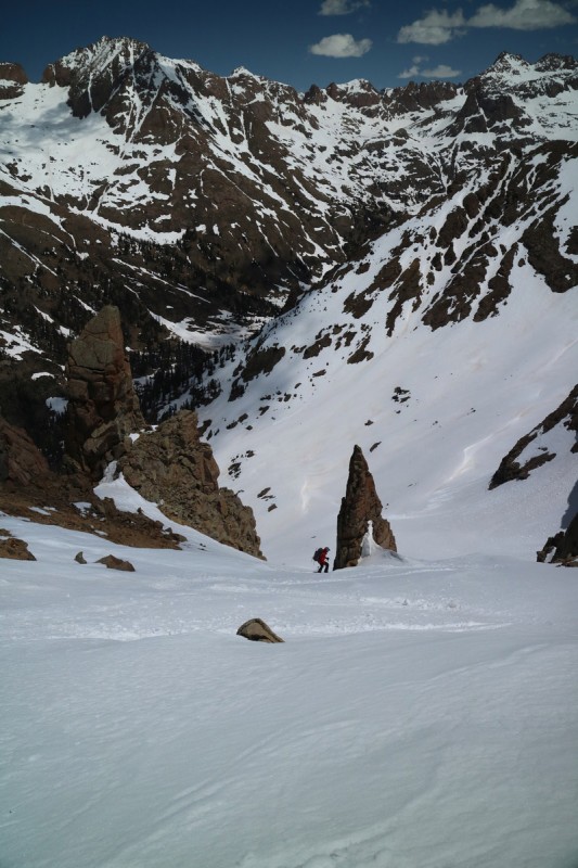 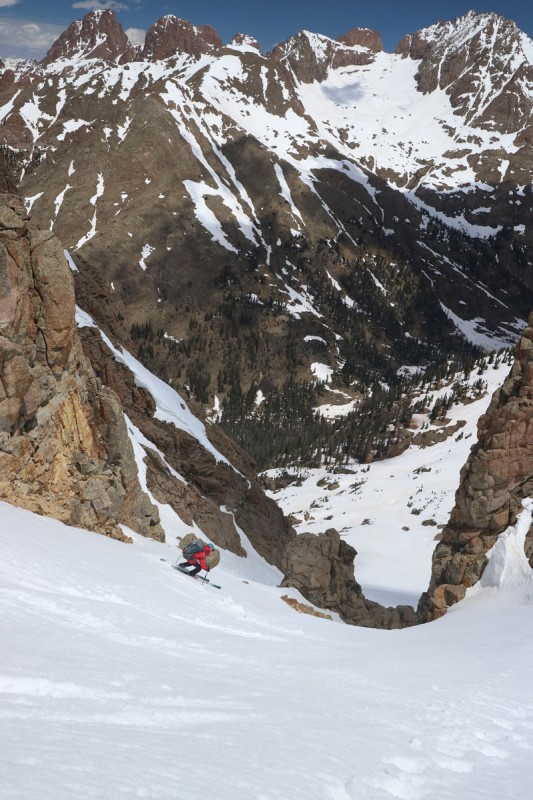  Fast corn turns  Our tracks from camp First day of the whole trip, we had all afternoon to relax in camp. And what do I get to do? Watch for marmots, hungry, salt seeking marmots! We had one that would not leave us alone all afternoon! The other day he ate through my bivy tent to get to my nasty salty socks! @%(*&!@(#&$% I hate marmots! At least I had entertainment, as I watched him try to sneak into camp from every angle!  Evil marmot ate through my bivy tent to get to my salty nasty socks!  Marmot eying my salty ski boot liners  Evil salt seeking marmot That evening, as we were both relaxing in our respective tents, getting ready to sleep the last night - I see a group of 3 come up the trail. So I exclaim "People!" After only seeing one person briefly on day one (and never seeing him or tracks of his the rest of the trip), this was our first human contact in days. So what is the difference between an introvert and an extrovert in the wilderness all alone? Me, I was content to stay in my bivy, and just wave at the passers by. Joel on the other hand, immediately throws on pants and runs out of his tent, and goes up to the trail to meet the new arrivals. So I begrudgingly do the same, but slower, and meet the group of 2 splitboarders and 1 photographer. Arriving just in time for some Koosh POW! in the next few days. Day 5: Pack outMileage: 5.69 Elevation Gain: 102' We sleep in till the sun is lighting up the peaks above us. Eat a leisurely breakfast and then pack up camp. I manage to pack most things up, while still remaining in my bivy. No need to get out before the sun reaches camp! We head out around 9am, and make quick work of the trail out. This time keeping our skis and boots firmly on our packs! No need for that silliness! I decide to keep my skis and boots higher on my pack, and it seems to work out better in the long run. Since I have to put the skis in A-frame mode, having it higher means no calf bang! Plus it's easier to get into the pack from a seated position, and to sit on downed logs.  NY creek - half way! We were making such great time down the trail, we wondered if we would see anyone coming up the trail. Once down on the flat section, and almost to the bridge, a group of 5 fresh faced young men show up. Only one asked about conditions. Considering it started snowing on us on the descent, I think they will spend most of their time in their tents. Sorry boys! Since we had only just *missed* the 11:15 train, the rafters were there setting up for their river run. One commented that we would have to wait for hours before the train came back. Oh the horror! Waiting for hours, in the wilderness, outside of cell range, in the sun (well part sun), after 5 days in a tent, skiing. What's civilization again?  Joel setting up camp at the bridge - preparing to wait for *HOURS* (oh the horror) We picked up those rafters farther down the line, freezing. This turned out to be a good thing, since as we approached Rockwood, the conductor asked us if we wanted to get off there. OH HECK YES!!!!! This perked up both of our spirits. Especially since my level of silliness was going to reach a level where we would make fools of ourselves around the serious tourists. Instead of being stuck on a wobbly slow train, smelling like dirty cinnamon around fresh tourist, we were off and able to eat dinner, get into a deep food coma, drive to pick up my car, BEFORE the tourists even got off the train. Yep. This time around, we won. Too bad I had to pay for parking still. But we saved 3 hours on the train, getting on and off at Rockwood. Just beware when talking on the phone to the train people... it took a lot of phone calls arranging it!  See ya suckers! If you want to see more beta shots, here are the filtered out ~400 photos from the trip: http://otinasadventures.com/index.php?trip=chicago_basin My GPS Tracks on Google Maps (made from a .GPX file upload):
View on the Map
Thumbnails for uploaded photos (click to open slideshow):  The curve")
 The curve behind")
 Releasing some pressure")
 First evening in camp, Aztec and Mt Kennedy behind")
 Joel gazing at the other side of Chicago Basin")
 Skinning up, with Aztec behind")
 Approaching the couloir")
 Booting up the couloir")
 Up up we go")
 Joel topping out of the couloir")
 Snow route to summit on west side")
 The other half of the basin")
 North Eolus is OUT")
 Icy scrapey west side descent")
 Oh the corny smoothness")
 On to Jupiter")
 Climbing Europa couloir")
 Joel about to top out")
 Eolus")
 Sunlight and Windom")
 Joel skiing with Sunlight and Windom behind")
 Joel skiing with Eolus behind")
 Skinning up into the basin")
 Sulight")
 Joel booting up, with Windom behind")
 Sunlight ramp looks meager")
 Last stretch to the summit block")
 Joel skiing near the top of the skiable snow")
 Looking down the south slope")
 Joel skiing with Windom behind")
 Booting up Windom's north face")
 steep booting")
 Top of the ridge, summit blocks on right")
 View down from summit")
 Joel climbing down from summit blocks, to ski to ridge")
 Sunlight and Sunlight Spire")
 Jagged")
 Joel making first turn in Widowmaker couloir")
 Joel skiing down our ascent route")
 Booting up to Aztec and Kennedy basin")
 Booting up by the waterfall")
 Shadow puppets")
 Joel booting up the more appealing route")
 Nearing the ridge")
 Chicago Basin and surroundings")
 Mt Eolus's west face")
 Joel at the edge of the couloirs")
 Joel skiing down the middle section")
")
 Pano from Kennedy")
|
| Comments or Questions | ||||||||||||||||||||||||
|---|---|---|---|---|---|---|---|---|---|---|---|---|---|---|---|---|---|---|---|---|---|---|---|---|
|
Caution: The information contained in this report may not be accurate and should not be the only resource used in preparation for your climb. Failure to have the necessary experience, physical conditioning, supplies or equipment can result in injury or death. 14ers.com and the author(s) of this report provide no warranties, either express or implied, that the information provided is accurate or reliable. By using the information provided, you agree to indemnify and hold harmless 14ers.com and the report author(s) with respect to any claims and demands against them, including any attorney fees and expenses. Please read the 14ers.com Safety and Disclaimer pages for more information.
Please respect private property: 14ers.com supports the rights of private landowners to determine how and by whom their land will be used. In Colorado, it is your responsibility to determine if land is private and to obtain the appropriate permission before entering the property.


