| Report Type | Full |
| Peak(s) |
Mt. Blue Sky - 14,268 feet |
| Date Posted | 02/19/2017 |
| Date Climbed | 02/18/2017 |
| Author | Greenhouseguy |
| Mt. Evans Winter Route, Gomer Gully |
|---|
|
Mount Evans 14,264 Feet (14th Highest in Colorado) Mt. Evans Winter Route, Gomer Gully Trailhead Elevation 10,896 Feet Approximately 10.2 Miles Roundtrip Approximately 3,500 Feet Elevation Gained Class 2 February 18th, 2017 Partners: Derek Mt. Evans Winter Route, Gomer Gully Mt. Evans must be one of the most-visited fourteeners in Colorado. During tourist season, it is one of only two fourteeners that have an access road all the way to the summit. Hikers also have multiple options on Mt. Evans. The Chicago Creek route from Echo Lake is long and arduous, but offers rewarding scenery. The west ridge route from Guanella Pass is quick and dirty, but it requires some objectionable grunt work heading up the Gomer Gully. The route from Summit Lake doesn't involve enough elevation gain to be considered a legitimate ascent. Winter conditions on Mt. Evans change the game entirely. The road from Echo Lake is closed, and there are several avalanche-prone slopes that have claimed lives and must be taken seriously. Avoiding these slopes is possible, but it makes for a long day. The Chicago Creek route is rarely considered in winter because of its length, but it also has areas of unacceptably high avalanche risk. In terms of length and avalanche risk management, the west ridge route from Guanella Pass is usually the preferred winter approach. However, the avalanche risk on this route is not zero. The winter trailhead is at the Guanella Pass Campground; this is 1.5 miles down the road below the summer trailhead. The first switchback in the road passes below a slope that can and does slide at times. It would be best to avoid this route during periods of high avalanche risk. The slope in Gomer Gully exceeds 50 degrees in some places, and tends to accumulate wind-blown snow. The steep sides of the gully could also slide on an unwary hiker. Conditions should be studied carefully before entering the gully. The slopes surrounding the next gully north of Gomer Gully (on another branch of Scott Gomer Creek) are gentler and much safer to ascend. The added length can be a small price to pay for safety. I believe that I first met Derek on Mt. Sniktau in 2007, and we've summited well over a hundred peaks together since then. We've hiked everything from Mt. Elbert in winter to obscure wilderness peaks known only to Lists of John peak baggers. A winter attempt on Mt. Evans would be more ambitious than most of my adventures; it gave me some peace of mind to have an experienced partner along on this trip. 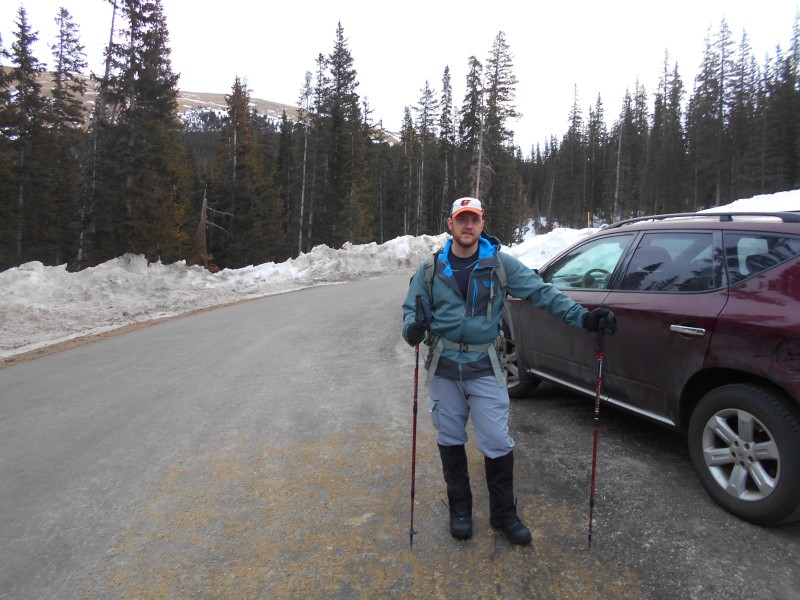 Derek at the Guanella Pass Campground trailhead Our starting temperature was somewhere in the mid-20s, which is not bad for February. The Guanella Pass Road sees plenty of action from snowshoers and cross country skiers, so the snow on the entire width of the road was packed. Snowshoes were not necessary until we left the road near the top of the pass. 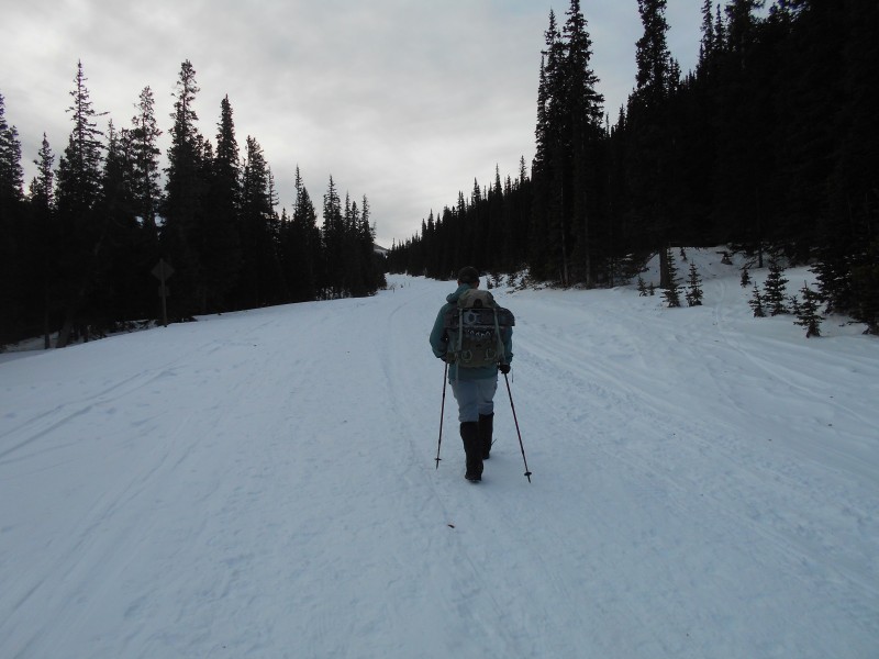 Booting it up Guanella Pass Road There is a well-travelled shortcut that bypasses the first pair of switchbacks in the road. It doesn't necessarily avoid the slide path, but it passes a bit lower on the same slope. 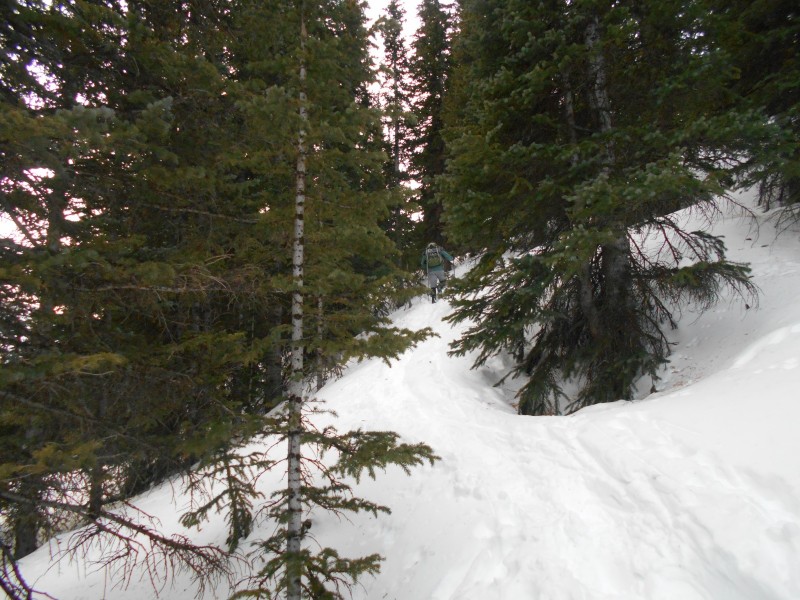 Derek taking the bypass around the first pair of switchbacks 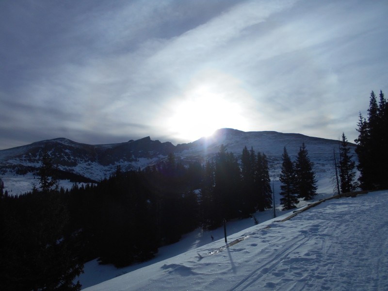 Sunrise over Mt. Bierstadt When we reached the second set of switchbacks in the road, an obvious snowshoe track diverged from the road and headed towards the Mt. Bierstadt standard route. This route heads directly into the willows, so we stopped to put our snowshoes on after a few yards. 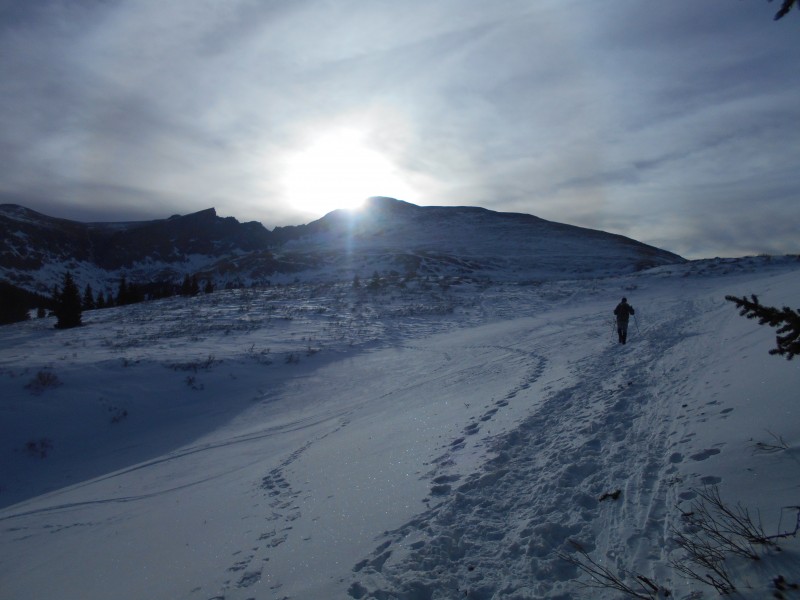 Derek heading into the willows We angled over to the Bierstadt standard route, and stuck with it for a short while. We turned off towards Gomer Gully just before we got to the prominent boulder beside the summer trail. 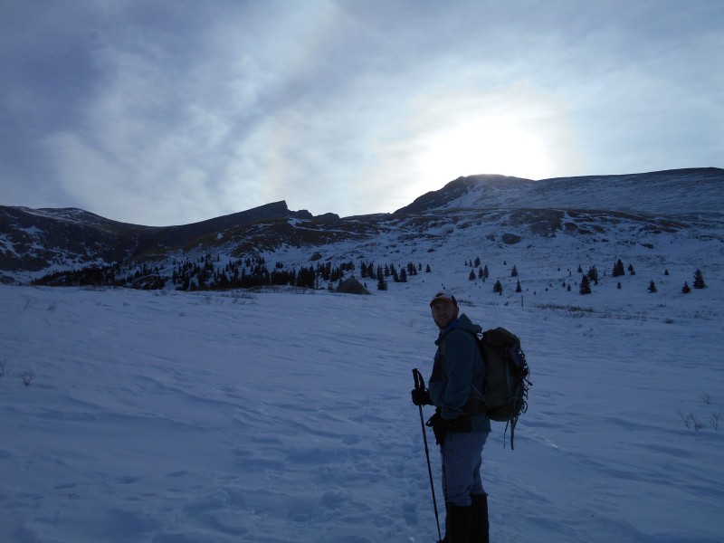 On a tangent through the willows 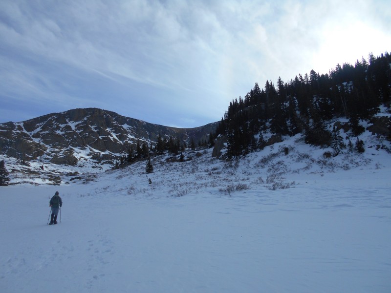 Passing the wooded knoll above Scott Gomer Creek 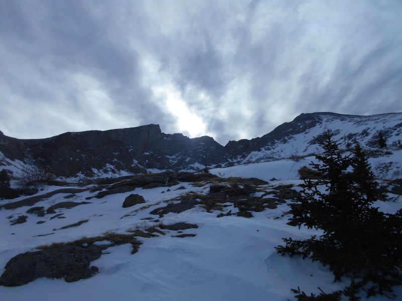 The sun peeking through the clouds above the Sawtooth The weather was starting to concern me. There were clouds everywhere, but the forecast didn't call for snow until after 4:00. The wind was not bad at all, but any wind in combination with snowfall could be enough to create whiteout conditions. We would be in complicated terrain that would be difficult to navigate in a whiteout. I was born to worry. We had faith in the forecast and pushed onwards. We went back and forth about the next portion of the route. Should we turn left and head up the gentle slope, or should we head up the short but brutally steep Gomer Gully? We had viewed the gully from a distance, and could see that the steepest choke point was entirely devoid of snow. The only snow was in the lower-angle slope at the bottom of the gully. Some of the slope was probably more than 32 degrees, but was frozen and well-anchored with rocks. The shorter route up the gully appeared to be safe enough. 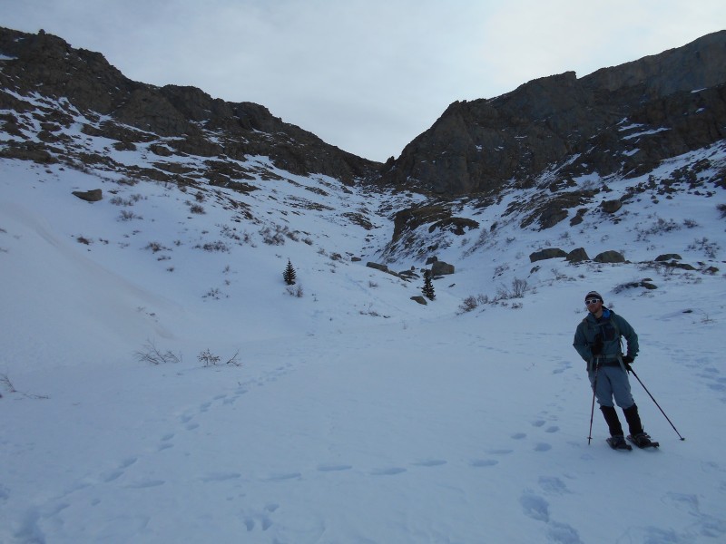 Derek at the mouth of Gomer Gully The start of the trip up Gomer Gully is pretty mellow; it was easy snowshoeing. I was more concerned about the snow on the left wall of the gully than I was about the center. 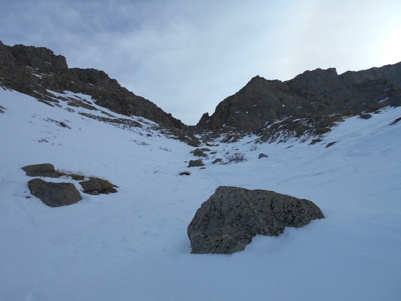 Starting up Gomer Gully The conditions farther up the gully were almost summer-like. The steep scree was not at all frozen, so footing was more treacherous than it had been on the snow. There were a few patches of snow, but nothing significant. 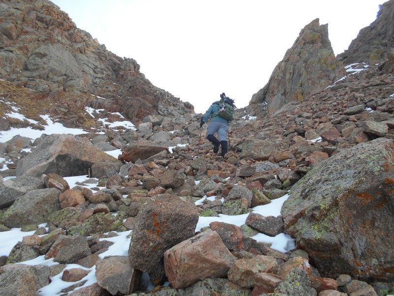 The steeper middle portion of the gully By the time we reached the top of the gully, we were cruising on the summer trail without difficulty. We were no longer protected by the deep gully, so the wind became more of a nuisance. Given the potential for extreme weather on a Colorado fourteener in winter, I was still feeling pretty blessed. 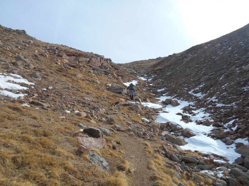 Approaching the top of the gully 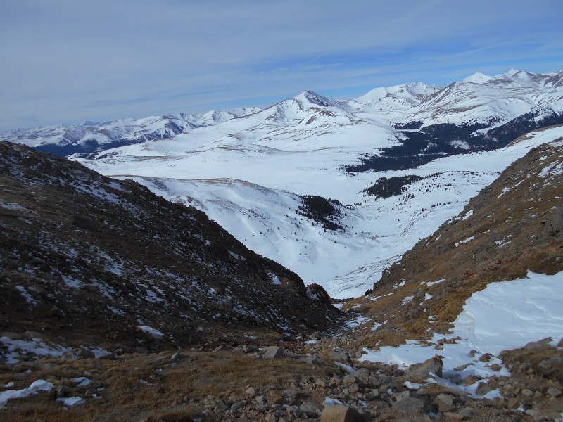 Looking back down the gully towards Squaretop Mountain It's going to be a piece of cake once we get out of the gully, right? Not exactly. We still had six-tenths of a mile of steady uphill travel through a boulder field before we reached the west ridge. Near the top of the boulder field, we found some cairns that are part of the Summit Lake route that goes over Mt. Spalding. They were easy to see from a distance, and took us in the right direction. The weather still looked a little sketchy, and I didn't want to get caught on the wrong end of the ridge in a snowstorm. 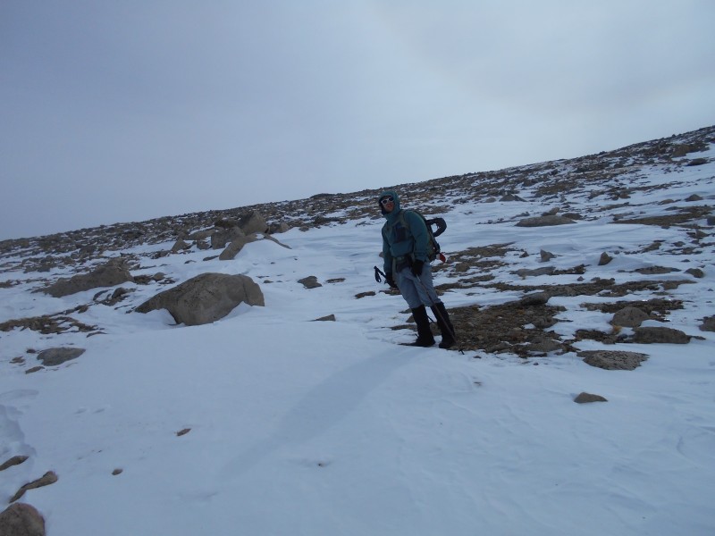 In the boulder field at the top of the gully The prominent knob on the end of the west ridge was a useful landmark to aim for. There was a cairn on a small notch on the end of the ridge; we climbed over some rocks, and angled slightly downwards on the south side of the ridge. From this point onwards, we would be above 14,000 feet until we reached the summit approximately eight-tenths of a mile away. 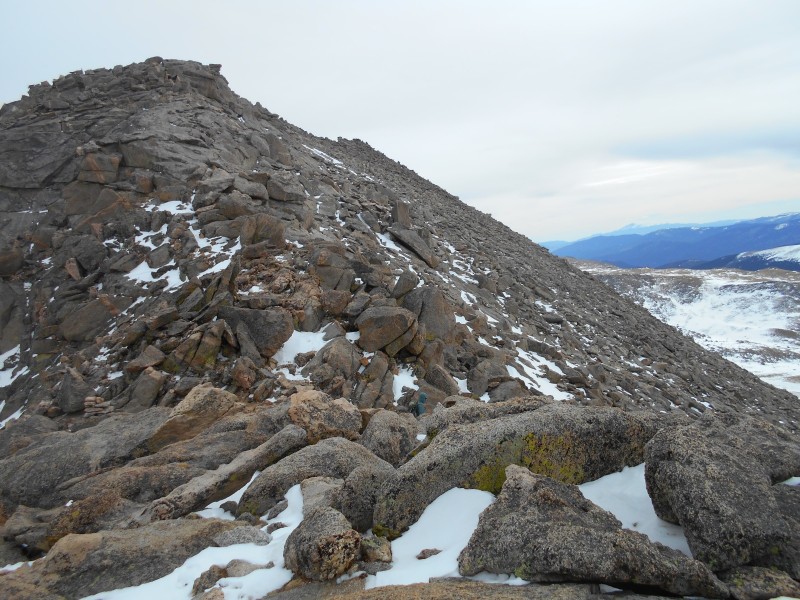 Starting out on Mt. Evans' west ridge Under snowier conditions, I would be hesitant to take the summer route on the south side of the west ridge. The slope is steep, and the runout is bad. It would be safer to take the crest of the ridge. We had ideal conditions with very little snow. The route has just enough cairns to make it easy to follow. 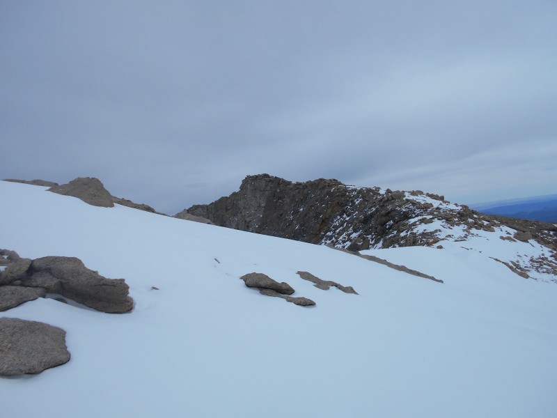 Nearing the end of the west ridge, with the summit in sight We started the gradual curve in the ridge towards the summit, then I saw a face. We were being watched intently. Then I saw another face, and another. Soon I lost count of the number of mountain goats that were watching us. Their head honcho was doing his due diligence to make sure that we didn't get too close to his herd. We gave them a wide berth. 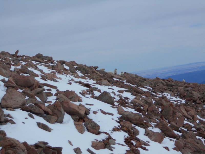 Anxious goats  The rest of the herd At the end of the trail, we started up the switchbacks to the summit block. Some of the trail was covered in snow, but most of it was dry. I appreciated having a gentle ramp at the end of a long journey. 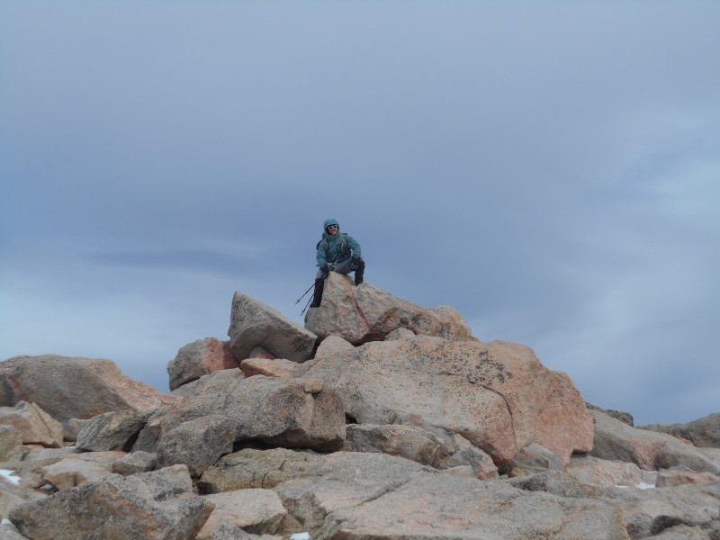 Derek on the summit 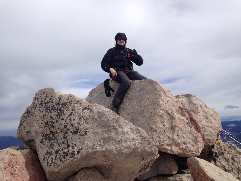 Me on the summit (image by Derek) The sun was out again, and the air was absolutely still. It doesn't get much better than this on a fourteener in winter. Clouds threatened from a distance, but I was confident that we could make it back to safety before the weather could take a turn for the worse. We had a long return trip, so we didn't spend too much time on the summit. 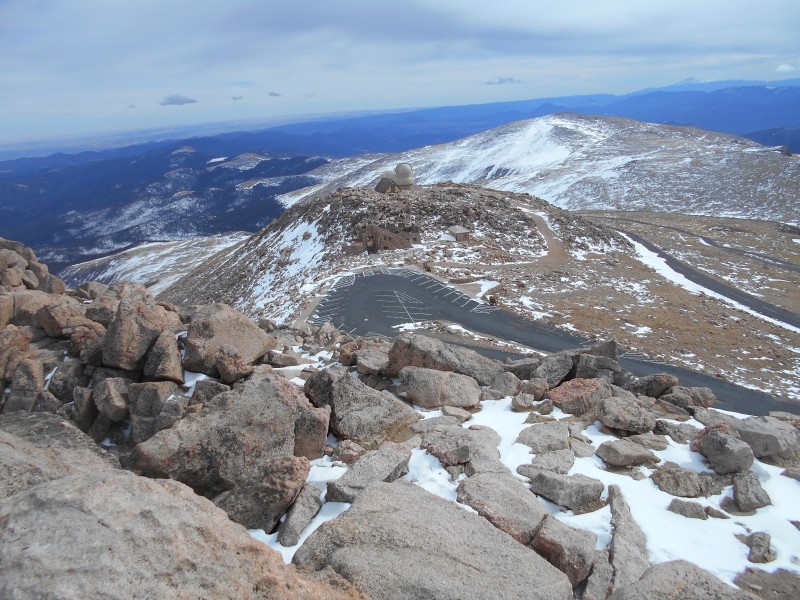 Looking down on the parking lot and observatory from the summit 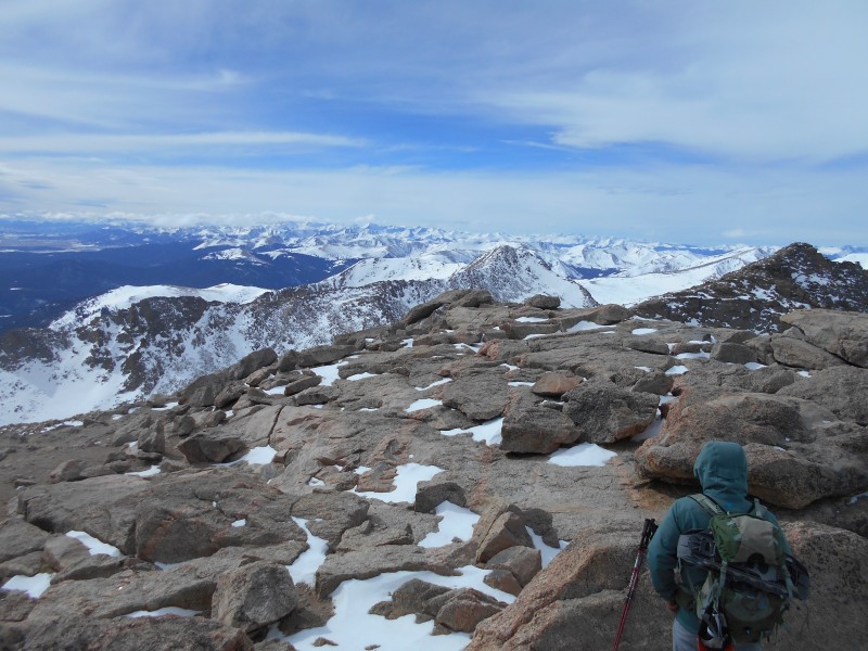 Looking toward Mt. Bierstadt and the west ridge 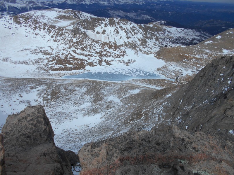 Looking down on Summit Lake I was elated to have gotten my eighth winter fourteener summit, but that was only half the battle; we still had to make it back. We started the next leg of our journey with blue skies and high spirits. 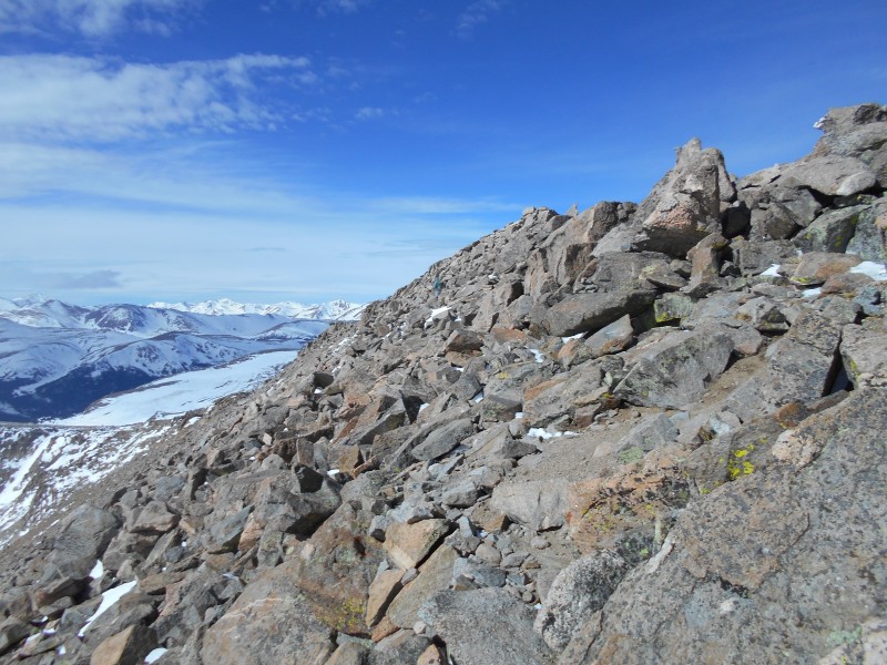 Back on the west ridge 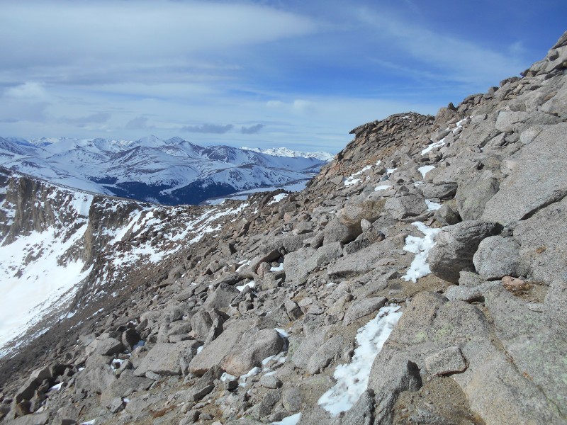 Approaching the prominent knob on the west end of the west ridge 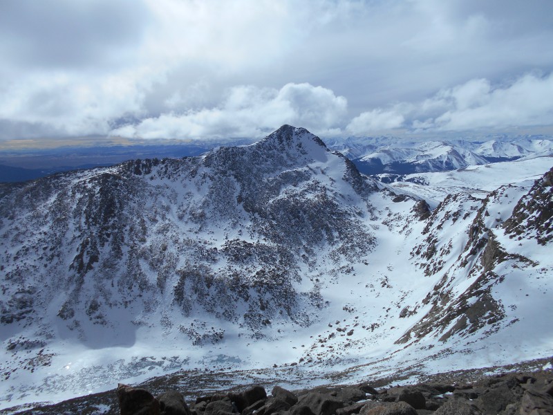 Mt. Bierstadt and the Sawtooth ridge as seen from Mt. Evans' west ridge When we reached the end of the ridge, we had a choice; descend the gentle slopes of the Scott Gomer Creek drainage, or follow the same route by which we had summited. We opted for the shorter and steeper route 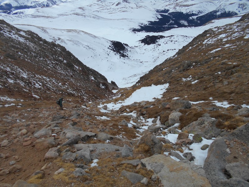 Descending Gomer Gully On the way out, we passed some ice climbers who had been playing on a nice frozen waterfall. It looked like a good way to spend a winter day. 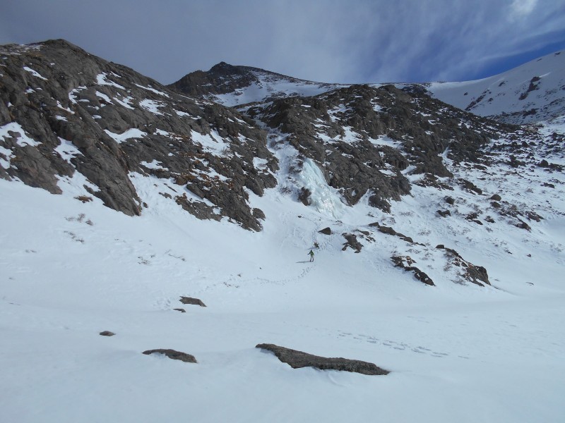 Ice climbers and the frozen waterfall From the mouth of the gulley to Guanella Pass Road was about 1.8 miles, mostly over deeply-buried willows. It went on and on. We occasionally postholed when we stepped directly over a willow that was surrounded by an air pocket. For the most part, it was smooth sailing over frozen snow. 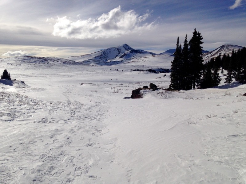 Looking out on the infamous stand of willows from the mouth of the gully (image by Derek) 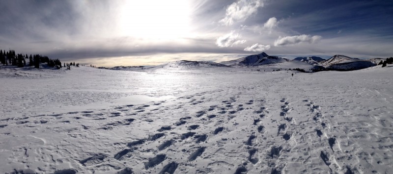 Another look at the massive expanse of deeply-buried willows (image by Derek) When we got back to the Guanella Pass Road, we sat on a guardrail and took a break. Snowshoes probably weren't necessary beyond this point, but we kept them on all the way back to the car. The most difficult part of the hike was behind us. 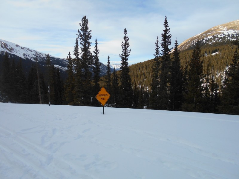 Entering the slide zone On the way down, we chatted with the ice climbers and a couple who had summited Mt. Spalding. There were several groups of hikers on Mt. Bierstadt, but we were probably the only ones on Mt. Evans on this particular day. I was grateful for the favorable weather and avalanche conditions that allowed us to reach this excellent fourteener summit in calendar winter. 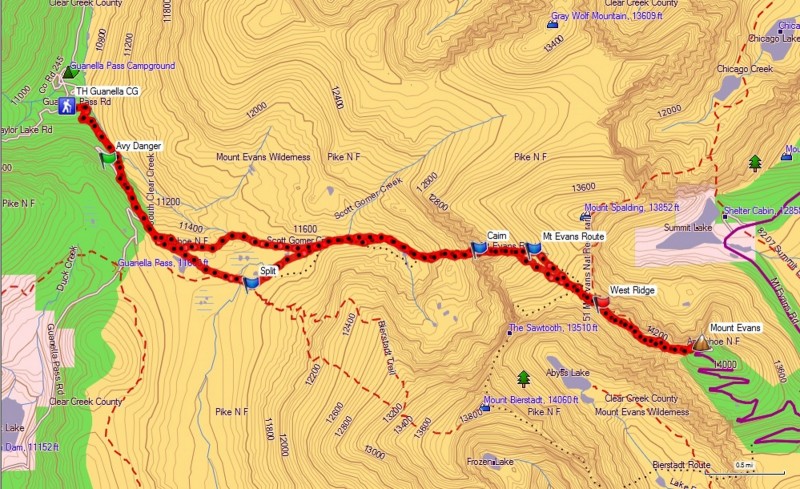 GPS track of our route Thumbnails for uploaded photos (click to open slideshow): ")
")
")
")
")
")
")
")
")
")
")
")
")
")
")
")
")
")
")
")
")
")
")
")
")
")
")
")
")
")
")
")
|
| Comments or Questions | |||||||||
|---|---|---|---|---|---|---|---|---|---|
|
Caution: The information contained in this report may not be accurate and should not be the only resource used in preparation for your climb. Failure to have the necessary experience, physical conditioning, supplies or equipment can result in injury or death. 14ers.com and the author(s) of this report provide no warranties, either express or implied, that the information provided is accurate or reliable. By using the information provided, you agree to indemnify and hold harmless 14ers.com and the report author(s) with respect to any claims and demands against them, including any attorney fees and expenses. Please read the 14ers.com Safety and Disclaimer pages for more information.
Please respect private property: 14ers.com supports the rights of private landowners to determine how and by whom their land will be used. In Colorado, it is your responsibility to determine if land is private and to obtain the appropriate permission before entering the property.


