Download Agreement, Release, and Acknowledgement of Risk:
You (the person requesting this file download) fully understand mountain climbing ("Activity") involves risks and dangers of serious bodily injury, including permanent disability, paralysis, and death ("Risks") and you fully accept and assume all such risks and all responsibility for losses, costs, and damages you incur as a result of your participation in this Activity.
You acknowledge that information in the file you have chosen to download may not be accurate and may contain errors. You agree to assume all risks when using this information and agree to release and discharge 14ers.com, 14ers Inc. and the author(s) of such information (collectively, the "Released Parties").
You hereby discharge the Released Parties from all damages, actions, claims and liabilities of any nature, specifically including, but not limited to, damages, actions, claims and liabilities arising from or related to the negligence of the Released Parties. You further agree to indemnify, hold harmless and defend 14ers.com, 14ers Inc. and each of the other Released Parties from and against any loss, damage, liability and expense, including costs and attorney fees, incurred by 14ers.com, 14ers Inc. or any of the other Released Parties as a result of you using information provided on the 14ers.com or 14ers Inc. websites.
You have read this agreement, fully understand its terms and intend it to be a complete and unconditional release of all liability to the greatest extent allowed by law and agree that if any portion of this agreement is held to be invalid the balance, notwithstanding, shall continue in full force and effect.
By clicking "OK" you agree to these terms. If you DO NOT agree, click "Cancel"...
Trailhead: Matterhorn
Mileage: 13.15
Elevation Gain: 4,976'
Partners: Solo
With fresh snow falling on Thursday and the gathering this weekend, I figured I would go and hike something reasonably easy. I had originally planned this group of 6 as a single day traverse, with either a car shuttle or a bike. But it never happened, so I decided to split it into 2 days for this trip. I still think the traverse would be interesting, but that's for someone else to do now.
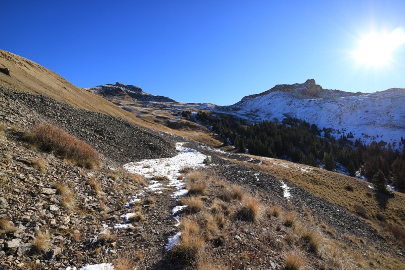
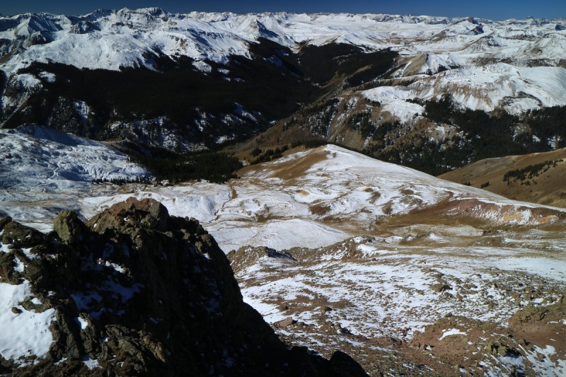
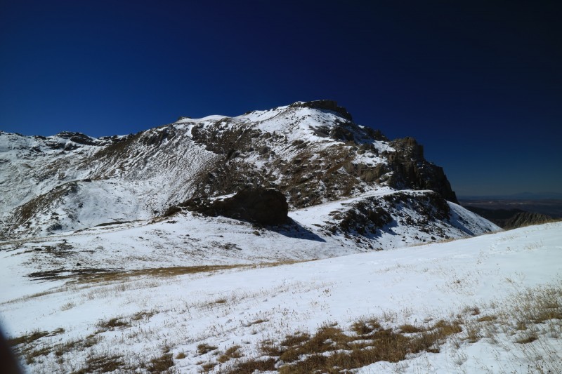
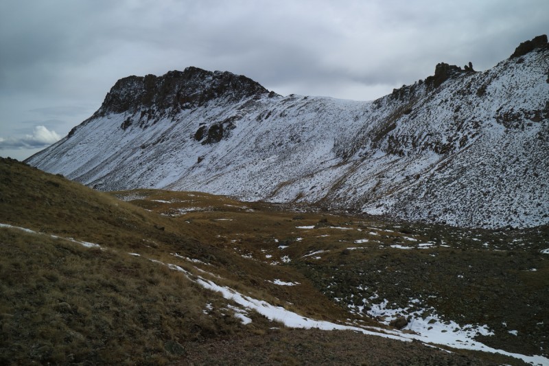
I camped below the high clearance 4x4 road over night, then got up with the sun to drive the last little bit of road. I did not get an early start, and it was well past 7am (if not after 8am) by the time I started up the initial trail. Once to the big meadow area, I found where the old defunct road went into the trees and followed it. Plenty of downed trees to go around, but otherwise pretty easy hike uphill. I left the road to gain the west ridge of Broken Hill and followed that up towards the summit. The snow along this part of the route was thin, but still prevalent. Later it would pretty much all melt away.
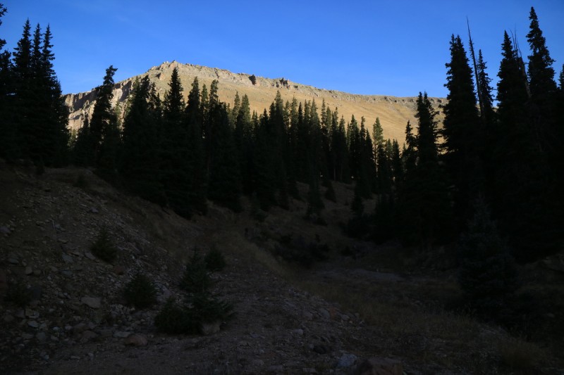
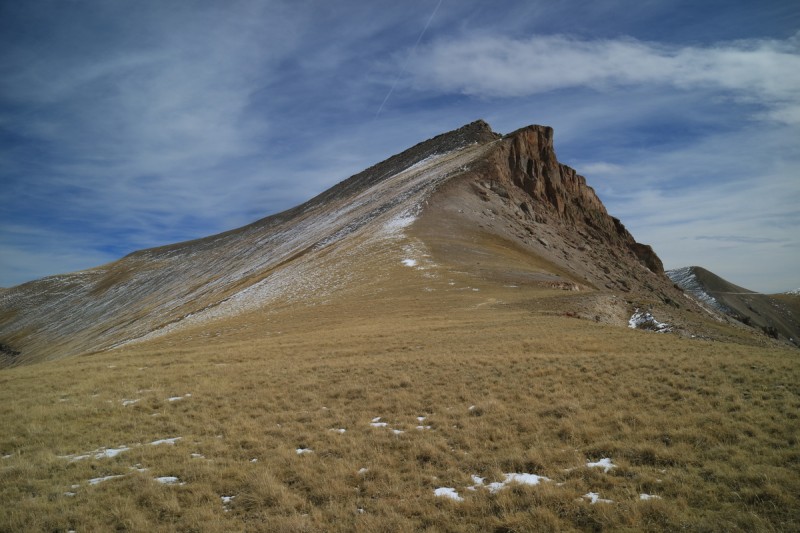
Fresh Snow on the trail, as I glimpse Wetterhorn for the first time
Hiking up road, first view of Broken Hill
Looking back on the snowy road
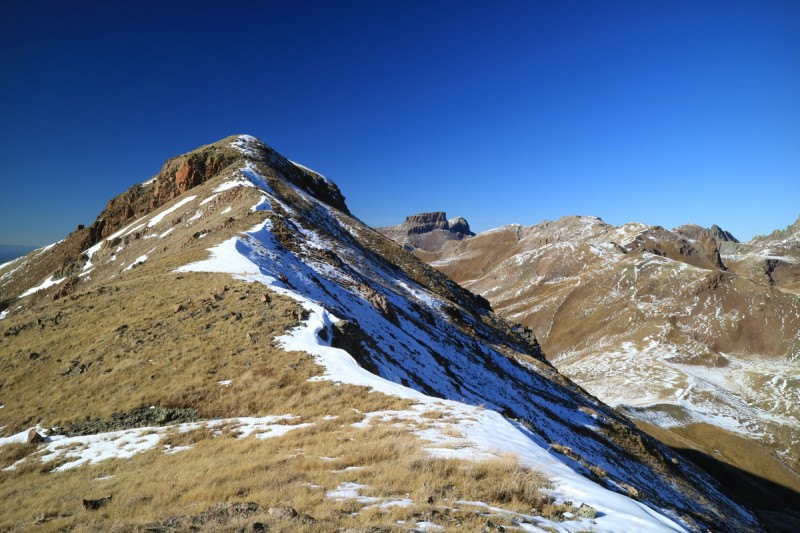
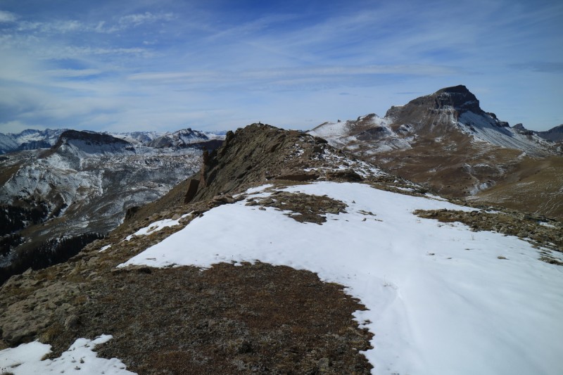
Route up Broken Hill on left
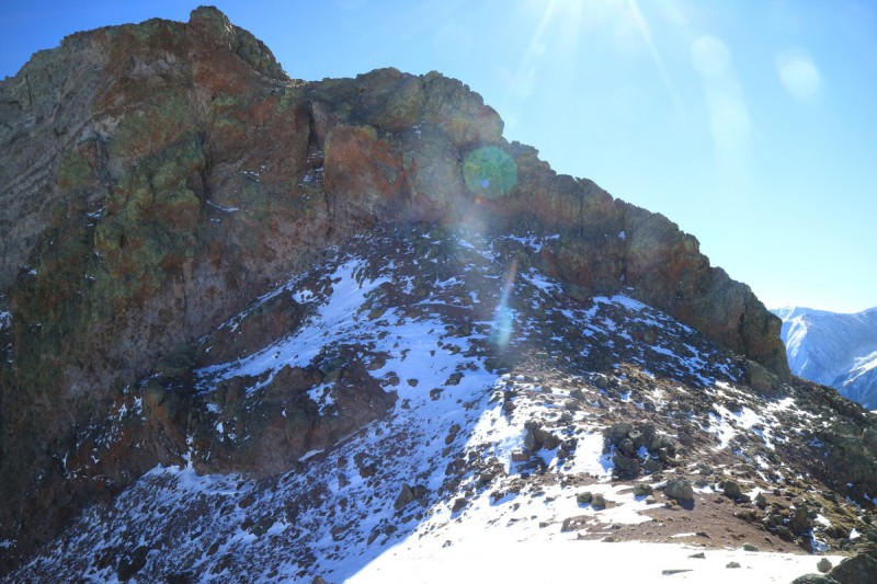
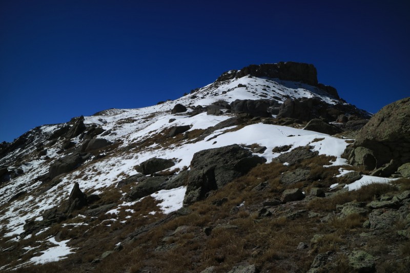
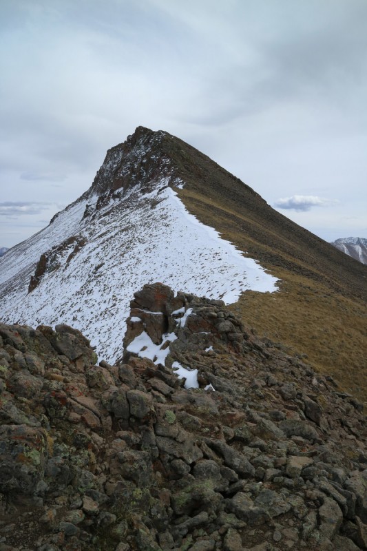
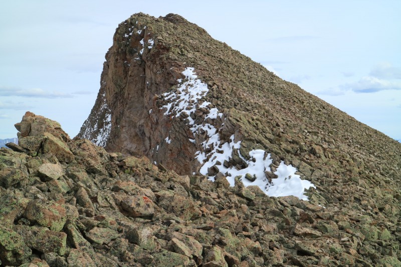
As I approached the rocky summit block area, I wondered about the exact route. Getting closer, I could see a use trail that skirted the difficulties to the right. From there it was a very scree rich scurry to the summit. Some pretty glorious blue bird views today!
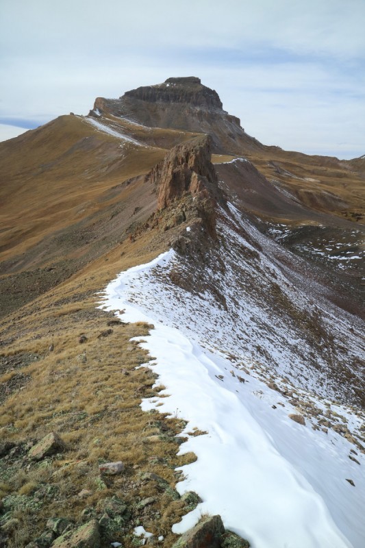
Broken Hill summit block, route to right Uncompahgre!
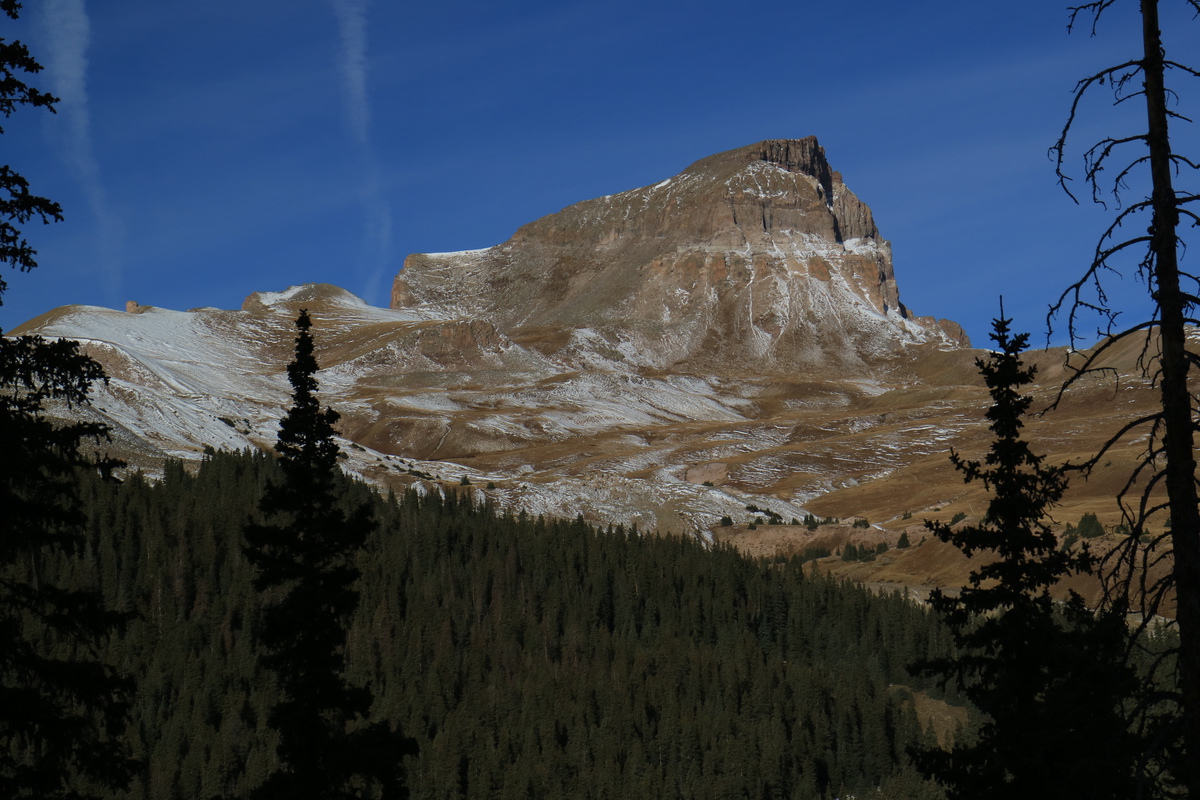
Wetterhorn is not skiable yet.
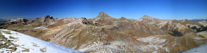
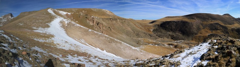
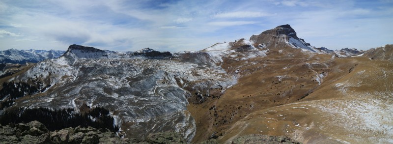
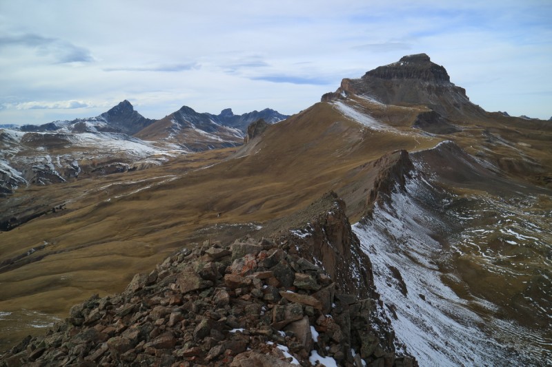
Summit pano Tomorrow's 13ers Route up Broken Hill
With a long day planned, I couldn't stay too long. Just posted a couple beta pics for the gathering goers. Though with all the sun, most of the snow would melt before they got on the trails!
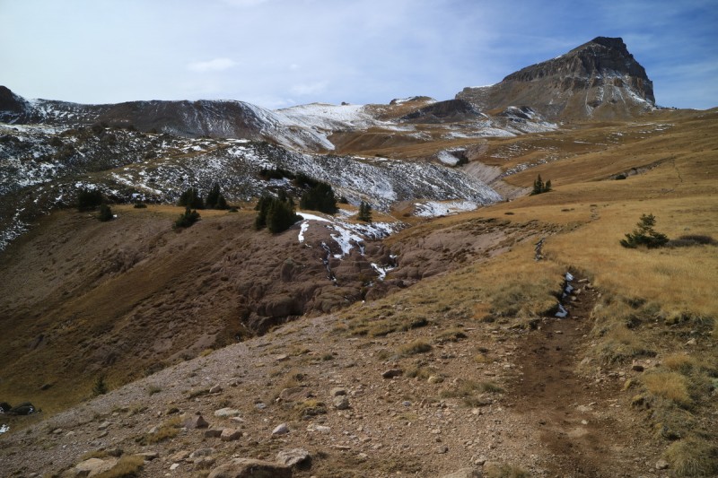
I followed the lower angle path, so as to not slip on the snow too much, and contoured my way around a couple hills on my way to intersecting the Wetterhorn trail. I found one particularly deep snow patch where I post holed above the knees. First post hole of the season!
Looking back on Broken Hill Looking back on Broken Hill
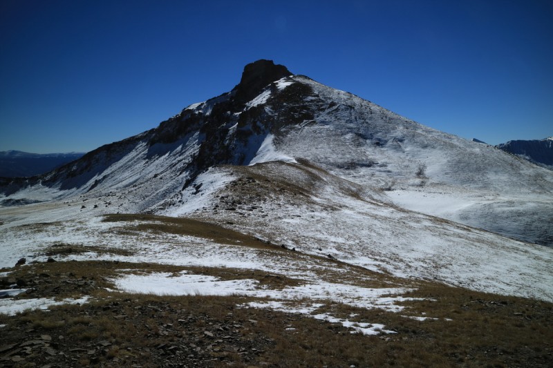
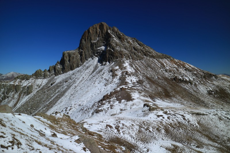
Wetterhorn and Matterhorn
When I met up with the standard route up Wetterhorn, I was not surprised to see tracks already going uphill. Beautiful day, why waste it? As I was hiking up to the saddle, I briefly saw someone peek over the summit cliff.
Matterhorn and Uncompahgre
I got to the saddle and hoped the traverse over to the 13,300 C saddle wouldn't be too bad. I look over the edge and am pleased that it would go easily, and I even found a decent use trail to use as well.
From that saddle, I tried to find the best snow free route up to the summit. The feet had gotten a bit wet from that big post hole section, so I was trying to avoid making it worse.
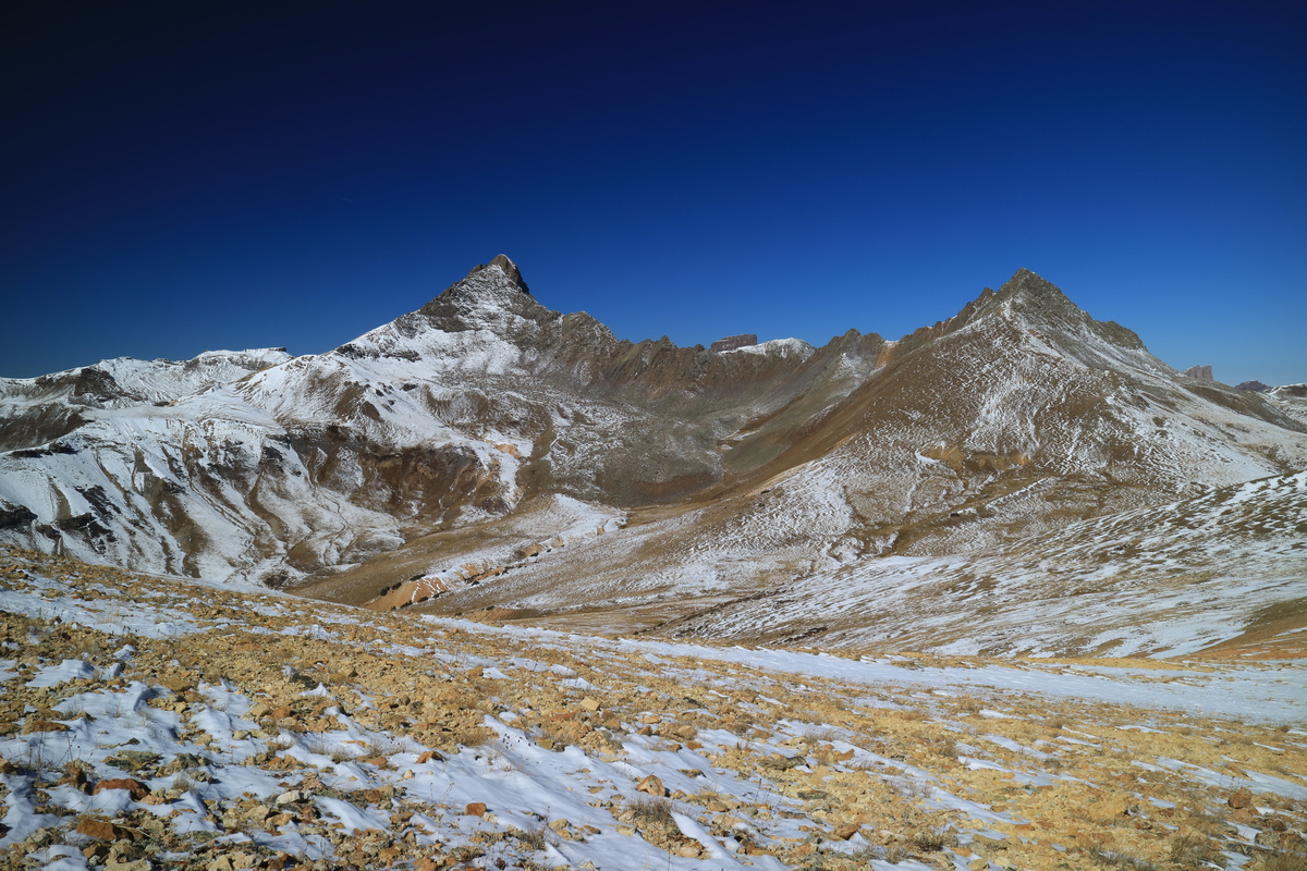
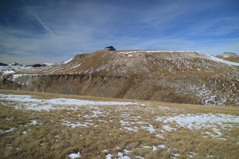
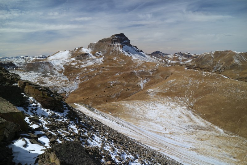
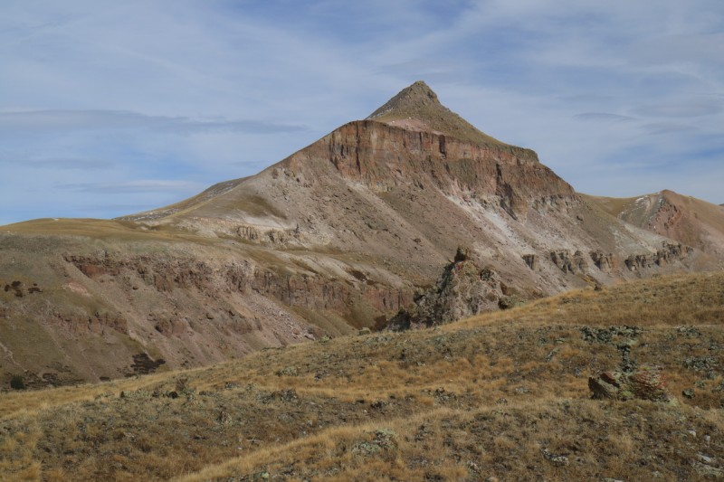
13,300 C from Wetterhorn saddle Approaching 13,300 C Route up 13,300 C Wetternhorn from 13,300C
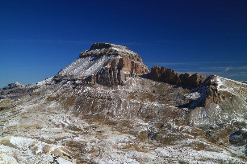
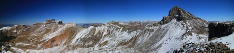
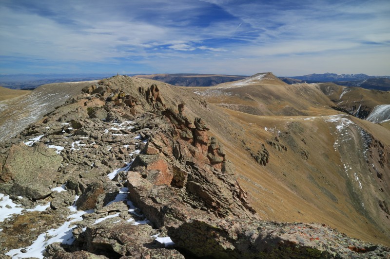
The summit area of 13,300 C is pretty broad, and I spend some time wandering around, seeing what the exact high point is and taking photos. After the wandering, it was the rocky section by where I initially climbed up. When I find the summit register, it's confirmed. I think this one also has a super unofficial name, but I forgot to take note of it.
Summit pano
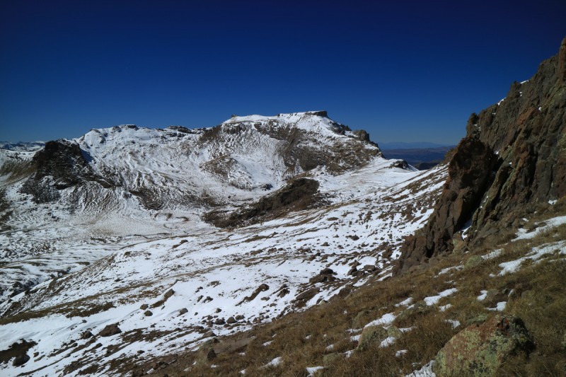
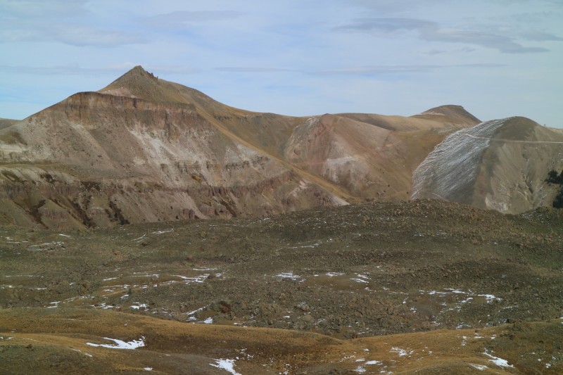
With the sun getting further west, i keep hiking down the ridge of 13,300 C on the way to 13,201. There is supposably a trail down below to the east, but I could only see meager hints of it. My GPS even showed a trail coming up the ridge and following it down to the saddle area with 13,201. I continued to follow the ridge, when I probably should have descended to the main saddle in pic #16. Probably added on more time than I would have otherwise liked.
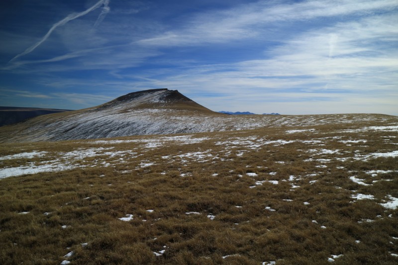
Looking back on 13,300C from ridge !3,201 from 13,300 C ridge
There was supposed to be a trail that goes around at about 13,400, But I couldn't find it. It kept going lower and lower to a bit of a game trail and contoured at about 12.2K. So after a bit I decided I wouldn't go up the south slope, but instead went up the steep east ridge/flank area. Steep but doable. Didn't take any photos since I was in the shade and it wouldn't show anything, plus it was getting late at this point too.
Took a nice break on the summit, even it it was about 4:30pm. Lovely long shadows on the neighboring snowy peaks. Redcloud and Sunshine looked pretty dry.
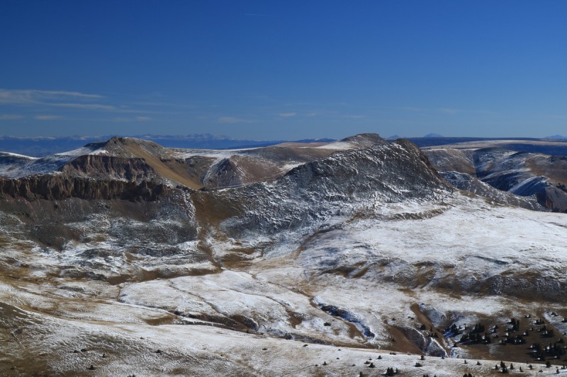
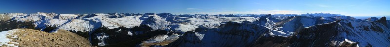
Summit ridge of 13,201 Summit pano NE Summit pano SW
Broken Hill looking mostly snow free now!
On the return, I followed my way up and got back to the saddle with Wetterhorn Basin. There is supposed to be a trail back to the main one, and it got more visible the closer I got to it. Likely all the snow covered most of the obvious trail.
A macabre trail sign. The rest of the skeleton and fur was a bit lower on the trail
Approaching Wetterhorn Basin, with 2 trail signs - dueling
Wetterhorn!
Sunset on a snowy trail.
The trail decisions were pretty interesting and after only seeing the mineralization in the lower stream, I noticed that between the 2 stream crossings on this trail, is where the old defunct mine is that is polluting the stream..
Trailhead: Nellie Creek
Mileage: 10.69
Elevation Gain: 3,679'
Partners: Solo
I left the campsite at about 6:30 and was up at the upper Nellie Creek TH just before 7:30. After a bit of getting ready, I used the trail for about 20' before I left it and took an old defunct road that I had spotted on my GPS. Since I had planned a traverse initially, I didn't really think about this cutoff until now. Once above the meadow, the route is pretty clear, and the going is pretty fast. I make very good time up to the broad saddle ridge area and spot my way over to the 13091 ridge.
Uncompahgre framed
13,106 from road 13158 and Uncompahgre 13106 and 13091
Once on the main ridge, the traveling was at 3-3.7mph all the way to the summit. Plenty of super random cairns all over. I doubt there is any way to get lost on this ridge!
13106 saddle Long tundra jog over to 13091
Cairn and San Luis group
Summit Pano
I keep thinking about the scene in Lord of the Rings with the flaming towers...
Took a short break on the summit. I figured the route today would be super easy... so why rush too much? Probably shouldn't underestimate the San Juans, even easy peaks can throw curve balls.
On the return, I met a super friendly local that was just as curious about me, as I was about him. Really wish I had my zoom lens on at the time, but I didn't want to take the backpack off and rustle through it. Figured that would be too much.
Why are there 3 huge cairns? Someone got bored!
After that, I went up the nice grassy ramp I saw on the way up from the trailhead initially. On top, the ridge is long and flat, until you get nearer to the summit area. The ridge to the cairn was made all the more interesting by the snow on the north side of it. A bit more scrambly than I had anticipated! Fun. At the first cairn, I wasn't sure if it was this one or the next, even though this first one had the summit register. But my map showed a lower angle slope by the end of the ridge, so I had to go there anyway.
Cairn on the summit? At the other cairn, looking back at the other one. Which is higher? Uncompahgre 13158 and Uncompahgre
It was a steep talus slope down to the first break, then another steep grassy slope down to the trail. I took it to the junction of the Uncompahgre trail, and went up that for a short bit until I could cross after the little waterfall. Having only summitted Unc in snowy conditions on skis, I was a bit surprised to see the surroundings dry!
Looking back on 13106 Where I left the Uncompahgre trail 13106
The slope up to the ridge with 13158 was littered with boulders and strange looking rock features. You couldn't put up a cairn if you wanted to here! Undulating terrain all the way up to the 200' foot slope of super crap. That was the worst part of the entire trip.
Rocky garden on path to 13158 13106 and 13091
The snow made the obvious ascent scary. So I ended up scrambling up the slightly more solid rock to the ridge. While it was more solid, it was also steep and down sloping rock, so not a good decent option. I ended up going down the snow slope, very carefully. But it did not look fun on the way up.
On the ridge, I was happy to note that the west side was not a complete cliff! Even a bit of a use trail all the way up. It stays pretty close to ridge proper for most of it.
The slope of suck! Finally on saddle, looking at summit At least the west side isn't a cliff!
I enjoyed the summit for as long as I could, since I knew it was late, and there was a gathering to attend!
Steep ridge line with Wetterhorn and Uncompahgre A sunny last view before crawling downhill
The descent sucked as bad as I imagined it would. I mostly crab walked, trying to keep my center of gravity lower, in case I did slip on the snow. I was quite happy to be back on flat ground. The return to the trail was quick, and my feet barely got wet today! Amazing how a little sun can melt away a light snowfall!
Note: Bill just added 50 photos. So I may edit the TR with that in mind later... I have to go to the TGR movie now
My GPS Tracks on Google Maps (made from a .GPX file upload):
LOVE the different look of the SJ's with the light dusting of snow! It changes it's appearance completely giving it much more texture than a mid-winter one.
Regarding the 3 cairns - maybe someone was just picking up the place, getting the clutter off the floor. :lol:
MtnHub - The mountains always look better with snow on them :wink: But yes, the fall dusting does bring out the special textures.
Tornadoman - The 13ers are a great excuse to go revisit special places, without having to repeat. Seeing these peaks from different vantage points, really makes that apparent. Maybe I'll ski these sometime...
Trotter - Beautiful day for Wetterhorn! Short tailed weasel eh? Either way, I was excited to see it so curious about me!
XterraRob - Tough to take bad photos on these days. Too bad Furthermore had cloudy conditions for one of his days. Scanning his TR didn't give me the an indication about how amazing the views would be.
aweskamp - Very worth the trip!
Bill - Great to see you again. Looking forward to skiing soon!
Caution: The information contained in this report may not be accurate and should not be the only resource used in preparation for your climb. Failure to have the necessary experience, physical conditioning, supplies or equipment can result in injury or death. 14ers.com and the author(s) of this report provide no warranties, either express or implied, that the information provided is accurate or reliable. By using the information provided, you agree to indemnify and hold harmless 14ers.com and the report author(s) with respect to any claims and demands against them, including any attorney fees and expenses. Please read the 14ers.com Safety and Disclaimer pages for more information.
Please respect private property: 14ers.com supports the rights of private landowners to determine how and by whom their land will be used. In Colorado, it is your responsibility to determine if land is private and to obtain the appropriate permission before entering the property.