Download Agreement, Release, and Acknowledgement of Risk:
You (the person requesting this file download) fully understand mountain climbing ("Activity") involves risks and dangers of serious bodily injury, including permanent disability, paralysis, and death ("Risks") and you fully accept and assume all such risks and all responsibility for losses, costs, and damages you incur as a result of your participation in this Activity.
You acknowledge that information in the file you have chosen to download may not be accurate and may contain errors. You agree to assume all risks when using this information and agree to release and discharge 14ers.com, 14ers Inc. and the author(s) of such information (collectively, the "Released Parties").
You hereby discharge the Released Parties from all damages, actions, claims and liabilities of any nature, specifically including, but not limited to, damages, actions, claims and liabilities arising from or related to the negligence of the Released Parties. You further agree to indemnify, hold harmless and defend 14ers.com, 14ers Inc. and each of the other Released Parties from and against any loss, damage, liability and expense, including costs and attorney fees, incurred by 14ers.com, 14ers Inc. or any of the other Released Parties as a result of you using information provided on the 14ers.com or 14ers Inc. websites.
You have read this agreement, fully understand its terms and intend it to be a complete and unconditional release of all liability to the greatest extent allowed by law and agree that if any portion of this agreement is held to be invalid the balance, notwithstanding, shall continue in full force and effect.
By clicking "OK" you agree to these terms. If you DO NOT agree, click "Cancel"...
Trailhead: Intersection of 727 and 759 Holy Cross City road
Mileage: 10.39
Elevation Gain: 4,385'
Partners: Solo
Difficulty: class 5.6
When I started my long weekend on Friday morning, I thought I had 3 hikes, 1 ski and 2 partners for 2 separate days all lined up. By the end, both partners bailed and I skipped the last day. Just proving that sometimes the best laid plans can go awry. At least one partner bailed early on, despite setting on the calendar a Gore ridge run for Monday, a month ago. Simple enough, I'll just substitute something else nearby. I have only a few "easy" ones left in the Vail-I70 corridor... Still rather not waste them though. So off I went to get my September ski, and complete 6 years of skiing every month of the year.
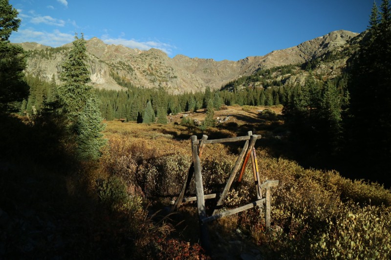
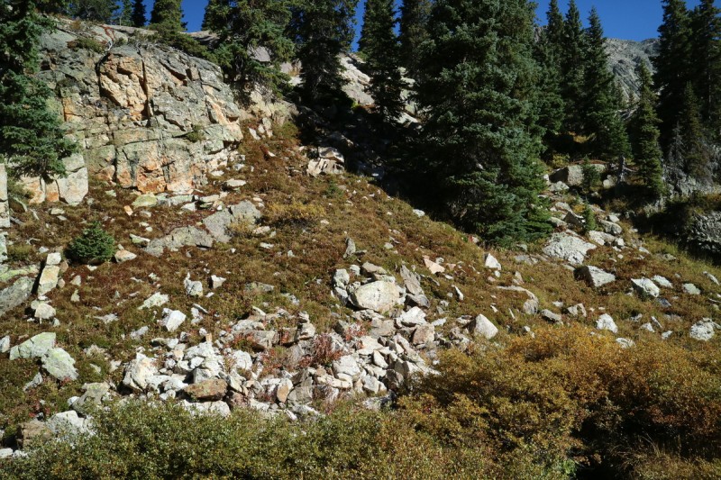
Pt 13,768 and Whitney have been just sitting there for a while on my radar. I've planned a variety of routes with other peaks added in. But once I skied Holy Cross Ridge earlier this year, my planning got easier. Just didn't quite know where the start of the hike would be. A bare bones TR on LOJ, with only a map, no words, showed the start at the lower road (703). There is a 4x4 road that goes up to Holy Cross City, but I didn't have beta on how bad that was. But once I saw the sign at the start... yeah not gonna drive that solo! I grabbed out my Trails Illustrated map, and noted there was a road that followed an aquaduct. So I went up to the other trailheads for Fancy Peak/Pass and kept driving. The road isn't bad but clearance and 4WD may be a good idea, as it seems that the stream blew out the road. They are currently fixing it.
Camped near the intersection of the difficult 4x4 road and French Creek. Saved myself a mile and 1,000'! Not bad! The next morning I got to see how narrow and difficult that road was. Not for large wheel bases like my truck! The lower section is even one-way, as evidenced by the sign when I started up. Not a few tenths of a mile further up, the road goes to difficult, and I can say I wouldn't want to go over that first obstacle without all the gear and other Jeeps. Plenty of other difficult road features as I went up higher into the basin.
Not gonna do it!
5, count them - 5 no snowmobile signs!!!
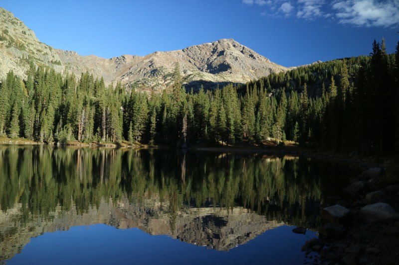
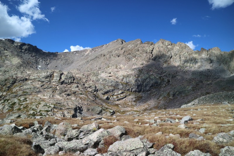
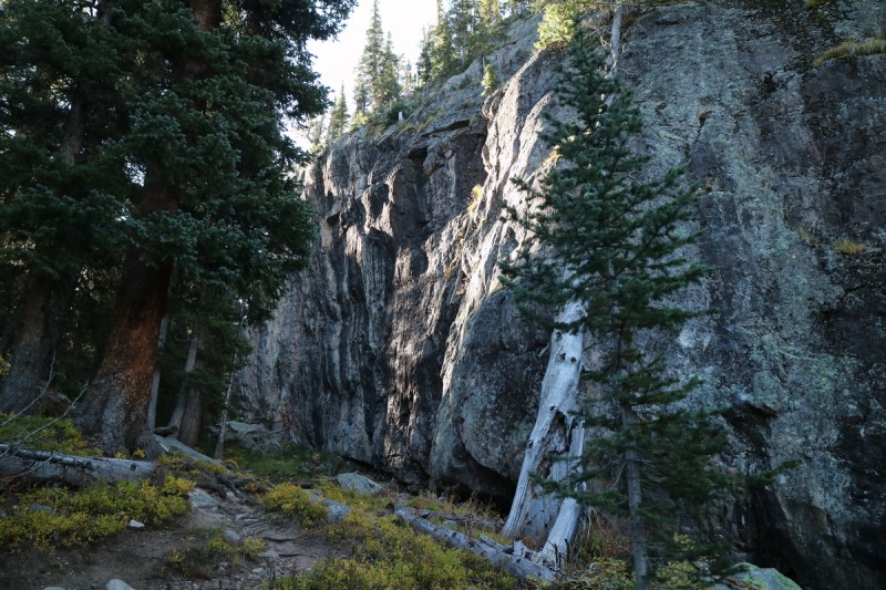
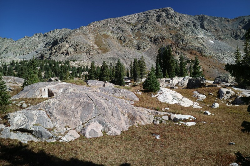
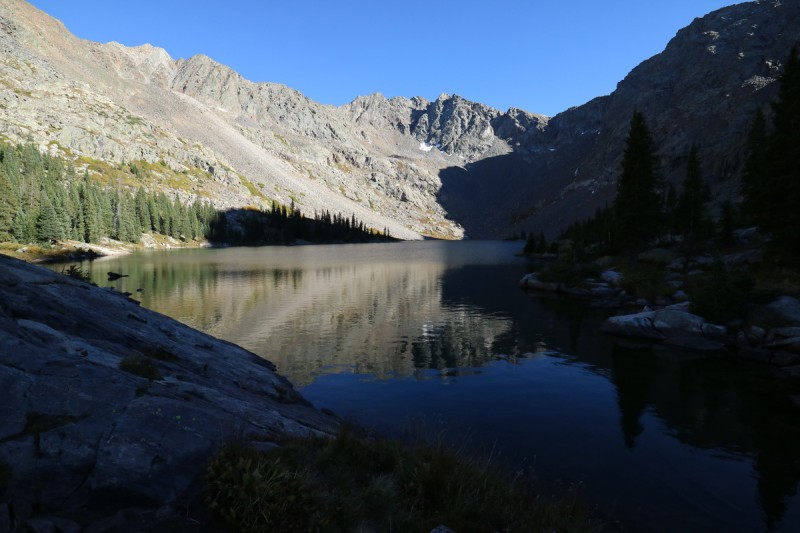
Once I got past the difficult stream crossing - for vehicles, no problems for me, the actual trail veers off to the right. A pretty decent trail, if a bit muddy in places. A nice pleasant stroll as I approached the first lake and campsite(s). After that, the trail continues the slow roll uphill and out of the trees, where I get the first views of the first peak. It was pretty cool in the morning shadow of Whitney Peak, as I hear hunters off in the distance somewhere.
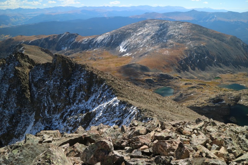
Start of trail Calm reflections First view of 13,768
Frosty fall morning
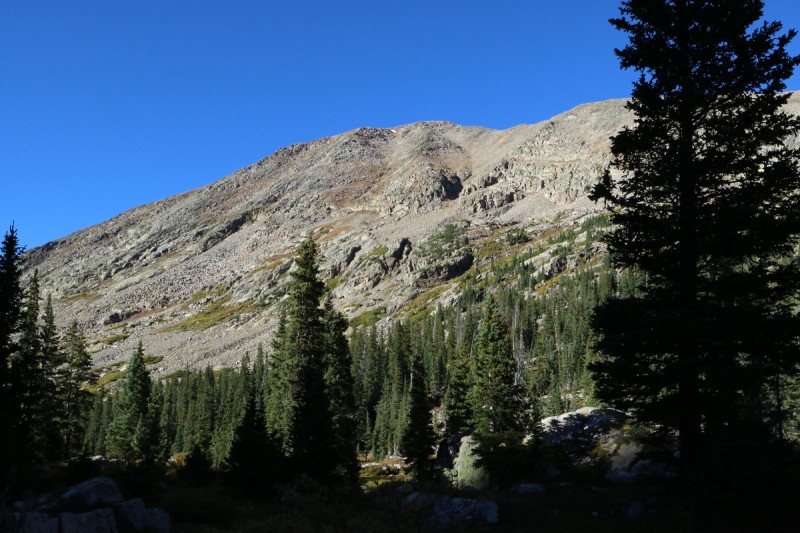
Fancy Peak
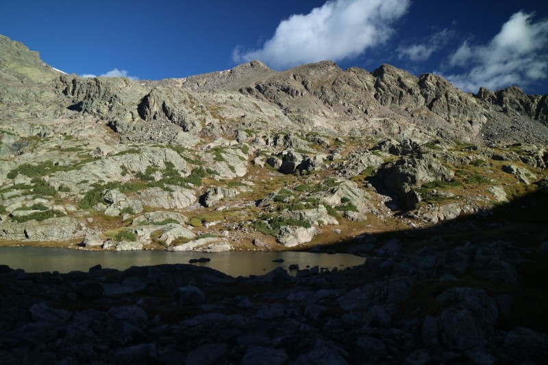
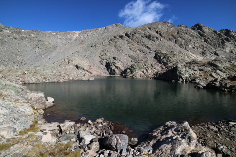
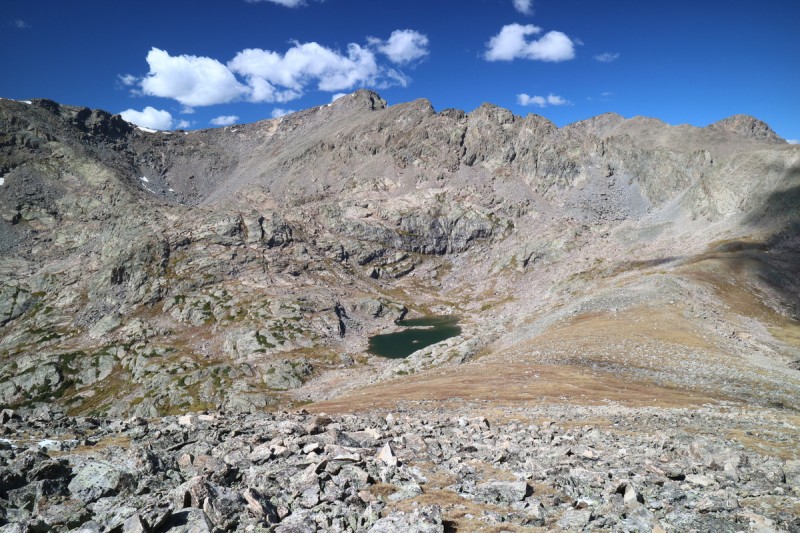
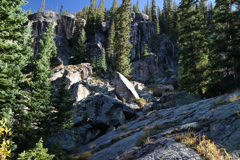
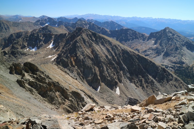
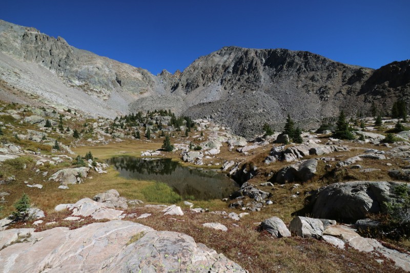
I split from the trail that continues over to the Holy Cross Tigiwon road area, and start up a boulder strewn grassy knoll. I approach the stream that drains the Seven Sisters Lake, but stay on the south side on slabby rocks. At the lake, I start looking for a way around to the right, but it doesn't look like it goes close to the water level, so I go around to the left. On the left side, I'm confronted with boulder drop offs and cliffs, so I continue higher and higher as I try to traverse around. Finally I get to a spot where I can get down and over to the talus slope on the south face of 13,768. Looking back, much of what I had to go around were cliffs, but low down, by a drying up pool of water, I see some easier slabs for the return.
Slabby ascent to Seven Sisters Lake Seven Sisters Lake with 13,768 Cliffy section trying to get over to 13,768 Spying a better return, Whitney in background
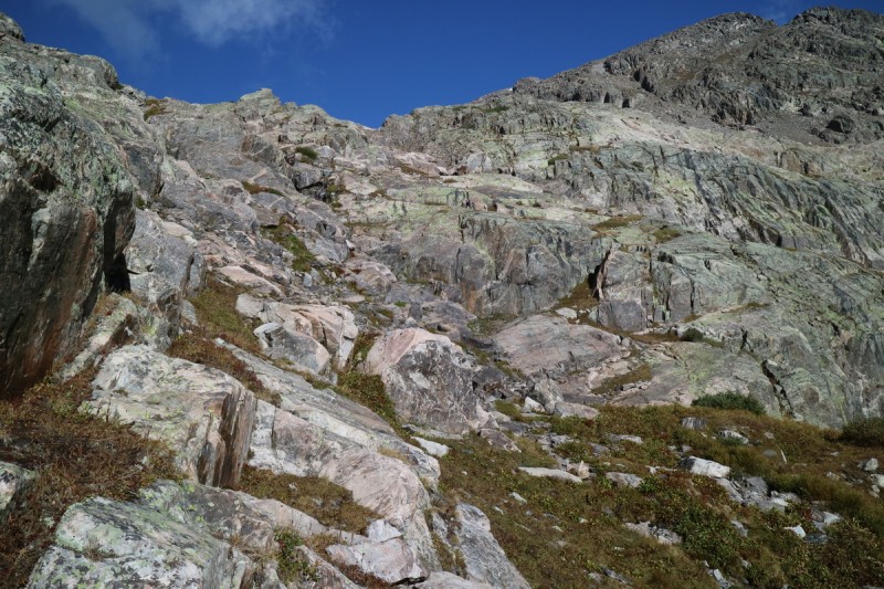
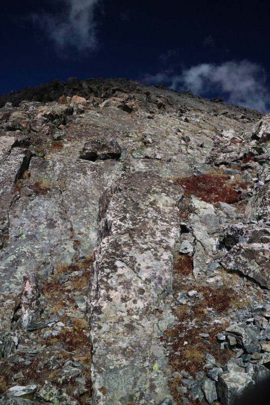
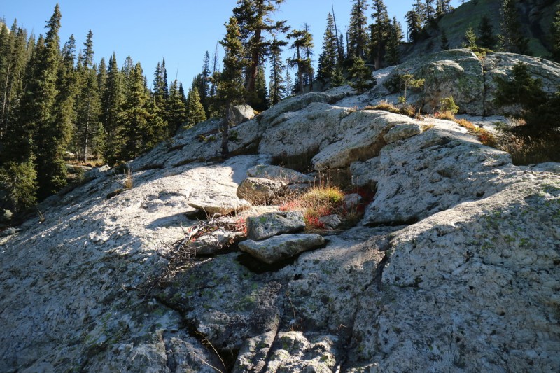
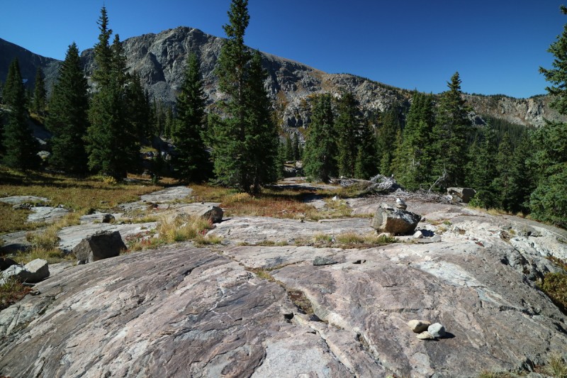
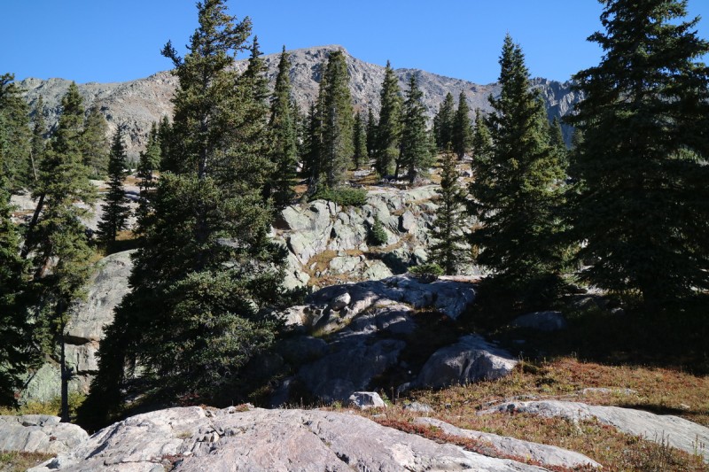
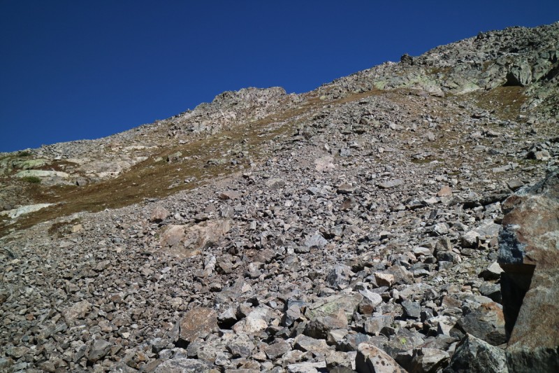
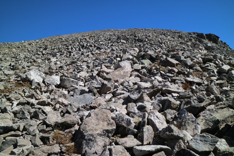
The talus slope up to the ridge is annoying as expected. I work my way up and to the right on whatever looks lowest angle and most stable. On the ridge, the final summit pitch presents itself as a lovely slabby ramp! Some scrambly fun for the last 200'. A nice pay back for the talus BS below.
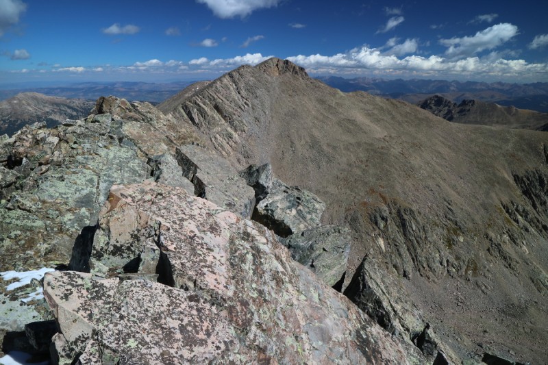
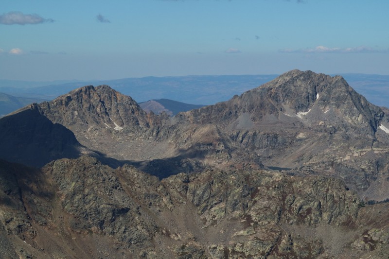
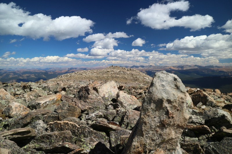
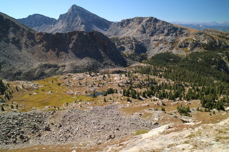
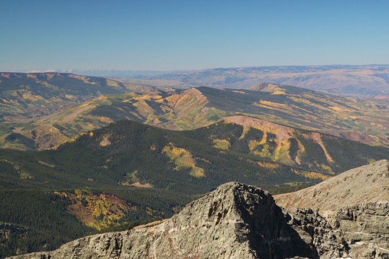
The views are pretty nice, though having Holy Cross Ridge almost perfectly imprinted on Holy Cross is unique. I sit up top for a little while, and look over at tomorrow's objective. Texting my partner for those beauties. Difficult being out of cell range, when plans are finalized with others. But I figured it was just final details, like when&where to meet to line up. But with my battery dying and another peak to go, I head off down the slabs and back onto the talus.
Slab-way to Heaven Holy Cross, Holy Cross Ridge imprinted Snowy north sides, Whitney in background
Some HCW 12ers and frosty Elks in distance
Pika and Gold Dust Glittery Lakes
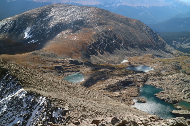
On my way down, I spot a cairn that looks to go through a gully on the SE face. I am drawn to it, but soon don't like the look and feel of the gully. All the rocks are moving, and it would be a sloppy descent. I decide to go with the known vs unknown. Especially after all the cliffs and round boulders I found on the way up. 4 people are down by the lake too, probably wondering why there's someone dropping rocks down to the lake.
But once I get down to the lake, I note that those 4 people are making their way up a gully. It looks tedious by how slow they are going. I didn't see them turn around, so it must have went.
Back on the other side of the lake, I had to decide wether to do a high traverse, or just go down to the trail the way I came up and then go to the saddle with Whitney. Here I went with the more adventurous option and scouted the grassy ramp traverse that I had spotted in the morning, but didn't take a beta photo of. Thankfully it didn't end in a grassy cliff, and I easily made my way around to the saddle with Whitney after a group on horses and on foot had passed by.
The rest of the way up Whitney was pretty easy and gentle.
Slabby scrambling Green traverse Looking back at 13,768 and green traverse A little higher view of 13,768 from Whitney Zoom of summit slabs on 13,768
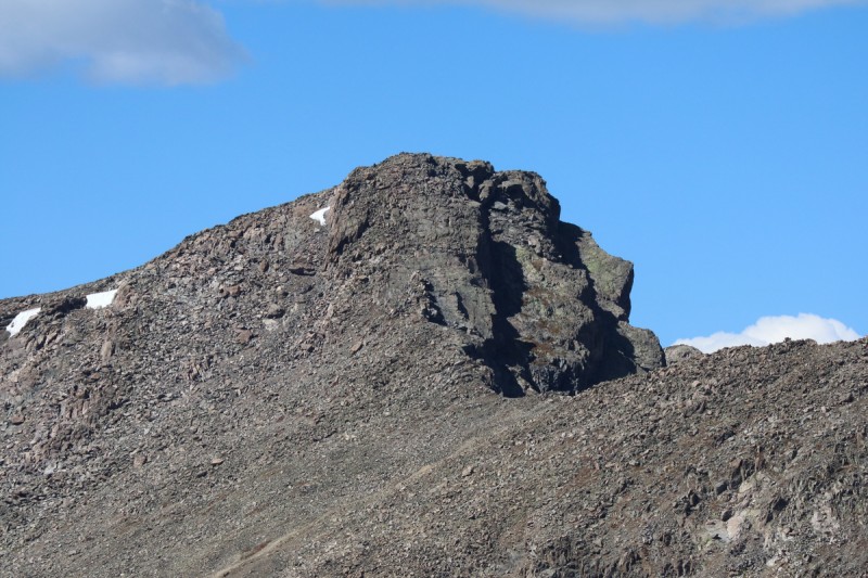
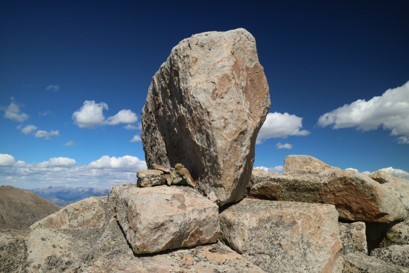
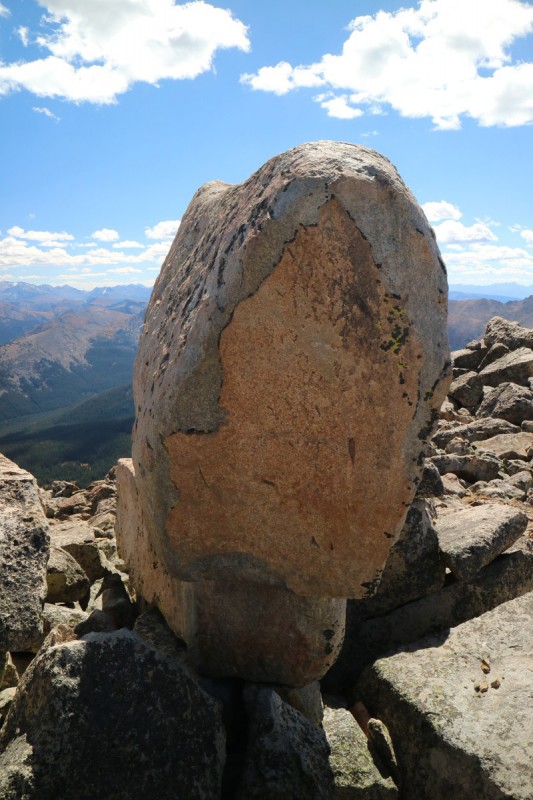
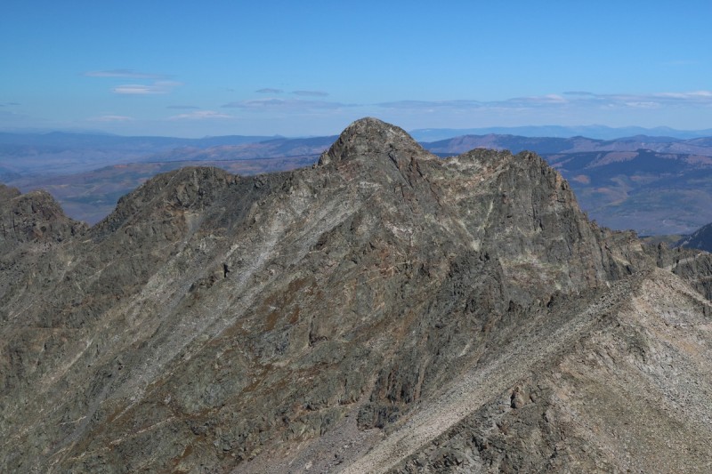
Once on the west summit area of Whitney, it's apparent that it's the east side that is higher. With the boulder. The 5.6 boulder to be exact. Previous TR's either gloss over the boulder, or just matter of factly 'climbed it'. I approached with a bit of trepidation, as it was quite windy on the summit plateau. Some rocks were stacked up on the west side. I circled the boulder, hoping for a better ascent point. Nope. It's the west side. I go up to it looking for hand and foot holds. Not much, very smooth. I kinda had hoped for some nice jugs for a 5.6 problem. So after a bit of thinking and staring, I finally find a tiny nubbin for my left foot and get friction holds for my hands and manage to get my right foot most of the way up the boulder, so that I can kinda flop my torso on top. I call it good, and go back down again. Being solo, there's no one to help me find the miracle nubbin, and with shitty hand holds, I'm not going to arm muscle my way down again. Circling the boulder again, I find a few spots where I can put in some pro. I'll probably be back with a partner, so I can stand on this one proper. I had brought some cord, hoping to sling something, but the boulder is pretty smooth.
West ridge of Whitney, looking across to East Summit The 5.6 Summit Boulder The 5.6 Summit Boulder, from NE
I text my partner once again, wondering why there's no response. But phone's at 14% and I just have to descend back to my truck and drive out, so I figure that's better than waiting for a response up high.
Descending Whitney
A lonely cairn in the middle of the woods - I was here!
Colorado Gold
As I get back into cell service, I finally get a text from my partner for the next day. Change of priorities, and he wouldn't be making it out this way tonight. Too bad, I had a great couple peaks lined up. Try to save the fun ones for partners. Tough to motivate people for random 13ers and those with slogs and crappy approaches.
In hindsight, I probably should have saved this trip for another day when I had solid partner(s) lined up. But one doesn't always make good decisions on a hungry belly. So I drive up the road to the Fulford Cave Campground, turn around and find the only 'free' camp spot a short distance away and cook dinner. At least I was surrounded by golden aspens as I cooked and wound down for the day.
Next morning as I wait for the campground outhouse, I try to capture the setting moon with the golden aspens. But I had to choose, golden or moon. I went with moon.
Hand holding the moon
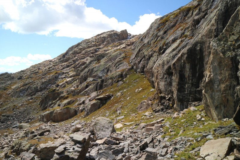
Reading SarahT's TR on Gold Dust and Pika, I was hoping to repeat her route and add photos in, since her camera had died on this trip. It sounded exciting, class 4 and fun. The trail is still muddy and wobbles around a lot at the start. I leave the trail after crossing the mini streams, and start ascending the drainage on the right.
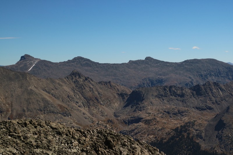
I start near the stream, but there's some deadfall, so I scamper up on top of the slabs above to the right. A cairn! With more visible too! But then I wonder if the slabs go, so I go back down to the stream area again. Trail-ish with more cairns. Ok. Then came the willow bashing over broken boulders. Less than ideal, so after a bit I go back up to the slabs. On the return, I stayed up on the slabs for longer. As I go higher up the drainage, and get into the basin, there seems to be cairns every time I look to where I want to go. So it would seem I'm on the right track! Rolling terrain over to the base of Gold Dust Peak.
Boulders to the right of the trail Boulder cliffs to the left of the trail Slabby boulders are the trail Cairns on the slabs Viewing Gold Dust between the trees A weakness in the boulder cliffs - with cairns Gold Dust Peak
Withered dry mushroom
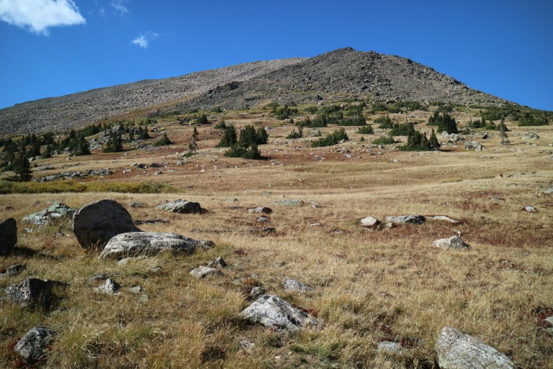
Starting up the slope to get to the SW ridge/slope to the summit, I decide to go around the rock slide to the right, and on the return I go to the other side. Both go just fine. The steep grass is tedious and slow, but it works. At the top, there's some nice scrambling, if you ignore some cairns for a bit. Once on the upper SW slope, the terrain is just talus. Never ending talus.
Talus and grass up to SW ridge/slopes
Mica glittering in the sun
If only it was gold
Looking back down on the basin Talus to the summit Colorful trees down below
I sit on the summit contemplating my future. The route over to Pika looks just as intimidating as Sarah describes. I'm solo too, and out of serious scrambling shape. Just to get around that first tower looks horrific. I'm loosing interest quickly. With a partner it would be a go, but right now, my confidence isn't at it's highest. So steep scrambling isn't looking like a good idea. But yet I sit on the summit for about an hour, thinking. I got up here early with the traverse in mind, why not enjoy it. Plus my body is starting to put up a fight, and with no partner for Monday, I bail on it all together. Sunday night traffic isn't something I've had to do in a long time, so there's no rush to get down either.
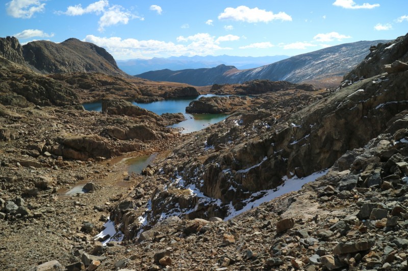
After a summitpost gander, I decide that I'll hike up to the lakes instead of going over to Pika Peak. Gather beta for the return for Pika and/or backpacking trip to the area.
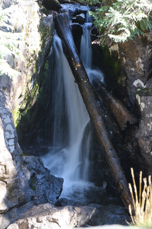
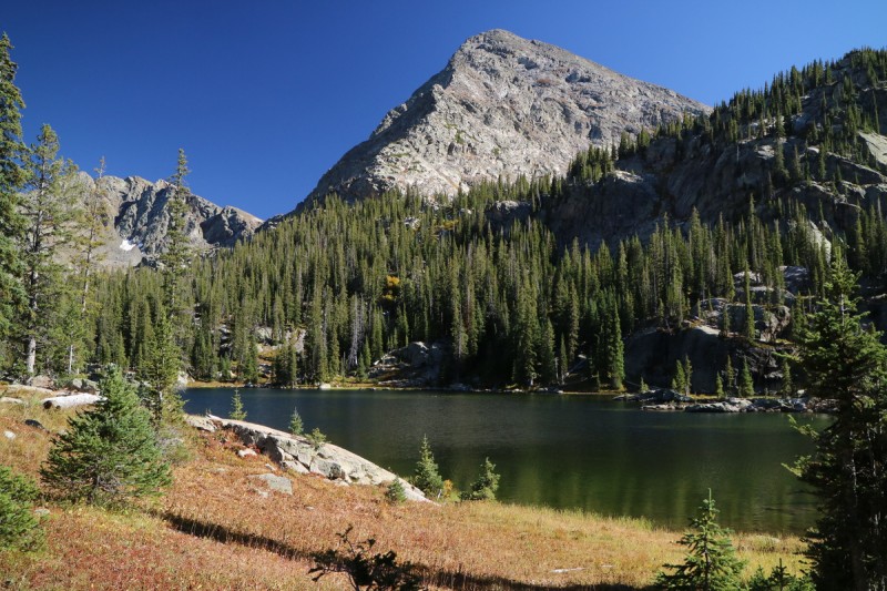
Right as I approach the trail after my bushwacking, I run into the first other lake hikers. While it is only 1.5 miles up to the end of the trail and the second lake, it does take a bit out of me. The muddy puddles and marshy areas abound above Lake Charles. Looking up at the slopes of Pika Peak, I'm not impressed. Can I ski that? I don't really want to walk on that steeep talus!
Mini waterfall on way to Lake Charles Fools Peak with Lake Charles Mystic Island Lake and Eagle Peak Pika Peak
The exit out was long and slow. It would seem that 14 miles on a tired body was more than enough for today. A similar distance and elevation gain for tomorrow was definitely out of the question. Grilled dinner and then drove home on empty roads. A bit of disappointment today, but also realization that I do want to come back to this spot again. The lakes are quite beautiful. So not all is lost!
My GPS Tracks on Google Maps (made from a .GPX file upload):
Ha! Thanks for posting that photo. I was wondering what it actually looks like! Doesn't look like a V0 problem to me, not in approach shows. Reminds me of some neat boulders on the looong approach to RGP, by Wemi pass. What pro would you recommend? Thinking small to #.75 and 30 m. I wonder if there's a rap anchor on that thing?
Looks like you are more than capable of getting out there with or without partners! Nice job making a good trip out of the weekend. How tall is that summit block on Whitney?
12ersrule & Bill - Glad it will be useful! Funny how little info was available on the Whitney summit block. If only I had known a few details...
Jay521 - thanks for the appreciation :D
Doug - Ha! Colorado is fun because it's not flat like Iowa :wink: Some of us actually like the rough roads, keeps the visitors lower.
Sunny1 - Gotta roll with the punches! Weather windows lately have been narrow.
Natalie - The boulder is taller than both of us, so challenging! On the east side of the Boulder is a narrow crack, so small passive pro should be fine. With a partner a dead weight would also be a go. Slinging a nearby boulder with lots of webbing another. I forgot to take a photo, and the geologist in me is cringing since I didn't even give scale to the photos! :oops:
Tornadoman - I have soloed over 62% of the 13ers already, and have definitely done harder and more committing routes alone. But after 3 years of skiing and the spending the summers hobbled in a cast, I have lost a little of the mental side to route finding and scrambling. Just a few more trips and I'll be back to normal, I hope! The boulder is at least 5'6" tall or so. So non-trivial for us short people!
Ute - I have a Canon Eos M3. I also carry a tele zoom and a wide angle lens with me, since the regular lens misses a few shots.
I really wouldn't count on placing any gear on the east side of the block:
Best bet if you are uncomfortable with an unprotected 8' pitch is to bring a 30ft piece of webbing and run it over the top, anchored on the west side to a boulder or a partner, and use as a hand-line for aid/self-lowering on the east side. I made a lower/jump down off the west side since it is closer to the ground, but took some time to think about it.
jkirk - I saw the couple photos of the block on LOJ, but it didn't really give me a good feel for exactly how big it is! There's no way I can jump off the top - none. With a titanium rod in my left leg... it's possible to explode the tibia, or worse. I've been warned to not huck big cliffs on skis by Fritz, who also has a rodded tibia and had the unthinkable happen. As for the webbing over the top, that was my plan, roughly, when I brought up some cord. But the boulder itself was too smooth for the cord, and webbing would have been much better. With the high wind at the time, I figured it would be better to return, since it's not all that far to go for just Whitney.
Great report as usual. I was up there alone a few years ago and did the summit block. Actually went back and forth to make sure it was the highest point, it is. As for the summit block, I too circled it and saw a couple of ways to get up it, but I generally look for the easiest line because (a) I'm just super lazy, my defining attribute as a climber :lol: , and (b) when alone, I want to minimize the chance of a sprain, bumped noggin, etc. Anyway, my recollection is that there was an adjoining boulder from which I stemmed over to the face. Not sure if it was a nubbin or seam, but it was a 1-2 move bouldering problem. Could be that raised seam on the left side of John's shot. The down climb was sporty, but OK. Maybe a stiff 5.6 under modern standards. I think (?) I had rock shoes, again to minimize the chance of a mishap when solo, and if the person who took John's shot was in boots, great job. Anyway, if you ever want to go back I'd be game to go along and help.
There was nothing to stem to get onto the boulder... look at my photos again. For me it wasn't a matter of getting on top of it, it was of getting down safely. I was in my regular hiking boots too, though mine are now getting a bit soft. So maybe better for bouldering? I'm also a path of least resistance ie lazy climber as well. Unless the choice is scree vs scrambling, then the choice is typically the latter. I'll keep you in mind when I go back.
Fugitives, if I remember correctly - 8 years ago. Can count the number of times I've worn boots in the last five years on one hand - don't know how I ever did boots. Anyway, the bulge/seam is what I used for hands/feet. This photo shows the starter boulder Tom references on the left:
Caution: The information contained in this report may not be accurate and should not be the only resource used in preparation for your climb. Failure to have the necessary experience, physical conditioning, supplies or equipment can result in injury or death. 14ers.com and the author(s) of this report provide no warranties, either express or implied, that the information provided is accurate or reliable. By using the information provided, you agree to indemnify and hold harmless 14ers.com and the report author(s) with respect to any claims and demands against them, including any attorney fees and expenses. Please read the 14ers.com Safety and Disclaimer pages for more information.
Please respect private property: 14ers.com supports the rights of private landowners to determine how and by whom their land will be used. In Colorado, it is your responsibility to determine if land is private and to obtain the appropriate permission before entering the property.