| Report Type | Full |
| Peak(s) |
Grays Peak - 14,275 feet Torreys Peak - 14,272 feet |
| Date Posted | 09/24/2016 |
| Date Climbed | 09/23/2016 |
| Author | Aramis |
| Rhapsody in Blue makes a great soundtrack for a retreat |
|---|
|
Spur of the moment I decided to attempt these two on Fri and maybe Bierstadt on Sat to close out the Front Range. The forecast wasn't ideal with 30% chance of snow late in the afternoon, no thunderstorms, so I figured I could always back off if needed. CDOT's traffic cameras showed the day was bright and clear all the way from Denver past the Eisenhower tunnel. I've mostly been cragging lately, so after reloading my pack and truck for this (camping gear, couple of sandwiches for the mountain, summit beer, food and coffee in case I opted to camp), an hour later I was on the road. I made good time to the winter trailhead, weather still lovely as can be. I took note of the warning signs about needing 4x4, but also remembering there being discussion that 2WD vehicles can make it they have sufficient clearance. After double checking here for anything new regarding the road to the summer trailhead, I opted to continue. I've driven small cars across much worse lease roads, but those weren't on a grade, so at 4 cylinders my truck simply didn't have the horsepower to go across the first of two potholes that could swallow a VW Golf. I reversed down the road until I reached a spot wide enough to turn around and parked behind a Toyota Tercel. This was just a bit below the sign indicating "Private land next 1.4 miles". I hiked the rest of the way, being passed even by a truck same size as mine but clearly with more horses under the hood. Time cost - about 45 minutes (this will be important later). Offloading some dead weight at the toilets, I started up the trail and was surprised how quickly I was progressing through the lower part of the trail. 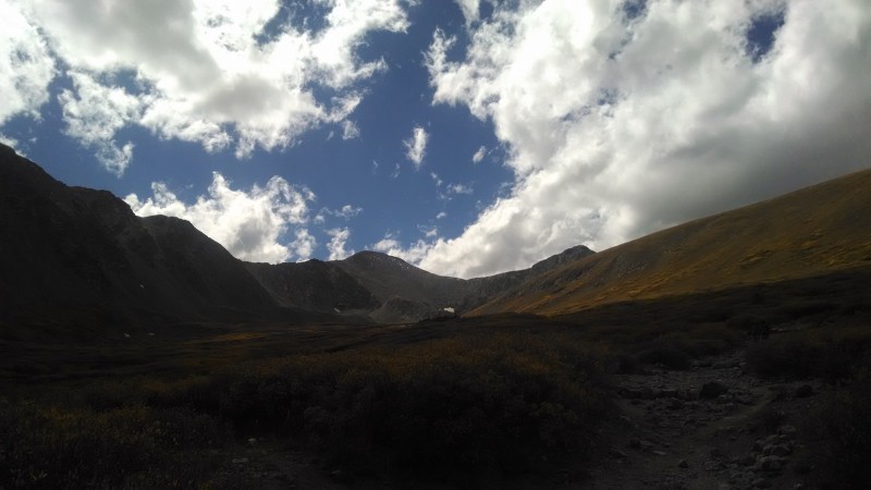 It's been magnificently maintained, thank you to everyone who's been putting time and energy in. I was probably halfway to the Grays/Torreys trail split when clouds really started rolling in. 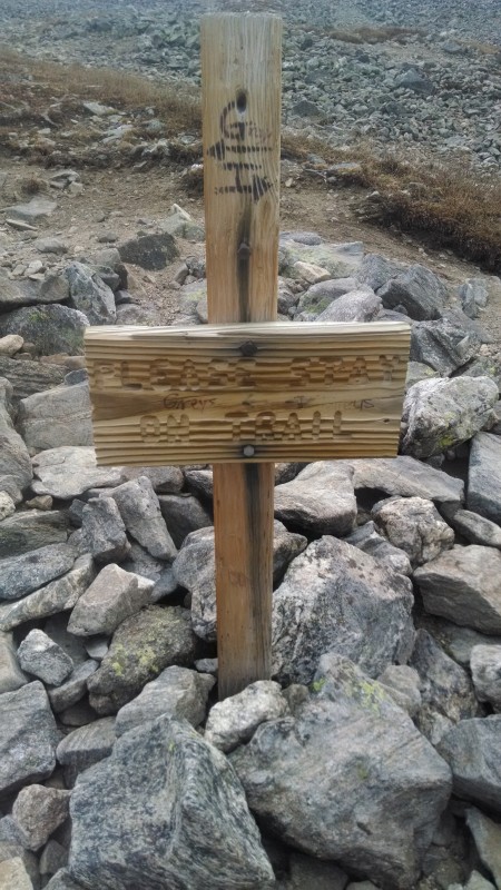 Earlier they had been fluffy and not laden with precipitation, so I kept going, even passing a volunteer crew working the trail. I was still in just a tshirt since I was warm enough. Occasionally little flurries of snow came down, but each time they were followed by a big break in the clouds and sunshine, so I kept going. Then things started changing. 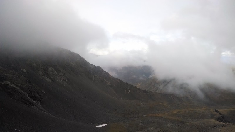 I had aimed for the saddle, planning to do Torreys first since the combo trail description implied getting there would be a bit more challenging of the two from the split. That way, I could rely on the trail to Grays being more bomber to get down even if bad weather struck. Well that became a moot issue - by the time I reached the big cairn with a wooden sign next to it, visibility had dropped to maybe half a mile. Going a couple of cairns further up Torreys, visibility dropped to the point where I could see the next cairn but not the one past it. The clouds on the windward side definitely showed no more breaks, so the little voice of reason finally won the discussion and I bailed. Reaching the Grays/Torreys sign again, it looked like the sun might be coming back out. 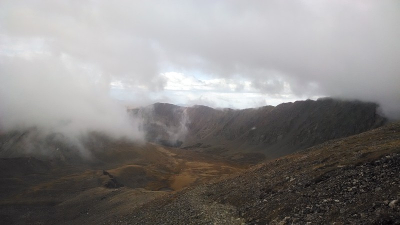 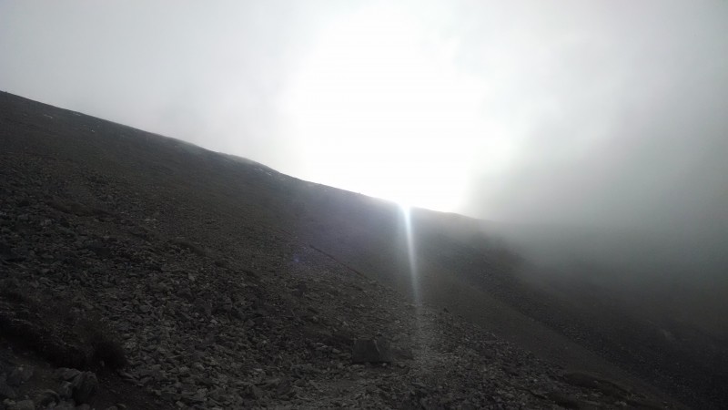 I waited a few minutes to see if the storm was done, as little enough snow had fallen that I could summit if it was over... but no love. Imagine where'd have been if I had been able to get to this point 2 hours earlier (on my way down after both summits) or 1 hour earlier (perhaps lost on one of them). With more clouds rolling over the ridge into the valley, snow started falling in more significant quantities. It was mostly melting, but I wanted off the mountain side before it started freezing on the many rock steps along the trail. I hustled, but it's a long retreat when you are 5 miles uphill from your truck. Sure enough, I was last one off the mountain, so the last mile and a half from TH to truck was mostly done with snow driving into my face. Hopefully one of the parties who were driving up a I drove down will report on how much snow they got overnight; I understand Loveland Pass got quite a bit. 10 miles of hiking, no summits, all in all a great day. Thumbnails for uploaded photos (click to open slideshow): ")
")
")
")
")
|
| Comments or Questions |
|---|
|
|
Caution: The information contained in this report may not be accurate and should not be the only resource used in preparation for your climb. Failure to have the necessary experience, physical conditioning, supplies or equipment can result in injury or death. 14ers.com and the author(s) of this report provide no warranties, either express or implied, that the information provided is accurate or reliable. By using the information provided, you agree to indemnify and hold harmless 14ers.com and the report author(s) with respect to any claims and demands against them, including any attorney fees and expenses. Please read the 14ers.com Safety and Disclaimer pages for more information.
Please respect private property: 14ers.com supports the rights of private landowners to determine how and by whom their land will be used. In Colorado, it is your responsibility to determine if land is private and to obtain the appropriate permission before entering the property.

