Download Agreement, Release, and Acknowledgement of Risk:
You (the person requesting this file download) fully understand mountain climbing ("Activity") involves risks and dangers of serious bodily injury, including permanent disability, paralysis, and death ("Risks") and you fully accept and assume all such risks and all responsibility for losses, costs, and damages you incur as a result of your participation in this Activity.
You acknowledge that information in the file you have chosen to download may not be accurate and may contain errors. You agree to assume all risks when using this information and agree to release and discharge 14ers.com, 14ers Inc. and the author(s) of such information (collectively, the "Released Parties").
You hereby discharge the Released Parties from all damages, actions, claims and liabilities of any nature, specifically including, but not limited to, damages, actions, claims and liabilities arising from or related to the negligence of the Released Parties. You further agree to indemnify, hold harmless and defend 14ers.com, 14ers Inc. and each of the other Released Parties from and against any loss, damage, liability and expense, including costs and attorney fees, incurred by 14ers.com, 14ers Inc. or any of the other Released Parties as a result of you using information provided on the 14ers.com or 14ers Inc. websites.
You have read this agreement, fully understand its terms and intend it to be a complete and unconditional release of all liability to the greatest extent allowed by law and agree that if any portion of this agreement is held to be invalid the balance, notwithstanding, shall continue in full force and effect.
By clicking "OK" you agree to these terms. If you DO NOT agree, click "Cancel"...
When I was in the Winfield area in June, I skipped Pear Peak (13,462) and Unnamed (UN) 13517A (both accessible from Clohesy Lake) because I didn't want to drive across Clear Creek at the height of snowmelt season. Fall seemed like a perfect time to climb these two peaks.
Wednesday, Sept. 21, 2016
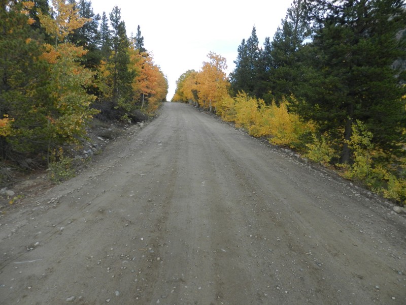
I drove through Buena Vista and on to Rockdale where I turned onto the Clohesy Lake jeep road. As expected, the water in Clear Creek was not a problem. I set up camp near the end of the road and got rained on while I was cooking dinner.
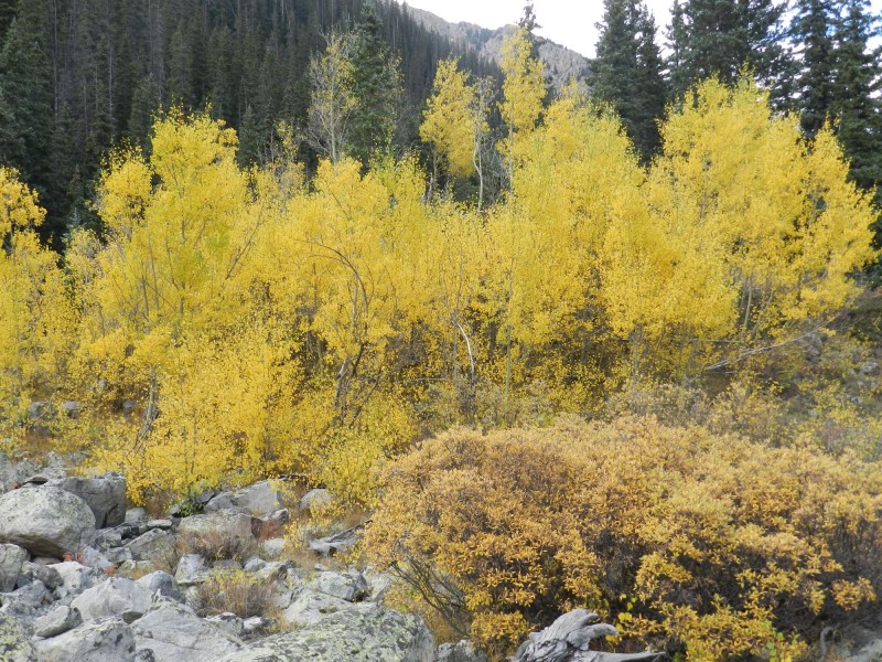
Fall has arrived along the Clear Creek Road near Vicksburg
I was aware that others had combined Pear Peak and UN 13517A in a single day, but the traverse sounded like it might be tricky so I planned to target UN 13517A tomorrow and Pear Peak on Friday.
Thursday, Sept. 22, 2016
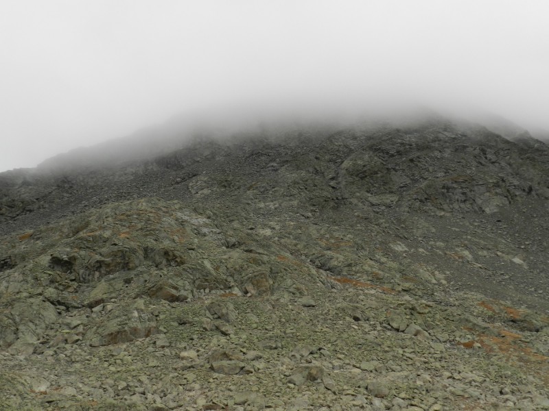
Rain had fallen during the night, and I got up to overcast skies and some fog.
The clouds are out in full force already
I headed up the Pear Lake Trail, intending to leave the trail at about 11,240' and head WSW toward UN 13517A. The problem was that low-lying clouds blocked my view of the peak and I ended up overshooting where I'd intended to leave the trail.
Low-lying clouds made it difficult to see UN 13517A
No problem; I decided to continue on the Pear Lake Trail to about 12,160' (where the trail makes an abrupt curve from SE to NE) and then head up Pear Peak.
The east ridge of Pear Peak from where I left the trail at about 12,160'
My ascent route on the east ridge of Pear Peak; I aimed a little bit east of where I thought the summit should be
Once I reached Pear Peak's east ridge, this is the view I got. I reached the summit 10 minutes later
The intermittent rain made the lichen-covered rocks quite slippery, so I made it a point to be extra careful.
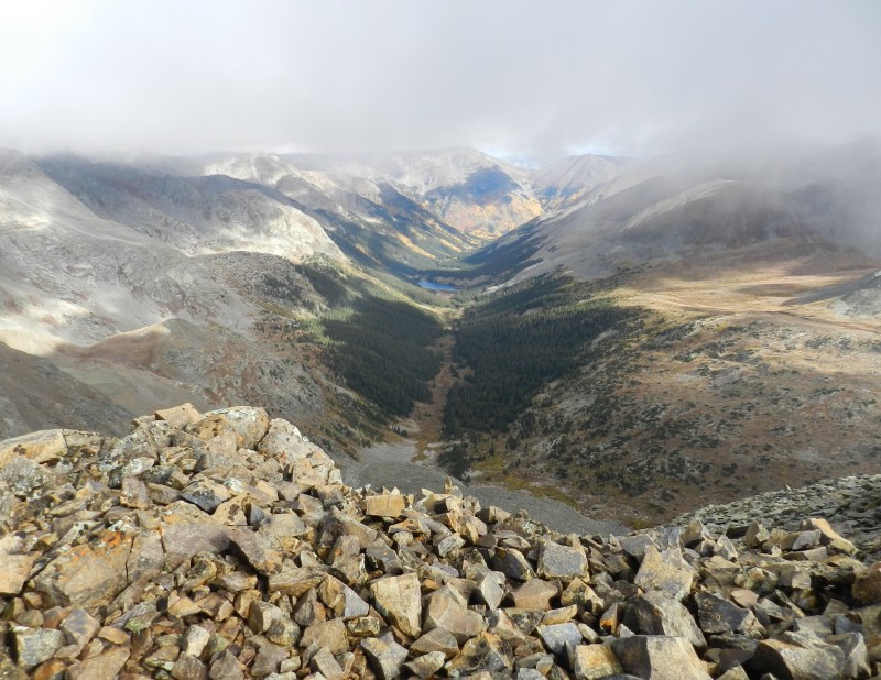
The fog lifted briefly so I got a view looking south down the valley from the summit of Pear Peak. Clohesy Lake is the lake y
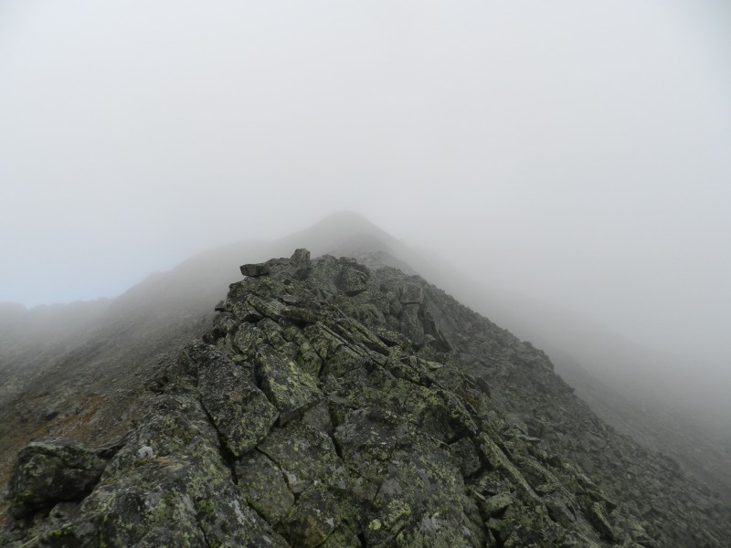
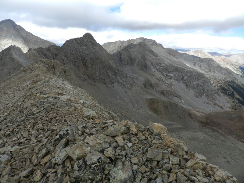
I took a look at the ridge between Pear Peak and UN 13517A and decided that it didn't look too bad. There appeared to be some bailouts from the ridge in case the weather worsened, so down the ridge I went.
A look at the ridge to UN 13517A, which is about 1.75 miles away
A 13,220' ridge bump rears its ugly head. In general, the best way around obstacles is on the west side of the ridge
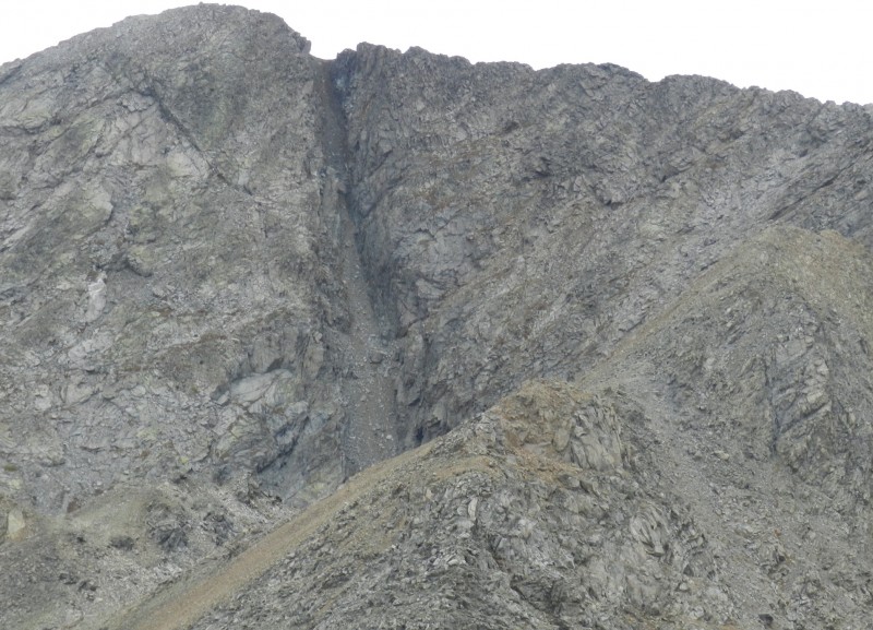
UN 13517A is getting closer. I thought the notch to the right of the summit would be a problem, but it wasn't
A CMC summit register had been placed on the summit of UN 13517A in 2014. Seven climbers signed in 2016, but only two in 2015. I could see a descent route all the way to the valley that began near the notch just east of the summit. It required zigzagging on ledges, but nothing too sketchy.
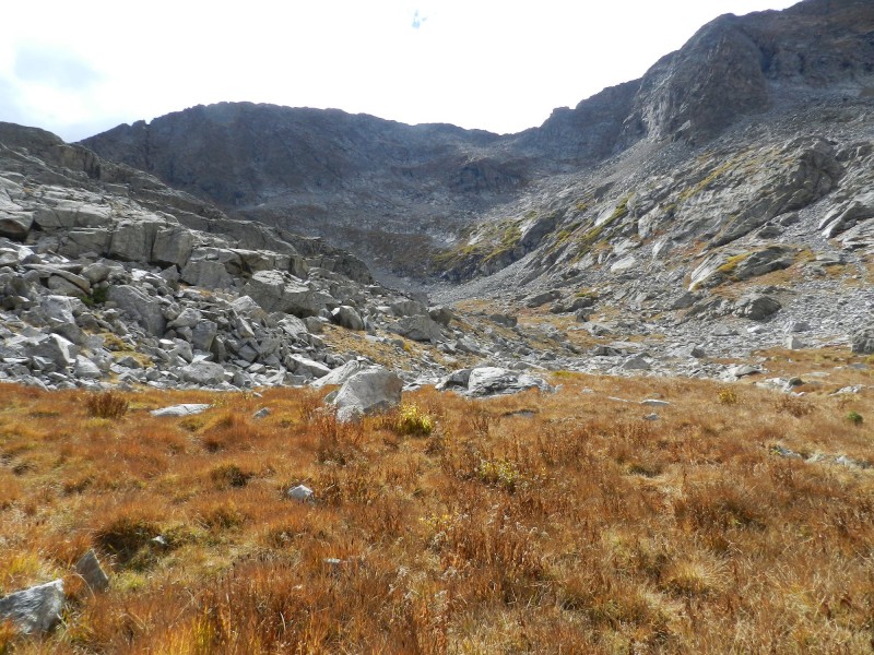
Looking back at my descent route from UN 13517A
Looking east toward the Pear Lake trail from the same location as the previous photo
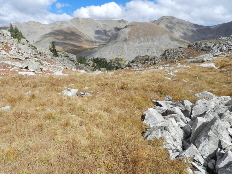
I followed some game trails down to the Pear Lake trail. As long as they went the right direction, I didn't mind. Rain fell most of the way back to my campsite. Then the sun came out!
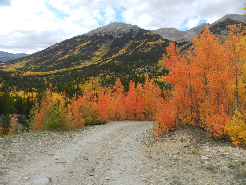
Fall foliage close to my campsite
More fall foliage on the east slopes of Huron Peak
It was nice to get both peaks in one day, but I hadn't brought any other maps with me so I couldn't really add another peak on Friday. That's okay; there's always next week.
Along the Clohesy Lake jeep road
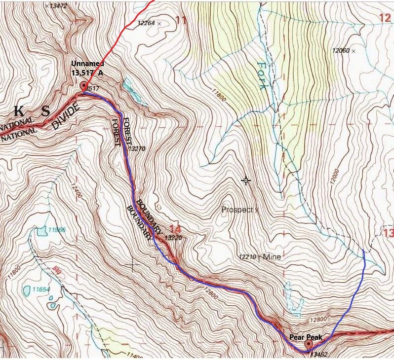
Blue = ascent route; red = descent route
Thumbnails for uploaded photos (click to open slideshow):
Thanks, Dave and Brian. September can be a great time for climbing and enjoying the fall colors, but sometimes the weather's marginal. I still have a lot of tri's to go.
Caution: The information contained in this report may not be accurate and should not be the only resource used in preparation for your climb. Failure to have the necessary experience, physical conditioning, supplies or equipment can result in injury or death. 14ers.com and the author(s) of this report provide no warranties, either express or implied, that the information provided is accurate or reliable. By using the information provided, you agree to indemnify and hold harmless 14ers.com and the report author(s) with respect to any claims and demands against them, including any attorney fees and expenses. Please read the 14ers.com Safety and Disclaimer pages for more information.
Please respect private property: 14ers.com supports the rights of private landowners to determine how and by whom their land will be used. In Colorado, it is your responsibility to determine if land is private and to obtain the appropriate permission before entering the property.