| Report Type | Full |
| Peak(s) |
Dome Mountain - 13,379 feet Tower Mountain - 13,545 feet Twin Sisters East - 13,441 feet Twin Sisters West - 13,382 feet "V 7" - 13,043 feet Unnamed 13076 - 13,076 feet Unnamed 13145 - 13,145 feet Bridal Peak - 13,514 feet Little Giant Peak - 13,417 feet King Solomon Mountain - 13,196 feet |
| Date Posted | 09/13/2016 |
| Modified | 09/14/2016 |
| Date Climbed | 09/08/2016 |
| Author | bergsteigen |
| 4x4 Silverton 13ers |
|---|
Tower Mountain, Dome Mountain ATrailhead: South Fork Animas River 4x4 Road: 3 Eureka Gulch (traildamage.com) Mileage: 9.64 Elevation Gain: 4,122' Partners: solo After a month of second guessing the weather, and not wanting to race monsoon weather, I realized I hadn't hiked a peak in a month. That's kinda unusual for me, especially in summer. But when your speed isn't what it was pre-injuries, then trying to plan out a trip to the San Juans or anywhere else far away becomes problematic. Part of it was my fault, I didn't have any short and easy days lined up. Everything I had was long ridge runs that required good weather to even contemplate. So eventually my frustration won out, and I did the research to find a bunch of hikes I could do, that weren't the usual crazy Furthermore inspired ridge runs. Need to work my way back up to that... So after a lot of doodling on TOPO! I had a variety of trips ready to go, based on weather and on what I felt my body could do. Now I just needed a weather window! Labor Day Weekend looked mostly rainy. But a window did start to open on Sunday afternoon. So despite my usual reservations, I decided to start driving out of town on Saturday afternoon *GASP* on 285 *SUPER GASP*. Other than the usual slow down where the road goes from 2 lanes down to 1, there was much thinner traffic than even I could possibly imagine. I made it to Silverton in 7 hours, just like I would have at a less traffic time of day. Hmmmmm. Take that holiday traffic freak out types! Day 1 was up in the air, even as I was driving in and out of Silverton. How much do I trust a forecast that says the rain will end around 11am? Well, I've driven this far. Let's give it the benefit of the doubt. So instead of using an easy day, I went with a pretty sizable route, but with bail-out options. Why not. I drove up the spur road off the main Alpine Loop after Eureka, and found the road to the defunct trailhead on the left, after the gated road. Not too bad, but the willows are really overgrown, and I ended up stopping 0.1mi from the end of the road itself, just from not wanting to scratch the truck too much. Plus I had a good parking spot, didn't know what I would find if I continued. Turns out, there are some nice camp spots at the end, if one would like to go all the way. 10am starting hiking! I decided to gear up in my rain pants, just to avoid getting soaked on day 1, morning 1. I didn't find the exact start to the trail at the start, but I did a little further up. You need to take the switchback up the hill for a few feet, and there it is. After crossing the talus rockslide path, the trail withers to something more resembling a game trail, but I don't need it for too long at this point, and after 1.3 miles or so, I cross over the stream to find the best uphill progress. I chose to ascend up drainage of the stream/waterfall area and find some old use trails here and there at times. Once above that initial headwall, the rest of the way presents itself. A scree gully. Welcome back to 13ering...  Breakfast! 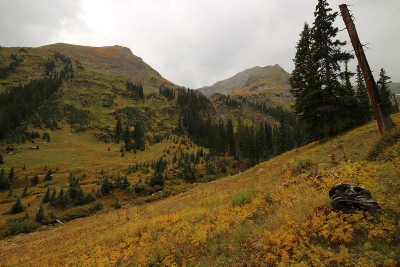  Looking down valley, as I start up the slope to approach Dome Mtn 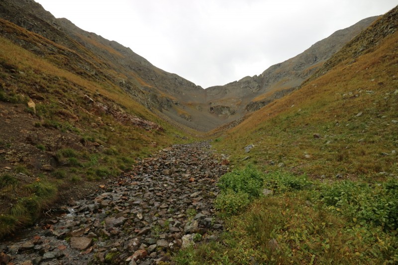 After a not terribly difficult scree gully, I was on the saddle just below the first summit. Weather was steadily improving, so I scampered up the remaining way, to sit upon ranked 13er #300. Didn't know it at the time, but it was still pretty nice to be back at altitude again! Furthermore had dropped down to the south side and traversed below the ridge and then back up to Tower. From my vantage point, it also looked like the faster way to do things. Ridge proper types can go find out the beta on that first section, it looks a bit nasty! 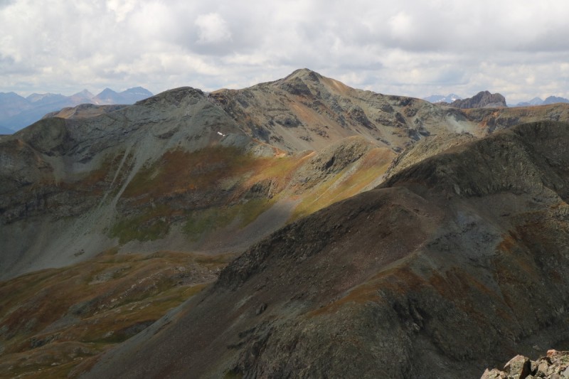  Little Giant Peak - a preview of what's to come. So down a short scree gully and a nice traverse over fall tundra. As I make my way, I come across a nice herd of elk, that want nothing to do with me, and take off into the next drainage. Nice to see the main users of the trails out and about! 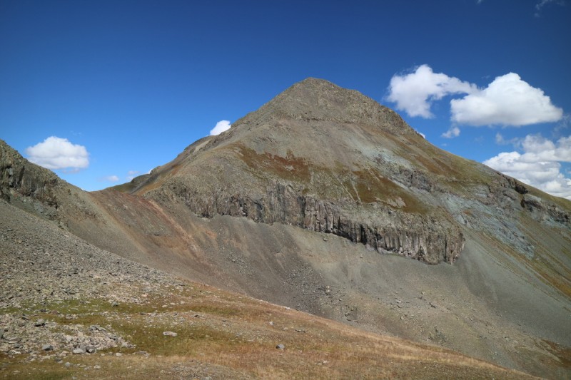 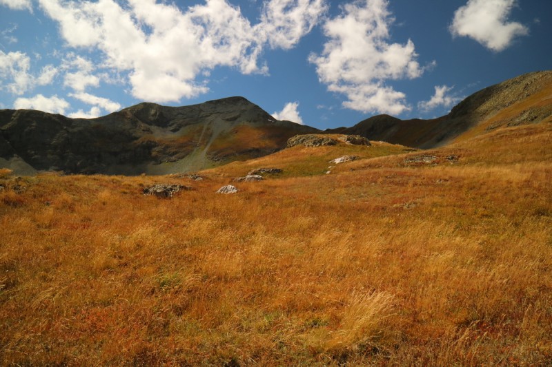  Elk herd  Elk trails  Elk scrambling  My route up to the ridge to Tower I get to the summit of Tower and the clouds are really starting to clear up, and its becoming quite a nice day. Minus the wind of course. But with full gortex shells on, I can handle a bit of wind. I sit and enjoy the early evening light, but all too soon it's time to head down. Dinner and getting ready for day 2 need to happen, so off I descend the north ridge, to what I hope is a good trail 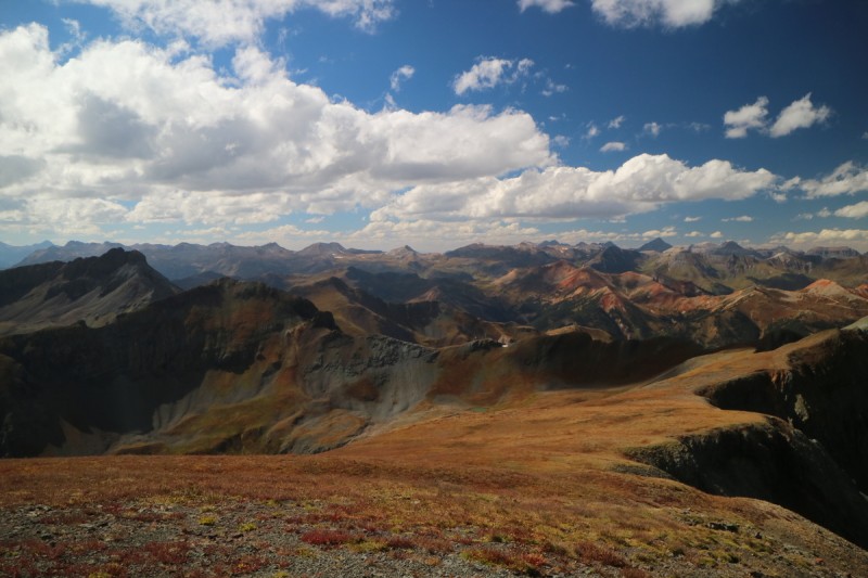 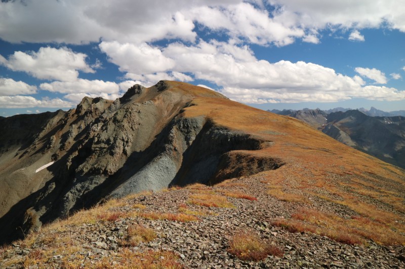  I can see the start of the "trail", but then it quickly disappears.  Hello backside of Silverton Mountain ski area! 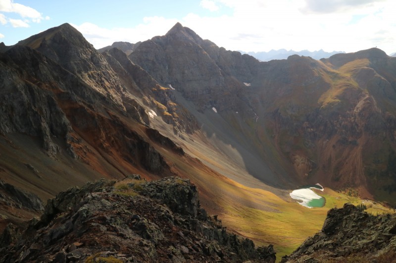 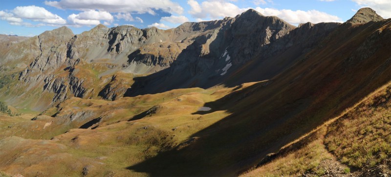 The trail that starts out rather nice, quickly becomes a game trail that is not easy to follow. I do my best, and soon decide to jump to the other side of the creek where I started up, since there was some trails over there. But then I remember the treed nightmare of that side of the stream, and soon regain the trail on the other side, where it becomes more solid again. I got back before sunset, so I'll call that a win! Twin Sisters East, Twin Sisters West, Pt 13,042Trailhead: Hardrock 100 crossing on FS 585 Mileage: 11.73 Elevation Gain: 5,017' Partners: solo After camping at the free part of the Mineral Creek campground at the start of the road, I wake up and start driving up the remainder, as I make my hot coffee. After the pay campground, the road is actually really nice. So I'm sipping my coffee, sans cover just fine. The remainder of the road up until the trail head - I would not consider coffee sippable. Unless you want to wear the coffee. Not difficult, but very rocky and steep enough to need 2 hands (especially with a stick). I finish my coffee at the small pullout near the start of the Hardrock trail, and gear up as a few other 4x4's pass by. The trail start is cairned, even if it is still very faint. The stream crossing then follows a tributary stream uphill for a while. I thankfully brought my stream crossing sandals, and they came in handy, since the first uphill is in a mud bog. I had to use some surplus water I brought with my to clean my feet and ankles from the mud. Mmmmm mud! It was like a spa day with the mineral water ice soak, and mud/clay mask. Nice at the end of the day, annoying at the start! 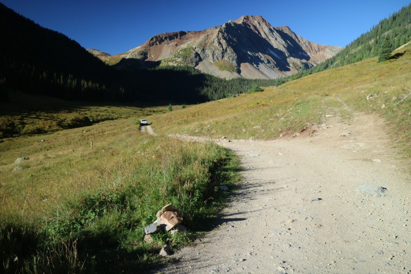 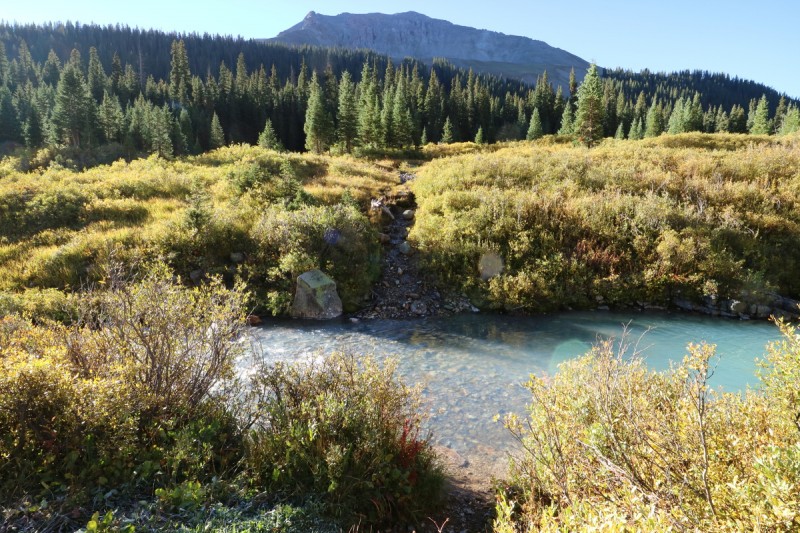 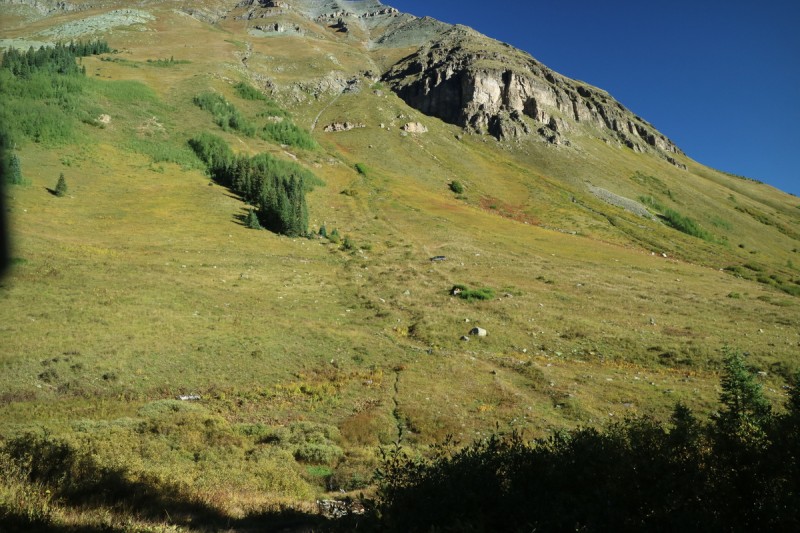 After that initial section, where I have to wonder how the Hardrock runners put up with that wet muddy crap, it's a fairly steep uphill progress on really nice trail. I then follow it as it traverses underneath the Twin Sisters massif. I note where Furthermore broke off from the trail to bushwhack uphill, but I keep going. I have plans to tack on Pt 13,042 at the end, and knowing where this trail goes, will be useful. The trail drops off the mini ridge, and goes downhill and to the other side of the drainage. Many sections of the trail are wet muddy messes, but its also simple and easy to follow a trail, than to bushwhack, so I'm still happy with my decision. As I get up to the saddle area - which is a huge bog - the traverse over to the base of Twin Sisters East goes fairly fast. So I doubt I lost much time over the total bushwack on the other side.  Trail is reasonably well cairned 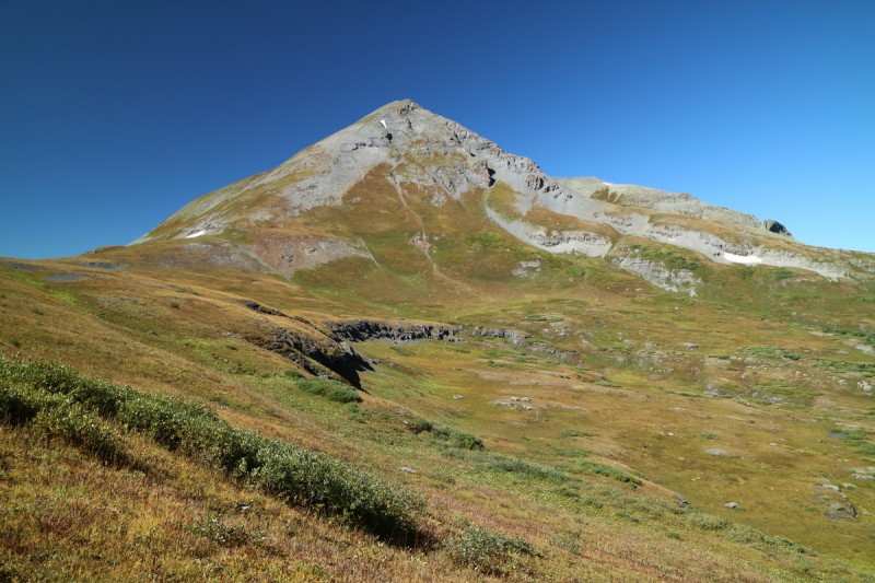 Once at the base of Twin Sisters East, I just put my head down and slowly go up hill. It's steep, with scree - talus and some plants. Uphill progress is slooooooow, but steady. Soon enough I reach the summit and take a nice break. Great views of the Ice Lakes basin, just next door. 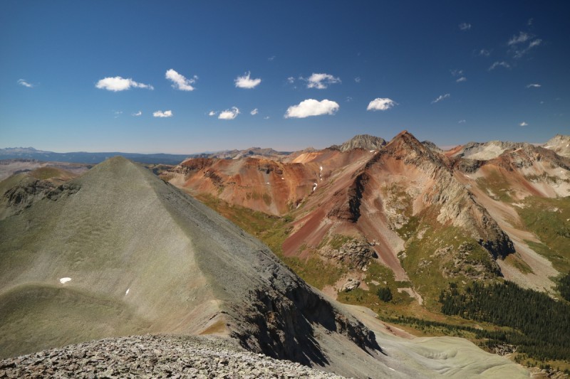 With the west summit so close by, I quickly head down then up the easy talus to the summit. The views are pretty incredible, and makes up for the howling wind that I've been in since I got to the saddle on the other side of East. 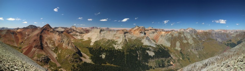  Ice Lakes basin peaks   OMG people!!! Actual people on 13ers!!! Since I didn't really want to go down the east ridge of TSE, I decide to drop down and traverse around it's southern flank. On the way down West, I run into the couple I saw on East. The came up from the Rollingrock trail, but diverted to come up the NW ridge. So there are quite a few routes to choose from now on these peaks. Though, I wonder how the scree slope off west was, to bring them back to the trail... 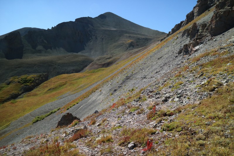  Pt 13,042 just a hop, skip and a jump away! Once on the nice grassy, yet boggy saddle area, it's a quick jaunt back to the Hardrock 100 trail, and a short time over to the base of Pt 13,042. From there its a semi steep grass slope to the summit, where I enjoy the early evening light around me. The Weminuche looks quite spectacular from here!  The faint Hardrock 100 trail continues across the basin, and brings me to the base of Pt 13,042 quite nicely! 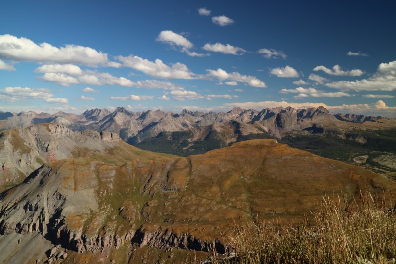 After basking in the glow for a bit, it's time to head down. I won't make the trailhead till just after sunset, so I decide to continue up the road to camp, instead of going back to the main campground. Mostly so I can eat and sleep a bit more. Turns out, I probably should have driven back. A marmot started chewing on my truck at midnight, and it took driving around for a while, before he gave up. I even sprayed 2 types of critter ridders under my truck. But a second application of the one containing coyote urine seemed to do the trick after driving the truck a little bit. Grrrrr marmots!!!!!  +1 life Pt 13,069Trailhead: End of road Minnie Gulch 4x4 Road: 3 (traildamage.com) Mileage: 4.47 Elevation Gain: 1,523' Partners: solo After 2 fairly long big days, it was time for an easy one. Good thing the weather cooperated too. At 6am, I heard thunder and saw lightning from my sleeping bag. Hmmmm slow morning, as I drove back into cell service to see what was up for the weather today. Clearing after noon, possibly after 5pm. Dang, gonna be a short day! So I pick out my shortest route, and decide to do some rockhounding as I wait out the weather.  Waterfall along road back to campsites Soon as I see the weather window start, I drive up the Minnie Gulch road, which is quite easy, to just about the end. Yet again, stopping 0.1mi from where the actual trail starts, mainly to have to flat parking spot. It's after 2pm, and I'm starting a 13er hike... watch out 14er noobs - it can be done! Hahaha  Start of weather window - snow has fallen!  Little waterfall in Minnie Gulch Clouds are still whipping overhead, but they are thinning, so up the trail I go. At least I can pause if need be, just below the ridge. But not much pause was needed, as I got up on the windy ridge and make my way to the summit shortly thereafter. 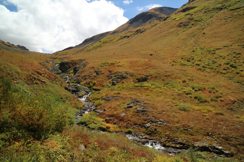 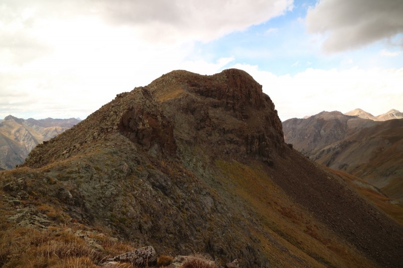 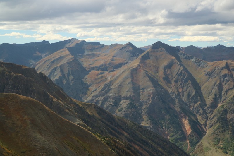  Colorful fall ridge 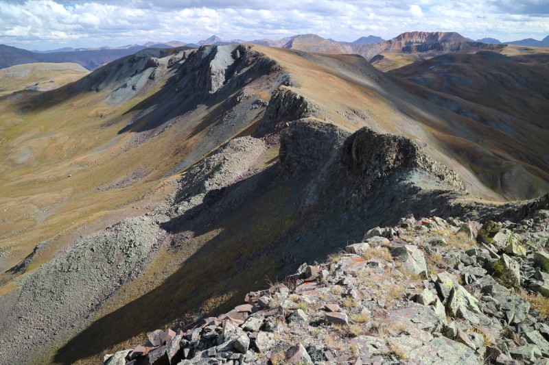 A short and sweet hike for an afternoon hike. I briefly thought about hiking the unranked 13er, but I wanted to relax a little bit this evening in camp. Meh, I'd come up here again if need be. Easy road, easy trail/terrain. As I'm approaching camp, it looks like RMNP in full tourist mode. There must be moose, and there they are in the swamp, eating dinner!   Pt 13,159, Bridal Peak Or "T 11"Trailhead: Imogene Mine off Ophir Pass road Mileage: 8.94 Elevation Gain: 3,900' Partners: solo 3 years ago, I had started a traverse from Red Mountain pass (Insanity on the Million Dollar Hwy - Part II TR ), with the full intention of ending it with T 11 and Pt 13,159, but the day was ending, and I didn't think I could bike up the pass in the dark, and not be killed. So I had to leave these 2 beauties for later. Well later, was this trip finally! I drive up to where the old mining road meets the trail, and end up backing up to a good parking spot. The road is a loop, so I had approached from the north, whereas most approach from Ophir pass road from the south. There are a couple of parking spots, but not many. Just as I'm about to take off, I see the first couple arrive. Hmmm? There must be a lake up there somewhere. Who hikes random 13ers? The trail quickly switchbacks up the slope, and I get the first view of Pt 13,159 from the initial clearing. I hike up to the saddle, since I figured staying on the trail would be faster. From there I remember Furthermore had gone up between the summit and false in a scree gully (though I can't find his TR now...!!!!), but I end up following the ridge and going up and over the false summit with only minor scrambling. From there I get a nice view of the summit ridge. 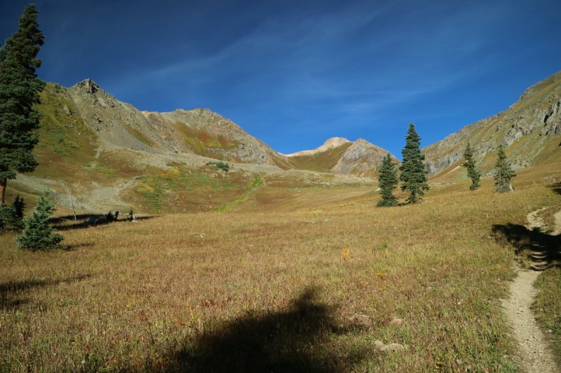  Below the false summit on the ridge. 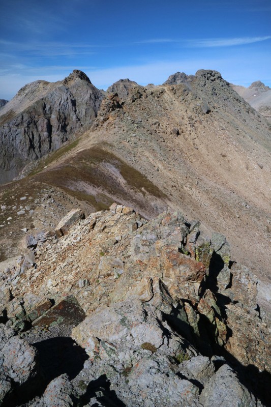 After the false summit, I make may way through the loose rock until I can see the final summit ridge area. I've been on this terrain before, following ridge proper won't be continuous, and could involve multiple jumps or weird down climbs. So instead I follow just below the ridge and scramble as necessary until I see the final summit block. Ridge proper didn't "go", so I made the right call, thankfully. Quick scramble, and I was on the summit block. 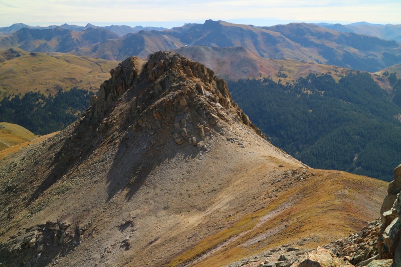  Super amazing views! Columbine Lake below looks - wildly blue. That can't be healthy blue! That must be where the couple was going, since they didn't follow me up to Pt 13,159. Since I didn't think following the ridge down would go either on this side, back to that nasty scree gully in the center. At least going down is easier! 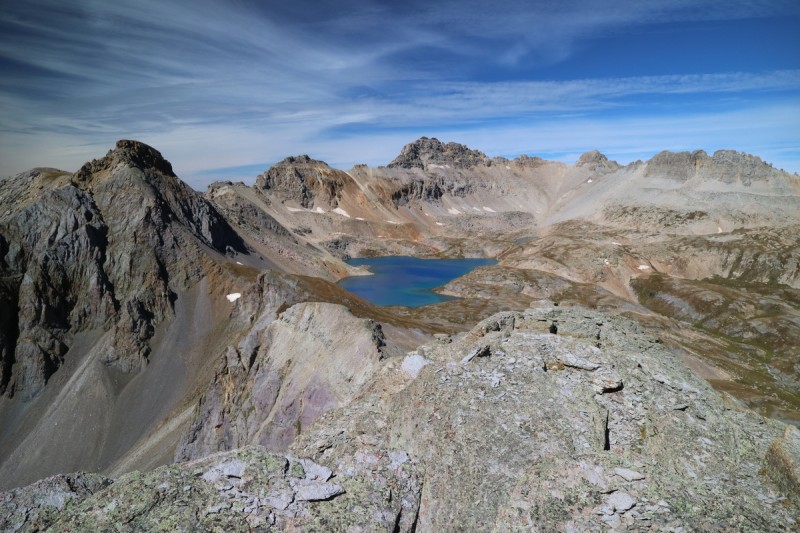 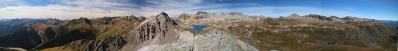  Ice Lakes Basin peaks from the other side 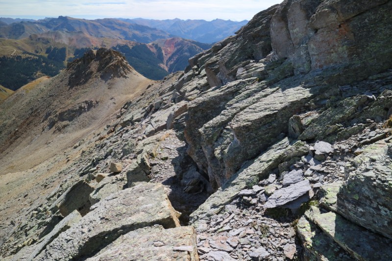 Once back onto the trail, I make quick work of the basin to the saddle to Bridal Peak. Only stopping to wonder and admire the white stream. What chemical or mineral is doing that? Once up on the windy ridge, it was a short talus hop to the summit.  Bridal reflections  White water... that's not healthy!  Wonder what mineral is making the rocks all white?  Flowers persist, even into alpine fall 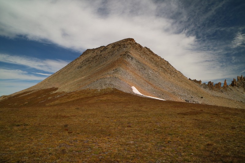 The views from the summit are once again amazing. Sneffels range to the north, Weminuche, Ice Lakes... I wanted to sit up there forever! The traverse was finally done, completed all the peaks. I knew the downhill would be really quick on the really nice trail, so I stayed on the summit as long as I stayed warm in the stiff breeze, and wasn't completely starving (packed food wasn't appetizing today).   The false summit to Bridal Peak / "T 11" - I don't think ridge proper 'goes' 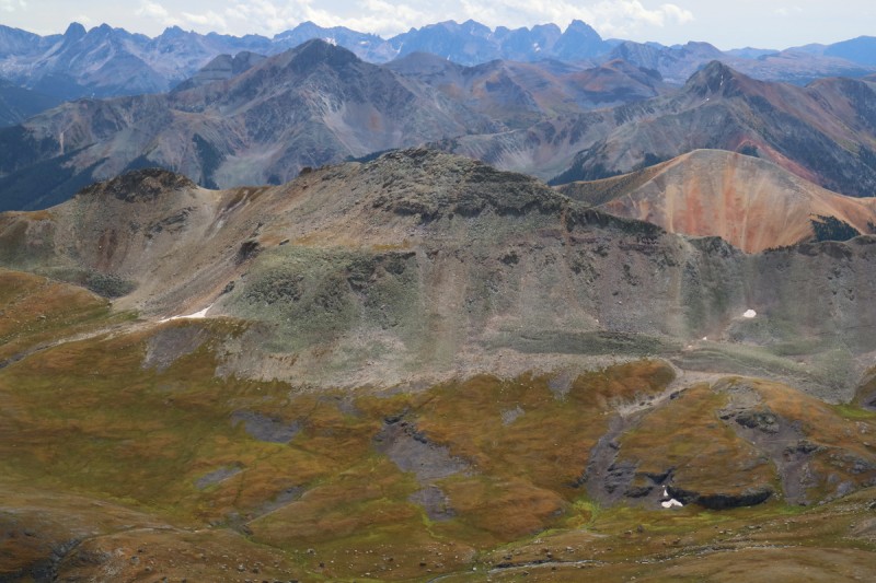  Twin Sisters E&W  Bridal, 3 Needles and the rest of the traverse The trail back to the saddle with Pt 13,159 went quickly, and so did the final descent. Nice quiet walk in the woods. Saw 4 other couples, all went to the lake and never really saw them much. Little Giant Peak, King Solomon MountainTrailhead: Close to end of road in Little Giant Basin 4x4 road: 5 Mileage: 4.41 Elevation Gain: 2,256' Partners: solo (with appearance by Steve) Final day, what to do? I had gotten a 4x4 road book in Ouray a month ago, and I was doing research into this final road up to Little Giant - or at least what I thought was the road. Turns out, the one Furthermore took and I followed is an off-shoot trail, and even harder than the one described (which goes to a rating of 5 by the end, Arrastra Gulch). I was a bit nervous about doing a road this tough, but figured with it being after Labor Day, and mid week, I should be fine. So I finally got up the nerve and tried to drive up to the base of Little Giant. Well, I took the wrong turn after the bridge, and even though it was wrong, the turns were at the same mileage points. hmmm I broke out my GPS and confirmed I was no where near where I wanted to be. The book says that this drainage is poorly signed, and it really is. After finally getting up there, taking all the left branches seemed to work. That final road... super narrow with very few pullouts, and the worst is a blind corner with a cliff on one side and a thousand foot drop off on the other. On the way up, I got the birds eye view of the plunge downhill. This did not help my nerves at all! I hate heights in vehicles, and I wondered how I would get down this, if I met someone right there. No way I could back up around a sinuous road with cliffs! But I kept going, and it got easier. I reached a nice flat valley area, and I decided to call it there. Furthermore went up higher, but without more beta - I was done. Nerves shot. As it was the trail the he missed on the way up, starts about where you can easily drive to, another 0.8mi and ~500' up. Oh well. I can walk the short distance, I've already gotten higher than any other access point on this peak! I missed the exact start to the trail, but met up with it shortly thereafter. There is a cairn, but I missed it because I wanted a photo of the mining ruins. The trail starts right there, just to the east of the mine about.  How a 4x4 truck should look after 6 days on wet muddy dirt roads  Once on the trail, I make very quick work of it up to the saddle. Couldn't quite say the same of an older gentleman who had driven up to the end of the road and went up the steep grassy slope. I encouraged him to make it to the trail, as he was almost there. 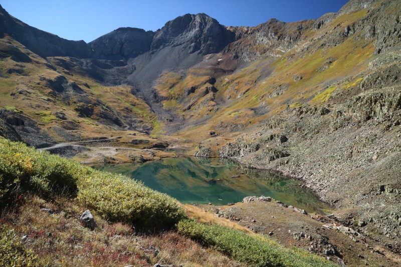 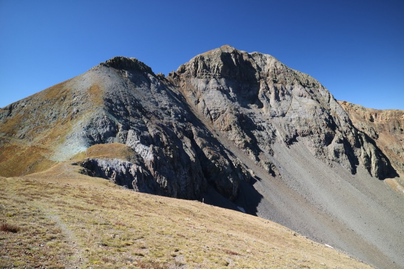 After the saddle, I decide to follow Furthermore's advice and take the ridge proper on the false ridge area. Pretty nice scrambling until I got to the end of the falsy. Hmmm how did he get down. It looked vertical. I didn't want to waste time, so I backtracked a little and made my way down a spicy class 4 descent to the 'trail' below, where Steve was taking the easy way, this time.  Steve on the lower use trail We met up as I reached the lower trail and we started talking a bit. He hadn't even heard of 14ers.com, so I figured he didn't know the route up this beast. So I decided to forgo any scrambling and see if I couldn't get him to the summit. He went up to the saddle with the falsey, just in case there was a "trail", but there wasn't. I went ahead and scouted that gully Furthermore mentioned, and I figured it was our best bet. Loose, but it went without much scrambling.   Steve traversing back to the use trail after investigating the saddle area When we both got to that gully, Steve didn't like the look of it, so he decided to traverse around some more, while I went up the gully to the summit. I saw him trying to make it up the far ridge (which does go, if steep and scree like), but he didn't like that either. 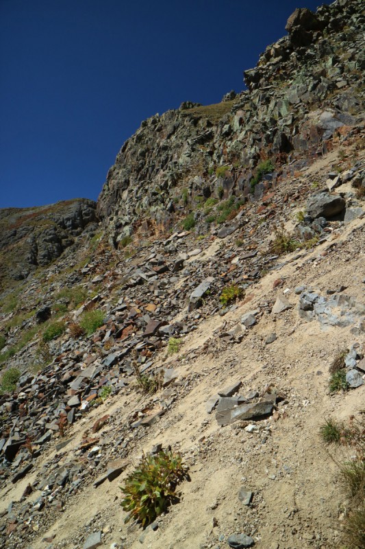 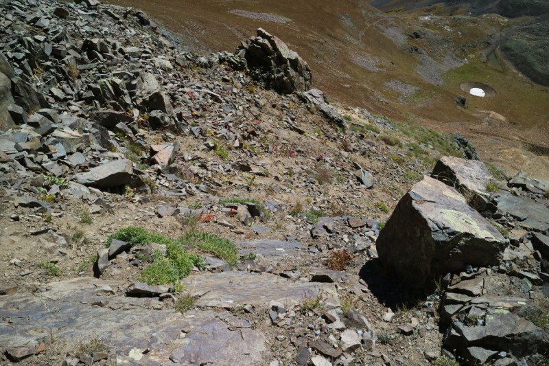   Oh the call of Vestal Basin... With this summit, I now have more total peaks in the San Juans, than any other range. Too bad (or good) that there are just so many peaks out this way. 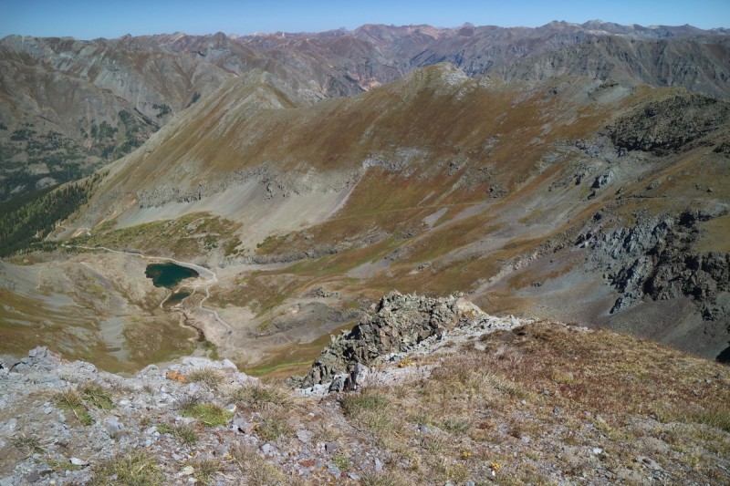 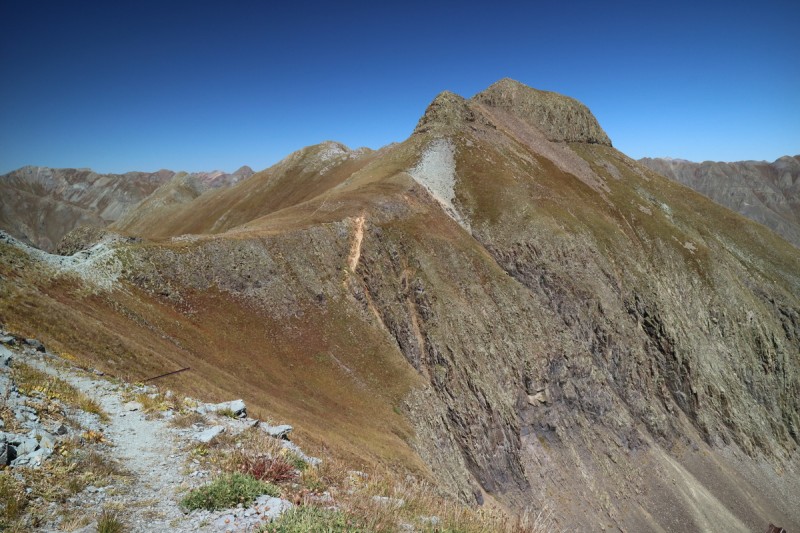 I met up with Steve back on the lower use trail, and we probably talked for an hour or so. A very nice ~75yr old fellow scientist, out enjoying hiking. Wish I could have stayed longer, but we both had places to be. I made my way up King Soloman, as he went down the trail.  View from King Solomon Mtn After all that worry about the descent (where uphill has the right of way), I met no one on the narrow trail back to the main 4x4 road. Phew! Even honked my horn a couple times, just in case someone was on the way up. But as I noticed on the way down, now that my nose wasn't over the abyss, there are pullouts just before and after this section on both sides. Still, an area to be careful of!  The blind hairpin turn with cliff on one side and thousand foot drop offs on the other... nervous all day over this one! So while the individual peaks I hiked in a nice orderly way in all 4 quadrants around Silverton may not be exciting of themselves, the views from them were top notch and well worth the effort! Note: I still have to edit a couple more pano's and add some more info, but I figured I'd let this go live now. Thumbnails for uploaded photos (click to open slideshow):  Fall is in the air")
 scree gully up to saddle with Dome Mtn")
 Tower Mtn in the sun")
 Looking back on Dome Mtn")
 Fall groundcover")
 Storm peaks")
 Looking back up Tower Mtn")
 Storm Peaks in the evening light")
 Descent off ridge")
 Starting point - crossing of Hardrock 100")
 Stream crossing")
 Start of")
 Twin Sisters east ridge")
 Twin Sisters West")
 Pano from west")
 Twin Sisters East")
 Lower traverse")
 Oh the Weminuche in the early evening light")
 Start of trail")
 summit area of Pt 13,069")
 Tower and Dome Mountain")
 Looking down the ridge")
 Approaching Pt 13,159")
 Ridge off false summit")
 Looking back on false summit")
 Summit scramble of Pt 13,159")
 Columbine Lake with Lookout Peak beyond")
 Pano from 13159")
 Below ridge scramble area")
 Quick 300' to Bridal Peak from saddle")
 360 Pano from Bridal Peak")
 Pt 13,159")
 Little Giant reflections")
 Little Giant from saddle")
 King Solomon Mtn")
 Lower traverse")
 Lower gully")
 Upper grassy gully")
 Looking at drainage below")
 King Solomon from lower trail")
|
| Comments or Questions | ||||||||||||||||||
|---|---|---|---|---|---|---|---|---|---|---|---|---|---|---|---|---|---|---|
|
Caution: The information contained in this report may not be accurate and should not be the only resource used in preparation for your climb. Failure to have the necessary experience, physical conditioning, supplies or equipment can result in injury or death. 14ers.com and the author(s) of this report provide no warranties, either express or implied, that the information provided is accurate or reliable. By using the information provided, you agree to indemnify and hold harmless 14ers.com and the report author(s) with respect to any claims and demands against them, including any attorney fees and expenses. Please read the 14ers.com Safety and Disclaimer pages for more information.
Please respect private property: 14ers.com supports the rights of private landowners to determine how and by whom their land will be used. In Colorado, it is your responsibility to determine if land is private and to obtain the appropriate permission before entering the property.


