Download Agreement, Release, and Acknowledgement of Risk:
You (the person requesting this file download) fully understand mountain climbing ("Activity") involves risks and dangers of serious bodily injury, including permanent disability, paralysis, and death ("Risks") and you fully accept and assume all such risks and all responsibility for losses, costs, and damages you incur as a result of your participation in this Activity.
You acknowledge that information in the file you have chosen to download may not be accurate and may contain errors. You agree to assume all risks when using this information and agree to release and discharge 14ers.com, 14ers Inc. and the author(s) of such information (collectively, the "Released Parties").
You hereby discharge the Released Parties from all damages, actions, claims and liabilities of any nature, specifically including, but not limited to, damages, actions, claims and liabilities arising from or related to the negligence of the Released Parties. You further agree to indemnify, hold harmless and defend 14ers.com, 14ers Inc. and each of the other Released Parties from and against any loss, damage, liability and expense, including costs and attorney fees, incurred by 14ers.com, 14ers Inc. or any of the other Released Parties as a result of you using information provided on the 14ers.com or 14ers Inc. websites.
You have read this agreement, fully understand its terms and intend it to be a complete and unconditional release of all liability to the greatest extent allowed by law and agree that if any portion of this agreement is held to be invalid the balance, notwithstanding, shall continue in full force and effect.
By clicking "OK" you agree to these terms. If you DO NOT agree, click "Cancel"...
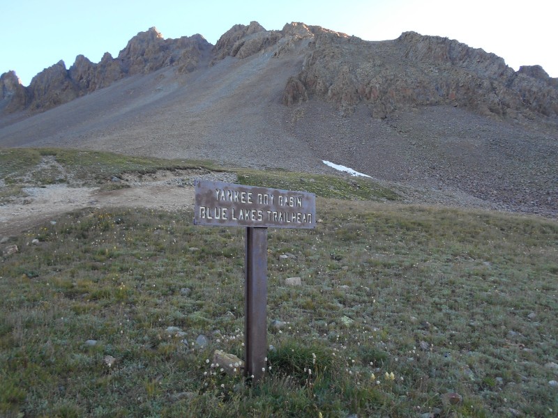
Mt. Sneffels 14,150 feet (27th Highest in Colorado) Standard Route from Yankee Boy Basin Trailhead Elevation 11,350 Feet
Approximately 6.0 Miles Roundtrip
Approximately 2,900 Feet Elevation Gained
Class 2+
August 14th, 2016
Partners: Solo
Existential Dilemma on Mt. Sneffels
Sweat rolled off of my body as my fingers curled tightly around the white medical tape on the knob end of my Louisville Slugger. I had never intended to use this club as a weapon against an animal - at least the four-legged kind. But it was 3:30 a.m., and I had just heard the unmistakable scratching of a porcupine's quills on the undercarriage of my vehicle. These prickly woodland denizen will go to any length to satiate their thirst for ethylene glycol, which they gleefully obtain by chewing through radiator hoses. As I prepared to spring into action, I inexplicably dropped my baseball bat and collapsed in a heap on my pallet of mover's blankets in the back of my RAV4.
Why do I do this to myself? My sojourn started more than 350 miles away in Brighton. I took a side trip to the seamy side of Colfax Street, where I've found a suitable weekend companion for my late wife's beloved shih tzus. I promised her that I would take care of the little knuckleheads, and I'm a man of my word. From there, my navi system instructed me to drive 243 light years to Grand Junction. Groan...not Grand Junction! After nearly falling off of the edge of the planet in Grand Junction, I would have to drive another 120 miles to Ouray.
Ouray? I've never been there. Don't they have an ice festival there? Maybe this will be cool. I've always admired the fourteener finishers more for their driving exploits than for their mountaineering accomplishments. How many miles of road, paved and unpaved, does it take to finish the fourteeners? The road warriors on Highway 285 who pass five cars at a time, the Amish horse and buggies near Westcliff, the speed traps in virtually every Podunk mountain town...traveling to each fourteener presents unique challenges. One has to enjoy the journey; it's part of the hazing required to rush the mountaineering fraternity.
The miles rolled by on I-70 like hours in the dentist's chair. I whizzed past the broken-down RVs in Mt. Vernon Canyon, and before long I was blowing by the broken-down RVs by the Eisenhower Tunnel. I scarcely noticed the scenery until I hit the Tenmile Range and the venerable Gore Range. I stopped at Officer's Gulch to walk off a sugar crash.
Traffic delays in Glenwood Canyon reminded me that there are only two seasons in Colorado: winter and road construction. A small brush fire at mile marker 120 broke the monotony. Pretty much everything west of Glenwood Springs looked like it belonged in Utah. I enjoyed watching the rafters and kayakers in the river. I hope that the rest of Grand Junction is more interesting than the bypass. The Grand Mesa aroused my curiosity. What's up there? I don't remember anything else remarkable until I hit Delta. Crudely-painted signs on an abandoned storefront suggested that we have a Kenyan Muslim president, and that all Liberals should be deported. I wondered if the proprietor had any friends who told him that this might be a bad idea. Moving right along, I saw a used car lot that sold only unrestored 1950's and 1960's project cars. I wouldn't have given a Jordanian dime for the whole lot, except for a '69 Pontiac LeMans that would make a nice GTO clone. I saw what was certainly an escaped mental patient's van with a "Texas Toilet Museum" bumper sticker on one side and "Honk if You Have to Poop" on the other side. People are nuts. I was finally starting to enjoy the journey.
I stopped for a sweet onion chicken teriyaki sandwich in Montrose, and started the final leg of my journey. Highway 550, the "Million Dollar Highway," is undervalued by several decimal points. I've never seen more dramatic scenery. Ouray lives up to the hype. There seemed to have been an unlimited supply of rental Jeeps, brew pubs, upscale hotels, and feral millenials. Note to self: must return to Ouray to explore the opportunities.
The shadows in the canyon were getting long as I started up the dirt road towards Yankee Boy Basin. Four wheelers, dirt bikes, side-by-sides, and 4WD vehicles of every description kicked up clouds of dust in the road. This was a playground for an interesting cross section of society.
The first few miles of dirt road were unextraordinary. The shelf road cut into the hillside had a distinctive overhanging ledge. Hey, let's drive under a giant slab of rock and hope that it doesn't fall! I eventually caught up with a Subaru that was having problems with some of the deeper potholes and whoopdedoos. I scraped my trailer hitch a few times, and left the Soobie behind where the sign suggested that only 4WD vehicles should proceed. I passed an active mine site, and an 1800's vintage mine that looked like it got leveled by a cluster bomb.
Looking through my sunroof at the ledge hanging over the shelf road
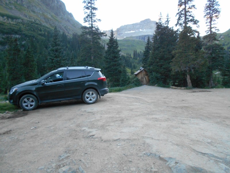
At last, I found myself at the trailhead with two other vehicles. Dusk was falling, and the other campers had already turned in. A mule deer doe strolled nonchalantly through the camp. I checked out the surroundings, baptized the pungent bio-toilet, and prepared to hit the rack.
Yoda at the trailhead
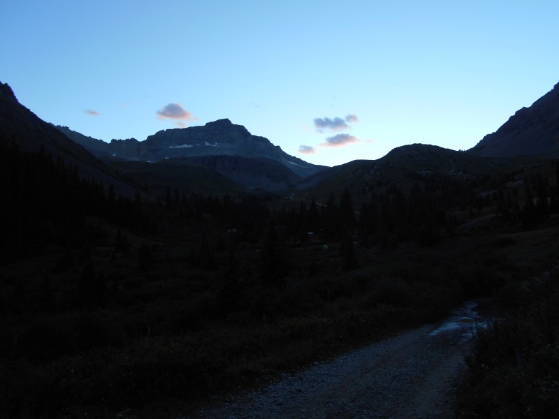
The sun setting behind thirteener Gilpin Peak
Back to reality. I've just collapsed in desperation. I'm pondering my very existence as my red, swollen eyes burn holes through the roof of my car. Let the little varmint chew through my hoses. Antifreeze may be sweet, but it's also deadly poison. I'll have my car fixed long before Porky dies from kidney failure. Besides, what kind of Karma would I earn for bludgeoning a porcupine? Is it even worth the exasperation just to climb an immense rock? I should just drive home right now and...I couldn't find the next word. What would I do without this in my life? I was exactly where I needed to be at this moment.
Mercifully, I didn't hear any more noises from beneath my car. However, listening for gnawing saboteurs kept me awake for the rest of the night. I hadn't slept a wink when my alarm went off at 5:30; this is pretty typical for me when I camp above 10,000 feet. My brain is wired differently, and I can usually just power through it with caffeine and adrenalin.
Everything was pretty much packed and ready to go, so it didn't take long for me to get ready. I chatted with the other campers for a bit, and hit the trail. It took a few minutes to warm up the torn cartilage in my knee. Aging gracefully is for sissies.
About four tenths of a mile down the road, there was a junction. A small spur headed downwards towards Sneffels Creek, where there were some prime campsites. Darting beams from several headlamps signaled that the occupants would soon be joining me on the trail. In mere moments, the headlamps would be unnecessary.
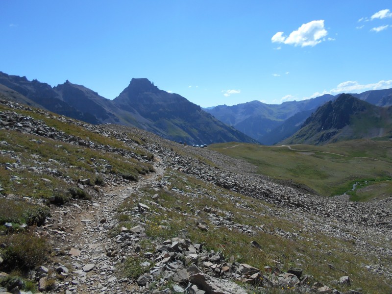
Up the road towards Yankee Boy Basin
The road really wasn't terrible. An average driver in an average SUV could make it with no undue risk to himself or his vehicle. A couple of tight switchbacks give the advantage to shorter wheelbase vehicles like Jeeps, but full size pickups seem to do just fine. Several vehicles were parked at pullouts along the road, and hikers were already under way ahead of me on the road. Humans, this far from "civilization." Who were they, and why were they here? There are 228 trip reports for Mt. Sneffels on the Dot Com, so there is not much to say about this route that hasn't already been said about 228 times. The mountain remains the same, but the hikers are the wild cards that change with every ascent
The Yankee Boy Basin Upper Trailhead
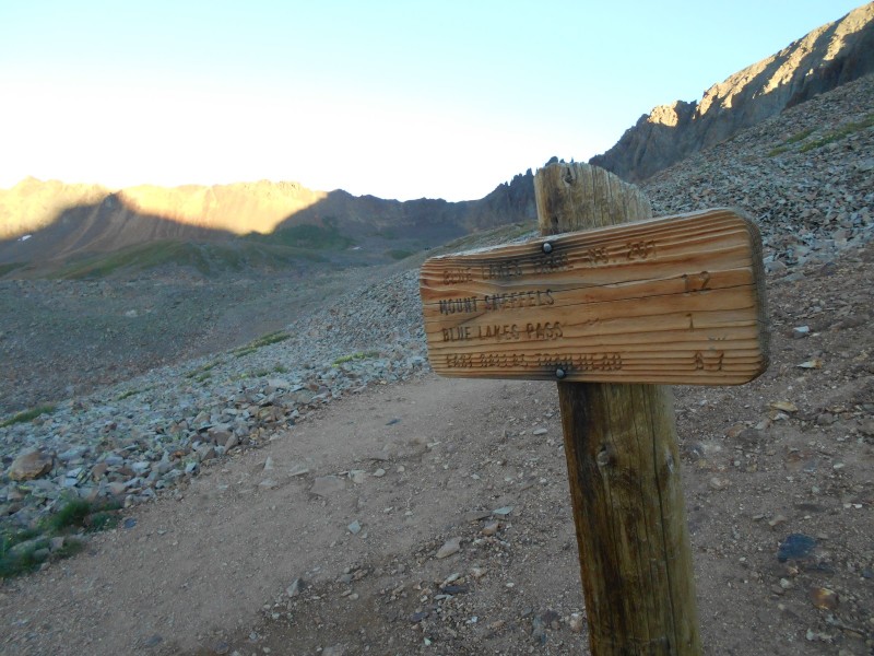
As I made the final approach to the upper trailhead, I stepped out of the way of a black Tacoma full of exuberant twentysomethings. They seemed to be in high spirits as they jumped out and practically jogged towards the southwest ridge. They were well on their way by the time I reached the parking area. The sign at the trailhead said "Mt. Sneffels 1.2 Miles." It had only taken me 45 minutes to get this far, and I only had 1.2 miles to go? I was starting to have visions of an early dinner back in Brighton. A good trail through the boulder field ahead guided me towards the summit, which I had not yet seen.
Trail sign just beyond the upper trailhead
Twentysomethings double timing towards the southwest ridge
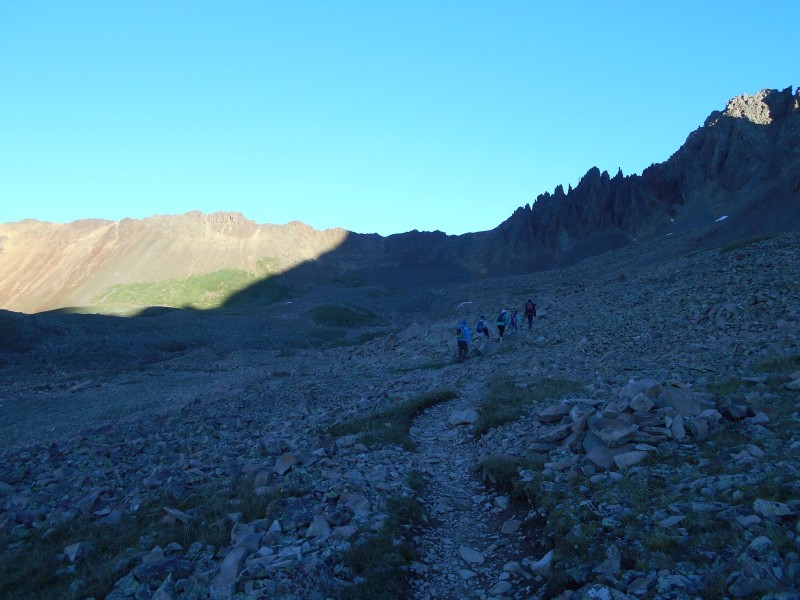
The trail was clearly marked, and the rock was mostly stable; I was still moving pretty well. I had the pleasure to meet three nice young ladies who were doing a memorial hike for lost parents. We found some common ground because I hike with a pink ribbon on my backpack for my mother, who survived breast cancer, and for my wife, who didn't. We exchanged some stories and went on our separate ways. I was happy to see that they had achieved their goals when I saw them on the summit later on. I believe that it was a first fourteener for two of them.
Three young ladies on the trail just below the Gully of Despair
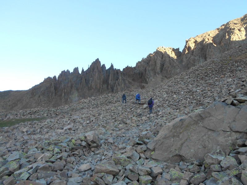
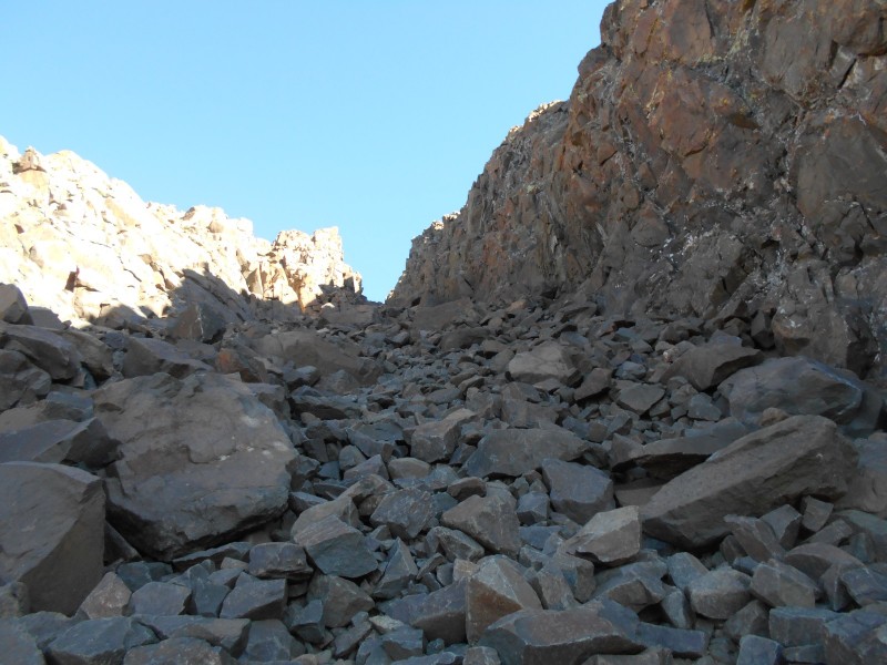
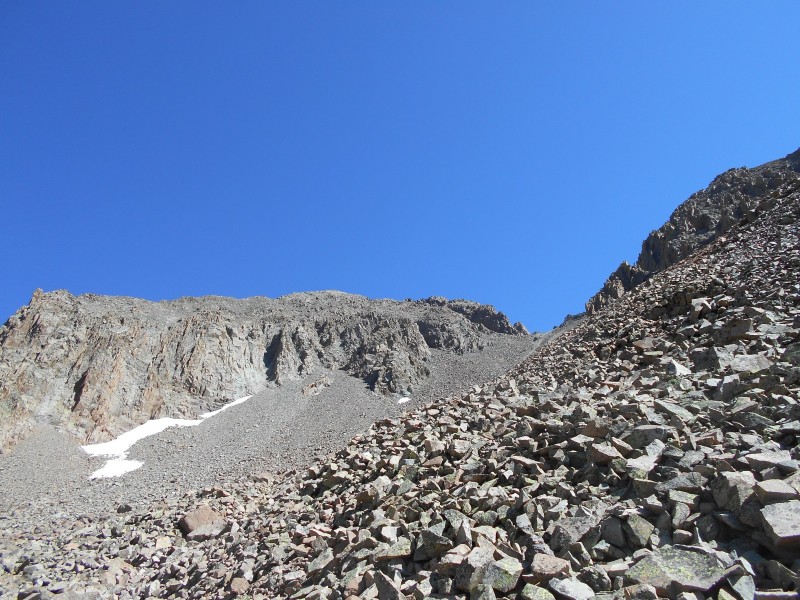
So, this is it, huh? I stood at the bottom of a broad gully pondering my next move. People kvetch endlessly about this slope. The steepest, loosest scree on any fourteener. Two steps forward, one step back. There were still a couple of hikers ahead of me, and they didn't seem to have the magic formula for dealing with it. The angle and the traction at the bottom were not bad; it looks like there has been some effort to construct an actual trail through the talus on the left side of the slope. It was an incomplete effort, but every little bit helped.
Starting at the bottom of the Gully of Despair
I'd estimate that the gully went on for about 800 vertical feet. It got steeper and looser along the way. The center was mostly scree, and offered very little traction. The proper route goes up the left side, and is only slightly better. The small talus was not anchored well, and some of it was covered with ball bearing scree. Try to imagine going up a wooden staircase covered in marbles. I wouldn't have considered doing it without trekking poles, but most of the other hikers were slipsliding their way up the slope without them. Good decisions come from experience and experience comes from bad decisions. Falling hurts a lot worse when you're over 40 years old, so I plan to make as many good decisions as possible. I strongly recommend the use of trekking poles on this route.
Looking back down the gully from the col near the top
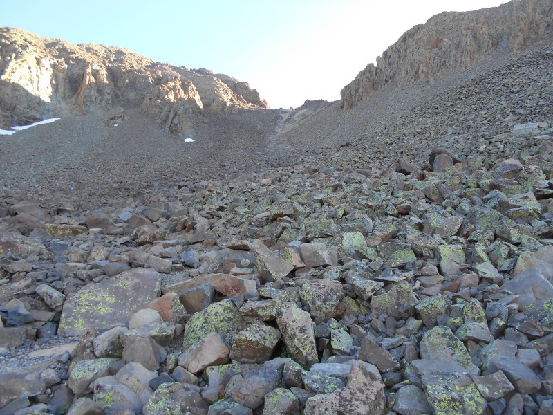
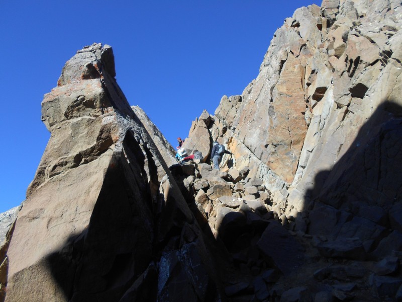
I breathed a sigh of relief when I reached the col, but I realized that I had to ascend a narrower rubble-filled gully to reach the summit. This one was no more than 600 feet high, and the traction was marginally better. A piece of cake, right? Not for everybody. There have been numerous rockfall accidents in this gully. In 2009, one of our 14ers.com members was kayoed by a 4x10 foot piece of rock that fell from the side of the gully. He was badly injured, but survived largely because he was wearing a helmet. If I had remembered this incident, I certainly would have worn my helmet. Most people, including myself, don't think about wearing a helmet on a casual Class 2 route. One of Gerry Roach's most poignant mountaineering rules is that "geological time is now." If you find that you're the only guy on the route wearing a brain bucket, play it off like you're the coolest guy on the mountain. Stuff happens.
The upper gully on Mt. Sneffels
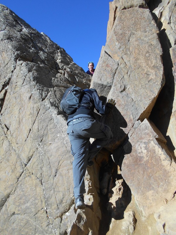
When I reached the top of the gully, I chimneyed up to the much-feared v-notch...
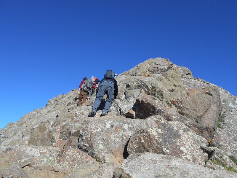
Hikers passing through the v-notch to exit the gully
No; that didn't happen. A weird camera angle just made it look like it was steep. I've noticed the same thing in images of the homestretch on Longs and the wall on Wetterhorn. In reality, the approach to the v-notch is no steeper than the rest of the gully. The v-notch itself is basically two tilted slabs that form a vee. There are a couple of chockstones fortuitously placed between the slabs that make excellent handholds. It's hard for me to imagine how a shorter person could stretch far enough to make it through the notch, but they clearly do it nearly every day. This obstacle could be the end of the hike for some people who aren't comfortable with mildly exposed Class 3 moves. A fall here could be pretty painful.
A more realistic view of a hiker passing through the v-notch
Once I passed through the v-notch, it was a short and simple boulder hop to the summit.
On the way to the summit past the v-notch
Just below the summit
I had plenty of company up there; the twentysomethings were celebrating, and the memorial hikers I had met earlier soon joined us with a couple of other groups. These folks were more interesting than the typical people you would meet on the streets of your hometown, and I enjoyed their company. Three of the young ladies were kind enough to remove their tops for very personal summit shots, which I didn't exactly hate to see. Members on the 14ers Facebook page have discussed and over-discussed this trend. Truthfully, it didn't seem like a big deal. The ladies took 30 seconds to preserve a memento of a beautiful day spent enjoying nature. They wore appropriate gear on the ascent and descent, and weren't reckless or disrespectful. It seems like a waste of time for the morality police to get their panties in a wad over something so trivial.
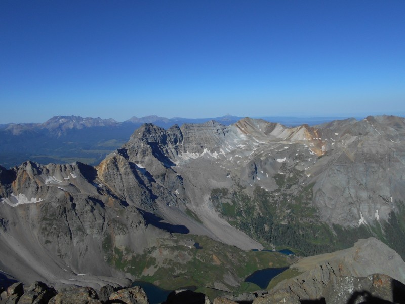
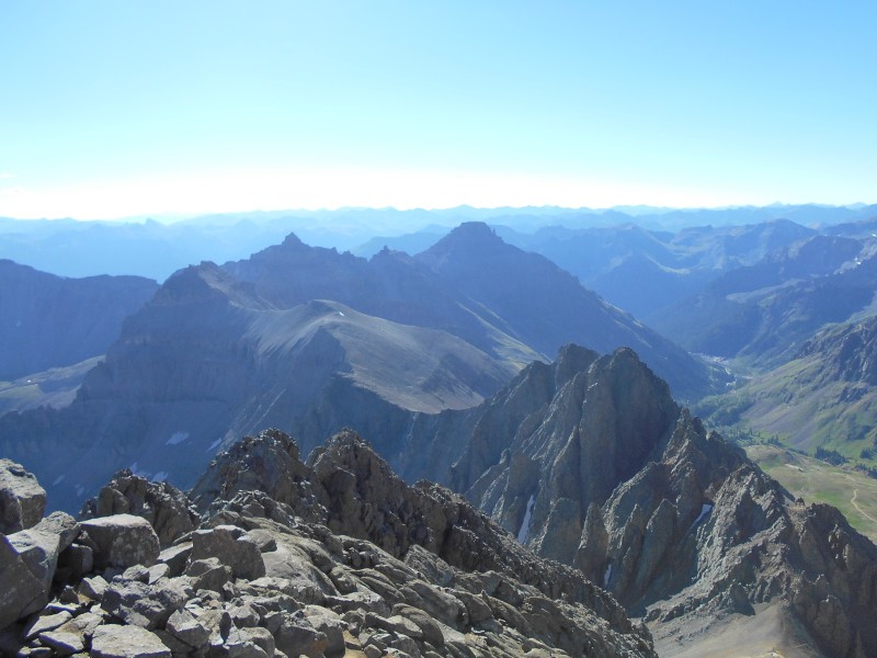
Centennial thirteener Dallas Peak rising above the Blue Lakes
Cirque Mountain to the east, with Teakettle Mountain and Potosi Peak in the distance
Looking down at Wright Lake and Yankee Boy Basin
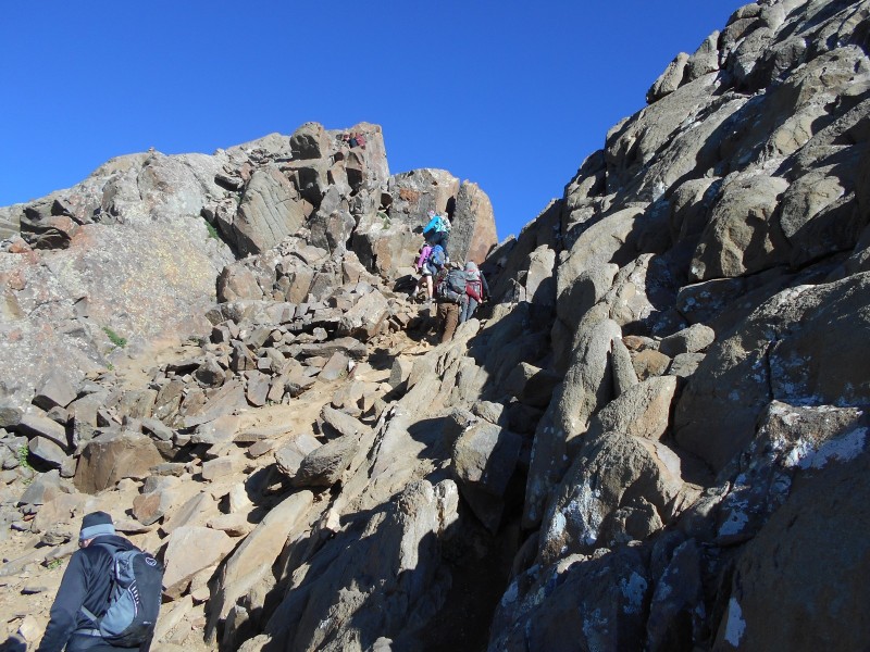
Most of the people on the summit chose to descend the southwest ridge instead of scree surfing down the standard route. This may have been a good idea, but I chose the devil that I knew over the devil that I didn't know. It seemed like the route wouldn't be as miserable on the way down, and it really wasn't. I placed my trekking poles carefully, tried to keep three points of contact, and kept my weight centered over the balls of my feet. I didn't fare too badly. When I was about halfway down the slope, I heard huge rocks crashing down from the southwest ridge; I hope that everyone made it home safely.
Leaving the upper gully, and entering the lower gully
The human factor truly contributed a lot to this hike; I certainly saw some curious sights. The Front Range fourteeners attract huge crowds, and I've learned to avoid them. I was amazed, though, by how many people showed up on this remote mountain so far from any metropolitan area. There were people of all skill levels on the mountain, but it seemed to be weighted heavily towards the lower end. I have no idea how people planned to get their large dogs through the v-notch; it seems difficult enough just to get one's self through it. I saw three members of a family elephant walking on all fours because they were having a hard time remaining upright on the scree. Seriously. I saw several people whose only gear was one 16-ounce bottle of water. A teenager near the lower trailhead asked me for directions to the upper trailhead. When I told him, he asked me if I knew of any shortcuts. I've mostly been hiking thirteeners lately, and I'm not used to meeting so many people on the trail.
Looking back at Mt. Sneffels from an unimpressive angle
I was shooting for an 11:00 return to the trailhead. By the time that I returned to the upper trailhead, the trail was crowded and I could hear the distinctive exhaust tones of various offroad vehicles climbing the mining road to the basin.
Potosi Peak rising prominently behind the upper trailhead
When I wasn't contemplating about what brought the masses to Mt. Sneffels, I was reflecting on why I was here. My love of nature and the mountains were largely influenced by my grandfather, who was a botany professor and somewhat of an explorer. He identified several previously-unknown species of plants during his rambles in the Appalachians and the Andes. Like the absent-minded professor, I'm usually paying more attention to the plant life than I am to the trail. My hiking partners will certainly testify that hiking with me is a decent introduction to botanical Latin. I would be remiss if I didn't include a little botany lesson gleaned from my hike.
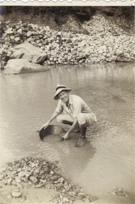
Dr. Earl L. Core panning for gold in the Quebrada Toruro near Madreseca, Colombia in 1944
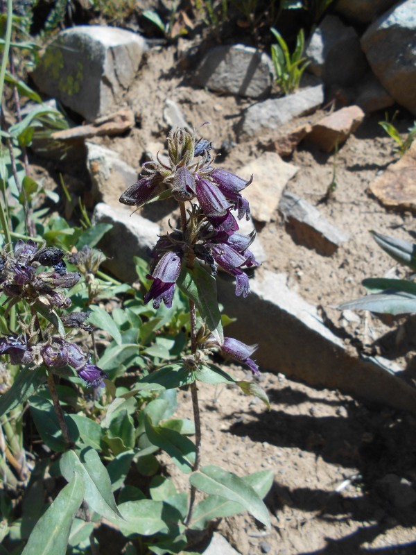
One of the wildflowers that caught my attention on this hike was Whipple's Penstemon. It was named for Lt. Amiel W. Whipple, an Army engineer who did some surveying in the west for a potential transcontinental railroad. The start of the Civil War made construction of the railroad an impossibility, but the route that he laid out eventually became the famed Route 66. Lt. Whipple died from injuries received in the war, and Dr. Asa Gray (for whom Grays Peak is named) named the plant in his honor.
Dusky Penstemon (Penstemonwhippleanus) below treeline on the way back from Yankee Boy Basin
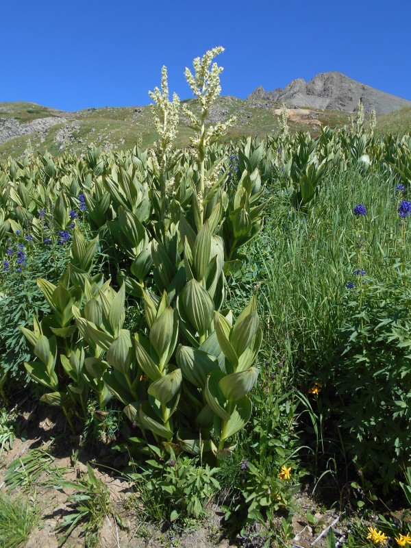
Another plant that commanded attention was the false hellebore. There were dense stands of it near the lower trailhead, and specimens here and there all the way to treeline. It has several common names including skunk cabbage, which it somewhat resembles as it emerges in the spring. Unlike the true skunk cabbage, this one reaches heights of over six feet. It usually grows in marshy areas.
False Hellebore (Veratrumtenuipetalum)
As I proceeded farther down the road, I passed some scenery that affirmed why I was here; I've included an image here just to make my flatlander friends jealous. What could be more beautiful than a rushing waterfall in an alpine valley, with blue skies and a craggy mountain for a backdrop? This was like the olive in my martini.
Waterfall on Sneffels Creek with Gilpin Peak in the background
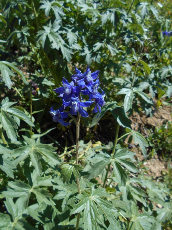
One of the more colorful and prominent wildflowers along the trail was Barbey's Larkspur. It was named for Swiss politician and botanist William Barbey, who had absolutely nothing to do with discovering the plant or describing it to science. The flower spikes can reach seven feet in height, and are frequently supported by willows when they grow through them. As with the false hellebore mentioned above, all parts of the plant are probably poisonous.
Barbey's Larkspur (Delphiniumbarbeyi)
I had nearly aborted this hike out of frustration and extreme exhaustion, but it turned out to be one of my more memorable days in the mountains. The outrageous beauty of the San Juans just can't be described; it must be experienced. Meeting kindred souls in the mountains reaffirmed my faith in mankind in these times when civility has seemingly ceased to exist. As for the exhaustion...I found that hiking a fourteener on zero sleep and driving 350 miles does nothing to cure that. After a good night's sleep in my king size bed, I was good to go on Monday morning. Such is the life of a weekend warrior.
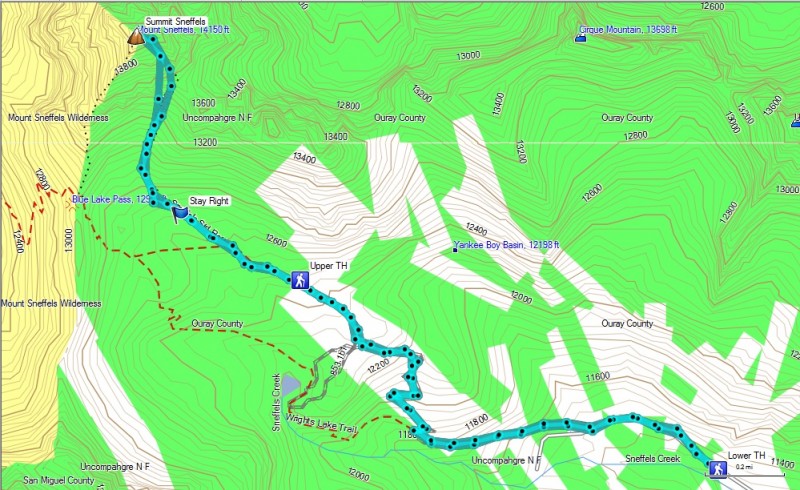
GPS track of my standard route ascent and descent of Mt. Sneffels
Thumbnails for uploaded photos (click to open slideshow):
Hey man, congratulations on a successful and eventful climb! I would agree wholeheartedly with your depiction of "The Gully of Despair..." You're an incredible storyteller, managing to perfectly capture the events and atmosphere of each section of your journey. I had a great time reading your post!
"Pretty much everything west of Glenwood Springs looked like it belonged in Utah." I thought the same thing many times. You nailed Ouray, absolutely would love to spend a few months there! Great report and photos.
There are 228 trip reports on Mt Sneffels, but this is one of the best. Really enjoyed the read - the journey is recognizable, I know well the road signs in Delta you're talking about! :)
I believe False Hellebore is also known as corn lilies. Is that right?
I have been a happy recipient of several botanical Latin lessons from you, Brian. I absolutely LOVE this report and look forward to yet another lesson one of these days.
Looked like a party on top of Mt Sneffels from where we were watching on top of Teakettle. You won't find any crowds there, but I would have to say after seeing the photos, Mt Sneffels is way more fun as a snow climb. Congrats on a safe and successful summit bid!
Well done and keep writing these. Who cares if there are tons of trip reports on a peak. Too bad we didn't run into you down there. Totally relate to some of your thoughts.
...are pretty much all I got, Brian. Fantastic job with the report, the climb, and living your life. This is your best effort to date.
(The morality police do not care that girls take topless pics; they do disagree with the need to spray those pics all over a public Internet website, though. Just my opinion.)
Great TR. We visited Durango last year, and Mt. Sneffels was on the agenda for the week. This hike/climb was one of my favorites. Reading your trip report brought back some great memories of the colors, variety of vegetation, and panaramic views from Sneffels. I'll be back for sure. Thanks!
Thanks for your kind comments, people. I think that stress brings out a person's creativity, and I was definitely stressed out.
Caution: The information contained in this report may not be accurate and should not be the only resource used in preparation for your climb. Failure to have the necessary experience, physical conditioning, supplies or equipment can result in injury or death. 14ers.com and the author(s) of this report provide no warranties, either express or implied, that the information provided is accurate or reliable. By using the information provided, you agree to indemnify and hold harmless 14ers.com and the report author(s) with respect to any claims and demands against them, including any attorney fees and expenses. Please read the 14ers.com Safety and Disclaimer pages for more information.
Please respect private property: 14ers.com supports the rights of private landowners to determine how and by whom their land will be used. In Colorado, it is your responsibility to determine if land is private and to obtain the appropriate permission before entering the property.


")
")
")
")
")
")
")
")
")
")
")
")
")
")
")
")
")
")
")
")
")
")
")
")
")
")
")