| Report Type | Full |
| Peak(s) |
Clevleand - 10466 |
| Date Posted | 08/11/2016 |
| Modified | 08/14/2016 |
| Date Climbed | 08/11/2016 |
| Author | spiderman |
| Mt. Cleveland - One handed ascent |
|---|
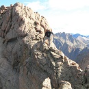
Climbing Mt. Cleveland, Montana with one handThe UltrasThere are 58 peaks in the contiguous United States with more than 5000' of prominence... 57 after Mt. Saint Helens exploded in 1980. These mountains are dubbed "Ultras" and generally are the most majestic places to climb. The views are spectacular as you tower above the surrounding terrain. Only nine climbers have claimed completion of this list on Peakbagger.com. A few of the peaks, like Pikes and Mitchell, are drive ups; a majority are hikes of varying degrees of difficulty. The toughest ones include the following list: Mount Hood Mount Shasta Mount Baker Mount Cleveland Glacier Peak Mount Rainier Mount Jefferson OR Grand Teton Mount Olympus Gannett Peak This has been a big year for myself (Doug "2Big" Harris) and my 15 year-old son (Arthur "Spiderman" Harris). We have been trying to complete the list and needed to climb Baker, Cleveland, Glacier, Jefferson, Teton, and Olympus. In one long 10-day expedition we managed to climb the four tough ones left in Washington and Oregon. That only left Cleveland and Teton to become the tenth and eleventh peakbagger-listed completers of the Ultras. Logistical HeadachesCleveland is located in the northern part of Glacier National Park. That place sees almost a million visitors a year. Most of the tourists are content to drive along the road that cuts across the middle of the park. Getting a permit to actually explore he pristine parts of the wilderness is a much harder task. The current procedure (changes every year) is to reserve spots on March 15th. If you log on a few minutes after applications are accepted, it is too late and you must wait another year. We were unfortunate last year and couldn't get a spot. This year we managed to score two nights: a spot at Stony Indian Lake on day 1, and Kootenai Lakes on day 2. 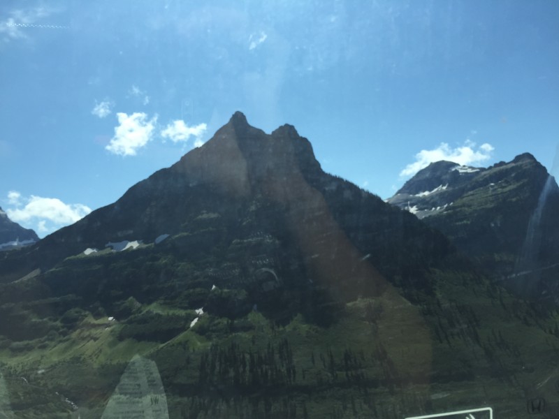 We were allowed to pick up the permit 24 hours before the start of the hike so drove from Boulder, and after a few side detours to climb 4000-foot prominence peaks, arrived on the west side of the park on August 9th. The rangers at the Agpar Backcountry Permit Office were in particularly bad moods. When asked for any condition reports on Cleveland, they gave us a long lecture about the dangers of that route. They concluded that we would have no chance of reaching the top and very likely would die trying. Such helpfulness! After watching a 15 minute video about safety in the park, they handed us our permits and we quickly got back into my trusty Honda Civic. We traveled the Going-to-the-Sun road that passes through the heart of the National Park. Lots of expensive SUVs that could barely go 10 mph on the nice paved highway. After driving the 32 miles in two hours, we headed north into Canada. Don't forget your passports! The border guard checked that I had permission to take my son out of the country without Mom, inquired if we had any weapons (FYI: bear spray is fine), and let us enter Alberta. We managed to score the next-to-the-last spot in the Crandell Mt campground. Between travel costs, park fees for the US and Canada sides, and other expenses, doing Cleveland is not cheap. Hence there was a very strong incentive to reach the top on the first attempt. Adding in the possible 1-??? year wait to get another permit, we were determined to get to the top on the first attempt. Approach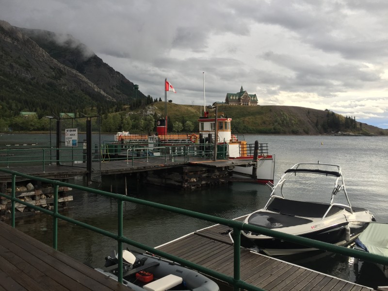 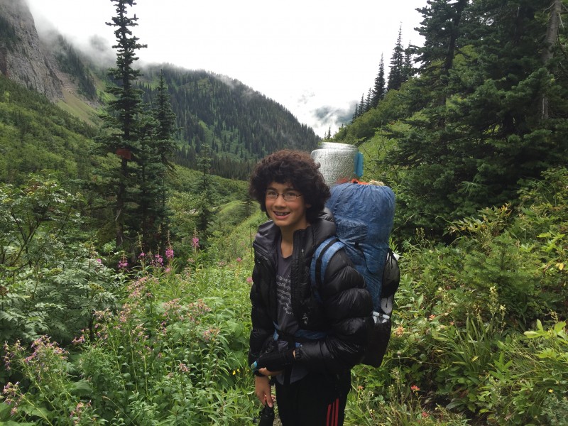 The best way to approach Cleveland is from the North. The first step is getting tickets on the International ferry that starts in Waterton Park and heads due south on the beautiful lake that is situated at 49 degrees North latitude, the US-Canada border. The ticket office opens at 8 AM. There wasn't much of a rush while booking tickets mid-week, but we didn't want to miss out on this critical part of the journey. The only other option was a long hike on trails around the lake: not a fun way to begin a big climb. The cost of the ferry was not cheap, but it was well worth the price! In about an hour we arrived at Goat Haunt Ranger Station. The US Border Patrol checked our passports and confirmed that we had a valid camping permit. The trail to Stony Indian Lake is very well marked. There are a few other trails that lead to other directions, but it is trivial to stay on the correct path with the excellent signage. We talked in loud voices to warn grizzly bears that we were coming. There are so many delightful berries along the way. The piles of bear poop proved that this path was not just used by people. After five miles, we reached the turnoff to Stoney Indian Lake. The path proceeded at a modest grade for the next 2.5 miles, climbing approximately 2000 vertical feet of elevation. Arthur carried an ultralight Z-Pack with our tent and sleeping bag. I carried the food, stove, and miscellaneous stuff in my smaller day pack. Each of us only carried 15 pounds, allowing our team to maintain a fast pace. That was fortunate since the skies started to darken. Rain poured down, soaking us and blocking out any view of the path for summit day. It was a cold night in the Stoney Indian campground. We hid in our tent and had nightmares of climbing Cleveland in the middle of a heavy rainstorm. Summit Day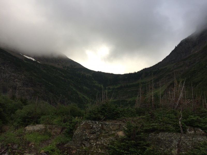 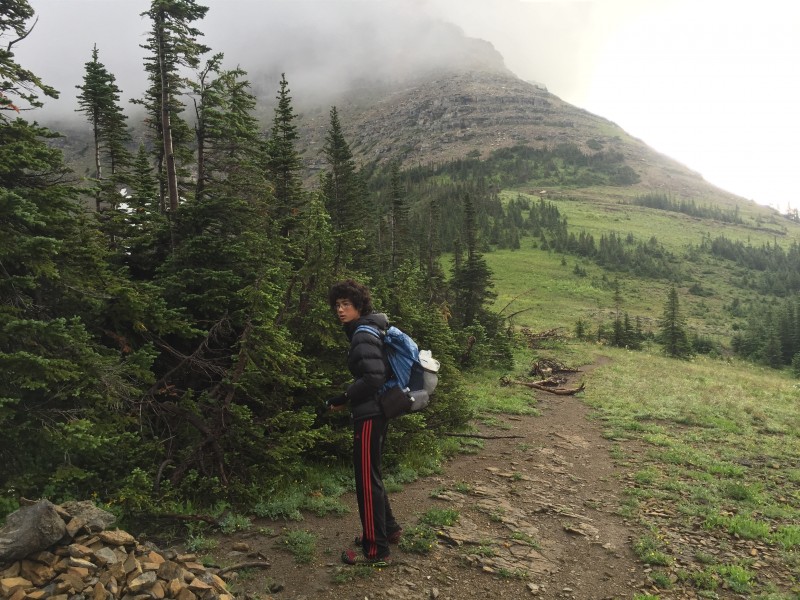 The trail continued up from the campground for another mile, climbing from 6300' up to a final pass height of 6900'. After that point, we entered the unknown. We had several trip reports from previous expeditions, along with GPS tracks and a topo map. It probably would have been easy navigation on a clear day, but with the clouds we had lots of questions on the best route. There are periodic cliff bands as we headed up to 8000'. We couldn't easily find a weakness along the direct ridge, so we took a detour to the climbers' right. There was a 20' high steep gully that cut through the most troublesome cliff. After a few easy Class 3 moves, we ascended above that first difficulty at 7500'. We then traversed back to the left and crossed over to the West face of Stoney Indian Peaks. According to a previous report, the crux of the climb was on the goat trail on this side of the traverse. Apparently there was supposed to be an exposed Class 4 section with undercling holds. We found that it was easy to stay 30' below the cliffs, walking on the moderate talus and scree fields. The terrain was relatively easy and a faint goat path made it even faster. This definitely was Class 2. If it is any more difficult on the West side, drop down a bit and get into the easier slopes. After walking for a half mile, we reached the "stairway" that led into the notch between the southern and the northern parts of the Stoney Indian Peaks. This was the toughest scramble of the path, reaching Colorado Class 3 difficulty (California Class 2...?). There was no exposure during the 100 vertical foot ascent. A fall would just result in a few scratches and a bit of embarrassment at struggling in such modest difficulties. I made it up in a jiffy, with Arthur uncharacteristically lagging behind. His badly-sprained left thumb made it slower to scramble up the boulder steps. Otherwise he would have been running up the cliffs like a true Spiderman! Traverse from HellThe next section was mostly covered by fog so we had to rely upon our GPS tracks to navigate onto the proper ledge that runs atop a cliff band. Fortunately the route finding isn't too hard since the ledge starts at the same elevation as the West-East crossover notch. The "ledge" ranges from 1 to 20 feet wide and slopes downward at a 20-30 degree angle. It is comprised of dirt, grass, rock, and scree. The very narrow sections had good rock ribs to hold onto as you stepped across onto a broader path. Beneath you is a 40-foot white cliff that ends in another ledge, followed by another cliff, followed by more ledges and cliffs. A fall in most of the traverse would likely be fatal, and indeed there have been people who have died on this Traverse from Hell. There was supposed to be more of a goat path on this ledge, but the heavy rains from the previous day washed away much of the trail. Fortunately the rocks stayed relatively grippy despite the moisture. We were able to maintain a relatively fast pace on this 1.5 mile traverse, reaching the other side in a bit over an hour. I would rate the section as Colorado Class 2+ difficulty. The side-hilling took a toll on our knees. Knowing the consequences of a bad slip kept our adrenaline pumping even though this was not a technically-demanding hike. Reaching the PeakThe traverse ends at a notch between the Stoney Indian Peaks and Mt. Cleveland. Whenever possible stay on the ridge proper. At 9200' we encountered a cliff band. In the dense fog, we opted to head left onto the talus and scree SW face of Cleveland. It was a pain to ascend back onto the ridge. Lots of slippery scree and Class 3 scrambling. The proper path climbed up a series of Class 2+ ledges on the right side of the cliff band. There are a few cairns marking the correct path, but they are difficult to spot even without fog. The next difficult section is between 9800-10,000' elevation where the scree turns into nasty black rubble. Every part of this talus field is loose. All of the boulders want to kill you. Don't trust anything! The only good thing is that this section is brief and you end up on the gently slopping summit plateau. Many tracks led to the peak: none of them were human! Lots of wolverines, black bears, and grizzly bears head to the summit in search of moths and lady bugs that hatch in July and August. Clearly a large number of these creatures had walked the same way as we were heading, just an hour or so before we reached that point. We talked in very LOUD voices as we continued up the final four hundred vertical feet to the summit. There is a 3-foot tall cairn on the summit and you can look straight down 5000' to Waterton Lake. Heading back down to the camp was not fast since the traverse takes even longer on tired legs. The exposure grows on you and after three hours of walking ontop of death, the easy terrain becomes much more difficult. Friends have asked how the goat trail on the ledges compared to Pyramid or the Bells. There is no comparison: the walking is much easier but the consequences of a slip is so much worse. We have never climbed a mountain quite like Cleveland! Round Trip from Stoney Indian camp was 11 hours, including a few leisurely breaks and a few route finding mistakes in the dense fog. It required another two hours to reach the Kooenai Lake campground where we could finally enjoy a well-earned dinner. Along the way, we munched on the bountiful thimbleberries that tasted like raspberries. We should call them aggregate fruits of numerous drupelets around central cores since they are not technically berries, but regardless they sure were yummy! Most of the other backpackers thought these were poisonous and avoided eating these delectable treats. We slept well that night. It was an easy stroll the next day to catch the International Ferry back to our car. On the drive home, we stopped by Table Mountain south of Butte to claim another p4k. Now we can look forward to our final Ultra-Prominence peak: Grand Teton Total distance: 26 Miles Elevation Gain: 6300' See pictures at the end of this report for traverse details.  STAY ON TOP OF THE WHITE CLIFFS! 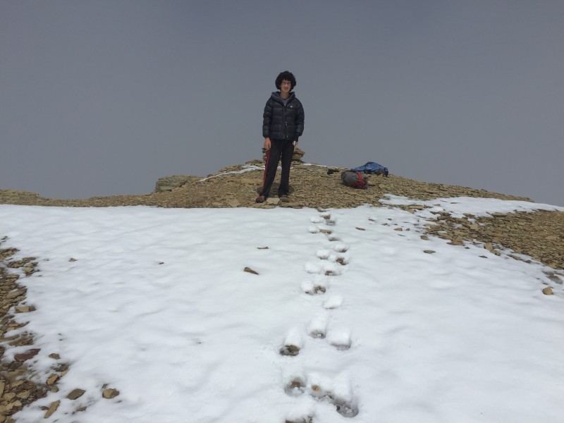 BEAR PAWS AND ARTHUR PAWS HEADING TO THE PEAK 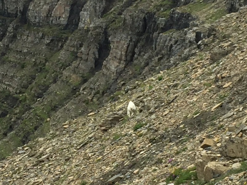 FOLLOWING A MOUNTAIN GOAT BACK HOME 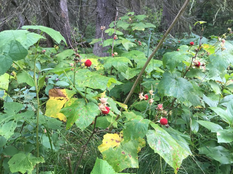 THIMBLEBERRIES 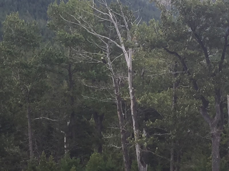 BALD EAGLE SAYING GOODBYE ON OUR WAY HOME 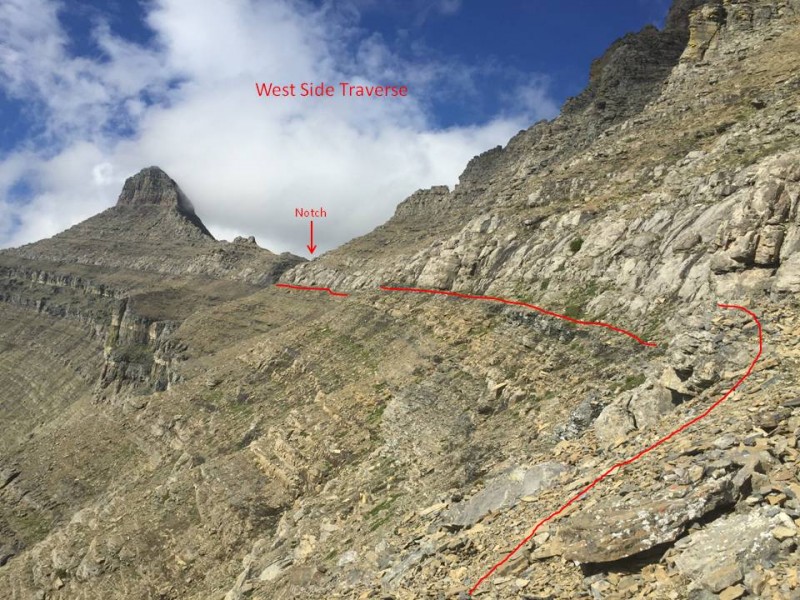 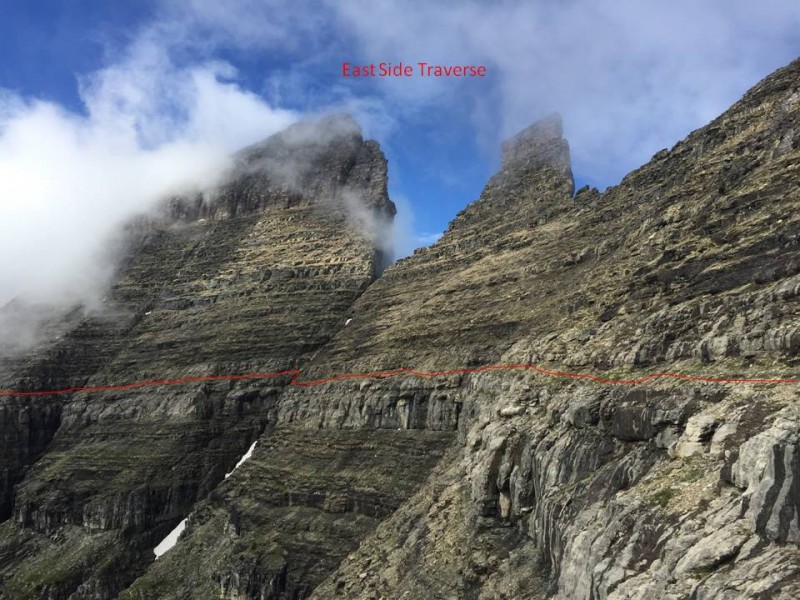 Thumbnails for uploaded photos (click to open slideshow):
|
| Comments or Questions | ||||||
|---|---|---|---|---|---|---|
|
Caution: The information contained in this report may not be accurate and should not be the only resource used in preparation for your climb. Failure to have the necessary experience, physical conditioning, supplies or equipment can result in injury or death. 14ers.com and the author(s) of this report provide no warranties, either express or implied, that the information provided is accurate or reliable. By using the information provided, you agree to indemnify and hold harmless 14ers.com and the report author(s) with respect to any claims and demands against them, including any attorney fees and expenses. Please read the 14ers.com Safety and Disclaimer pages for more information.
Please respect private property: 14ers.com supports the rights of private landowners to determine how and by whom their land will be used. In Colorado, it is your responsibility to determine if land is private and to obtain the appropriate permission before entering the property.