Download Agreement, Release, and Acknowledgement of Risk:
You (the person requesting this file download) fully understand mountain climbing ("Activity") involves risks and dangers of serious bodily injury, including permanent disability, paralysis, and death ("Risks") and you fully accept and assume all such risks and all responsibility for losses, costs, and damages you incur as a result of your participation in this Activity.
You acknowledge that information in the file you have chosen to download may not be accurate and may contain errors. You agree to assume all risks when using this information and agree to release and discharge 14ers.com, 14ers Inc. and the author(s) of such information (collectively, the "Released Parties").
You hereby discharge the Released Parties from all damages, actions, claims and liabilities of any nature, specifically including, but not limited to, damages, actions, claims and liabilities arising from or related to the negligence of the Released Parties. You further agree to indemnify, hold harmless and defend 14ers.com, 14ers Inc. and each of the other Released Parties from and against any loss, damage, liability and expense, including costs and attorney fees, incurred by 14ers.com, 14ers Inc. or any of the other Released Parties as a result of you using information provided on the 14ers.com or 14ers Inc. websites.
You have read this agreement, fully understand its terms and intend it to be a complete and unconditional release of all liability to the greatest extent allowed by law and agree that if any portion of this agreement is held to be invalid the balance, notwithstanding, shall continue in full force and effect.
By clicking "OK" you agree to these terms. If you DO NOT agree, click "Cancel"...
Mount Antero Raspberry Gulch- The most official unofficial way
I've been thinking about doing Antero for a while not but have not because of the single route up the mountain that is often cluttered with people and dirt bikes. However if you'd like to skip the crowds and go for a more adventurous hike, there is another way!
Aside from Baldwin Gulch trailhead, there is the Raspberry Gulch trailhead on the more east side of the mountain. While not being an official route with no clear trail markings the entire time, it is still a somewhat easy route to follow. It requires navigating through trees from the trail head up to the ridge to the summit. For this hike I used the information in wildlobo71's trip report from 2011: http://14ers.com/php14ers/tripreport.php?trip=10173
Wildlobo71 had this route marked at 8.7 miles. Since this is not an official route, and therefor not having marked trails, I would put 8.7 miles as the minimum hiking length. An extra half mile to a mile can easily be added by not climbing the mountain efficiently.
To the trail head: Follow 285 South from Nathrop (South of Buena Vista), the turn right (west) onto Rd 270. Road 270 goes to a stop sign where it goes strait and turns into 272. Keep going on Rd 272 and go strait to 274, it should then be a left onto Rd 273. Just look for the signs, its pretty east to navigate through here. Continue on 273 until it ends, there was one gate we had to open and re-close after driving through, so be ready to deal with some cattle in the area. A quick maps search of "Forest Road 273, Nathrop, CO 81236" will do the trick as well.
My group and I started on the the trail from Raspberry Gulch at about 8:15 am. I'd start earlier as we got to the summit later than I expected we would at 1. There is a pretty good path for the first mile or so from the trail head. However once you get to the saddle between Mines mountain, and the end of the ridge of Antero you break from the trail and just go "up" to the left. This part of the climb was a little harder because it requires path finding through dense trees up steep terrain. Getting to the ridge from treeline is pretty easy, however doing the opposite is not. When we came down the final parts to the ridge we went off to the right too early. There is still a ridge in tree line that you need to follow until it drops off. We went off to the right too early when we hit tree line because we didn't remember staying that far over coming up. So just be attentive and try to keep Mines mountain in sight, and follow continue following the ridge through the trees while entering them.
The ridge seen from Mt. Princeton
The summit is in the background
A look at the ridge just out of tree line
Continuing up to the ridge
Once out of tree line you can see the ridge that leads to the summit. The rock just below the ridge is rather loose and I would recommend staying as high on the ridge as possible (where the rock seems to be more steady). It is a long ridge so be aware.
The view of the summit
Looking back onto the ridge from 13,500 feet
The ridge from the summit
From the summit; the ridge we climbed up is right in the center. Pretty cool because that is the ridge on the mountain that can be seen from Buena Vista/Nathrop
This was an awesome climb, I'd say it's better than it would have been if we did the standard route. I would do this one again and would recommend the same for you. Just be cautious and safe as it is still an unofficial route.
Thumbnails for uploaded photos (click to open slideshow):
Great report! I took this route a couple years ago after my first experience involved driving to within 500 feet of the summit in a Rubicon. Raspberry Gulch was a much better approach! LOL
I've been avoiding Antero like the plague because I'm not thrilled about the mileage on the standard route, what would you estimate the mileage to be going from Raspberry Gulch?
Probably something worth mentioning. My apologies. Wildlobo71's report put it at 8.7 miles, however we got around 10.2 miles. We did get off "trail" at the end for a little which would account for about an extra mile of hiking. So I would say 9ish miles would be the right number.
Caution: The information contained in this report may not be accurate and should not be the only resource used in preparation for your climb. Failure to have the necessary experience, physical conditioning, supplies or equipment can result in injury or death. 14ers.com and the author(s) of this report provide no warranties, either express or implied, that the information provided is accurate or reliable. By using the information provided, you agree to indemnify and hold harmless 14ers.com and the report author(s) with respect to any claims and demands against them, including any attorney fees and expenses. Please read the 14ers.com Safety and Disclaimer pages for more information.
Please respect private property: 14ers.com supports the rights of private landowners to determine how and by whom their land will be used. In Colorado, it is your responsibility to determine if land is private and to obtain the appropriate permission before entering the property.


 The view of Mt. Princeton")
 The summit is in the background")
 Continuing up to the ridge")
 The view of the summit")
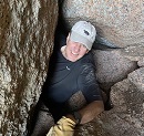
")
 The ridge from the summit")
 Looking back onto the ridge from 13,500 feet")
 The ridge seen from Mt. Princeton")