| Report Type | Full |
| Peak(s) |
Mount Charleston - 11916 |
| Date Posted | 05/18/2016 |
| Date Climbed | 05/09/2016 |
| Author | derekesq |
| Mount Charleston, Nevada |
|---|
|
First trip report. I figured I would write a trip report on my recent trip to Mount Charleston (a/k/a Charleston Peak, Nevada, because: (1) Mount Charleston seems like a peak that would be on the radar of a lot of people on this site; and (2) there is a dearth of information regarding the conditions in late spring, the last trip reports I found on this site and summitpost go back years and so the goal is to provide a more recent conditions report for late spring. Background: Day 1 - Mount Charleston half marathon and Valley of Fire state park. Day 2 - Mojave National Preserve - Teutonia Peak Trail - nice, short hike, through the world's densest concentration of Joshua Trees. Great desert hike 3.4 - 4 miles (including abandoned mine detour/visit), summit gains about 700 feet. About an hour fifteen minute drive from Vegas. Day 3 - Mount Charleston General information: can be found at summitpost; and weather at http://mtcharlestonweather.com/ Route - Two trails go to the summit. The South Loop appears to be closed, but may reopen soon. The North Loop has 2 starting options; I went with the Trail Canyon Trail to the North Loop Trail. Clear info on the starting points and 2 North Loop options can be found on summitpost so I won't repeat such here. Started on the trail at 6:40 AM (had planned to start a little earlier but Vegas At the signed intersection stay left for The North Loop Trial. At the intersection its worth a short detour to the right to take in the cliffs and view. The North Loop Trail continues toward Cave Spring. Commencing right after the intersection The North Loop Trail had areas of spotty snow. 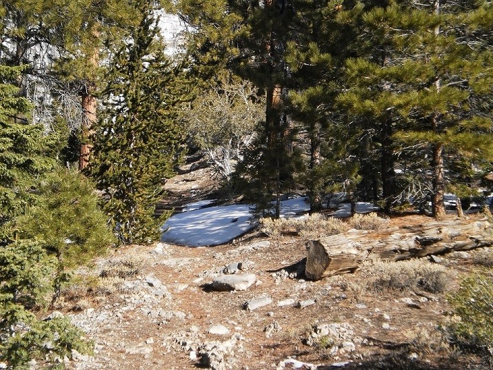 Once I reached Cave Spring the snow went from spotty to continuous. Reading prior trip reports, and seeing the snow covered summit and approach from below, I had expected snow, but not this low. The snow was about 6 inches deep but there was a path made by previous hikers so the going was smooth and easy (for now). 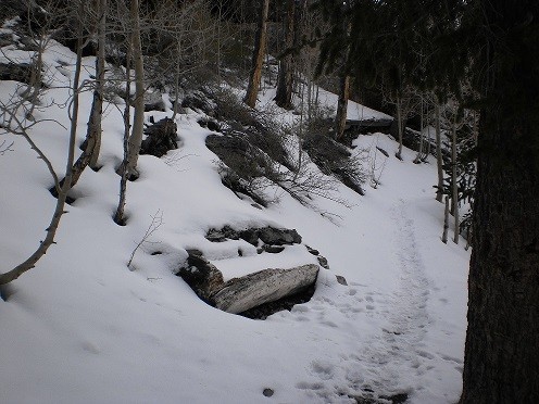 As I moved up the trail the snow got deeper, and the amount of foot prints decreased. Shortly after the "horseshoe" turn in the trail the footprints following the trail veered directly up the slope. This did not appear to be the trail, however, as the trail was due to turn back to the SW, the trail may consist of switchbacks up this slope and the prior hiker(s) may have been just taking the straightest route up. I turned left and followed the trail (now just one set of footprints), up the slope. At this point it was trail-making and post-holing in about 8 - 12 inches of snow, with deeper drifts and holes that could not be seen before stepping in such. Pictures of the slope to the ridge: 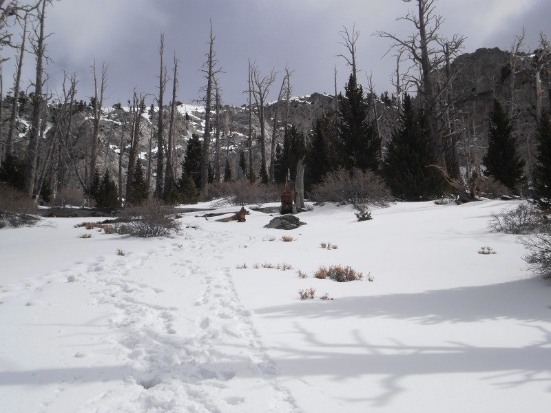 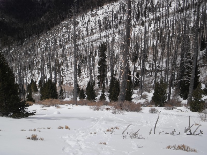 Once I neared the top of the ridge the prior footprints stopped. Although I knew the trail turned SW, I did not know exactly where, and there was no clear indication of such. At this point my low-cut Keens had suffered from a decent amount of snow infiltration. I knew the trail would sooner or later be a ledge along cliffs. Given how slippery the climb up the slope had been (even with micro-spikes the angle was such that each step sunk and slid), the increasing amount of snow, my wet boots/socks/feet and likelihood that the ledge would be covered with went snow over ice, I elected to hang out on the ridge for a while and then turned back. Bottom line: When heading up Mount Charleston in early May be prepared for snow, ice and an unbroken trail. 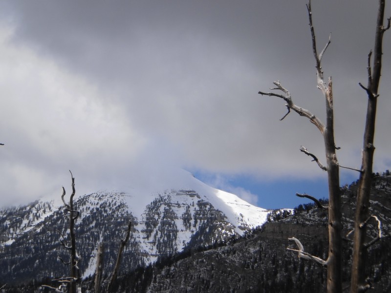 Thumbnails for uploaded photos (click to open slideshow):
|
| Comments or Questions |
|---|
|
|
Caution: The information contained in this report may not be accurate and should not be the only resource used in preparation for your climb. Failure to have the necessary experience, physical conditioning, supplies or equipment can result in injury or death. 14ers.com and the author(s) of this report provide no warranties, either express or implied, that the information provided is accurate or reliable. By using the information provided, you agree to indemnify and hold harmless 14ers.com and the report author(s) with respect to any claims and demands against them, including any attorney fees and expenses. Please read the 14ers.com Safety and Disclaimer pages for more information.
Please respect private property: 14ers.com supports the rights of private landowners to determine how and by whom their land will be used. In Colorado, it is your responsibility to determine if land is private and to obtain the appropriate permission before entering the property.

