Download Agreement, Release, and Acknowledgement of Risk:
You (the person requesting this file download) fully understand mountain climbing ("Activity") involves risks and dangers of serious bodily injury, including permanent disability, paralysis, and death ("Risks") and you fully accept and assume all such risks and all responsibility for losses, costs, and damages you incur as a result of your participation in this Activity.
You acknowledge that information in the file you have chosen to download may not be accurate and may contain errors. You agree to assume all risks when using this information and agree to release and discharge 14ers.com, 14ers Inc. and the author(s) of such information (collectively, the "Released Parties").
You hereby discharge the Released Parties from all damages, actions, claims and liabilities of any nature, specifically including, but not limited to, damages, actions, claims and liabilities arising from or related to the negligence of the Released Parties. You further agree to indemnify, hold harmless and defend 14ers.com, 14ers Inc. and each of the other Released Parties from and against any loss, damage, liability and expense, including costs and attorney fees, incurred by 14ers.com, 14ers Inc. or any of the other Released Parties as a result of you using information provided on the 14ers.com or 14ers Inc. websites.
You have read this agreement, fully understand its terms and intend it to be a complete and unconditional release of all liability to the greatest extent allowed by law and agree that if any portion of this agreement is held to be invalid the balance, notwithstanding, shall continue in full force and effect.
By clicking "OK" you agree to these terms. If you DO NOT agree, click "Cancel"...
Since Joel and Nate were planning on day tripping Rio, Joel suggested I go up and camp the day before, since there was no way I was day tripping. That's crazy! But after 2 nights of not sleeping all that well (one involving Joel calling me in the middle of the night to play 14er skimo google), I was not looking forward to another short night before packing in to a high camp and then attempting to ski 2 13ers. So after braving wild kingdom on the road in, with tons of deer and a mountain lion crossing my path a few miles from the campsite, I settle in for 3 hours of sleep. 3 hours is very much needed at this point. Too bad my alarm the next morning is silent (really good alarm, eh?), and I take a bit too long to get ready. So a 3am start is going to make getting the 10 mile approach difficult. But it is what it is.
I was able to boot for the first mile or so, before the snow started. Then it looked like a crazy icy steep side hill, so I continued to boot by the side of the trail. The snow was mostly supportive for me this morning, only post holed a few times. But around the time the trail turns away from the reservoir and goes a bit up hill, it became stupid, so I put on the skis. It wasn't too bad until the second tree across the path. No easy way above or below it, since we were on a steep slope. So I had to go through it. I swam up to it, and inched my poles and skis nearer to the tree trunk. I had to start breaking off a few branches as I got closer. Then it was a weird monkey move around the tree, since my body was lower than the tree by the time I reached it. This will suck on the return!
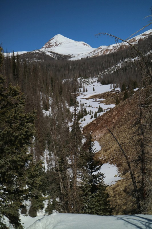
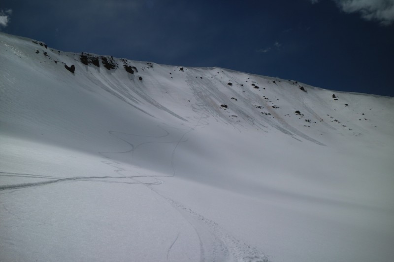
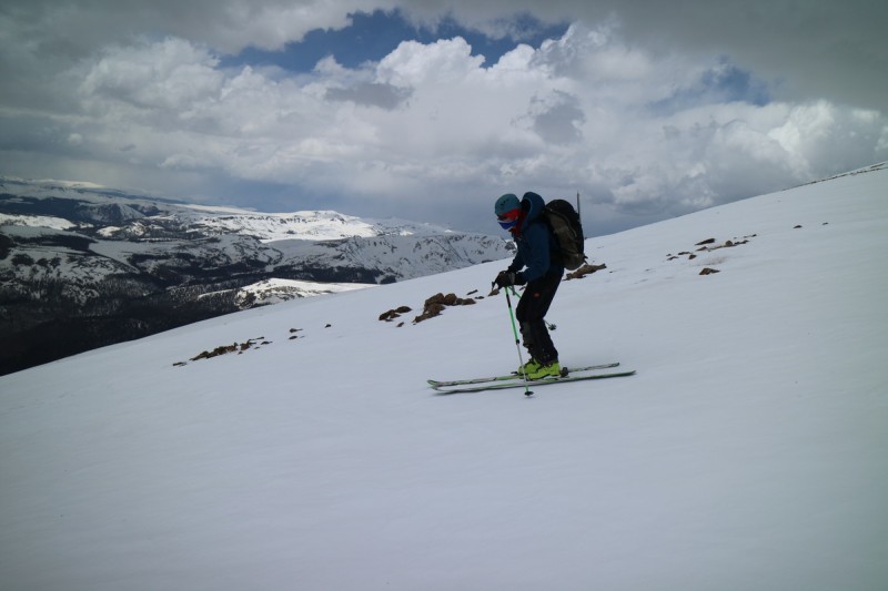
After that, the trail stayed pretty nice until it rounded the corner and went along the roaring stream. Dry trail. Off went the skis. Then into the trees again, snow. On went the skis. Crossed the stream on a very nice bridge. Here I thought things will improve greatly. Dry meadow. Off with skis. Into woods, snow. On with skis. Exit trees to see the sun expose the long drainage for the first time. Ahhh continuous snow on the east side of the stream valley. So I skin ski down a tufted slope, until I go a bit too fast. Take off skis, cross icy stream. Put skis back on, for a long time now, thankfully. Up the drainage I go, getting a nice view of 13,278' along the way. That looks quite skiable on the way out. Too bad I don't get a view of the other 13er to the north. Hope it's holding enough snow!
First light on the long approach, skied on the shadowed left side of the stream
Scoping out 13,278 for the exit.
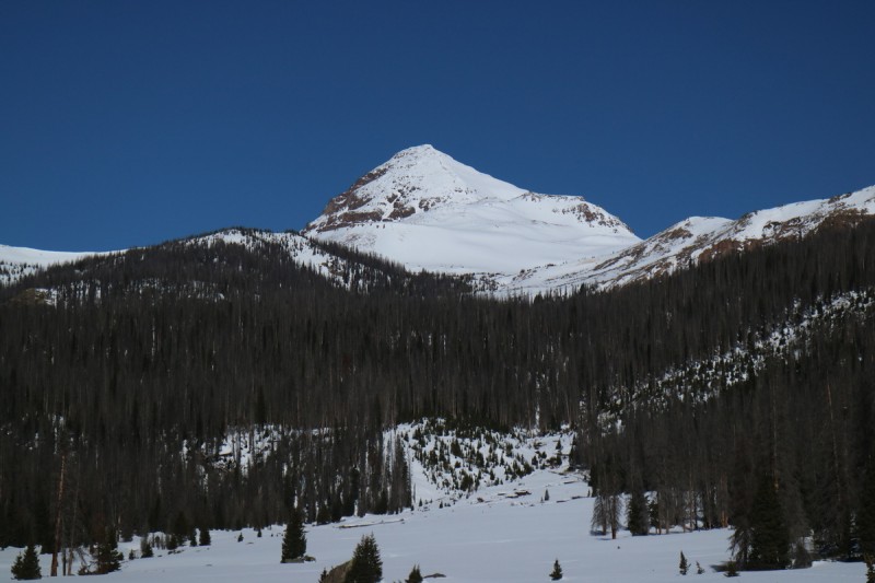
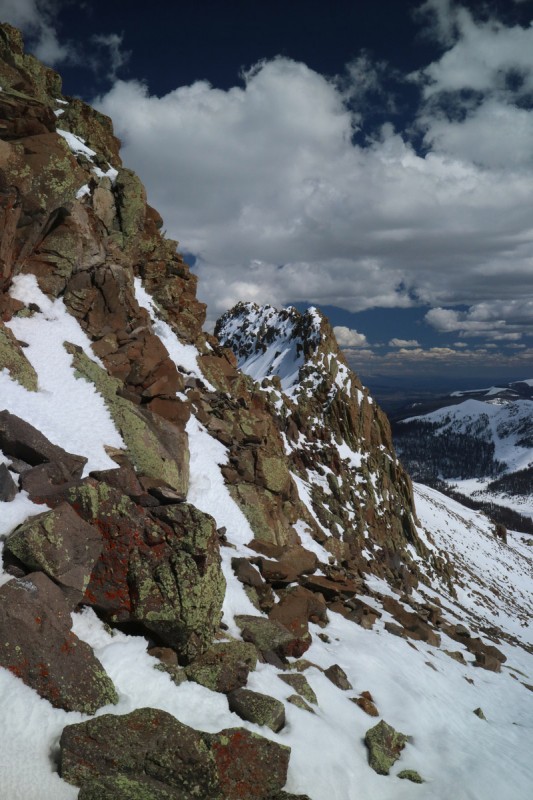
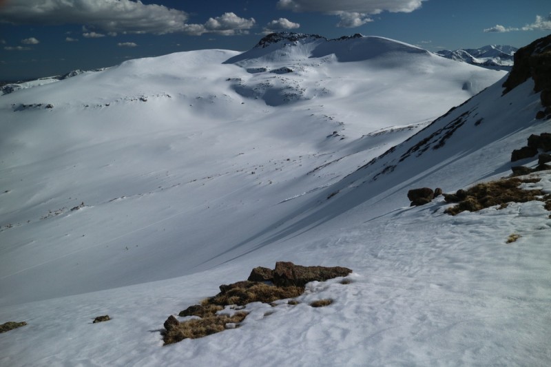
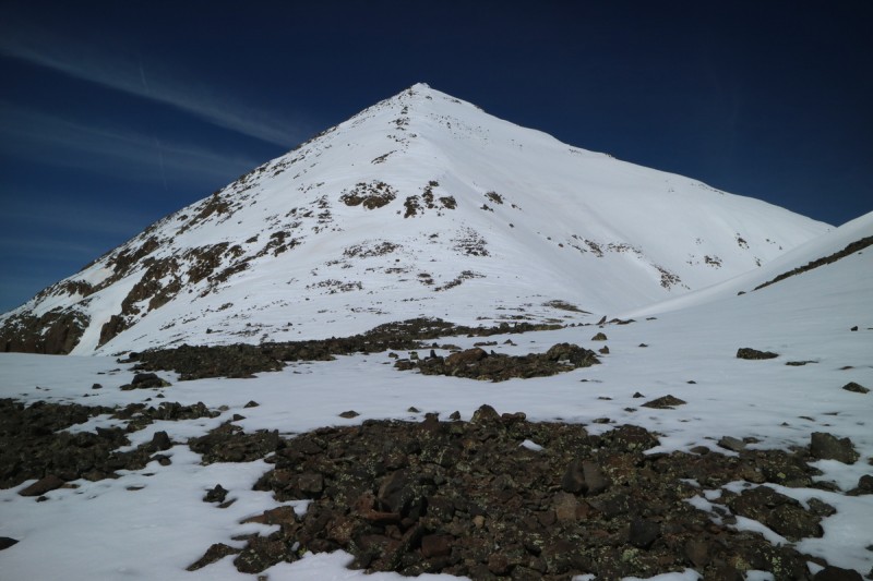
As I approach the pass and nearing the turn off for the main RGP 13ers, I start hearing a strange noise coming from south of the pass. It kinda sounds like someone laughing, like Ha, long pause, Ha! Hmmm a coyote pack is in the vicinity. Great, I'm solo out here till tomorrow morning. Hope they stay where they are and don't come and investigate me! I follow a ditch that takes me right into the depth of the drainage. When I see the end of the ditch, I figure the trail contours around up the stream, so I start following it. But then the snow starts to get thin and ends. So I boot up the slope a bit and get a view of the rest of the drainage. The side of the stream I'm on, is all dry. But if I go to the top of the stream bank, there is snow in the trees. So a couple more feet uphill and the skis go back on the feet. Here I get my first view of RGP through the trees. Soon I exit the trees into the main meadow and get a nice view of both RGP and the Window.
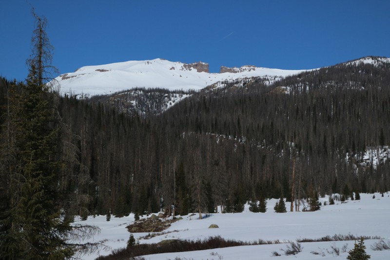
First good view of RGP, dry north side stream drainage below RGP from big meadow Window from big meadow
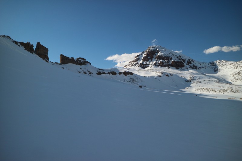
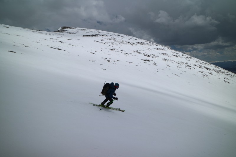
I'm still debating how I'm going to spend my day. Do I go with the plan I finalized before starting of going up to the Window, drop my overnight gear, climb and ski the Window then go over to 13,017, climb & ski, then contour over to my overnight gear, and then go to the base of RGP to camp. Or do I just go up to my campsite, drop gear and then do Window and 13017. Going directly to camp is closer, let's do that. As I started making my way up further, I noted some big, fresh bear prints. Also big moose knuckles in the snow. Hmmm I think I will make a super high camp. I want no part of wild kingdom around my bivy! So all the way up to 12,000' I went. Found a great spot where I could see down trail, and could have a nice view of RGP for sunrise. Dropped my gear. It's late in the day (noon), but the snow is still really supportive and the terrain I'll be traveling over is safe, why not go and see. Every once in a while I see a TR about skiing the refreeze. Why not try that out?
So I started up the rolling terrain and decide I'll try 13017 first, since it's north facing. With the ups and downs, I'm constantly getting in and out of my skis, and my boots don't sink but a cm, so the snow is good to go. Still not going to ski anything steep solo, but oh does it look tempting, as I pass the Window's east face.
When I checked my GPS at camp, 13017 was only about 2 miles away, but it took forever to get there in the sticky wet snow. Very little glide to be had on soaked skins. As I get closer to 13017', I start to have some doubts about it, but my tired brain doesn't register my concerns. I keep thinking about which line looks safest to drop. Direct off the summit looks crazy, but nearby looks good. I didn't read any other TR's on these peaks other than Dad Mike's, since his was the only one in snow. And he didn't put up a photo of this peak. So I go up to the western saddle, get my first view of the rest of the Weminuche, and continue up to the very western point of the summit ridge. Yikes... this doesn't look safe to scramble solo at this hour of the afternoon. Maybe there's an end-around to the south, where I can just scramble up the last little bit... Oh sh!t, that's a big old NOPE! One look at that and I bailed. Went back up to the saddle, and amazingly I had LTE coverage. So I brought up both Furthermore's and Natalie's TR's from summer. Hahahahaha, class 4, exposed and loose, AND from the other side. That's definitely NOT going to happen today!
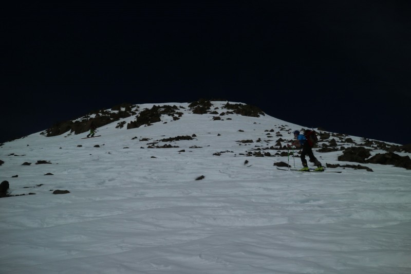
So I turn tail and ski down the ridge directly and over to the Window. At this point, this was my first significant downhill slide of 300'... long day!
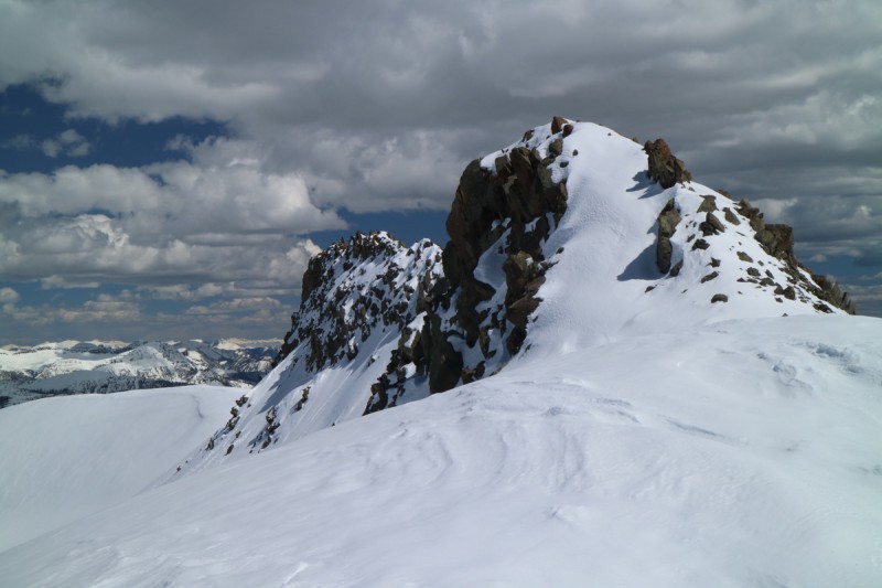
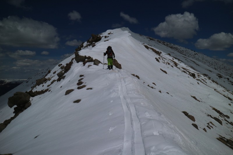
The ridge up to the Window is fairly easy, as I contour up the western slope. I get up to the false summit in the middle, and have an extraordinary view! Well worth the short detour. Then it's off to the summit, for an evening arrival.
The big east face of the Window looks sooo tempting to ski!
13,017 from west saddle The backside of 13017 - yeah NOPE! Looking over at Window and RGP from 13017 RGP and the Window!
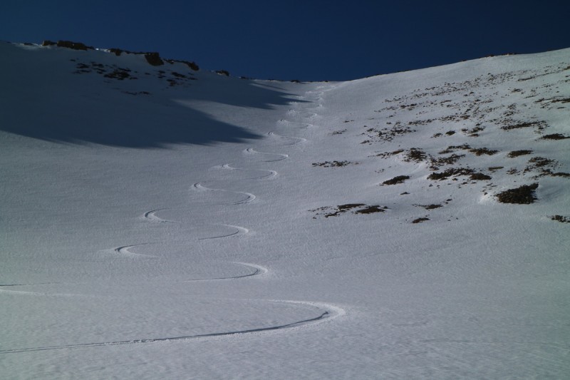
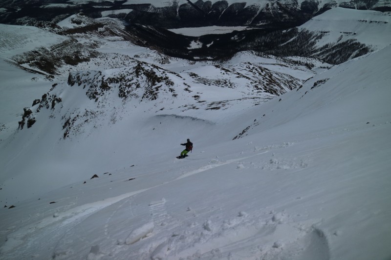
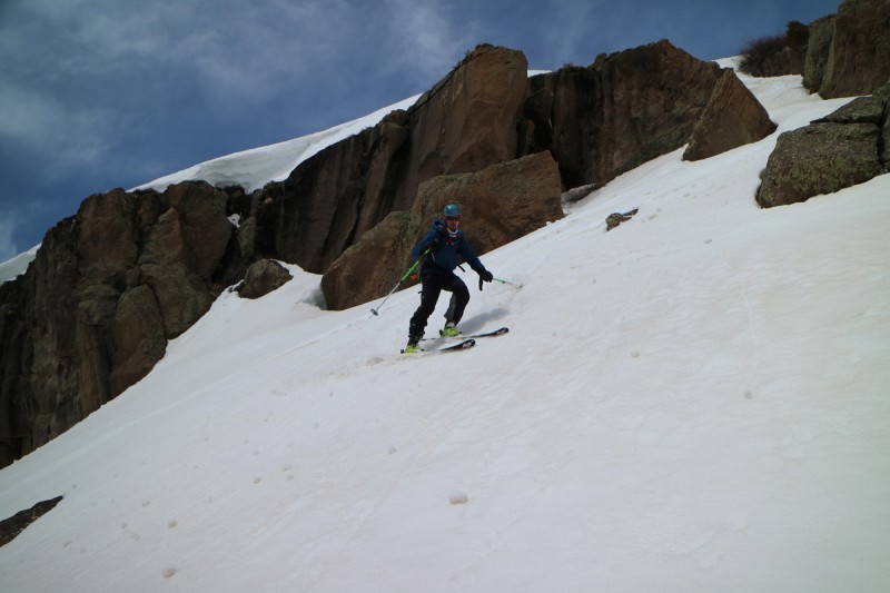
I sign the summit register and sit and take my first significant break of the day. I'm rather exhausted! I want to wait long enough for the snow to refreeze a bit, but not long enough that I miss sunset at my camp. So at about 5pm, I click into my skis and start down the gentle southeast face in refreezed storm and fully transitioned snow. The turns at first were a bit tough on my tired uphill legs, but soon I get into a rhythm. I get to the nick point on the slope to view my final drop down the slope. Here it gets slightly steeper, but not bad at all. The snow is good enough for this slope angle. It was tough to give up that east face, but I just felt it was too steep to do solo at his point in my day. So this lower section was just steep enough to be fun, but not enough to be worrysome. The refreeze, was decent, though it was still a bit punchy. I made good turns, but I much prefer the warm up corn to the refreeze corn!
View down the first drop from the summit
First set of turns down The Window The lower drop, with 13017 in background Some decent refreeze turns
I'll be back 13,017....
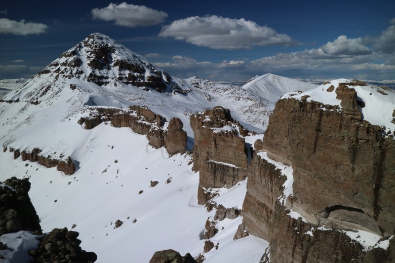
Shutting the window with RGP
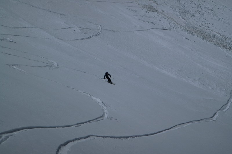
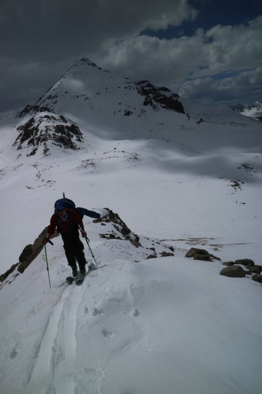
I stomped around the ridge of the Window to the first drop on the return to camp. It looks so far to go! As I start down the steep first slope, I see that the snow is getting really fast and breakable. My turns are full safety. I get to the middle and I decide that I'll just leave my skins on till I get up to the final rise, it's not worth the on-off-on-off-on of the skins at this point for a few feet of downhill. I plod along, looking forward to getting into my sleeping bag and eating dinner.
That final drop into camp was fast. The snow was getting cold so fast, I had to make super wide turns since I was going too fast to turn in the breakable crust. Joel and Nate will laugh at them when they see them, but I'm going to play this one safe. I got to camp, just in time for local sunset. I set up camp, ate and drank what I could, and settled in for a less than restful sleep.
The long rolling traverse back.
Final drop before camp, where the refreeze continues.
Local RGP sunset from camp
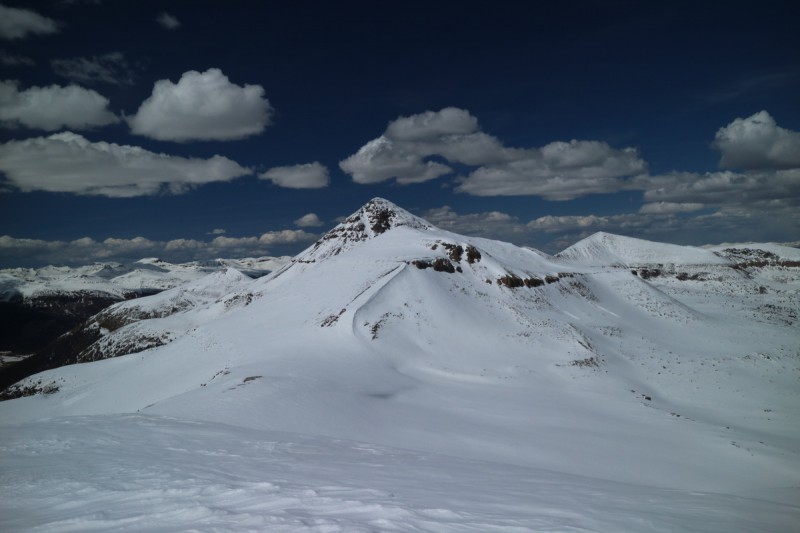
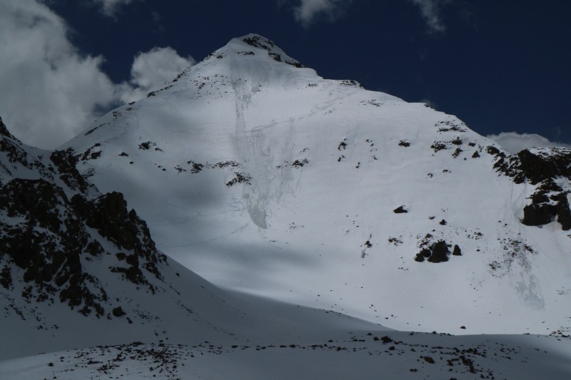
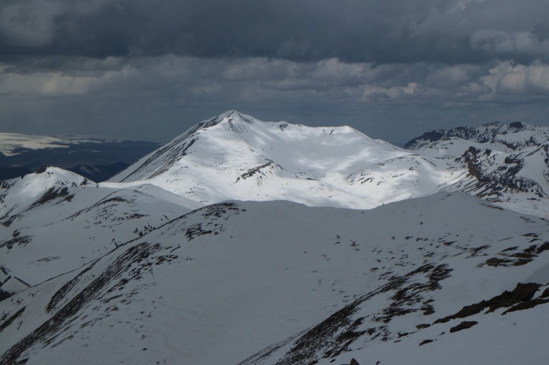
Rio Grand Pyramid and 13,278 (aka Fools Pyramid on LOJ)
Trailhead: 12K Camp
Mileage:11.88
Elevation Gain: +2,587', -5,074'
Partners: The 2nd Tier Centennial skiers: Joel and Nate
Joel said that he would meet me at "the base" of RGP at 6-7am. So I make sure I'm up well before. Plus I have a great view of sunrise from my bivy. But the morning is really cold, and getting out of my bag and bivy sucks. So as 6am arrives I'm still in my bag. But I can look down the slope and see no one, no headlamps flashing. My gear in my pack is ready to go, but my camp is still set up. I figure Joel and Nate can wait a few minutes while I tear down. It's freaking cold with the sun not on my camp yet! As it approaches 7am, they're still not here, but the sun has now hit me. It's not quite warm yet, so I'm still in my bag. Everything else is packed but bag, bivy and inflatable pillow/pad. At about 5am, I heard the coyote's laughing, so if that means they are at the pass... they're going to be late for 7am! That is if they are showing up. I have no way of knowing! So a little bit after 7am, I get the skins on my skis, and pack up the rest of my camp. I hadn't really planned to fully solo this trip, but if I have to, I will.
I leave my camp around 7:45 or so. Late. Late for that NE face, but there's always the east ridge to ski, if I have to. Alpenglow on RGP, while I stay warm in my bivy
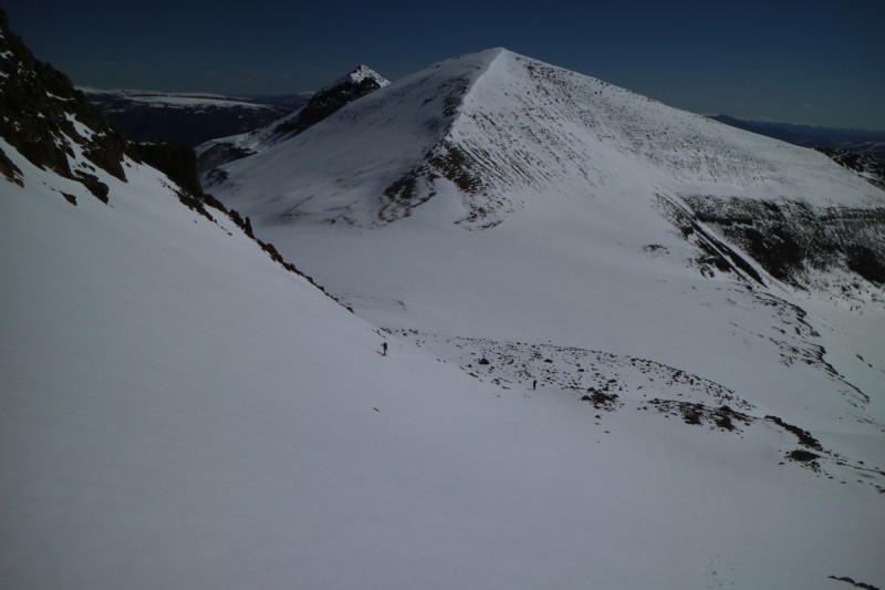
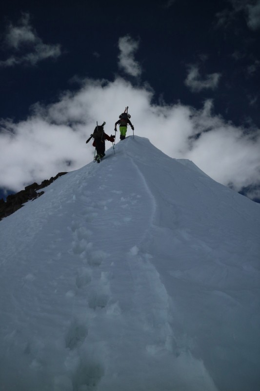
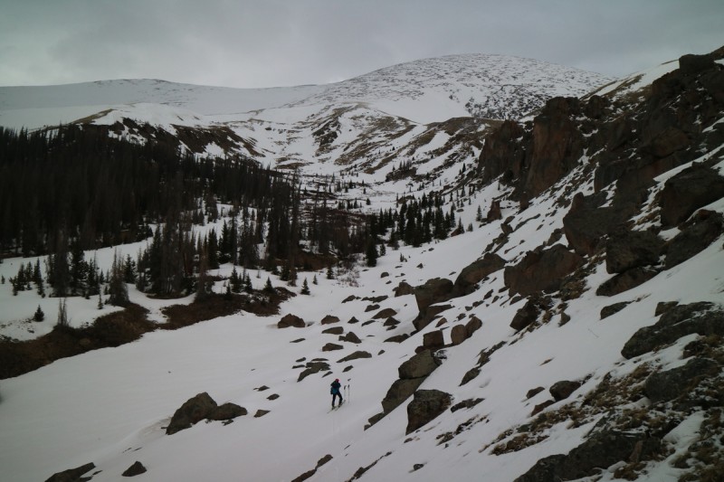
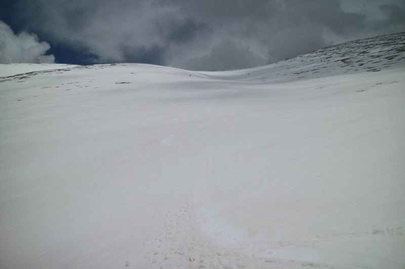
So I slowly make my way up the drainage and work my way around the rolling terrain. I keep looking back at my camp, hoping to see someone coming up. Nada. So I keep going. Somewhere just below the final slope where I'm planning on dropping my overnight gear, I see 1 skinner. Just one. Is this Joel and Nate, or some other crazy person? As I skin up the last slope, I now see 2 people, I wave my pole at them, but keep going. Overnight gear that weighs 6.4 pounds is more than enough to slow me down a bit. Better to keep going. On the final broad slope before the base of the east ridge proper, Nate and Joel catch up to me. Woohoo! After a happy little reunion, we start up the east ridge. Both of them still skinning, me booting, as I did up the final slope. Both were similar in time effectiveness, untill both of them changed over to crampons for the final assault on the ridge.
Oh look who decided to finally show up! East ridge of RGP Joel and Nate skinning up the first section of RGP while I booted Further up the east ridge
The Window looks so small now!
Approaching the corniced section
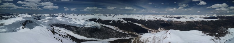
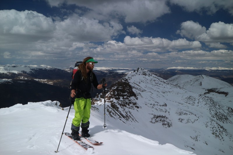
Along the way, they mentioned that the north face has snow, and that we should ski that. So we weren't late! I had seen most aspects on the peak, but not the north or west. But once on the summit, the north face was out. Too rocky and too steep to be viable. We may be able to ski down the west ridge and then drop in, but it wasn't looking good. So now onto another plan. We could always safety ski the east ridge, since the northeast face has been in the sun since 6am, but we would see once we got there. The snow pack was good to me yesterday, so that means it isn't complete soup yet. Plus CAIC mentioned the only problem was in the storm layer barrier, which here on RGP wasn't that thick. But we could make that decision when we got to the face. First to enjoy the Weminuche views...
Summit crazies - where's the Margs?
Gaping the Weminuche
Mmmmm Weminuche
Oooo what's that?
Vestal and neighbors...
Weminuche Pano - drooling
Joel looking at the east face, having just skied off the true summit.
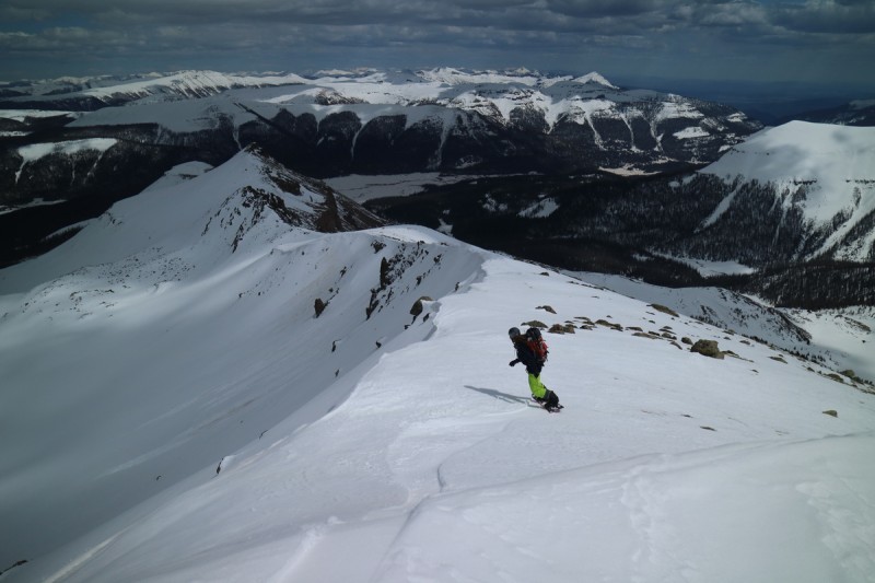
Once at the departure of the east ridge and ne face, we decide that we can ski the first drop safely. We can make a decision lower, and then bail over to either the dirty snow or the east ridge again. Nate drops first, since he's the most experienced at cutting slopes and avy determination, he did just spend the winter in Japan teaching Avy classes and cutting lots of slopes. The first section of wet and sloppy, but still a pretty decent ski. Then below we discuss what we saw and felt, and where to go from here. We know the storm snow will slough off, no matter how gently we ski it. Nate is pretty confident he can get the slope safe for us, so he goes first. The center section sloughs, and off he goes. The snow below is still solid. I skied in the middle section until below the rocks, where the slope angle drops off again, then hit the fresher snow for some good turns. Joel follows my lead and does the same. From there, its a short contour ski over to our respective gear stashes.
Nate dropping the first section of the northeast face Joel's first turn down the northeast face of RGP Nate going out to make the rollover safe for the tiny skiers Joel starting down the second drop Joel ripping the soft lower snow Nate riding past RGP Looking over at 13,278 and that other 13er Hmmmm that almost looks like a Phoenix...
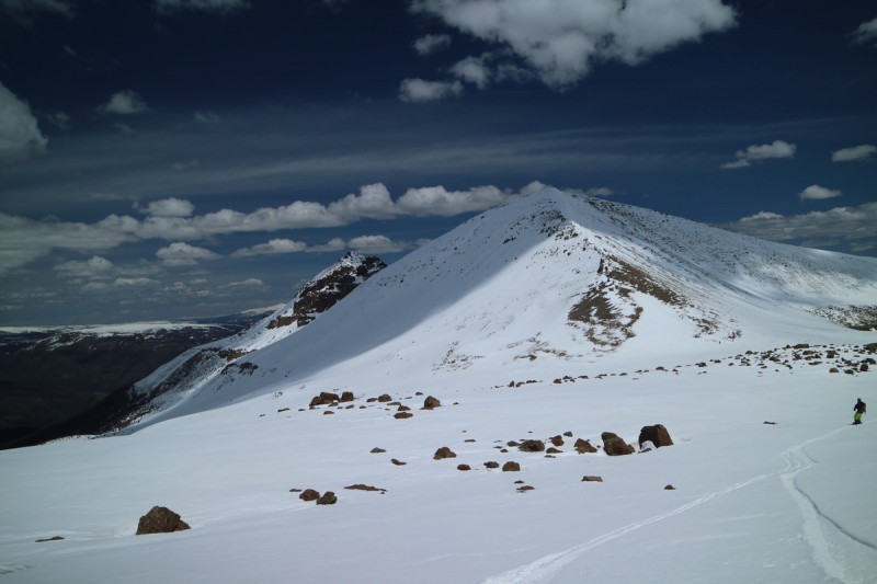
Joel had wanted to ski the Window, but after telling them how long it took me, they decided against it, and even decided to follow me up 13,278', since going up 700' and 0.55mi would save at least a mile of flat and up hill to the pass in the return valley. So up the ridge on 13,278' we went. We made the summit fairly soon, even with me carrying my overnight gear at this point. We decided that the safest thing was to drop down the east ridge and get onto the smoother more northerly snow. It also dropped in slope the further east we went. Nate rocketed of the ridge and dropped quickly down and well into the basin below before we could even get our cameras ready. Joel and I skied down the ridge a bit farther. I went the furthest of all, since I was carrying extra weight, and with tired legs and a weird balance, this wasn't going to be easy.
Nate leading the way up 13,278 Joel coming up the short ridge on 13,278' Nate with 13,261' in background. Yeah, not skiing that.
The first couple of turns were tough, as the top layer of snow was sloppy. At least the layer below was still supportive. After I got below the steeper section, the turns came easier with the weight, and I made my way over to Joel and Nate's stopping point. The drainage below the upper basin was fun to ski, as the clouds and bit of wind were keeping things cool enough, the snow was still really good. In fact, the entire drainage out to the main one went really smoothly. So not only was the snow still good and safe enough to ski, there was little navigation issues, other than deciding which side of the stream to be on. We skied all the way down to the main valley, and over to the east side and continued our slide for a while.
Nate about to drop 13,278' Joel standing above our drop in point Looking back on a tiring but enjoyable ski
Eventually we ran out of snow, and transitioned to booting. Then back to skiing. Then to post holing until we got to the bridge. Then skiing. Post holing, skiing, carrying, skiing.... By the time I reached the downed tree, I didn't recognize it until I see the photo of Nate going over it (below). He really went to town on those branches! Got rid of a lot of snow around it too! Amazing. Then the slide out was pretty good until the trail went parallel to the reservoir. Nate's mood went black, and many cuss words were uttered. Joel ended up dropping down to the reservoir, but the rocks were loose, and after a quarter mile, was back up on the trail with us. At one mile, we finally transitioned for the last time, and walked our way out. A nice sunset over the reservoir, but I was barely awake enough to take a photo or two of it.
Why doing yoga may actually help. So this was the tree that saquatch went all lumberjack on and removed all the branches.... DANG!
Reservoir Sunset
I get back to the car and Joel and Nate a busy getting dinner of tacos ready. Woohoo Cinco de Mayo dinner! Glad we don't have margs, or we would all just pass out in our chairs!
So what to do tomorrow? It was a bit up in the air. It would be Joel's 4th day on skis, and Nate and my 3rd. Ouray? Aetna? Joel thought the drive to Ouray wouldn't take that long, but I had just enough service to google map that. 3-4 hours. it was 9:30pm. We wouldn't get much sleep. Hmmm! Joel asks me what's nearby. So I think. Oh wait, Phoenix! I haven't hiked it yet, but that's just outside of Creede. Joel looks at me incredulous in his delirious state of mine. That's not a centennial. Yes it is! Then what are those quotation marks? Just means its an unofficial name. Joel still doesn't believe me. But he's been awake for so long, he should be skeptical. So he brings out his Roach 13er book, and I look up the centennial skier webpage. Yes, Phoenix is a centennial (which means it's on Joel's list), so we got our plan. Pack up camp and drive over to however far we can get. So we make about the slowest drive over to Creede possible. 4 Elk try to run into my new car at one point, all the deer stay put. We get to the base of the 4WD road and I park it. Brand new Subi ain't going up that rough road! Joel goes up and sees a tree across the road he thinks he can break with his SUV. But we leave that for the morning. We get 3 hours of sleep tonight! Better get to it...
Phoenix Peak
Trailhead: 2WD on 502
Mileage: 12.27
Elevation Gain: 4,412'
Partner: The delirious 2nd Tier Centennial skier, who forgot that Phoenix is a centennial peak: Joel
Baseball. I'm dreaming about baseball. I just caught a pop fly. Then my alarm goes off. Total confusion. WTF?!?! I hit snooze reflexively. A few minutes later, theres a knock and headlamp at my window. I wave back. Yeah, yeah I'll get out of my bag now. By the time I'm out doing my business, Joel and Nate are up doing their lumberjack routine. It doesn't look like its going well. They back down after a bit, and Joel says we're good to go, but Nate is staying here and sleeping. Turns out Joel had to jump on the trunk to break it. I took that time to pack my bag and get ready to go, so I pile into the SUV and we go up 400' on the road. 2 tiny trees have blocked the road now. We both go out and pull them out of the way. 100' later on the road... 2 huge fallen trees with big branches. Done. So much for getting up 1.6mi of the 4WD road (which is really rough at one point). Time to boot.
Just as we start, a few rain drops fall. Oh great! What's the weather like today? A mixed bag was what I remembered, but still better than the weekend forecast. A few feet after the trees, we head downhill, a painful long downhill we would curse on the return. We make fairly quick work of the road and take a quick break at the "trailhead". Another poorly marked trailhead with no parking spots. Hmmm my GPS confirmed, so we then started looking for a river/stream crossing. Nothing easy. Joel finds a place he can jump. I'm so not jumping, so I utilize the sandals I brought with me and strip off my boots and socks and cross. Soon after that, we run into snow. So Joel puts on his ski boots. But then it starts looking like it may rain, so Joel picks up his gear cache of shoes and socks and carries them. Snow is off and on, and then off till we cross the next stream. Here we have a lovely steep, icy and rather unsupported snow to skin by the side of the Mongul dynasty of beaver dam lakes. We have a bout a mile of horrible and terrifying skinning next to about 14 beaver dams. It truly was the dynasty to end all beaver dynasties on this stream. Quite impressive amount of downed trees on the far side. Who thought just getting to the trail head would be the easy part of all of this?
Thankfully once the beaver dams stop, and we criss cross the stream a bit, the skinning got a bit easier. Soon we were making the left turn to access the west face of Phoenix. Finally things got easier! But after eating a bar that was going bad, my stomach turned. Despite managing to eat something more, after that nasty bit I had to spit out, my energy tanked. The route up to the ridge didn't look that far, but to my exhausted, and bonking body and brain, it was soooo far away. Thankfully the weather was keeping the snow frozen solid. There was no real rush to get to the summit. And once I saw the east face, I figured we were not going to drop that and do a reclimb. Even if it was only 700'. It would be fun, but I no longer wanted the extra uphill. Getting out would be tiring enough.
The terrifying icy, unsupported, side hill above one of the multitude of beaver dam lakes
Getting our first view of Phoenix Peak
Joel skinning up the big west face
First view of the snowy west face
Long ridge to the summit
Summit ridge in the sun
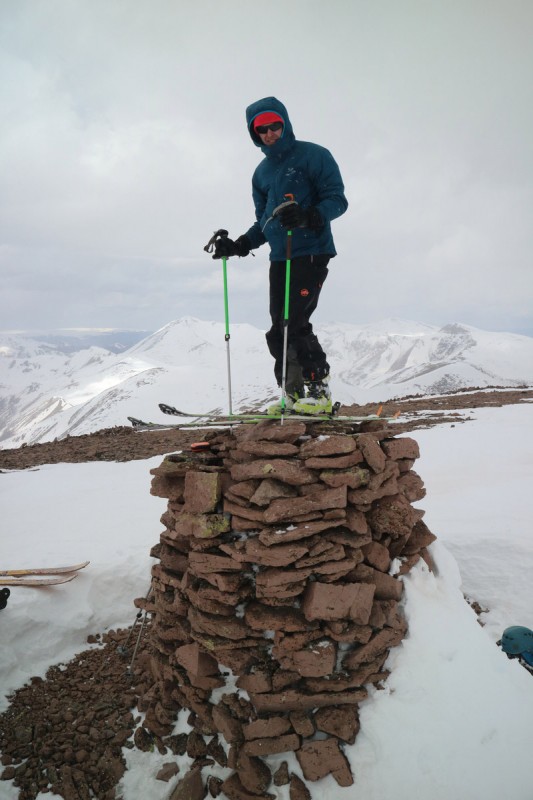
The summit is marked by a giant cairn, which is nice because the ridge is so gentle, it would be difficult to find otherwise. After a very short break, Joel climbs onto the summit cairn, to get in his true summit click in descent. I ask him if he's going to do anything now that he's up there. But he's also too tired to do anything funny. So off he comes and we make the gentle slide down to the west face that we want to ski. I convince him to at least wait for a small weather window, so that we can ski it in some sun. He relents, and we wait for a short time. After skiing so many peaks in bland white outs or in not perfect snow, I'm hoping this smooth snow corns up nicely at some point, and I want to be able to see it!
After a short wait, it was go time, and we leap frog each other in the sun windows. I take first on the lower stretch, and here is where the money corn was! I open it up and tear down the slope, knowing that each turn would bite perfectly. I stop just before the slope turns into thin snow and brushy. THAT, was worth it! Joel follows me down, and then we contour over into our ascent drainage, where we get a bonus little drop.
San Luis in the sun Joel takes standing on the true summit with skis to the extreme Joel looks cold as we drop the first icy section of the ridge face Joel whipping past, as the snow slowly warms up a bit Joel following me down, after the best and fastest corn turns of the season Bonus drop we found along the ridge traverse
The skies above look less than ideal, and we can hear some rumblings, so we make as quick work of our contour and reascend as possible. On the way up, we decided that staying high up in the woods would be better than following that stream below. The snow would have become mush, and neither of us wanted to fall into a beaver pond. So I kept track of my GPS and we contoured and traverse skied as well as we could, until we got caught by a tributary stream. After we crossed it lower down, we managed to stay high on the ever more unsupportive slope above until we were 0.3mi from the stream crossing below the beaver dams. We had reached the end of our traverse. I got whipped in the face by trees and crawled my way through the slop. It was just as horrid as imagined in the morning! We had one high traverse over a beaver dam which terrified me, but I made it across. Got to a dry spot and took off the skis. Too bad that wasn't it though. But there was no way we'd be able to boot a high traverse over another beaver lake, so we had to cross the stream above. Then it was just a boot out to the main stream and to the 4WD road. Walking through the stream was actually pleasant!
Since Nate had stayed behind, Joel wanted to go rescue him from his predicament, so he raced ahead of me, since heartbreak hill was going to kill me! The road seemed to go on forever. I was almost to the top of heartbreak hill, when I see Joel and Nate. Nate grabs my pack and carries it the last quarter mile out. So nice of him, and it lifted my spirits just enough to pick up the pace for the final 700' along the road I had left. We all had long drives home, so we didn't spend much time at the trailhead. Long but good few days! Something to be pretty happy about.
Of course, in Creede, I get cell service and decide to check on things. Oh lovely, 300 work emails. What blew up? As I scan the list, I see one that makes my heart sink. A good friend and coworker has been battling cancer for years. His name was the title. I start to loose it. I don't make it very far through the email before I'm bawling. He has month(s) to live. The cancer is back with a vengeance. So here I am driving and crying. There isn't much I can do. Sometimes I can go full stretches without crying, but it isn't long. Glad my car has all the bells and whistles and warns me when I get close to any lines. The one thing I can be grateful for, is that he saw this coming, and has been working on his bucket list and doing all the things he's wanted to do in life. Traveled when he could and felt good enough. What a reminder that life is short, sometimes way too short, and that if you are not accomplishing what you want in life (career, education, business, family etc), then you better get started doing it. No one is on their death bed wishing they worked more! So get out there and climb that mountain! A cliche, but in our community...
My GPS Tracks on Google Maps (made from a .GPX file upload):
View on the Map
GPX file cannot be downloaded (per author)
Thumbnails for uploaded photos (click to open slideshow):
As usual, enjoyed your report, Otina. Very sorry to read about your friend. You're right in that at the end, no one wishes they worked more, got that promotion, corner office, whatever. Way to get after it!
-Tom
Thanks for the write-up! Great descriptions and photos. What an awful ending to the trip...I'm very sorry to hear about that. I hate the feeling of bad news after a good trip. But...agree 100% with the last sentence.
Tom - It's a perspective many may not get until it's too late. So glad to find weather windows in this crazy spring!
D_baker - Yes, I'll be back in summer for the 2 orphans I created. Next time I'll be better prepared! It was unique to see the differences with snow. Always refreshing!
AlexeyD - Tough to pick only these photos, so many good ones! I've had a few trips worse than this one (for bad news), but it's tough to not get back to the world, when you've been out of touch for a few days.
Caution: The information contained in this report may not be accurate and should not be the only resource used in preparation for your climb. Failure to have the necessary experience, physical conditioning, supplies or equipment can result in injury or death. 14ers.com and the author(s) of this report provide no warranties, either express or implied, that the information provided is accurate or reliable. By using the information provided, you agree to indemnify and hold harmless 14ers.com and the report author(s) with respect to any claims and demands against them, including any attorney fees and expenses. Please read the 14ers.com Safety and Disclaimer pages for more information.
Please respect private property: 14ers.com supports the rights of private landowners to determine how and by whom their land will be used. In Colorado, it is your responsibility to determine if land is private and to obtain the appropriate permission before entering the property.


 First good view of RGP, dry north side stream drainage below")
 RGP from big meadow")
 Window from big meadow")
 13,017 from west saddle")
 The backside of 13017 - yeah NOPE!")
 Looking over at Window and RGP from 13017")
 RGP and the Window!")
 First set of turns down The Window")
 The lower drop, with 13017 in background")
 Some decent refreeze turns")
 Shutting the window with RGP")
 Alpenglow on RGP, while I stay warm in my bivy")
 Oh look who decided to finally show up!")
 East ridge of RGP")
 Joel and Nate skinning up the first section of RGP while I booted")
 Further up the east ridge")
 Approaching the corniced section")
 Summit crazies - where's the Margs?")
 Weminuche Pano - drooling")
 Nate dropping the first section of the northeast face")
 Joel's first turn down the northeast face of RGP")
 Nate going out to make the rollover safe for the tiny skiers")
 Joel starting down the second drop")
 Joel ripping the soft lower snow")
 Nate riding past RGP")
 Looking over at 13,278 and that other 13er")
 Hmmmm that almost looks like a Phoenix...")
 Nate leading the way up 13,278")
 Joel coming up the short ridge on 13,278'")
 Nate with 13,261' in background. Yeah, not skiing that.")
 Nate about to drop 13,278'")
 Joel standing above our drop in point")
 Looking back on a tiring but enjoyable ski")
 Getting our first view of Phoenix Peak")
 San Luis in the sun")
 Joel takes standing on the true summit with skis to the extreme")
 Joel looks cold as we drop the first icy section of the ridge face")
 Joel whipping past, as the snow slowly warms up a bit")
 Joel following me down, after the best and fastest corn turns of the season")
 Bonus drop we found along the ridge traverse")


