Download Agreement, Release, and Acknowledgement of Risk:
You (the person requesting this file download) fully understand mountain climbing ("Activity") involves risks and dangers of serious bodily injury, including permanent disability, paralysis, and death ("Risks") and you fully accept and assume all such risks and all responsibility for losses, costs, and damages you incur as a result of your participation in this Activity.
You acknowledge that information in the file you have chosen to download may not be accurate and may contain errors. You agree to assume all risks when using this information and agree to release and discharge 14ers.com, 14ers Inc. and the author(s) of such information (collectively, the "Released Parties").
You hereby discharge the Released Parties from all damages, actions, claims and liabilities of any nature, specifically including, but not limited to, damages, actions, claims and liabilities arising from or related to the negligence of the Released Parties. You further agree to indemnify, hold harmless and defend 14ers.com, 14ers Inc. and each of the other Released Parties from and against any loss, damage, liability and expense, including costs and attorney fees, incurred by 14ers.com, 14ers Inc. or any of the other Released Parties as a result of you using information provided on the 14ers.com or 14ers Inc. websites.
You have read this agreement, fully understand its terms and intend it to be a complete and unconditional release of all liability to the greatest extent allowed by law and agree that if any portion of this agreement is held to be invalid the balance, notwithstanding, shall continue in full force and effect.
By clicking "OK" you agree to these terms. If you DO NOT agree, click "Cancel"...
Trailhead: Italian Creek
Mileage: 6.69
Elevation Gain: 2,618'
Partner: Solo
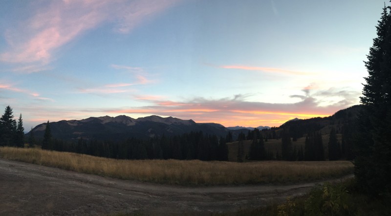
With the colors changing and me still in recovery mode, I figured a couple of lonely Elk 13ers would be the way to regain some strength and speed. Plus rebuild a 13er hiking ego a bit. After last weeks fail on Garfield, I figured going with something done before, would be best. Get some of my 13er mojo back.
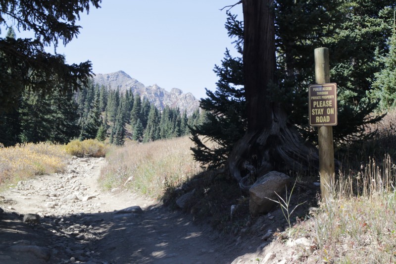
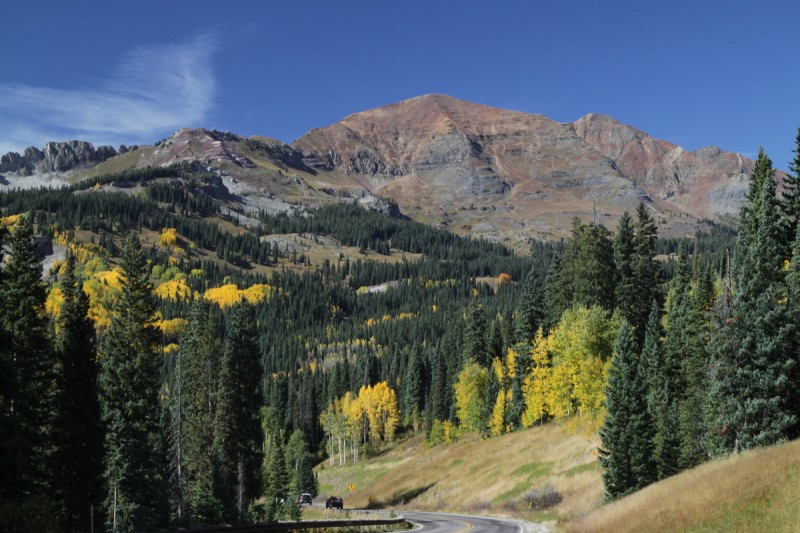
So after a nap on Cottonwood Pass, I was driving up the Italian Creek road around civil twilight. The road wasn't too bad once it went high clearance 4WD, but once it hit the first private property sign (You better be a friend if you continue past this sign), it gets a lot rougher. I had planned a loop, so I wasn't sure exactly where would be ideal. I made the turn after the switchback and continued up the much more technical 4WD road. I got up about 0.35 from the switchback, and the road started to narrow. I hadn't seen a place to turn around or pullout in a while. I wasn't sure if I should continue. So I started backing up the truck. It just happened to be over the worst of the road. Very glad to have a lift on the truck, since I didn't have to worry too much about placement of my tires/undercarriage. Just had to keep it on the road. After 0.2mi I found a place to 3 pt turn it, and parked it back at the switchback. On the return I would find that I only had another 0.15mi to go till the road intersection where I could have parked/turned around. OOPS!
So instead of walking up the road, I decided to go up a nice grassy slope. I had scoped on my map a way to avoid the mine property, and I did my best to follow it. Found the grassy ramp that Furthermore mentions and started up that. My GPS said that Lambertson Peak was to my right, not left, so I went that way and got on the summit of the super false peak. With my confidence a bit shattered after last week, I figured my 13er radar was just off. Turns out that the GPS had the peak in the wrong place. Oh well, a bit of extra hiking and a super short scramble up to the summit didn't really hurt.
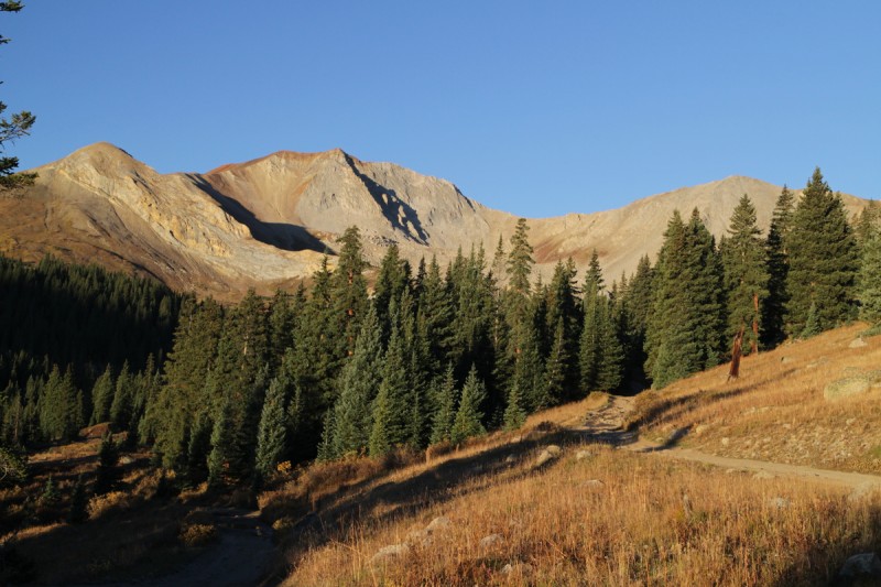
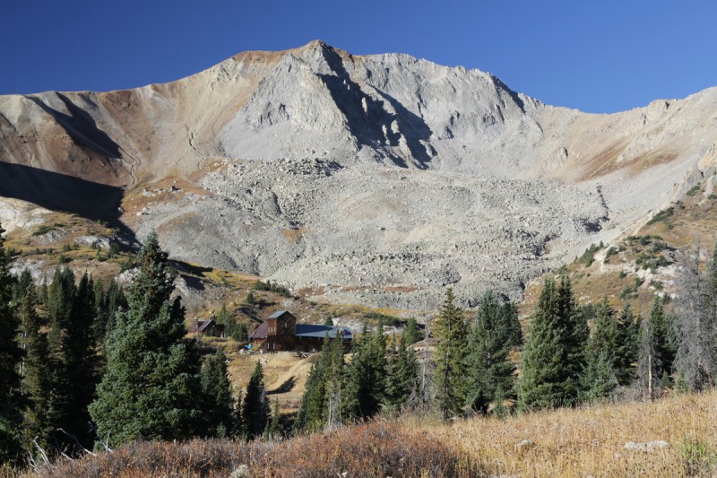
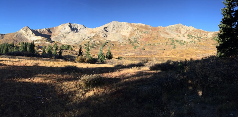
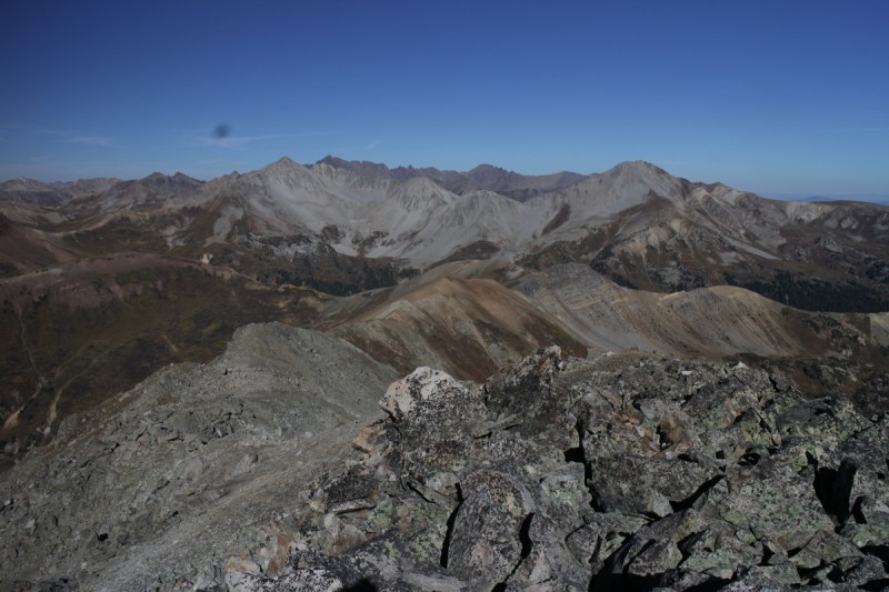
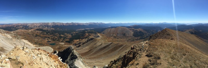
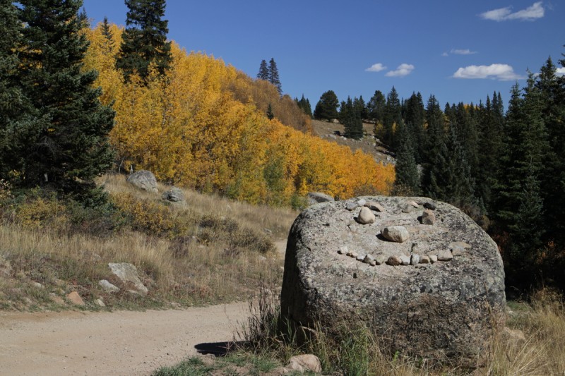
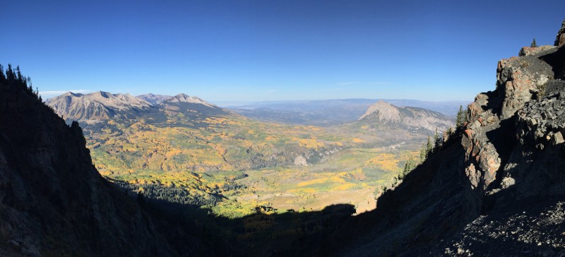
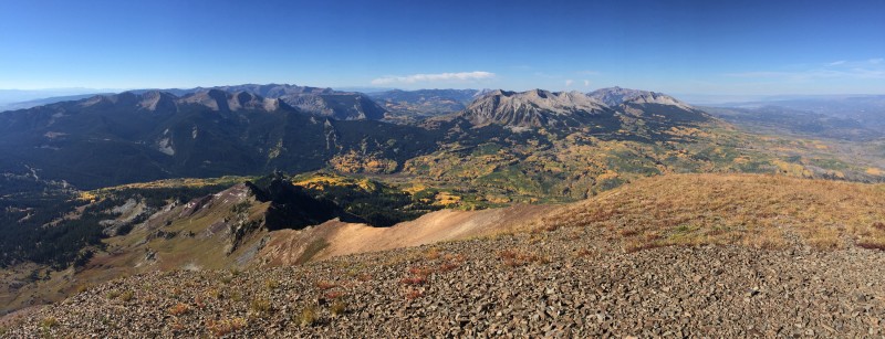
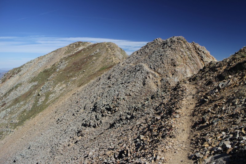
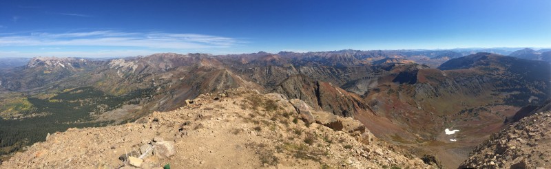
Italian from my parking spot at the switchback Italian with the Star Mine buildings Pano of Italian and Lambertson Ridge from false Lambertson Star, Taylor and Castle from a 13er point Elks and tomorrow's objective in the center - Owen B
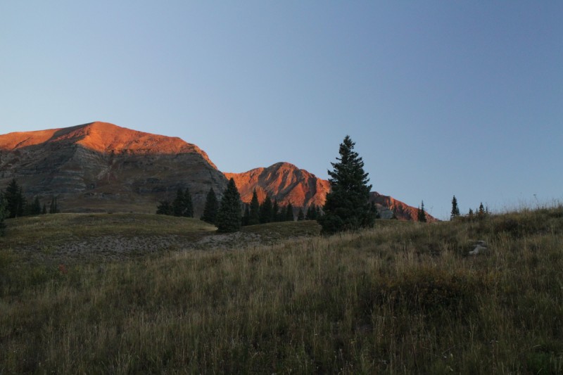
The ridge over to Lambertson was easy and I made quick time up to it. Quite a nice view of the Elks from this perspective. Always nice to see familiar peaks from a different view!
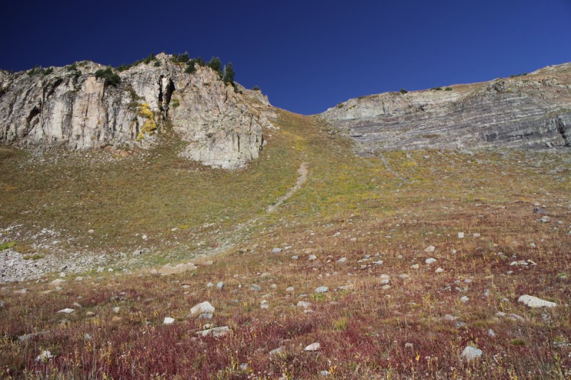
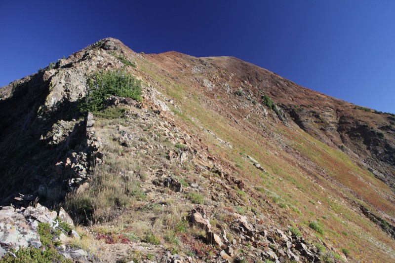
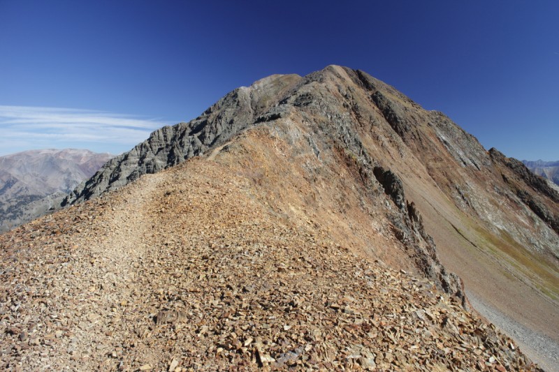
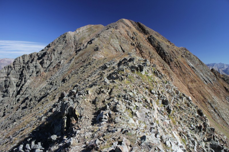
After Lambertson, I knew there would be minor scrambling up to the summit of Italian. I didn't stay super ridge proper, since the gendarmes and the exposure was a bit more than I would have liked. So I stayed just below. There are even cairns along the way I went. The scrambling was incredibly minor, and was mostly just scrambling on large boulders. Not too bad over all.
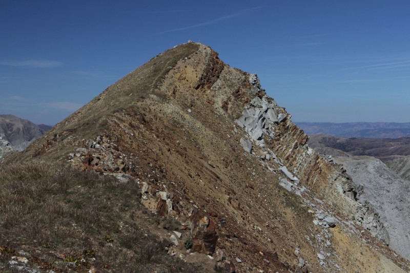
Italian from the summit of Lambertson
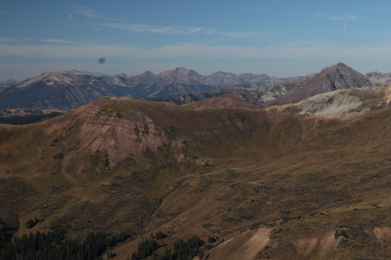
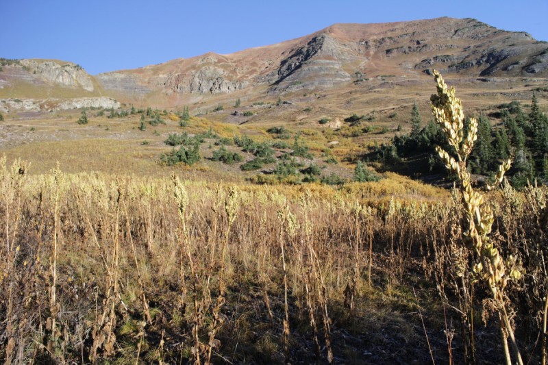
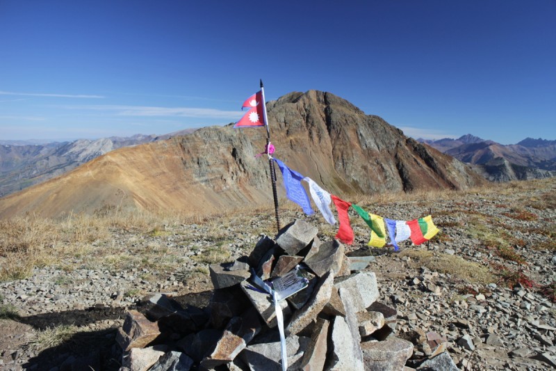
Enjoyed my stay on Italian. I looked over to the 2 12er points and wasn't inspired. The close one looked overly talusy and not very interesting. American Flag peak had a steady stream of 4WD traffic going up and down it, so it quickly lost appeal. Coming up Cement Creek may be a better way to avoid the problems with the private property and to run the ridge with the 12ers included.
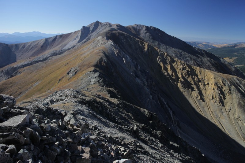
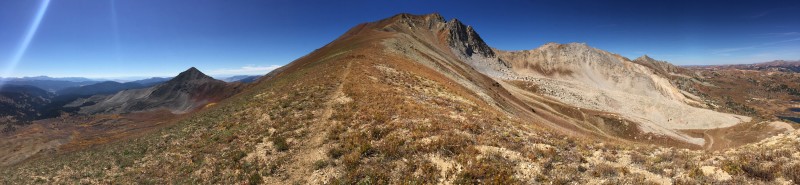
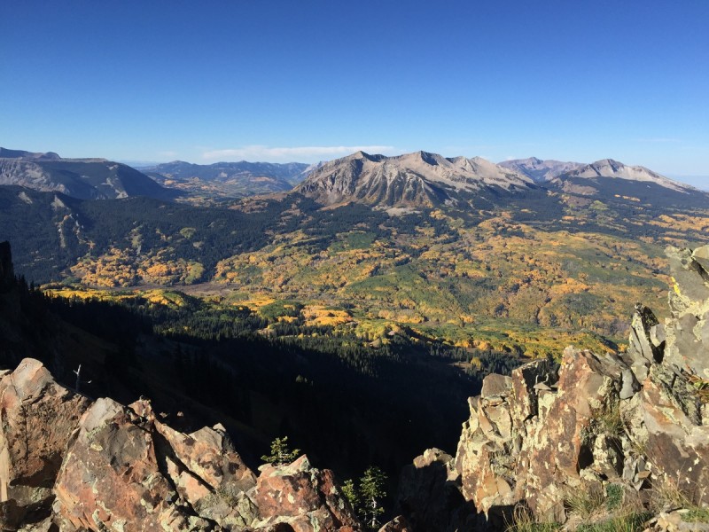
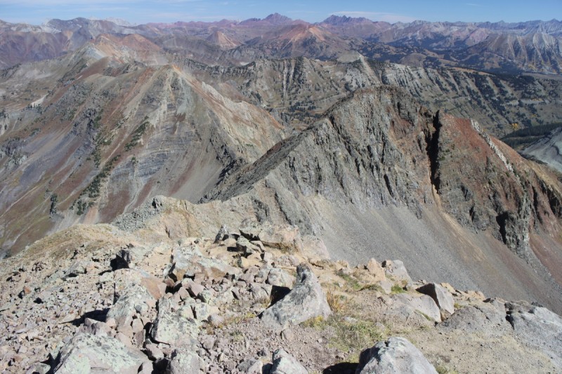
Pano west from Italian Pano east from Italian Italian's summit from the east Pano on the descent of the 12er and Italian
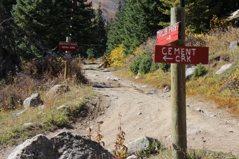
On the descent I frequently consulted my Trails Illustrated map of the area to find the best way through the Private property. I tried going through the mine area, but come along the sign telling me to turn around, so I did. I hiked down along the Cement Creek FS road, hoping to see a sign saying it was ok. And I did. Phew! Since I had stopped 0.05mi from the sign on the Italian Creek road, I didn't know that there was a public easement along the road. Along the road is where I saw the only people of the day, all 4WDers.
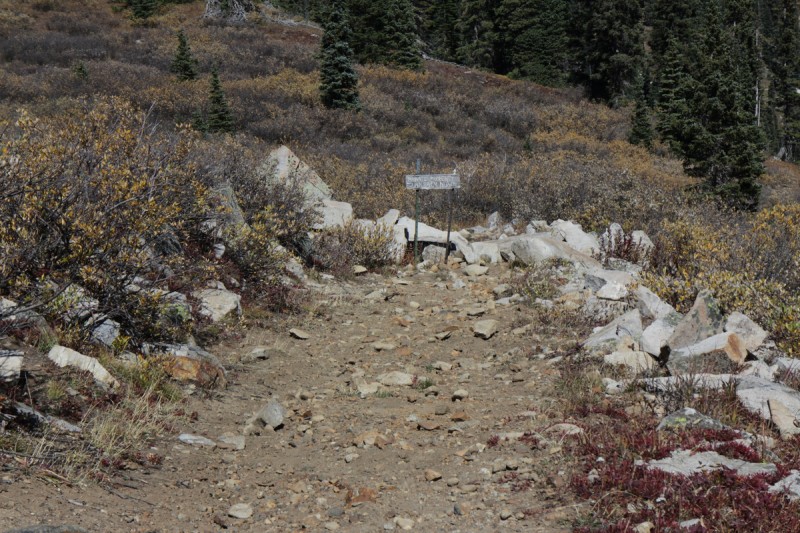
Mine property sign - Turn back now! It's OK to walk the road Road intersection at the mine Someone was having a bit of fun!
Mt Owen B & Ruby Pk
Trailhead: Lake Irwin
Mileage: 6
Elevation Gain: 2,825'
Partner: Solo
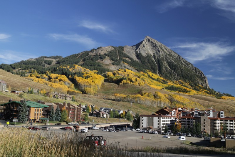
On the drive over to Lake Irwin, I made a quick stop to check out Crested Butte. Pretty peak colors! From there it was a short drive over to the very popular Lake Irwin camping area. Passing by the actual campground, I found most of the dispersed campsites taken. One that was open was horribly slanted, but I decided to stop there to walk around. Good thing since it was the last public spot available! After a quick grilled dinner, I enjoyed a nice sunset over the peaks to the south and clambered into my badly tilted truck to sleep for the night. At least I got one axis flat!
Another lazy post-sunrise start and I was starting up the narrow public causeway up to the saddle with Ruby. In retrospect, driving further up the road may have been easier and it seemed to be what everyone else did. At least most walked that direction "to the lake".
The final push up to the ridge line was stupid steep, and I had to hold onto the plants to pull my way up. Once on the ridge, the view of Kebler Pass was quite stunning. On the drive up, I kept wondering why everyone talked about Kebler Pass. What I saw was all evergreens! So apparently all the Aspens are on the west side of the pass, not the east. Made for a fairly distracted hike up Ruby, since I was constantly looking down at the leaves!
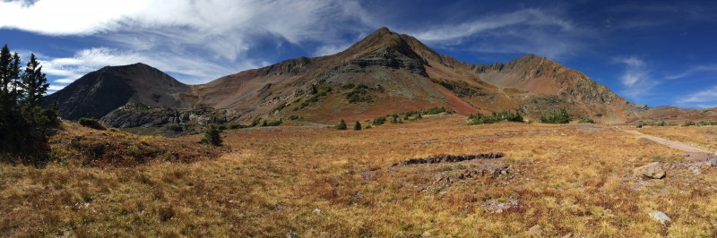
Crested Butte - pretty, but needs some snow! Sunrise on Ruby and Owen from camp Route up Ruby from parking spot The stupid steep of the day Colorful leaf pano from saddle on ridge Another Kebler Pass shot along ridge Ridge up to Ruby
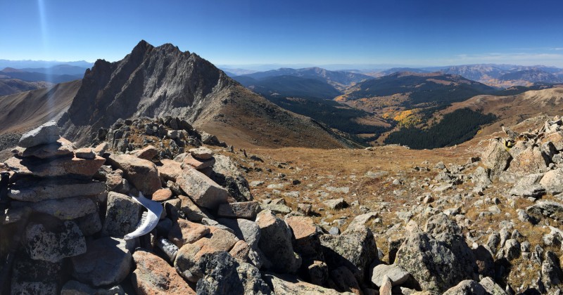
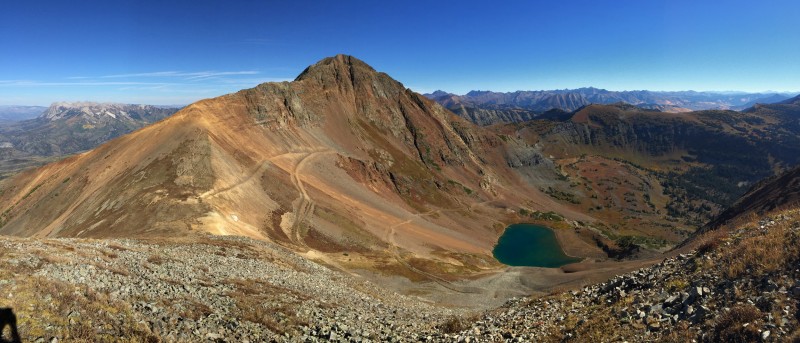
Once on the summit of Ruby, Owen didn't look all that far away. Steep up and down from the saddle, but close. I could see 2 separate hikers with their dogs coming up the old mining road (not on any maps). If I had known about that road, I wouldn't have chosen the loop route I had planned. I guess I might have some company today.
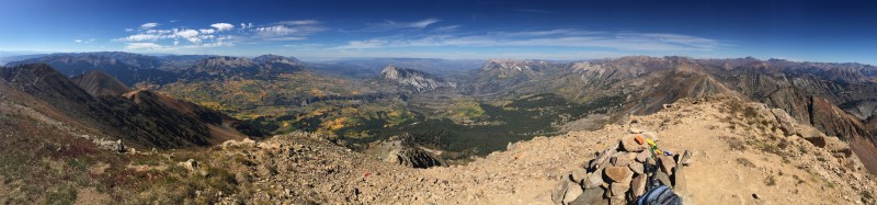
Ruby's summit, looking at Owen Pano south Pano looking at Owen
After the steep scree on the Owen side, the route up to the summit is trailed and quite pleasant. So after a short jaunt, I was on the spectacular summit of Owen. At least the view was well worth it!
Ridge up Owen Nearing the summit of Owen Summit area of Owen
I sat on the summit for a very long time. It was hard to tear myself away! Had to promise myself that I would come back another fall day. The views of the Elks around me had me salivating for future trips!
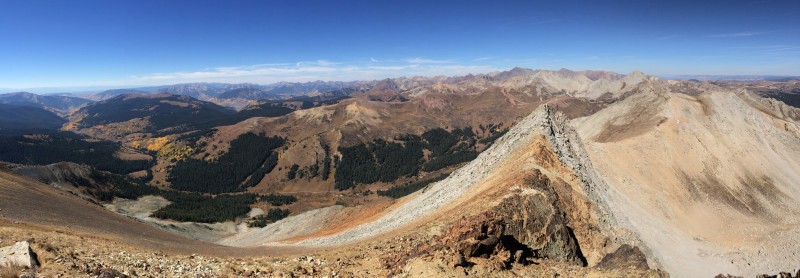
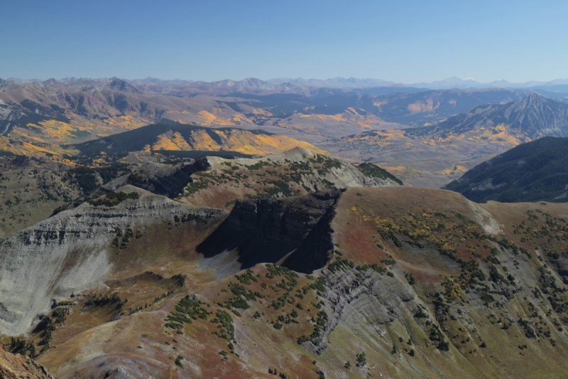
Ridge to Purple Peak - yeah Nope! Looking at Italian Mtn Pano west Pano north Owen and Ruby from the 4WD road
Even with the steady stream of people coming up the 4WD road, only one guy and dog went up Owen. Multiple groups went up the 12er Ruby. Not sure why. Most of course were going to "the lake". The 4WD road up the the upper basin is all good except for one tricky spot, just into public land. It could use a spot or at least a scout. High clearance should be able to handle it, with some off-roading experience.
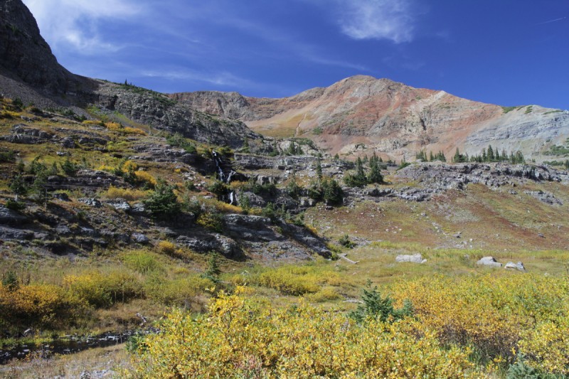
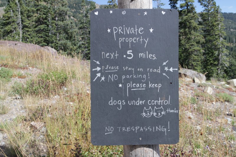
Waterfall with Owen behind Cutest Private Property sign I saw all weekend! Owen and Ruby from Kebler Pass
My GPS Tracks on Google Maps (made from a .GPX file upload):
We were out on Ruby and Owen last Saturday. I was having second thoughts about this being the right route to combine the two because of that steep loose grass/dirt crap!
...On this report & your Sawatch Orphans report. I’ve literally been planning trips to both Ruby / Owen & Twin Peaks / Rinker for a couple weeks now! I’m thinking I’ll reverse the loop on TP / Rinker though. Thanks for the recent beta on both these routes! Nice TR’s too!
CUaaron25 – I knew about that slope from Keith’s TR from a fall gathering many years ago – that I meant to go on. Seeing it up close was everything I expected. Now I know a better way!
Abe – Very soulful weekend! Felt great to be in the Elks again. Mmmm snow!
TakeMeToYourSummit – Glad I could help in your planning! The reverse loop on TP–Rinker would be a good idea. Steep climb is better sometimes than a steep descent.
Great, Otina. Glad to hear your on the mend. I meant to get to Italian Creek this summer but never made time. I’ve taken my pickup up some really nasty roads but haven’t been to the end of this one – how is the road to that "11,006" mark on the USGS map? I’m thinking if I go up before the snow, I’ll park in that area.
I just passed a peak not 0.5 mile +/– and 800 feet away because of daylight. Now makes it a 13 mile rt and 4000+. That is the nature of the beast. I seem to recall those were Elk Peaks but not really Elk type peaks. nice going. Al (oh and I am Italian too)
Bill – "11,006" is where me and another Toyota both took off 4WD low on the descent, so fairly easy 4WD to that point. Couple of nice camp areas along that road!
piper14er – This Elk definitely had more of a Sawatch feel to it. I’ve missed unnamed peaks before. Thankfully one of them was an excellent ski (Blarney or 13,500 off Indy Pass).
Otina, I’m obviously very slow these days. So many TR’s in that damn list! haha. Solo jaunts in the Elks... Well done indeed! Be careful out there :) Italian Creek and Italian Mountain, who knew... Need to add those to my list and send Grandma a summit shot. Winter is coming. Hope you had a great summer!
I was researching Italian today as I made a note to myself to find out more info on the route so your TR timing is perfect. Now that I have seen your pics and description of Owen I have to add that to my "soon" list too as it looks fantastic.
Caution: The information contained in this report may not be accurate and should not be the only resource used in preparation for your climb. Failure to have the necessary experience, physical conditioning, supplies or equipment can result in injury or death. 14ers.com and the author(s) of this report provide no warranties, either express or implied, that the information provided is accurate or reliable. By using the information provided, you agree to indemnify and hold harmless 14ers.com and the report author(s) with respect to any claims and demands against them, including any attorney fees and expenses. Please read the 14ers.com Safety and Disclaimer pages for more information.
Please respect private property: 14ers.com supports the rights of private landowners to determine how and by whom their land will be used. In Colorado, it is your responsibility to determine if land is private and to obtain the appropriate permission before entering the property.