| Report Type | Full |
| Peak(s) |
Mt. Sherman - 14,043 feet Mt. Princeton - 14,200 feet Mt. Harvard - 14,424 feet Mt. Elbert - 14,438 feet |
| Date Posted | 09/11/2015 |
| Date Climbed | 09/06/2015 |
| Author | R3Girls |
| Tried for 5, got 4. Great Weekend |
|---|
|
Left Lone Tree at 3 AM, Sunday, fully loaded with sites on trying to get bag five by the time I returned on Tuesday night. Ambitious goals, but when you have an opportunity like this, you have to take advantage. Arrived at Mt. Sherman, around 5 AM, parked just past the gate at 12000'. Actually a little surprised there weren't more people/vehicles up that high. This was my second run at Mt. Sherman, I had attempted about a month ago with my 11 year old daughter, but at around 13,500', she got the AMS. Had to run back down with her. So, I decided to extract some revenge on the mountain and beat it badly. Total distance of 4.64 miles, in 2:30. Great sunrise pictures, as the clouds were forming over the peak, and the sun was rising. I was in an orange cloud. 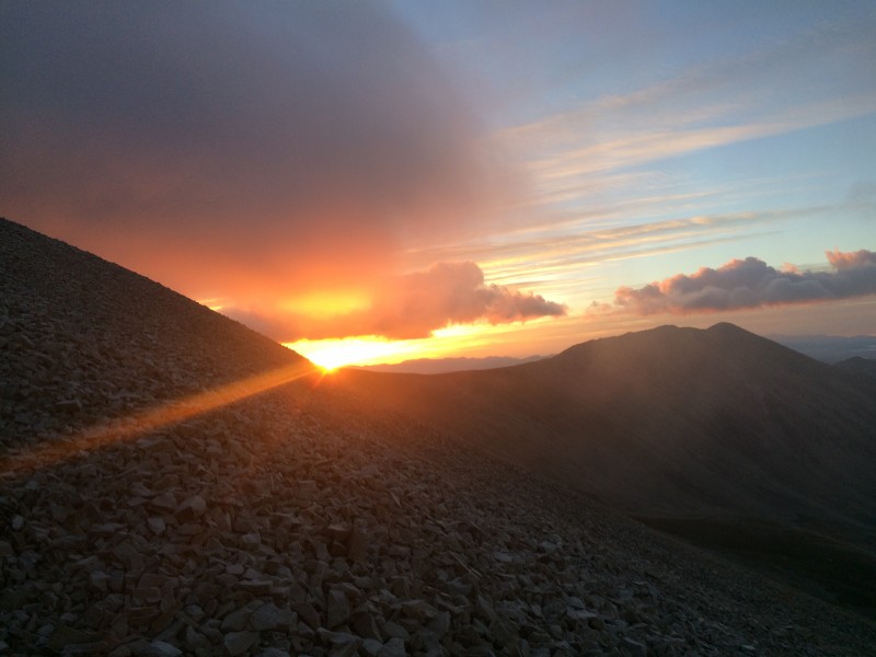 Winds were HOWLING, and I mean HOWLING right around the point where it opens up to the west around 13,000. Winds were coming out of the valley around 40-50 MPH and you had to cross a section of about 150 yards or so. I literally was crouched down about 2' off the ground, leaning into the wind. No other way to get across. Cold summit, having to walk in that same cloud all the way out to the end, where the actual summit really is. 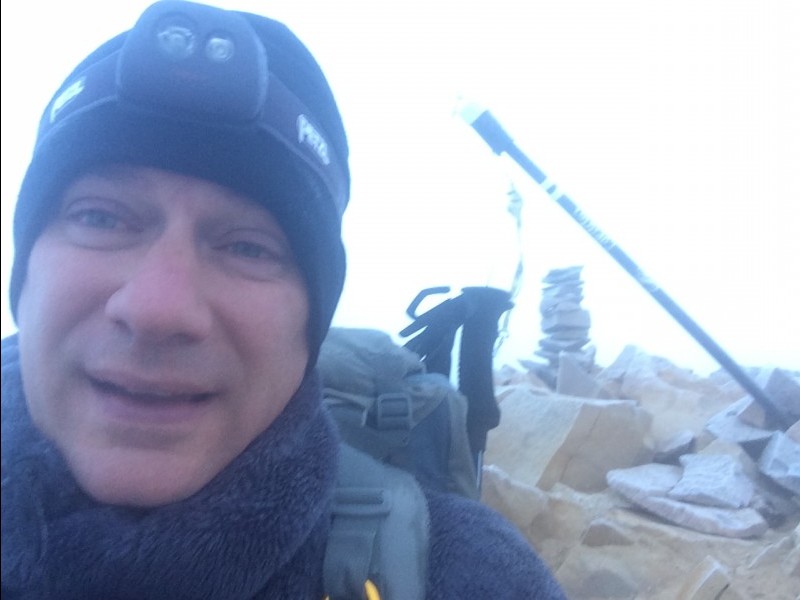 I did warn folks on the way down about the conditions, specifically the wind, because I don't think everyone was prepared for it. Saw a group of about fifteen teenage boys, and spoke with their leaders about the pending winds and issues. And any parents with kids. Hopefully everyone made it up or made the right decision to turn around. Made my way down, and headed over to Mt. Princeton. Took the Mt. Princeton road to the radio towers at 10.800'. If you haven't ever been on the Mt. Princeton road, and don't have a high clearance 4x4, I'd suggest parking down at the lower parking lot. Had a Jeep GC, and still didn't like it, though, I never did scrape bottom. If you aren't used to 4x4ing, this is a tough road to handle. Left the radio towers around 10 AM, and started up Princeton. The first couple of miles are on the road until you get to the meadow and start heading up. 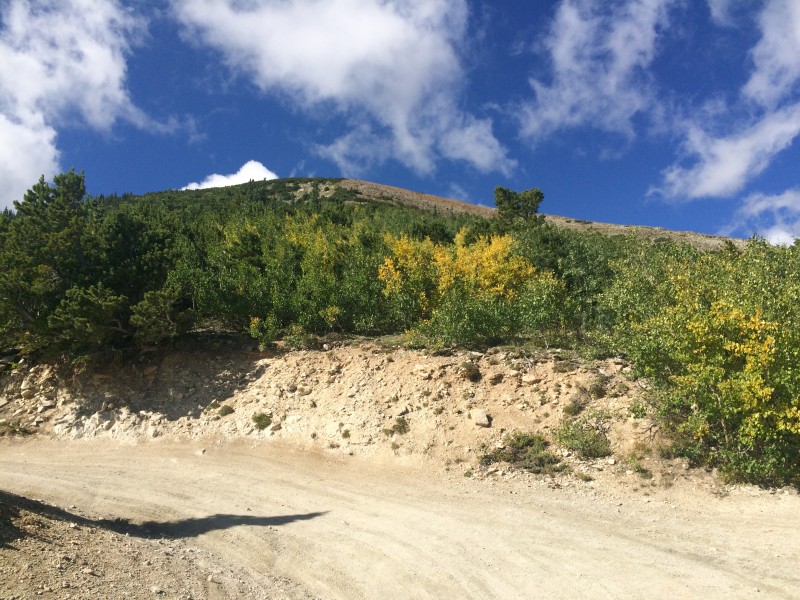 Once you get through the meadow, you get to traverse the rocks. Not a bad hike, but some balancing must be done, as you become the rock hopper. 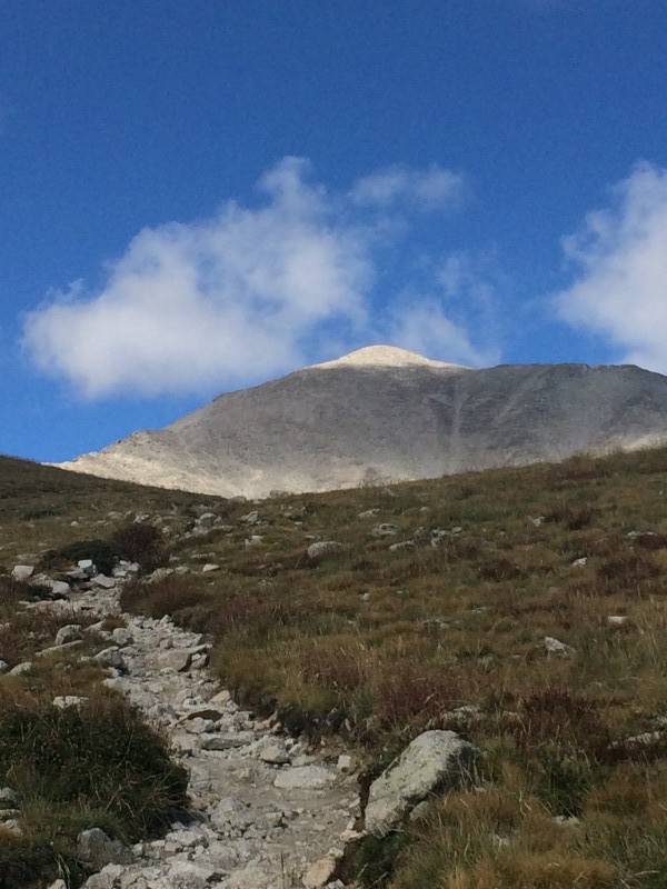 I missed the turnoff of the trail (though looking back, the big rock laying perpendicular to the trail should have been a key), and started to go to far west, going up the coulier around the the right shoulder of the ridge. Wasted about 20 mins, until I realized that wasn't the way, and listening to enough people who decided to come down that way, warning me it sucked. Turned around, found the same perpendicular rock, and headed up an initial steep 20' before finding the switchbacks. Much easier route!! The rest of the route was pretty straight forward. Steep but doable. Might have been that I had already done one, but overall, the last 1000' were taxing. 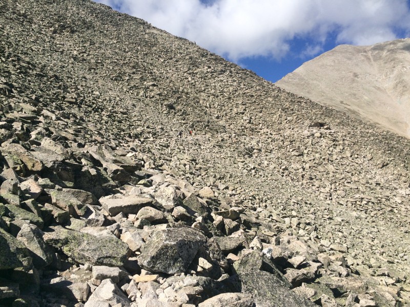 Headed down, and it began to sleet. Make the rock very slippery and the sleet was stinging to say the least. That lasted about 20 minutes, and a rainbow appeared in the valley below me. I don't think I've ever been ABOVE a rainbow, so thought I'd capture that. 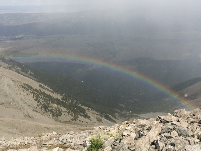 Made my way down carefully, until it dried up a bit, and back to the Jeep. Alright, I cheated a little bit, and got a ride from a Dad and his son for about the last mile. Greatly appreciated, and returned the favor to a group who had parked at the lower parking lot. Saved them a bunch of time getting down, and felt good about paying it forward. Total distance was 7.6 miles and I took 6:13. Day #1 Total 12.2 miles and 8:33 of hiking. Should be around 6000 vertical feet as well. After Sherman/Princeton, went and showered at the Buena Vista community center, just east of downtown. If you are camping or car camping, this is a great place to get the funk off of you for $1.00. I think that gets you 4 minutes of hot water. Great amenity!! Headed over Eddyline for dinner and refreshments Woke up on Monday with intentions of doing both Harvard and Columbia, in one long day. Left the trailhead around 5:30 and quickly encountered light snow, rain, and sleet. That lasted all the way through the basin, into the willows. Wind picked up from the willows to above tree line. Gusty, strong winds, and the clouds just kept pouring into the basin. 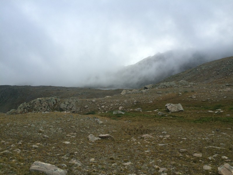 Met a couple of folks on their way down, who turned around because of a whiteout blizzard. It seemed like going later would have actually been better. Not the typical deal for sure. 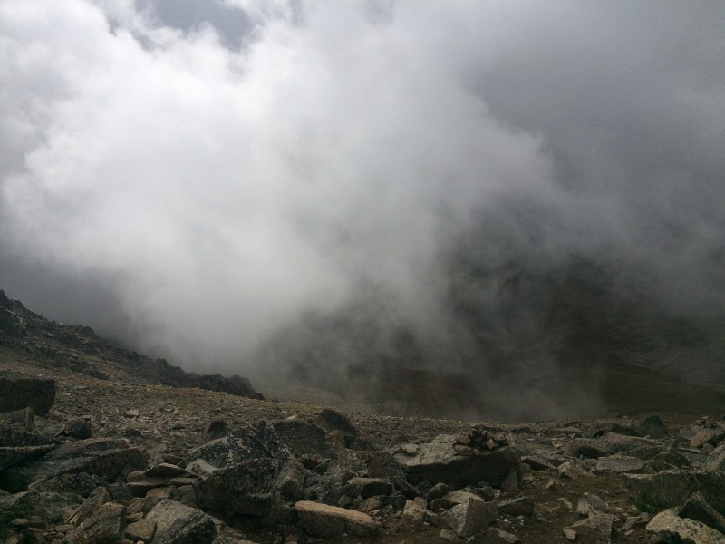 Summited Mt. Harvard, but because of the snow earlier, the last scramble up the summit block was REALLY slippery. Took a look at the clouds that still hadn't cleared up, and decided it wasn't the right day or time to do the traverse over to Columbia. I was a bit crushed, because I knew that bagging 5 was no longer in the cards. 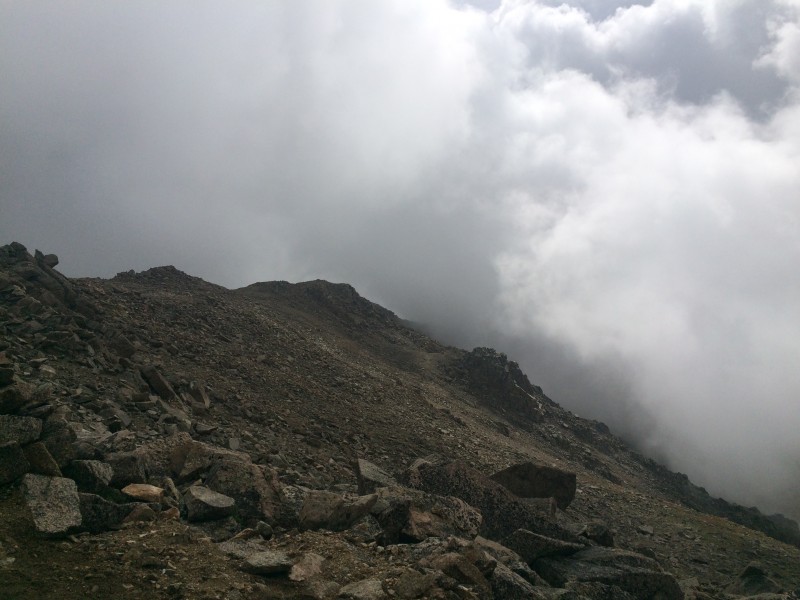 Headed back down, and as I was about 3 miles away from the trailhead, I heard claps of thunder over my left shoulder. I thought about it a bit, and realized I had made absolutely the right decision, because that would have been about the same time I would be about 3/4 of the way across the traverse with no way or where to go from there. Felt MUCH better about things from there on out. I'd say that the hike through the basin is the prettiest one I've been on to date, and would happily take anyone up Harvard again. Even if it wasn't a summit attempt the 4-5 miles up past the willows and to the ridge would be a great acclimation hike for folks who are new to Colorado. Day #2 Total 12.38 miles, 6:42 of hiking. 4600' of vertical. Back to the BV showers, and onto the Mt. Elbert trailhead outside of Leadville. Tuesday was the day after Labor Day and I actually thought the trailhead would be busier. I was the only one to park there overnight. Cars started rolling in at 5 AM on the dot, and I was already getting ready. Left the TH right at 5:30 for the grand daddy of them all. Beautiful morning to hike up the trail. I had read that the NE ridge was steep, and I should have expected it, but it is a constant grind when you start going. Oh man. Around treeline, winds picked up pretty substantially, and even more so around 13,000'. The one section of Elbert that was the hardest is the area where you have to pick your way through a larger boulder field. No real main path here, and the rocks can be loose in many of the areas. Summited with no real issues, other than realizing above 14,000' after 3 solid days of hiking, it was starting to take a toll on me. Took me a to walk the mostly flat final summit. Buffeting winds and just plain exhaustion slowing me down. Had the entire summit to myself for a good 15-20 minutes, and didn't see anyone else except for a woman who was near the last cairn as I was coming down. The day after Labor Day could be the best hiking day known to mankind. I've never had a summit completely to myself for the entire time. There is something magical, inspiring, and humbling about standing on the top of Colorado. 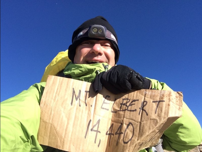 In a small piece of irony, I used the cardboard sign at the top for my summit selfie. Didn't realize it until I got back but it reads 14,440'. I think Elbert is actually 14,433'. Note to self, never use someone else's sign, they all exaggerate. In all, it was a slow day, I think I only saw 30 folks ascending as I was descending. Day #3 Total 9.2 miles, 5:32 of hiking. 4700' of vertical Total Trip 33.8 miles, 20:45 of hiking. 15,300' of vertical. Wow, what a great adventure and trip. I had started hiking as a bit of a hobby, something fun to do. But after this trip, I've become more inspired by nature, in awe of what it is, and encouraged to do even more. Its hard to capture on an iPhone camera the vastness, the minute details of the flowers, the steepness of the trails, and what it actually takes to be out in it all day walking. That makes 8 for me this year, and total of 15. Hope to squeeze in 2 more before the end of the summer hiking season. Good luck, and have a safe trip. Thumbnails for uploaded photos (click to open slideshow):
|
| Comments or Questions |
|---|
|
|
Caution: The information contained in this report may not be accurate and should not be the only resource used in preparation for your climb. Failure to have the necessary experience, physical conditioning, supplies or equipment can result in injury or death. 14ers.com and the author(s) of this report provide no warranties, either express or implied, that the information provided is accurate or reliable. By using the information provided, you agree to indemnify and hold harmless 14ers.com and the report author(s) with respect to any claims and demands against them, including any attorney fees and expenses. Please read the 14ers.com Safety and Disclaimer pages for more information.
Please respect private property: 14ers.com supports the rights of private landowners to determine how and by whom their land will be used. In Colorado, it is your responsibility to determine if land is private and to obtain the appropriate permission before entering the property.

