| Report Type | Full |
| Peak(s) |
Mt. Arkansas - 13,804 feet Mt. Tweto - 13,683 feet |
| Date Posted | 08/07/2015 |
| Date Climbed | 08/02/2015 |
| Author | Greenhouseguy |
| Tweto and Arkansas Combo from Mosquito Pass Road |
|---|
|
Mt. Tweto 13,672 Feet (167th Highest in Colorado) Mt. Arkansas 13,795 Feet (108th Highest in Colorado) Tweto and Arkansas Combo from the Mosquito Pass 2WD Trailhead Trailhead Elevation 11,429 Feet Approximately 8.3 Miles Roundtrip Approximately 2,650 Feet Elevation Gained Class 2+ August 2nd, 2015 Solo Tweto and Arkansas Combo from Mosquito Pass Road Mt. Tweto and Mt. Arkansas are a pair of big bicentennial thirteeners in the Mosquito Range between Fairplay and Leadville. The mountains lie in a historic mining district, which is immediately apparent when one is on the summit of Mt. Arkansas looking down on the Climax Mine's steady conquest of Bartlett Peak. The standard route on Mt. Arkansas starts near the Climax Mine, and approaches the mountain from the north. I wanted to visit Mt. Tweto as well, and thought that it would be interesting to check out the large basin at Mosquito Creek's headwaters. The southern approach allowed me to take in some incredible scenery, and hit another bicentennial thirteener along the way. The Mosquito Range has a reputation for rare and interesting wildflowers, and the flora did not disappoint me. My day's journey started at the Mosquito Pass 2WD trailhead, which is the same one that I used to access London Mountain, Kuss Peak, Mosquito Peak, and Treasurevault Mountain. There is plenty of room to park at the trailhead.  The Mosquito Pass 2WD trailhead, with Loveland Mountain in the background I started by backtracking about a tenth of a mile to the intersection of Mosquito Pass Road and FS783. FS783 is an old mining road, and is still passable to 4WD vehicles all the way to the mine ruins at 12,600 feet. 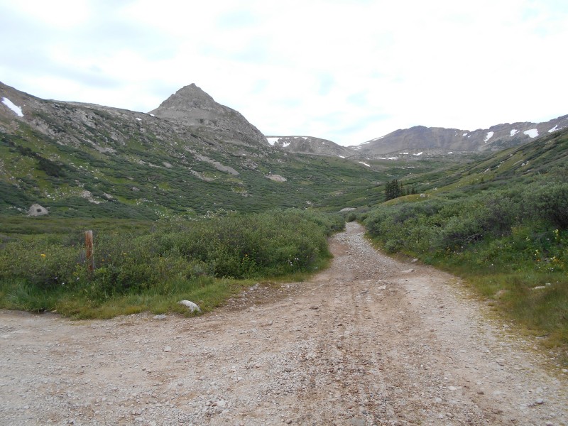 Up the junction: the intersection of FS783 and mosquito Pass Road. Mt. Tweto is visible in the distance Elevation gain is gradual along the old mining road, which is lined by willows on both sides. The willows provide shelter for numerous wildflowers, including the deadly Columbian Monkshood (Aconitum columbianum). All parts of the plant are toxic, although several caterpillars can feed on it and bumblebees depend on its pollen. Ancient Greeks used the poison on their spear tips, and Europeans used it to poison wolves in the middle ages. Monkshood is a lovely plant, but it should generally be avoided for safety's sake. 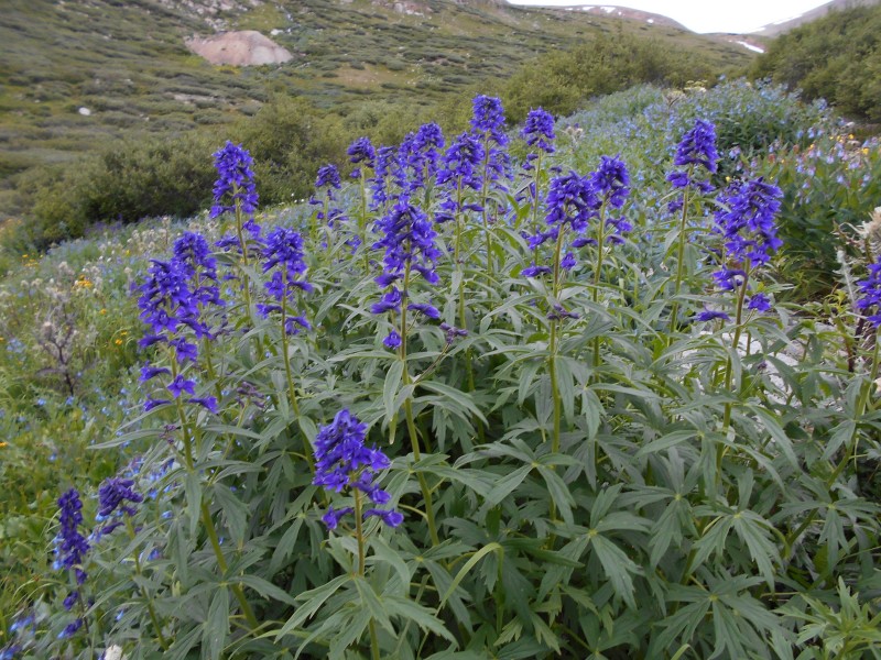 Columbian Monkshood (Aconitum columbianum) growing in the Mosquito Creek Basin. After 0.62 miles on the mining road, I hung a right at an intersection. The road to the left doesn't appear to go very far up the basin. This looks like it would be a rough turn in a 4WD vehicle; with the exception of a few muddy spots and shallow creek crossings, the entire road is refreshingly easy for hiking purposes. 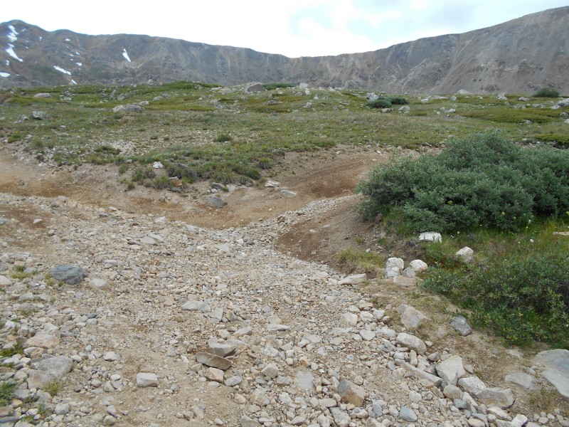 The intersection at 0.62 miles, with Mt. Buckskin on the left and Loveland Mountain on the right The mining road switchbacks up from the subalpine zone into an alpine meadow. The marmots were grazing on the alpine grasses, and I startled a snowshoe hare that was munching on some bistort. There were plenty of insects for the birds to eat as well. 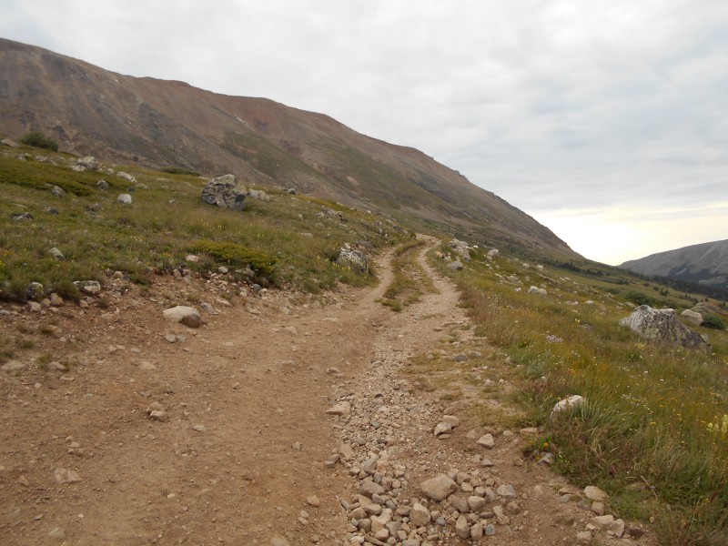 The first switchback in the mining road As I climbed higher in the basin, the gradual slope up to Mt. Tweto came into view. The ridge between Mt. Tweto and Mt. Buckskin looked gnarly, but interesting; I understand that it's Class 4 terrain. 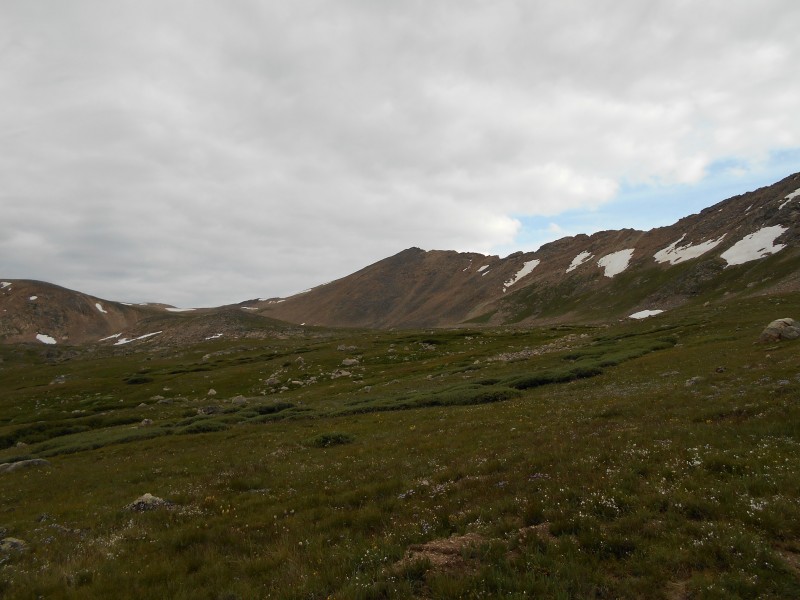 Mt. Tweto and the ridge to Mt. Buckskin I reached the collapsed remains of a mining building at 12,600 feet. The building was almost exactly two miles from the trailhead. Judging by the nails, lumber, and asbestos shingles, I'd say that it was still in use in the mid-20th century. There is a collapsed mine shaft nearby, and cables still stretch from the site up to an open shaft on the side of Loveland Mountain. I'd definitely stay away from these cables during a thunderstorm. The mine building is a good spot to leave the road and cut across the beautiful basin towards the saddle on Mt. Tweto's northwest ridge. 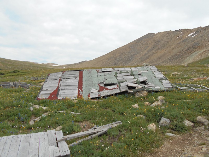 The collapsed mine building at 12,600 feet 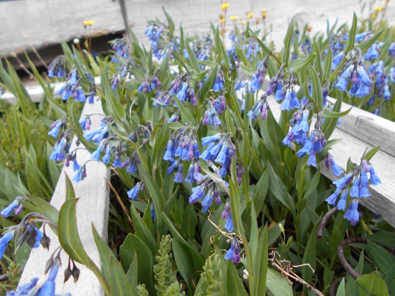 Chiming bells (Mertensia ciliata) growing up through a miner's wooden bed frame. Nature always finds a way! A faint trail traverses the basin directly between the mine building and the saddle; it's probably the remnants of an old mining road. Tundra is usually considered a fragile habitat, but alpine avens can actually cover man-made scars like this very quickly if it's given a chance. 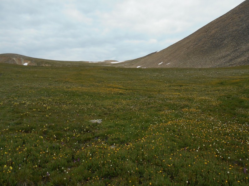 Heading straight towards the bump in the saddle. What's not to like about alpine meadows?  Subalpine and alpine wildflowers from the first part of the hike (clockwise from upper left): Aspen Sunflower (Helianthella quinquenervis), King's Crown (Rhodiola integrifolia), Snow Lover (Chionophila jamesii), and Heartleaf Bittercress (Cardamine cordifolia) At 2.59 miles there is a wooden post that denotes the starting point of the route up the saddle. The post, along with a couple others like it, probably marks a winter route for snowshoers and backcountry skiers. The slope is not steep at all, and with a little bit of effort it seems like it would be easy to avoid any avalanche danger. 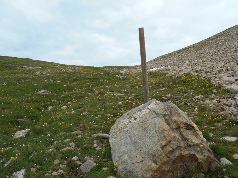 Wooden post and boulder at the base of the slope that rises up to the saddle The shortest route up to the saddle involves some talus-hopping. The talus was 99% stable, but that other 1% banged up my ankles pretty badly. High-cut boots with some padding around the collars would have been a blessing. The slope opened up into rocky tundra near the top.  Approaching the crest of the saddle When I reached the crest of the saddle, the first thing that I wanted to see was the route over to Mt. Arkansas. The drop-off to the saddle from Mt. Tweto looked pretty steep, as did the ascent on the other side of the saddle.  Looking over to Mt. Arkansas from the Treasurevault/Tweto saddle The route over to Mt. Arkansas looked challenging, but the route to Mt. Tweto's summit looked like a piece of cake. It was a continuous talus hop up a gentle slope with no obstacles.  Looking towards Mt. Tweto's summit from the Treasurevault/Tweto saddle As I neared Mt. Tweto's summit, I could see that it was typical for Mosquito Range 13ers; mostly a featureless rock pile. 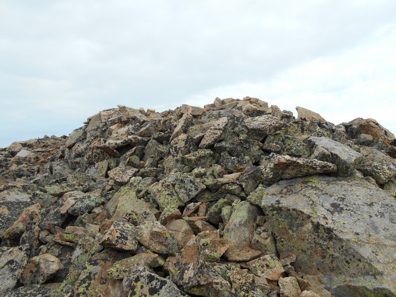 Approaching Mt. Tweto's summit There is a bronze plaque on the summit dedicated to its namesake, Dr. Ogden Tweto. Dr. Tweto was a geologist for the USGS. He devoted much of his career to studying the minerals of the Leadville mining district, and he was praised for his work in creating a detailed geologic map of Colorado. His study of the Gore Range/Eagles Nest Primitive Area became a model for future geological studies of wilderness areas.  The Ogden Tweto memorial on Mt. Tweto's summit Mt. Tweto's summit is ideally located to take in views of the Sawatch, Tenmile, and Mosquito ranges, but I didn't have a lot of time to enjoy it. There was a 70% chance of thunderstorms, and I was extremely motivated to make it over to Mt. Arkansas. The skies had been overcast all morning, and I could hear an occasional rumble in the distance from the Leadville side of the range. Mt. Arkansas' southeast ridge looked intimidating, to say the least. I knew that there would be a simple route through the maze of talus, but I couldn't see it from a distance. 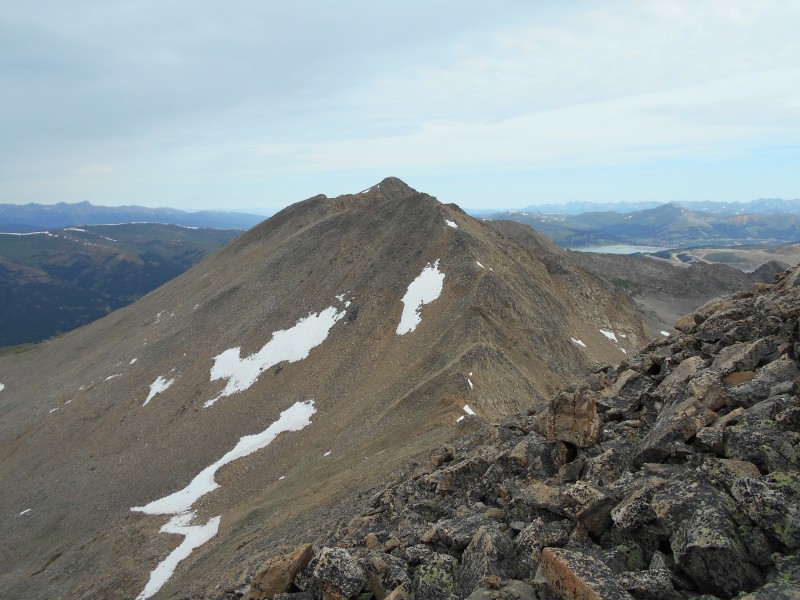 Viewing Mt. Arkansas' southeast ridge from Mt. Tweto's summit Dropping down to the Arkansas/Tweto saddle wasn't technically difficult, but it was physically challenging. There is somewhat of a trail that stays just below the ridge crest on the west (left) side, but I was only able to stay on it about half of the time. It was a bumpy ride. Parts of Mt. Arkansas' southeast ridge looked even more intimidating up close. 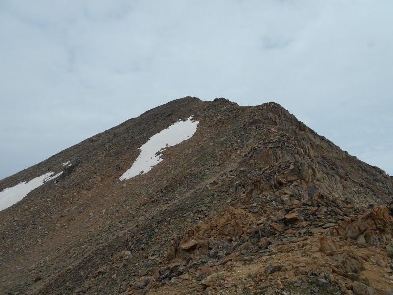 Looking up Mt. Arkansas' southeast ridge from the low point of the Arkansas/Tweto saddle The dropoff on the east side of the ridge was significant, so I looked for evidence of a route on the west (left) side. I'd hesitate to call it a trail, but there were obvious signs of a route on this side. 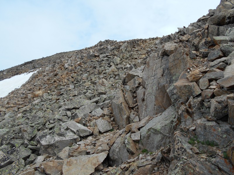 Bypassing the first bump on Mt. Arkansas' southeast ridge The slope was steep, but I knew that I would gain the majority of the remaining elevation by the time that I reached the top of the first false summit. The rest of the route was likely to be an easy cruise. I was pushing hard to make the first false summit when I noticed that I had company; a burly mountain goat assumed a defensive posture at the apex of the false summit 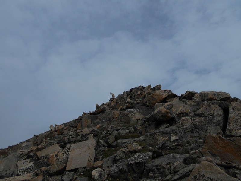 Mountain goat staking his claim on the false summit Mountain goats are typically shy, retiring creatures. I expected the beast to put some distance between us as rapidly as possible. This was not how it went down, though. It stared me down, and made a beeline directly at me. 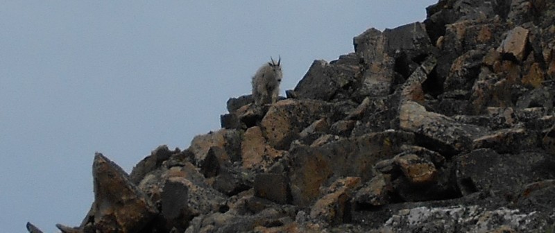 Ferocious carnivorous mountain goat sizing me up for dinner 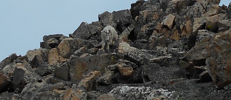 Ornery goat moving in for a closer look I had heard stories of aggressive goats knocking hikers off of mountains. This didn't seem likely on such a broad ridge, but I wasn't keen on the notion of having a powerful beast bounce me around like a soccer ball on the sharp talus. I grabbed a fist-sized chunk of talus and fired a warning salvo in its general direction. It stopped its descent, and stood sideways to plot its next sinister move.  Goat reassessing the situation After a moment of reflection, the goat decided to continue on its course directly at me. I wasn't feeling like a victim and I wasn't about to run out of ammunition on this choss pile, so I tossed another rock towards it. This was enough to convince the horned demon to give me a wide berth. As he passed me on the far side of the ridge, he stopped to give me one last curious glance. 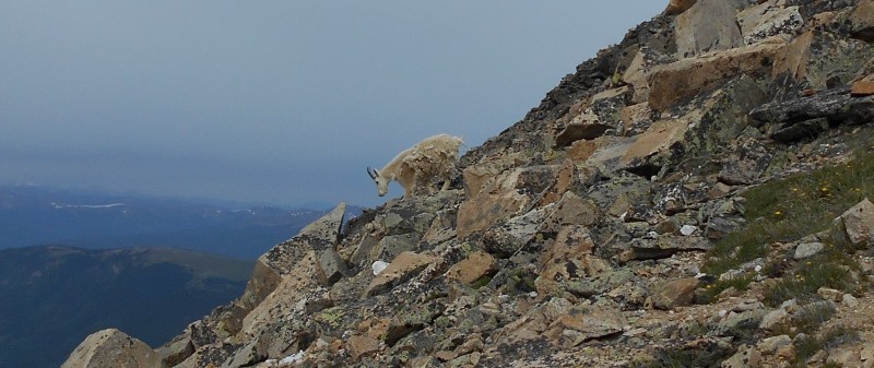 "We cool, Bro?" I was relieved that the goat and I resolved our differences without physical contact. Conditioning wild animals to avoid human encounters keeps all parties safer. In a matter of minutes I could see that the goat was on the Tweto/Treasurevault saddle, headed towards Mosquito Pass. I made the summit of the first false summit a few minutes later, and found another wooden post protruding from a cairn. The wooden post was approximately 3.8 miles from the trailhead. Beyond the cairn, I could see the remainder of the route. It was a little bumpy, but there was not a whole lot of elevation left to gain. There is a route on the west side that avoids the ups and downs of the ridge, but there is also a faint trail on the ridge crest. The scenery was much better on the ridge crest, so I took the high route. 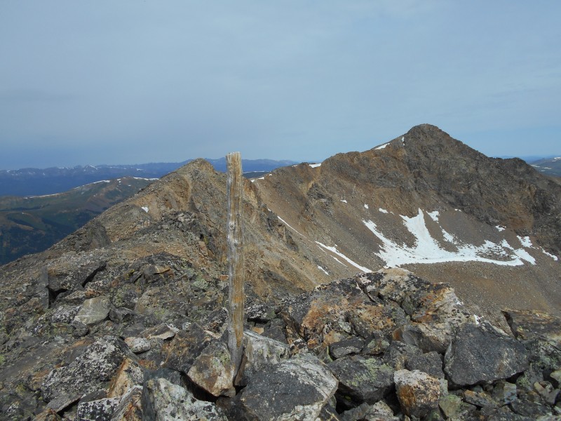 The remainder of the route viewed from the first false summit  A view of the summit from farther along on the ridge When I reached the summit block, I had to choose a route to the top. Wrapping around to the west side looked like the easiest way. The talus seemed to increase in size as I neared the finish line. 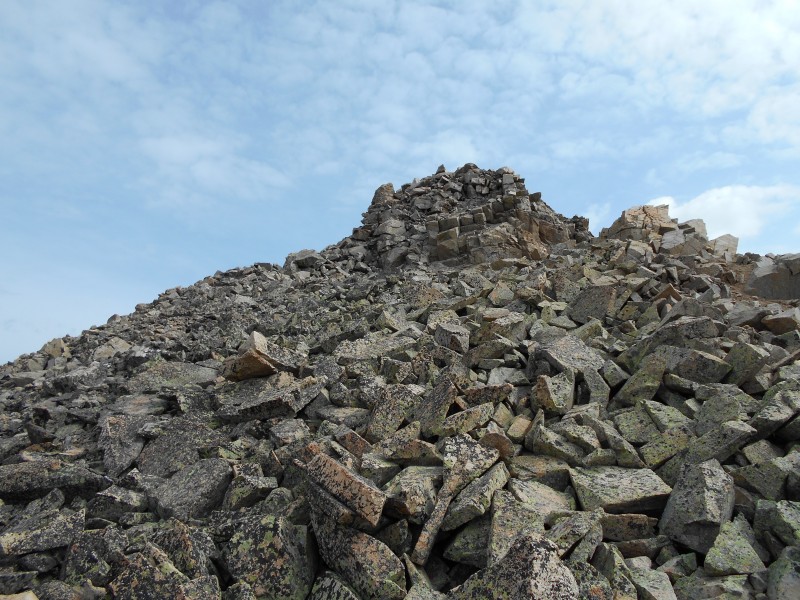 Mt. Arkansas' summit block Mt. Arkansas' narrow, cozy summit was among the nicest that I've visited in the Mosquito Range; this was no scree dome like some of the others.  Summit cairn on Mt. Arkansas. Note the mining activity on Bartlett Mountain in the background In spite of the enormously destructive mining activity to the north, the standard route on the north ridge looks like a blast. English Gulch on the west side also looks like a beautiful area. 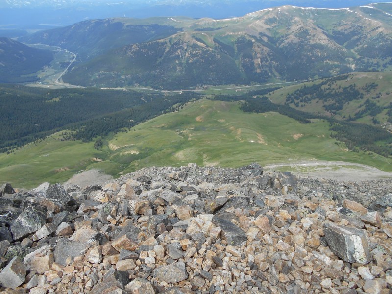 Looking down English Gulch to Highway 91  View of Mt. Tweto from Mt. Arkansas  Looking across the basin towards Mt. Democrat. The headwaters of the East Fork of the Arkansas River are in this basin The weather was threatening to take a turn for the worse, so I decided to take the express route back to Mt. Tweto. The path below the ridge crest was marginally quicker. When I reached the Arkansas/Tweto saddle, I could see that there were two distinct routes to sidehill around Mt. Tweto. The upper one involved the least altitude loss and gain, so I started up the trail until I was roughly level with the Treasurevault/Tweto saddle (about 13,200 feet).  Sidehilling around Mt. Tweto to the Treasurevault/Tweto saddle I started out on a trail, but I wasn't able to follow it very far. I chose my own route through the mostly-stable talus, and was able to make decent time. The terrain was not steep enough to present any significant danger, but rolling a big talus block could have ruined my day. 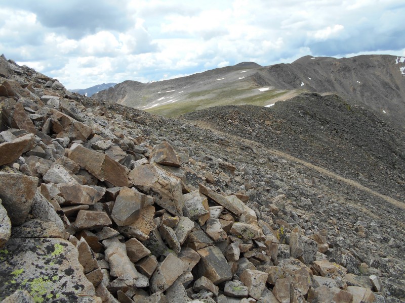 Closing in on the Treasurevault/Tweto saddle When I reached the low point of the saddle, I could see that my descent was blocked by a huge cornice. I had a view of the Mosquito Creek valley that stretched far beyond the old London Mill. I went around the south end of the cornice and started down the slope to the basin below.  Gazing over the cornice at the Mosquito Creek valley 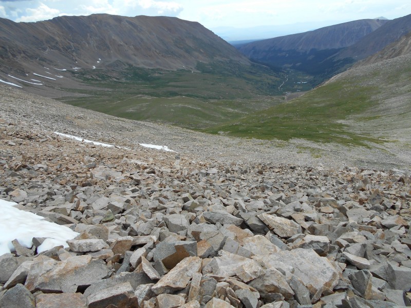 Bypassing the cornice and heading down the slope I found the fastest route down the slope and aimed for the wooden post that marks the beginning of the route through the meadow back to the mine ruins and the road. 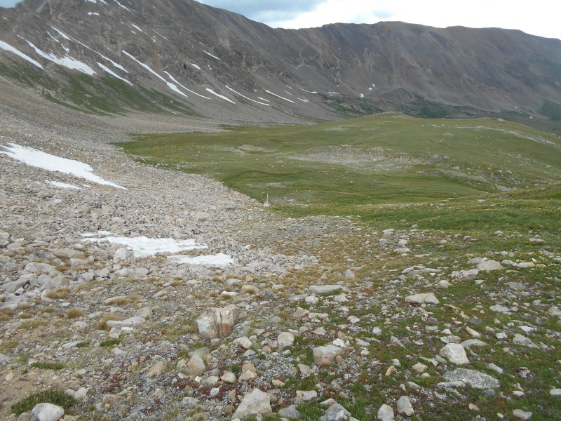 Moving down the slope towards the wooden post It didn't look like I needed to worry about a thunderstorm, so I took my time crossing the basin. The basin is infinitely more interesting when you enjoy it at a leisurely pace. When I reached the mine ruins, there was not much left to do but cover the two miles of mining road back to the trailhead. 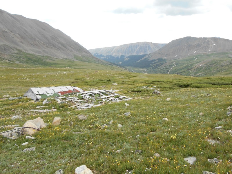 Returning to the mining road at the collapsed building 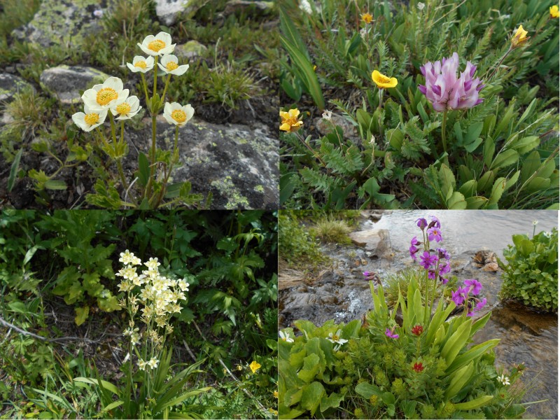 Wildflowers from the second part of the hike. Clockwise from upper left: Globeflower (Trollius laxus ssp. albiflorus), Parry's Clover (Trifolium parryi), Parry's Primrose (Primula parryi), and Death Camas (Anticlea elegans) One more plant is worth mentioning, particularly because of its common name. If you look carefully at the Marmot Tail Grass, you will probably agree that it is appropriately named.  Marmot Tail Grass (Trisetum spicatum) The route was not overly long (8.3 miles), and the elevation gain was minimal (about 2,650 feet). The wildlife was memorable, the wildflowers were spectacular, and the historical mining ruins added to the interest. The uphill part of Mt. Arkansas was strenuous enough to make it a decent workout. The scenic summit vistas were icing on the cake for this great day in the mountains.  GPS track for the Tweto/Arkansas combo from Mosquito Pass Road Thumbnails for uploaded photos (click to open slideshow): ")
")
")
")
")
")
")
")
")
")
")
")
")
")
")
")
")
")
")
")
")
")
")
")
")
")
")
")
")
")
")
")
")
")
")
")
")
")
")
")
|
| Comments or Questions | ||||||||||||
|---|---|---|---|---|---|---|---|---|---|---|---|---|
|
Caution: The information contained in this report may not be accurate and should not be the only resource used in preparation for your climb. Failure to have the necessary experience, physical conditioning, supplies or equipment can result in injury or death. 14ers.com and the author(s) of this report provide no warranties, either express or implied, that the information provided is accurate or reliable. By using the information provided, you agree to indemnify and hold harmless 14ers.com and the report author(s) with respect to any claims and demands against them, including any attorney fees and expenses. Please read the 14ers.com Safety and Disclaimer pages for more information.
Please respect private property: 14ers.com supports the rights of private landowners to determine how and by whom their land will be used. In Colorado, it is your responsibility to determine if land is private and to obtain the appropriate permission before entering the property.


