| Report Type | Full |
| Peak(s) |
Snowmass Mountain - 14,105 feet |
| Date Posted | 07/27/2015 |
| Modified | 07/28/2015 |
| Date Climbed | 07/25/2015 |
| Author | Krullin_14ers |
| Magic in the Elks |
|---|
|
Magic in the Elks - West Slope
Saturday, July 25 Start time: 10:15AM Geneva Lake: 11AM Summit: 1:45PM Car: 5:00PM I do not endorse you taking your Outback to Lead King Basin With that said, lets begin. Let me start off by saying I have never done more research for a route than this one. I read through almost all of the trip reports for the S ridge and West Slope. I posted in the forums asking for advice on the route. Lead King Basin seemed as though a seldom talked about place, wearing from a lack of information. I got a few hits on the thread, most of which bagging on the west slope, and hailing the S ridge. After much research, I agreed with everything these people were saying. Much more stable rocks, better views. But this all hindered on weather or not the Subaru Outback would make it to the Lead King Basin Trailhead. Well, if you are interested in finding out, please read on. (' We left Boulder around 2 on friday afternoon. Plans were made to sleep in snowmass, and drive into marble on saturday. Our plans were met with a sudden twist as we hopped on i70. Rainfall. I mean downpour. It was pounding rain all the way from Genesse to Aspen. We had checked the weather and nothing of the nature had existed 24 hours before. Tons of motorcyclists seemed to be surprised as well traveling on Independence pass. As we pulled into Aspen, we began to change our minds, planning to hike somewhere else. We had two major problems to face. 1. If the road from Marble to Lead King Basin was wet, the Subaru would have an extra hard time in the mud. 2. If we went, we would need to leave later, allowing the sun to dry out the road, leaving us exposed to possible afternoon storms. As we pondered these questions over dinner in Aspen, the weather began to clear up, the rain stopped and a beautiful rainbow popped out, followed by a sharp, sherbet sky. I checked the weather and the forecast for the next day was to be completely sunny, with a very very slim chance of rain. This was the best possible news for us. We decided to leave aspen at 7:30AM. Planning on a two hour drive to Lead King Basin, the sun had plenty of time to dry out the road for us. We arrived in Marble around 8:45AM, sunny clear skies beamed above us. Allow me to clarify that this late start time was our only option. Had we left earlier, we would have ran into many problems with a wet road from Marble to Lead King Basin. Knowing that there was very very little chance for afternoon storms, we only saw it fitting to leave later and allow the sun to dry things up a bit. We arrived in Marble around 8:45AM, and the fun began.(' Just past Marble, there is a fork, turn left for Lead King, right for Crystal. From here, the trail is bumpy with small rocks but mostly tamed. Any car can make it until the first river crossing. This is where I found the first set of difficult moves. A deep water bar just after the river allowed me my first challenge. This was followed by a steep, rocky section for about 200 feet. This is not a "Ill give it a shot" moment, it is a "I'm gonna send it" moment. Any hesitation here will require you to back up into the waterbar and river, not something you want to be doing backward. SO. Do not loose your momentum and be forced to back into the creek (' After this, there is one more sketchy section, which I would say is THE WORST section there is, an uphill with scattared sharp rocks for about 100 feet. It is pictured below, but has some shadows concealing its danger. I found it helpful to send the far left side. After this, you have smooth sailing, with the exception of deep water bars for the next 5 miles. 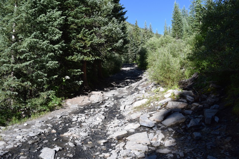 After this though, it is smooth sailing all the way to Lead King Basin. The road is dirt for the rest of the way with lots of deep water bars that you must go up and down at an angle if you want to avoid scraping the front of your car. 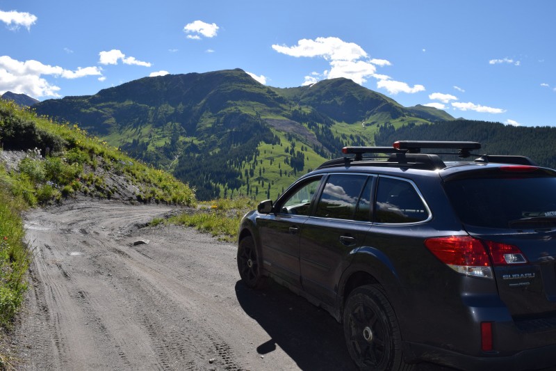 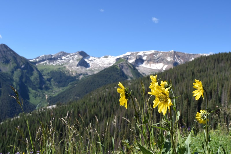 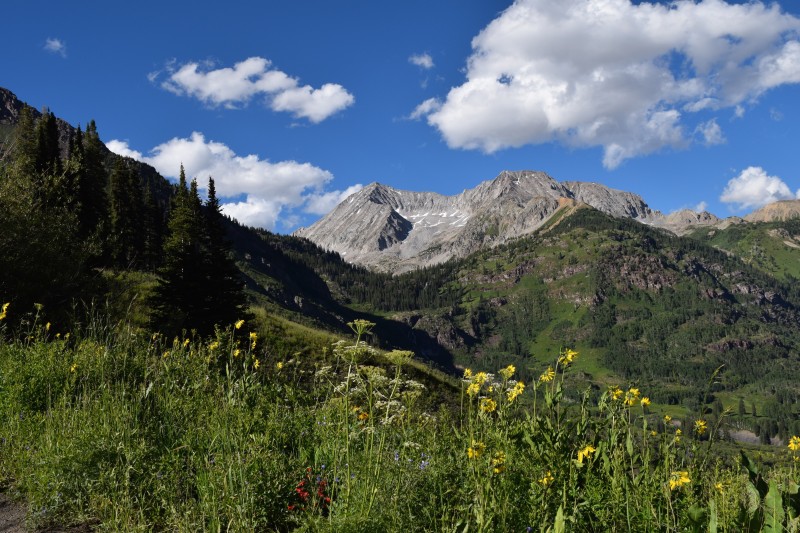 We arrived at the Lead King Basin TH in the Outback at 10:10AM, leaving at 10:15AM. At this point the stoke was high - the Outback had just made it to the basin. Against all odds, we made it. It was not as bad as it was made out to be - further enhancing my belief to be skeptical of things people say until you see it for yourself. We all have varying opinions and judgements. Anyway, the deed was done, we were at Lead King Basin, and it was time to begin! There was not a cloud to be seen in the sky, it was a gorgeous day to say the least! The trail starts as quite the bush whacking experience. Much of the beginning of the trail is overgrown with vegetation up to your eyeballs. But this is manageable due to how pretty everything is. 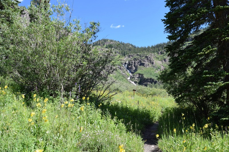 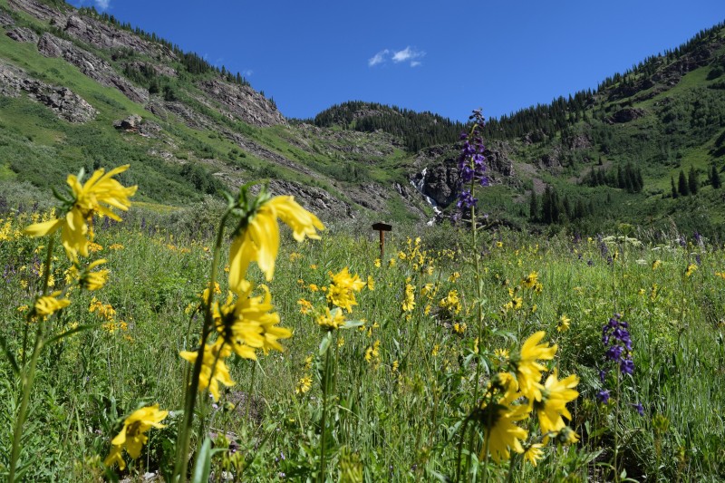 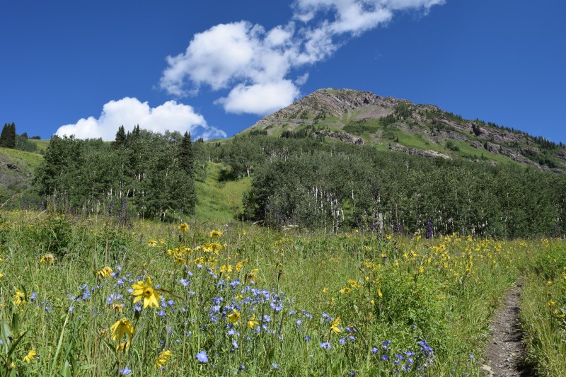 Wildflowers were in fully effect, it was truly amazing. I have never seen such a healthy, colorful area in my life. While hiking the lower section, the trail will take you to the left of the waterfall, and eventually above it. While to the left of it, make sure to look right and you will find a great view of the Maroon Bells. 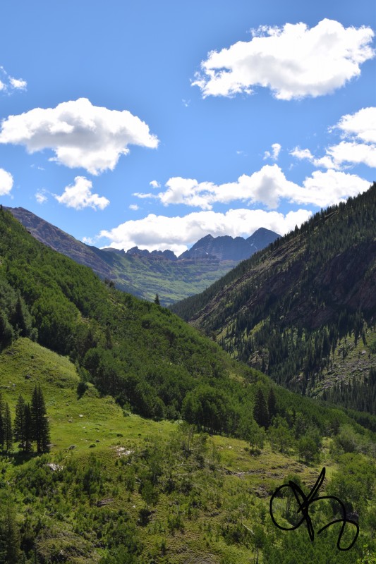 Try not to get too distracted as the views will continue to get better! 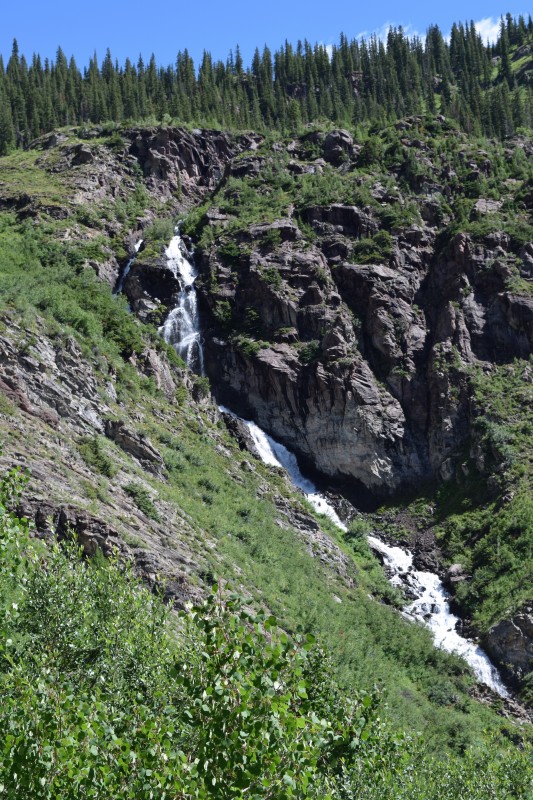 The waterfall, the route takes you to the left of it, and eventually over it up to Geneva Lake. 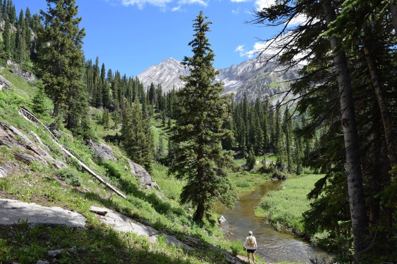 Above the waterfall. It took us 45 minutes to get to this point. We made haste upon departure, hoping to beat any storms in the slim slim chance there would be one. BUT...what do we have here??? Our first view of Snowmass! Glorious moment seeing the behemoth we would be summiting. WOW...so much more vert to go haha. 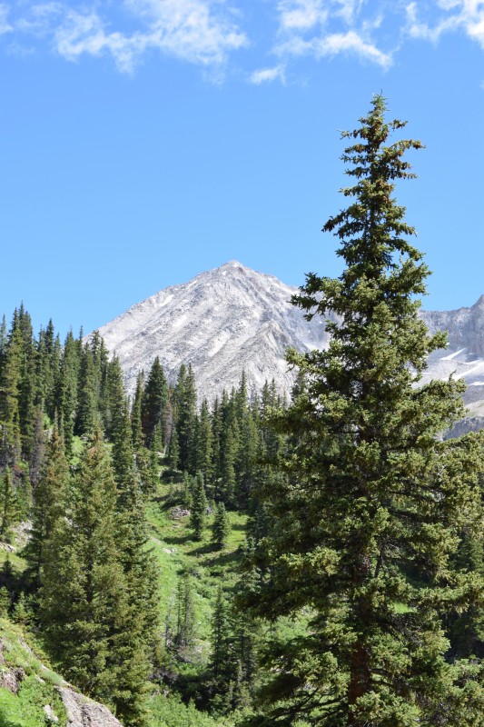 Another view of Snowmass, the left gully(s) are the West Slope, and that ridge on the right side is the S Ridge. 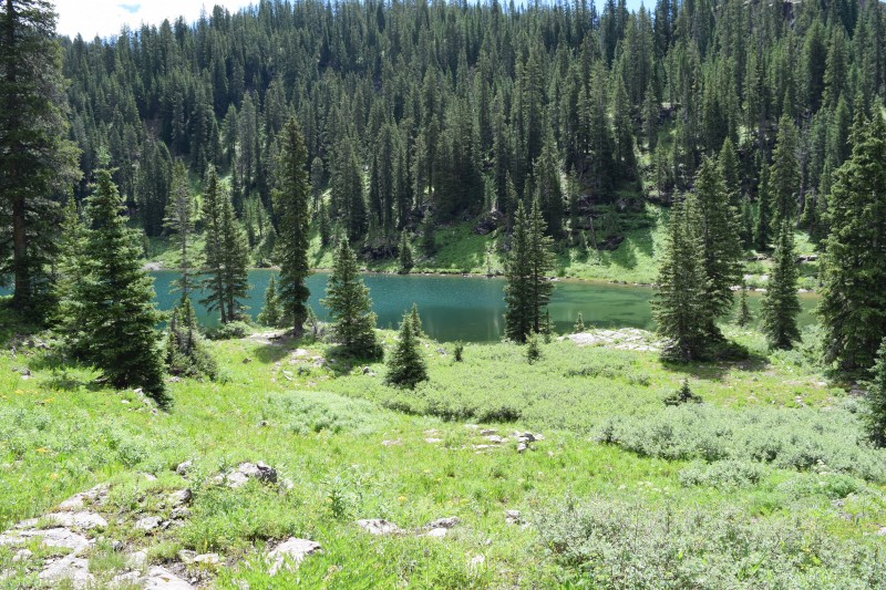 And finally we had arrived at Geneva Lake. Seeing it in person is much better than pictures. I know you are wondering how. how could it be better than this picture?? Well it is. The best lake I have ever been to by far. So secluded, so green, so blue, so calm, once again proving how awesome Lead King Basin is! The lake is much bigger in person. There are some awesome camping spots on the side. 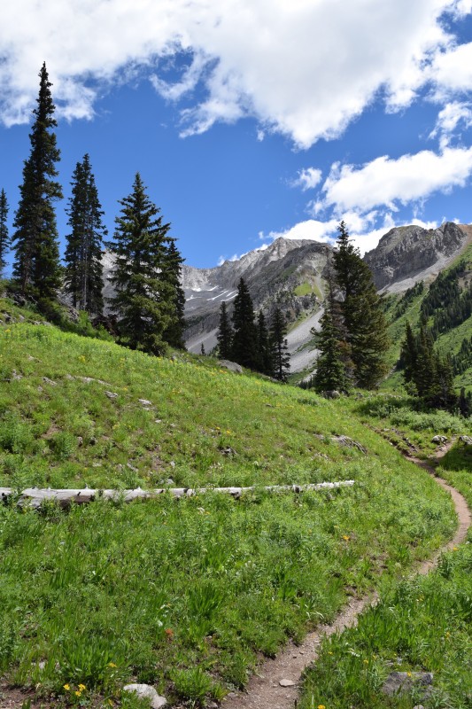 But try not to get distracted from the trail (' but wait..... more lake.... 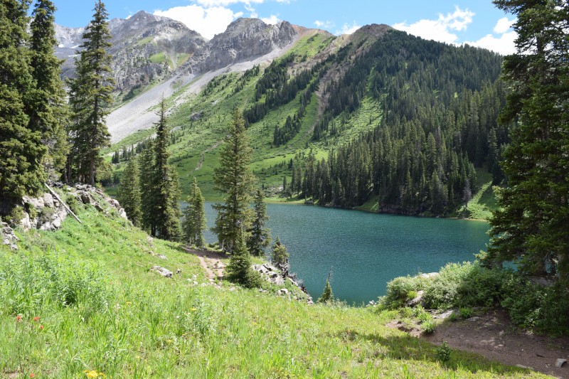 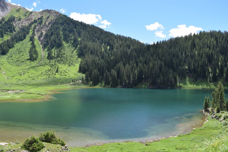 We saw some people camping who had been caught in the storm the night before. They mentioned they were still drying out their goods. Man, it must have been a muddy one up there before the sun came out... IMPORTANT: The next picture is crucial. At this junction, just past Geneva lake, you must go LEFT. There is a small wooden sign that says "Camp site 4". Yes, you must pass Camp Site 4 to continue on the correct trail. Do not be mistaken thinking there is only a camp site up this direction! 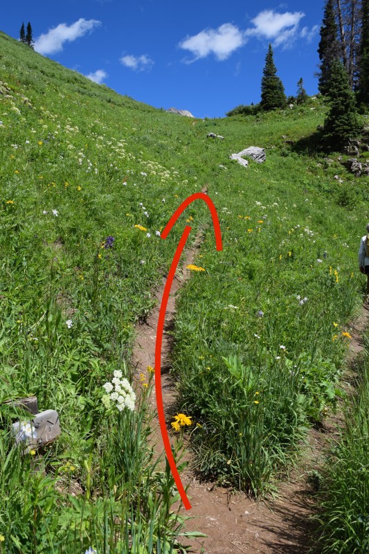 The wildflowers were literally amazing. So many different types growing uninterrupted in the glorious sun. It was seriously like being in the floral department of King Soopers! 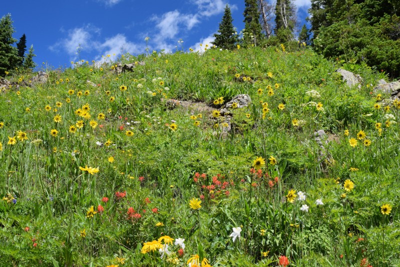  After passing Geneva lake, you will dip into one more bowl of fantastic wildflowers, then ascending to another lake AND get your first full on view of the West Slope and the S Ridge  The second lake you will encounter. From here, continue past the lake for a short while, until descending into the basin below the west face. 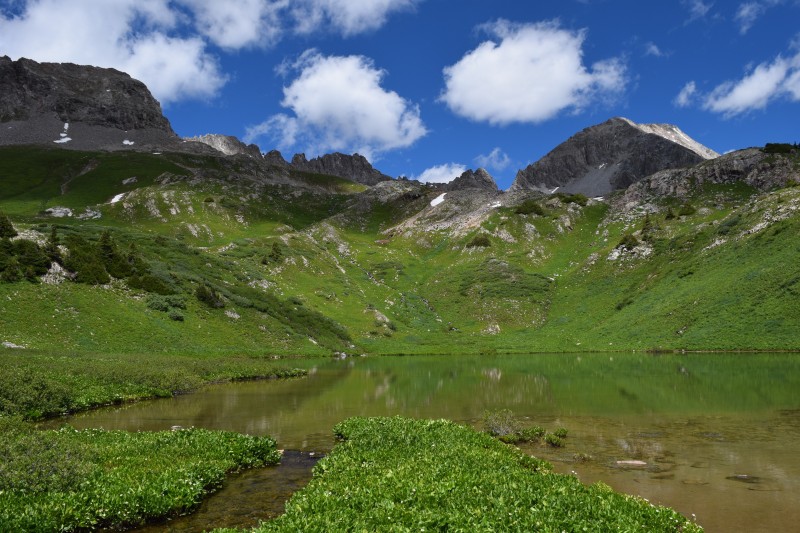 It was here we debated the West Slope or the S Ridge. Some fellow hikers, one of which a buddy of mine, Mark who was coming down from the West Slope had stated it was a great climb and easier than made out to be. Being a more straight forward route, we sided with the West Slope as it would take us straight up. It was already getting into the afternoon and we were not feeling ambitious enough for the S Ridge. Loose rocks would await us....(' Here she is, in all the glory - head on, 2,500 of vert From this picture, you head directly up the middle between those two patches of green. Once past these 2 patches of green, aim toward that small snow patch, but just to the left of it. There you will find a small green section that serves as a nice shelf set to enter the West Slope. I considered this as one of the more difficult, steep sections. The rock is wet here from water drainage and above it houses some initial steepness to get into the actual gully.  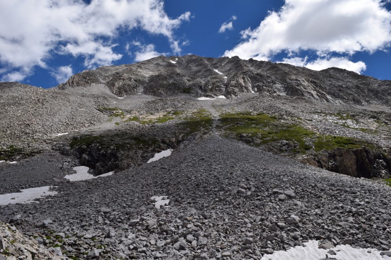 Looking down. The picture below features the route from the lake above Geneva Lake, all the way to above the initial skree fields. 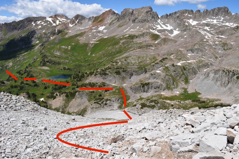 Below is the beginning to the gully. Shortly before this, you must climb the green section and about 100 feet of some more difficult material. I would argue that this section, right before the picture features some class 4 moves. But once you are in the gully (as shown), the angle eases up quite a bit. Now you just have to be careful of loose rock. People are not kidding when they say this route features some loose rock. It seriously is loose. You cannot trust anything you trust, especially not with your complete body weight. Countless times would rocks pop out after exerting even the slightest pressure. So be careful! 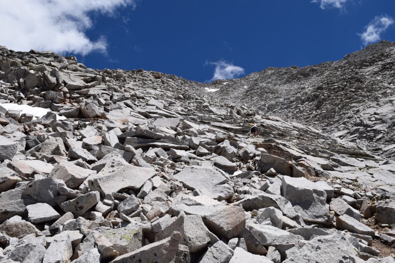  Looking down, a few hundred feet from the summit  A couple hundred feet closer....literally almost there! The struggle is real at this point. 2,000 vert straight up in less than a mile is enough to make you want to puke. At this point, we had crossed the initial gully heading right. The picture is taken on the rib. 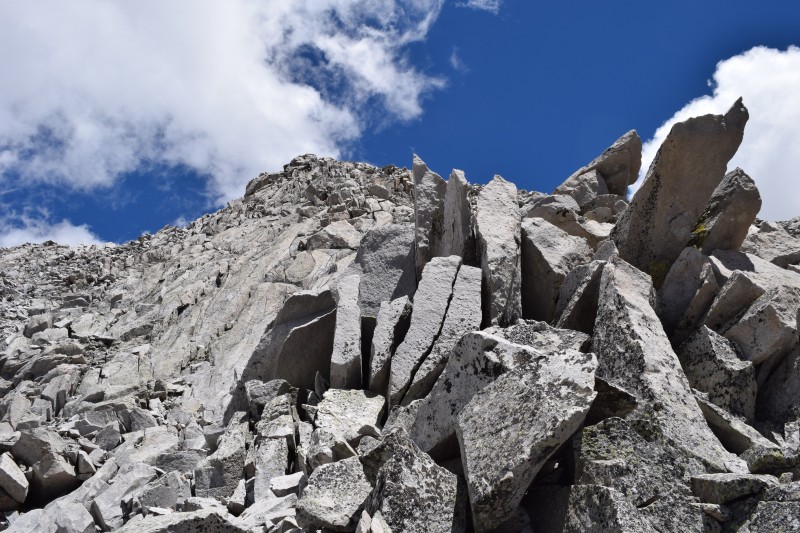 Just about to top out! The S Ridge is on the left, and the west gully is on the right, just out of the picture. As you can see, we traversed out of the gully heading hikers right to the next rib over. We did this to avoid falling rock from potential groups or forces of nature. Almost every step you take will shift some rock, big or small. Very similar feeling to gambling. (' 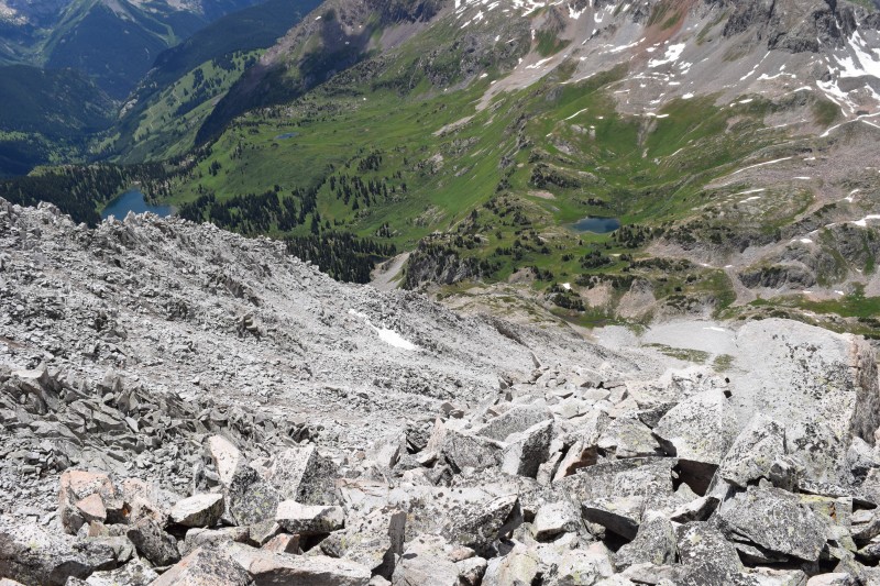 Looking back down at Geneva lake and Lead King Basin. Truly a great basin and place to spend a day 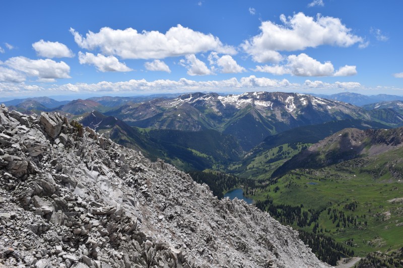 Annnnndddd.....the top! Finally, after 3 hours and some change, we made it! Mother nature had cooperated and we survived to see the summit of snowmass. I know it was a late summit, but the weather was forecasted to be good. Now, enjoy some summit shots! 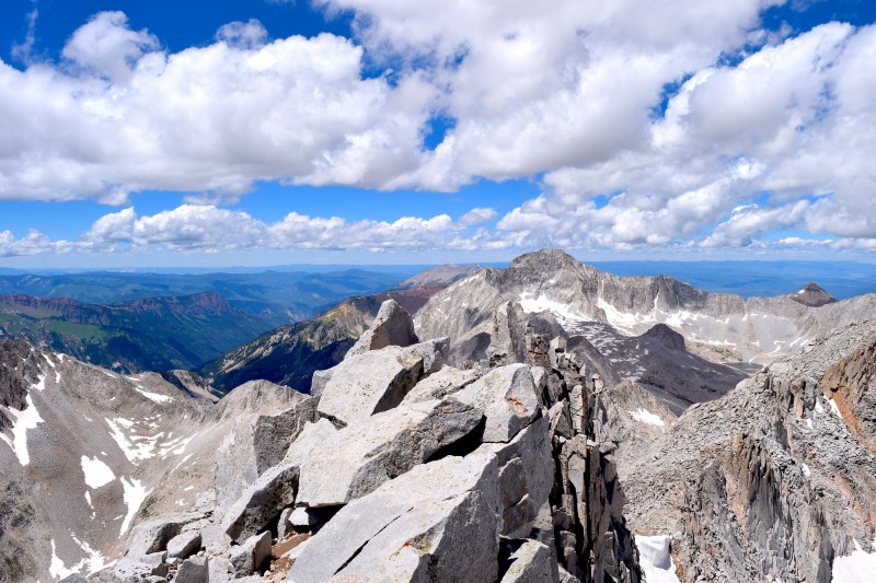 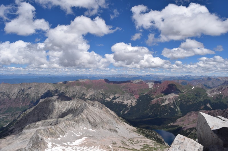 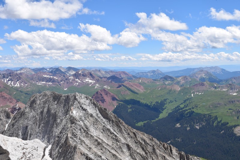 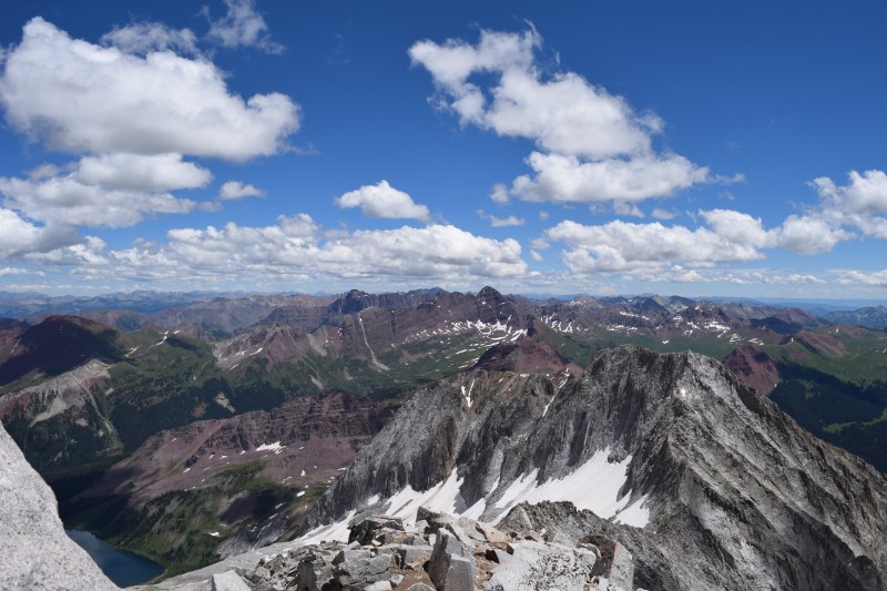 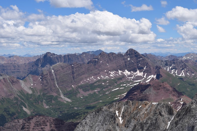  And so the descent began. What an experience. It actually took us longer to descent this section than it did to ascent. The reason? The loose rock. It was extremely dangerous as everything you stepped on would shift. The top section is pretty stable, but once you are back in the gully, the rock is unpredictable, I mean every step is a gamble. Be on your A game. 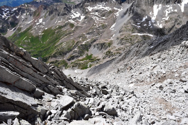 Our route down as shown below. We pretty much took the center of the gully all the way down. There is a bit of a path carved out which was nice to avoid some loose rock. BUT, about half way down, I stepped on a dinner table sized rock thinking it was solid in the ground. It was not...immediately after I had placed both feet on it, it began to slide. It literally slid so perfectly out of its place I was in shock. I let out a scream "ROCK" to warn my father who thankfully was no where near the fall line. This brick slid to a patch of snow right below me, caught some air and made the biggest crashing sequence making its way all the way to the bottom of the gully. It was amazing to experience, I could even smell the rock from its impact on other rock. I sat down for a moment checking the minor scraped I had from the incident, playing it back in my head. How could I have been so stupid to put both feet on this thing? It could have been much worse. For this reason, I would Never climb this route with another group above me. You simply don't know what is going to go, it can happen at anytime! 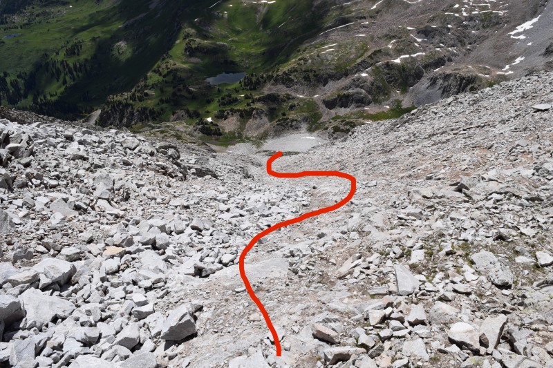 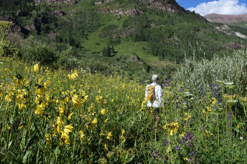 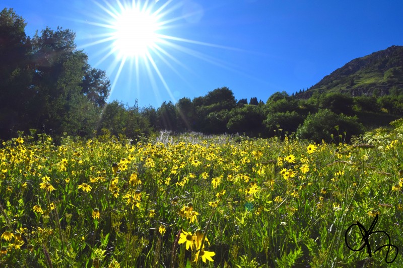 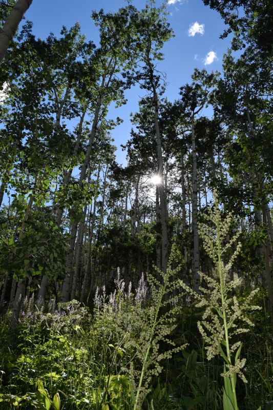 Some peaks I would say the scary factor is similar to: Pyramid, Crestone Needle, Wetterhorn, part of the Knife Edge - here, I was more scared than any of those - Strictly due to the loose rock. It is really unpredictable. And I know, I know..."Why didn't you do the S Ridge?" Well, I am thinking the same thing, if I was to do it again. I would totally do the S Ridge. The rocks over there appeared to be much more stable, and the ridge just seemed cool. BUT we had left late and figured the West Slope would place us at the top the quickest. I don't regret it, it was quite fun, it was intense. For anyone looking to hit this route, just remember don't place complete faith on one rock and remember to try and stay out of the center of the gully. Also, remember that an Outback, yes Subaru Outback can make it to the Lead King Basin TH. Feel free to follow along with my adventures on Instagram: @Krull_Da_Gucci If you decide to take your Subaru up, be careful. The couple sections are no joke and require some careful navigating. Any mishaps could damage your car and/or require it to get towed out. Remember to take the deep trenches at an angle to avoid scraping the front end. Evaluate the risk as you see fitting, just because I did it, doesn't mean everyone else can. With that said, good luck! Thanks for reading, hope this report was a benefit! Alex Thumbnails for uploaded photos (click to open slideshow):
|
| Comments or Questions | |||||||||||||||
|---|---|---|---|---|---|---|---|---|---|---|---|---|---|---|---|
|
Caution: The information contained in this report may not be accurate and should not be the only resource used in preparation for your climb. Failure to have the necessary experience, physical conditioning, supplies or equipment can result in injury or death. 14ers.com and the author(s) of this report provide no warranties, either express or implied, that the information provided is accurate or reliable. By using the information provided, you agree to indemnify and hold harmless 14ers.com and the report author(s) with respect to any claims and demands against them, including any attorney fees and expenses. Please read the 14ers.com Safety and Disclaimer pages for more information.
Please respect private property: 14ers.com supports the rights of private landowners to determine how and by whom their land will be used. In Colorado, it is your responsibility to determine if land is private and to obtain the appropriate permission before entering the property.