| Report Type | Full |
| Peak(s) |
Mt. Lindsey - 14,055 feet "Huerfano Peak" - 13,837 feet Square Top Mountain - 13,799 feet Mt. Silverheels - 13,828 feet Mt. Bierstadt - 14,066 feet Red Mountain - 13,238 feet "South Bross" - 14,020 feet |
| Date Posted | 05/28/2015 |
| Date Climbed | 05/25/2015 |
| Author | bergsteigen |
| Every snowflake is sacred, every snowflake is good |
|---|
... if a snowflake is wasted, I get quite irate! South BrossDate: May 16 Mileage: 9.24 Elevation Gain: 3,380' Route: Dolly Varden Gully Partner: Solo What do you do when the forecast is horrible, and the avy is dodgy? Ski something you don't really need to see that's rarely in and safe. A ski punt. Figured if I had to turn around on a super unranked 14er, this would be the one. At least the skiing would be good no matter what. Parked at the standard Kite Lake winder closure at Paris Mill and started up the regular road. After a short distance, the road that winds around to the east side of Bross appeared and I continued booting up that road. Nearing the top and the big curve in the road I started skinning, as the snow was now mostly continuous. A map with private property marked will come in handy, as there is some to avoid on the way up - if you don't go up and down via the Dolly Varden Gully. As I made my way up the ridge, I could see the clouds building to the south, and I wondered if by sleeping in, I had missed my weather window. The clouds were moving slower than me, so I figured I still had a chance. But they caught up to me on the ridge briefly and then after Mt of the Magic Mike, came in until the summit. Well, false summit or my summit for the day. I sat at the cairn for a while, hoping I would get another weather window. Soon enough, it appeared that the clouds were breaking up. I didn't want to wait too long and miss the window, so I started skiing down asap. It soon became a perfect bluebird powder day - completely unexpected. The nice mellow slope angle was fun and I enjoyed racing down my snow spray that was rolling down the slope with me. Near the bottom I stopped for a while to watch a storm building over South Park. Spending 90% of the day in a sunny halo when you expected whiteout conditions - priceless!  Target driving up in the morning. Looks like there's a weather window...  Slope up to the false summit - Mt of the MagicMike  Mt Democrat  South Bross and Bross  Me conquering the false false summit of Mt of the MagicMike  First drop of the summit ridge  Creamy turns down Dolly Varden  Storm brewing Red Mountain CDate: May 17 Mileage: 7.76 Elevation Gain: 928' Route: North Ridge Partners: Zach, Rob Not being fooled into thinking Sunday's weather would be as good as my day on Bross, Zack, Rob and I changed plans from Silverheels to Red Mountain C. At least with this safe option, we'd be in the trees for some of the ascent and not starting at treeline for the expected wind forecast. The wind was already blowing around the trees at the trailhead. A lot had melted out since either of us was here last, and we ended up booting for a bunch, then doing the on-off-on-off routine until the meadow. There we had some fun finding a good stream crossing. After that a mellow skin up through the trees. Nearing the end of the trees, we had to give up their protection for the snow and wind above. Soon after, we entered into a full whiteout. I navigated based on my previous trip here, the shadows of the ridge falling off to either side, and most importantly - the angle of where the snow pellets where hitting me on the cheek. As long as I kept getting hit directly on the right cheek - we were going the right way. We got a few peeks at the summit ahead, but not much. Eventually we reached the summit, and decided to hope that a weather window would appear. At least one good enough to see enough to ski down. Soon enough, that weather window occurred, and we took full advantage of it. Dodged around the ridge cornices and across the open ridge areas on sustrugi was not always pleasant, but we knew we had some decent skiing upcoming in the trees. Hands were so cold, I didn't take out the camera, but used my GoPro to capture what I could. Through the trees, we had some fun skiing down to the road, where the sun finally came out. Hanging out at the trailhead with 2 other skiers, it appears our weather window had opened full up. Oh well. Can't always time it perfectly!  Rob and Zach in the falling snow, with a closed Breckenridge ski resort behind.  Summit ridge in a small sun hole  Rob skinning up the ridge with Zach behind  Me working on a new skin removal technique (without removing my skis) - Photo Credit: Rob  Zach and Rob off the summit ridge  Zach catching some sustrugi air  Skiing down the ridge  Navigating  Rob kicking some pow  Zach kicking up some freshie pow Mt BierstadtDate: May 21 Mileage: 8 Elevation Gain: 3,271' Route: Standard - but drooling over NW gully Partners: Alex, Jason, Scott It's been raining almost nonstop down on the Front Range for weeks. Grey skies pretty much all month. I was sick of it. So when Alex proposed skiing Bierstadt in near unheard of snow conditions, I was game. Even having to start from the winter closure was not going to dampen my spirit to see the sun finally. Met the group at the closure and geared up ready to walk the completely dry road until we could find a good place to start skinning. Ended up cutting a switchback on skins, though it was likely was faster to boot the road, as Scott (who was on snow shoes) beat us to the pass. It was lovely to see the sun again and blue skies above. We had nice weather until we neared the summit. Then the expected clouds and snow arrived in the neighborhood. Still the skiing was good and perfectly continuous off the summit. Much easier than the first time I skied this peak in 2010, with much poorer coverage. Alex and I had been spying the NW gully directly off the summit, but viewing it from above, it looked thin and fairly unconsolidated. It might go, but I wasn't wearing my rock skis for that adventure. As it was, I was in my old boots, since Neptune had my new boots with my even newer skis. Small sacrifices to ski a peak in pristine condition. So the 2 split boarders and poor snowshoer went back the way we came up, enjoying the fresh powder and the open slope ahead. Instead of going back to the pass, we dropped down to the lower switchback through the willows. Snow was becoming quite unsupportive, and Scott had some postholes till we got back to the ease of the road. 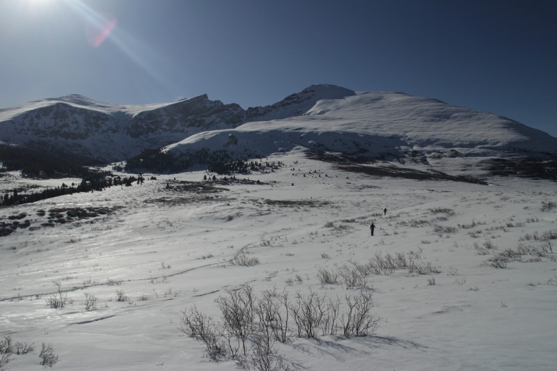  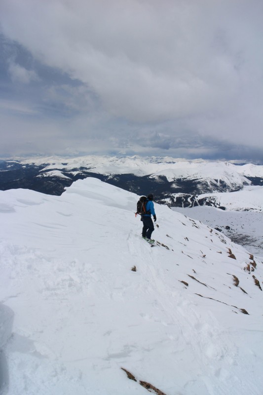 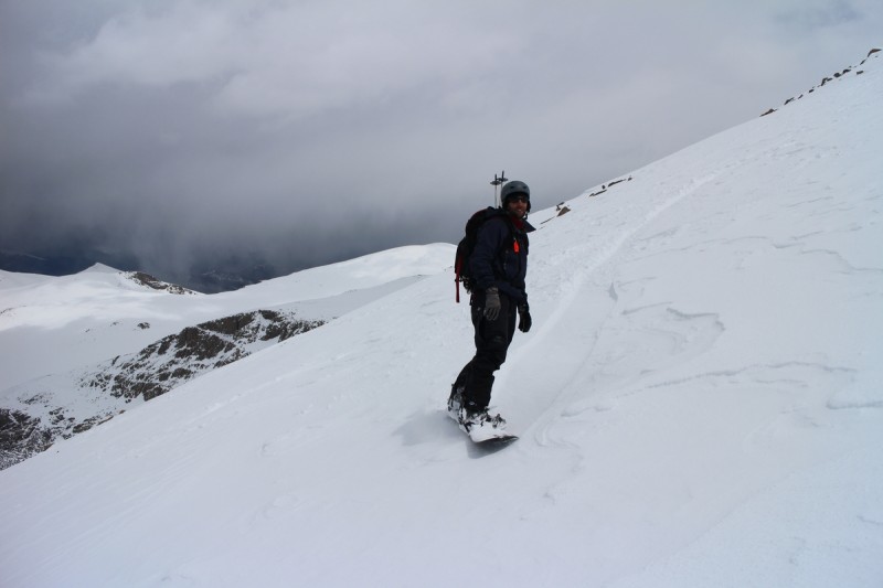 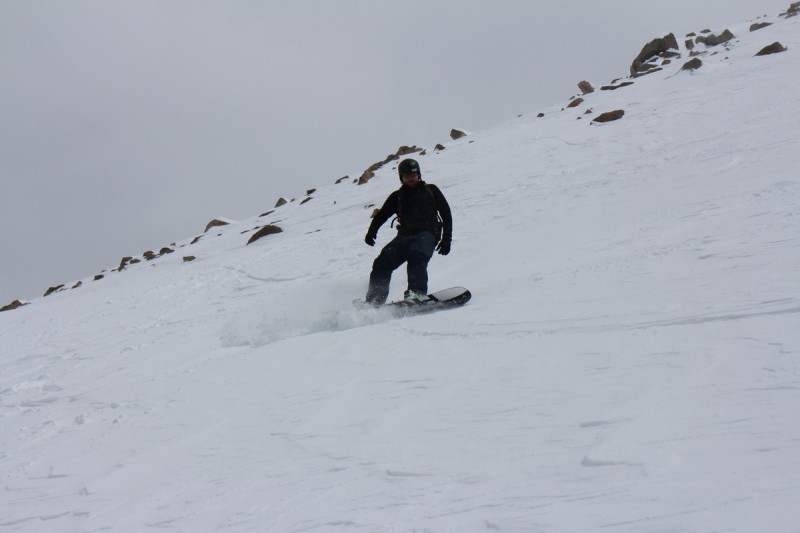 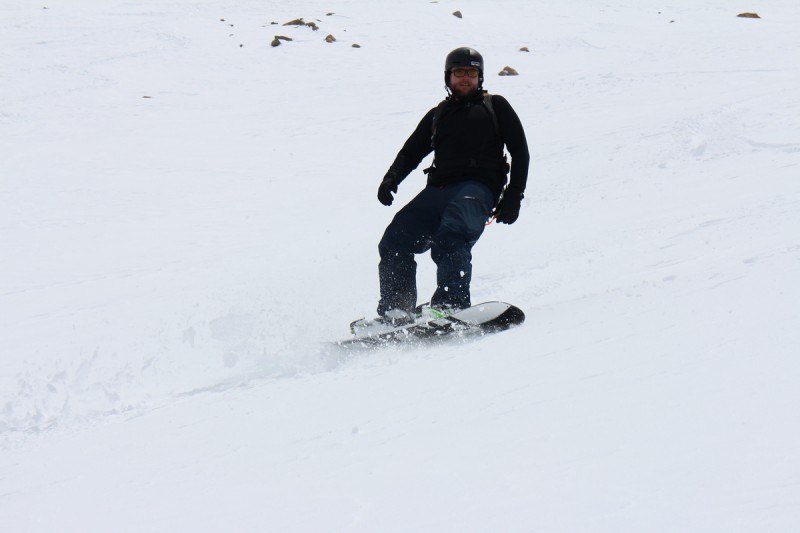 Silverheels (attempt)Date: May 23 Mileage: 4 Elevation Gain: 2,132' Route: West Ridge Partners: Bill, Craig, Alex, Zach, Rob Once again the weather forecast for the week/weekend has been rough. This May is quickly becoming the 'best of times and the worst of times'. Lots and lots of fresh snow for our winter powder deprived souls, yet the avalanche and weather conditions have been downright tricky for anything steep and committing. So stay local and just go out and attempt something. What's the worst that could happen? So parking along HWY 9, we made our way up a drainage through the trees with grey ominous skies above us. Under the power lines, it was difficult to see very far, or to tell any features of what we were skinning on. We had to drop down into a small valley before going up the west ridge proper. There the sun started to peek out ever so slightly, and I got excited. A weather window! It was steep skinning up the initial part of the ridge, and Zach was having some trouble and decided to boot a section. Others above were either toughing it out on the skins, or were also booting. Soon, both Zach and I heard the low rumblings of approaching thunder. It was fairly quiet and still far enough away that I wasn't terribly concerned, but I still wanted to discuss with the group. We had cell service and so I checked the radar. A cell was blowing up big in a line with us. This wasn't going away, but coming right for us! (South Park double reference... Zach wasn't going to go higher, but I decided that I would catch up with the group above and talk with them about it. Along the way the thunder kept getting louder. Right when I caught up, Zach yelled up Buzzing! It was then, those of us carrying skis, noticed that the metal on the ski edges and on the skin strap were buzzing. At first it was hard to hear over the graupel hitting us, but soon it couldn't be missed or ignored. A hasty retreat was needed. Most quickly booted down the slope, while Bill skin skied down and Craig and I quickly ripped skins off and made a hasty descent. It was my first day on my new skis, and the couple of turns I was able to make were lovely. It was 9:30am Once down in the valley, we had a bit of a light show overhead. The storm was upon us. It had moved very quickly! Our return involved skinning uphill and under the power lines again to get back to the relative safety of the trees. Zach wanted no part of that and skied down the drainage with Rob, and had a *wonderful* time getting back to HWY 9. Bill, Craig, Alex and I skinned it to win it, and went as fast as humanly possible. Amusingly, back at the trees at 10am, the sun started coming out and the skies cleared. But it was done, we were done, time to go downhill and drown our sorrows. 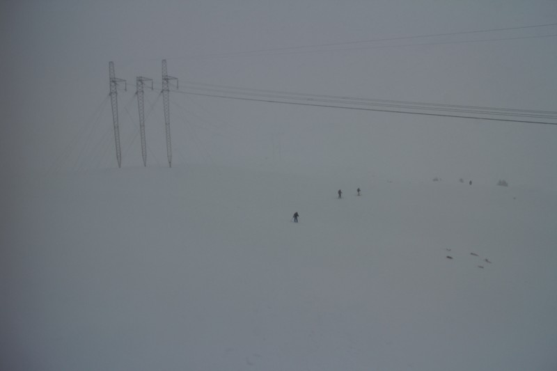 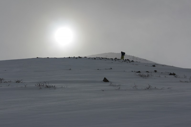 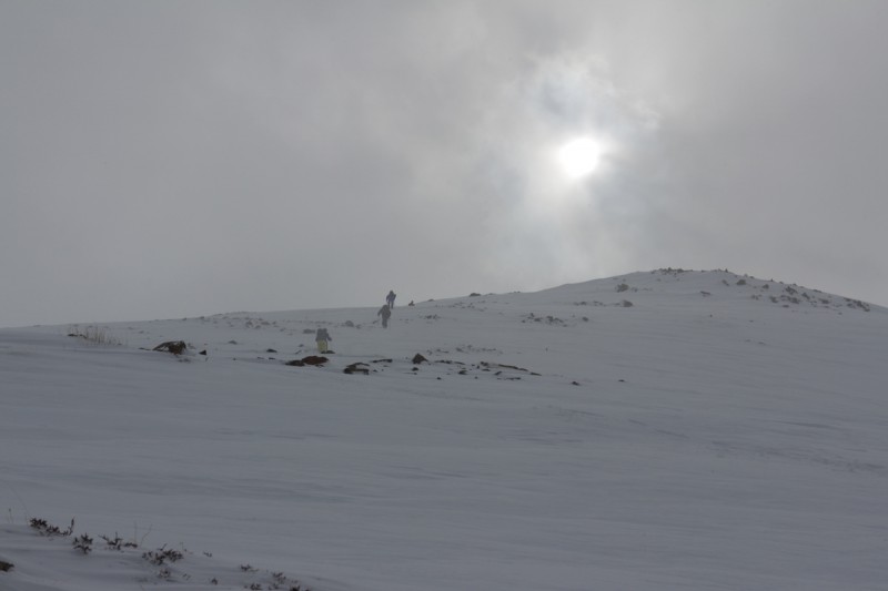 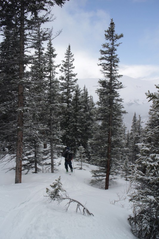 Square Top Mtn ADate: May 24 Mileage: 6.78 Elevation Gain: 2,574' Route: East Ridge Partners: Alex, James Once again I find myself surround by split boarders. After the kerfuffle on Silverheels, neither Bill or Craig wanted a repeat. The forecast for Saturday was better than the one for today. But why waste good pow? Might as well go out and see what we can find! Alex was bringing along his friend who had never skinned before, so it was bound to be an interesting day. Drove up to the pass with perfectly blue skies above. A better weather window already than yesterday, despite a worse forecast. Started the undulating skin from the pass over to the base of Square Top. From there there was one steep section to skin along a fairly mellow ridge. Unfortunately the noob skinner got stuck there, despite numerous attempts. James decided after tiring himself out, he'd just wait for us there. So Alex and I quickly scooted up to the summit, meeting the other 2 skiers on the top. 2 snowshoers that me wet while waiting for James, also arrived on the summit while we were there enjoying the sunshine. Clouds were surrounding us, but my sun halo was in effect today. We managed to find a snow route down the ridge that was snowboarder approved and skied down the initial slope in a weird snowfall sunlight mix. The final drop with James was back to full sun, and some creamy turns were had all the way down the drainage. We decided to drop down to near the road, instead of having to skin all the way over the undulating terrain back to the pass. I found it a better option for better and more skiing. 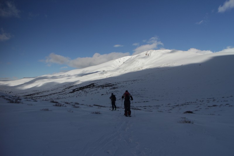 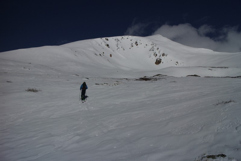 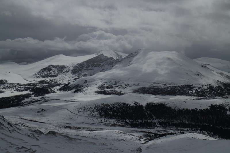 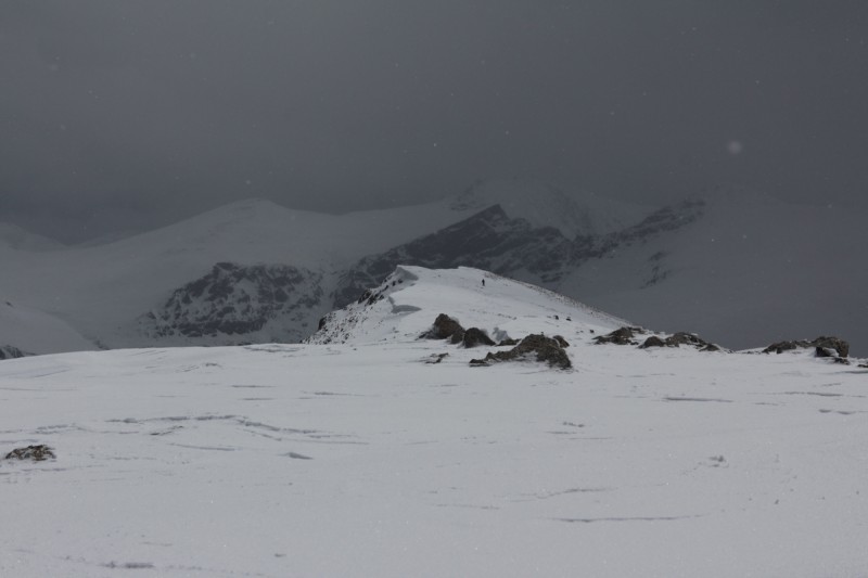 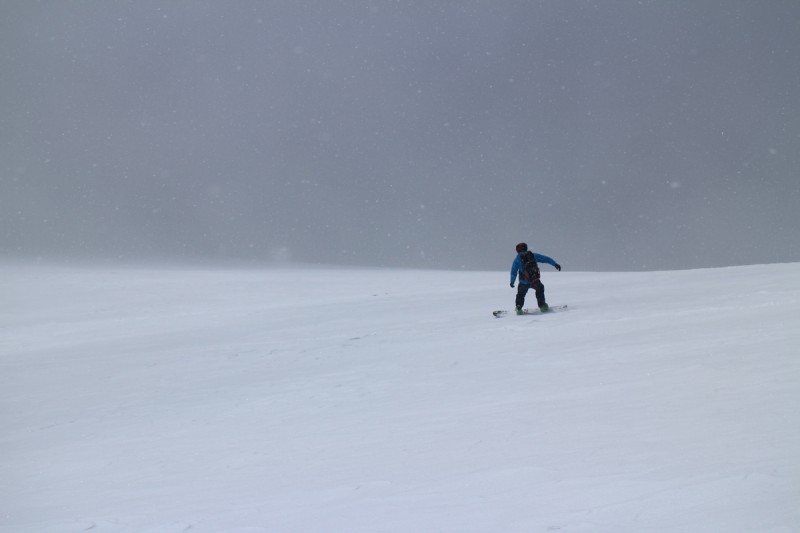   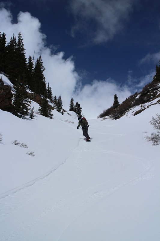 Huerfano and Mt LindseyDate: May 25 Mileage: 12.15 Elevation Gain: 6,469' Route: South Face on Huerfano, North Gully on Lindsey Partner: Joel With my ski mojo coming back, finally, it was time to get out skiing with Joel again. Joel never plans easy days. He keeps promising me that one day we'll have a sub 14 hour day, but I doubt it. His eyes are bigger than my legs. I didn't exactly plan on skiing Lindsey again so soon after skiing it for my project, but there was the lure of Huerfano as well. Lindsey is a great ski, the approach can be - heinous. Without cell service for much of the length of that interminable road up to the trailhead, and not knowing how far we could get, I told Joel that I would drive as far as I could. Beta from Natalie put us 2-3 miles from the trailhead with a 3 car length snowbank in our way. Joel would bring the snow shovels, and at 3 am we would dig if we needed to. Since the other part of the beta was that we could drive farther if we could just get past that one big snowbank. Well, I got to that first snowbank, got out and walked the length of it. It didn't seem too bad, as long as I kept my speed. One tire in the snow, the other in mud puddles. So I gunned it and got through it. Then a mile or so of dry road with a couple smaller snow banks. After that, much higher snowbanks started occurring, but they were small in length. So I just rally drove over them. I kept going until where I ended up parking for the night. At about 0.7 miles from the trailhead, the road goes into some shady trees, up a hill and around a bend. It would be too much for RallySubi, I wouldn't have the power or the control for something like that, while bottoming out. I have chains, but I knew how close we would be to the trailhead, after walking it with skis and boots 2 times last year. This was good enough! Looking under my vehicle was pretty amusing. At least I had that rattling heat shield removed, that snow would melt quickly! At ~3am Joel got to that first snowbank and figured I wouldn't have the strong lady parts to continue. He was also not sure if he was on the right road, so he went back to the ranch to confirm. On his return to the snowbank, he went ahead an drove it in the dark, and continued to drive all the snowbanks I did - noticing my scrape marks. I had my headlights on, so as he got closer, he knew where I was. I had placed my skin bag on a tree that overhung the road, in case he got there before I was awake, since he was driving straight in from working all day long with no sleep. After that mornings excitement, we got a later start than planned, but we were miles ahead of where we thought we would be. We booted up the road and along the trail until about the stream crossing. After that we started skinning, as the snow was finally continuous. The stream crossing was the easiest I've done in a while, as there were a few logs across in the narrow spot. At least that was easy! The sun came up as we started the steep skinning portion of the day. We were treated to some pretty skies briefly. The day was starting off mostly cloudy, with the big peaks shrouded with clouds. Barely saw Blanca and Ellingwood all day, as they had their cloud caps on. Lindsey peeked out on occasion as we made our chilly way up to the saddle. The wind howled once we got there, and neither of us wanted to remain for too long. Let's just ski down and decide which peak we want to do first. We aimed for Huerfano and switched back to skinning. Pretty easy and relatively low angle as we made our way over wind blasted hardpack and powdery sections. We weren't sure if we'd be able to see when on the summit, but the skies slowly cleared. Once it got a bit brighter, the time was good to strike. Better ski with sunshine than in flat light! So we made our way down, to ever increasingly bright sunny skies! We had both wanted to ski down a SE facing gully, but there was no beta on it. Did it go, how steep was it? All unanswered questions. 2 friends had recently skied Lindsey, but neither had posted a photo of lowly Huerfano for our LTE service iPhones. (Yeah - getting beta on the summit). But the route we took down was still good and had plenty of creamy turns to be had. Joel says he'll be back for that line another snowy season. 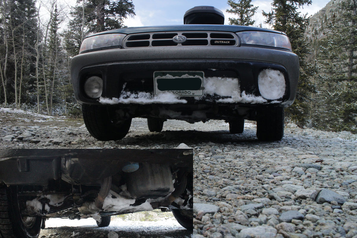 Super Rally Subi!   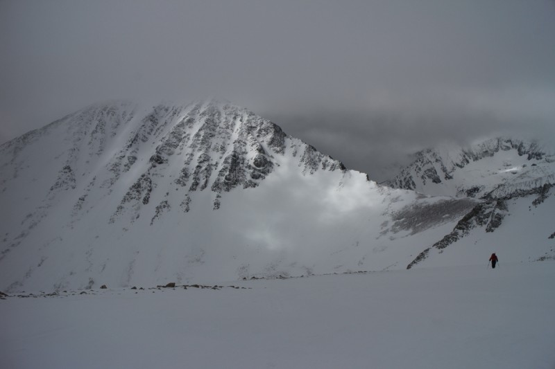 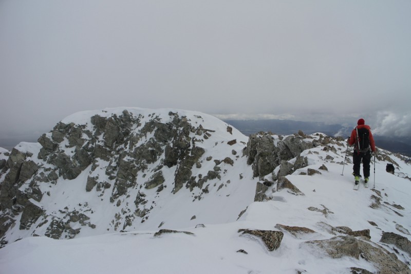  Me approaching the summit 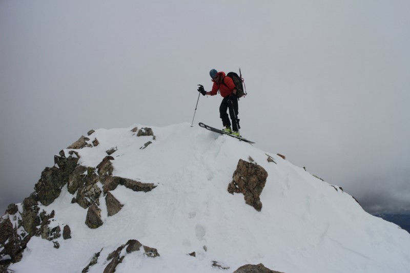 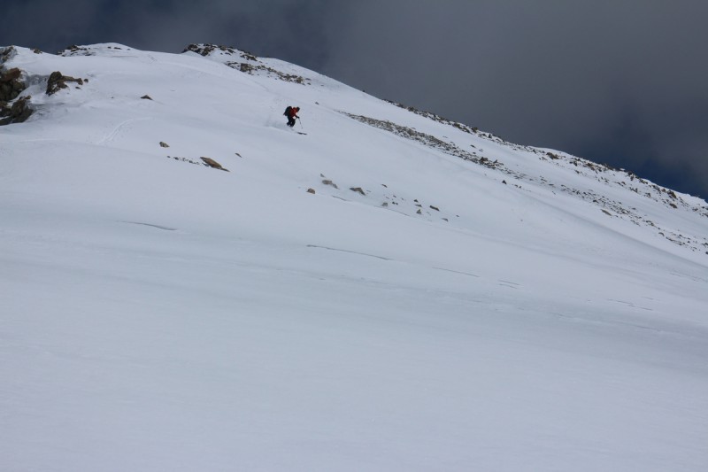 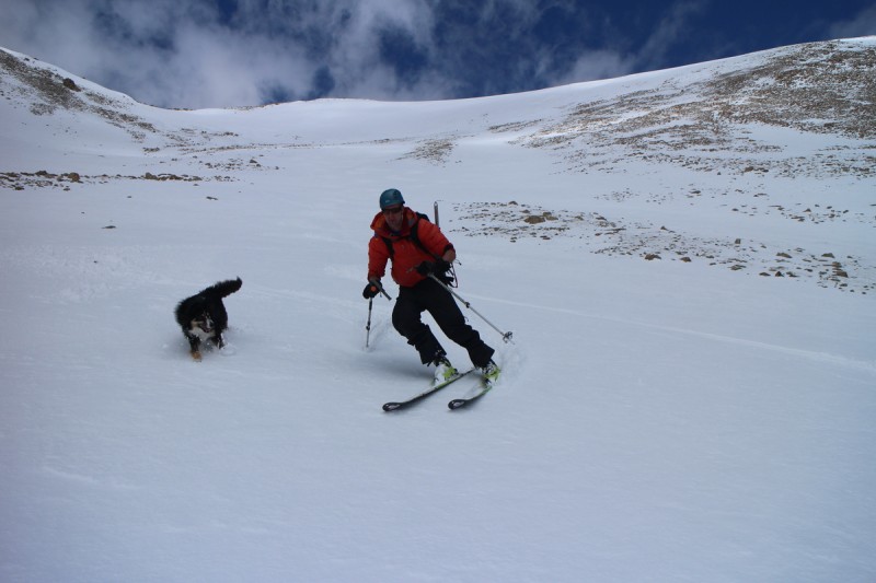 From the base of Huerfano, we traverse over and into the North Gully of Lindsey, where I started throwing down a skin track up the right side. I go until it just becomes uncomfortably steep, and switch to booting. From there, Joel and I would take a couple turns booting up the powdery slope. The last section up to the summit were quite painful, as my right toe was killing me from having to wear my old boots on Bierstadt a few days ago. But eventually we made it up to the top. The snow on the north face never really warmed up much, as I frequently tested it with my hands. The heat from the unexpected sun was baking both of us. I wanted to roll around in the snow like Max to cool off. While it was a pretty late summit, we got lucky with the weather, despite worrying about the solar oven we found ourselves in. Summit ridge snow stuck horrifically to my crampons, so I was quite glad we didn't go up the standard route. I did that last time, and had massive crampon glop the entire way. Joel even tested the slope by trying to find unfrozen rocks to throw down. After a short summit break, Joel let me drop first onto the creamy powder slope. A few cautious turns up top with my new skis, and then it was go time. I dropped fast and hard down to the first safe zone, to take photos of Joel throwing powder. Then it was my turn for more high speed powder thrashing. New skis were performing beautifully. I wished they were 10cm longer, so I could have skied faster, but these are not my big mountain powder skis. These I got specifically for the needs of typical steep, narrow, icy 14er/peak skiing. Short, narrow, stiff and cambered, but still capable of handling the unexpected powder stash! Of all the peaks skis I've done, this was by far the best 14er ski ever, and likely top 5 of all the others (if not #1 overall). Joel had to shut me up from gushing halfway down, to not jinx us. But nothing could damp my enthusiasm as I flew down the last section of gully down to the base of the valley below. This time, I let Max chase me since I knew he couldn't keep up. On steeper sections, Joel has to hold him back, since I don't tend to ski with abandon. But here, the slope was mellow enough, and the snow consistent enough - I flew at the fastest my skis would let me. At the base, Joel and I did something unusual. We just sat there and enjoyed the moment. We are usually gearing up or down or doing something to continue the trek, but after that experience, we had to let the afterglow set in a little bit. Enjoy what we knew at the time to be the best 14er ski, either of us had had. Way too soon, we transitioned to uphill skinning mode again to get back up to the saddle. It was a rough go, but step by step we made it. The storm was brewing all around us, and finally the clouds covered the sky shortly after I arrived on the saddle. From there, we skied down the ridge and onto a slope I wanted to ski the last time I was up there, but didn't want to do solo that late in the day. Today, it was corny goodness. We had a pleasant ski down the drainage all the way down to the big stream valley below. Transitioned back to skinning for the short distance to the stream crossing. From there it was a fairly zombified sloppy walk out, if a happy zombified walk. 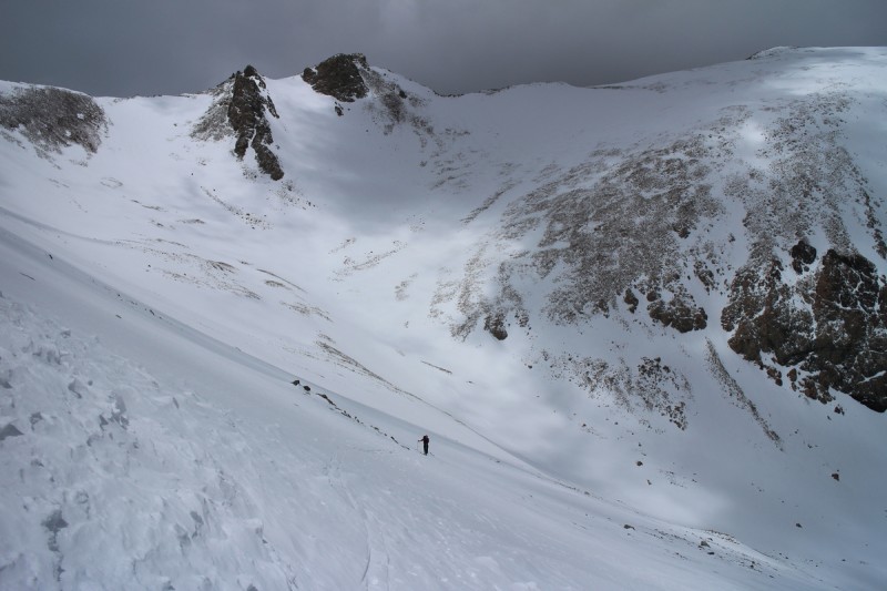 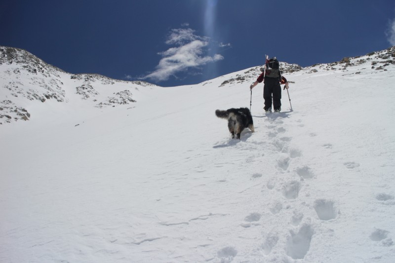  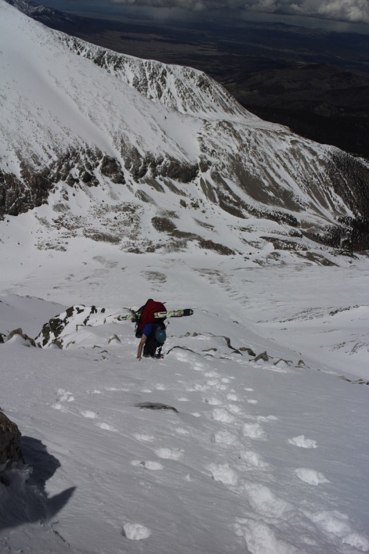 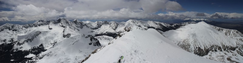 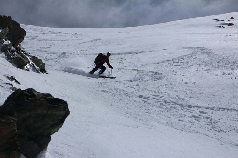 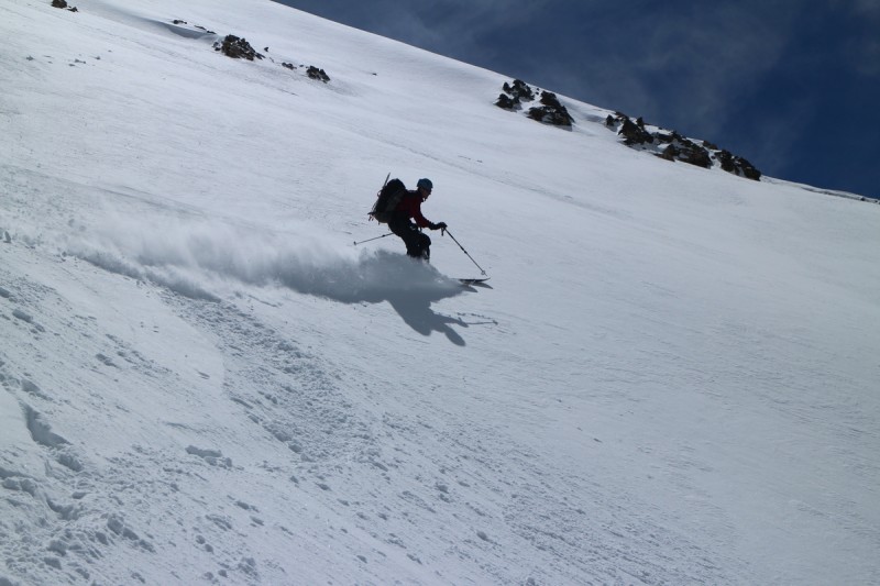 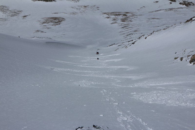 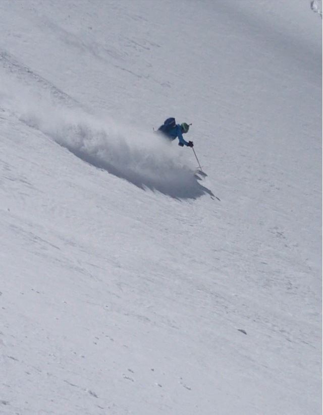 Me throwing powder   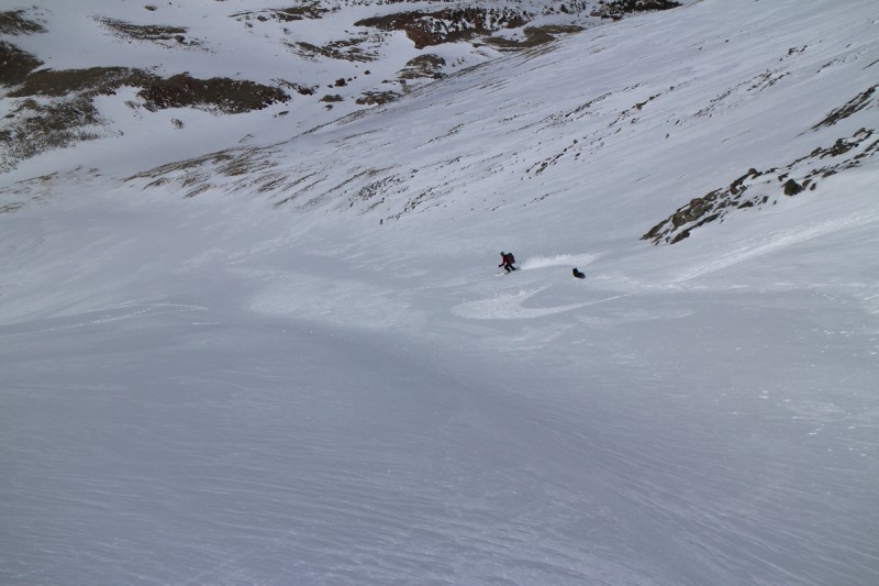 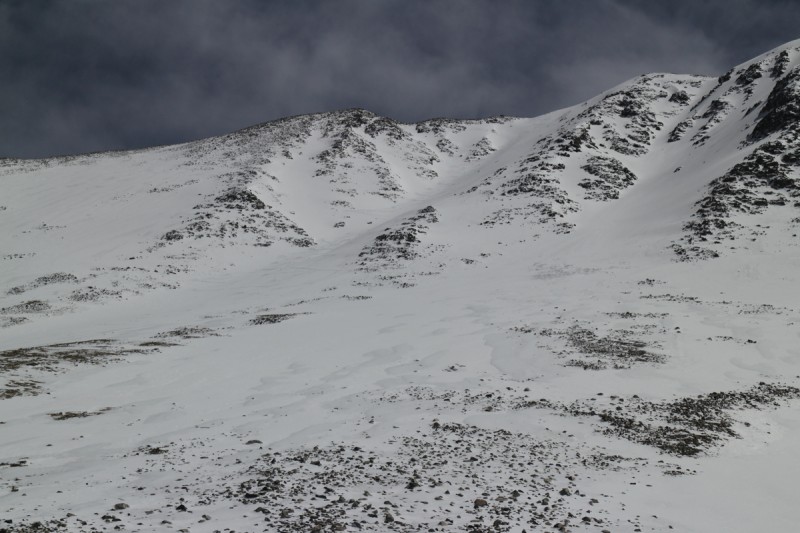 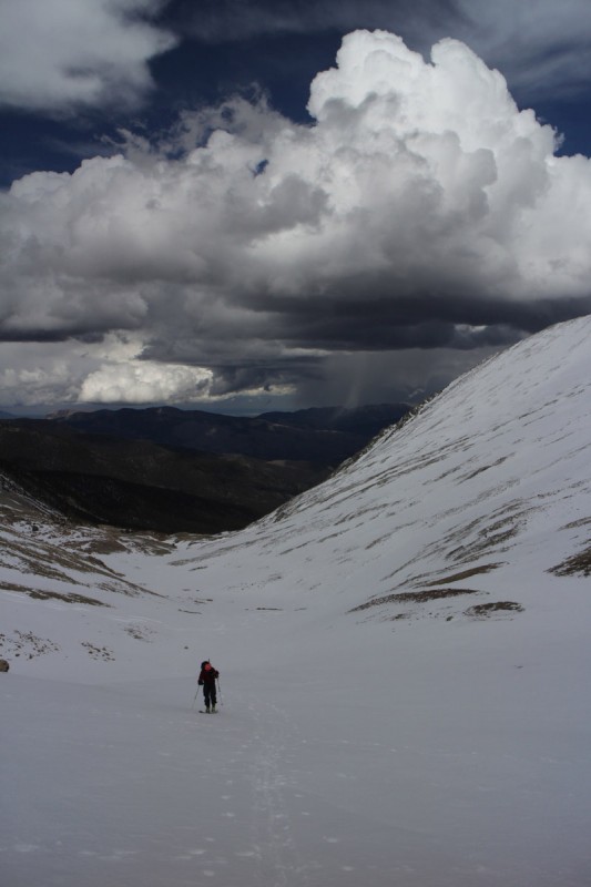  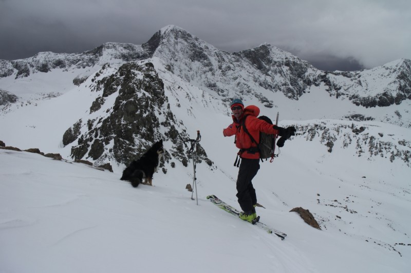 Thumbnails for uploaded photos (click to open slideshow):  Skinning up a familiar peak")
 NW Gully looking ever so tempting")
 Alex boarding off the summit ridge")
 Jason boarding")
 Alex throwing up some pow")
 Alex throwing up some more pow")
 Skinning in a whiteout. At least those power lines are there for some perspective")
 Rob with evidence for a sun")
 The group going up the west ridge")
 The sun comes out for our retreat")
 Skinning to Square Top")
 Tasty steep bowl - later!")
 Bierstadt and Evans")
 Looking east with my sun halo in effect")
 Alex boarding in the sun-snow")
 James boarding")
 Alex dropping the creamy slope")
 James in the drainage below")
 Joel skinning up to the saddle")
 Joel with Iron Nipple behind")
 Sun starts to peek out on Lindsey")
 Joel approaching Huerfano's summit")
 Joel skiing down Huerfano")
 Sun returns for us to ski down Huerfano")
 Great turns on the way down Huerfano")
 Skinning up Lindsey, with our route on Huerfano behind")
 Joel taking a turn at booting")
 Max says")
 Joel booting the last section up to the summit")
 Summit Pano")
 Joel skiing the first pitch")
 Joel kicking up snow")
 Joel making super G turns")
 Looking back up the gully at our turns")
 Joel slashing some pow")
 Joel and max")
 Our turns")
 Joel with a valley storm behind")
 Sunny Lindsey")
 Joel must be hallucinating by this point")
|
| Comments or Questions | |||
|---|---|---|---|
|
Caution: The information contained in this report may not be accurate and should not be the only resource used in preparation for your climb. Failure to have the necessary experience, physical conditioning, supplies or equipment can result in injury or death. 14ers.com and the author(s) of this report provide no warranties, either express or implied, that the information provided is accurate or reliable. By using the information provided, you agree to indemnify and hold harmless 14ers.com and the report author(s) with respect to any claims and demands against them, including any attorney fees and expenses. Please read the 14ers.com Safety and Disclaimer pages for more information.
Please respect private property: 14ers.com supports the rights of private landowners to determine how and by whom their land will be used. In Colorado, it is your responsibility to determine if land is private and to obtain the appropriate permission before entering the property.


