Download Agreement, Release, and Acknowledgement of Risk:
You (the person requesting this file download) fully understand mountain climbing ("Activity") involves risks and dangers of serious bodily injury, including permanent disability, paralysis, and death ("Risks") and you fully accept and assume all such risks and all responsibility for losses, costs, and damages you incur as a result of your participation in this Activity.
You acknowledge that information in the file you have chosen to download may not be accurate and may contain errors. You agree to assume all risks when using this information and agree to release and discharge 14ers.com, 14ers Inc. and the author(s) of such information (collectively, the "Released Parties").
You hereby discharge the Released Parties from all damages, actions, claims and liabilities of any nature, specifically including, but not limited to, damages, actions, claims and liabilities arising from or related to the negligence of the Released Parties. You further agree to indemnify, hold harmless and defend 14ers.com, 14ers Inc. and each of the other Released Parties from and against any loss, damage, liability and expense, including costs and attorney fees, incurred by 14ers.com, 14ers Inc. or any of the other Released Parties as a result of you using information provided on the 14ers.com or 14ers Inc. websites.
You have read this agreement, fully understand its terms and intend it to be a complete and unconditional release of all liability to the greatest extent allowed by law and agree that if any portion of this agreement is held to be invalid the balance, notwithstanding, shall continue in full force and effect.
By clicking "OK" you agree to these terms. If you DO NOT agree, click "Cancel"...
Starting Point: Intersection of CR-18 and FS-603, Elevation: 11,600'
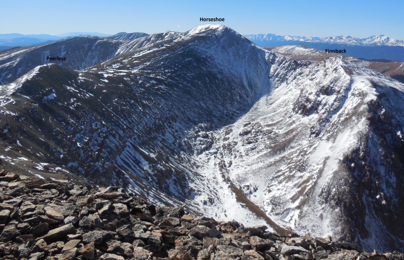
Peaks Climbed in order of ascent: Mt. Sheridan (13,748'), Peerless Mountain (13,348'), Horseshoe Mountain (13,898') and Finnback Knob (13,409')
Route: Northeast ridge ascent of Sheridan, ridge traverse to other peaks and loop via east slopes of Horseshoe
RT Distance: 9.1 miles
Elevation Gain/Loss: 3,800 feet
Group: Solo
"Whether you think you can, or you think you can't--you're right." - Henry Ford. A bit over three hours and two ranked peaks into the hike, I looked down the steep 600 foot drop before me and thought my day was over.
I'll have to come back for this...
Trudging over varying amounts of snow and talus while fighting a cold and the effects of the usual fitful sleep from the night before had taken its toll and I was running on low. "There is no shame in turning back", I told myself as I walked away from the ridge connecting Horseshoe to Finnback. I couldn't do it, or so I convinced myself.
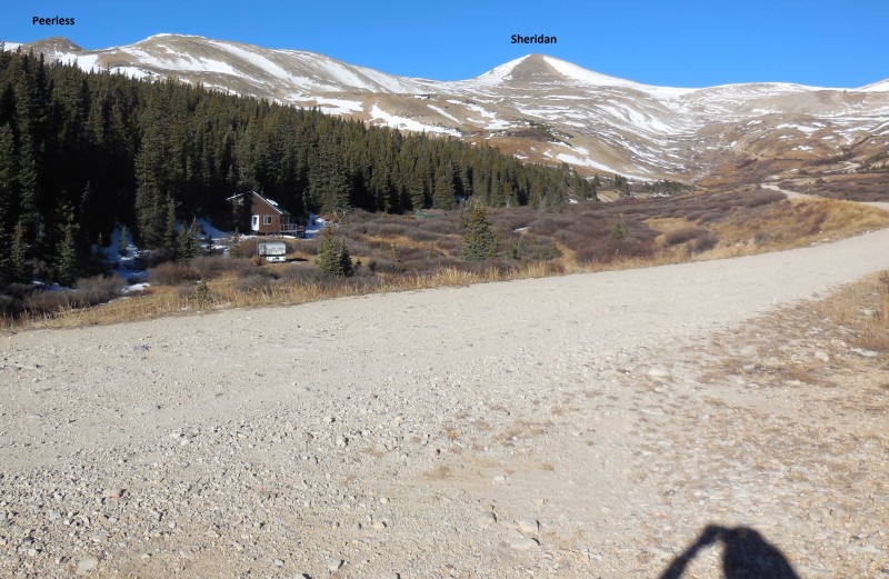
My day started just after nine a.m. on Four Mile Creek road at the intersection with Forest Services Road 603.
Starting point
Unseasonably warm weather meant that I couldn't pass up another chance to visit the mountains and today's goal was lowly and unranked Finnback Knob - so unimpressive in its credentials that it gets neither the "Peak" nor the "Mountain" suffix, but makes do with the "Knob". Ouch!
Finnback can be easily climbed directly from Gold Basin off Weston pass. It can also be summited from Four Mile Creek following the east slopes route over Horseshoe Mountain. I had attempted this route almost exactly two years ago, and was unceremoniously evicted off the saddle by gale force winds without as much as a peek at the ridge route to Finnback. Neither of those aforementioned routes pass the 3,000 vertical feet requirement so I decided to change things up a bit and add another ranked 13er to the mix, Mt. Sheridan. In fact, this decision was made the night before during my sleep; note to self: dreaming about mountains is ok, losing sleep over them...not so much!
I won't bore the reader with minute-by-minute details of the all too familiar route up Sherman/Sheridan but a few pictures should at least highlight the general conditions of the day.
Standard route so far
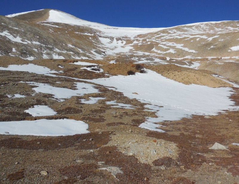
I stayed on the main road up to around 12,700' before seeking a more direct approach toward Sheridan's northeast ridge.
Detour aiming for Sheridan's NE ridge
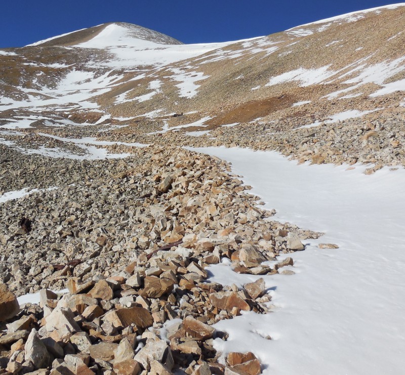
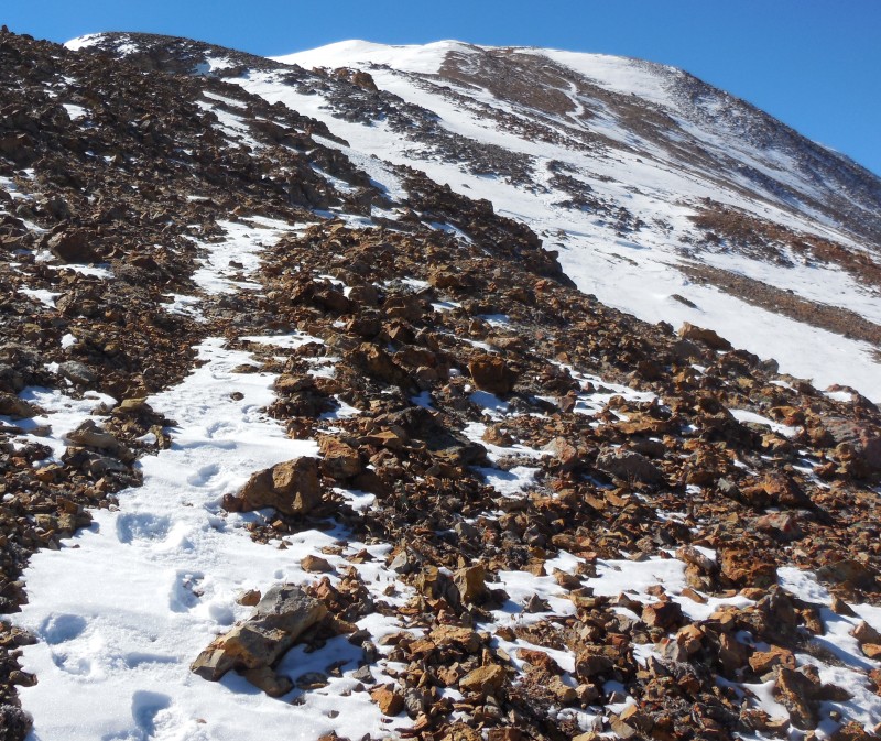
Snow hadn't been an issue up to this point but looking up at the route to the ridge, I knew that would change.
Microspikes came in handy here
I stopped here to don my microspikes and while they weren't absolutely necessary, they certainly made matters a bit easier today. I generally like to hike with minimal gear but I'd come well equipped today even though the weather was supposed to be mild. My "winter" backpack was stuffed with multiple layers, gloves, gaiters et al. As I sat on the rocks, I also noted that I was carrying my wallet in my back pocket - so there, I was equipped alright!
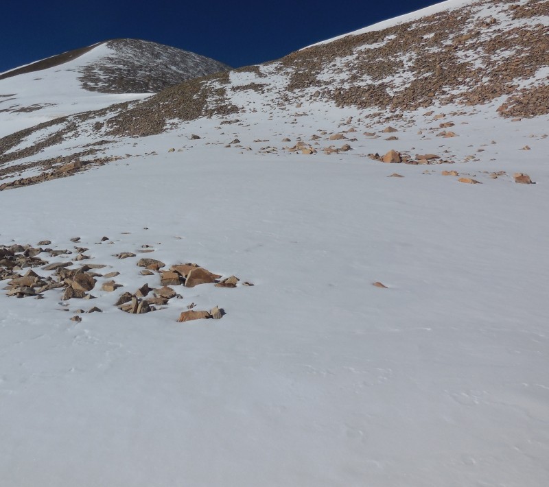
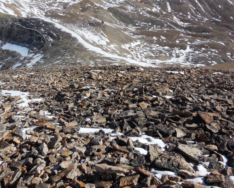
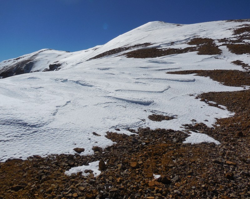
The snow varied from just a dusting to several inches so even the gentle lower east slopes of Sheridan needed a bit of work to navigate.
Looking back down the slope
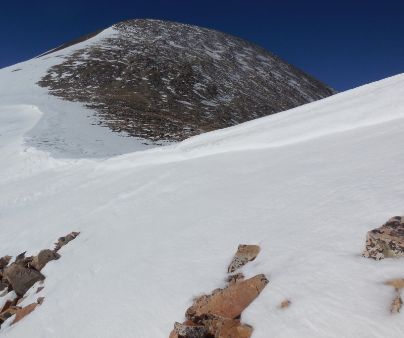
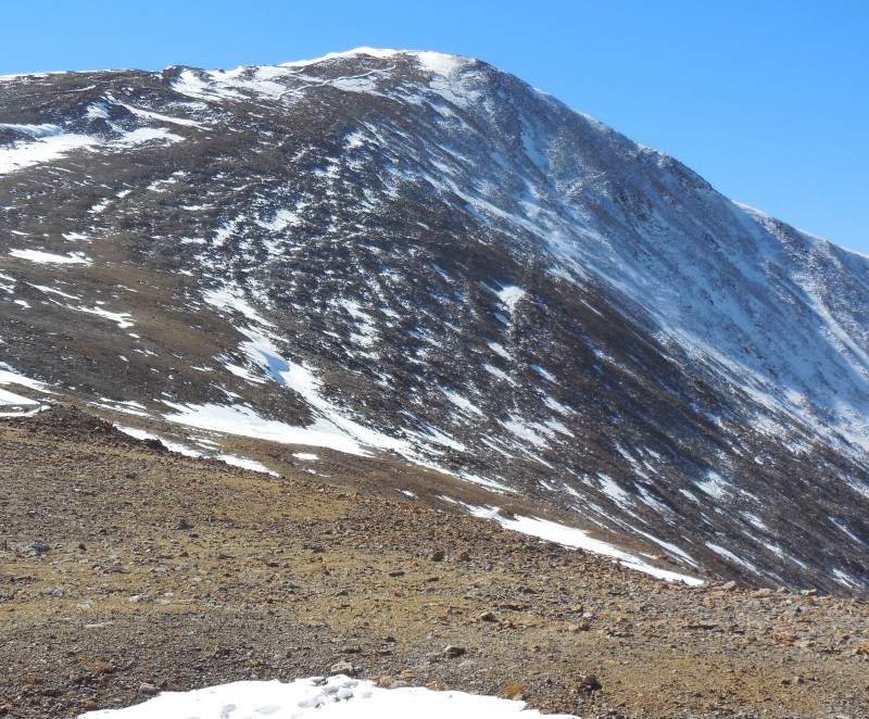
If there is snow on these slopes, you can bet that there will be a cornice guarding Sheridan's northeast ridge and sure enough, there it was.
The cornice you can count on
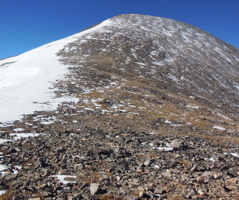
I used my hiking pole to gauge the depth of the snow and picked a relatively safe spot to make the final pass up to the ridge. In contrast to the lower slopes, the snow cover atop Sheridan's ridge was patchy at best and posed no real issues.
Ridge route to Sheridan
Looking down Sheridan's NE ridge
Twenty minutes of huffing and puffing later, I was greeted by the rock shelter on Sheridan's summit.
Summit cairn AKA rock shelter
Also two years ago on another rewarding outing, I'd successfully summited the other Mosquito peaks that can be seen in the next shot.
Other Mosquito'es
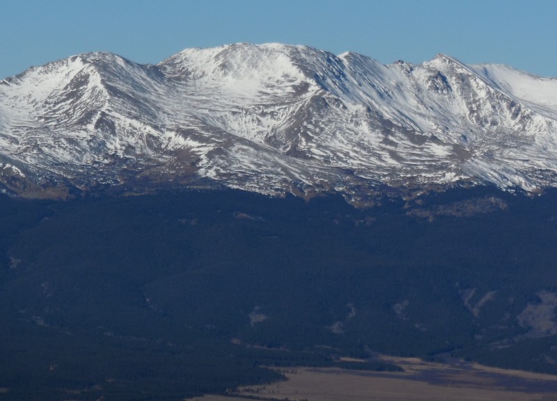
There wasn't a speck of cloud in the sky so I spent some time atop my first summit enjoying the view to the west, dominated by the giants of the Sawtach.
1,2,3,4,5 summits make for one "massive" mountain
Monarch of the CO Rockies
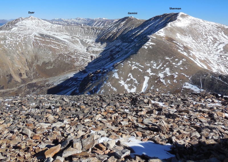
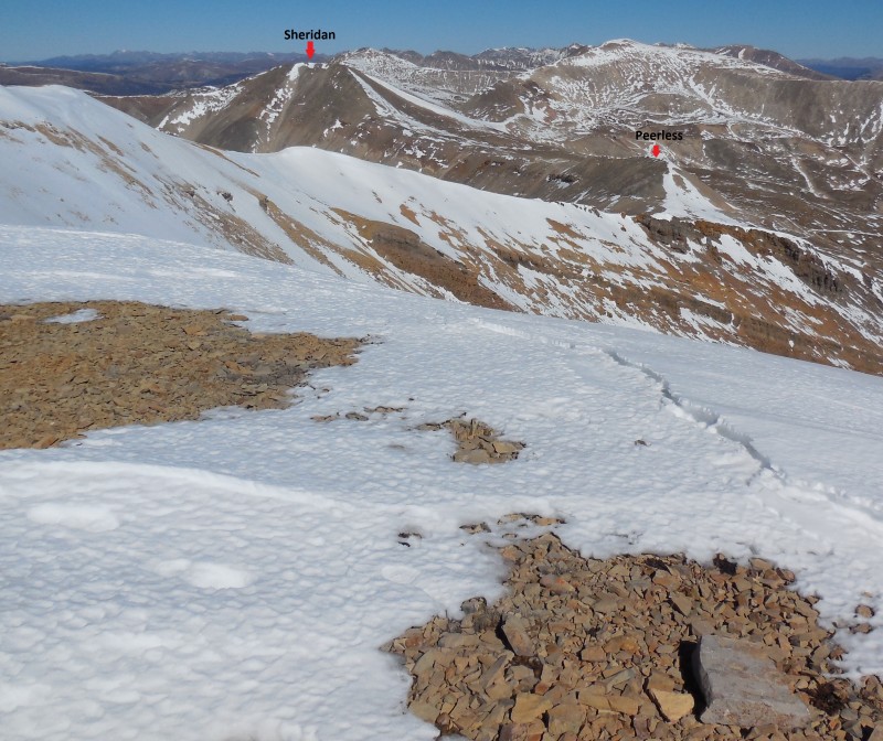
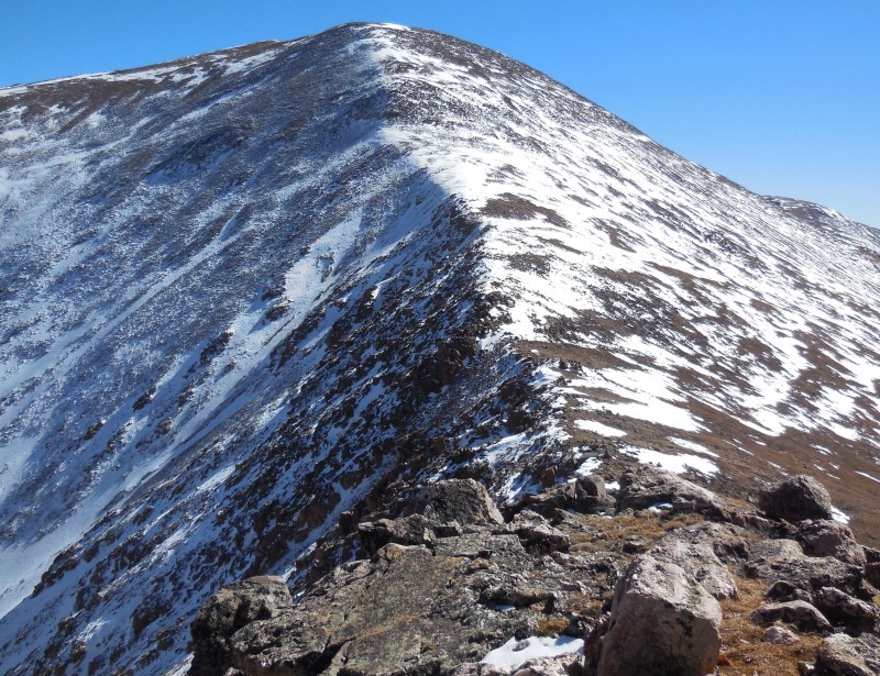
Then I surveyed the ridge route to the next three peaks on the cards.
Agenda for the remainder of the day
The descent from Sheridan was steep and direct and most of the snow fields adorning the slope could be avoided by staying on the ridge crest.
Starting down the ridge
Looking back at Sheridan
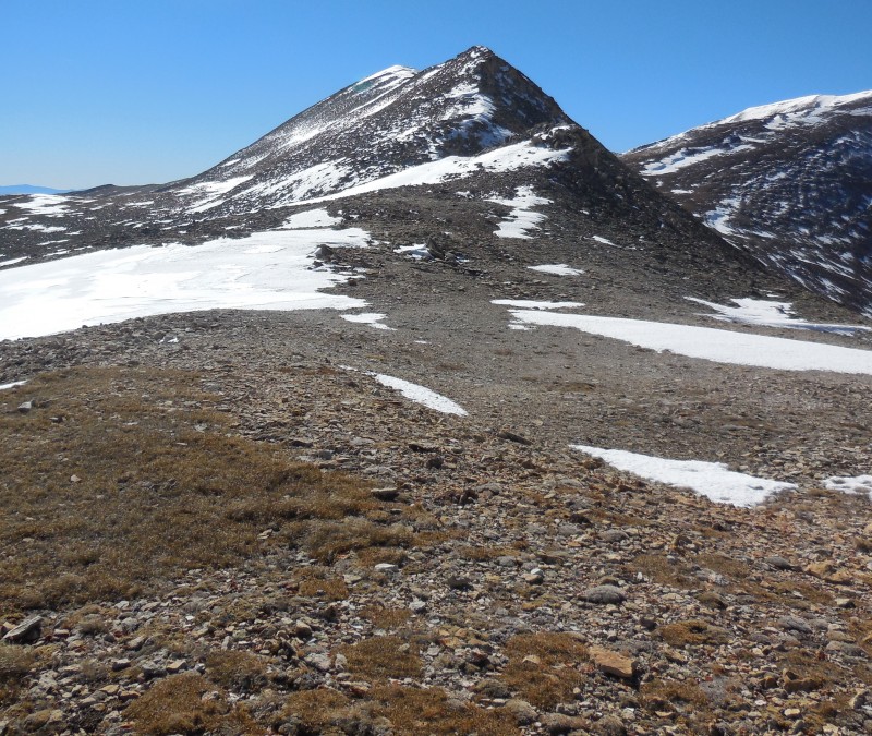
Much like Finnback, Peerless also isn't ranked but is probably mostly traversed only because it's on the connecting ridge between two more prominent peaks.
Peak without Peer
The two hundred vertical feet from saddle to summit came quickly and soon I was on the saddle to Horseshoe looking back at the two peaks I'd just visited and reflecting on the progress.
Two down, two more to go...
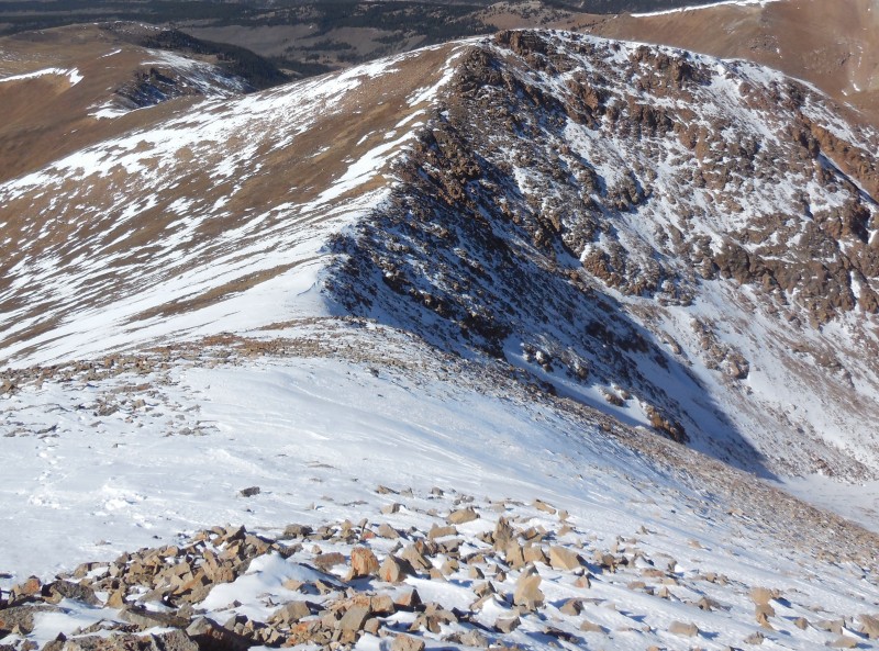
The weather forecast for the day had called for winds from 5 to 15 mph but they were on the lower end of that range - a welcome contrast compared to my last visit to this very station. So maybe my own conditions weren't the best but at least the weather was complying so I took advantage, scanned the route ahead to the highest peak of the day and marched on.
Studying Horseshoe
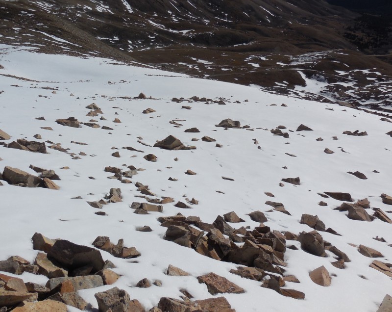
The terrain up Horseshoe's broad northeast ridge was more of the same, but my pace had slowed as swallowing large quantities of air produced a none-too-comforting burning sensation in my throat.
En route to Horseshoe
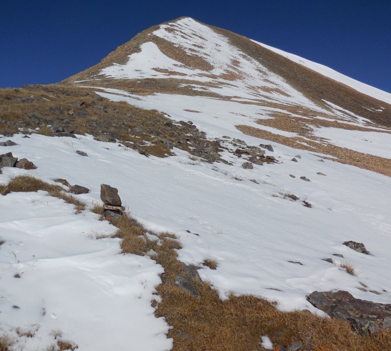
Finnback was the last thing on my mind as I labored up the 700 foot climb from saddle to the broad flat summit.
Last stretch to almost 13.9K'
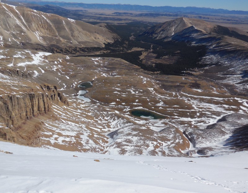
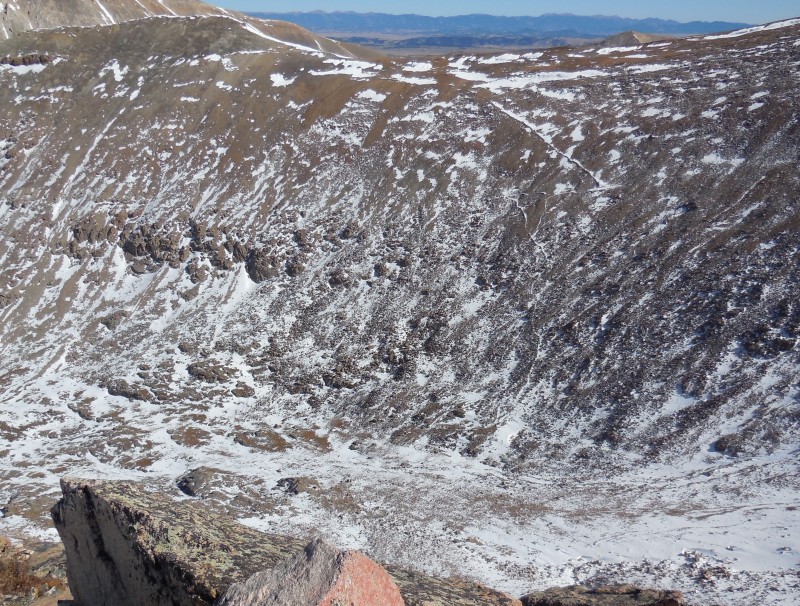
Peering down Horseshoe's large namesake cirque was the reward for the hard work.
Horseshoe's Cirque
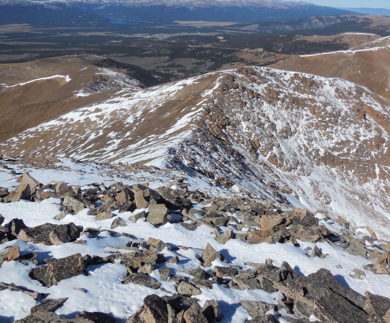
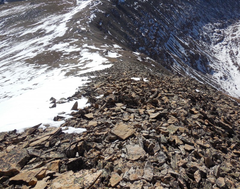
I surveyed the ridge route I'd taken so far. Ridge traverse
It was time to go check on the traverse to Finnback Knob. The winds had now picked up as I made my way back down Horseshoe's broad mesa to locate where the ridge to Finnback connected. I peered down the steep ridge at the mixture of bare talus and snow and started to run some estimates in my head - 30 minutes to saddle, 15 to Finnback, 15 back to saddle and then a grueling 45 minute slog back to Horseshoe...settled then, I think I'll just have to come back another day.
I'll have to come back for this...
After all, I said to myself, I'd already climbed three peaks, so I had nothing to be ashamed of. I turned around and started walking back up the slope when it dawned on me that if all I'd wanted to do was to climb Finnback I could've chosen one of the easier ascents. I chose this path to make it just that bit more challenging and here I was, backing away from it. I was going to climb that knob if it was the last thing I did, so I turned around again to tackle my nemesis, hoping that it wouldn't be the last thing I did.
No, wait...
The six hundred foot drop occurs in less than a third of a mile and patchy snow conditions meant care needed to be exercised to avoid any mishaps on this descent. Even with that approach, the descent went down (no pun intended) in just over 20 minutes.
From the saddle, Finnback's summit rises less than 150 vertical feet, well below the 300 feet of prominence required for a rank in this state of geological giants.
That's the knob I almost didn't make?
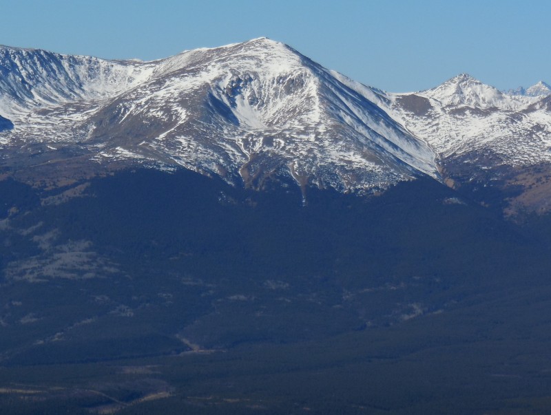
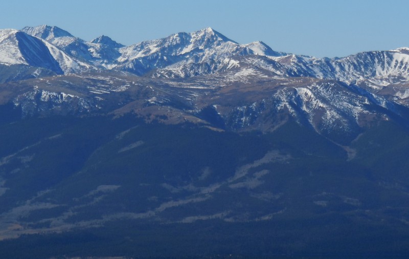
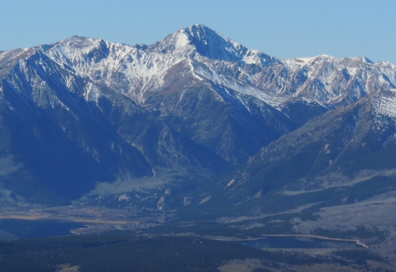
So, a knob it is, but one with great views. To the southwest, Sawatch peaks bask under sunny autumn skies.
Shapely Huron
La Plata in all her majesty!
To the east and much closer, the impressive Empire amphitheater is cradled between Finnback and the ridge connecting Sheridan to Horseshoe.
Empire Amphitheater
Making Finnback's none-too-lofty summit had invigorated me for the final ascent that I'd dreaded, and I dispatched this in the same time it took for my descent.
The final ascent
For the return trip I took the standard east slopes trail from the saddle between Horseshoe and Peerless. Pumped from the successful venture, I rewarded myself with a short but sweet glissade.
That's one way to celebrate
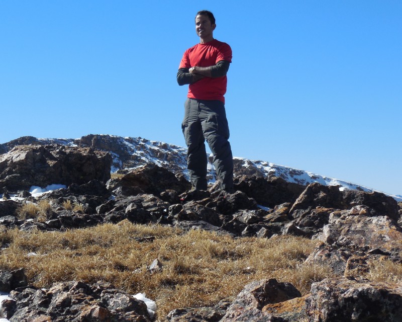
Of all the battles we fight, the toughest ones are with the demons within us.
Yours truly
My GPS Tracks on Google Maps (made from a .GPX file upload):
The BMs( right?)
Frasco BM
Sayres BM
White BM
Prize BM
Buckskin BM
Coney BM
Black BM
Cow BM
Kendall BM
Cuba BM
The plausibly rude:
Booby Prize
Dicker's Peck
Iron Nipple
The trying-too-hard:
Sun dog
Hardrocker
The weird:
Baldy no es cinco
Lackawanna
Van Wit
Point Pun
Cupid
Northwest Pole
Coffeepot
Kismet
Lo Carb
Tundra Top
I'm excluding diminutives of parent mountain names (Huerfanito, Castleabra, etc) EXCEPT for Lo Carb, which is funny in its own right
Caution: The information contained in this report may not be accurate and should not be the only resource used in preparation for your climb. Failure to have the necessary experience, physical conditioning, supplies or equipment can result in injury or death. 14ers.com and the author(s) of this report provide no warranties, either express or implied, that the information provided is accurate or reliable. By using the information provided, you agree to indemnify and hold harmless 14ers.com and the report author(s) with respect to any claims and demands against them, including any attorney fees and expenses. Please read the 14ers.com Safety and Disclaimer pages for more information.
Please respect private property: 14ers.com supports the rights of private landowners to determine how and by whom their land will be used. In Colorado, it is your responsibility to determine if land is private and to obtain the appropriate permission before entering the property.