Download Agreement, Release, and Acknowledgement of Risk:
You (the person requesting this file download) fully understand mountain climbing ("Activity") involves risks and dangers of serious bodily injury, including permanent disability, paralysis, and death ("Risks") and you fully accept and assume all such risks and all responsibility for losses, costs, and damages you incur as a result of your participation in this Activity.
You acknowledge that information in the file you have chosen to download may not be accurate and may contain errors. You agree to assume all risks when using this information and agree to release and discharge 14ers.com, 14ers Inc. and the author(s) of such information (collectively, the "Released Parties").
You hereby discharge the Released Parties from all damages, actions, claims and liabilities of any nature, specifically including, but not limited to, damages, actions, claims and liabilities arising from or related to the negligence of the Released Parties. You further agree to indemnify, hold harmless and defend 14ers.com, 14ers Inc. and each of the other Released Parties from and against any loss, damage, liability and expense, including costs and attorney fees, incurred by 14ers.com, 14ers Inc. or any of the other Released Parties as a result of you using information provided on the 14ers.com or 14ers Inc. websites.
You have read this agreement, fully understand its terms and intend it to be a complete and unconditional release of all liability to the greatest extent allowed by law and agree that if any portion of this agreement is held to be invalid the balance, notwithstanding, shall continue in full force and effect.
By clicking "OK" you agree to these terms. If you DO NOT agree, click "Cancel"...
Grabbing The Unicorn by its horn, and searching for its rainbows
Day 1: Montezuma Peak, "The Unicorn", Summit Peak
Trailhead: End of FS 380 (2WD)
Mileage: 7.7
Elevation Gain: 3,209'
Parnter: Solo
Cameras: Canon EOS-M, 1946 Leica IIIc (B&W, except 2 images)
I have been wanting to hike "The Unicorn" for a couple years now. It's one of the few 13ers with a really unique name. But it's in the middle of nowhere on long dusty dirt roads, 7 hour drive from home, so it always seemed to get pushed off the docket. Till this past weekend, finally. The mileage and elevation gain on these peaks is pretty low, considering, and with my recovery rolling along nicely (and very quickly by everyone's judgement), I figured these peaks would make a lovely intro back into the 13er game. Since the 13er game usually entails no trails, game trails and the occasional random trail popping out of nowhere, bushwacking, scree swimming, talus that doesn't get trod often, and a variety of other terrain that will put my weak ankle through it's paces. 2 months of immobile ankle does not lead to great strength when it comes to stability! But I've been hitting the PT as hard as I can, so hopefully by shortening the mileage and gain, I can complete my objective of 5 peaks in 2 days!
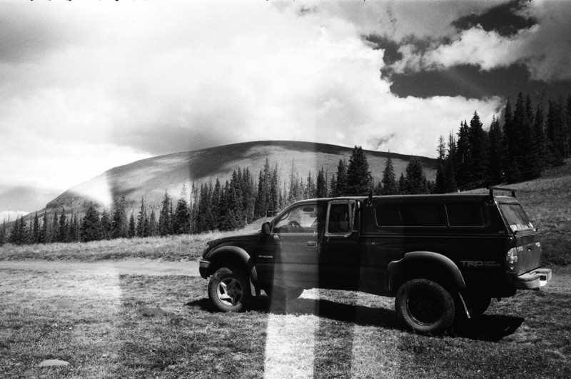
I decided to approach the peaks from the east on FS 250, and then onto FS 380. A long and dusty road, but an easy 2WD. I spiffed up my truck after a while of non-use (clutch + broken leg => disaster), so I was hoping that tomorrow I would at least be able to put my truck into 4WD! Arrived at the TH at 9pm, and quickly made dinner and crawled into the back of my truck for a nice rest on a newly installed mattress. Yup, a twin mattress is the new addition this year - Posh!
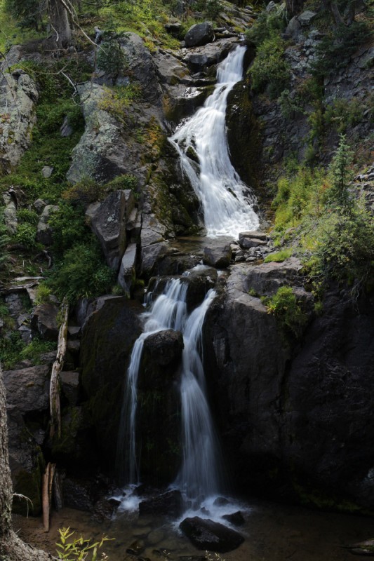
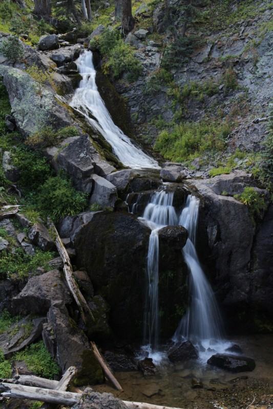
I wait for civil twilight the next morning, as my headlamp died a few moments after turning it on. The weather forecast looked like typical September stable with no storms probable. I was pretty excited to get on the trail of new peaks after a 3 month, 11 day hiatus. Amusingly, I didn't make it very far up the locals trail before hearing a unique gushing sound coming from the nearby stream... a Waterfall!!! Or as my solo whimsical self began calling them: Unicorn Rainbows! So much for a quick start to the day!
Unicorn Rainbows!!! More Unicorn Rainbows!!! Fuzzy Unicorn Rainbow
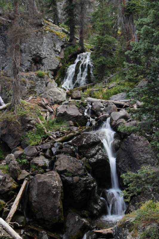
I only saw 2 waterfalls on the way up, and decided that photographing the first one could be done on the return. I didn't realize that there were more! But my primary objective today was peaks, not photography - so upwards! Quite the change for me, since up until last weekends altitude test on Sniktau and Quandary, I've been wandering the hot desert going to 6 National Parks and 4 National Monuments with just my tiny board shorts, tank top, flippy floppies and a camera bag with some mineral water. Such a let down to have to wear regular hiking clothing and a real backpack again... Oh well!
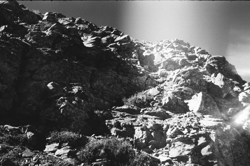
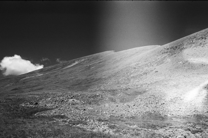
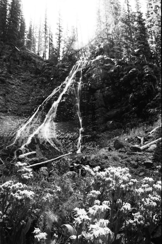
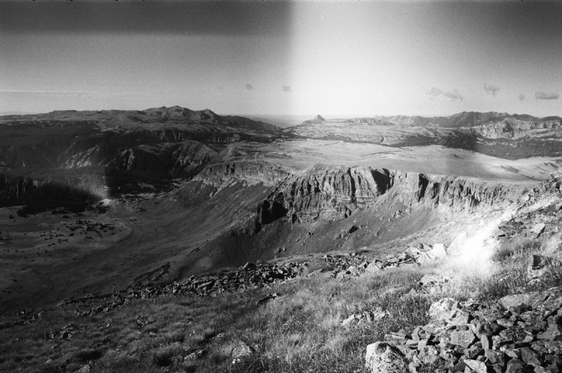
Part of my mental therapy these past few months, has been learning how to use my Leica camera. It would seem that I have been loving it to a bit of a strain. Many of the images are contaminated by a light leak or 3. I knew about the light leak flare on the upper left, but the streak down the center and other leaks are new. I guess as I heal and get back at it, my Leica will have to go into the camera shop for some TLC!
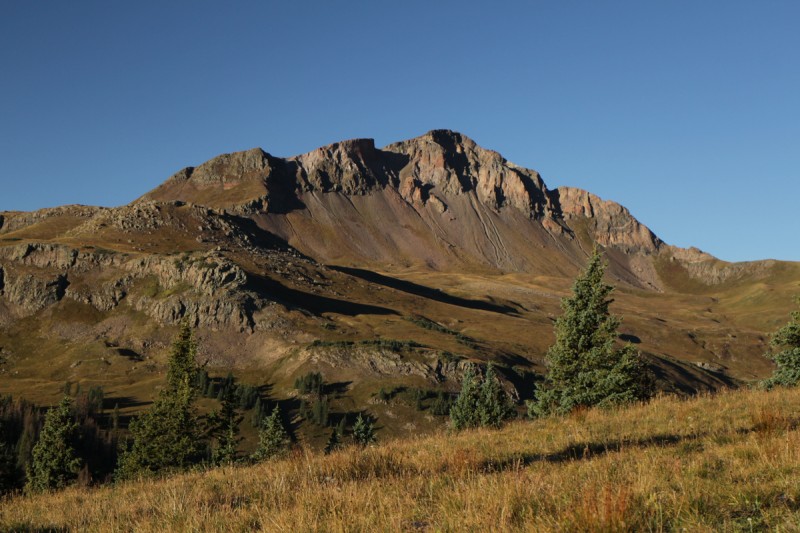
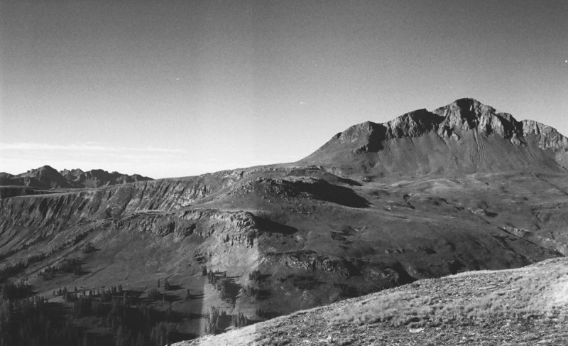
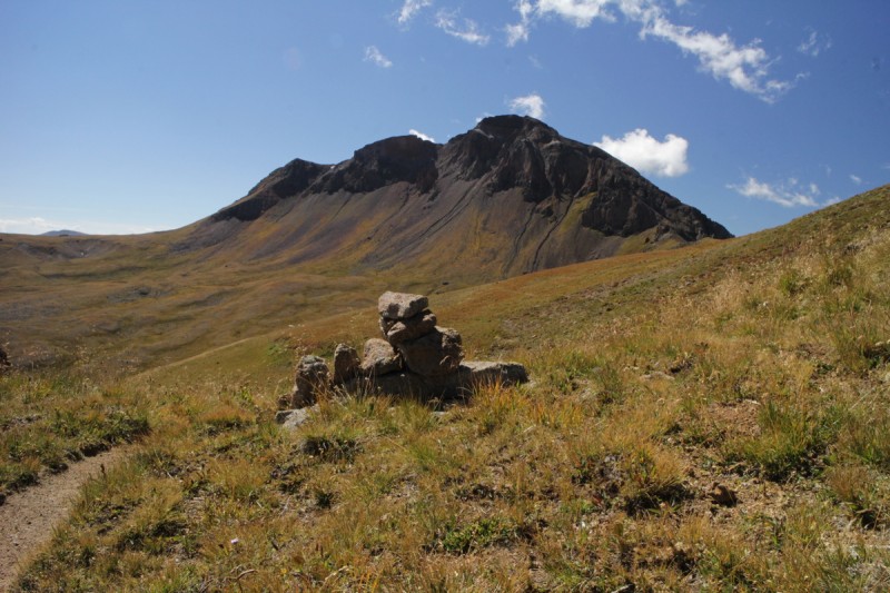
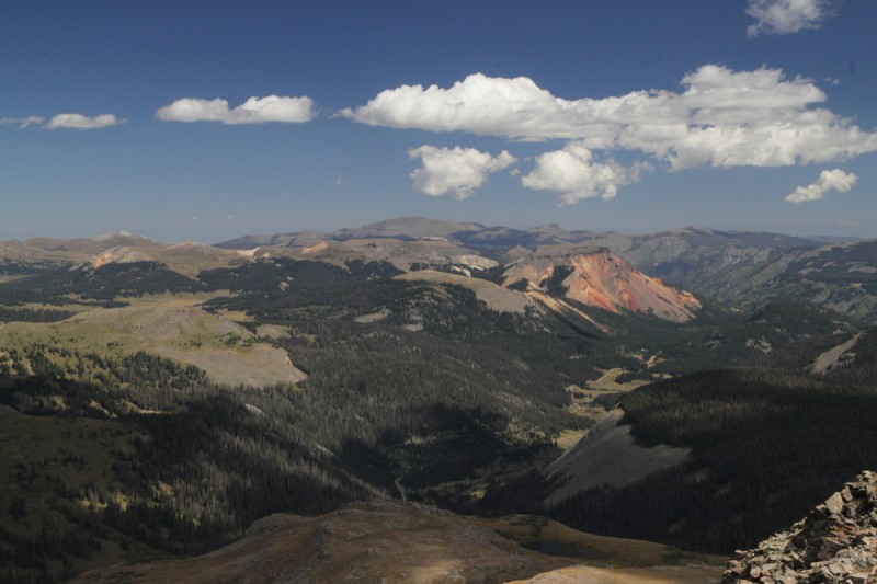
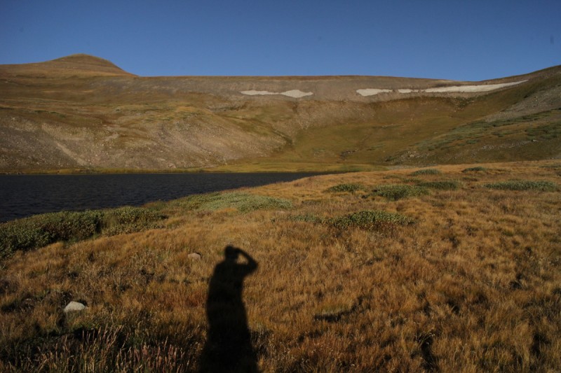
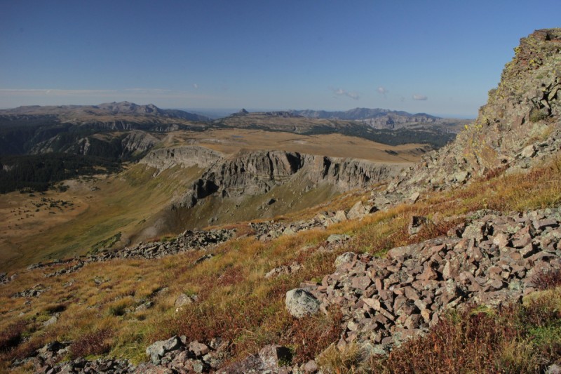
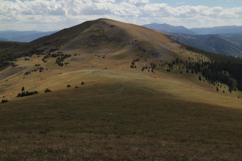
Treeline came quickly and I decided to beeline it up the steep slope above, instead of contouring further up drainage. My way entailed loose dinner plate talus, where going further up meant steep grass changing to less steep grass the further up you go. Must be my rusty 13er skills, but I got up the slope either way. The views of Summit Peak are stellar. The Unicorn looks interesting, and Montezuma... well there's the revenge - a nasty steep scree slope to swim up. Uggg. At least the view was nice from the top of my first new 13er in a while!
Summit Peak Summit Peak Montezuma Peak from the east The Unicorn with the CD trail Scree slope up Montezuma Peak - ascent on left Montezuma summit pano
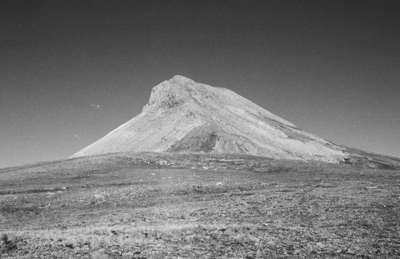
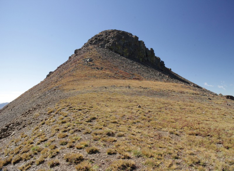
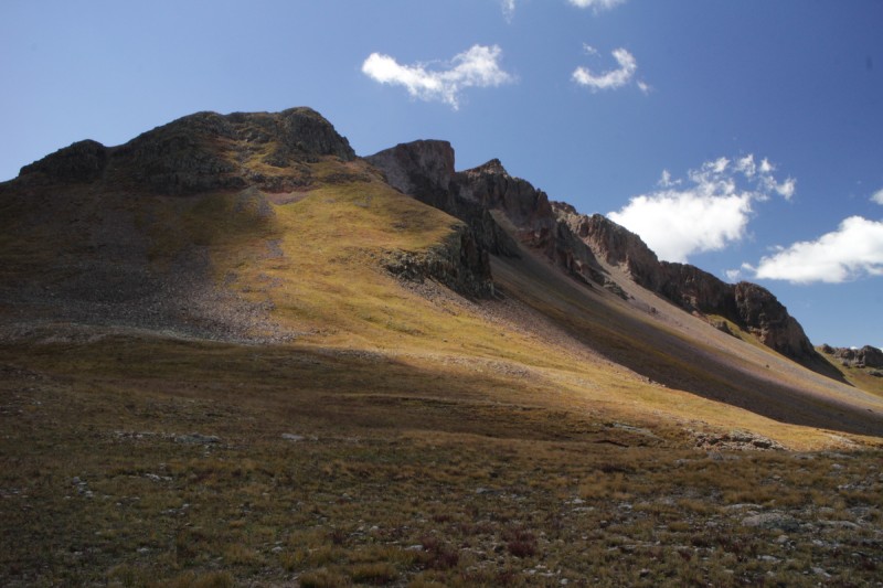
Only spent a short time on the summit of Montezuma before plunge stepping and carefully descending the scree slope. The way up The Unicorn was still under debate in my head. Figured I would make the decision as I got closer. With me not hiking 13ers in quite a while, my usual 13er skills of finding the most efficient route seemed to be a bit rusty. I couldn't seem to figure out slope angles, and The Unicorn looked like another steep scree ascent. But as I got closer, I saw that it wasn't so bad. So I did an ascending traverse, avoiding the false summit of the Unicorn's a??.
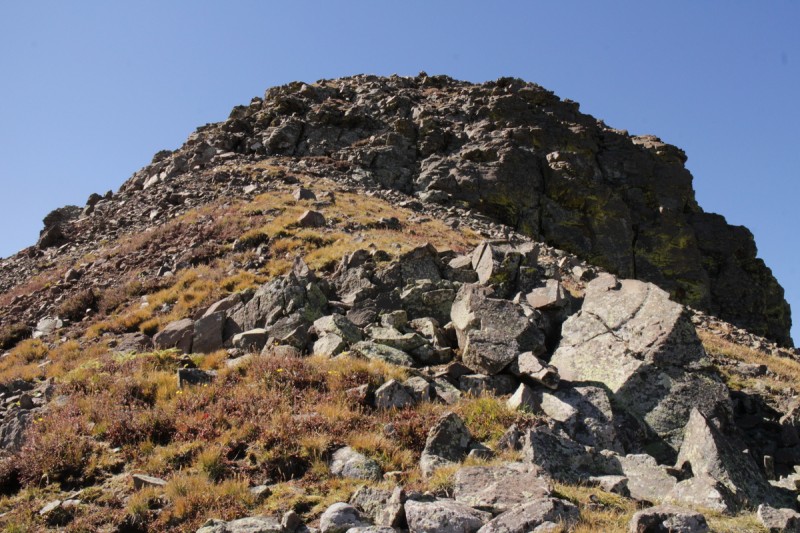
I was also debating the final summit push. Was there class 3 involved? I know Furthermore can sandbag things from time to time. But as I got closer, I could see a very easy class 2 route up.
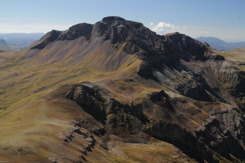
On the summit I was treated with an incredible view of the north face of Summit Peak. Worth the trek for sure! Better yet, I got to sign the register in pink ink using a My Little Pony pen. Since how else can you sign a register for "The Unicorn"?
Route up Unicorn Montezuma Peak Riding The Unicorn Approaching The Unicorn's horn No scramble up the horn Summit Peak looking grand Signing the register of "The Unicorn" with a pink My Little Pony pen: Priceless!
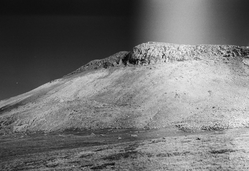
A minor class 2+ (barely +) descent off of The Unicorn placed me back on the CD trail that would take me around to the easier side of Summit Peak. The trail is difficult to follow at points, since the grass has grown over it. Only missed it by a little in a few places, but keep that in mind and always scan ahead for other segments.
The ascent up Summit is a fairly steep grassy slope. At least the grass tufts acted kinda like steps in places!
Other side of The Unicorn CD Trail to Summit Peak The gentle south slope of Summit peak Grassy summit hike
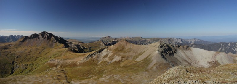
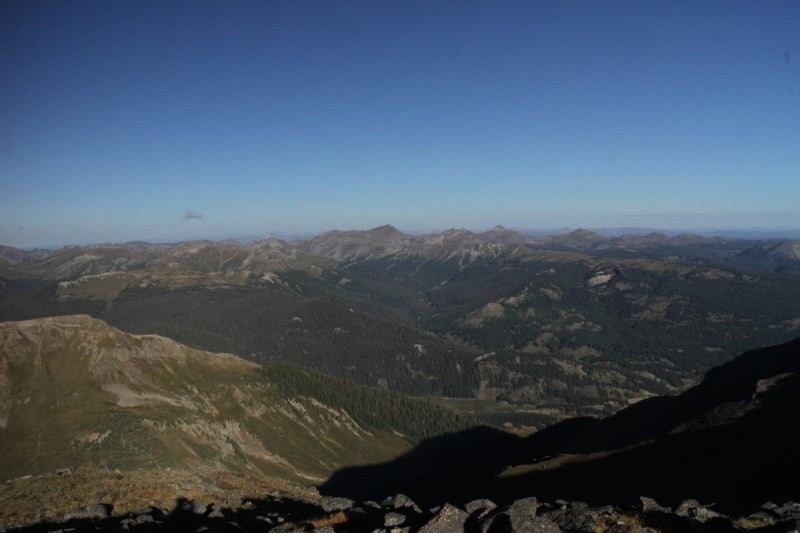
Soon I was on the top of my 3rd 13er for the day. Felt great to be back at it, and enjoying a view that I hadn't seem before. It's why I am enjoying the 13er list, it forces me to go to places I may not have otherwise have gone to. Quite the solo experience out here as well. Not many people signing registers, though Summit is more popular being a County High Point. I wanted to stay for a long time, but I had a lot of elevation to descend and another trailhead to find. Plus more Unicorn Rainbows to photograph!
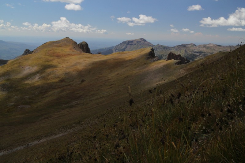
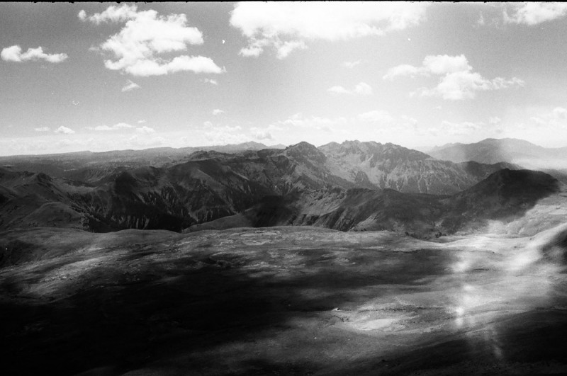
View south Looking at The Unicorn and Montezuma down the rugged north face of Summit Tomorrow's objective #2 Bennet Peak Cloud shadows on Summit Peak The Unicorn and Montezuma
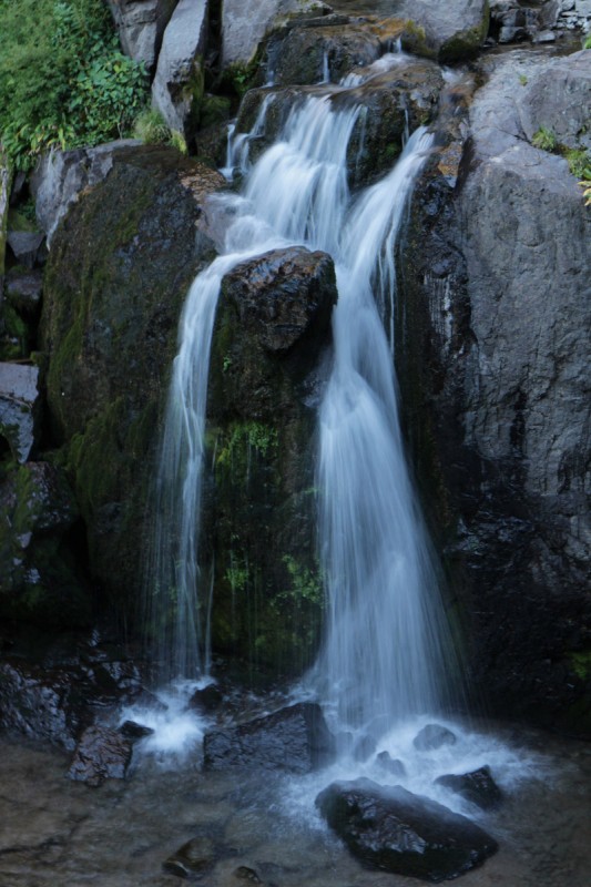
I had been debating all day whether or not to take the Treasure Creek trail. It looked like it added on considerably more mileage and plopped me down into a boring flat valley. The pull of the Unicorn Rainbows was overwhelming. So when I lost the "trail" and couldn't see where to aim anymore, I bailed on it. For me it was a brilliant decision, since I found more Unicorn Rainbows than I did that morning. The furthest one up drainage, #5, was a bit of a surprise, but it gave off it's tell tale song that I could hear from a short distance away. I was sad that I forgot my ND filter, as the sun was bright and I couldn't use the Leica for the shot.
It was then a longer stretch to my favorite Unicorn Rainbow, and I spent some time photographing it again. Lower down I discovered another one that I had missed on the way up. This one involved crossing the stream on a log to get closer. Quite worth it! Can't believe they put the trail up the other stream valley. Treasure creek? Ha!
Trailhead: Tobacco Lake TH off FS 100 (high clearance 4WD)
Mileage: 6.3
Elevation Gain: 1,760'
Parnter: Solo
Cameras: Canon EOS-M, 1946 Leica IIIc (B&W)
After getting back from the trek up The Unicorn and friends, I pack up the truck for another dusty ride. Back to FS 250 for the long but leafy colorful drive past Platoro and onto FS 100. It starts off a nice 2WD, but as the road ascends up the massive bulk of Conejos Peak, it get rougher. A 2WD can make it to the lower trailhead, but no further. After the 100 105 split, the road proceeded to get very rough. There's another trailhead at a large switchback, but it was filled with horse trailers, so I continued on. Beyond that, the road gets rather narrow and rougher. I see a sign pointing to Tobacco Lake Trailhead, a bit sooner than I was expecting, but it is the correct way (as opposed to the trails illustrated map version). This road is especially rough and takes it to the high clearance 4WD realm, as you need to get your tires in the correct spot.
I cook up my Paleo dinner and watch a pleasant sunset. A few bow hunters descend the trail, just as civil twilight is ending. So be hunter aware!
As soon as civil twilight begins, I'm on the trail. It's a fairly flat trail until after Tobacco Lake, then it's a fairly straight forward ascent up the ridge to the summit. There are quite a few trails, old and new, in the area. I essentially followed the old one, as it was more straightforward. The views on the summit made up for the easy/boring nature of the trail itself. But as I had a 2 hour drive ahead, I couldn't relax for too long. At least the trail made it easy breezy to go quickly (well as quick as I can go right now)
Conejos Peak with Tobacco Lake in front Hey look snow! Should brought the skis! ;) Summit view View of Summit, The Unicorn and Montezuma Next objective: Bennet Peak Another view south of some rugged peaks
I approached from the town of Jasper to the south. The road from the start is rough 4WD. Once past the town itself, the road turned into a narrow and incredibly steep and rocky trail. I had to put it into 4WD Low just to make it up a really steep loose section. I then had 5 miles of 'I hope I don't meet anyone else on the road' half hour.
From the top of Blowout Pass (aptly named, since those rocks could blowout your tires if you don't know how to off-road), it was a simple jaunt up an ATV trail or as I did, a gentle tundra stroll to the broad summit area. The views were good, but the clouds had begun, so I didn't stick around too long. Not the most exiting peak, but it's also a county high point, so there's that appeal. Frankly, the drive was the best part.
My truck on Blowout Pass with Bennet Peak behind View of Conejos, Summit, The Unicorn and Montezuma Sheep Mountain and coming down the gentle slope of Bennet
Back at the pass, I debated which way to go from the pass. Return to Jasper, or explore the north deproach. Figured the 4WD section on the north side was shorter, so then I wouldn't have to worry as much about meeting another vehicle. Much easier 4WD road. Still high clearance and I did crawl in 4WD Low till about the big switchback, but it got easy quickly. A 2WD vehicle could make it to the 4WD section no problem (~11.4 - 11.6K). Only adds about a mile RT and ~500' of elevation gain.
Recovery
Many have remarked on my quick recovery and return back to hiking and soon to be climbing (rocked the 2nd Flatiorn last night!). You're not alone, my Doctors and Physical Therapists are also amazed. They call me a fast healer. I know most of you have heard this before, but I can attribute my fast recovery to the Paleo diet/lifestyle. Without it, I would still be recovering on the couch or just barely starting to hike flat trails again. The amount of inflammation that should have occurred, didn't. I rebuilt bone quickly. My muscle mass has returned. I almost have 100% motion back in my ankle, just a degree to go in one direction, the others movements are already back. I may not be as fast as I was last year, but I'm currently faster than I ever could dream of - pre paleo. I know I sound like a broken record, but unless everyone calls you a "beast" in the mountains, you too can benefit from cutting out the processed foods, carbs and sugar.
My GPS Tracks on Google Maps (made from a .GPX file upload):
.. you out and about again! If I knew you were healing that quickly, I would've asked for a climbing date this past week. Am flying back home tonight. Has been a difficult summer for finding good days to hike, but still got some great ones in. Maybe next year! :D
...like you're back in business pickin' 13ers like cherries! Best testimony yet for the paleo diet. BTW, those waterfall shots are quite ”unicorn”ish - ethereal even.
Johnson - Only a matter of time, glad it was as short as I could make it.
Brian - Finding those rainbow unicorn images was a nauseating process...
Vicki - Can't wait to hike with you again, or maybe bike something really easy
Nat - The waterfalls were a special treat. I thought about this Unicorn photo, but thought it a bit much
MtnHub - I didn't quite know things were going to go until after my altitude test. Looking forward to next year!
rajz06 - Running out of season for too many more 13ers, but these were sweet! I am the walking billboard for Paleo - I used to be weak and slow
quackquackcolorado - Considering water falls on The Unicorn, runs down this particular stream... what else could I call them? Haha
TravelingMatt - Guessing, the name above mine in pink :wink: I must bow to your superior knowledge on My Little Pony. I left my collection with my Mom, so I've been out of touch with my previous 8yr old self :P I do remember having a pegasus too, just don't remember which.
Monster5 - Playing photographer for 2 months has been fun and quite useful. I now understand my EOS-M a whole lot more!
Great photos of waterfalls- it's not often you see those on hikes.
p.s. I think this Unicorn photo is missing in this TR :)
Caution: The information contained in this report may not be accurate and should not be the only resource used in preparation for your climb. Failure to have the necessary experience, physical conditioning, supplies or equipment can result in injury or death. 14ers.com and the author(s) of this report provide no warranties, either express or implied, that the information provided is accurate or reliable. By using the information provided, you agree to indemnify and hold harmless 14ers.com and the report author(s) with respect to any claims and demands against them, including any attorney fees and expenses. Please read the 14ers.com Safety and Disclaimer pages for more information.
Please respect private property: 14ers.com supports the rights of private landowners to determine how and by whom their land will be used. In Colorado, it is your responsibility to determine if land is private and to obtain the appropriate permission before entering the property.


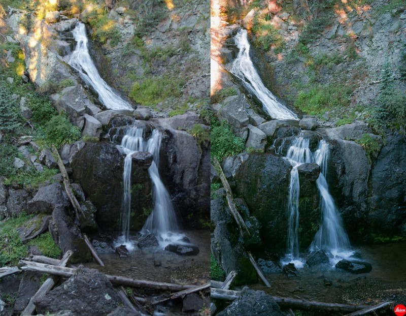
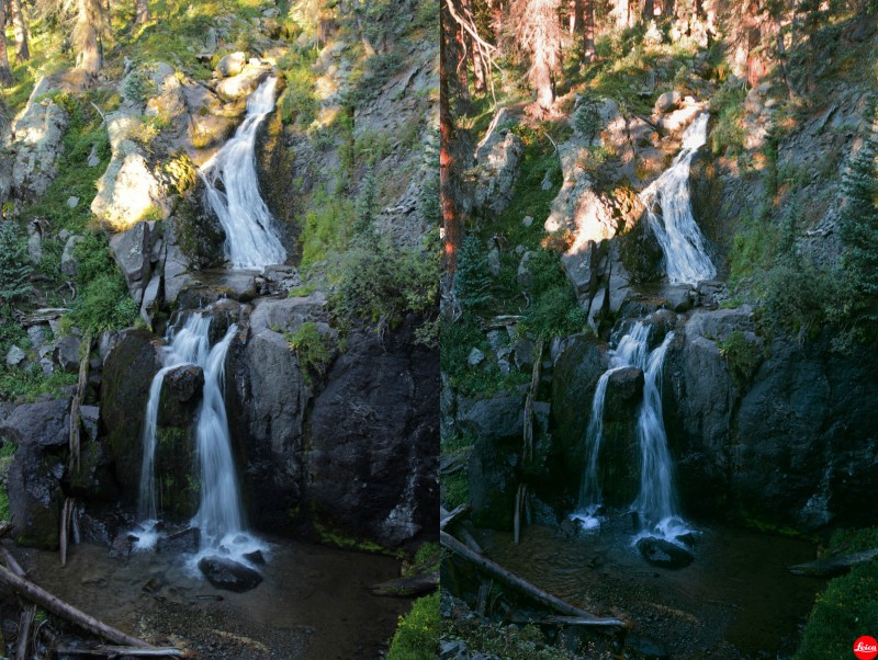


 Unicorn Rainbows!!!")
 More Unicorn Rainbows!!!")
 Fuzzy Unicorn Rainbow")
 Summit Peak")
 Summit Peak")
 Montezuma Peak from the east")
 The Unicorn with the CD trail")
 Scree slope up Montezuma Peak - ascent on left")
 Montezuma summit pano")
 Route up Unicorn")
 Montezuma Peak")
 Riding The Unicorn")
 Approaching The Unicorn's horn")
 No scramble up the horn")
 Summit Peak looking grand")
 Signing the register of")
 Other side of The Unicorn")
 CD Trail to Summit Peak")
 The gentle south slope of Summit peak")
 Grassy summit hike")
 View south")
 Looking at The Unicorn and Montezuma down the rugged north face of Summit")
 Tomorrow's objective #2 Bennet Peak")
 Cloud shadows on Summit Peak")
 The Unicorn and Montezuma")
 Unicorn Rainbow #5")
 It's still summer...")
 Unicorn Rainbow #3")
 Unicorn Rainbow #3")
 Unicorn Rainbow #2")
 Unicorn Rainbow #1")
 Conejos Peak with Tobacco Lake in front")
 Hey look snow! Should brought the skis! ;)")
 Summit view")
 View of Summit, The Unicorn and Montezuma")
 Next objective: Bennet Peak")
 Another view south of some rugged peaks")
 My truck on Blowout Pass with Bennet Peak behind")
 View of Conejos, Summit, The Unicorn and Montezuma")
 Sheep Mountain and coming down the gentle slope of Bennet")


