| Report Type | Full |
| Peak(s) |
Uncompahgre Peak - 14,318 feet |
| Date Posted | 08/12/2014 |
| Modified | 08/13/2014 |
| Date Climbed | 08/04/2014 |
| Author | Greenhouseguy |
| Additional Members | doggler, SenadR |
| Uncompahgre: Paradise in the San Juans |
|---|
|
Uncompahgre Peak 14,309 Feet (6th Highest in Colorado, highest in the San Juan Range) South Ridge From the Upper Nellie Creek Trailhead Trailhead Elevation: 11,400 Feet 7.25 Miles Roundtrip Approximately 3,000 Feet Elevation Gained Class 2 August 4th, 2014 Partner: SenadR Fellow Travelers: Doggler, Don Nelson Uncompahgre: Paradise in the San Juans Uncompahgre Peak is the undisputed monarch of the San Juan Range. Its 4,278 feet of prominence ensure that it can be seen for many miles, and the rugged volcanic cliffs on its unique summit massif make it easy to identify. Its name is derived from the Ute Indian words that mean "red lake" or "hot water spring." When the Utes were exiled to Utah's Uintah Reservation in 1874, the U. S. government sent the Hayden Survey team into the San Juans to map the area. The sheer cliffs intimidated the survey team, but they were relieved to find that the summit was much more accessible than they had initially believed it to be. When they reached an elevation of about 13,000 feet, they were shocked to see a mother grizzly and her two cubs charging down the slopes. Grizzlies have not been seen in the area since 1979, but many hikers are still pleasantly surprised to find that the summit is not overly difficult to reach. 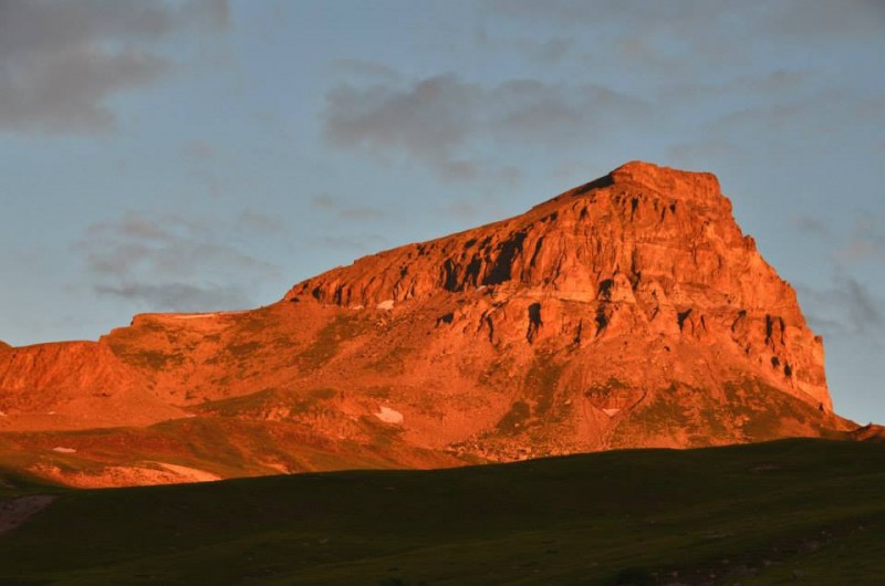 Uncompahgre Peak in the alpenglühen (seen from the east; image by SenadR) Suffice to say, Uncompahgre is a long drive from the Metro Denver area. Hikers may choose to find lodging in Lake City, or can look for primitive camping spots near the trailhead. There are several good camping spots along Engineer Pass Road (also known as Henson Creek Road), and a few more along the first stretch of Nellie Creek Road past the lower trailhead. Warning: even the first hundred yards of Nellie Creek Road requires high-clearance and/or 4WD! There are pit toilets at the parking area about 100 yards west of the lower Nellie Creek Trailhead. The toilets at the upper trailhead are closed and slated for removal. Sen and I found an excellent spot along the creek about 350 yards west of the lower trailhead parking area. The pullout had enough space for several vehicles, and the camp site had a fire ring and several obvious places to pitch tents. The area was immaculately clean, and we left it as we found it. 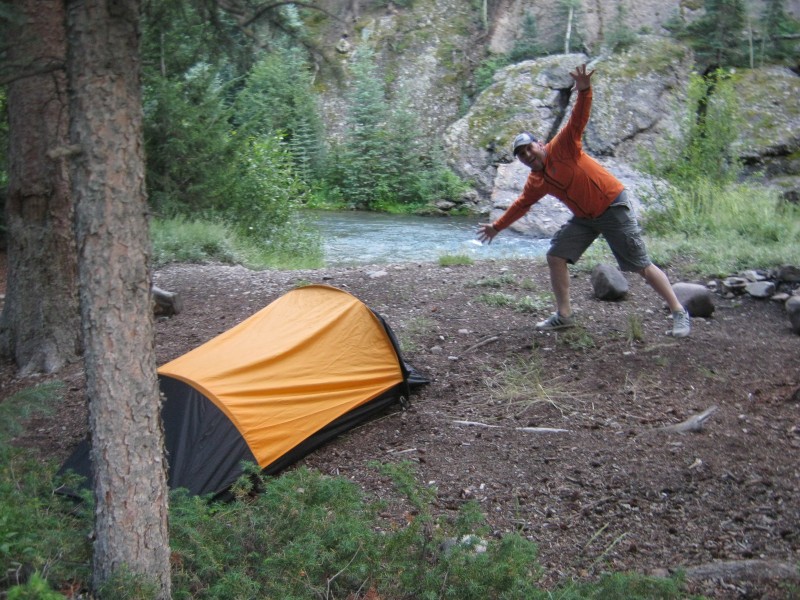 Sen photobombing my shot of the camp site The Nellie Creek Road has a reputation for being one of the tougher routes for accessing a fourteener trailhead, but the reputation is largely undeserved. There are no major rock obstacles like the Lake Como Road has, and the two creek crossings are level and shallow. There was one tight switchback that required 4WD low and is probably easier with a short wheelbase vehicle like a Jeep. Besides that, it mostly involved finding the best path through and between ruts and puddles. Conditions are certain to be more difficult during spring runoff when the road is muddier and the crossings are deeper. Most of the vehicles that made it to the upper trailhead were unexceptional stock 4WD SUVs and pickups. 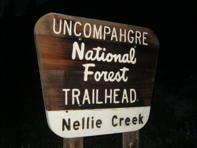 Upper Nellie Creek Trailhead sign We met 14ers.com member Doggler and his hiking partner Don Nelson at the trailhead, and had a nice chat. We hiked at about the same pace, so we had some company on the trail for much of the day. The well-maintained trail was easy to follow even though it was still dark when we started. 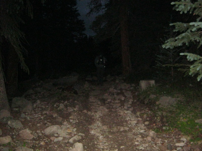 Starting out on Forest Service Trail #239 We signed a trail register and entered the Uncompahgre Wilderness about 50 yards into the hike. The summit came into view just a few minutes later. The ascent was gradual, and stayed that way for most of the route. 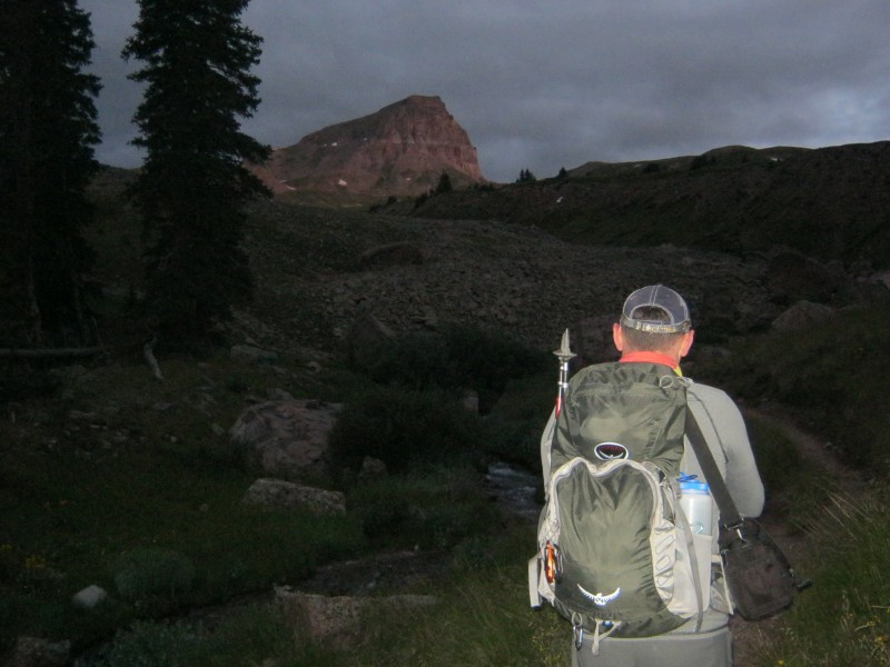 First view of the summit in the dim morning light We hit the first switchback at about 11,850 feet, and passed the junction with the Big Blue Trail at about 11,950 feet. The trail junction is a great spot to take a moment to appreciate the beauty of one's surroundings. 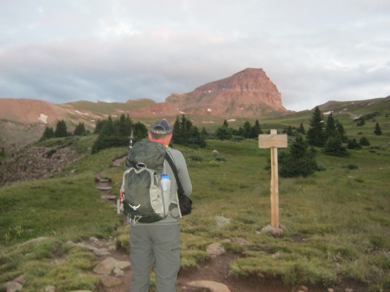 Sen absorbing the beauty of the Uncompahgre Wilderness Our small group proceeded to cross an immense basin full of wildflowers while the summit was bathed in alpine glow. Uncompahgre gets high marks for its natural beauty, and it richly deserves the accolades. 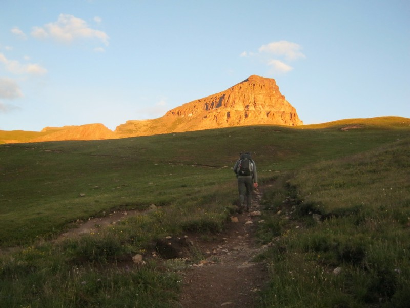 Sen following the track through the basin 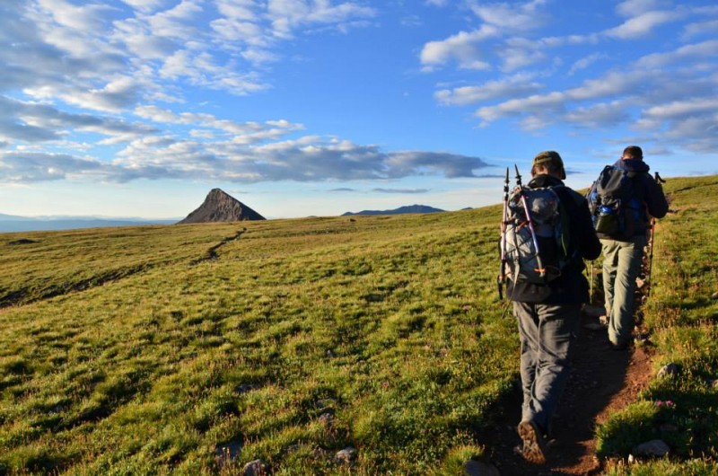 Greenhouseguy (L) and Don Nelson (R) with UN 13,158 sticking up like a shark's fin to the south (image by SenadR)  Another look at UN 13,158 (image by SenadR) The trail passes the junction with the Ridge Stock Driveway Trail at 12,920 feet, and starts to follow the lower portion of Uncompahgre's south ridge. The area to the north of the trail here is protected habitat for an endangered butterfly known as the Uncompahgre Fritillary (Boloria acrocnema). There are plenty of wildflowers in the closed area to provide nectar for the butterflies.  The lower portion of Uncompahgre's south ridge, with the huge swath of protected butterfly habitat to the right  Self-explanatory sign for the butterfly closure area From the lower portion of the south ridge, it is necessary to pass through a series of switchbacks to gain the upper portion of the ridge. The switchbacks lead to the crest of the ridge at 13,800 feet. The view of the San Juans is remarkable from the ridge crest; it's a good spot to take a moment to soak in the scenery.  Greenhouseguy on the south ridge's first switchback (image by SenadR) The terrain changes from tundra to talus when the trail on the south ridge crosses over to the west face. The basin below the west face is lovely, but the rocks above present the biggest challenge of this hike.  Sen on Uncompahgre's west face The upper portion of the west face is the crux of the route. Short sections of trail wind through 150 feet of steep talus. There is little exposure, and the route does not exceed Class 2+ if you stay on-route. If not for this short section, the entire route would probably rate Class 1. 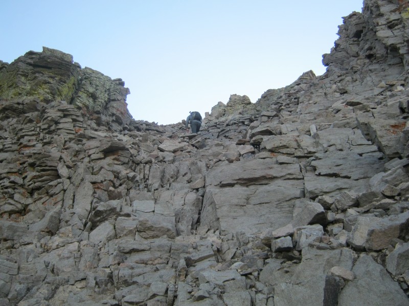 Sen climbing a talus staircase The hard work on the west face leads to another short section of trail on the south ridge. The summit plateau is just above this short section. 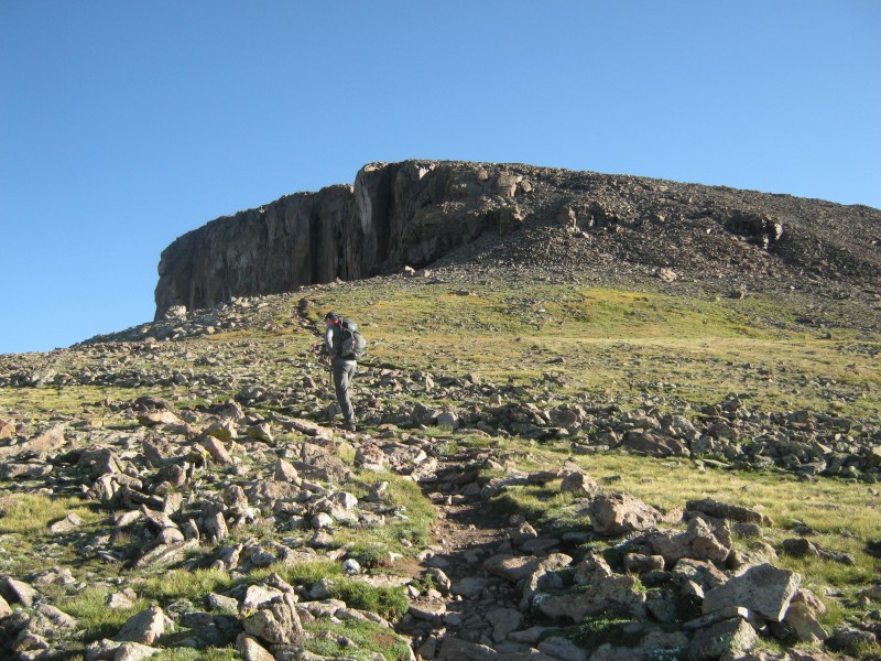 Sen on the south ridge approaching the summit plateau A gentle rocky slope leads from the south ridge to the summit plateau. 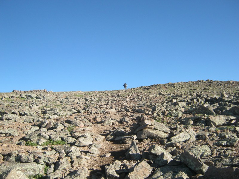 On the rocky slope below the summit plateau Like Longs Peak, Uncompahgre has a large, flat summit big enough to play football on. There are several high points on the plateau, but the true summit is all the way to the north. 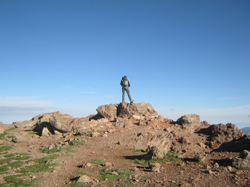 Sen on one of the high points 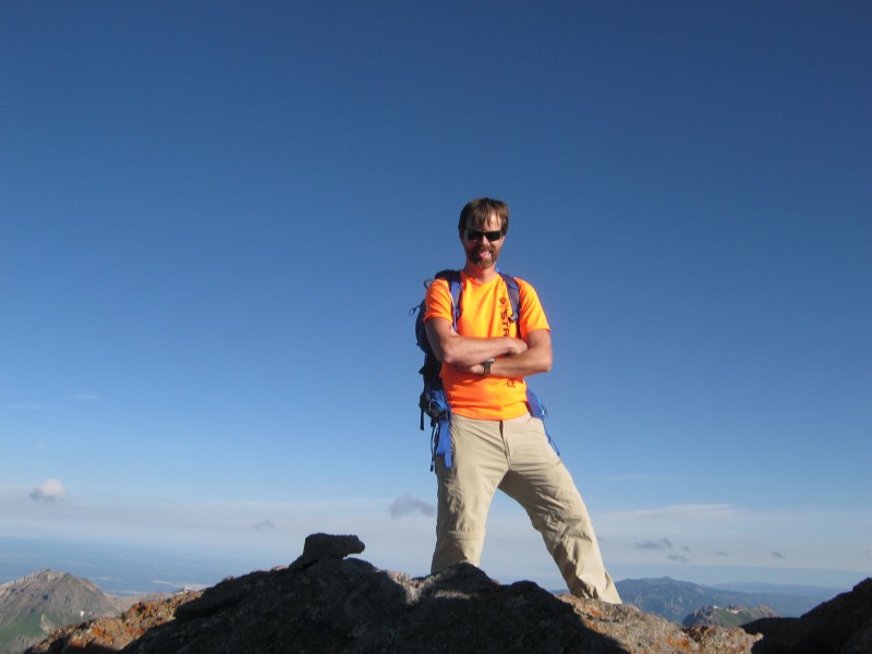 Shawn (Doggler) topping out  Don getting used to the idea of being 12 inches away from 700 feet of exposure The exposure on the north face of the summit is absolutely horrific. You could drop a pebble straight down and it wouldn't hit anything for 700 feet. If a person ever fell from this summit, it would take a spatula and a sponge to recover the remains. Use extreme caution when posing for that epic north face summit shot!  Peering over the edge of the north face Of course, the views were incredible in every direction. There are 250 thirteeners in the San Juans - that's more than twice as many as any other mountain range in Colorado. They seem to go on endlessly, seemingly untouched by man. Uncompahgre is a very special place, tucked within a very special region. 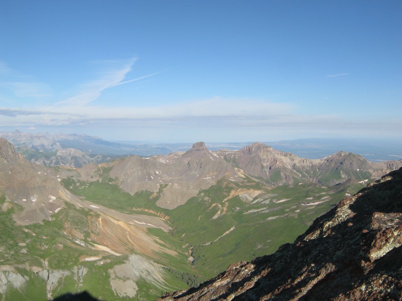 (L to R) Thirteeners Coxcomb, Redcliff, and Fortress Peaks viewed from Uncompahgre  Beautiful valley below the summit 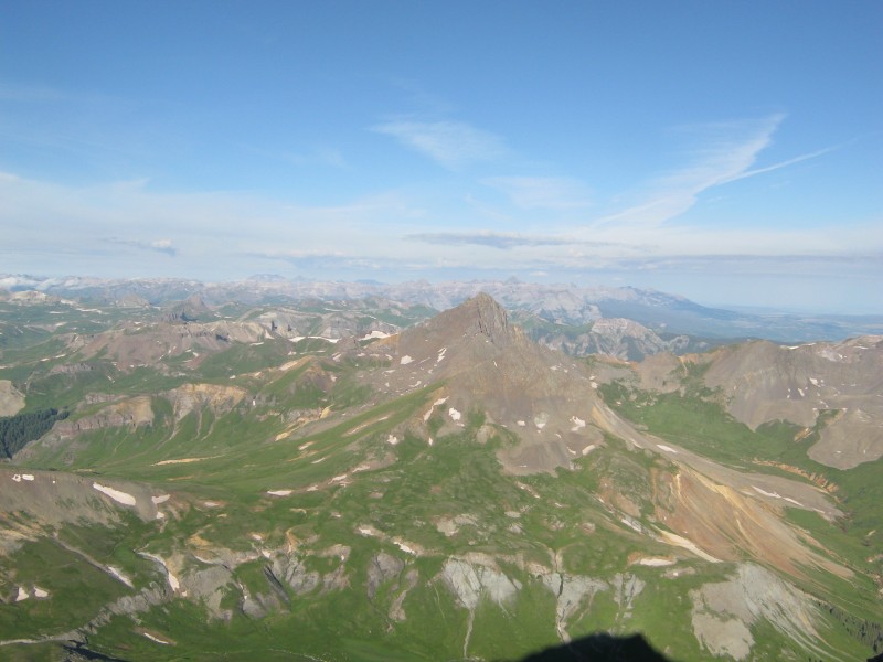 Wetterhorn with its gorgeous backdrop Despite the lousy weather forecast, the bluebird skies encouraged us to enjoy a long stay on the summit. We left the summit as a group, and spread out to enjoy the trip back at a more leisurely pace. 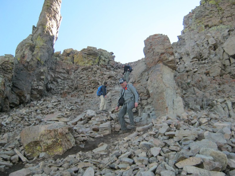 Coming back down the crux section on the west face When we reached the bottom of the crux, I heard the unmistakable sound of sheep baaing. There must have been hundreds of them moving through the valley below. That's a sight that you don't see every day! 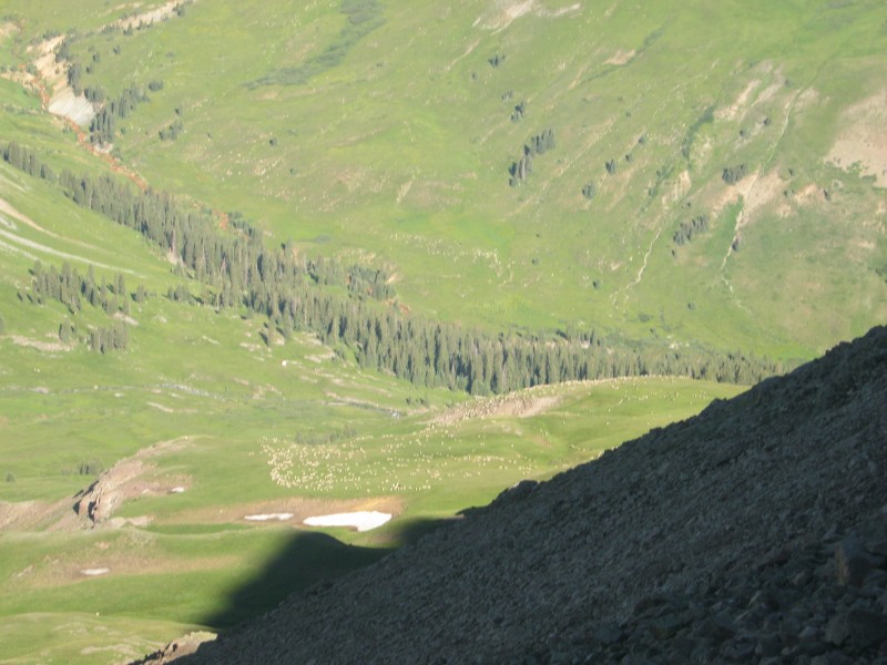 Sheep on the move in the valley on the west side of Uncompahgre 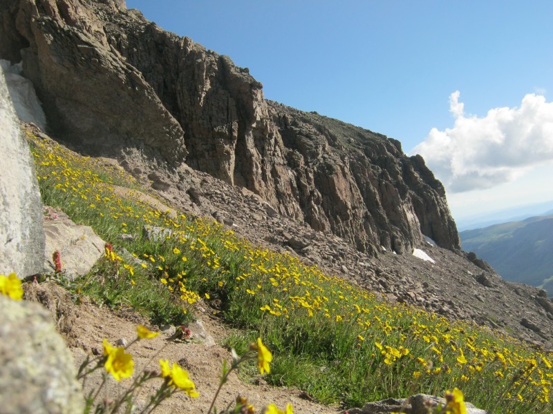 Below the cliffs on the southeast side of the summit 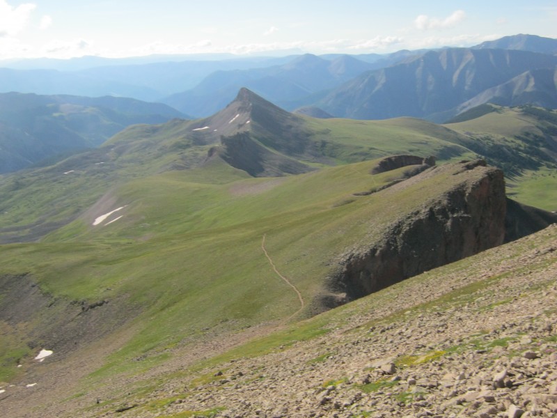 Looking at the route back to the trailhead There was no shortage of wildflowers in this vast expanse of tundra, and I noticed a few specimens that stood out in the crowd. I found a moss campion (Silene acaulis var. subcaulescens) that didn't look quite like any that I had seen before; the ends of the petals are usually notched, but these were rounded. That's the sort of inanity that qualifies me for "plant nerd" status. 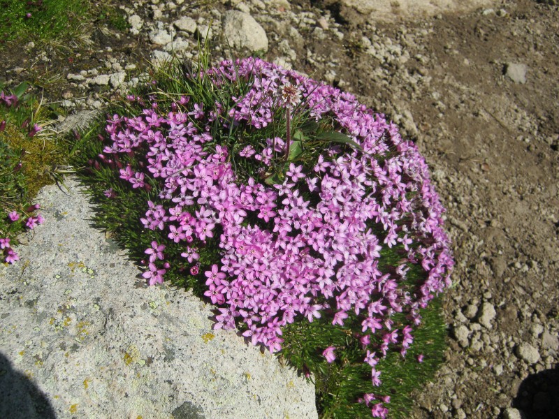 Moss campion (Silene acaulis var. subcaulescens) The rose paintbrush (Castilleja rhexifolia) is a semi-parasitic plant that is usually found on moist tundra. It frequently hybridizes with several other alpine species of paintbrush, so odd colors are not unusual.  Rose paintbrush (Castilleja rhexifolia) Hall's beardtongue (Penstemon hallii) is a vibrantly-colored scree dweller. Elihu Hall collected the first specimen of this plant while he was on an expedition with Charles Christopher Parry, for whom thirteener Parry Peak was named. Dr. Parry is known as "The King of Colorado Botany," and he was also quite a mountaineer. 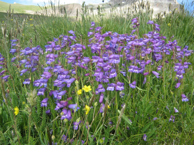 Hall's beardtongue (Penstemon hallii) Lewis and Clark wrote about finding mountain death camas (Anticlea elegans) on their legendary journey to the west coast. Native Americans and some early settlers sometimes mistook this poisonous plant for the edible common camas (Camassia quamash), and suffered the unfortunate consequences. Common camas is not found in Colorado, so it is best to assume that anything that resembles this plant is poisonous.  Mountain death camas (Anticlea elegans) with Uncompahgre in the background The lower portion of the trail winds around some volcanic boulders that add a bit of character to the landscape.  Nellie Creek flowing through volcanic rocks with columbines in the foreground. Subalpine larkspur (Delphinium barbeyi) is one of the more colorful residents of moist meadows just below treeline. It is also deadly poisonous to humans and livestock, and has killed a significant number of cattle on open rangeland in Colorado. 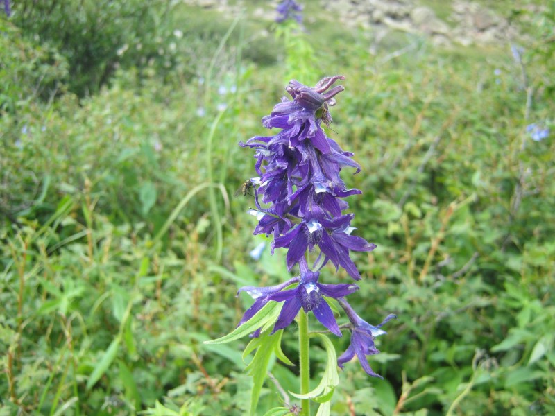 Subalpine larkspur (Delphinium barbeyi) Back at the trailhead, I noticed water flowing out of a wooden flume. Was this a relic from the mining era, an accident of nature, or a construct of a trail builder?  Water flowing out of a flume 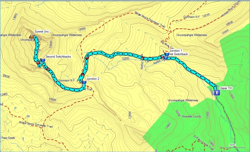 GPS track of our hike on Uncompahgre Peak We got back to the trailhead by 10:15, which was almost (but not quite) too early to enjoy a celebratory beer. The enjoyment : effort ratio was probably the highest of any fourteener that I have hiked so far. The hike is easy enough to be anybody's first fourteener, but I can't imagine any seasoned trekker growing tired of this outrageously beautiful area. Thumbnails for uploaded photos (click to open slideshow): ")
")
")
")
")
")
")
")
")
")
")
")
")
")
")
")
")
")
")
")
")
")
")
")
")
")
")
")
")
")
")
")
")
")
")
|
| Comments or Questions | |||||||||||||||||||||
|---|---|---|---|---|---|---|---|---|---|---|---|---|---|---|---|---|---|---|---|---|---|
|
Caution: The information contained in this report may not be accurate and should not be the only resource used in preparation for your climb. Failure to have the necessary experience, physical conditioning, supplies or equipment can result in injury or death. 14ers.com and the author(s) of this report provide no warranties, either express or implied, that the information provided is accurate or reliable. By using the information provided, you agree to indemnify and hold harmless 14ers.com and the report author(s) with respect to any claims and demands against them, including any attorney fees and expenses. Please read the 14ers.com Safety and Disclaimer pages for more information.
Please respect private property: 14ers.com supports the rights of private landowners to determine how and by whom their land will be used. In Colorado, it is your responsibility to determine if land is private and to obtain the appropriate permission before entering the property.


