| Report Type | Full |
| Peak(s) |
Mt. Shavano - 14,230 feet Tabeguache Peak - 14,158 feet |
| Date Posted | 06/11/2014 |
| Date Climbed | 06/07/2014 |
| Author | Krullin_14ers |
| Tabeguache via Shavano (2 birds w/one stone) |
|---|
|
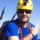
Hello again folks! After such an awesome time writing a report for Mt. Bierstadt a few weeks back, I felt that I needed to express my feelings about my recent adventure to Mt. Shavano and Mt. Tabeguache. Boy was this one a beaut...where do I begin. AH, first let me say that this was an incredible hike with spectacular views and very moderate terrain - with something everyone can enjoy. Second let me put a disclaimer out there. Mt. Tabeguache is pronounced (TAB-uh-wash). We began the night before, departing from BoCo (Boulder). We left around 7 PM, and as you can see below, we caught a slight glimpse of that sherbert sky spotted during the Bierstadt ascent a few weeks back. It was a relatively simply drive - up to Leadville, down to Salida and then a dirt road to the trailhead. I had packed 3 (three) sandwiches the night before but forgot to put mustard/mayo on them, and that's a story we will get to later. We arrived pretty late and set up camp in the back of the subaru. It was quite a pleasant temperature outside so I made sure to crack the windows, but only so much that a bear paw could not make it in. (approx. 2 in.) 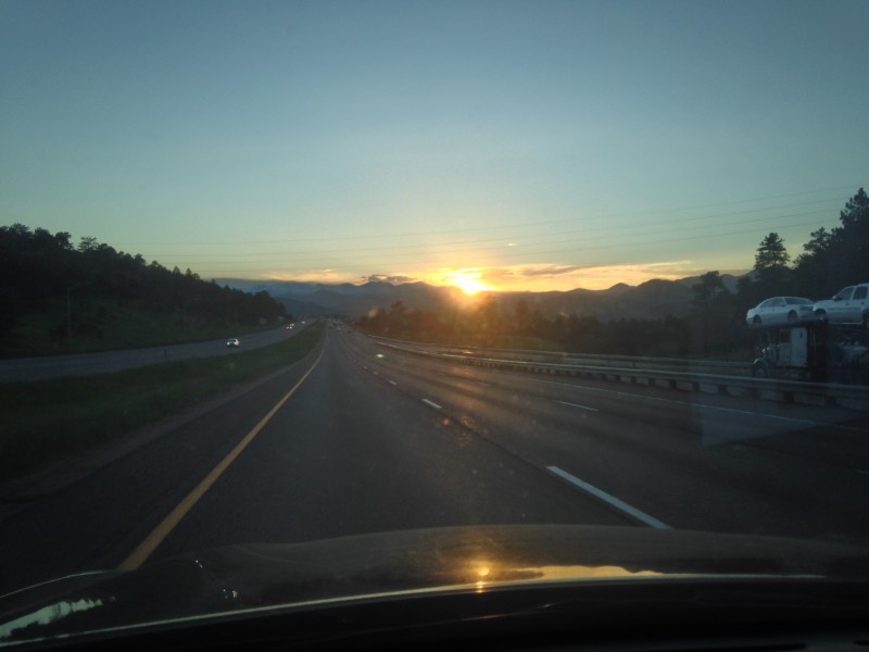 After a somewhat restless night of sleep we woke up at 4:20, but presumed to sleep till 4:45. I could hear groups starting before us, making me a bit weary. We ended up getting on the trail at 5:07AM. This is not bad, considering the lack of sleep the night before. About a tenth of a mile in, we encountered a cow guard. Be SURE to watch out for this thing, as it almost claimed my soul. 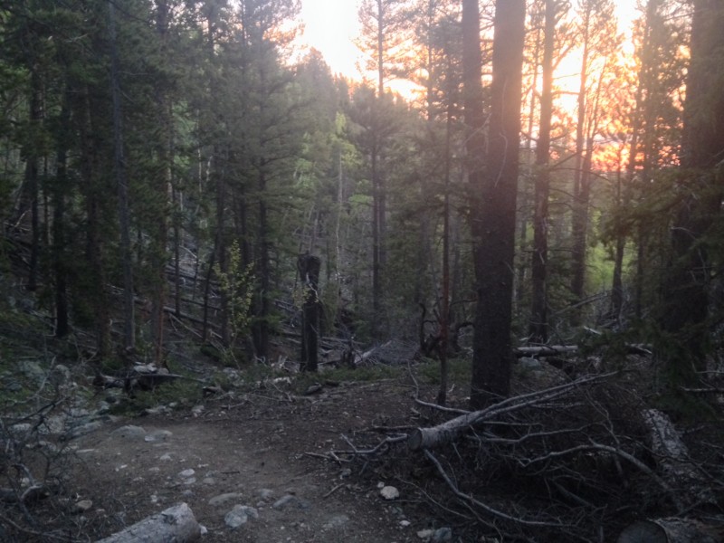 ^^^This is about 1.5 miles in, approaching tree line. I managed to capture a prime shot of the sherbert sky that never seems to leave us alone. 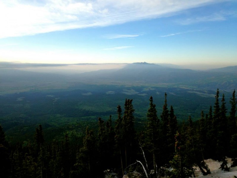 ^^WOW, looking back down at the valley, take a moment to soak this one in. 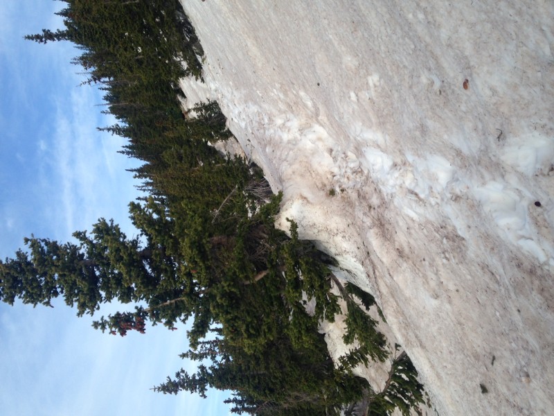 ^^^ about a half mile above the previous picture, we encountered our first batch of snow. Things began to get a bit hairy here, well actually "a bit" hairy. The snow was fortunately hard at the time (7AM). It was a few feet deep in places. By the afternoon, this stuff was straight taters. 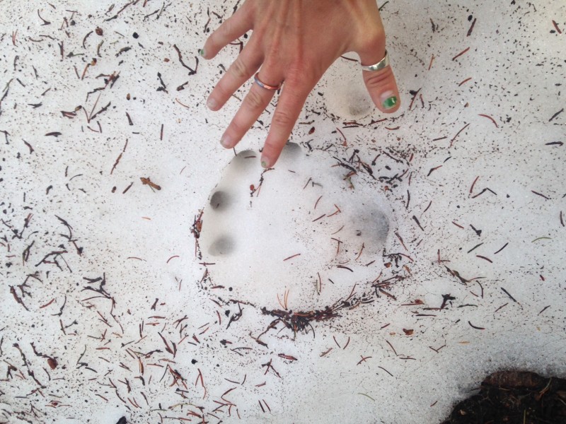 ^^^What do we have here? We think this could be a bear print, and after some expert evaluation, it could be anything honestly, but most likely a bear of animal of similar stature. Pretty cool to see one of these, although I was quite embarrassed to see this guy began his ascent before we did! 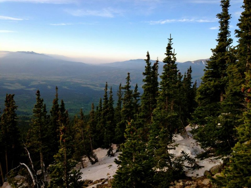 ^^^A nice shot of the pre-tater zone. (snow field) ...somebody call the sun, cuz its gonna be a magnificent day! 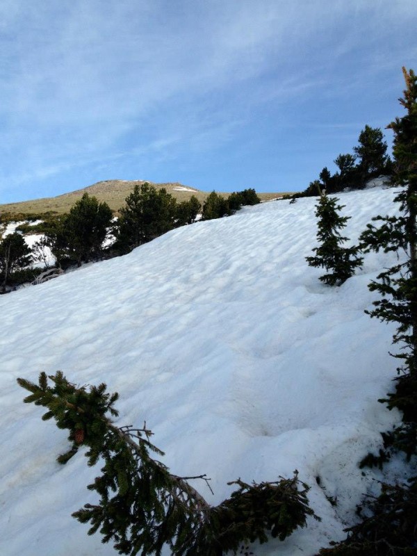 ^^^Approaching tree line. Another snowfield, this one was a bit more technical due to the gradient. I predict it will be gone by July. 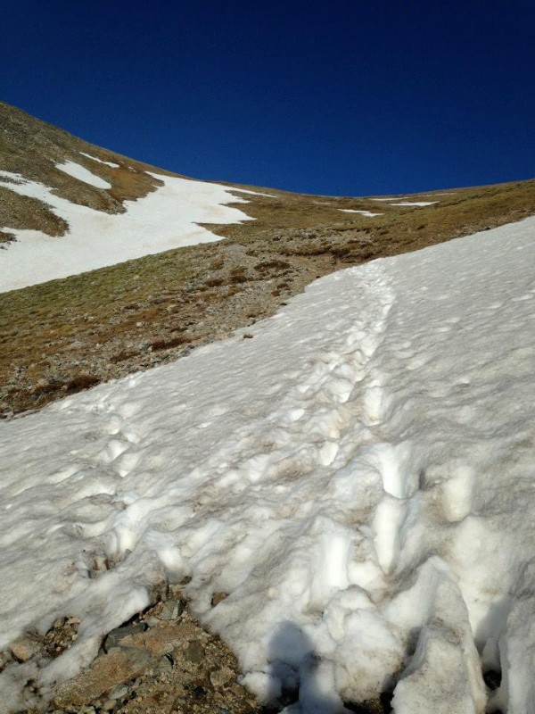 ^^^After that previous snowfield, we encountered this one right above tree line. Thankfully it was still early and the snow was hard packed. (Notice the angel of Shavano on your left) From here it was pretty much clear to the saddle of Shavano. 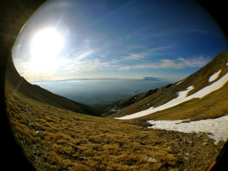 ^^^This is a fisheye shot of what we came up, standing on the saddle to Shavano. Can you say "picturesque" 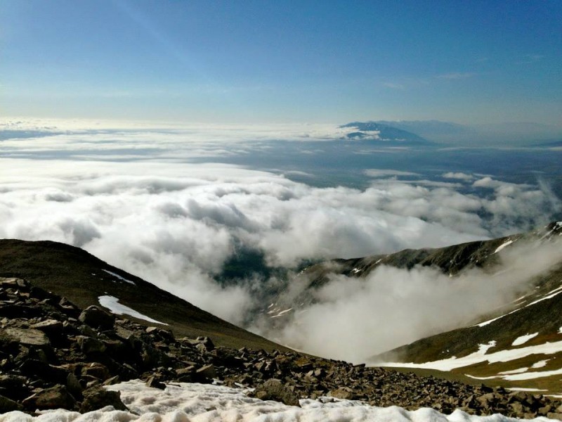 ^^^After some serious grunt work and contemplation of life, we reached the summit of Shavano. Our hearts were beating so hard, we could hear them in our ears. It is an exhilarating few hundred feet to the top of Shavano.  ^^^Another view from the top of Shavano. We ate our sandwiches that contained no mustard nor mayo and washed down some Gatorade before heading to Mt. Tabeguache. From the top of Shavano you descent the ridge before ascending Mt. Tabeguache. Its about 600 ft. down and 500 back up to the summit of Tab. 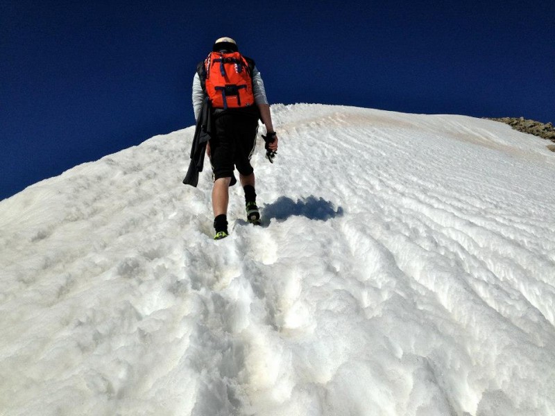 ^^^This is about 300 feet up Tab, from Shavano. There is a large cornice that you must walk along to reach the summit of Tab. Fortunately someone with very large feet had made some nice holes to trot in. 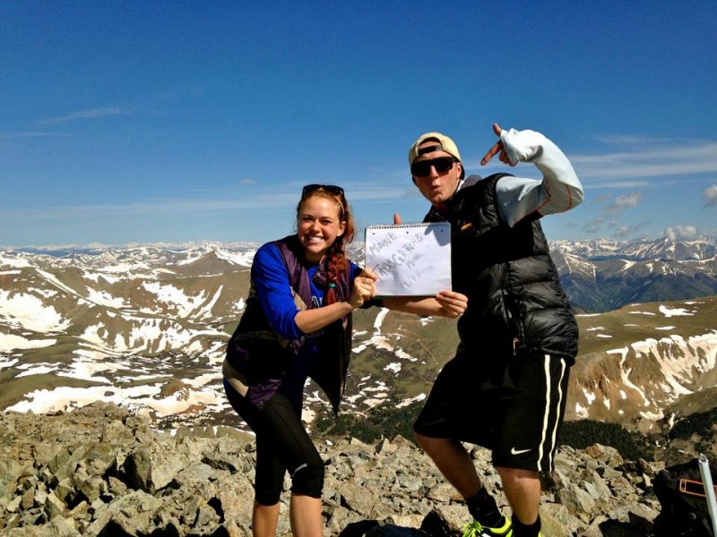 ^^^Finally, about 4 hours deep, WE SUMMITED BOTH PEAKS! Yahoo! This is a pic from the top of Tabeguache. The summit was clear of snow and the weather was peaking. Just a couple of happy campers (' 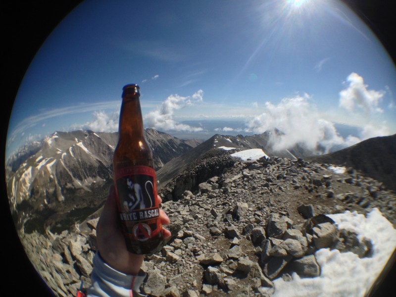 ^^^We stopped for a beverage at the top (well I did!), and nom nom'd on a few other snacks to reward ourselves. At this point, we met a couple cool cats. One of them had a mysterious green substance that he was munching, only to find out later, after a taste test, that it was a food called "kalechips". This man was only known as "Mark, the Mountain Whisperer". Mark gave us great insight to a fantastic non profit he promotes by hiking the 7 summits. He does 14ers to train! Check out MTJM.ORG - its a fantastic way to raise awareness of Cystic Fibrosis! We also encountered "Dan from Denver", another cool cat that summited shortly behind us. It was a pleasure to share our summit experience with these jablonski's. 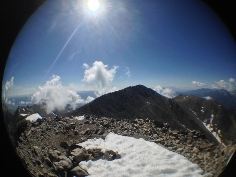 ^^^A view of Shavano from the top of Tab. After a good summit sesh, we headed back down Tab and once again summited Shavano. From Shavano, we descended back down the route we had taken up. Mark decided to do some "glissading" down the angel. I advised Mark against this due to a possible break in the tailbone, but who am I kidding, I would have done it too!  ^^^On the way down, I captured a shot of this fantastic creek flowing down the trail. We had never seem a creek so clean. I was literally thinking about taking a quick bath. This is really a great pic, and if you have any interest in submitting it to NatGeo, go for it, just give me photo cred. 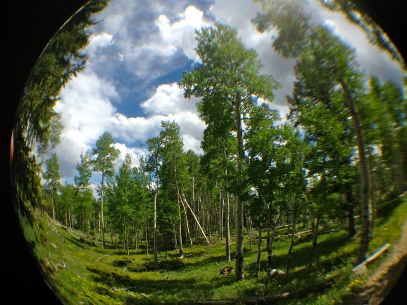 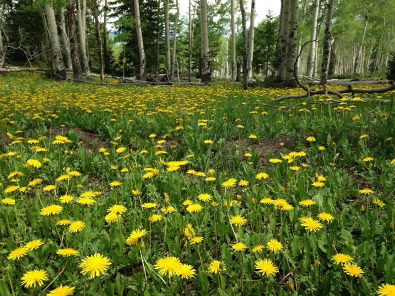 ^^^After all was said and done, we crossed over that deadly cow guard and opened our eyes to an amazing array of blooming aspens, and dense dandelions. This is one of the highlights of the trip. The valley is absolutely gorgeous right now. This is a spectacular trailhead, one to keep in the books for years to come. Overall it was an awesome hike. We ended up taking 9 hours I think. 11.25 miles round trip with 5600 elevation gain. For anyone looking to go anytime soon, you will NOT need snowshoes. Just remember to leave super early if you want to clock both peaks in, as the weather will come and shock you (literally). Thanks for reading, have fun out there! One love! -Krulln_14ers Thumbnails for uploaded photos (click to open slideshow):
 rock field right after treeline")
 top of shavano looking into valley")
 top of shavano looking into valley")
 me at the top of shavano (waiting for the volcano to explode)")
 top of shav looking down")
 dat tree broke!")
 first sign of snow!")
|
| Comments or Questions | ||||||||||||
|---|---|---|---|---|---|---|---|---|---|---|---|---|
|
Caution: The information contained in this report may not be accurate and should not be the only resource used in preparation for your climb. Failure to have the necessary experience, physical conditioning, supplies or equipment can result in injury or death. 14ers.com and the author(s) of this report provide no warranties, either express or implied, that the information provided is accurate or reliable. By using the information provided, you agree to indemnify and hold harmless 14ers.com and the report author(s) with respect to any claims and demands against them, including any attorney fees and expenses. Please read the 14ers.com Safety and Disclaimer pages for more information.
Please respect private property: 14ers.com supports the rights of private landowners to determine how and by whom their land will be used. In Colorado, it is your responsibility to determine if land is private and to obtain the appropriate permission before entering the property.