Download Agreement, Release, and Acknowledgement of Risk:
You (the person requesting this file download) fully understand mountain climbing ("Activity") involves risks and dangers of serious bodily injury, including permanent disability, paralysis, and death ("Risks") and you fully accept and assume all such risks and all responsibility for losses, costs, and damages you incur as a result of your participation in this Activity.
You acknowledge that information in the file you have chosen to download may not be accurate and may contain errors. You agree to assume all risks when using this information and agree to release and discharge 14ers.com, 14ers Inc. and the author(s) of such information (collectively, the "Released Parties").
You hereby discharge the Released Parties from all damages, actions, claims and liabilities of any nature, specifically including, but not limited to, damages, actions, claims and liabilities arising from or related to the negligence of the Released Parties. You further agree to indemnify, hold harmless and defend 14ers.com, 14ers Inc. and each of the other Released Parties from and against any loss, damage, liability and expense, including costs and attorney fees, incurred by 14ers.com, 14ers Inc. or any of the other Released Parties as a result of you using information provided on the 14ers.com or 14ers Inc. websites.
You have read this agreement, fully understand its terms and intend it to be a complete and unconditional release of all liability to the greatest extent allowed by law and agree that if any portion of this agreement is held to be invalid the balance, notwithstanding, shall continue in full force and effect.
By clicking "OK" you agree to these terms. If you DO NOT agree, click "Cancel"...
Plan A: Thwarted by lack of snow on line (Mon)
Plan B: Killed by 2 partners bailing, one due to broken ski (Wed night)
Plan C: Dead by warm forecast and lack of freeze below 12K and TH start at 8/9K (Thurs afternoon)
Plan D: Too many people on steep line for Sun (Sat)
Plan E: Worked, till day 3 and wind
Sometimes, you just have to keep changing the plan. And people wonder why I go solo? Coordinating with ~6/7 people last week on plans on different days for the weekend just about gave me an aneurism. But at least by the end of the day on Sunday, there was a smile on my face. That's all that really matters.
Day 1: Mt Lindsey
Trailhead: -2 miles from Lily Lake
Mileage: 13.88
Elevation Gain: 5,303'
Partner: solo
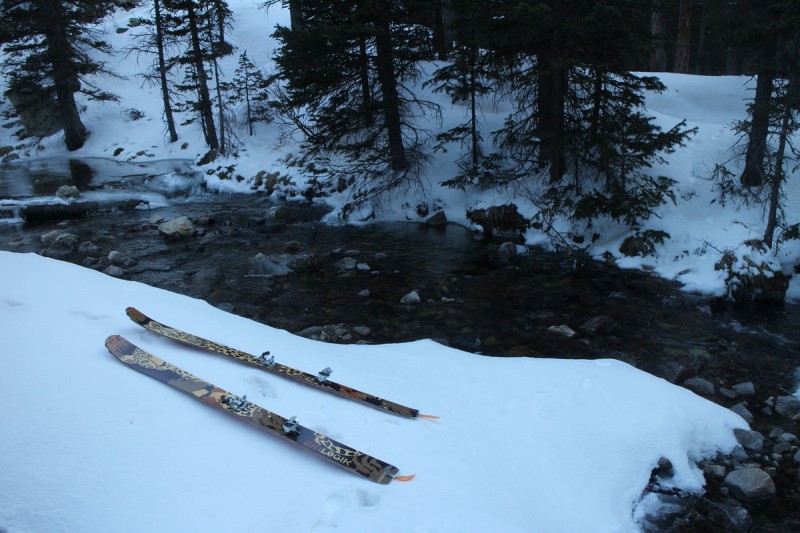
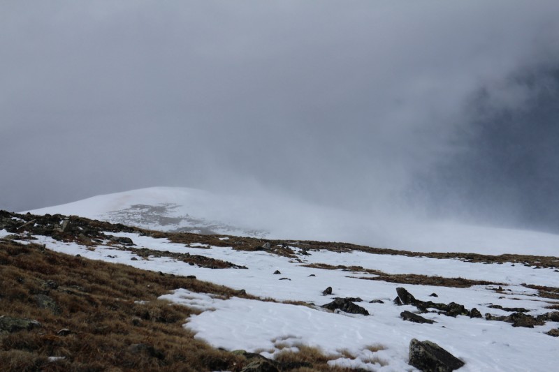
With Friday being the best forecasted day, I was going to get out and tackle something good. With plan A&B going down the drain for Friday, I came up with the next best plan. Revenge on Lindsey! A month ago, Eric and I made a valiant attempt at a powder descent of Lindsey, only to be thwarted at the saddle by time and an approaching storm. That and a stupid downed tree by the "winter trailhead", blocking passage of the road, 6 miles from the trailhead. On that descent from Lindsey, I hit shark after shark in the foot of powder over rocks that was on the slope we took. Got my first core shot in my brand new Day 1 skis. I was mad, very mad. 2 weeks ago, Eric went back solo and swam up Lindsey to get his revenge. I waited a month, and got slightly better conditions.
Drove up the road, hoping to get 1 mile from the trailhead as beta suggested, but found the first impassable snowbank about 2 miles away. I guess some people don't know how to use GPS/map. I got about 4/5 hours of sleep before I was on the trail around 4:30am. The road up to the trailhead is more dirt than snow, and I spent most of the time carrying my skis in both hands, hoping that the next snow patch would be continuous. Lots of wasted time putting on and taking off skis, when I could have just booted till 0.5 mile from the trailhead. The snow had gotten a good hard freeze, and it was supporting my weight. There are even dry patches growing after you get on the trail itself. But finally after the first two tiny stream crossings, the snow is continuous. Well, until the major stream crossing, which involved verglace on rocks. Always exciting!
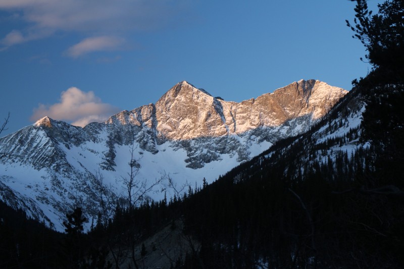
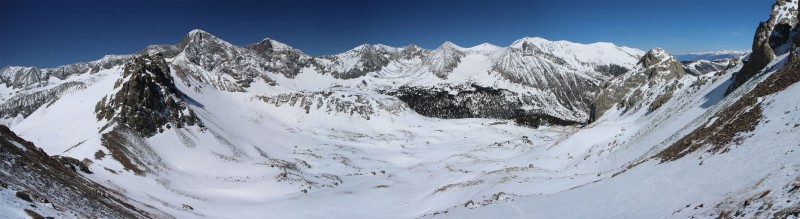
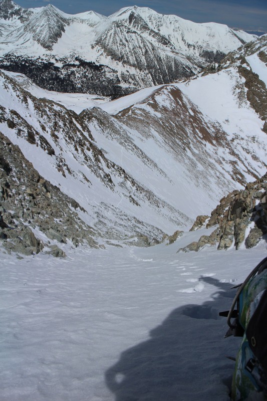
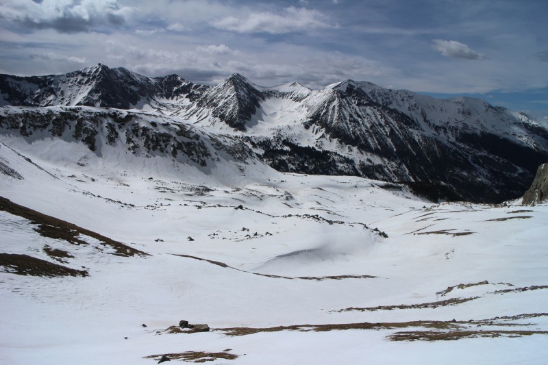
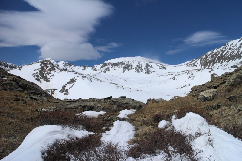
Sunrise on Blanca and Ellingwood Stream is in play
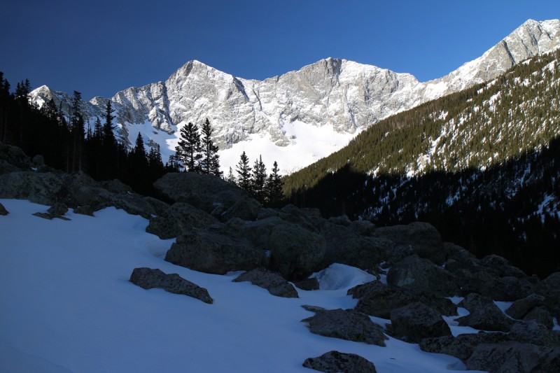
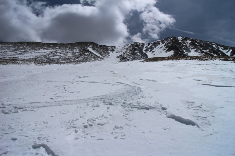
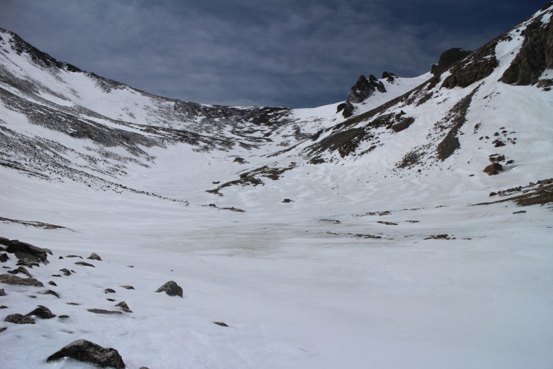
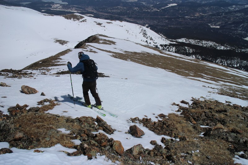
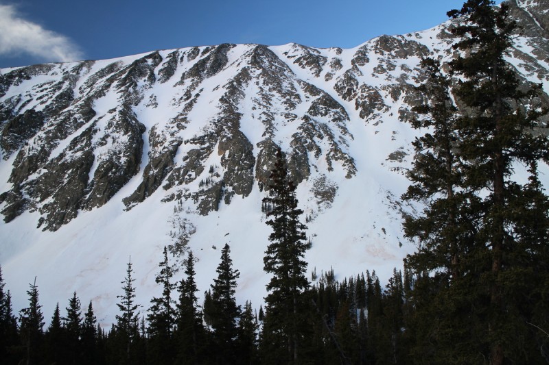
Getting to treeline involved another section of booting and carrying skis, as the icy steep slope was not taking an edge and I was tired of slipping. Once in the stream valley, it was easy and quick going. I looked up at the shark infested slope that Eric and I had taken, and said no f*ing way. So I kept contouring up drainage to the south and found a much better approach. Also saw that if the snow held on the other side of the ridge off the saddle, there would be an almost continuous line without sharks to take on the way down. Though to save some time, I did boot up the ridge that we had taken previously up to the saddle.
Blanca and Ellingwood First view of Lindsey and the slope of sharks
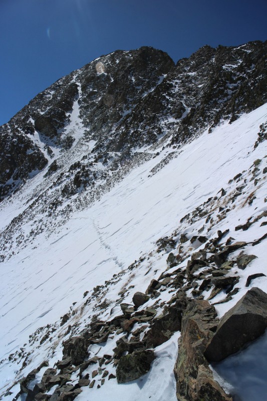
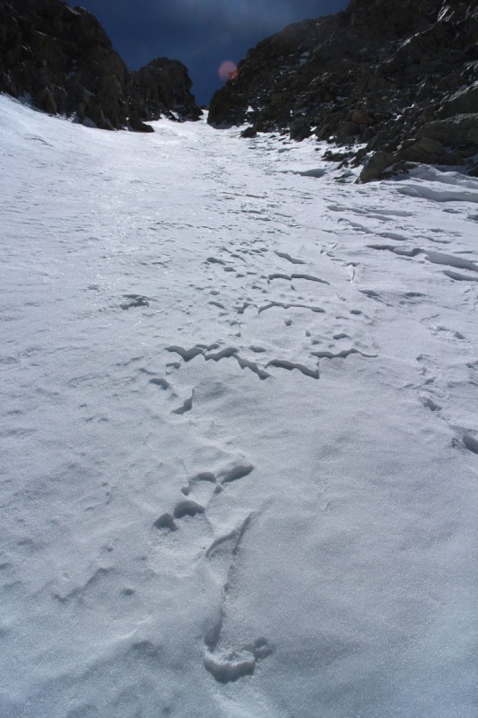
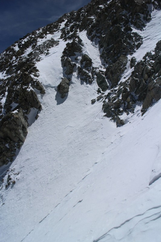
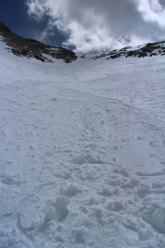
Once at the saddle, it was time to traverse to the gully proper. Made it a short distance, before I decided it was time for crampons. The slope was scoured and pretty steep. This section the steps were pretty easily made, as the snow was quite firm. Once in the gully proper, it was a mix. Loose rock and snow - lots of sliding at the base. Then deep unsupportive powder right next to crusty but further transitioned snow to the left. I stayed lookers left or east as much as possible for the better snow.
Pano from saddle Lindsey from saddle Approching the north face gully. North face gully: consolidated on lookers left, powder on right Looking down the gully
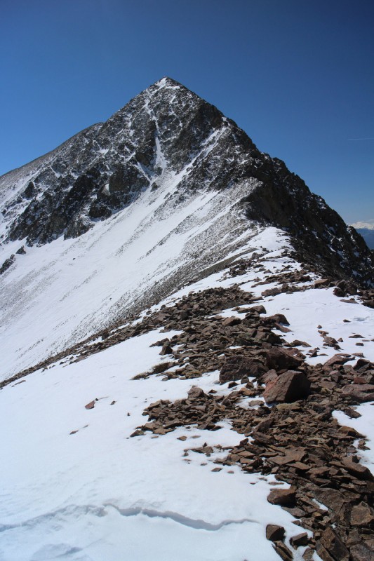
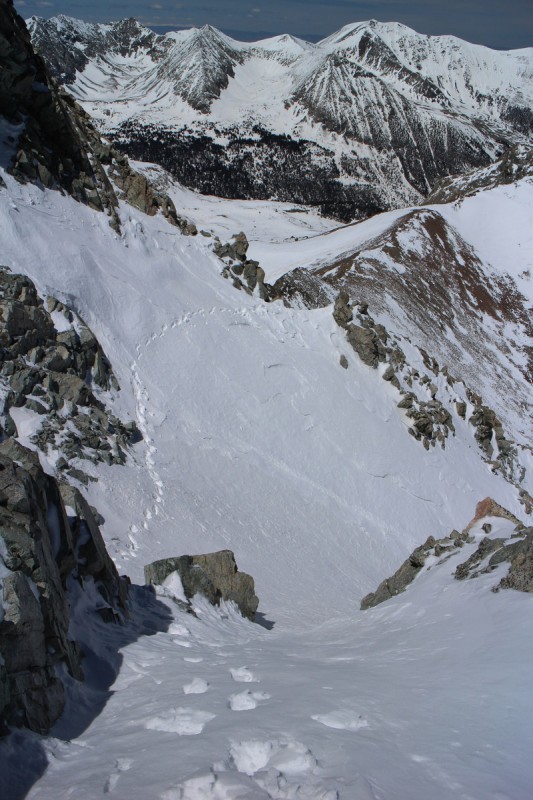
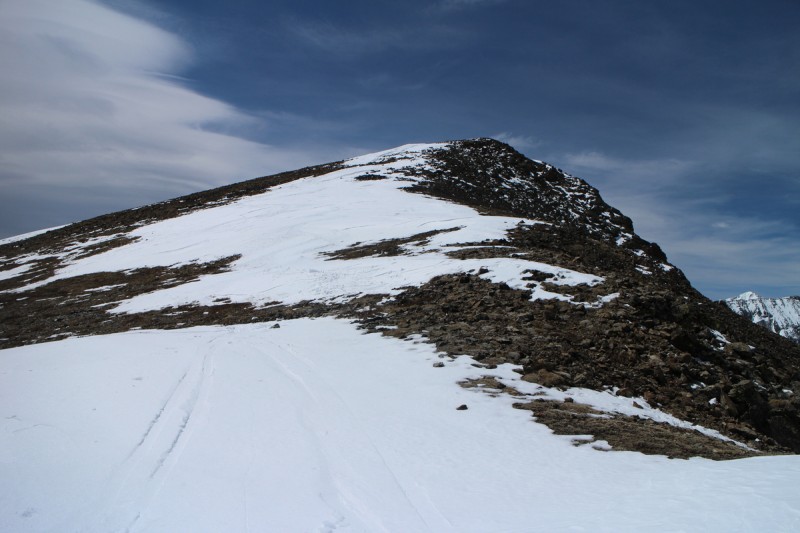
Once beyond the initial gully, I stick to the standard route traverse for a while. The snow here isn't too bad, but still isn't as supportive as I would like. I get beyond the first major traverse, and decide to just go up to NW Lindsey instead. The ridge had to be better to walk on! Or so I thought...
Up on NW Lindsey, the true summit isn't all that far away. But it is mostly snow covered and corniced. I didn't think it would take that long. Nope. Quite the opposite. The sun had been baking the summit ridge, and every step I accumulated a pound or two of snow on each crampon. If I didn't knock it off with each step, I had trouble walking. Not so good with steep rocky drops on each side. So walking to the summit took quite a bit of effort and time. But once I got there it was ever so nice to plop down and rest!
Snowy traverse Tracks over traverse Summit ridge to Lindsey from NW Lindsey
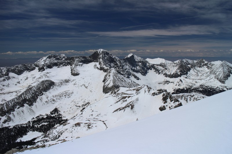
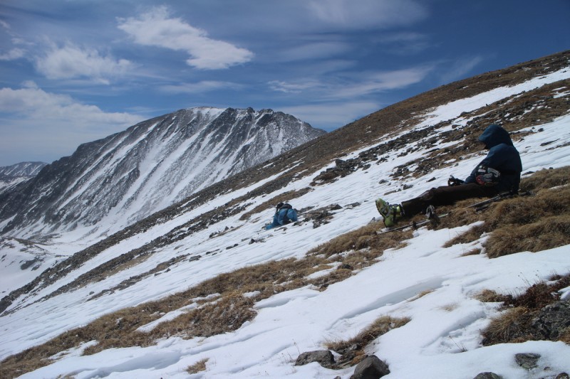
Clouds had started to form, and that only made the views that much more interesting. I sat up there for some time, refueling and recovering. I had a nice ski ahead of me to get ready for! Revenge is ever so sweet!
Little Bear, Blanca and Ellingwood
Spanish Peaks
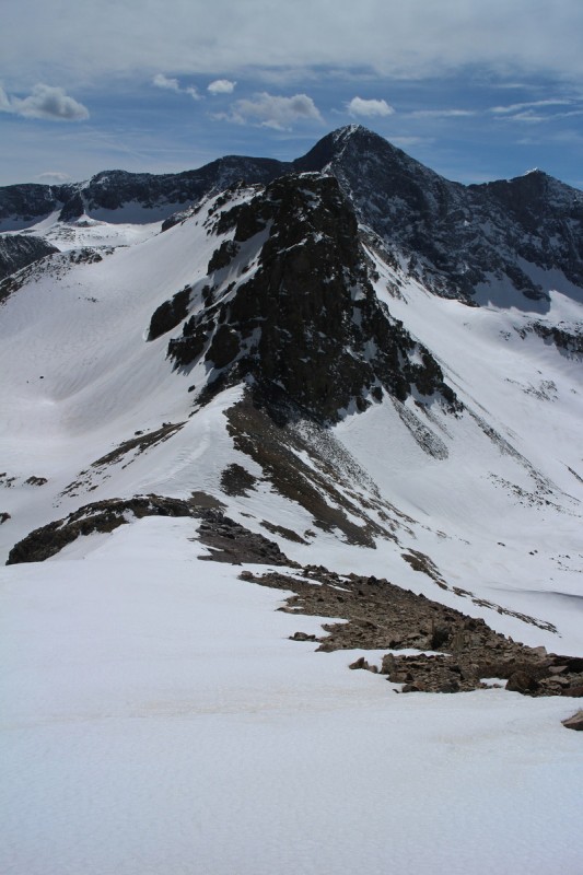
Bill - Doesn't the Needle look fat?!
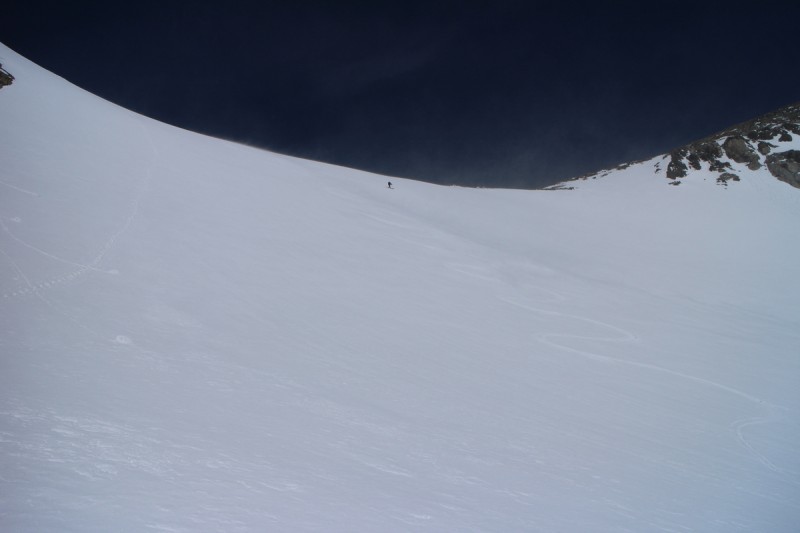
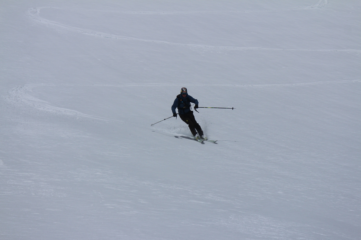
Only had to step over 2 small rocks to get down to the North Couloir proper. From there the upper section was pretty firm and wind blown. Good thing, since it was also the steepest section. As soon as I dropped into the center of the gully, I knew the fun would now begin. There was a nice stretch of reworked kinda fluffy powder in the center. Thanks to some updrafts, I even got some face shots! The lower section was nicely corned up, so I got almost all types of skiing in one line. Hardpack, powder and corn!
Getting ready to drop the line Shadow selfie on North Couloir Looking up North Couloir Tracks from base of North Couloir
Once at the base of the line, I just had 7-800' of elevation to gain to get back up to the saddle. Here, the slush began. This drainage had been baking from sunrise on. But that's the price you pay for skiing a north facing line sometimes. Every other aspect is some form of baked. I stomped on skis for a while, but once it started going uphill fast, I switched to booting. Got to the top of the saddle, and found the snow on this side was much less baked. So I skied down the west ridge on the south side for awhile. I saw Eric's tracks turn north, but I kept going. I was NOT going to get more shark bites in my new skis! The ridge was nice and wide for most of it, and keeping away from the cornice wasn't too bad. Nice corn to ski almost all the way down to the saddle with "Huerfanito". The snow stopped, but I saw that if I dropped a tiny rocky couloir for a few feet, I'd be back on the continuous snow once again. Once there, it was an easy shark free glide all the way back down to treeline. The last slope was fully slushed and the death cookies were rolling, but thankfully that slope isn't all that steep.
The route up to the saddle... 800' of slush West ridge ski Shark free drainage!
Once in the trees, it was a rather nordic exit to the trailhead. Skied about 0.5 miles down the road, before I decided to put the skis on my back and suffer the 5' of snowbanks for the 200' of dry patches in between. A hiker had postholed to the meadow beyond the trailhead, and returned. So at least I could follow his tracks through the snow banks. He dropped both his gloves along the way, so I carried them back and put them on his NM vehicle. Hopefully they were his... Guessing so by the socks & shoes drying on the roof
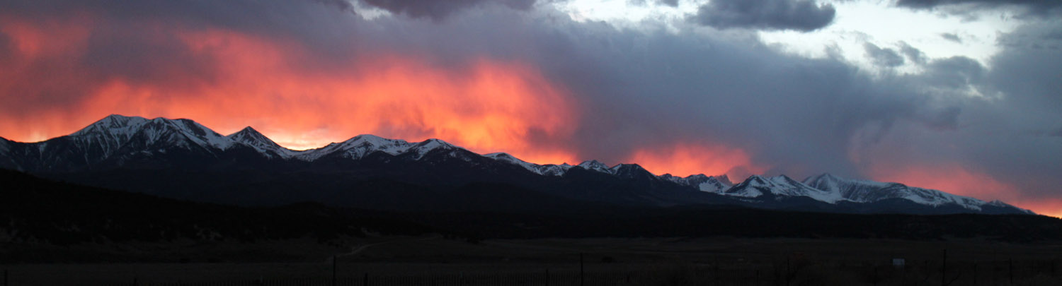
Drive out was uneventful, except for the view on my way to Westcliffe. I rather enjoy driving new stretches of roads, and have never connected Lindsey with the South Colony area before. Caught a lovely sunset on Linsdey and friends, as well as the peaks south of South Colony. After that, it was just a long dark drive up to the next destination.
Lindsey and friends from the NE
Raining fire...
Enjoy the video. My chesty/booby cam got a little too loose and bouncy on the initial descent, so I had to cut a bunch. Music was in my head all weekend... trying to feel optimistic!
Day 2: Mt Helen
Trailhead: Spruce Creek
Mileage: 5.43
Elevation Gain: 2,801'
Partner: Zach
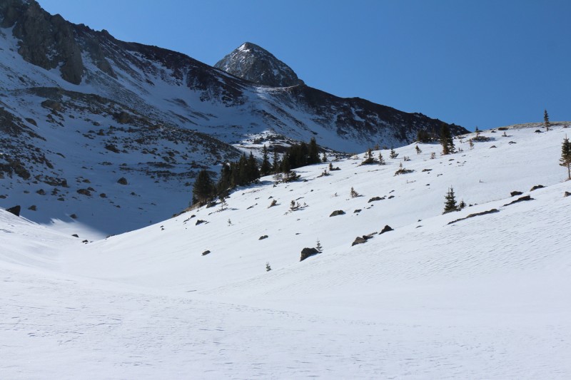
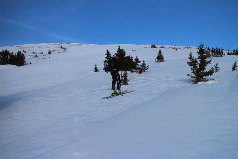
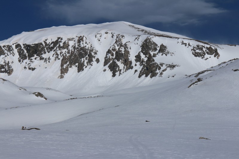
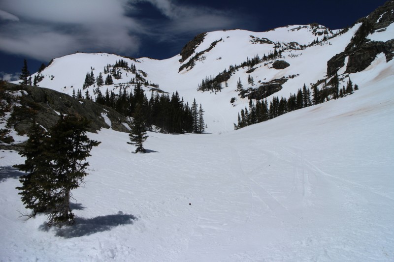
After another short sleep night, I wake to a mild pre-dawn morning. The forecast was not calling for freezing temps (with windchill) below 12K, so Zach and I decided to go with a safe route to test if the forecast was true or not. Didn't want to get on a steep, long committing line that was solar effected today! Zach had gotten turned around on Helen a few weeks ago in a snow storm, so he wanted revenge for himself. Plus I wanted to explore a safe winter option for future trips.
As it turns out, the snow froze well. Probably due to radiant cooling because of the clear skies and light wind. So we got to the summit and had to wait at least an hour for the snow to warm up! Great views and nice corn. We could only imagine this slope with a nice firm base and a foot of powder... Mmmm powder. We ripped some nice turns on the way down, and even found the avy safe corridor above the road, through the trees. We skied that section in full slush/death cookie conditions. But it wasn't like the slope was going anywhere!
Zach booting up initial bench Above the trees, the big skiable slope! Tundra skinning Pano west from summit Dropping the northern part of the ridge Looking back at summit from northern ridge
Zack kicking up some corn
Slush turns... attack of the death cookies!
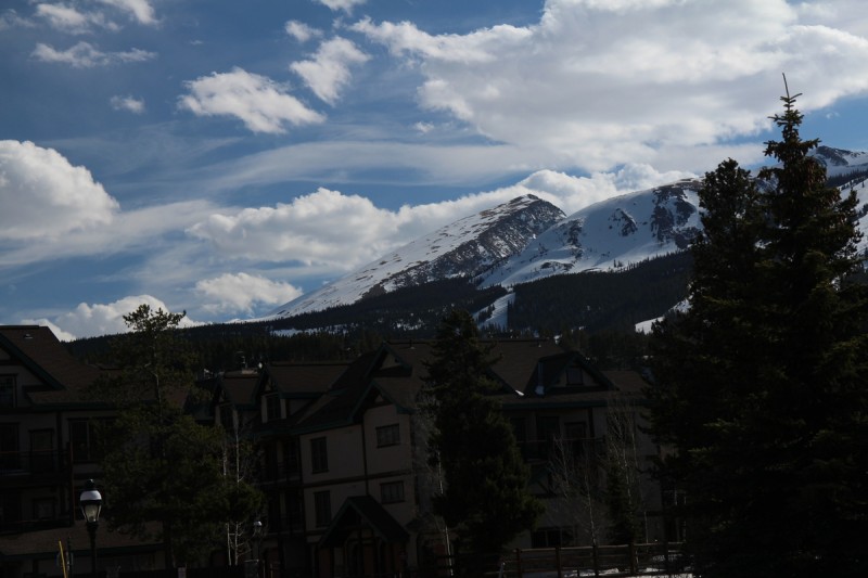
We refueled at Breckenridge Brewery. Mmmm Bison burger, milt julep and the Kentucky Derby on TV. No silly hat for me, but at least I got the drink right!
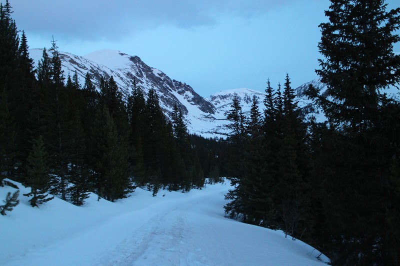
Feeling good about the changing weather forecast, and the hopes for another freeze over night again, we decided on the east couloirs on Atlantic. With the high trailhead, we wouldn't have as much problems with slush. Plus the McCullough Gulch road is fairly packed down from heavy XC ski use. No post holing, no matter what happens to the forecast. Good plan.
Started skinning up the road, passing by the Quandary trail, and rounded the corner to see giant, fresh tracks in the snow. Zach identified it as a bear, a big bear. Lovely. Sometime on Saturday afternoon, a bear was walking where we were now. So I guess the bears are in play now too.
Bear paw print...
The Quandary Bear is big...
After that excitement, we round the corner and see a lengthy downhill on the road. Oh, how I hate downhills on the way up! Especially with skis! At least we got a nice sunrise over Red Mtn C to enjoy. We followed the road to it's end beyond the small scary mining claim (Trespassers will be shot on sight - sign). We zig zagged up the drainage, contouring around the various features in our way, getting great views of the fat couloirs on Quandary's north side.
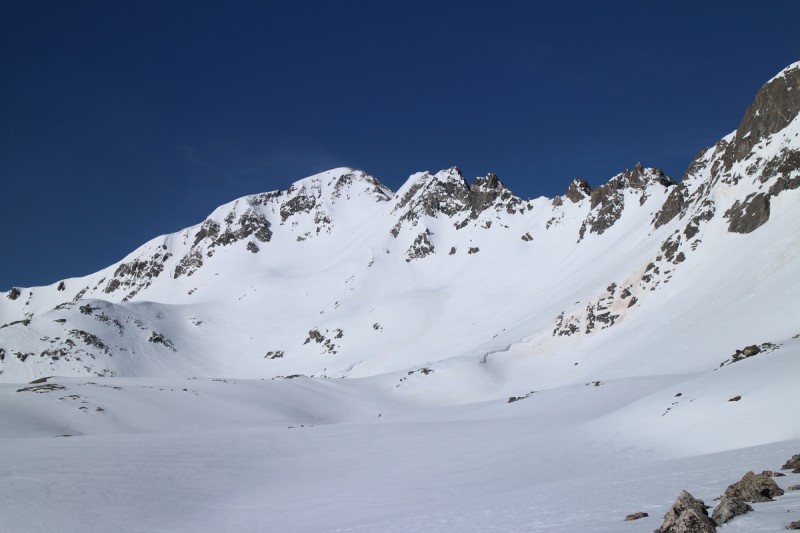
First view of Atlantic's lovely east face
Sunrise over Red Mtn C
Northern couloirs on Quandary
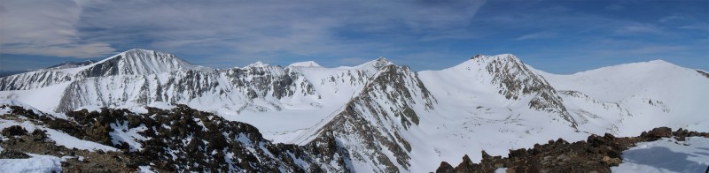
Once at the lake above treeline, the wind started. At first it was only annoying. Soon it would become ever so much more. But the skinning was easy and we made good time to the base of the snow slope we were going to climb. We decided to go up Tradewinds, instead of the V couloir - for speed. Figuring with the lack of clouds, it was better to get on top sooner, than later. Little did we know at that time how bad the winds were aloft! The V Couloir also had evidence of a wet slide and lots of death cookies, so it may actually be easier to climb Tradewinds as well.
Frozen Lake along the way - wind started here Approaching Atlantic, so many choices! The NE face of Fletcher - on the list now! Looking back at Quandary Booting up the Tradewinds...
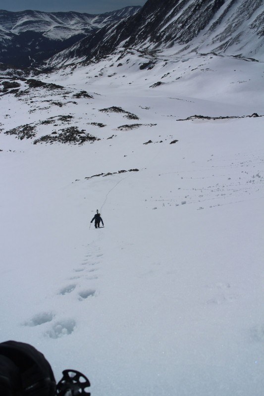
At first, booting up was pretty easy. I was hoping by charging ahead, Zach would have an easy time of following up and we'd get to the summit faster. That was, until a short distance up, when the winds began picking up. They were no longer annoying. Now they hurt! Ice chunks and sustrugi snow was pelting me all over, and in the face if you looked up! A bit higher, and the gusts were strong enough to knock me over. Here is where the booter starts to look like a drunk person walked up. Steps all over the place, random body prints etc. My only goal now, is to get to the top of the snow, where the rocky ridge is. It's a tough goal, as every so often, I have to use both my ax and whippet to anchor into the snow to stay in place. Large fat skis are wind sails, ready to whip me off the slope, if I'm not careful. In between lengthy gusts, or should I say minor lulls in the 50-70mph wind, I would inch uphill further, then brace for the next onslaught. I sat down, with my back to the wind and waited for Zach.
Eventually he showed up, and we discussed our options. He wanted to "try" to get closer to the summit. So we crawled using our axes uphill a bit further. We both had to "assume the position", bracing in the wind as we made our way a few more feet. At some point we both started laughing. Laughing incredibly hard. The wind hurt, the snow projectiles going 50+ mph hitting us, hurt. The very concept of going further was amusing and ridiculous. It was time to turn it downhill, summit not happening today! But yet we sat there and laughed. How the heck were we going to transition in this wind? How would we get the skins off our skis and safely stowed in our packs?
That's when a cute snowboarder and his skier friend showed up. They were assuming the position as well. They thanked us for the booter, and asked if we were going on to the summit... we laughed! So we all were now transitioning in the horrendous hurricane force wind. We had to time everything to the infrequent lulls in the wind to get things done. I was the first ready, and started the piecemeal descent. Couple turns, brace for impact, couple more turns, brace. Once I got to the rollover the wind was a bit less, and I decided to make a run for it. The wind was moving around all the chunks I was shredding up and around. Vertigo skiing... had to ski almost completely by feel. Good thing I've done that before. Got down to our previous transition spot and waited for the guys to come down.
Snow tornado on Atlantic summit Assume the position!
Zach made it out of the snow-wind vortex!
Zach appears over the wind shear
Turns!
Zach is smiling once again!
Once out of the wind tunnel, corn skiing is had. We ski down to a short climb where we saw tracks from earlier. Turns out it was the snowboarder and friends' tracks. So a good trade for a booter, was the best turns of the day! Then it was just a quick slide out till the annoying uphill, and road slide to the trailhead.
Looking back at Atlantic from short reclimb Best corn turns of the day... Another look at Quandary's north face couloirs
A great weekend out, with 2 revenges occurring, and one in the forecast.
My GPS Tracks on Google Maps (made from a .GPX file upload):
Those were/are my gloves! Thank you so much! That thursday I was looking at the forecast for the weekend and wanted to give something a shot, so I woke up and was bored on Friday so I drove down. I was gonna check out the trail to see what it was like before a ”real” attempt on Saturday. That snow was terrible to hike through haha!
I got too late of a start on Saturday and the snow seemed a bit sketchy by the time I got up to the two route options. I tried the ridge because it looked like less snow, which there was, but the snow that remained was right at the base of the crux and made it too much of a risk in my opinion.
Dave B - That approach view gets me every time. Well worth it. The ski was also pretty nice as well.
Nat - The winds pushed me downhill on the final good slope. Ahhh spring!
Jeff - I updated Image 31 to give the best visual beta on Atlantic. Atlantis looks to be fairly fat from that vantage point.
philip135792 - Glad to bring back your gloves. Not many people out that way this time of year. The ridge has turned me back before too. If it was later in the day, the snow in the gully could have been really sketch. Another time!
jam6880 - Well, that's where the view is from...
moneymike - Thanks, its a Canon EOS-M (mirror less) so I can use any lens I want with it. But I've been using the standard Canon EF-M 18-55mm f/3.5-5.6 IS STM Lens. So it has a reasonable zoom for most applications, but also a great wide angle.
were ridiculous. I can totally relate to ”assuming the position” :lol: The whippet kept me from sliding backwards on my skis. Lindsey ski looks awesome. Congrats!
Caution: The information contained in this report may not be accurate and should not be the only resource used in preparation for your climb. Failure to have the necessary experience, physical conditioning, supplies or equipment can result in injury or death. 14ers.com and the author(s) of this report provide no warranties, either express or implied, that the information provided is accurate or reliable. By using the information provided, you agree to indemnify and hold harmless 14ers.com and the report author(s) with respect to any claims and demands against them, including any attorney fees and expenses. Please read the 14ers.com Safety and Disclaimer pages for more information.
Please respect private property: 14ers.com supports the rights of private landowners to determine how and by whom their land will be used. In Colorado, it is your responsibility to determine if land is private and to obtain the appropriate permission before entering the property.