Download Agreement, Release, and Acknowledgement of Risk:
You (the person requesting this file download) fully understand mountain climbing ("Activity") involves risks and dangers of serious bodily injury, including permanent disability, paralysis, and death ("Risks") and you fully accept and assume all such risks and all responsibility for losses, costs, and damages you incur as a result of your participation in this Activity.
You acknowledge that information in the file you have chosen to download may not be accurate and may contain errors. You agree to assume all risks when using this information and agree to release and discharge 14ers.com, 14ers Inc. and the author(s) of such information (collectively, the "Released Parties").
You hereby discharge the Released Parties from all damages, actions, claims and liabilities of any nature, specifically including, but not limited to, damages, actions, claims and liabilities arising from or related to the negligence of the Released Parties. You further agree to indemnify, hold harmless and defend 14ers.com, 14ers Inc. and each of the other Released Parties from and against any loss, damage, liability and expense, including costs and attorney fees, incurred by 14ers.com, 14ers Inc. or any of the other Released Parties as a result of you using information provided on the 14ers.com or 14ers Inc. websites.
You have read this agreement, fully understand its terms and intend it to be a complete and unconditional release of all liability to the greatest extent allowed by law and agree that if any portion of this agreement is held to be invalid the balance, notwithstanding, shall continue in full force and effect.
By clicking "OK" you agree to these terms. If you DO NOT agree, click "Cancel"...
Panorama on the way up Argentine Peak TH/Route: Guanella Pass, Square Top - East Ridge, Ridge Traverse to Argentine, Edwards, McClellan. Finish at Bakerville. Climbers: Jed, Scott Distance/Elev: 12.2mi, 4100' elev gain, 5900' loss Time: 8hrs (7:30am - 3:30pm)
For the past 5yrs or so I've had the tradition around Thanksgiving to do some kind of physical activity to either: "Earn Your Turkey" = Do it before Thanksgiving Dinner, or "Burn Your Turkey" = Do the activity after Thanksgiving Day to burn off all the calories just consumed. This year it was of the Burn Your Turkey variety. This trip also begins a hiatus of peak climbing for me for 6 months or so. Soon I will be begin a climb to a MUCH higher and harder summit to reach:Raising a GIRL! (Due: Dec 11th)
On the forum thread about Guanella Pass I read that the pass would remain open until Dec 2. With the pass open I started planning out some peak climbing possibilities that would net a few peaks. One was an Out-n-Back similar to a TR that Milan did a couple of years ago: going out to Edwards and back. The other was a Point-to-Point from Guanella Pass finishing at Bakerville and climbing 4 peaks along the way. Scott signed up for option 2 and we were set.
We met just off the Bakerville exit and left my car there as I transferred into his and we drove up to Guanella Pass. He busted his jeep through a snow berm guarding the Square Top TH and parked close to the restrooms. The temps weren't too bad in the morning and the wind was delightfully calm. After gearing up we set off down the Square Top trail and 100yds after crossing the frozen stream we took a right at a "trail closed" sign and headed up towards Square Top's East Ridge. While tromping through the snow we startled a snow hare that bolted off across the snow, his long feet allowing him to float atop the crusty snow. The snow wasn't too deep here and we made it up to wind blown tundra in short order.
Sunrise Above the Sawtooth
When we reached about 13,000' we got our first view of the peaks ahead of us. We would not descend below 13,000' for the next 6mi!
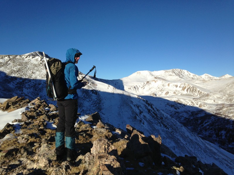
Scott surveying the route ahead. L-R: Square Top, Argentine, Grays, Torreys
From 13,200' to 13,400' the ridge steepened. Scott set a good pace that allowed us to keep moving without having to stop to catch our breath.
Steeper section on Square Top's East Ridge
Once atop Square Top's elongated summit plateau the wind began to pick up as we traipsed across the tundra and snow. We made it to Square Top's summit around 9:30am and we both bundled up to face the blustery wind as it roared around us and in our faces. As we started our descent, we began to think: "Oh Boy! Here comes the pain!" Miraculously, just 5 min later, when we were halfway down to the saddle with Argentine Peak, the wind calmed considerably and was never a real issue again the rest of the day! If anything, it stayed a nice breeze that kept us from overheating beneath the cloudless, sunny sky. So we stopped to take our first break and refuel and soak in the panoramic views surrounding us. The air was so clear we could even spot Crestone Needle and Peak to the south in the Sangres.
Panorama on way down Square Top
Mighty Square Top Mtn
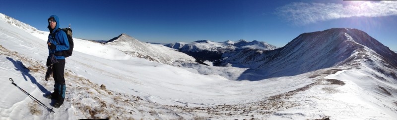
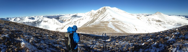
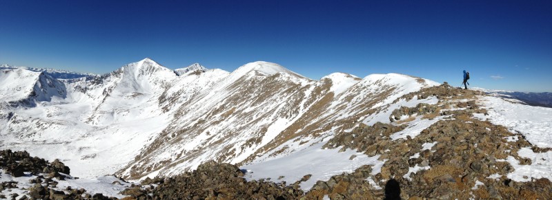
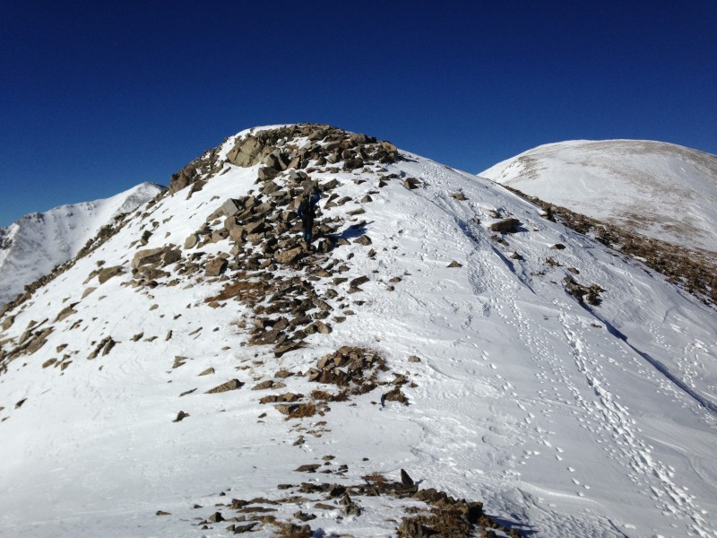
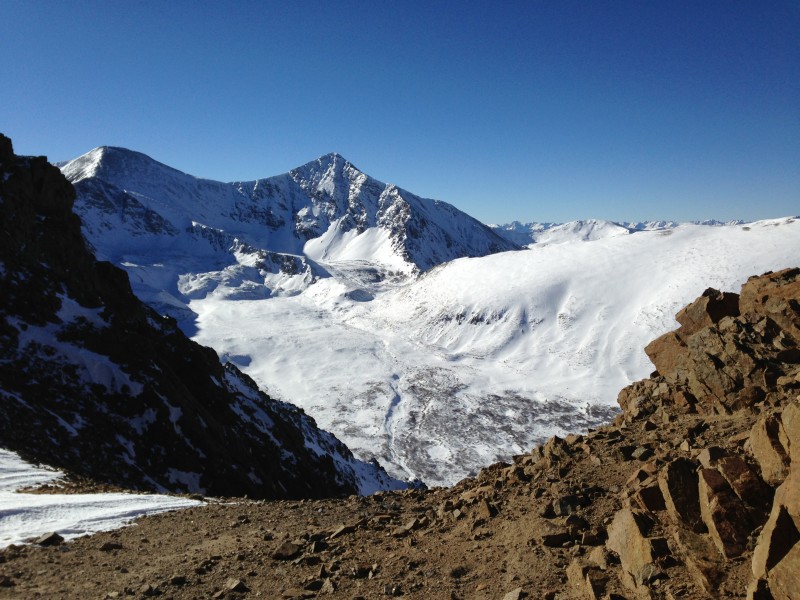
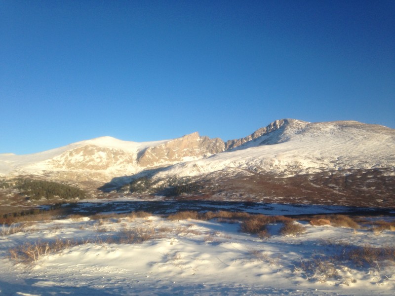
Panorama on the way up Argentine Peak
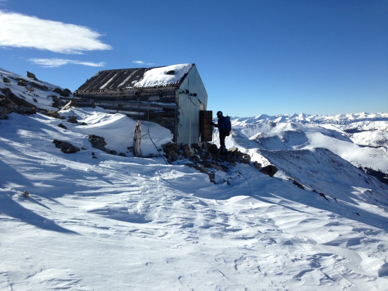
Near the saddle with Argentine we found a cool little shack that Scott checked out.
Scott checking out the "digs" of a cool shack
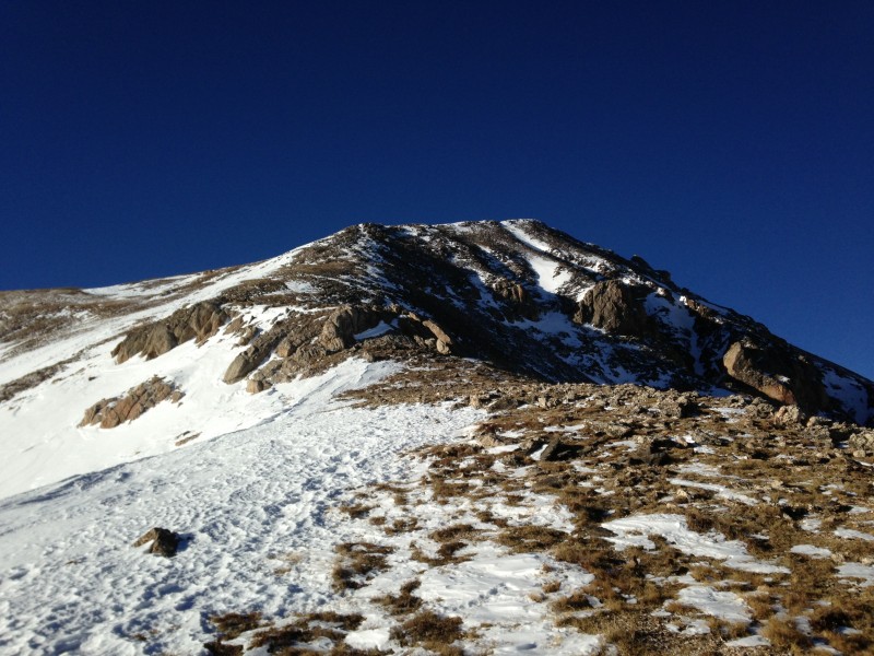
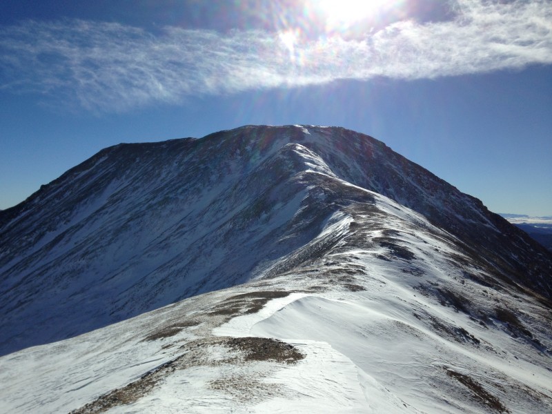
Looking up Argentine Peak's ridge to its false summit
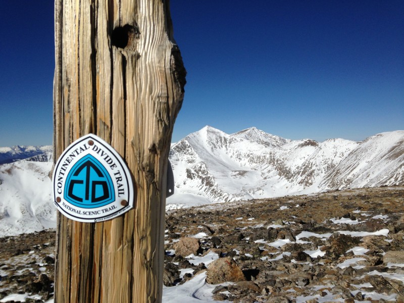
The ridge up to Argentine's false summit was moderate in slope, and here we joined the Continental Divide (which we would follow until Mt Edwards' summit). We cruised across the summit plateau to the summit that had a nice stick marking the CTD in the cairn.
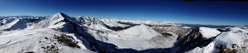
Panorama from atop Argentine Peak
CTD sign atop Argentine Peak
We relaxed on Argentine's summit for 15min or so and then began the 2mi traverse to Mt Edwards' summit. As we descended off of Argentine, there was a fairly steep 60' high bump that surprised both of us. Afterwards, the ridge mellowed out again and in short order we reached Argentine Pass.
Panorama from Argentine Pass with G/T ahead.
Looking back east from whence we came from Argentine Pass
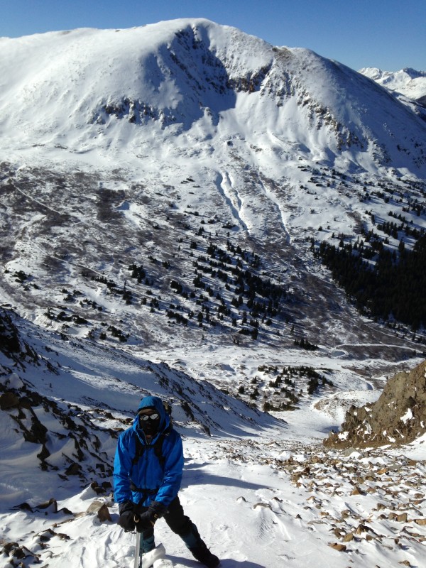
Grays, Torreys and Edwards and Scott
As we walked the ridge we were amazed at the quantity of tracks we saw in the snow following the ridge. It was a veritable animal Superhighway up here!
Animal Superhighway?
About 1.5hrs after leaving Argentine we reached the summit of our highest peak of the day, 13,850' Mt Edwards, and my last Centennial Peak to climb in the Front Range. The views across to Grays/Torreys and the entire Stevens Gulch Basin were incredible.
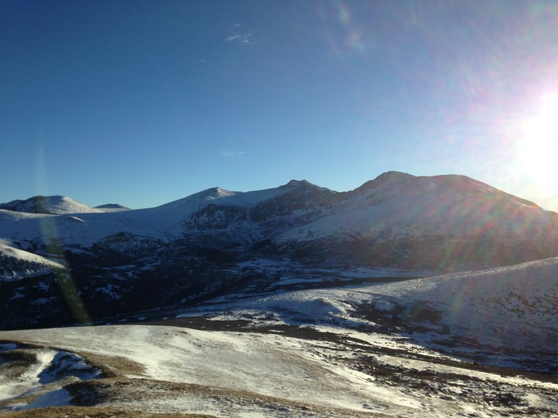
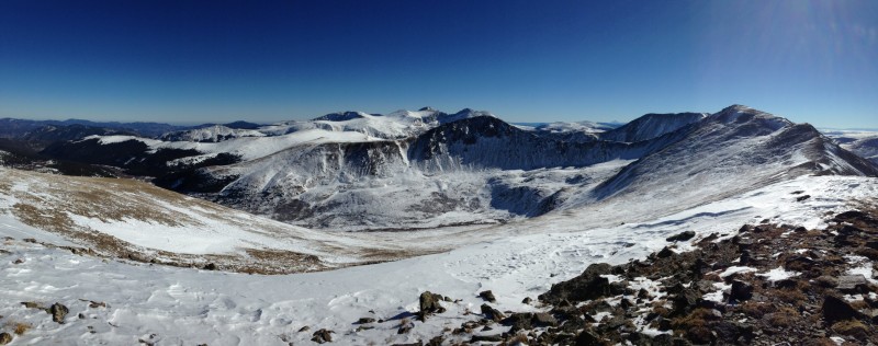
Spectacular Steven's Gulch Panorama
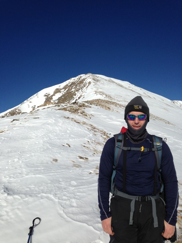
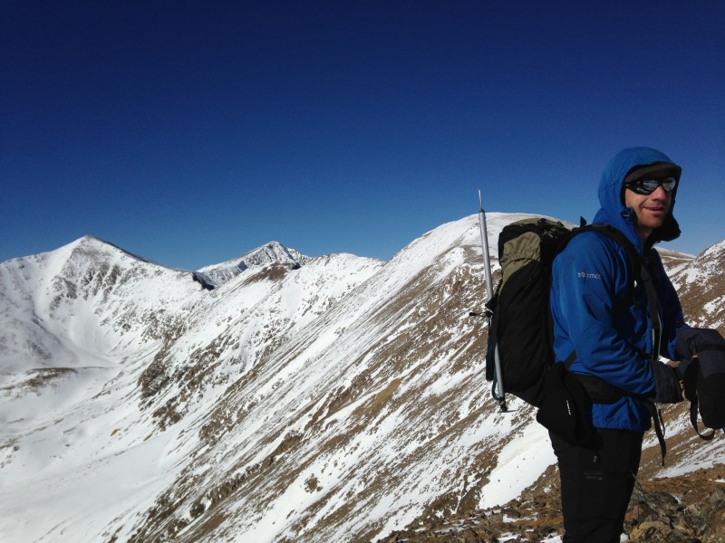
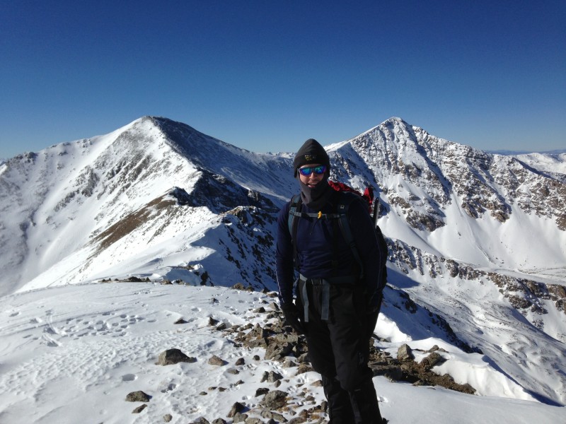
Me with Grays and Torreys behind from Mt Edwards' summit
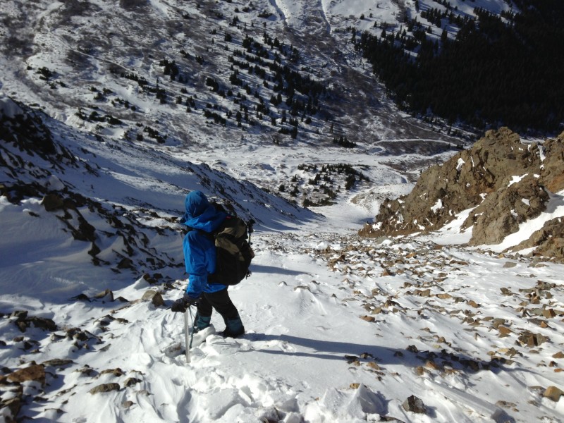
We stood admiring the views for 10min or so. From here we spotted a couloir on the north side of McClellan that looked safe to descend and would drop us off right at the Grays/Torreys Trailhead. There wasn't really a good spot to get out of the chilly breeze so we began our descent down to McClellan Mtn. The 180' climb back up to McClellan from the saddle with Edwards went quickly. Every time the breeze would calm I would say "This looks like a good spot for a break" and then a gust would come along. We finally found a nice tundra area with no wind. Here we relaxed for 20min or so and had lunch.
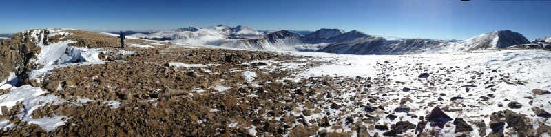
Panorama from McClellan Mtn
After lunch we continued down the ridge towards the couloir we had spotted from Edwards' summit. As we neared the couloir we saw a herd of 17 mountain goats decked out in their long Winter white coats chilling at the top the couloir. They fled from us along the ridge as we neared them.
View of G/T from top of couloir we used for descent
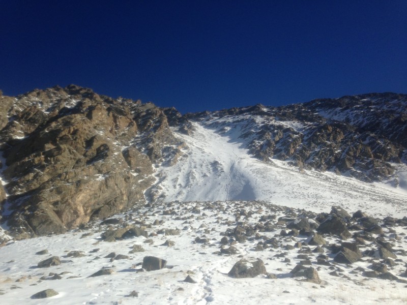
From the top of the couloir we could see that it was mainly loose talus and snow clear to the bottom. This 2000' couloir provided a nice quick and clean exit from the ridge and dropped us off right at the Grays/Torreys TH. It was mainly a combo of plunge stepping in snow and scree skiing the whole way down.
Couloir was snowy further down. Snow was usually calf to knee deep.
Scott descending the couloir
Looking back the couloir. I would NOT recommend trying to climb this couloir w/o good snow conditions. Talus is VERY loose!
You can see our tracks in the couloir.
From the TH we strolled the 3mi down the slippery, snow-packed and rutted road to the Winter parking area at the Bakerville Exit off I-70.
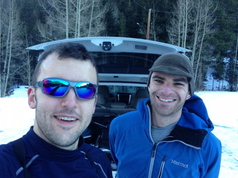
Scott and I at my car at the Bakerville winter parking area.
We quickly loaded up in my car and drove back up to Guanella Pass to get Scott's car. Ski traffic congestion began right above Georgetown so we both ended up driving down to Grant and taking the nice and clear 285 back into town.
Pretty sunset view of the E/B and the Sawtooth
This was a fantastic trip! I highly recommend doing this as a Point-to-Point. It would suck to have to retrace your steps back to Guanella Pass!
My GPS Tracks on Google Maps (made from a .GPX file upload):
That's a solid itinerary in winter...you string together some good ones.
Caution: The information contained in this report may not be accurate and should not be the only resource used in preparation for your climb. Failure to have the necessary experience, physical conditioning, supplies or equipment can result in injury or death. 14ers.com and the author(s) of this report provide no warranties, either express or implied, that the information provided is accurate or reliable. By using the information provided, you agree to indemnify and hold harmless 14ers.com and the report author(s) with respect to any claims and demands against them, including any attorney fees and expenses. Please read the 14ers.com Safety and Disclaimer pages for more information.
Please respect private property: 14ers.com supports the rights of private landowners to determine how and by whom their land will be used. In Colorado, it is your responsibility to determine if land is private and to obtain the appropriate permission before entering the property.


 Looking down the couloir with Kelso Mtn behind. The couloir began fairly dry.")


