| Report Type | Full |
| Peak(s) |
Wasson Peak - 4687 |
| Date Posted | 11/28/2013 |
| Date Climbed | 11/26/2013 |
| Author | Greenhouseguy |
| Wasson Peak, Arizona - Hugh Norris Trail |
|---|
|
Wasson Peak 4,687 Feet (3,530th Highest in Arizona) Hugh Norris Trail (Class 1) from the Hugh Norris Trailhead (2,580 Feet) Roundtrip Mileage: about 10.0 Miles Elevation Gained: about 2,400 Feet December 4th, 2009, March 13th, 2012, November 26th, 2013 Solo Dawn to Dust The Saguaro cactus is the symbol of the southwest that many people became familiar with by watching old western movies. These cacti can reach 50 feet in height, and may weigh up to eight tons. Although they may live for 200 years, not many live longer than 150 years. They only grow in a limited area of the northern Sonoran Desert in Mexico and Arizona. Encroachment by urban development and ranching operations threatened some of the most pristine stands of Saguaro cacti near Tucson in the early 20th century. President Herbert Hoover set aside an area east of Tucson as a national monument in 1933 to help preserve these unique plants. John F. Kennedy signed the bill that added a noncontiguous area west of Tucson to the national monument in 1961. The two districts of the national monument became Saguaro National Park in 1994. Of the two districts, the Rincon Mountain (eastern) District of the park has the highest mountains and most diverse ecology. The Tucson Mountain (western) District has some of the oldest and most dense stands of Saguaro cactus in existence. Wasson Peak is the highpoint of the Tucson Mountain District of Saguaro National Park. It was named for John Wasson, who was Surveyor General of the Arizona Territory and served as the editor of the Tucson Citizen newspaper in the 1870's and 1880's. He relocated to California in 1882, and died there in 1909. 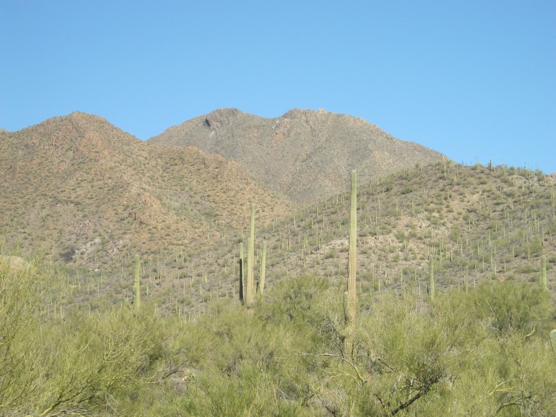 Wasson Peak viewed from a pullout on Kinney Road Before I started the hike, I stopped in at the Red Hills Visitor Center to pay for admission to Saguaro National Park. Admission is $10 per carload, and can be paid at a self-pay kiosk. There is also a free station for filling water bottles near the kiosk. Unfortunately, the restrooms are only unlocked when the visitor center is open. The Hugh Norris Trail starts in a Saguaro forest in a desert wash and winds through the Tucson Mountains for about five miles to the highest point in the western district of the park. The trail is the longest of several routes to the summit of Wasson Peak. It was named for a well-liked police officer and prominent community leader for the Tohono O'odham tribe, whose reservation is nearby. 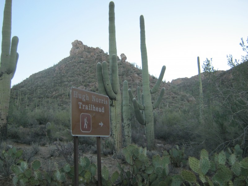 The Hugh Norris Trailhead The lower part of the trail is well-maintained and built with many stone steps to withstand high foot traffic and erosion. The hike starts out in the bajada, and turns due east to switchback up the south side of a small canyon. Two out of the three times that I've been up the canyon, I've seen mule deer browsing on the desert scrub. 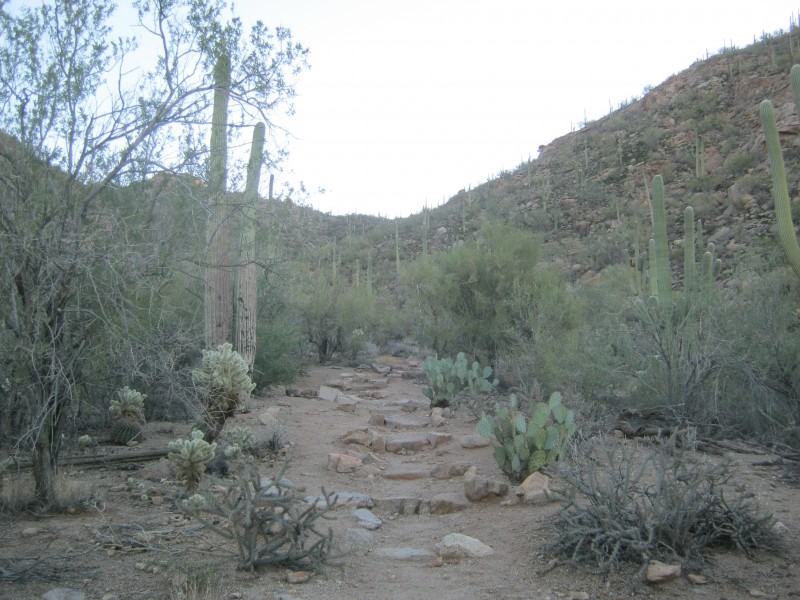 Starting up the canyon on the Hugh Norris Trail 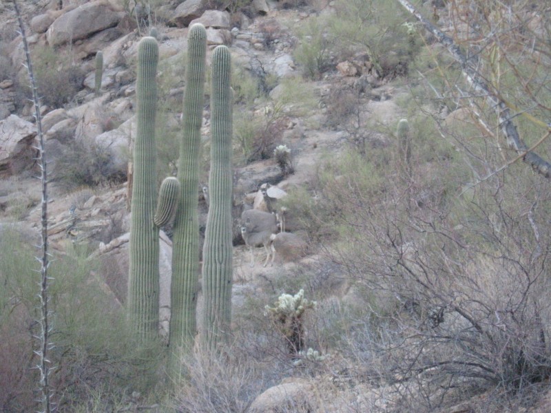 Alarmed mule deer in the canyon 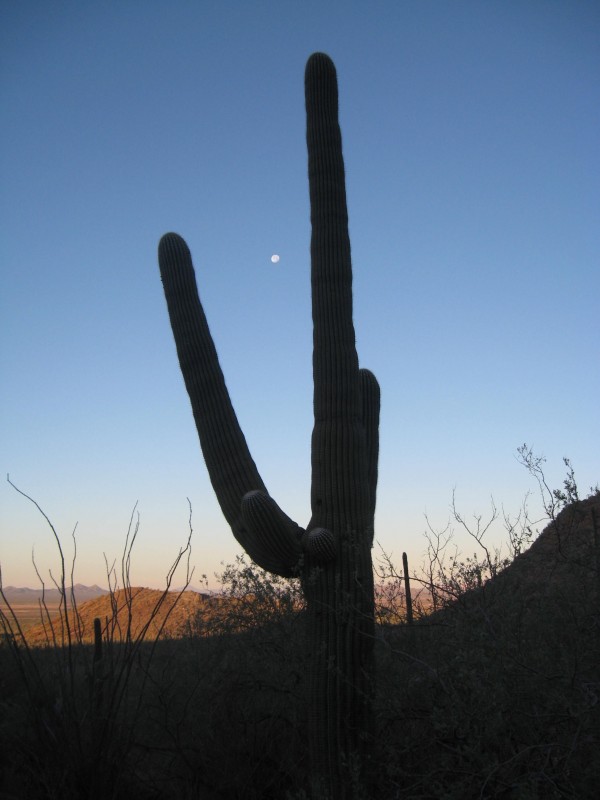 The park's namesake, the giant saguaro cactus (Carnegiea gigantea) I reached the head of the canyon at 0.86 miles. At the head of the canyon, there is a small saddle that gives a good view of the entire spine of the Tucson Mountains. Wasson Peak's summit is visible from this saddle, but it is obscured from view for much of the remainder of the hike. 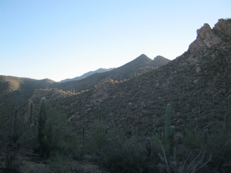 View from the first saddle. Wasson Peak is the farthest peak along the ridge in the distance. Beyond the first saddle, the trail is fairly level as it contours around two subpeaks on the ridge. The third saddle is fairly large and gives good views to the north and south. 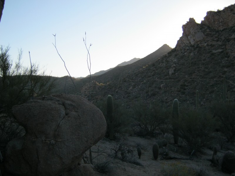 View of the trail as it contours along the north side of the ridge 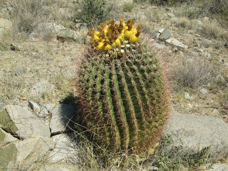 Fishhook barrel cactus (Ferocactus wislizeni) growing on the ridge. These cacti frequently lean to the south as they age 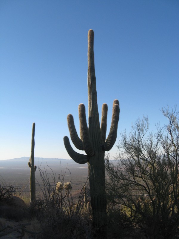 View to the south from the third saddle One of the more interesting plants of the Sonoran Desert is the Ocotillo or Devil's Coachwhip (Fouquieria splendens). Virtually every square inch of this plant is covered with sturdy spines. The stems are photosynthetic, and are leafless for much of the year. They only have leaves for a few weeks following a heavy rain, after which they are dropped in order to preserve water. 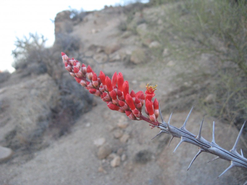 Ocotillo flower (image taken 12/04/2009) 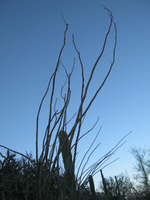 Ocotillo plant growing on the ridge The trail mostly stays on the north side of the ridge until the final push in the last mile. There are a few dips in the trail in the first couple of miles that must be regained on the return trip, but none of them are particularly long or steep. 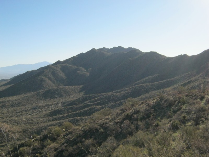 Looking towards the summit from the north side of the ridge The best time to hike the Hugh Norris Trail is probably in March several weeks after a heavy rain. The number and diversity of the wildflowers is nothing short of amazing. The bloom for the rest of the season may be sporadic, but the landscape is never drab. 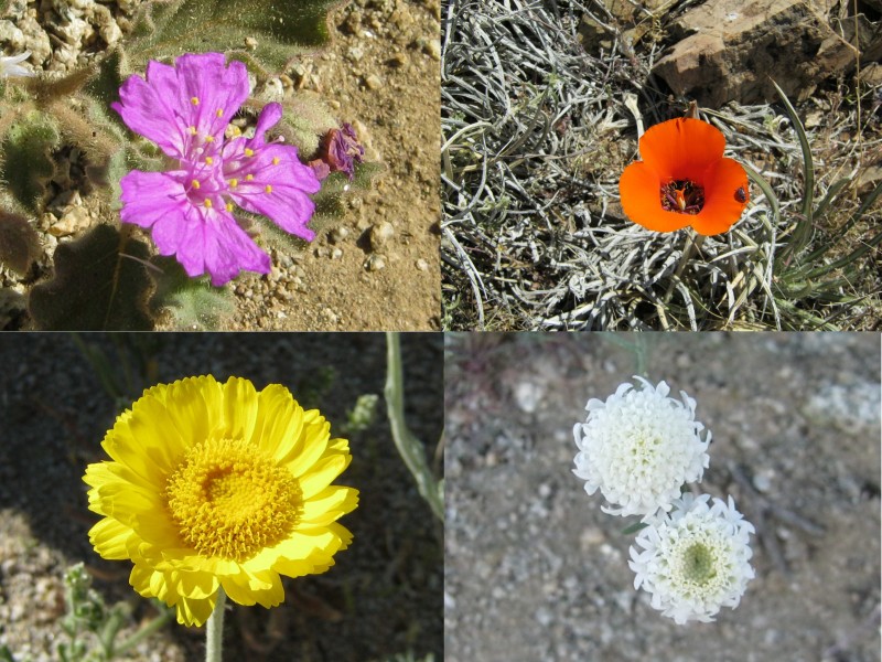 Wildflowers of Saguaro National Park part one: (clockwise from upper left: trailing windmills (Allionia incarnata), mariposa lily (Calochortus kennedyi), desert pincushion (Chaenactis stevioides), desert marigold (Baileya multiradiata)) 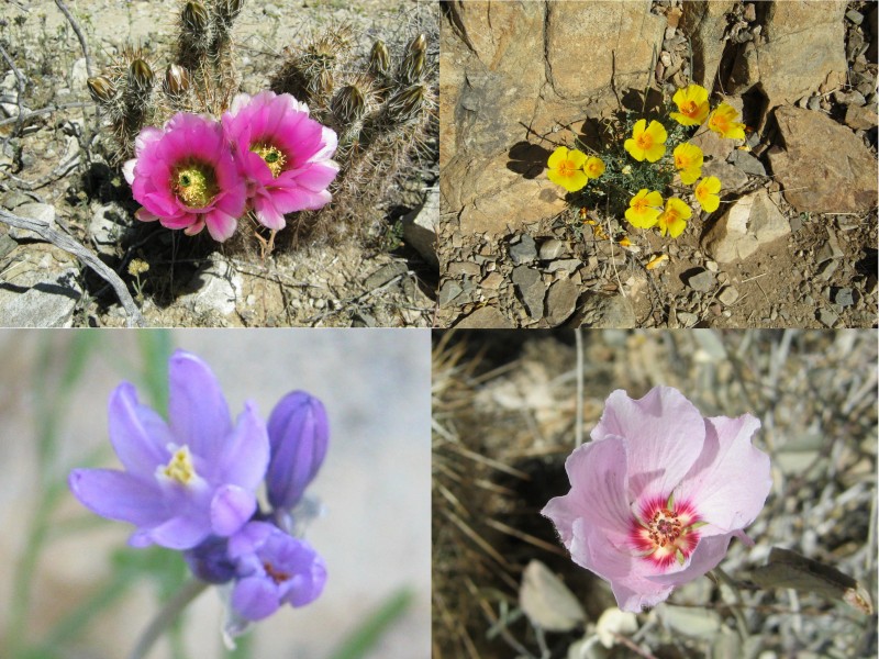 Wildflowers of Saguaro National Park part two: (clockwise from upper left: strawberry hedgehog cactus (Echinocereus engelmannii), Mexican gold poppy (Eschscholzia californica var. mexicana), rock hibiscus (Hibiscus denudatus), blue dicks (Dichelostemma capitatum)) 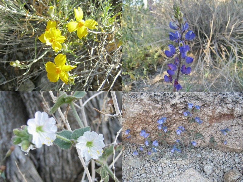 Wildflowers of Saguaro National Park part three: (clockwise from upper left: whitestem paperflower (Psilostrophe cooperi), arroyo lupine (Lupinus sparsiflorus), wild heliotrope (Phacelia distans), desert four o'clock (Mirabilis bigelovii)) After 2.74 miles, I crossed the junction with the Sendero Esperanza Trail. This trail offers a slightly shorter route than the Hugh Norris Trail, and it has a good reputation as a wildflower hike in the appropriate season. 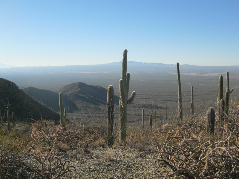 View to the south from the junction with the Sendero Esperanza Trail. The lower mountains to the south are the Red Hills.  View to the north near the junction with the Sendero Esperanza Trail The high winds were kicking up plenty of sand and dust, and I heard a curious clacking sound as I hiked along the ridge. I found that the source of the noise was the woody ribs of a dead saguaro that had died and decayed in an upright position. This wood can be useful in an environment that is generally devoid of "real" trees. 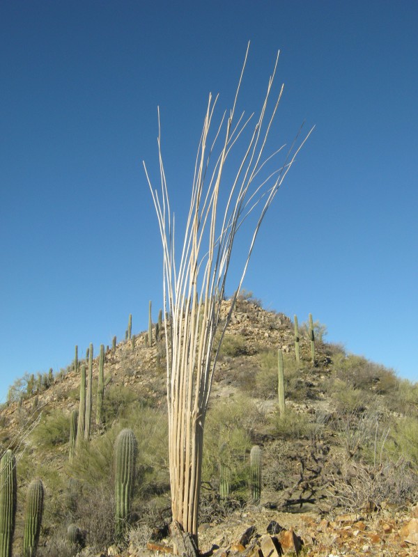 Woody skeleton of a dead saguaro cactus In the last mile or so of trail, the environment changes subtly. The lower temperatures at higher altitudes push the limits for saguaro cactus survival. A few hardier specimens are able to survive near the summit, but it can no longer be called a saguaro forest. Technically, it would be called chaparral. 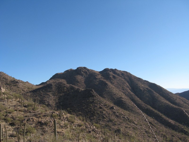 Higher on the ridge of the Tucson Mountains One of the last major bumps on the ridge before reaching the summit is called Amole Peak. Bushwhacking to the summit is discouraged, as is all off-trail hiking in the park. The peak is named for a type of agave that grows abundantly on its slopes. The amole (Agave schottii) is known as "shindagger" to English speakers because its sharp, rigid leaf tips are at just the right height to puncture a hiker's shins. The plant is not useful for food, but Indians used a concoction made from the roots to wash their hair and clothing. 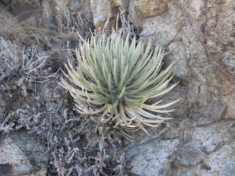 Shindagger (Agave schottii) growing on the south slope of Amole Peak At 4.63 miles, I crossed the junction with the King Canyon Trail. The King Canyon route on Wasson Peak is shorter, but the last portion is much steeper than any portion of the mellow Hugh Norris Trail. It looks like a fun route, but it would probably be a bad place to make a wrong turn on the descent. There is a marker with arrows at the junction to keep hikers properly oriented. The summit is only 0.3 miles beyond this junction. 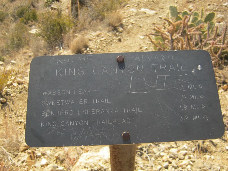 Sign at the junction with the King Canyon Trail Wasson Peak is near the Tucson International Airport, which is shared by military and civilian aircraft. The Tucson Air National Guard flies F-16 fighter jets out of the facility, and I noticed several flyovers as I approached the summit. 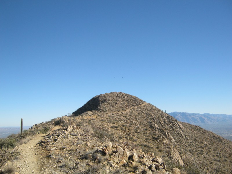 A pair of fighter jets over the summit of Wasson Peak What the summit lacks in drama, it makes up for with great views. To the north are the beautiful Santa Catalina Mountains. Tower Peak and Bushmaster Peak are neighbors to the southeast. The Red Hills are adjacent to the south, and Bobiquivari, Mt. Wrightson, and many other mountains are visible in the distant south. Tucson's urban sprawl and several mining operations lurk just outside of the park. 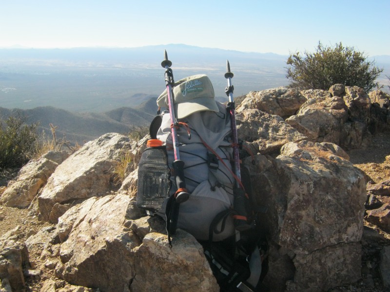 Summit shot 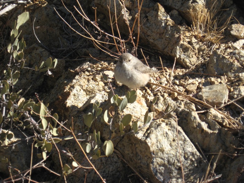 Friendly bird on the summit  Tower Peak and Bushmaster Peak to the southeast of Wasson Peak 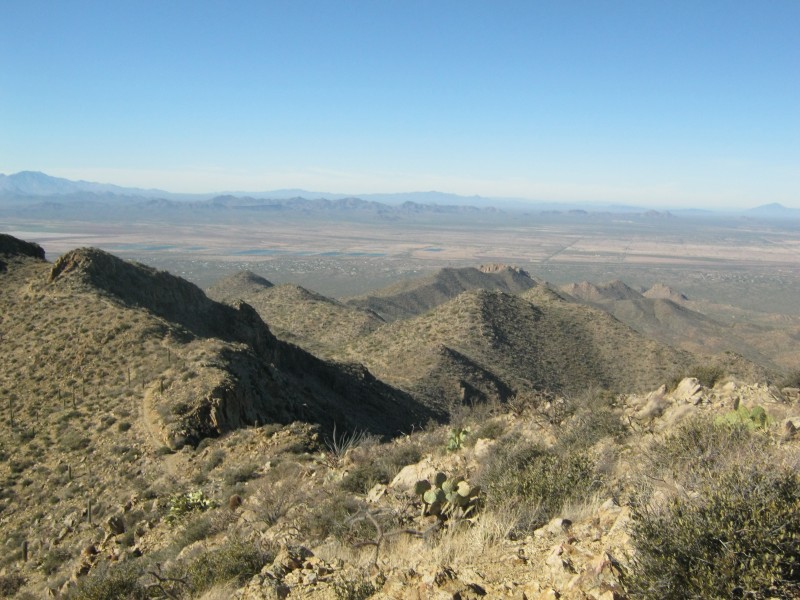 Looking back down the Tucson Mountains towards the trailhead. Amole Peak is in the foreground on the ridge.  Santa Catalina Mountains to the north I bailed over the edge and found a sheltered spot to have lunch. The only other group on the mountain took off, leaving me alone on the summit. This route probably sees a fair amount of traffic, but not today. On the way back down I noticed that my descent time was not much faster than my ascent, possibly because of all of the granite "speed bumps" on the trail. 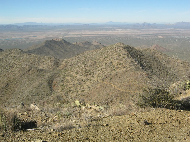 Looking back down the ridge from high on the trail One last gratuitous plant vignette...the sotol (Dasylirion wheeleri) is known as desert spoon to English speakers. The leaves are arranged like a burst of fireworks, and it performs well in xeric gardens. The plant has been useful to humans for thousands of years, and it continues to be useful in modern times. The leaves can be woven into durable baskets and mats. The base of the leaf can be used as a spoon. The flower stalks can be used to start fires. Like many agaves, the core of the stem can be baked and eaten. The stem can also be fermented and distilled into a beverage known as sotol, which is similar to mezcal or tequila. The sotol is an excellent example of how the Indians used everything that nature gave them in order to survive in a harsh environment.  Desert spoon (Dasylirion wheeleri) on the Hugh Norris Trail  GPS track of the Hugh Norris Trail to the summit of Wasson Peak The Hugh Norris Trail provides big rewards relative to the effort required to hike it. The scenery is tremendous throughout the hike, and no part of the trail could be described as difficult. The wildflowers, cacti, and wildlife such as deer, javelina, coyotes, and numerous species of birds make this hike particularly attractive to naturalists. The Sonoran Desert Museum just outside of the park is a great place to spend the rest of the day after the hike. The other routes on Wasson Peak certainly have their merits, but the Hugh Norris Trail is no ordinary walk in the park. Thumbnails for uploaded photos (click to open slideshow): ")
")
")
")
")
")
")
")
")
")
")
")
")
")
")
")
")
")
")
")
")
")
")
")
")
")
")
")
")
")
|
| Comments or Questions | ||||||
|---|---|---|---|---|---|---|
|
Caution: The information contained in this report may not be accurate and should not be the only resource used in preparation for your climb. Failure to have the necessary experience, physical conditioning, supplies or equipment can result in injury or death. 14ers.com and the author(s) of this report provide no warranties, either express or implied, that the information provided is accurate or reliable. By using the information provided, you agree to indemnify and hold harmless 14ers.com and the report author(s) with respect to any claims and demands against them, including any attorney fees and expenses. Please read the 14ers.com Safety and Disclaimer pages for more information.
Please respect private property: 14ers.com supports the rights of private landowners to determine how and by whom their land will be used. In Colorado, it is your responsibility to determine if land is private and to obtain the appropriate permission before entering the property.


