| Report Type | Full |
| Peak(s) |
Sandia Crest - 10678 |
| Date Posted | 11/17/2013 |
| Date Climbed | 11/10/2013 |
| Author | Greenhouseguy |
| Additional Members | SenadR |
| La Luz Trail to Sandia Crest |
|---|
|
Sandia Crest 10,678 Feet (120th Highest in New Mexico) La Luz Trail from the Juan Tabo Picnic Area Trailhead Elevation 7,060 Feet 14.8 Miles Roundtrip Approximately 3,700 Feet Elevation Gained Class 1 November 10th, 2013 Partner: SenadR La Luz Trail to Sandia Crest Sandia (Spanish for watermelon) Peak reportedly received its name because its rosy granite resembles the flesh of a watermelon at sunset. The mountain rises from the desert floor outside of Albuquerque, and harbors an amazing range of biological diversity. At the trailhead, one can find desert plants such as cholla cactus, banana yucca, and plains prickly pear cactus growing among gray oak, pinyon pines, and single seed junipers. For those of us who are interested in such things, this is known as the Upper Sonoran Life Zone. At higher altitudes on the mountain, cooler temperatures and increased precipitation support species that would be more familiar to Coloradoans; ponderosa pines, Gambel oaks, and Rocky Mountain junipers are among the dominant plants. This Transition Life Zone is found between approximately 8,000 and 9,000 feet of elevation. Between about 8,500 feet and the summit, one can find Canadian Life Zone plants such as Douglas fir, white fir, and Rocky Mountain maples. For the naturalist, it's a joy to experience so many habitats on a single hike. 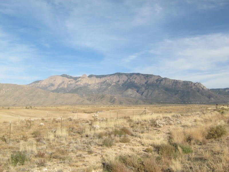 A view of Sandia Mountain from the West The La Luz Trail is one of the most popular hiking trails on Sandia Mountain, but the nearly 15-mile trek to the crest and back is too grueling for many casual hikers. Some choose to take the Tramway Trail to La Luz, hike to the summit, and take the tramway to descend to the Tramway trailhead. The La Luz Trailhead is located at the Juan Tabo Picnic Ground, which was constructed by the Civilian Conservation Corps in the 1930's. The abandoned stone cabin that served as the CCC headquarters is an object of curiosity for many visitors. 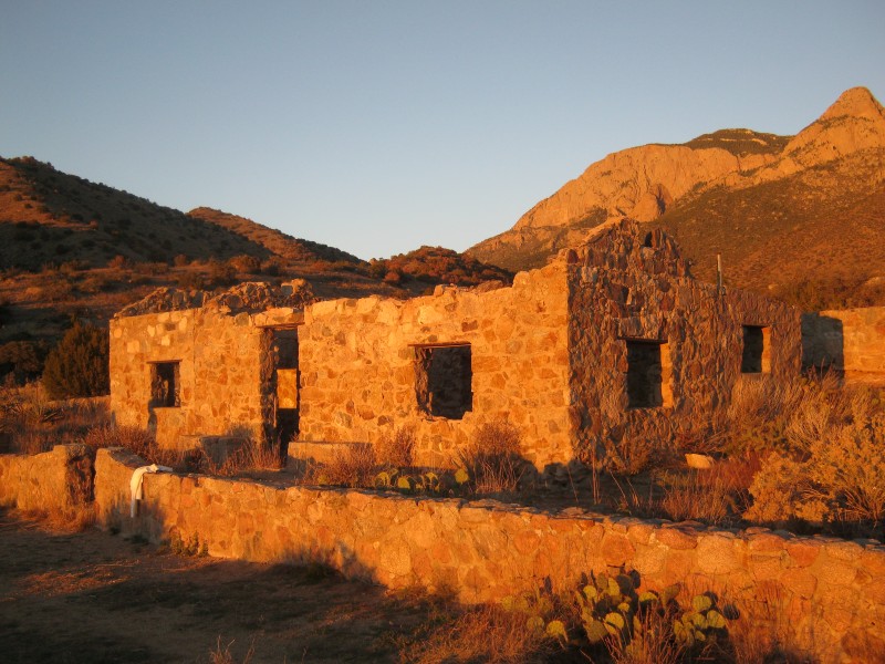 The Juan Tabo cabin The road to the La Luz trailhead is paved, and there is ample parking. There is ordinarily a $3.00 charge for use of the facilities, but the charge was waived in honor of Veteran's Day weekend. We were among the first to arrive, but the lot was full by the time we returned. Late risers get lousy parking spots! 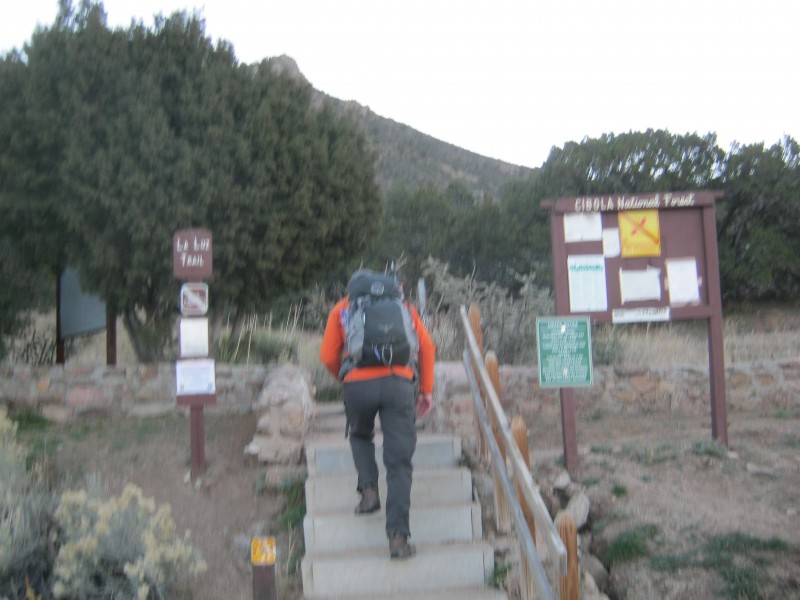 Starting out on the La Luz Trail The well-worn trail starts out in a shallow valley on the west side of the mountain. This allows trekkers to hike in the shade for much of the day as they wait for the sun to rise above the crest. Our view to the west was initially blocked by a low ridge, but the valley floor and downtown Albuquerque eventually came into view as we moved upwards towards the head of the valley. 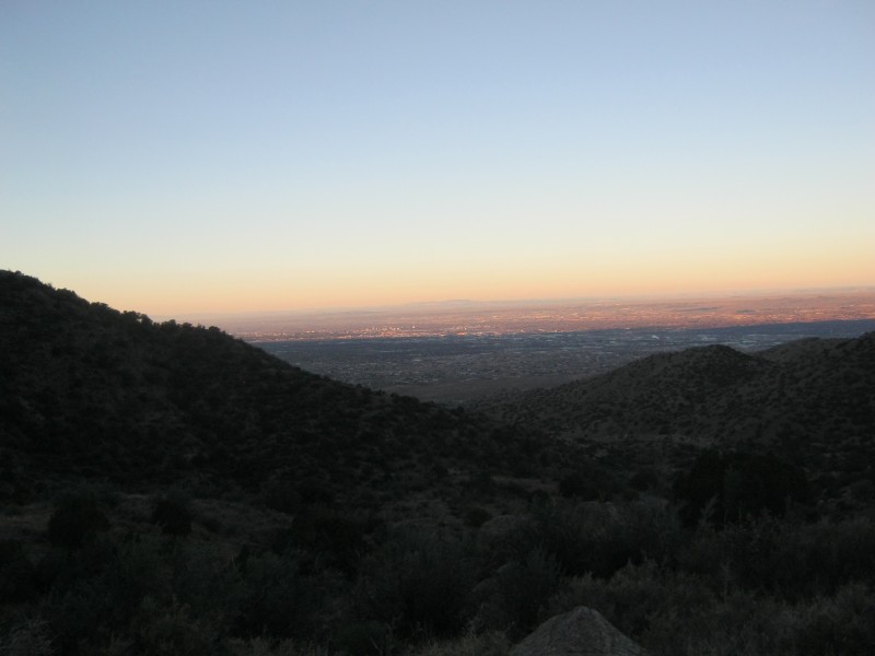 Looking westward towards downtown Albuquerque At about 0.9 miles, we reached the junction with the Tramway Trail. This 2.5-mile trail heads to the base of the tramway that goes to the summit. The junction is clearly marked with a sturdy metal sign, but making a wrong turn here on the way down could leave one far from the correct trailhead. 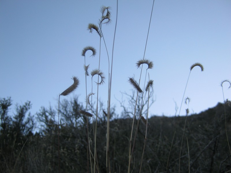 Blue grama grass (Bouteloua gracilis ) beside the trail The cane cholla, prickly pear cactus, and banana yuccas offered us a not-so-gentle reminder to stay on the trail. Desert plants frequently store water in their leaves, and many have evolved spines as a strategy to defend themselves from thirsty creatures. Bushwhacking isn't much fun when the bushes whack back.  Cane cholla (Opuntia imbricata) with the true summit directly above in the distance. The high point of the crest is immediately to the right of the radio towers, which are barely visible in this image. La Cueva Canyon is visible to the right. The canyon that the upper part of the trail follows is called La Cueva Canyon, which is Spanish for "the cave." The limestone in the upper reaches of the canyon must certainly contain caves, but it probably earned its name because it is deep, shady, and relatively cool. These attributes may be virtues in the scorching summer heat, but in the cooler months it simply means that ice, snow, and hikers will remain frozen. 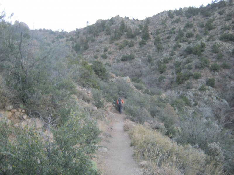 Sen rounding a bend in the lower reaches of the canyon  Wild buckwheat (Eriogonum polycladon) seeds provide food for small mammals  A pinyon pine (Pinus edulis) silhouetted against the rising sun. This tree's seeds (pine nuts) are tasty roasted or in pesto sauce. Just as the dust of the scrubby desert was getting monotonous, the landscape began to change. Massive granite domes and spires lined both sides of the canyon. For rock climbers, this is a true paradise. The rest of us can just gaze humbly at the sheer cliffs and enjoy the picturesque scenery. 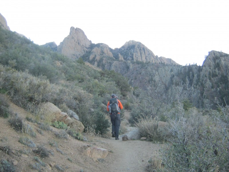 Sen approaching some impressive granite formations in La Cueva Canyon As we entered the upper part of the canyon, the trail itself changed. The trail was mostly dirt below, but it became increasingly rocky as we gained elevation in the canyon. The trees (ponderosa pine, aspen, and Douglas fir) were reminiscent of a Colorado foothills hike. We started to encounter light patches of fresh snow. We were clearly no longer in the desert.  The fir-lined flanks of Sandia Crest  The fuzzy tails of the mountain mahogany (Cercocarpus montanus) seeds twist like a corkscrew when they get wet, and can actually help push the seed into the soil The trail switchbacks through a talus field on the south side of the canyon numerous times. This section was icy, but I didn't need any traction on the way up. I was grateful to have microspikes on the way back down, though. The rock formations gave us jagged skylines in every direction, and watching the sunlight pour through the crevices in the rocks was fascinating. 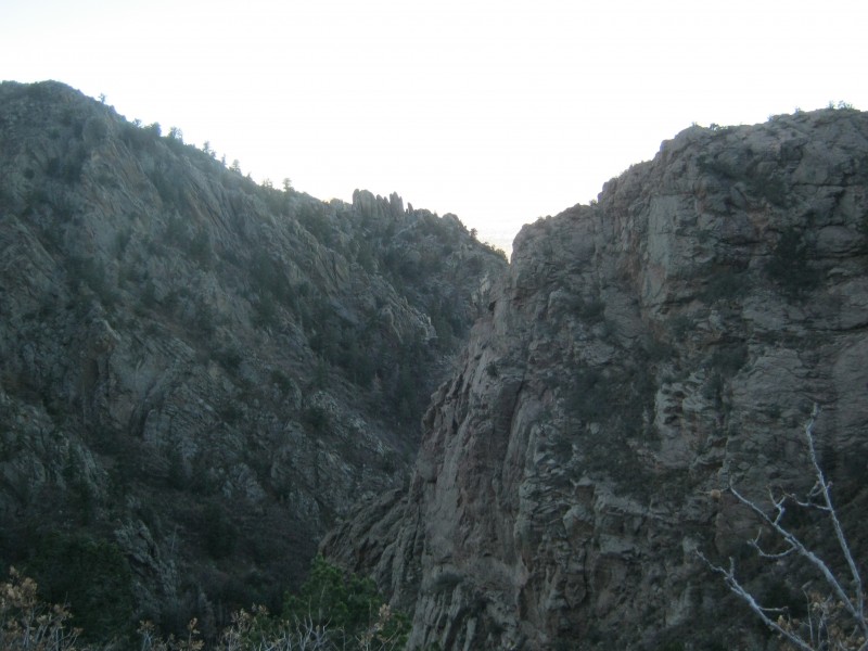 Entering the shadowy recesses of the canyon  Standing at the base of a formation known to rock climbers as The Thumb 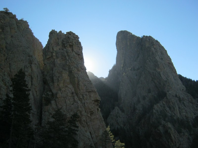 Passing between granite towers in the canyon 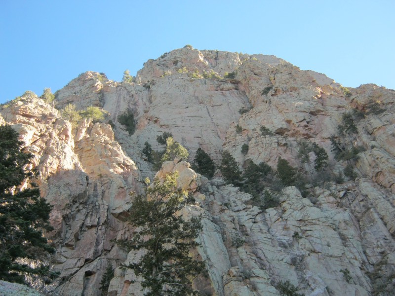 Hiking below a massive cliff near the head of the canyon  Is this spire giving me the finger? Walking through the tall coniferous forest in the canyon, it was hard to believe that we were actually on a sky island in the desert. The route kept us in the talus field for a long time. As Gerry Roach stated, geological time is now; rocks are still falling to the talus field from the cliffs above. I heard several large rocks fall, but I didn't actually see them.  The upper canyon 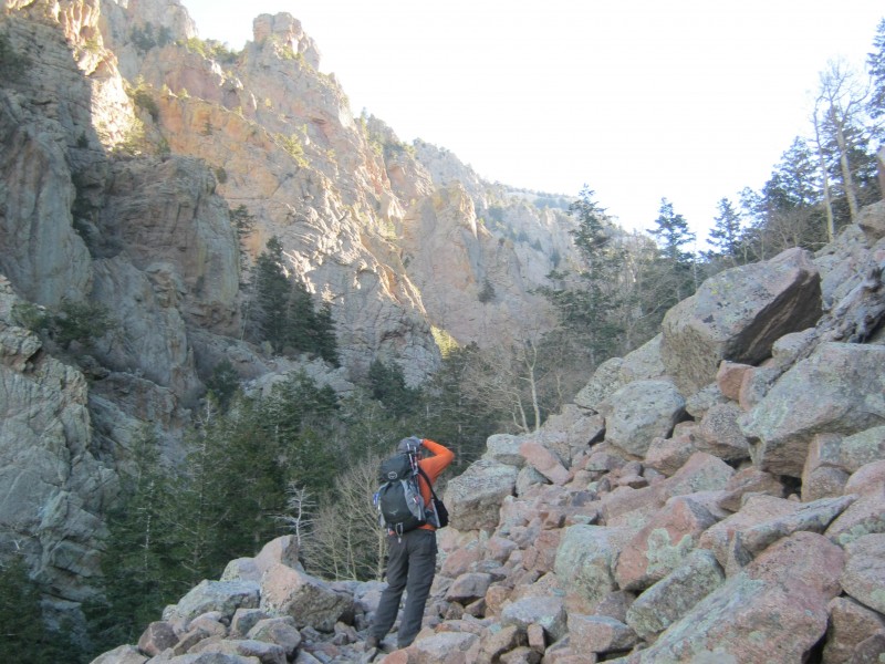 Sen on one of the many talus field crossings The snow on the south side of the canyon came as somewhat of a surprise. No snow was visible from a distance or from the trailhead. I thought that I had cleaned out all of my winter gear from my backpack for this hike, but fortunately I had left my microspikes in a water bottle pocket. The snow was not even ankle deep, but it made for poor traction on the rocks. A sign beside the trail at the five-mile mark warns hikers that snow frequently makes the trail impassable. When the trail is impassable, some hikers continue up the middle of the canyon on snowshoes. 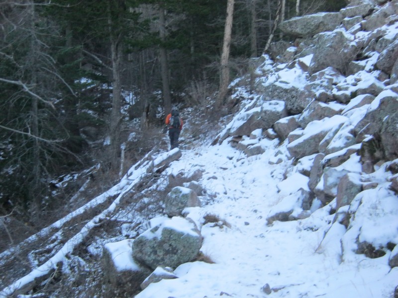 Sen exiting the talus field and entering the forest After 6.5 miles on the trail, we reached a saddle at the junction of the La Luz and Crest trails. A large flat rock at the junction makes an excellent spot to take a break. We headed left (north) towards the Crest. A right-hand turn would have taken us to the upper Tramway station. The summit is about 0.7 miles and 600 vertical feet above the saddle. 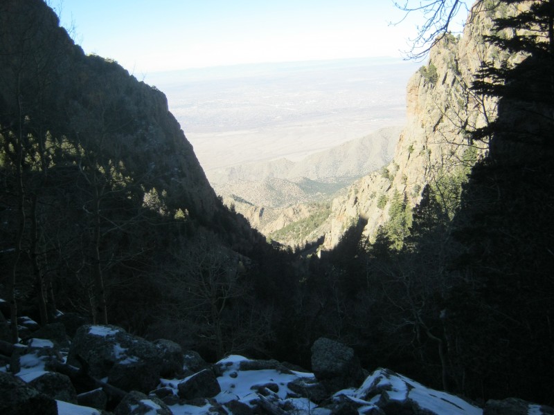 Looking back down the canyon At one troublesome spot on the trail about 0.25 miles beyond the saddle, the Forest Service built a concrete staircase to help hikers bypass a rock wall. 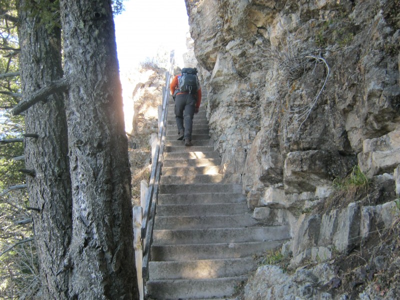 Sen ascending the staircase  Creeping grape holly (Mahonia repens) growing in a crack in the rock wall 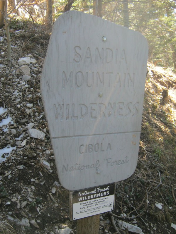 A reminder that we were in the Sandia Mountain Wilderness 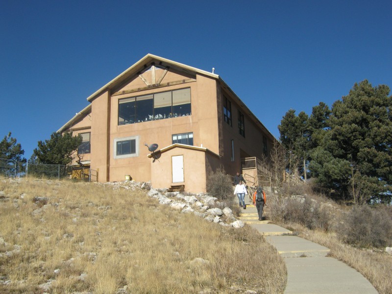 Approaching the Sandia Crest House  View from the Sandia Crest observation area Hiking Sandia Crest is all about the journey, not about the destination. During the hike, we were amazed by nature's splendor at every turn in the trail. At the summit, we were greeted by a paved parking lot, a gift shop, and numerous tourists. It was not unlike a Pikes Peak experience. An observation area above the gift shop marked the high point of the Crest. The view of the desert floor and downtown Albuquerque was amazing. We could see Mount Taylor, San Antonio Mountain, the Manzano Mountains, and the southern Sangre de Cristos. A large antenna field lies to the north of the summit. We chatted with some tourists and took an extended break. On the way back down, we passed throngs of hikers. Some were actually bound for the summit, while many were just out to see how far their legs would take them. 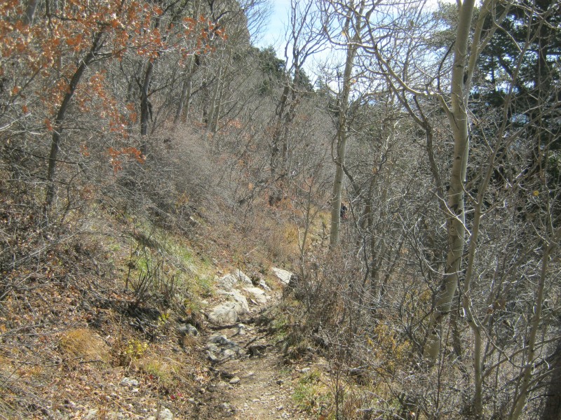 Descending towards the saddle through scrub oak and aspen 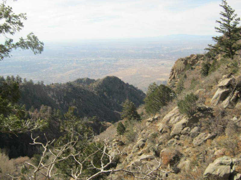 Hiking through the middle part of the canyon  Glancing back at the upper part of the canyon 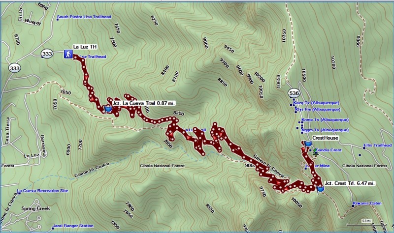 GPS track of our route on the La Luz Trail Sandia Crest is a rite of passage for many New Mexico hikers, and it's a great introduction to trekking in the desert. The hike can be excruciatingly hot in the summer and brutally cold in the winter, so we were fortunate to experience it in a shoulder season. For us mere mortals, 15 miles tends to be a bit long for a day hike. However, I found this hike to be a real eye-opener. I have always thought that the mountain just looked like a big lump of rock from the interstate, but I was pleasantly surprised to find that it has numerous rock formations that would look right at home in Yosemite. You can't lose when you hike La Luz! Thumbnails for uploaded photos (click to open slideshow): ")
")
")
")
")
")
")
")
")
")
")
")
")
")
")
")
")
")
")
")
")
")
")
")
")
")
")
")
")
")
|
| Comments or Questions | |||||||||
|---|---|---|---|---|---|---|---|---|---|
|
Caution: The information contained in this report may not be accurate and should not be the only resource used in preparation for your climb. Failure to have the necessary experience, physical conditioning, supplies or equipment can result in injury or death. 14ers.com and the author(s) of this report provide no warranties, either express or implied, that the information provided is accurate or reliable. By using the information provided, you agree to indemnify and hold harmless 14ers.com and the report author(s) with respect to any claims and demands against them, including any attorney fees and expenses. Please read the 14ers.com Safety and Disclaimer pages for more information.
Please respect private property: 14ers.com supports the rights of private landowners to determine how and by whom their land will be used. In Colorado, it is your responsibility to determine if land is private and to obtain the appropriate permission before entering the property.


