Download Agreement, Release, and Acknowledgement of Risk:
You (the person requesting this file download) fully understand mountain climbing ("Activity") involves risks and dangers of serious bodily injury, including permanent disability, paralysis, and death ("Risks") and you fully accept and assume all such risks and all responsibility for losses, costs, and damages you incur as a result of your participation in this Activity.
You acknowledge that information in the file you have chosen to download may not be accurate and may contain errors. You agree to assume all risks when using this information and agree to release and discharge 14ers.com, 14ers Inc. and the author(s) of such information (collectively, the "Released Parties").
You hereby discharge the Released Parties from all damages, actions, claims and liabilities of any nature, specifically including, but not limited to, damages, actions, claims and liabilities arising from or related to the negligence of the Released Parties. You further agree to indemnify, hold harmless and defend 14ers.com, 14ers Inc. and each of the other Released Parties from and against any loss, damage, liability and expense, including costs and attorney fees, incurred by 14ers.com, 14ers Inc. or any of the other Released Parties as a result of you using information provided on the 14ers.com or 14ers Inc. websites.
You have read this agreement, fully understand its terms and intend it to be a complete and unconditional release of all liability to the greatest extent allowed by law and agree that if any portion of this agreement is held to be invalid the balance, notwithstanding, shall continue in full force and effect.
By clicking "OK" you agree to these terms. If you DO NOT agree, click "Cancel"...
My company no longer thought that Columbus Day was an appropriate holiday, so we switched it to Veterans Day a few years ago. A much better reason to celebrate/remember, with the majority of the males in my family having served in one branch or another over the decades on 2 continents. Thankfully this year, the weather was great, and on a Monday. So I took advantage of it by searching out a loop that I have wanted to do with snow for a while. Only a few trip reports on these 2 peaks alone, and none have done the ridge loop. So I set out to see what it was like.
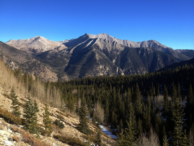
Being a Sunday night, no one was driving on the road by the trailhead, so I got a lovely ~12hr sleep at the base. Once again, no need to get up early in the cold when you have all day in the warm sunshine to complete the hike! So at the post-sunrise hour, I started hiking up the Baldwin Gulch Rd to where it splits off to head up Boulder Mountain. After the split, the road was snowy, and got deep enough to be annoying. Glad I wore my LS Glaciers today, as my feet were submerged below snow until treeline. I followed a couple switchbacks until it became ridiculous. Walking up the ridge isn't that steep and was quite pleasant as I stuck to the left side in the sun.
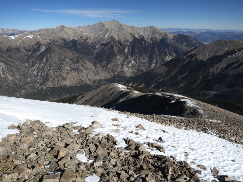
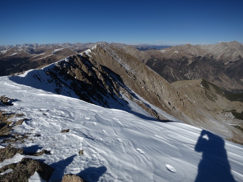
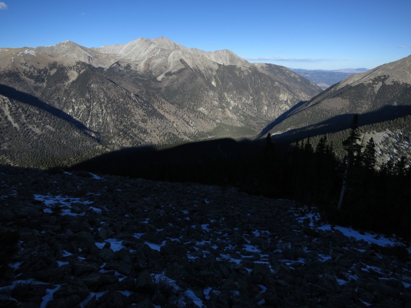
Above treeline, the wind increased a bit, but wasn't as bad as it was the day previous. Above the mine, there was evidence for a climbers trail that I followed until it petered out again. Just a gradual ridge hike all the way to the summit, with nice wind blasted snowy views.
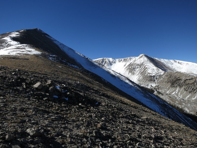
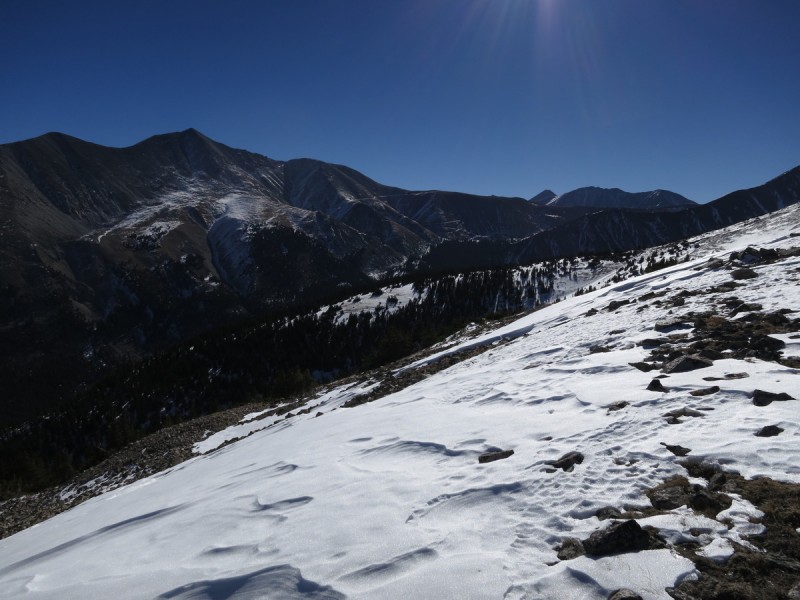
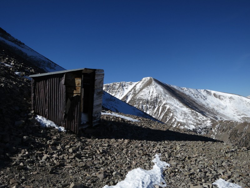
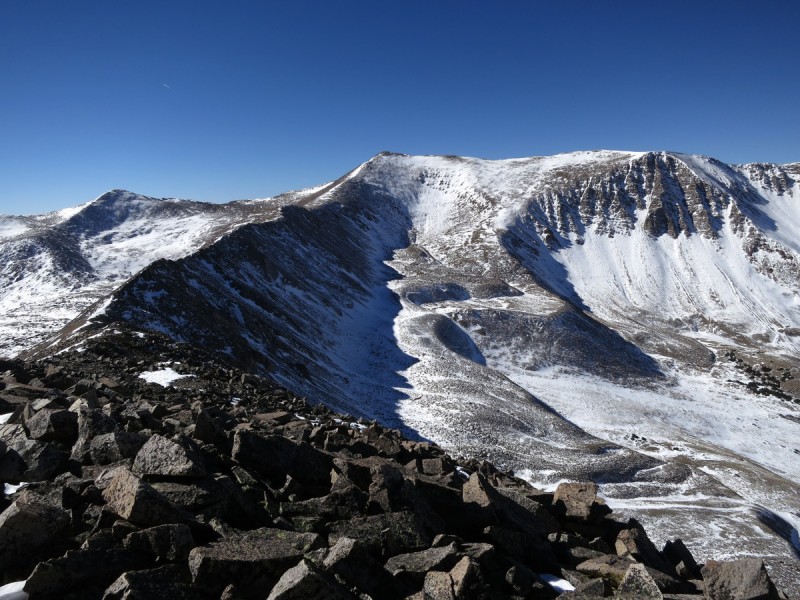
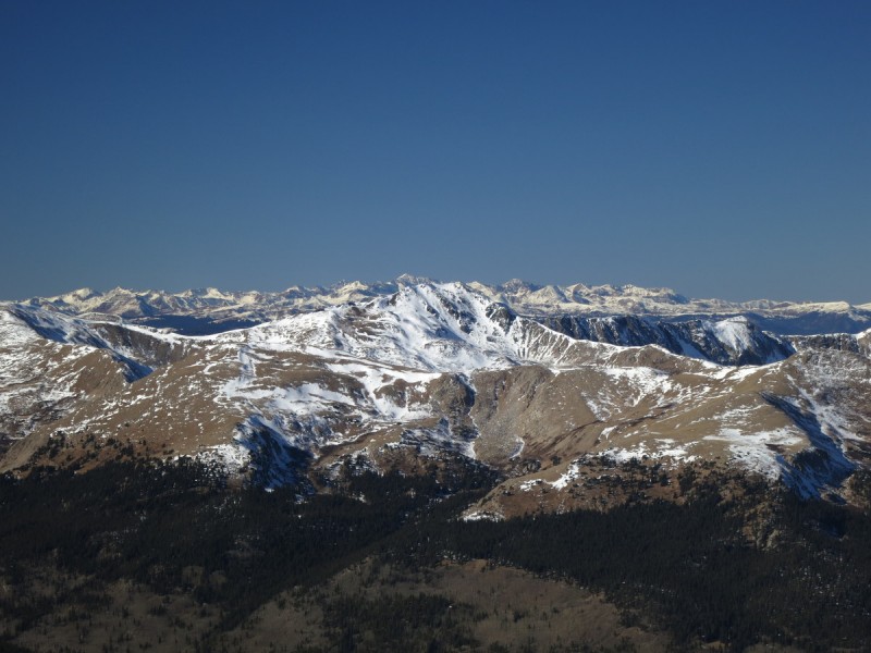
View of Princeton from a switchback Ridge up Boulder Mtn with Mamma's ridge behind Antero from ridge up Boulder Mtn A defunct mining outhouse with a view Looking down Boulder Mtn's ridge
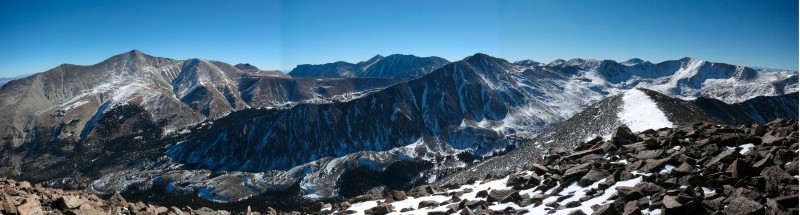
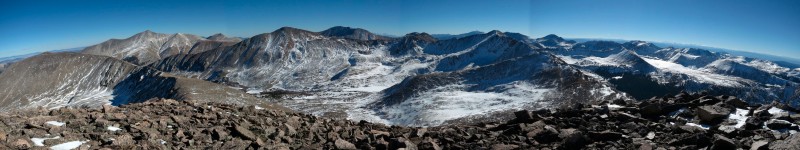
Arrived on the broad ridge summit and got the camera to eek out a couple pano's with another dying battery I found in my pocket. How my grandfather would be proud! (Pro photographer for Kodak, with a penchant for dying batteries lying around)
Pano east from Boulder Mtn Pano west from Boulder Mtn
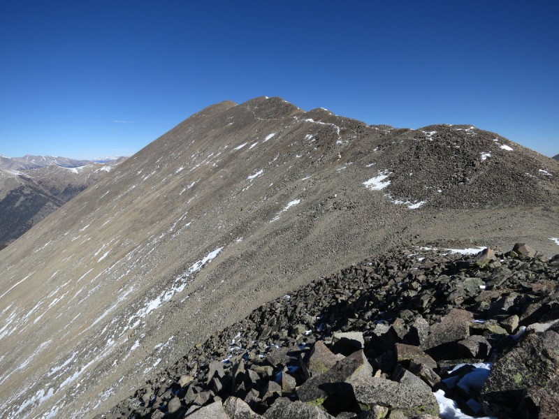
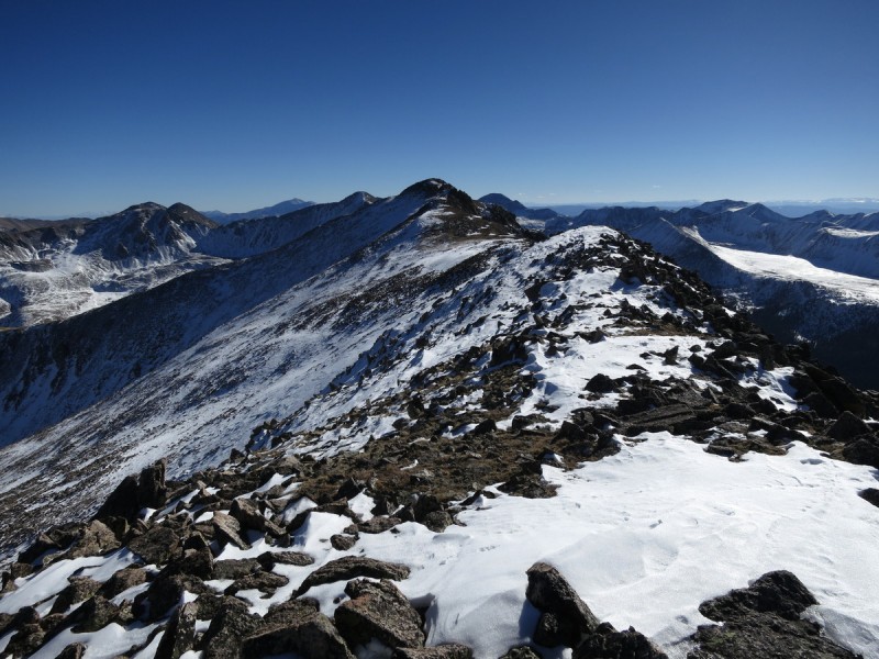
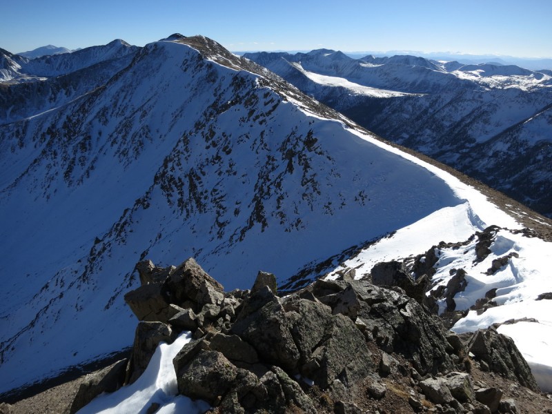
The ridge over to Mt Mamma was long and had a few bumps along the way, but otherwise easy. Even found some remnants from previous (paleo?) hikers along the way.
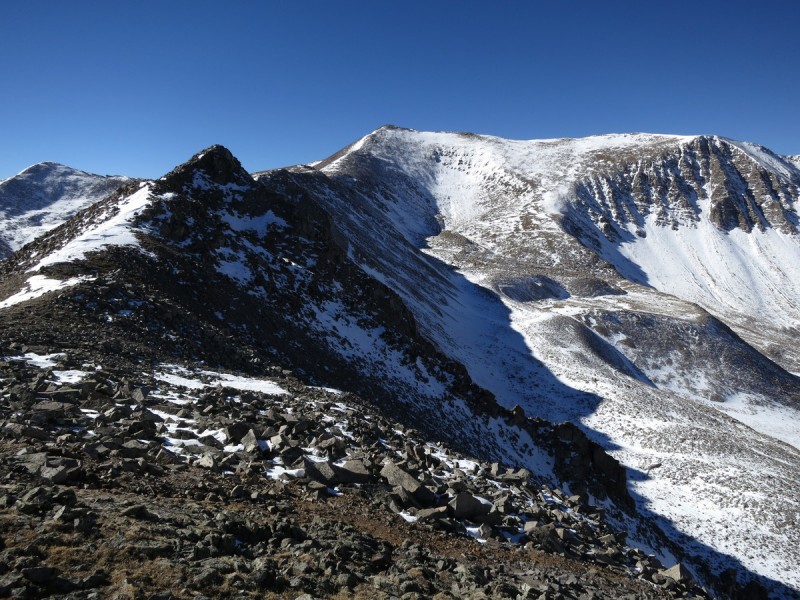
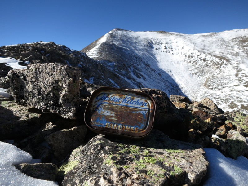
Looking back on Boulder Mtn Ridge over to Mt Mamma A couple ridge bumps along the way Looking back at Boulder Mtn A paleo treat... if I ever come to like sardines
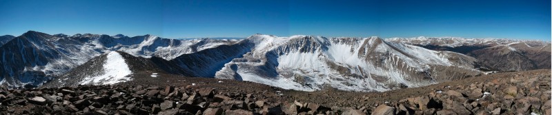
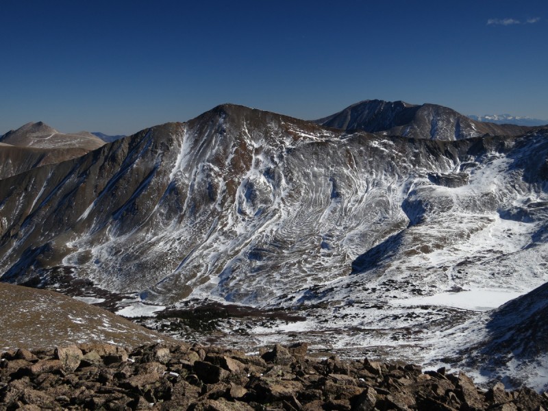
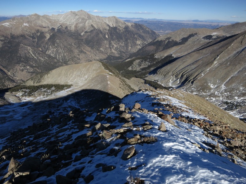
On the summit of Mt Mamma, I take a longer break, as the weather is pleasant and the views are nice. The rock slides/glaciers on Cronin look pretty nice with a dusting of snow to highlight the lobes.
Pano east from Mt Mamma Nifty rock glaciers on the west face of Cronin, highlighted by the snow! Now that looks like a skiable peak!
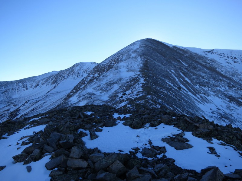
The initial ridge off Mt Mamma is mostly flat and with the snow, quite pretty. After the last flat spot, the ridge drops pretty quickly till near treeline. I was able to get in some nice plunge stepping on the way down, as the snow was just firm enough to allow for speedy descending.
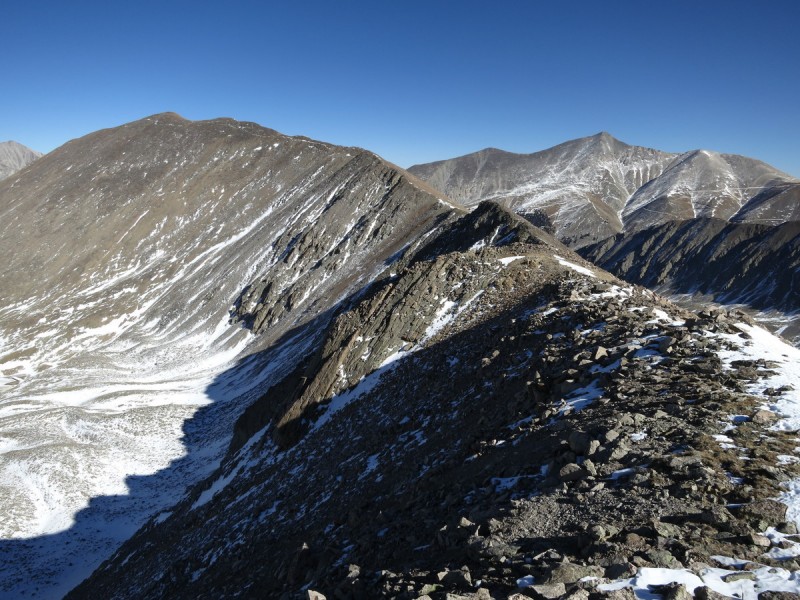
Looking back at Mt Mamma from ridge Pt labeled Mt Mamma (incorrect) Looking at the far point on the north ridge on Mt Mamma Mt Mamma's ridge looks almost skiable... Dropping down the ridge back to Baldwin Gulch Looking back up the steeper section of ridge About to drop below treeline on the Mt Mamma north ridge.
Once below treeline, there was a variety of terrain. The first part went pretty quickly, as it wasn't very rocky, and the plunge stepping made for fast work. Then I came across a rocky boulder section, that I tried to avoid by going further west. Soon it became apparent that there was no avoiding it, and I traversed back to the eastern ridgeline on rather steep boulders with scary snow. Back at the eastern ridgeline, the terrain got a bit easier and less rocky, but more slippery. Plenty of moss on rock slabs and such kept me grabbing at the aspens for support. Unfortunately half the aspens were dead, and on a few occasion as I slipped and went down, I took the dead tree with me. Fun times! Once on the flatter part near the road, it was just a simple matter of heading in the direction of the road merge. A nice loop, with just a wee bit of excitement in the trees on the way down.
My GPS Tracks on Google Maps (made from a .GPX file upload):
I've been looking at this combo as a possible for sometime next month. I wondered if coming down that ridge might end up in a tree-filled, posthole nightmare. Thanks for the info!
Brit - Solo trips bolster the mental toughness that helps me through the tougher parts of life! Nice Avy ”safe” ridge route, what I had been saving it for.
Dave - There was more snow on the road and the Boulder Mtn ridge, than the north ridge of Mamma (in the trees). I utilized Furthermore's late spring trip, and Papillion's from a similar date to chose my route with anticipated snow. The descent into the Baldwin Creek did not look fun!
Yikes - Yeah... I guess that would be one interpretation! :lol:
as always. Your tr's are my leading source of ski beta. Keep them coming.
Caution: The information contained in this report may not be accurate and should not be the only resource used in preparation for your climb. Failure to have the necessary experience, physical conditioning, supplies or equipment can result in injury or death. 14ers.com and the author(s) of this report provide no warranties, either express or implied, that the information provided is accurate or reliable. By using the information provided, you agree to indemnify and hold harmless 14ers.com and the report author(s) with respect to any claims and demands against them, including any attorney fees and expenses. Please read the 14ers.com Safety and Disclaimer pages for more information.
Please respect private property: 14ers.com supports the rights of private landowners to determine how and by whom their land will be used. In Colorado, it is your responsibility to determine if land is private and to obtain the appropriate permission before entering the property.