Download Agreement, Release, and Acknowledgement of Risk:
You (the person requesting this file download) fully understand mountain climbing ("Activity") involves risks and dangers of serious bodily injury, including permanent disability, paralysis, and death ("Risks") and you fully accept and assume all such risks and all responsibility for losses, costs, and damages you incur as a result of your participation in this Activity.
You acknowledge that information in the file you have chosen to download may not be accurate and may contain errors. You agree to assume all risks when using this information and agree to release and discharge 14ers.com, 14ers Inc. and the author(s) of such information (collectively, the "Released Parties").
You hereby discharge the Released Parties from all damages, actions, claims and liabilities of any nature, specifically including, but not limited to, damages, actions, claims and liabilities arising from or related to the negligence of the Released Parties. You further agree to indemnify, hold harmless and defend 14ers.com, 14ers Inc. and each of the other Released Parties from and against any loss, damage, liability and expense, including costs and attorney fees, incurred by 14ers.com, 14ers Inc. or any of the other Released Parties as a result of you using information provided on the 14ers.com or 14ers Inc. websites.
You have read this agreement, fully understand its terms and intend it to be a complete and unconditional release of all liability to the greatest extent allowed by law and agree that if any portion of this agreement is held to be invalid the balance, notwithstanding, shall continue in full force and effect.
By clicking "OK" you agree to these terms. If you DO NOT agree, click "Cancel"...
Ruby Mountain A 13,277 Feet (419th Highest in Colorado)
East Ridge from the Argentine Pass Trailhead
Trailhead Elevation About 11,050 Feet
4.57 Miles Roundtrip
Approximately 1,928 Feet Elevation Gained
Class 2
October 6th, 2013
Hiking Partner: Jay521
East Ridge Ruby Mountain A
Horseshoe Basin is a huge expanse of real estate that is bordered on the north by Grays Peak and Mt. Edwards, on the east by Argentine Peak, and on the west by Ruby Mountain. The basin is drained by Peru Creek, which is a tributary of the Snake River. Today, the basin seems like a peaceful sea of willows. In the closing decades of the 19th century, however, Horseshoe Basin was a bustling hub of mining activity. The mines are quiet now, but their crumbling remains persist as a reminder of the area's vast mineral wealth. The area's natural beauty belies the fact that it is one of the most polluted spots in Colorado. Zinc seeping from the mine tailings has killed all of the trout in Peru Creek. Aluminum hydroxide has turned the rocks in the creek a shocking white. Lead, cadmium, and copper make the water hazardous to humans. Efforts are underway to alleviate the pollution issues, but much work remains to be done. In the meantime, Horseshoe Basin remains a tranquil setting from which one can start exceptional routes on several twelvers, thirteeners, and a fourtener.
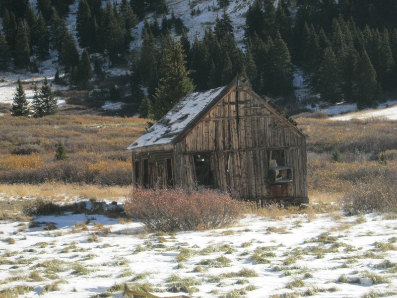
The Pennsylvania Mine, which is one of the "dirtiest" abandoned mines in Colorado
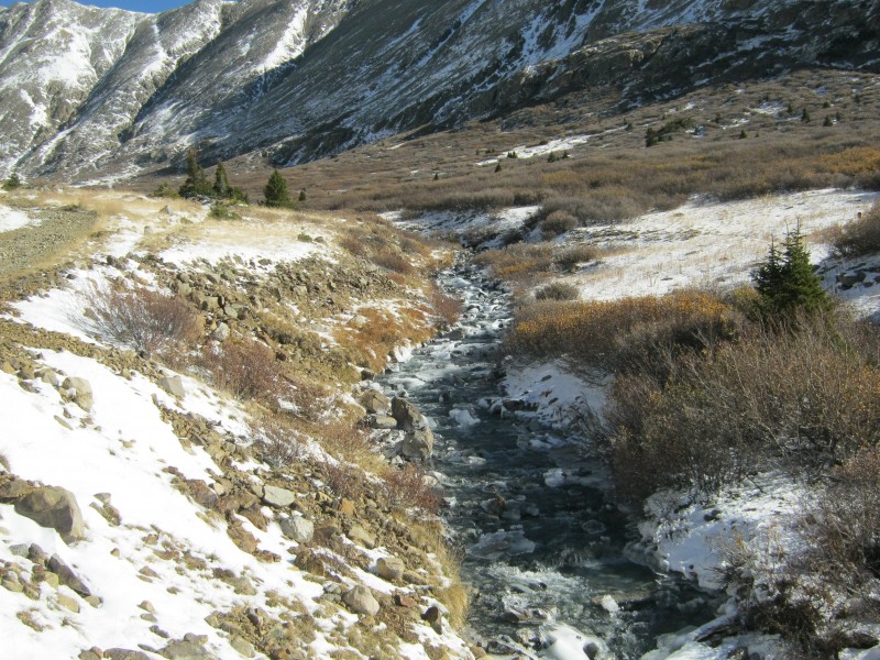
Peru Creek, with its aluminum hydroxide-stained rocks
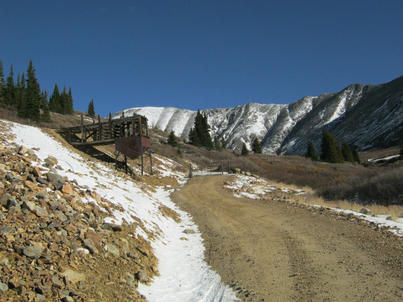
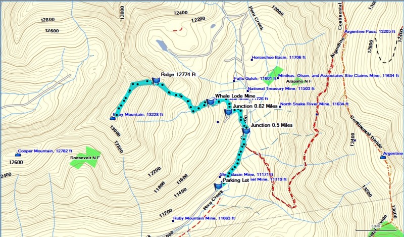
The hike started at a locked gate by the abandoned Shoe Basin Mine at about 11,050 feet. This is known as the Argentine Pass Trailhead. Several years ago, a large parking area was carved out of a tailings pile about a tenth of a mile down the road from the mine. I took advantage of the parking area, since there is no convenient spot to pull off of the road closer to the gate.
The gate on Peru Creek Road by the remains of the old Shoe Basin Mine
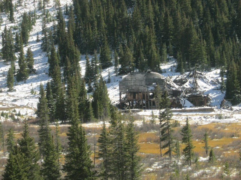
Old frame structure across the road from the parking area
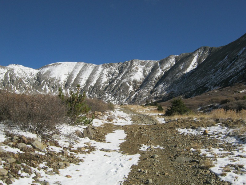
We passed through the gate and continued up Peru Creek Road. To our right, we could see the old Argentine Pass wagon road angling up the western slope of bicentennial thirteener Argentine Peak. It certainly would have been an interesting ride back in its heyday shortly after the Civil War. Straight ahead, we could see centennial thirteener Mt. Edwards and a long stretch of the Continental Divide.
Mt. Edwards (13,850 feet) at the northern end of Horseshoe Basin
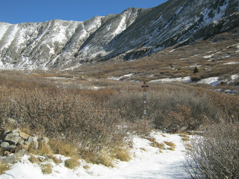
At about 0.4 miles from the parking lot, we passed the junction with the Argentine Pass Trail (Forest Service Trail #77). We continued on the main trail for another tenth of a mile until we reached the junction with the Peruvian Mine Trail (Forest Service Trail #9174). We took the left fork (Trail #9174), which headed uphill towards the Peruvian and Whale Lode mines.
Junction with the Argentine Pass Trail, FS #77
Junction with the Peruvian Mine Trail, FS #9174
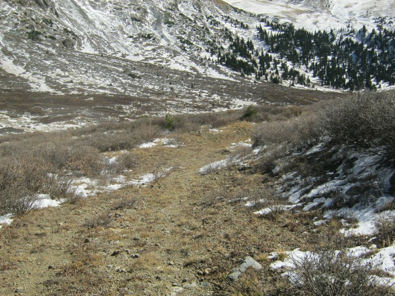
The Peruvian Mine Trail was narrow, winding, and covered with snow, but it offered the best route through the willows. It looked like it hadn't seen much vehicular traffic in recent years.
Jay on the Peruvian Mine Trail, with Grays Peak in the background
At about 0.82 miles from the trailhead, we came to another junction in the trail. The left branch of this trail headed towards the ruins of the Peruvian Mine, and the right fork continued uphill towards the Whale Lode Mine. We stayed to the right, and followed the old mining road as it curved to the northwest towards the Whale Lode Mine.
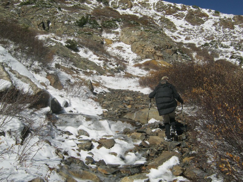
Jay hiking up the last stretch of the trail below the Whale Lode Mine
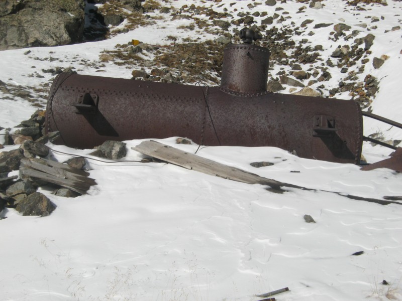
The last stretch of the trail is more like a creek than a trail. We had to choose our steps carefully to avoid ice-covered rocks. The path ended at the ruins of the Whale Lode Mine, which mostly consisted of flattened timbers and a rusting boiler. The mine was active in the 1880's and 1890's, and probably didn't see much activity after the price of silver collapsed in 1893.
Rusting boiler at the ruins of the Whale Lode Mine
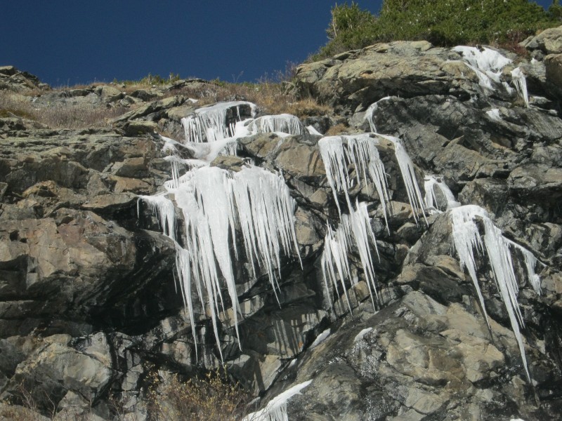
A low cliff behind the mine blocked our access to the east ridge, so we headed southwest to get around the obstacle. We saw some impressive ice formations as we passed under the cliffs.
Looking down on the scattered remains of the Whale Lode Mine
Ice formation on the cliff to the northwest of the Whale Lode Mine
The route around the west end of the cliff
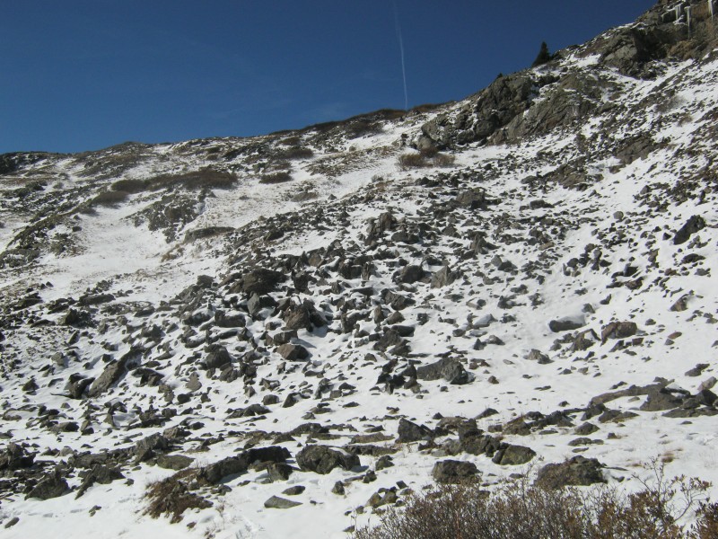
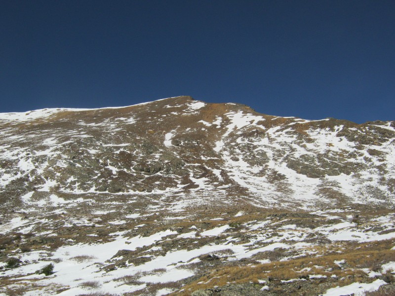
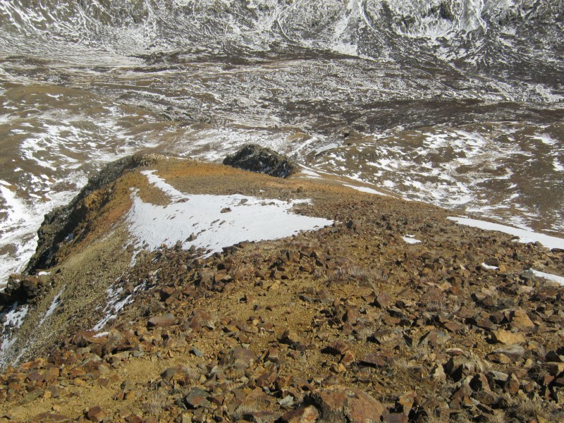
We reached a large, nearly-flat area above the cliff. A wicked looking rock formation on the east ridge was due north of us, and the ridge between Ruby Mountain's false and true summits was to our west. According to Bill Middlebrook, the nasty rock formation is only Class 2. With the ice, it looked like it had plenty of potential for fractures, dislocations, and contusions. Heading straight up the slope beside the ridge seemed like the safer and easier option.
Ruby Mountain's east ridge. The highest point in the image is the false summit, and part of the gnarly rock formation is visible to the far right.
The slope was steep and loose in some places, and it took some effort to find the best route. The slope relented a bit after we picked our way through a band of large rocks.
Angling up the slope towards the east ridge
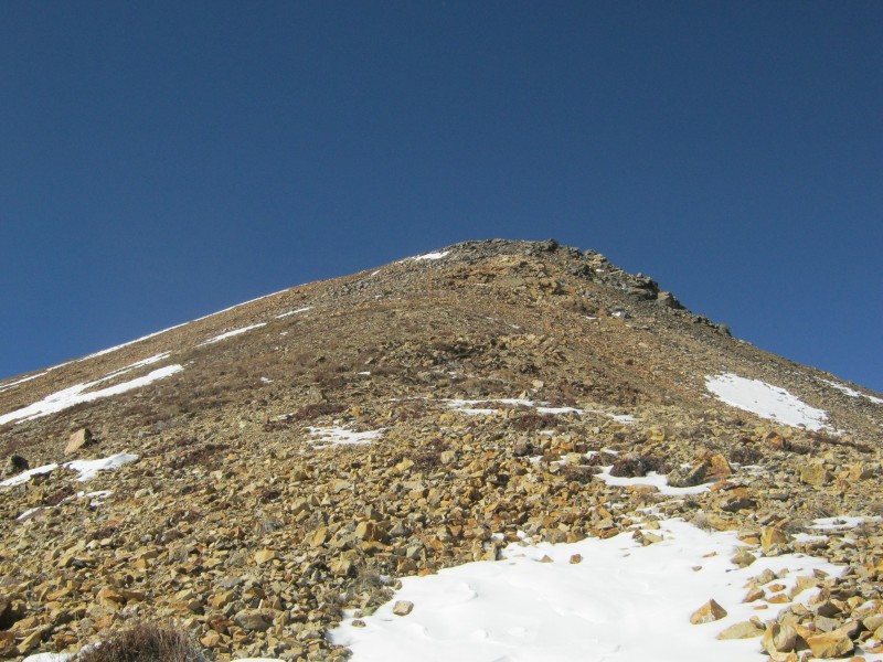
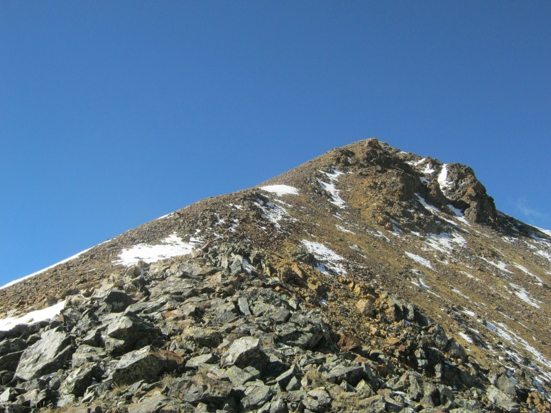
After we passed through the band of rocks, we ascended towards a mellow-looking spot on the ridge just above the gnarly rock formation. We hit the ridge at about 12,774 feet. There is no proper trail on the ridge, but it was easy to see where others had followed the path of least resistance.
Looking up Ruby Mountain's east ridge from about 12,774 feet
Bill Middlebrook described the next rocky section on the ridge as being the crux of the route, but it honestly didn't present any difficulties. We picked our way through the rocks, and soon found ourselves standing on the false summit.
Approaching the crux of the route below the false summit
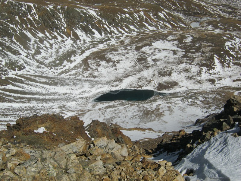
From the false summit, we had a great view of the small lake below the saddle between Ruby Mountain and Grays Peak. The route on Grays Peak's south ridge looked fascinating, and just moved up on my bucket list.
The lake at the end of Peru Creek Road, just below Ruby Mountain's saddle with Grays Peak
Grays Peak's south ridge, viewed from Ruby Mountain's false summit
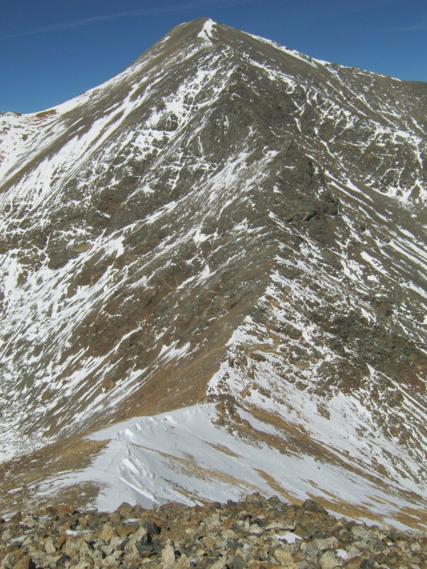
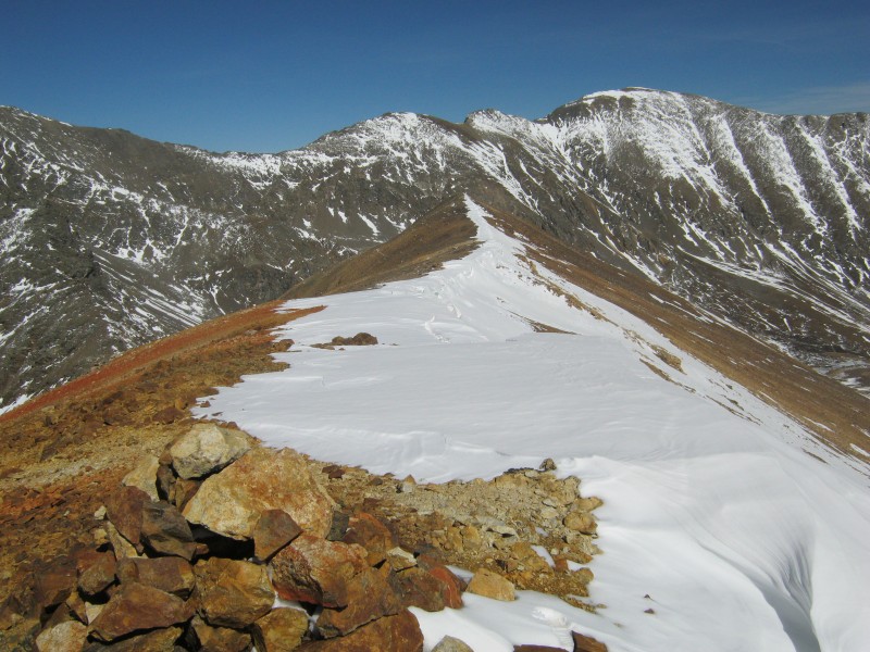
There was snow on the leeward side of the ridge between the false and true summits, and a cornice was already forming. There was not a great deal of elevation change between the summits.
Looking towards the true summit from the false summit
Me approaching the summit (image by Jay521)
Jay topping out with Grays Peak looking huge in the background
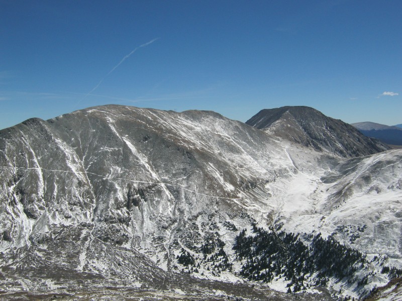
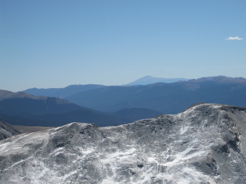
The view from the summit would be hard to beat. In addition to having the best view of Grays Peak, we could see much of the Gore Range, the Tenmile Range, and the northern Sawatch. To the southwest, we could see the Kenosha Mountains, South Park, and Pikes Peak.
Me taking in the view (image by Jay521)
Argentine Peak on the left and Squaretop Mountain on the right. The Argentine Pass Trail is clearly visible on Argentine Peak's flanks.
Looking over part of the Lost Creek Wilderness towards Pikes Peak
There was a bit of a cool breeze blowing on the summit, but we couldn't have asked for a more beautiful day. We took plenty of time to enjoy the scenery, then retraced our steps back to the Jeep.
Looking back towards the false summit with Mt. Edwards in the background
Descending the east ridge into Horseshoe Basin
Bypassing the gnarly rock formation on the slope
We both slipped and fell on the melting snow and ice, so it was a pleasure to get back to the mining road,
Back on the Peruvian Mine Trail
GPS track of our route on Ruby Mountain A
Ruby Mountain took a huge toll on my quads in a relatively short distance. While the mining ruins preclude this from being considered a wilderness hike, we were still the only humans occupying many square miles of rugged mountains. This sort of solitude may not be hard to find in the San Juans, but as far as the Front Range is concerned, Ruby was a real gem.
Thumbnails for uploaded photos (click to open slideshow):
Thanks for putting this up! It was great going with you. I think your knowledge of mining history is only surpassed by your knowledge of flora... No - wait - your VERY dry sense of humor has to fit in there somewhere.... :lol:
This is really a top notch report. Excellent photos, dialogue and well researched history. This is how it should be done.
Caution: The information contained in this report may not be accurate and should not be the only resource used in preparation for your climb. Failure to have the necessary experience, physical conditioning, supplies or equipment can result in injury or death. 14ers.com and the author(s) of this report provide no warranties, either express or implied, that the information provided is accurate or reliable. By using the information provided, you agree to indemnify and hold harmless 14ers.com and the report author(s) with respect to any claims and demands against them, including any attorney fees and expenses. Please read the 14ers.com Safety and Disclaimer pages for more information.
Please respect private property: 14ers.com supports the rights of private landowners to determine how and by whom their land will be used. In Colorado, it is your responsibility to determine if land is private and to obtain the appropriate permission before entering the property.


")
")
")
")
")
")
")
")
")
")
")
")
")
")
")
")
")
")
")
")
")
")
")
")
")
")
")
")
")
")


