| Report Type | Full |
| Peak(s) |
Santa Fe Peak - 13,181 feet Sullivan Mountain - 13,133 feet Geneva Peak - 13,266 feet Landslide Peak - 13,238 feet |
| Date Posted | 09/15/2013 |
| Date Climbed | 09/08/2013 |
| Author | Greenhouseguy |
| Front Range High Five: Santa Fe, Morgan, Sullivan, Geneva, and Landslide |
|---|
|
Santa Fe Peak 13,180 Feet (501st Highest in Colorado) Morgan Peak 12,474 Feet (Unranked) Sullivan Mountain 13,134 Feet (Unranked) Geneva Peak 13,266 Feet (426th Highest in Colorado) Landslide Peak 13,238 Feet (Unranked) North Ridge from the Quail Mine on FS264 Trailhead Elevation 11,920 Feet 8.42 Miles Roundtrip Approximately 2,900 Feet Elevation Gained Class 2 September 8th, 2013 Partners: SenadR and Jay521 Front Range High Five: Santa Fe, Morgan, Sullivan, Geneva, and Landslide Santa Fe Peak and its neighboring mountains lie in the historic Montezuma Mining District in Summit County, Colorado, near the Keystone ski resort. The town of Montezuma was founded in 1865 when silver was discovered nearby, and it once would have been considered a thriving community. As of the 2010 census, the town had a population of 65 and a footprint of 0.1 square miles. A few of the original mining-era buildings remain. Residents value their privacy, and the local no-parking ordinance is actively enforced. To avoid getting our vehicle towed, we chose to start our hike at a pullout by the abandoned Quail Mine on FS264 above the town. The shaft house at the Quail Mine has collapsed and been scattered by gravity and the four winds. Information about the Quail Mine is scarce on the Internet, but it is known to have been in operation in 1908 when it was listed in a Mines Register. An International Harvester stationary engine on the property probably dates back to the 1940's. 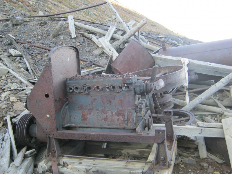 Old mine hoist engine among the ruins of the Quail Mine Our hike started out on FS264, which is an old mining road that ends at the Silver Wave Mine on Santa Fe Peak's south slopes. Stock 4WD vehicles can make it to the Quail Mine, but only exceptional vehicles and drivers should proceed farther. 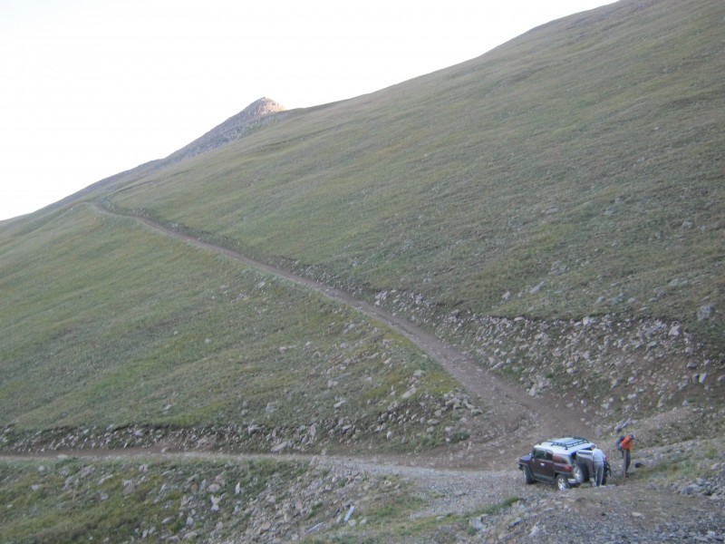 Jay and Sen gearing up at the Quail Mine, with twelver Morgan Peak in the background We followed the road up to a saddle between Santa Fe Peak and twelver Morgan Peak. From the saddle, we had an incredible view of Grays and Torreys peaks and the Geneva Creek basin. Sen wanted to hit every summit along the way, so we made a slight detour to the north. We passed over a false summit, and on the way down, we startled a small herd of mule deer. 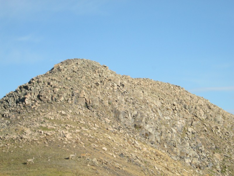 Herd of mule deer at the base of Morgan Peak There is no hiking trail to Morgan Peak's summit, but there is what appears to have been a pack mule trail on the western flanks that probably serviced the Rose Mine and the Tiptop Mine. Abandoned mineshafts dot virtually every hillside in the area. Morgan Peak's summit offers views of the Tenmile Range, the Gore Range, and Dillon Reservoir. The view of Grays and Torreys peaks is unequalled. 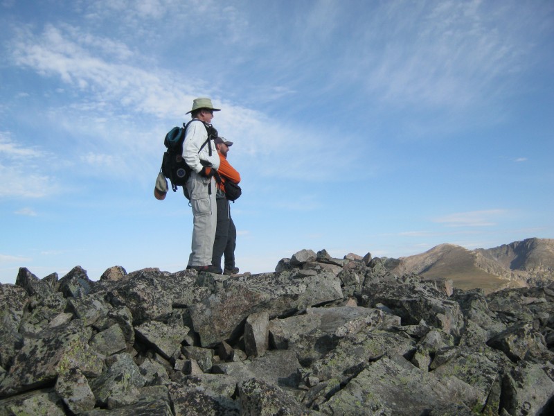 Jay and Sen enjoying the views from the summit of Morgan Peak  Torreys Peak (left), Grays Peak (right), and Ruby Mountain (front) viewed from Morgan Peak Morgan Peak was surprisingly nice, but it was just a brief side trip. We descended back to FS264 and started to switchback up Santa Fe Peak's north flanks. The road was rocky, but not in terrible shape.  FS264 on Santa Fe Peak's north flanks, viewed from Morgan Peak's false summit We reached a junction in the road at an immense nearly-flat area on the slopes. The right-hand fork looks like the correct route, but a Forest Service marker clearly shows that FS264 continues to the left. Hikers who make a wrong turn here can correct their course near the top of the ridge. 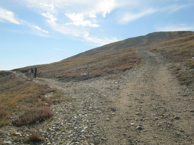 Junction of FS264 and an unnamed mining road The road stays to the west of the Continental Divide, and passes by the west side of Santa Fe Peak's summit  Jay hiking up FS264 about 0.4 miles north of Santa Fe Peak's summit, which is not visible in this image When the road approached Santa Fe Peak's summit block, we started looking for a climber's trail that would take us to the summit. It was not cairned, but we had no problem finding it. A few minutes on the steep and relatively loose trail got us to the summit.  Sen and Jay on the climber's trail below Santa Fe Peak's summit Santa Fe Peak's summit is well-situated to view a large slice of the Rocky Mountains. We could see much of the Gore and Tenmile ranges, some of the Sawatch Range, and a significant portion of the Front Range. There were far too many mountains to mention here, but highlights included The Mount of the Holy Cross, "The Citadel," the Sawtooth, Red Cone, Buffalo Mountain, and Whale Peak. I also caught a glimpse of South Park. The remainder of our route (Sullivan Mountain, Geneva Peak, and Landslide Peak) stretched out before us to the south.  Sen (L) and me (R) on Santa Fe Peak's summit. The remainder of the route is visible, with Landslide Peak directly above my head (image by Jay521) Our descent route from Santa Fe's summit was clearly marked. A good-quality trail descends the south slope and intersects with FS264 as it winds down towards the Silver Wave Mine. The trail is cairned at the intersection with the road. We followed the road until it made obvious sense to bail and headed straight down to the saddle between Santa Fe Peak and Sullivan Mountain.  Jay and Sen descending the climber's trail on Santa Fe Peak's south slope. Our next goal (Sullivan Mountain) was on the opposite side of the broad saddle On the way down Santa Fe's south slope, we found some timbers that were presumably covering an open mine shaft. Most of the abandoned mine shafts in the area have been dynamited, but this was a reminder that there is at least a miniscule chance of having an accident in these honeycombed hills.  Old timbers covering the opening of a mineshaft The jaunt over to Sullivan Mountain only took a few minutes. The Continental Divide Trail is not well-defined in this area, but there are several cairns on the east side of the saddle and on the east side of Sullivan Mountain's north slopes. We stuck fairly close to the cairned route. 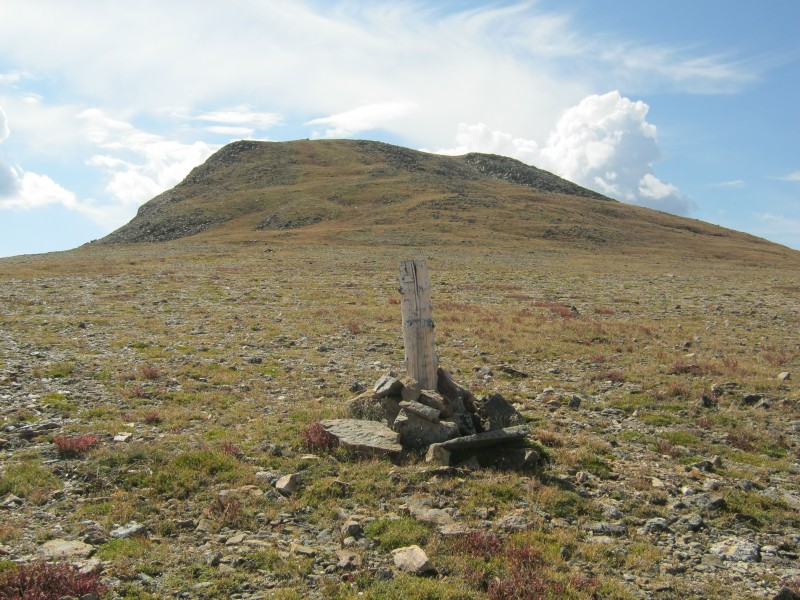 Looking at Sullivan Mountain from the Santa Fe/Sullivan saddle Sullivan Mountain was really pretty pleasant for an unranked thirteener. With a rise of 274 feet, it just barely misses being a ranked peak. We spent some time gazing into the Geneva Creek basin below. It looked like an inviting place to visit. One of the most attractive features was the beautiful blue-green Josephine Lake. 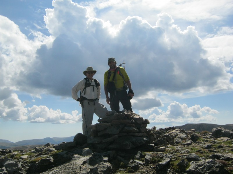 Jay and Sen on the summit of Sullivan Mountain  Josephine Lake, above the Geneva Creek basin We started down Sullivan's south slopes as dark clouds gathered in the distance. On the other side of the saddle was the big prize of the day, Geneva Peak. It was marginally taller than Santa Fe Peak, and somewhat more of a physical challenge. There is a climber's trail on the west side of the north slope.  Geneva Peak viewed from Sullivan Mountain. A climber's trail is visible on the west (right) side of the slope Wildflower season is basically over, but that's no reason to stop enjoying nature. As I descended Sullivan's south side, I kept catching movement in the tundra out of the corner of my eye. I thought that it was an illusion, but stopped to take a closer look at the tundra. There were crickets everywhere! I really didn't expect to see such a large insect population above 13,000 feet. 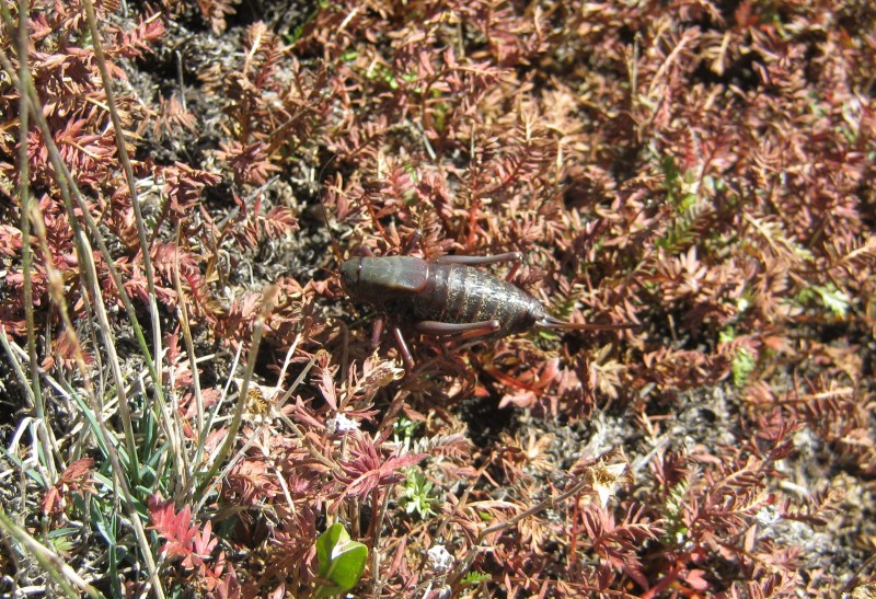 One member of the large army of crickets on Sullivan Mountain The trail on Geneva Peak seemed like something you'd find on a Sawatch fourteener. In other words, steep, junky, and kind of loose. It served its purpose, though. There were large cairns about every 75-100 vertical feet. We passed a false summit, and I was surprised to see a long, rugged-looking ridge that rose gradually to the summit. It was mostly small talus, and didn't deviate from the Class 1 and Class 2 that was normal for the day. 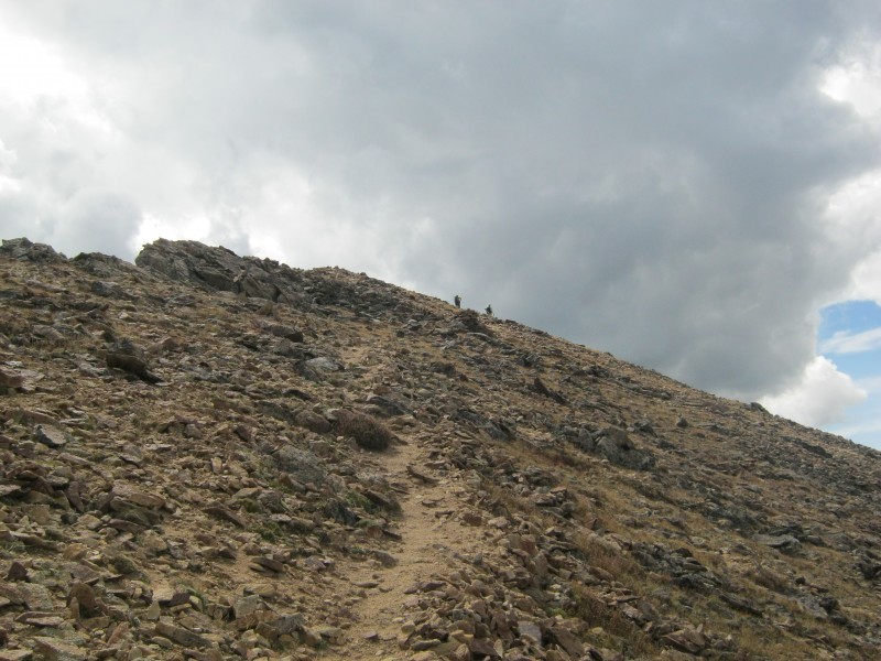 The trail on Geneva Peak's north slopes We didn't slow down much to enjoy Geneva Peak's summit. Clouds were building, and the weather looked like it meant business. We all had rain gear, but didn't particularly want to be put in a position where we had to use it. 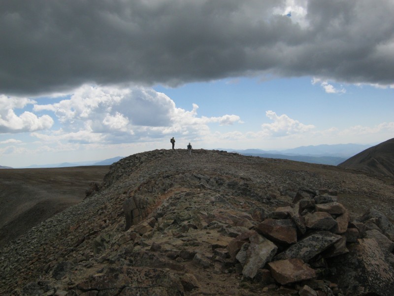 Jay and Sen on Geneva Peak's summit, with dark clouds overhead. The biggest summit cairn was nowhere near the highest point We left Geneva in a rush to get to Landslide Peak. With only 138 feet of prominence, it hardly deserves to be called a bump on the ridge. Its name dates back to the mining era, and refers to slide areas that are visible on two of its faces.  Sen getting ready to dash over to Landslide Peak On the way over to Landslide I noticed that Sen had stopped to take some pictures, but I couldn't see what had attracted his interest until I got closer. There was a small flock of ptarmigans, and they were exactly the same color as the surrounding rocks. The birds are edible, and are a popular game species here and in Europe. I don't see how hunting ptarmigan could be much sport, because they don't even make much effort to get out of your way. I failed miserably in my attempt to get a good photo, so I included one of Sen's images below.  Rock ptarmigan (Lagopus muta) on the saddle between Geneva Peak and Landslide Peak (image by SenadR) We felt a few drops of rain and a little sleet as we caught our breath on Landslide's summit. It was time to retrace our steps back to the trailhead. 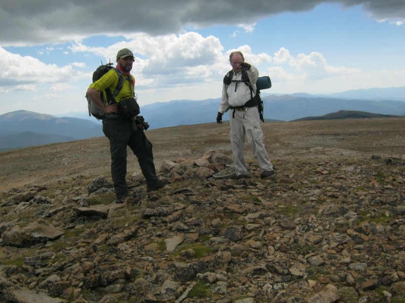 Sen and Jay on the "summit" of Landslide Peak I could hear thunder as we made our way back to Geneva Peak, but there was no lightning. Precipitation was my biggest concern  Geneva Peak as seen from Landslide Peak While we were descending the ridge from Geneva Peak's summit, I was worried that the rain would make the rocks slippery. The drop-off to the east side was enough to worry about, but the trail mostly sticks to the much safer west side. Fortunately, the rain never amounted to much. 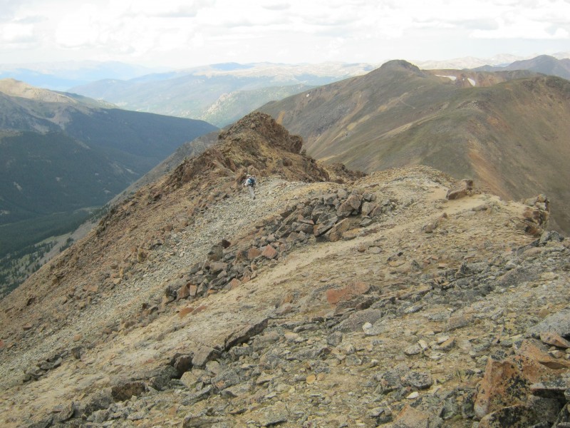 Jay descending Geneva Peak's north ridge The trail made it easy to descend from Geneva Peak in a hurry. I probably could have jogged down the trail if I wasn't still recovering from knee surgery. Hard surfaces really hammer the cartilage in the knee. 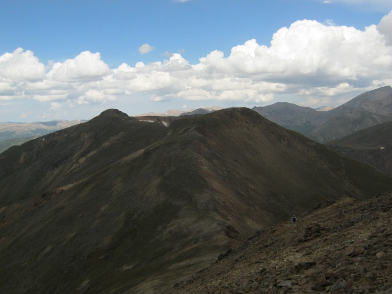 Descending from Geneva Peak, with Sullivan Mountain and Santa Fe Peak in the background The cairned route up Sullivan Mountain's south slope is to the west (left) of the ridge. The west side is rocky tundra, while the ridge proper is mostly rock. There's no trail, but the cairns are large and spaced closely enough that they are easy to see from a distance. 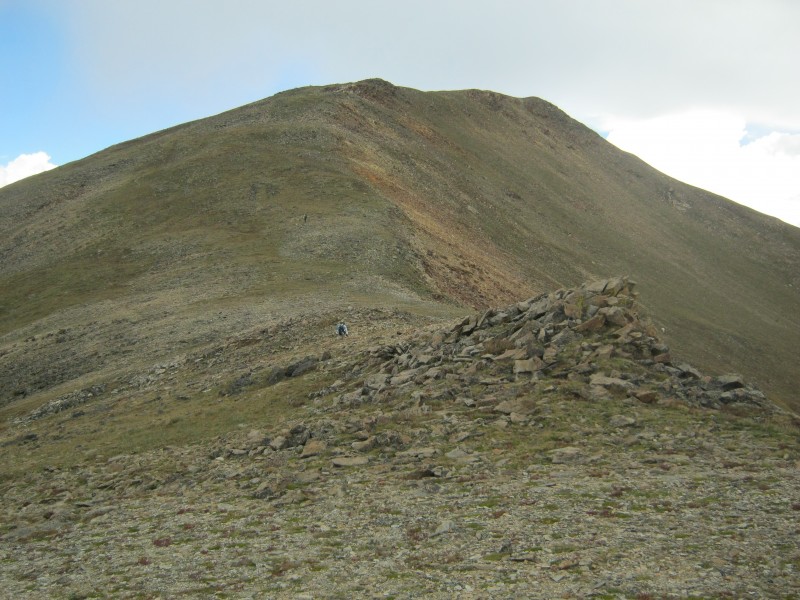 Starting up Sullivan Mountain's south slopes From the summit of Sullivan Mountain, it was easy to see how the mining road curved down to the defunct Silver Wave Mine on Santa Fe Peak. Once we crossed the saddle, it was easy Class 1 all the way back to the trailhead. 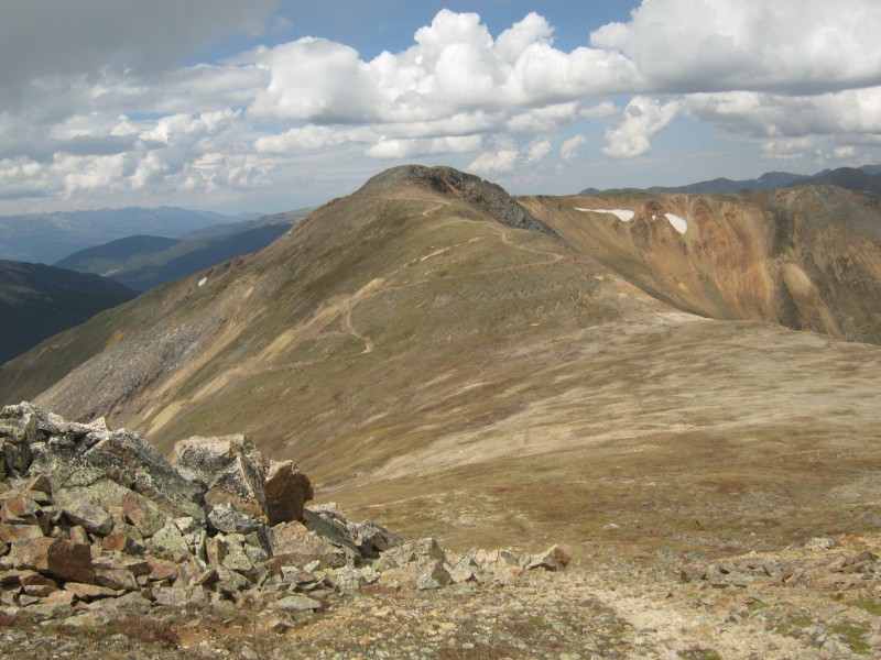 Looking towards Santa Fe Peak from the summit of Sullivan Mountain It wasn't necessary to re-summit Santa Fe Peak, so we stayed on the road just below the summit. The sun had come back out, and the trail was downhill all the way. Since we were no longer in a hurry, we slowed down the pace and took time to enjoy the surroundings. 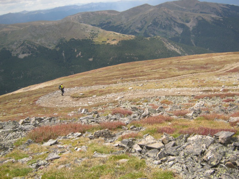 Sen on a switchback on FS264 on the north side of Santa Fe Peak 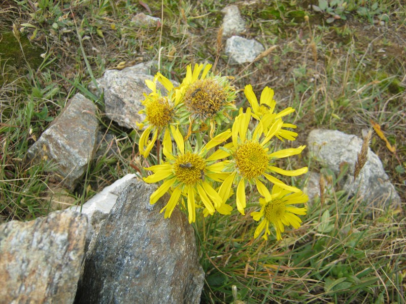 Old Man of the Mountain (Hymenoxys grandiflora) trying to squeeze the last bit of warmth and sunshine out of the waning days of summer The switchbacks never seemed to end on the way down. After the last switchback, I started to notice a lot of listless butterflies lying in the road. They seemed to be sunning themselves on rocks to warm up. Sorry, I have no idea what species they are. 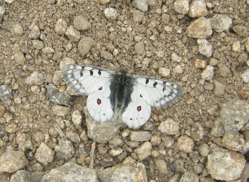 One of many butterflies that I saw lying in the road The multitude of abandoned mines on these mountains shows that this was once a busy area, but we didn't see another person all day. The restrictions on parking and the rough condition of the approach road probably keep all but the most enthusiastic hikers off of these peaks. Consequently, this high stretch of ridgeline may be one of the best bets for solitude in the Front Range. While the mountains themselves were not pristine, the 360-degree views were amazing. I've never had a bad day on the Continental Divide. Thumbnails for uploaded photos (click to open slideshow): ")
")
")
")
")
")
")
")
")
")
")
")
")
")
")
")
")
")
")
")
")
")
")
")
")
")
")
")
")
")
|
| Comments or Questions | ||||||||||||
|---|---|---|---|---|---|---|---|---|---|---|---|---|
|
Caution: The information contained in this report may not be accurate and should not be the only resource used in preparation for your climb. Failure to have the necessary experience, physical conditioning, supplies or equipment can result in injury or death. 14ers.com and the author(s) of this report provide no warranties, either express or implied, that the information provided is accurate or reliable. By using the information provided, you agree to indemnify and hold harmless 14ers.com and the report author(s) with respect to any claims and demands against them, including any attorney fees and expenses. Please read the 14ers.com Safety and Disclaimer pages for more information.
Please respect private property: 14ers.com supports the rights of private landowners to determine how and by whom their land will be used. In Colorado, it is your responsibility to determine if land is private and to obtain the appropriate permission before entering the property.


