Download Agreement, Release, and Acknowledgement of Risk:
You (the person requesting this file download) fully understand mountain climbing ("Activity") involves risks and dangers of serious bodily injury, including permanent disability, paralysis, and death ("Risks") and you fully accept and assume all such risks and all responsibility for losses, costs, and damages you incur as a result of your participation in this Activity.
You acknowledge that information in the file you have chosen to download may not be accurate and may contain errors. You agree to assume all risks when using this information and agree to release and discharge 14ers.com, 14ers Inc. and the author(s) of such information (collectively, the "Released Parties").
You hereby discharge the Released Parties from all damages, actions, claims and liabilities of any nature, specifically including, but not limited to, damages, actions, claims and liabilities arising from or related to the negligence of the Released Parties. You further agree to indemnify, hold harmless and defend 14ers.com, 14ers Inc. and each of the other Released Parties from and against any loss, damage, liability and expense, including costs and attorney fees, incurred by 14ers.com, 14ers Inc. or any of the other Released Parties as a result of you using information provided on the 14ers.com or 14ers Inc. websites.
You have read this agreement, fully understand its terms and intend it to be a complete and unconditional release of all liability to the greatest extent allowed by law and agree that if any portion of this agreement is held to be invalid the balance, notwithstanding, shall continue in full force and effect.
By clicking "OK" you agree to these terms. If you DO NOT agree, click "Cancel"...
2013 RTM Climbing Trip (Part 2): Wilson Group Clean Sweep
August 16, Friday. We drove through Placerville to the new Rock of Ages trailhead. This trail provides access to the Rock of Ages saddle in the Lizard Head Wilderness and replaces previous access from the Silver Pick Basin by going around private land. From the trailhead, we drove back down the road for 1½ miles and took the last designated campsite. It was a beautiful day, and our campsite was peaceful, despite being right next to the road.
August 17, Saturday. We broke camp and drove to the Rock of Ages trailhead. After 3.7 miles and 3000' of elevation gain, we reached the 13,020' Rock of Ages saddle.
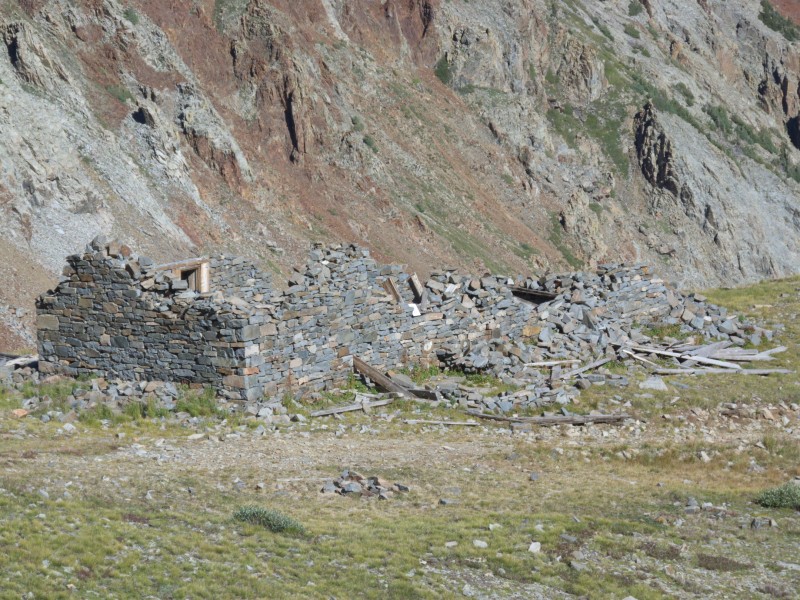
An old stone building near the trail to Rock of Ages saddle. People need to stay out of it so that access across private lan
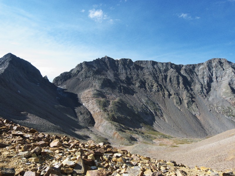
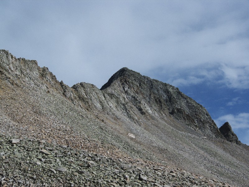
Mt. Wilson and El Diente from near the Rock of Ages saddle
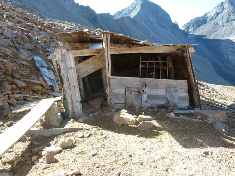
We left our backpacks in an old mining shack at the Rock of Ages mine that is affectionately known as the "Tiltin' Hilton." To thwart the marmots, we placed our backpacks on the top bunk in the "Tiltin' Hilton" and relocated any boards that might provide access to these pesky critters. It felt good to no longer have to climb with full backpacks.
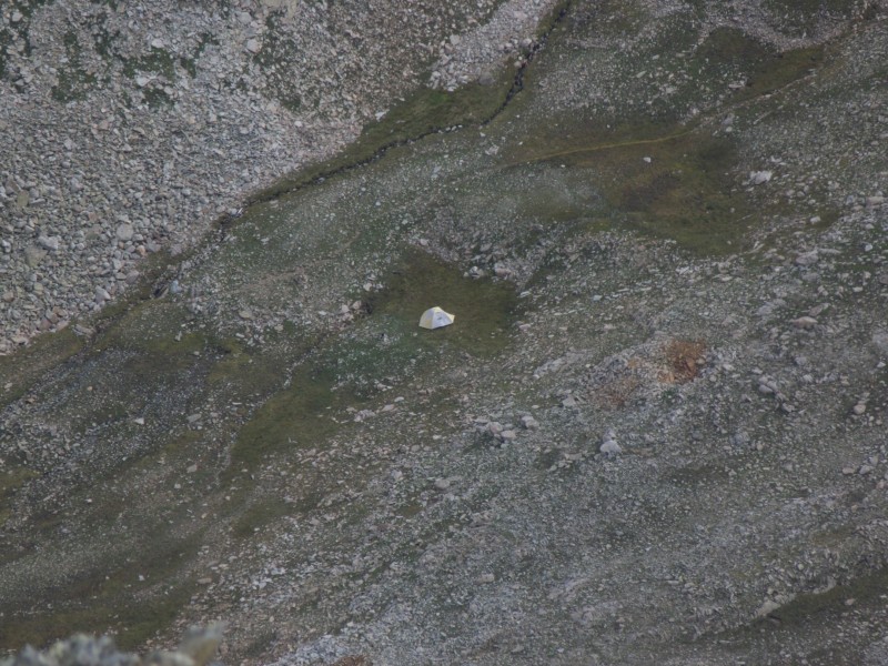
The Tiltin' Hilton. The bunk where we left our backpacks can be seen inside.
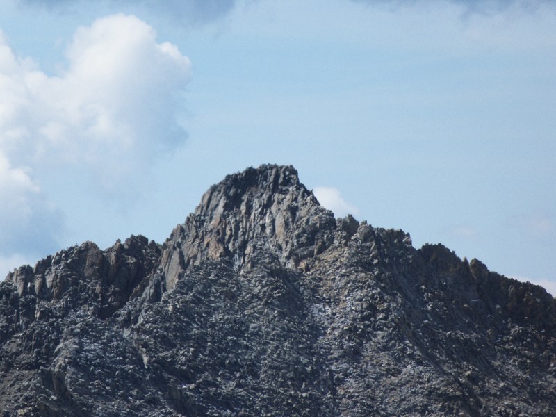
Wilson Peak and the morning sun
A decent trail brought us to the 13,140' saddle between Wilson Peak and Gladstone Peak. From the saddle, we followed the obvious route along the ridge northeast to Wilson Peak's false summit. We downclimbed left of the ridge and then climbed a gully back to the ridge. From here, we continued north to the summit of Wilson Peak (14,017'). The summit register consisted of a bunch of wadded-up paper, so we did not bother signing it.
Lizard Head from the summit of Wilson Peak
Mt. Wilson from the summit of Wilson Peak
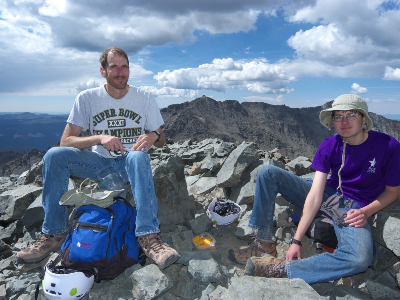
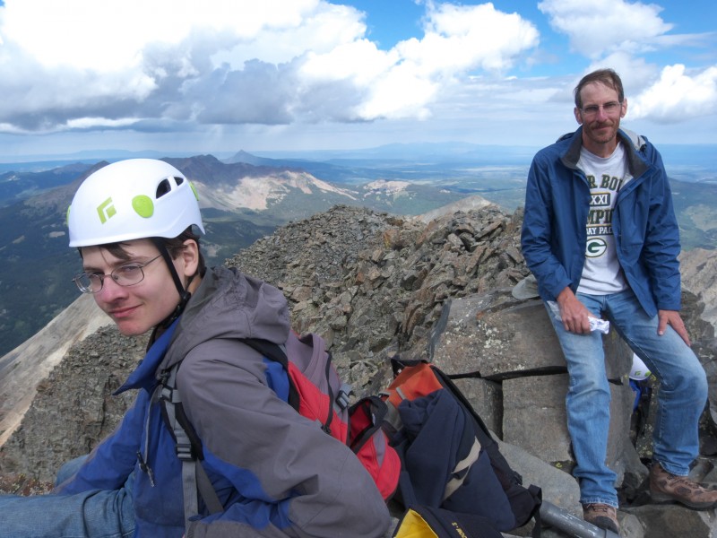
Eddie and David on Wilson Peak's summit
We ate lunch and chatted with a guy (C. Bergman of Gunnison) who has done 79 of the centennial peaks. After a half hour on the summit, we headed down. Upon returning to the Wilson Peak - Gladstone Peak saddle, we followed Gladstone's north ridge, staying on top of the long, tiring ridge itself whenever possible but sometimes bypassing obstacles on either side (but more often on the east side) until we reached the summit of Gladstone Peak (13,913'). Someone had left an old crowbar in the summit cairn. We signed the summit register and headed down after only 10 minutes on the summit due to threatening clouds. However, only about 20 drops of rain fell all day.
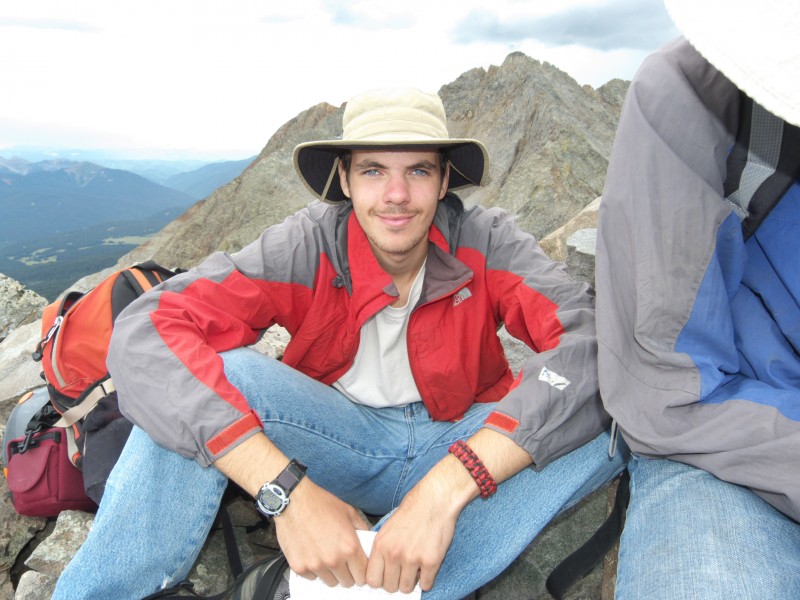
Randy on the summit of Gladstone Peak.
About ¾ of the way back to the Wilson Peak - Gladstone Peak saddle, we picked a couloir in which to descend into the upper part of Navajo Basin.
Looking back at Gladstone Peak from where we reached the trail in Navajo Basin after descending a couloir along the Wilson Pe
Once we reached the trail climbing out of Navajo Basin, David stayed with our daypacks while Randy and Eddie hiked up the trail to the "Tiltin' Hilton" and retrieved our backpacks. The three of us then backpacked down to about 12,000' in Navajo Basin directly below El Diente and set up camp. Tom Avery of Denver was camped near Navajo Lake and stopped by to chat after dinner.
August 18, Sunday. My dad and I had climbed El Diente via its north buttress in 1982 but ended up calling off our planned traverse from the summit of El Diente to Mt. Wilson due to bad weather (hail), resulting in a sketchy downclimb of the wet and slick north buttress. Today, our goal was for David and Randy to complete climbing the fourteeners with a traverse from El Diente to Mt. Wilson. We were confident that we would be successful if the weather held.
A trail of sorts took us to the base of the north buttress. We climbed more or less directly up broken rock and ledges toward the summit ridge.
David on the north buttress of El Diente
David on the north buttress of El Diente. This route was one of our favorites of this year's climbing trip.
We eventually angled left (east) of the suggested route, but to us it seemed easier to climb up the increasingly steep terrain on more solid rock. Once we reached the summit ridge, we turned left and scampered about 100' or so to the summit of El Diente (14,159'). Skies were mostly cloudy but did not appear threatening, so after signing El Diente's summit register, we began the traverse toward Mt. Wilson at 10:05 AM.
The summit of El Diente, with Gladstone Peak and Mt. Wilson visible in the background
Our tent in Navajo Basin from the summit of El Diente. We got our water from the small stream visible near the edge of the g
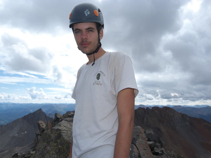
David and Eddie on the summit of El Diente
Randy on the summit of El Diente. The scratches on his helmet aren't from climbing but instead are from caving in a wild
The traverse to Mt. Wilson was surprisingly straightforward and easier than expected, as the route was well-cairned and obvious. Obstructions on the ridge (the "Organ Pipes" and "Gendarmes") are bypassed by contouring below them on the right (south) side of the ridge. After a long stretch of fairly easy ridge, we caught up to Tom Avery and joined forces with him.
From a saddle facing a steep section of rock, the four of us scrambled back up to the ridge, angling right when we were about ¾ of the way up. Once on the ridge, we headed east to another saddle. We then ascended a gully to the ridge a short distance west of Mt. Wilson's summit. A short scramble up and over some rocks brought us to the summit of Mt. Wilson (14,246') at 12:10 PM. This had been a challenging but fun way for David and Randy to conclude their four-year quest to climb the Colorado fourteeners and also marked completion of my second tour of duty on the fourteeners. Now that we were through with the fourteeners, we could focus our attention on centennial and bicentennial peaks.
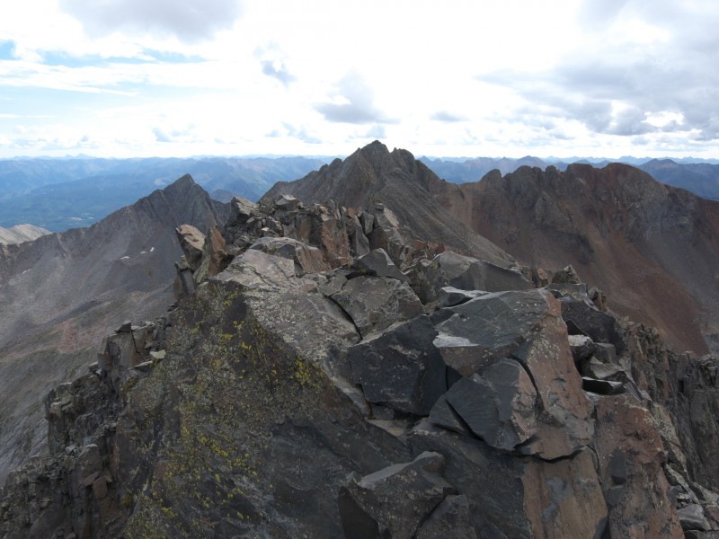
Looking back at El Diente from the summit of Mt. Wilson
The summit register was full after we squeezed in our signatures, so we took the register with us and later mailed it to the Colorado Mountain Club. From a short distance down the ridge, we descended scree and rocky/grassy slopes toward Navajo Basin. About halfway down, we stopped for lunch while Tom continued to descend. Rain began and followed us most of the way down to our tent.
August 19, Monday. We slept in, broke camp, and then began backpacking to the Rock of Ages saddle. After returning to our car at the Rock of Ages trailhead, we drove through Ridgway to Silverton and checked into a motel. It was nice to have most of today as a rest day. Later in the day, we got our backpacks ready for tomorrow's trip to the Ice Lake Basin for climbs of Fuller Peak, Vermillion Peak, Golden Horn, and Pilot Knob.
For Part 3 (Pilot Knob, Fuller Peak, Vermillion Peak, and Golden Horn), go to: http://www.14ers.com/php14ers/tripreport.php?trip=14318
Thumbnails for uploaded photos (click to open slideshow):
Great info here - I plan to do basically the same trip (ex Gladstone) this coming weekend. About how far below the ROA saddle is the Tiltin Hilton? We'd do Wilson Peak and then drop into Navajo basin for ED/Wilson with traverse the next day.
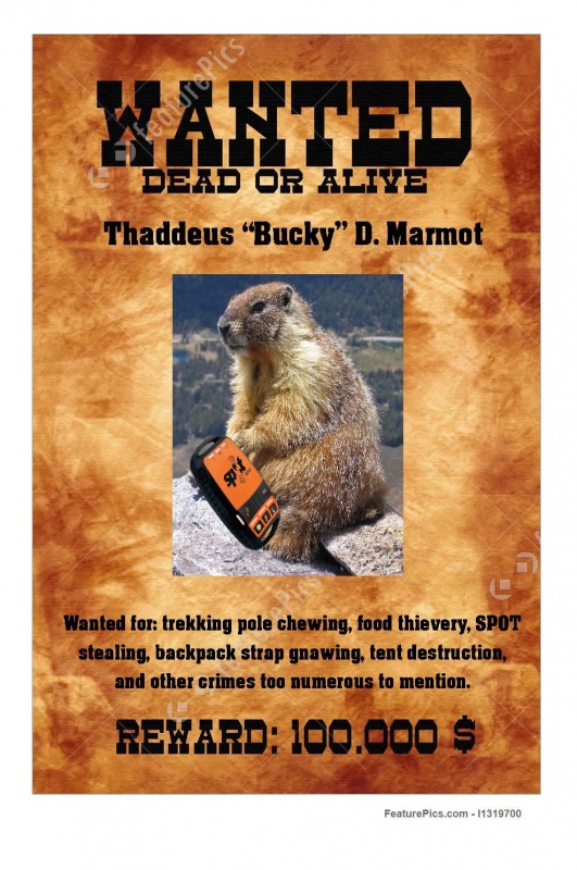
The Tiltin' Hilton is about 100 vertical feet below the ROA saddle. I strongly suggest that you leave your backpacks on the top bunk like we did, as I know that someone who left his pack on the ground ended up having Bucky the Marmot chew up his backpack.
Caution: The information contained in this report may not be accurate and should not be the only resource used in preparation for your climb. Failure to have the necessary experience, physical conditioning, supplies or equipment can result in injury or death. 14ers.com and the author(s) of this report provide no warranties, either express or implied, that the information provided is accurate or reliable. By using the information provided, you agree to indemnify and hold harmless 14ers.com and the report author(s) with respect to any claims and demands against them, including any attorney fees and expenses. Please read the 14ers.com Safety and Disclaimer pages for more information.
Please respect private property: 14ers.com supports the rights of private landowners to determine how and by whom their land will be used. In Colorado, it is your responsibility to determine if land is private and to obtain the appropriate permission before entering the property.