Download Agreement, Release, and Acknowledgement of Risk:
You (the person requesting this file download) fully understand mountain climbing ("Activity") involves risks and dangers of serious bodily injury, including permanent disability, paralysis, and death ("Risks") and you fully accept and assume all such risks and all responsibility for losses, costs, and damages you incur as a result of your participation in this Activity.
You acknowledge that information in the file you have chosen to download may not be accurate and may contain errors. You agree to assume all risks when using this information and agree to release and discharge 14ers.com, 14ers Inc. and the author(s) of such information (collectively, the "Released Parties").
You hereby discharge the Released Parties from all damages, actions, claims and liabilities of any nature, specifically including, but not limited to, damages, actions, claims and liabilities arising from or related to the negligence of the Released Parties. You further agree to indemnify, hold harmless and defend 14ers.com, 14ers Inc. and each of the other Released Parties from and against any loss, damage, liability and expense, including costs and attorney fees, incurred by 14ers.com, 14ers Inc. or any of the other Released Parties as a result of you using information provided on the 14ers.com or 14ers Inc. websites.
You have read this agreement, fully understand its terms and intend it to be a complete and unconditional release of all liability to the greatest extent allowed by law and agree that if any portion of this agreement is held to be invalid the balance, notwithstanding, shall continue in full force and effect.
By clicking "OK" you agree to these terms. If you DO NOT agree, click "Cancel"...
Carbonate Peak A, Cyclone Peak A, "Lo Carb", Cronin Peak, Grizzly Mountain, Pt 13,070, Pomeroy Mountain A
Trailhead: Shavano Historic Townsite
Mileage: 11.44
Elevation Gain: 5,894' (-4,984')
Partner: Solo, with guest star appearance by Al (Alby426), who gave me a car shuttle!
Time: 9.3 hrs (ridge run: 6 hrs)
Driving up from the Wescliffe area, there's very little cell service, so as soon as I hit Salida and Poncha Springs I immediately try to get an updated forecast for the next days ridge run. Won't load.... refresh.... won't load. Well, crap! I need to eat my dinner and relax before another long ridge run, so I hope that the weather hasn't changed too much. (Famous last words)
The road up to the Shavano Historic Townsite isn't all that bad, especially after the road I just came down from Cottonwood! The townsite is completely gone, so you'll have to use other methods to find it. Across from the old defunct road was a nice campsite, so I parked there. I settled down with dinner, a gatorade and a book for the evening. Lovely!
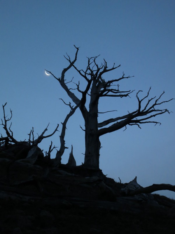
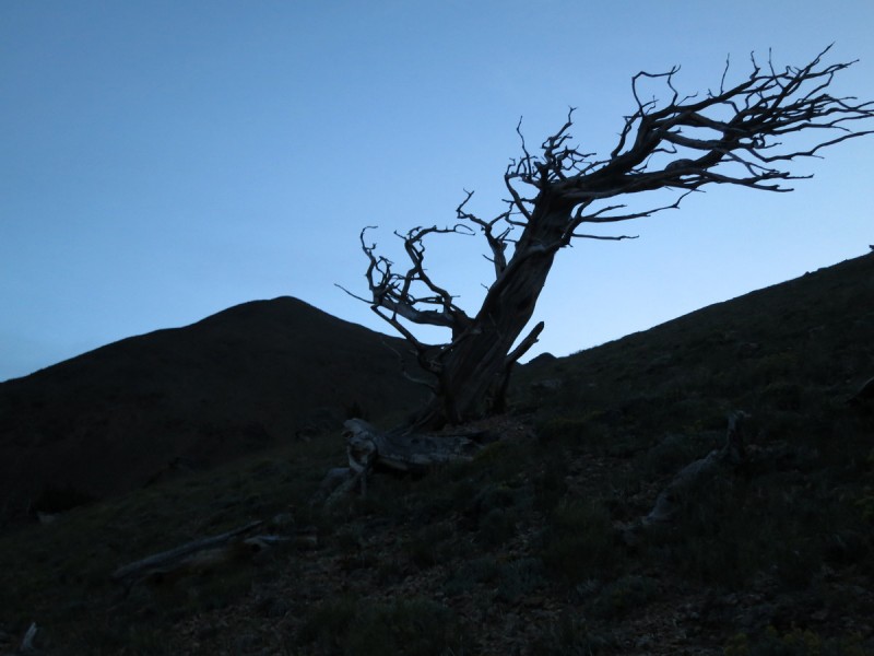
I get up early and am on the old road, now trail at about 4:30am. The road has tons of dead-fall which makes travel annoying. I had thought to follow it up to the point between Carbonate and Cyclone to gain the ridge there. But I had visions of mountain lions stalking prey by the stream in my head. So, up the ridge to Carbonate I went. Not too bad, as I seem to find a reasonably less treed area and so the bush whack was pretty easy. Found lots of pretty dead trees that filled some photography time. I figured I had a few minutes at least. They were so picturesque!
Tree - Moon Tree - Carbonate
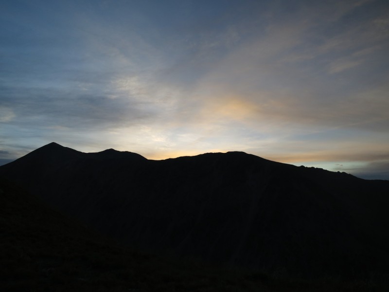
Up the gentle ridge I went, watching the sunrise and playing my favorite mountain past-time of stalk the silly ptarmigan. La, la la...
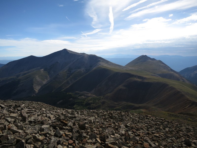
Sunrise behind Shav & Tab Sunrise on Taylor, Aetna and group Remaining ridge up Carbonate
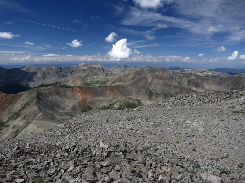
Once on the summit of Carbonate, I settle into my usual solo summit routine. I turn on my phone to make sure my SPOT message has sent, and see if I can get that updated forecast.... Oh F Crap S B!!!! 50% storms by 10AM!!!! Time to run this ridge! And GO!
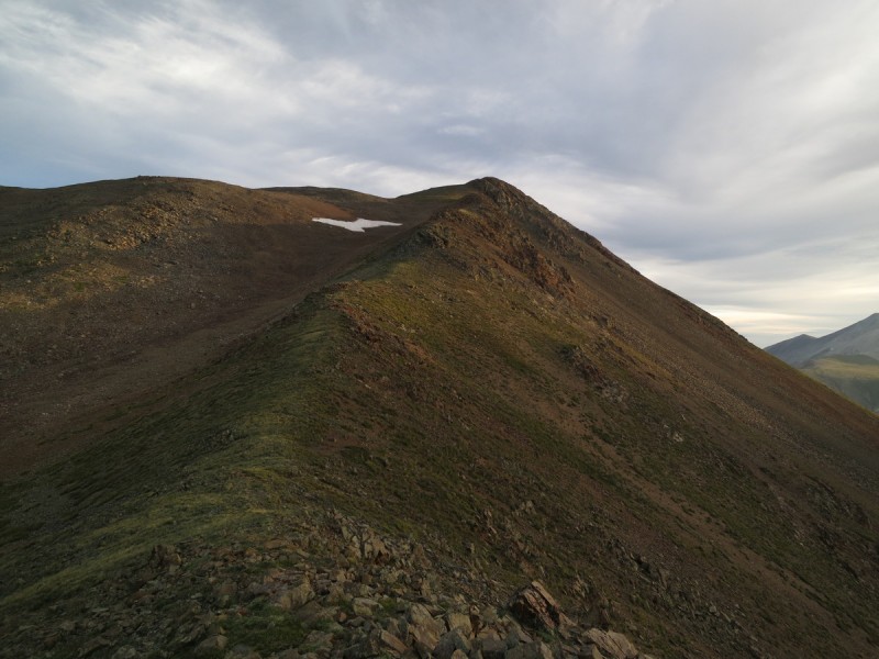
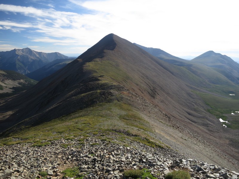
Ridge over to Cyclone Looking back at Carbonate
Cyclone is a short distance away from Carbonate, so I get there quickly. I really want Cronin, it's only an extra 2 miles.... Good thing the ridge looks pretty simple and easy.
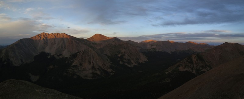
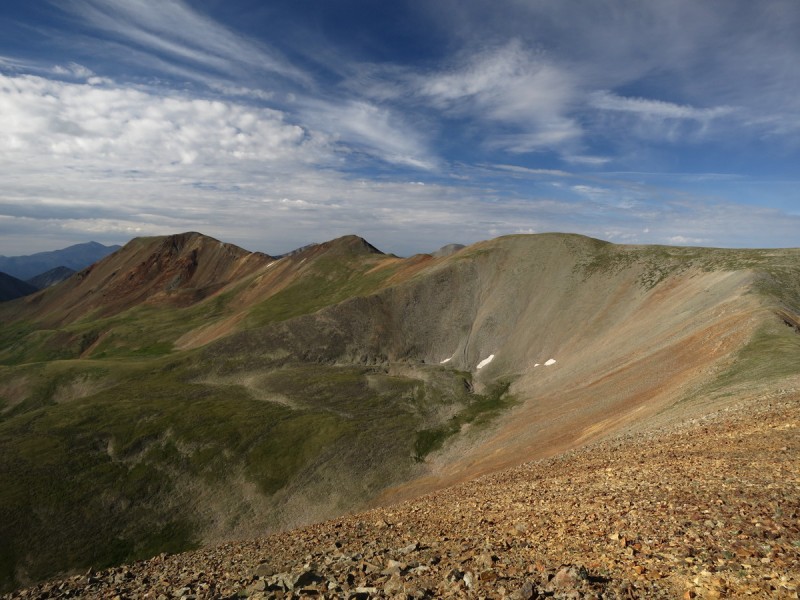
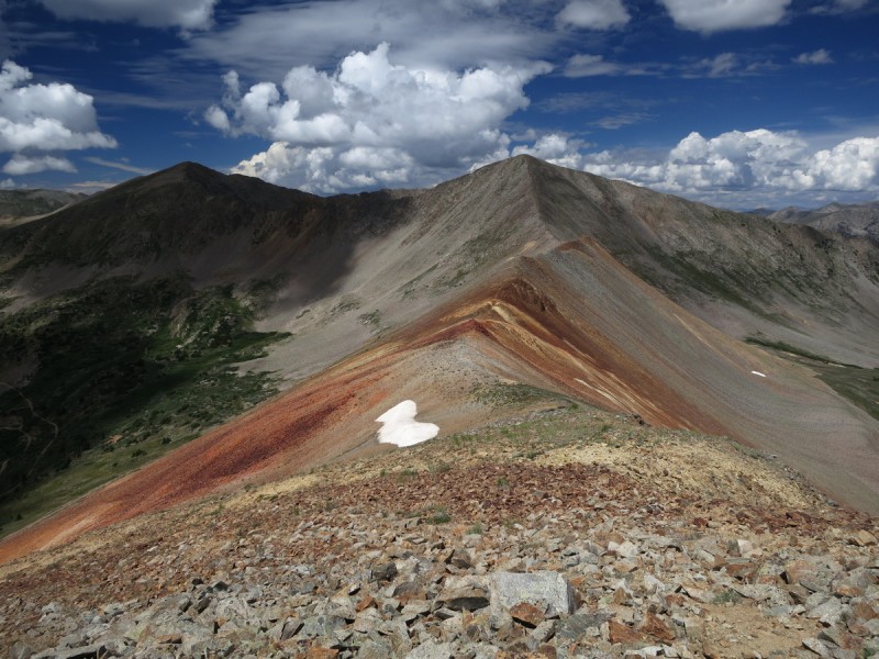
Grizzly, Lo Carb and Cronin Ridge to Cronin Looking back at Carbonate, Cyclone and Lo Carb Antero Shav & Tab
Phew, back on Lo Carb after only a 1:20 detour.
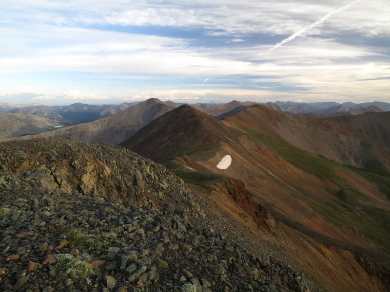
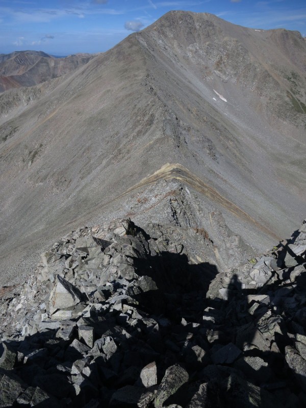
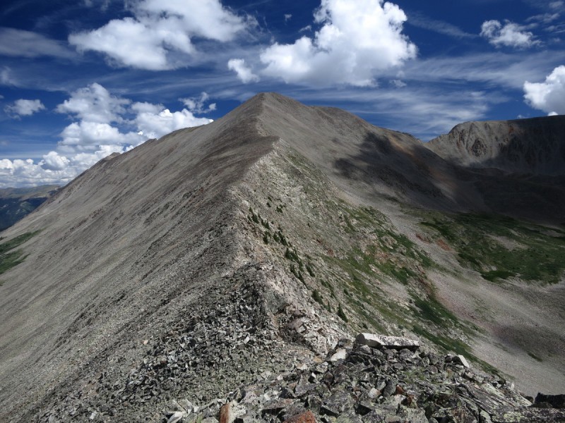
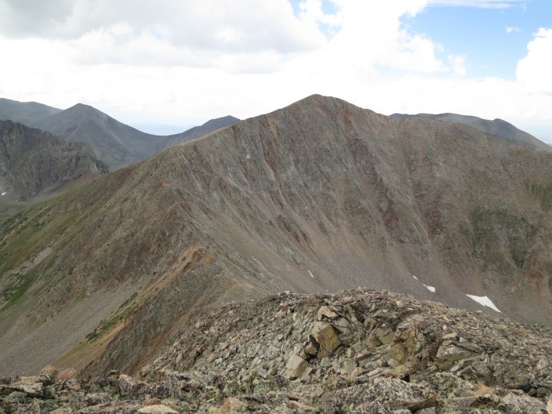
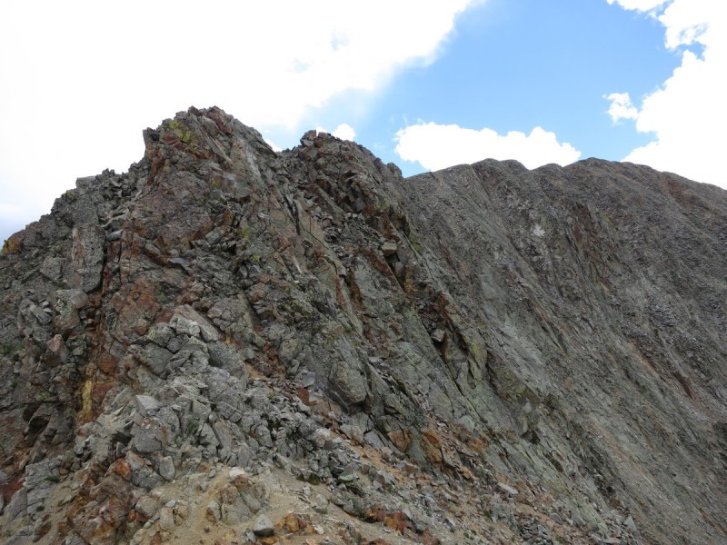
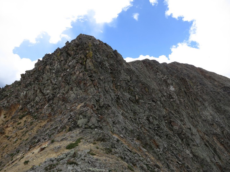
Now for the ridge to Grizzly.... uh oh! That doesn't look easy It's loose, blocky, knife edge like crap. There's times to stay ridge proper, and others to drop slightly to the south. Don't go too far off ridge, as the slope becomes more unstable. At least the class 3 scramble section of cliffs were fairly solid to down climb. I kept looking forward to the saddle, hoping that from there it would get easier. But it doesn't. There's 2 more blocky ridge bumps to go. THEN, it gets easier.
Ridge to Grizzly looks.... uh... challenging Please, let the class 3 loose crap be over already!!! - And no Looking back at the scramble off of Lo Carb
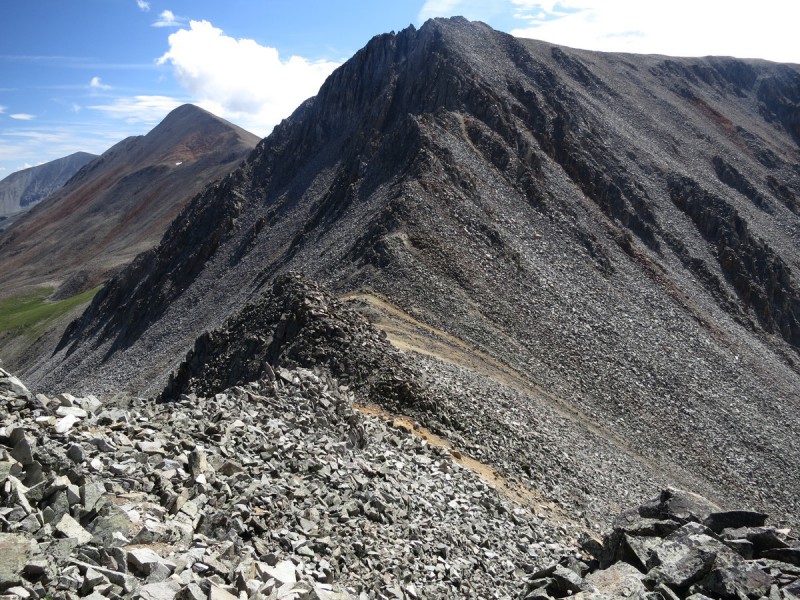
Once on Grizzly, I decide the weather, while building, is not going fast. So I can keep following the ridge to the next 2 peaks. At least I am heading in a bail direction if needed. The ridge down Grizzly is fairly stright forward, only a little bit interesting at the Pt 12,831 ridge bend.
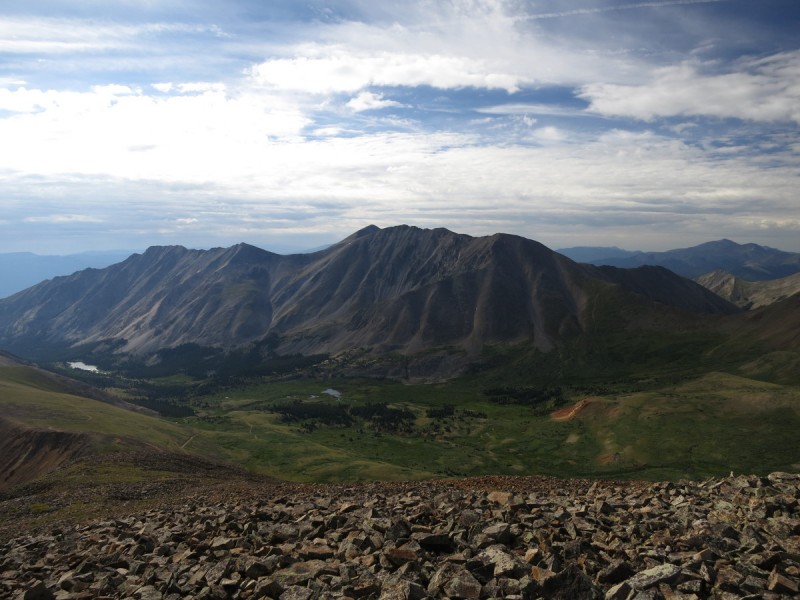
Looking back from summit of Grizzly On Grizzly - ridge left to go The descent ridge off Grizzly Pt 12,831 and ridge to go before 13,070 ridge Ah, so this is why I can't "cut the corner" on this ridge - Pomeroy and 13070 in background
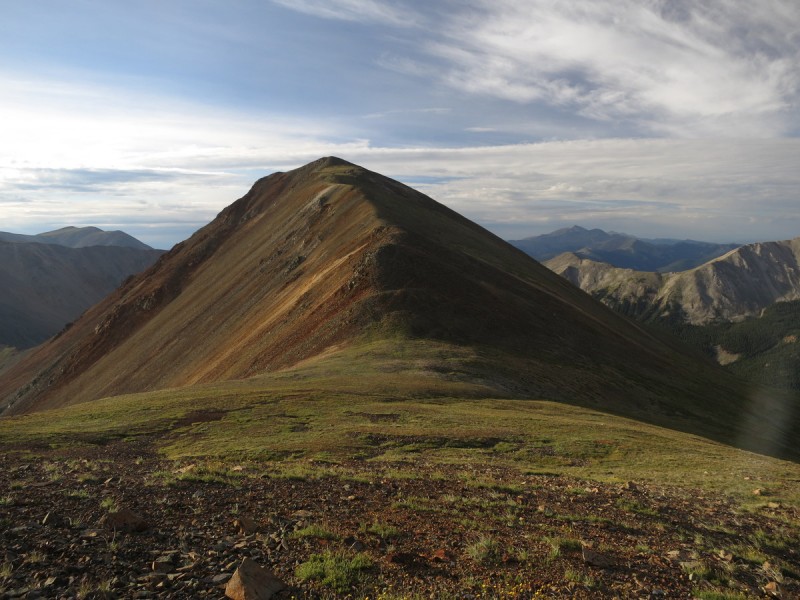
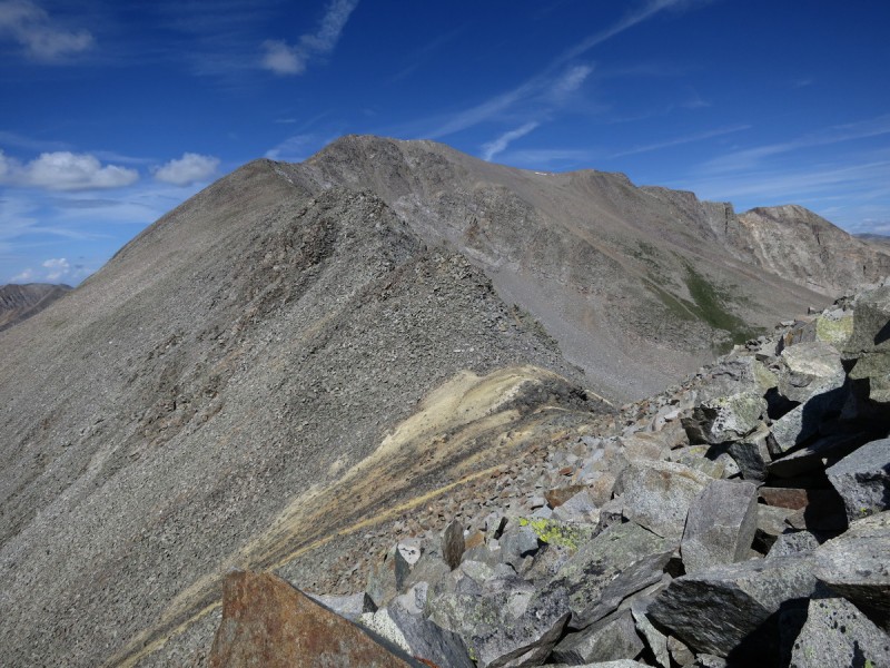
From the ridge bump, it's another short, but easy stretch up to Pt 13,070. Sunny still!
Ridge up to 13,070
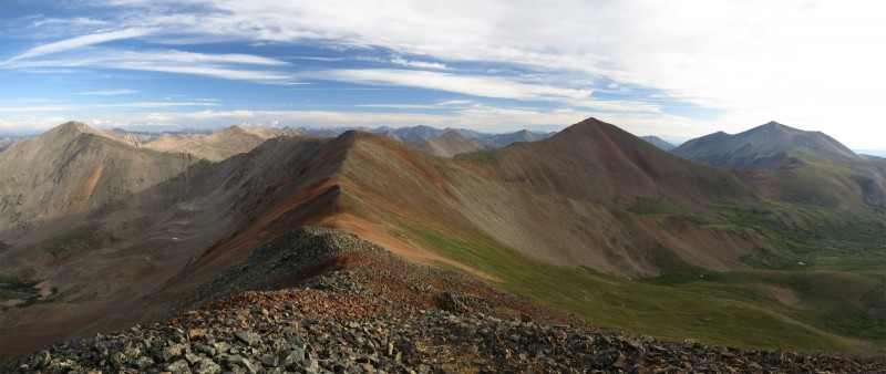
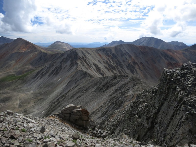
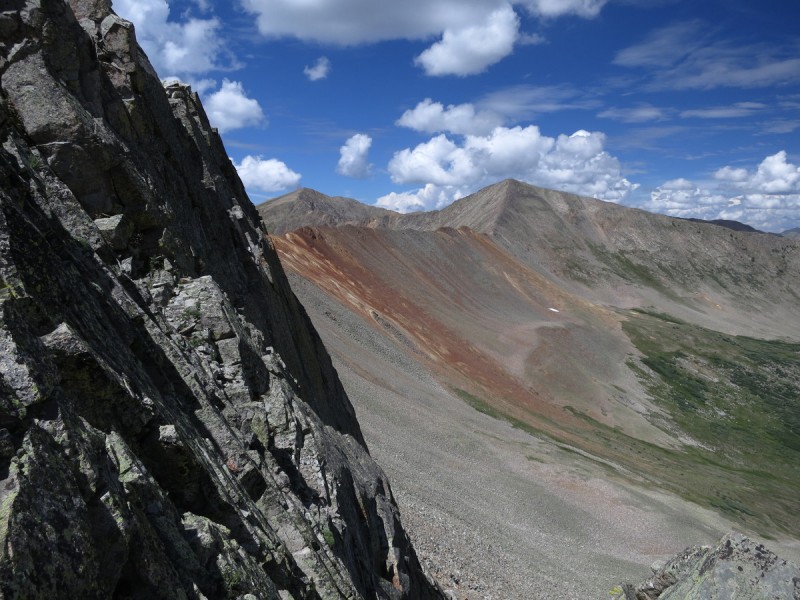
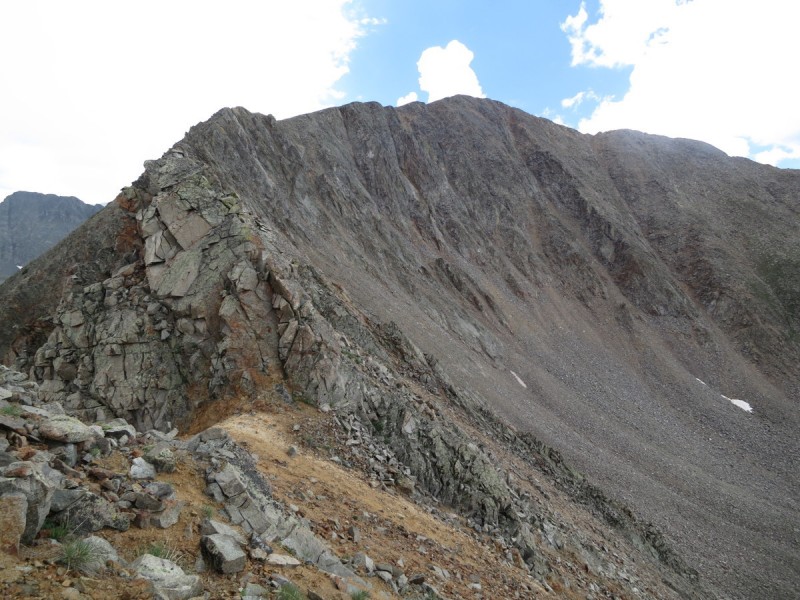
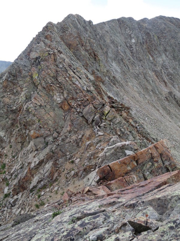
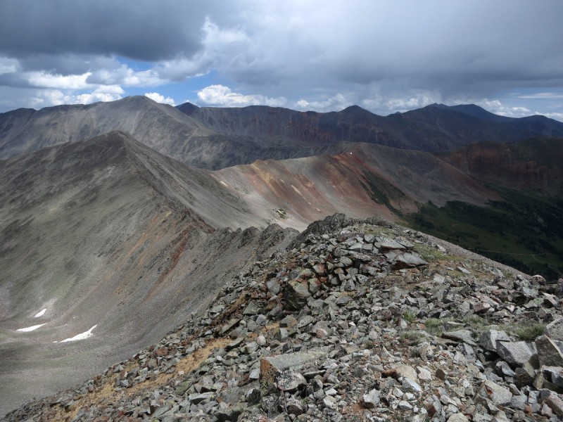
On the summit of Pt 13,070, I notice that the ridge over to Pomeroy Mountain, while only a short distance away, looks more technical than expected! Oooooo fun! It seems that the "Low 100 13ers" once again delivers a masterpiece! After my summit of Pt 13,001 in June 2012, the lowest 13er in the state, I have become ever more convinced that the lowest 13ers are the more interesting, and I have sought them out whenever I get the chance. These two, do not disappoint! A must have for the ubber 13er hipster!
On 13,070 - looking at ridge to Pomeroy
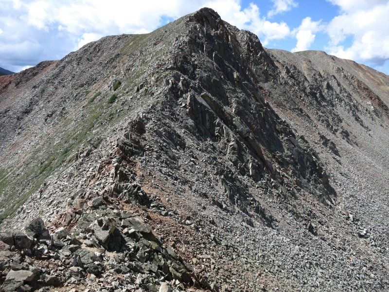
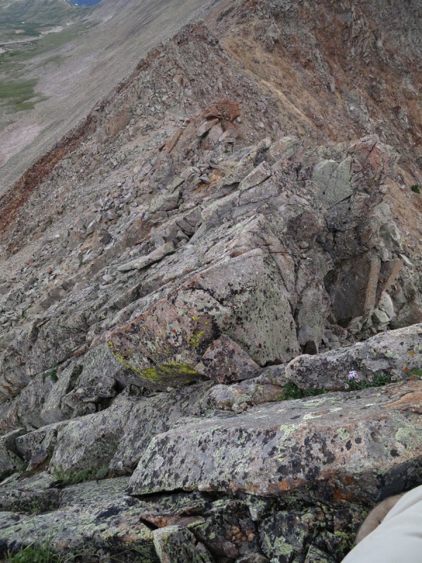
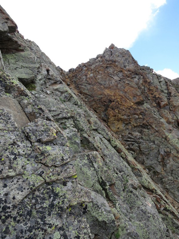
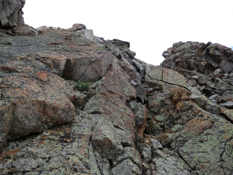
About halfway along the ridge, the scrambling begins. Lots of class 3, and some class 4 options exist on super solid slabby rock. I wish I had more time to play, but I am scramble-running to beat the weather. Of course, to catch my breath I snap photos of as many of the sections as I can, for your viewing and planning pleasure!
Easy ridge is over - now its class 3 & 4 scramble running Looking down on the first sectionNext ridge prominence Slabby scramble 3rd ridge prominence More class 4 slabs 4th ridge promince
I arrive on the summit of Pomeroy in the sun. But I am not fooled! I snap the last photos, click the last buttons, and head down with haste!
Looking back at super fun scramble ridge
Once below treeline, the rain and the storms begin with short work. Bleh, it will be a long walk down in the rain along the 4WD road. Hmmmm maybe I could hitch a ride?
Fun ridge traverse on low 13ers!
Down the 4WD road I walk, in the rain. Then, the AMAZING happens! My friend Al is driving up the road with his family! He offers me a ride, and I gratefully accept. It got me out of the rain and lightning, and I get to catch up with someone I haven't seen in a couple years. That and he saved my knees ~2 miles and almost 1,000' in elevation loss. Yay Al!
My GPS Tracks on Google Maps (made from a .GPX file upload):
...like a total blast, especially the ridge to Pomeroy! The rocks on this traverse are somewhat atypical for the Sawatch. Have to add these to the never-ending 13er wishlist - thanks for the beta! :D
Thanks for putting up more eye candy for me to eventually someday maybe get to. Looks like a great run and a total blast to do solo or with a partner. Looking forward to your next low 13er adventure!
I was talking with Al when he was giving me a lift, and making a loop of 13,070 and Pomeroy would be pretty easy with a decent 4WD vehicle. The other part of the loop can then be done out of Shavano, with less hassle
rajz06 - I'm always surprised when I find good scrambling in the Sawatch.
rking007 - Your Welcome! After finishing the 14ers, it was nice to have the freedom to just go wild on these 13ers, looking for the gems!
Rob - Just wait till you have Wilson finished, then you can do these fun things too :wink:
Thanks Otina on another great 13er loop idea for me, if I ever climb this summer. Snow is hinting at the peaks though :wink:
Caution: The information contained in this report may not be accurate and should not be the only resource used in preparation for your climb. Failure to have the necessary experience, physical conditioning, supplies or equipment can result in injury or death. 14ers.com and the author(s) of this report provide no warranties, either express or implied, that the information provided is accurate or reliable. By using the information provided, you agree to indemnify and hold harmless 14ers.com and the report author(s) with respect to any claims and demands against them, including any attorney fees and expenses. Please read the 14ers.com Safety and Disclaimer pages for more information.
Please respect private property: 14ers.com supports the rights of private landowners to determine how and by whom their land will be used. In Colorado, it is your responsibility to determine if land is private and to obtain the appropriate permission before entering the property.