Download Agreement, Release, and Acknowledgement of Risk:
You (the person requesting this file download) fully understand mountain climbing ("Activity") involves risks and dangers of serious bodily injury, including permanent disability, paralysis, and death ("Risks") and you fully accept and assume all such risks and all responsibility for losses, costs, and damages you incur as a result of your participation in this Activity.
You acknowledge that information in the file you have chosen to download may not be accurate and may contain errors. You agree to assume all risks when using this information and agree to release and discharge 14ers.com, 14ers Inc. and the author(s) of such information (collectively, the "Released Parties").
You hereby discharge the Released Parties from all damages, actions, claims and liabilities of any nature, specifically including, but not limited to, damages, actions, claims and liabilities arising from or related to the negligence of the Released Parties. You further agree to indemnify, hold harmless and defend 14ers.com, 14ers Inc. and each of the other Released Parties from and against any loss, damage, liability and expense, including costs and attorney fees, incurred by 14ers.com, 14ers Inc. or any of the other Released Parties as a result of you using information provided on the 14ers.com or 14ers Inc. websites.
You have read this agreement, fully understand its terms and intend it to be a complete and unconditional release of all liability to the greatest extent allowed by law and agree that if any portion of this agreement is held to be invalid the balance, notwithstanding, shall continue in full force and effect.
By clicking "OK" you agree to these terms. If you DO NOT agree, click "Cancel"...
Report Type
Full
Peak(s)
"Algonquin" - 12574
Sawtooth Mountain - 12304
"Red Deer Mountain" - 12391
Point 12277
"Ooh La La" - 12945
Destinations:
"Coney Island" - 11580 feet
"Algonquin" - 12574 feet
"Red Deer Mountain" - 12391 feet
Sawtooth Mountain - 12304 feet
Point 12277 - 12277 feet
"Ooh La La" - 12945 feet Route: Up the east ridge of "Coney Island," down its north slopes, up the east slopes of "Algonquin," a grassy stroll to points north, and then a backtrack to the Buchanan Pass trail. Round trip distance: ~22 miles (estimate based on post hoc map analysis) Round trip elevation gain: ~6800 feet Car to car time: Just under 11 hours Resources: Gerry Roach's IPW book and Floyd's trip report
We've all experienced failure in the mountains. I've found myself turning around for a variety of reasons, including unexpected weather, lack of appropriate gear, and overambitious route selection. Most of the time I succeed when I return to finish my business with a mountain, but there is one peak that has thwarted me on two occasions. Indeed, you could say that unofficially named "Algonquin" is my arch-nemesis, at least as far as is really possible when discussing a lowly twelver with multiple class 2 ascent options. Facing a promisingly low chance of storms in the forecast, and looking for a relatively straightforward route as I was going to be solo, a plan for redemption hatched. I would summit my mighty-ish foe and then add on as many nearby summits as the weather and my energy level allowed.
After a short and uneventful drive up, I parked next to Beaver Reservoir for the third (and hopefully final) time before starting up the 4wd road to Coney Flats. A short way in I was surprised to see the headlights of a descending vehicle come around a corner and pierce through the murky gray of civil twilight. Turns out the driver of the gigantic pickup had decided to turn around when faced with a muddy puddle of indeterminate depth (a Forester, driven by someone with excellent taste in both beer and non-profits, had cleared this watery hazard and parked at the start of the hiker cut-off trail) and was wondering if I knew what kinds of vehicles had made it through the puddle on the day prior. Having only driven up minutes ago, I was unable to help him and continued on my way.
The unremarkable and annoyingly familiar slog up the road went thankfully quickly, and I did enjoy occasional glimpses of the day's objectives through the trees. Upon reaching Coney Flats, I crossed a couple of bridges and entered into the wilderness area proper, grateful that the resident beaver population allowed me to pass with both femoral arteries intact. Then, it was up a nice trail for a mile or two before turning off to the south and gaining "Coney Island's" east ridge. Having been up this way twice before and happening upon a convenient game trail really enabled me to minimize time spent wallowing in the willows, though I gained the ridge perhaps lower than is advisable and was therefore treated to a couple hundred feet of bushwhacking through dense Krummholz.
Once out into the open, it was smooth sailing up a long but gentle ridge to my first summit of the day. I enjoyed the views of Paiute to the south and Sawtooth to the north, had a quick snack, and checked out the interesting and rarely signed register. Then, I backtracked a few hundred feet to descend the north slopes of "Coney Island" at a point where the angle appeared slightly less extreme.
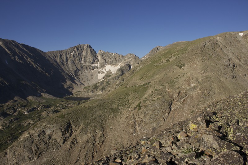
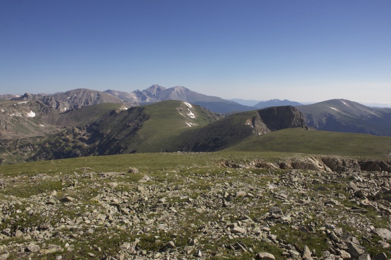
My first unobstructed view of a few of my destinations
From the east ridge of "Coney Island"
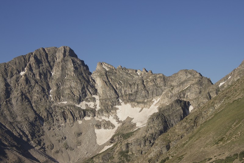
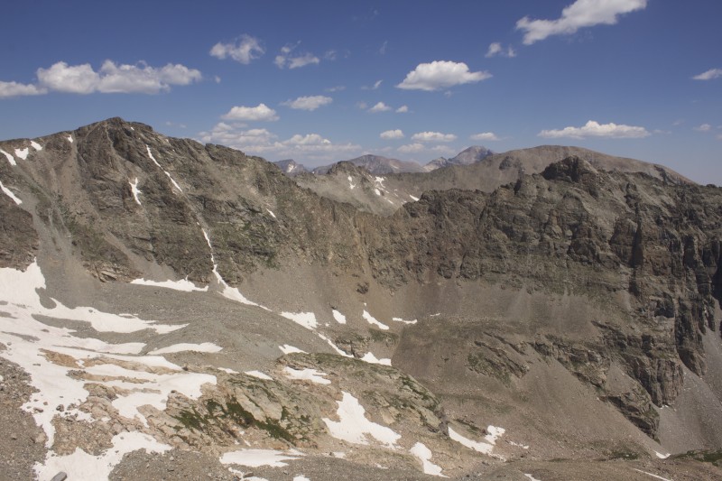
Paiute on the left, my initial ascent route on "Algonquin" on the right
Rugged.
Mine was just the second entry this year
My first attempt on "Algonquin" was back in the fall of 2011. I had been captured by Gerry Roach's extremely positive and almost poetic description of the mountain, though the large amount of off-trail hiking combined with some hesitant navigational decisions to expose my lack of ambition for the day. Still, it was a very enjoyable hike, as most are when out in nature with a person you love, despite failing to reach any destination in particular.
My second attempt was last year, in November. I was reeling from the end of my most significant romantic relationship to date, was unemployed, and was very much in need of an improved outlook on life. A meditative solo hike in my beloved Indian Peaks seemed like just the ticket, though I was unprepared for the amount of snow that I found on the trail. Recent tracks from both a moose and a mountain lion rattled my already fragile psyche, and, when exposed to the biting winds of the coming winter upon exiting the trees, I suddenly felt very viscerally alone. Luckily, I did the smart thing and turned around right then and there.
This time, I was feeling better, stronger, and more mentally ready. I followed the loose descent off of "Coney Island" by contouring around its northern side to the "Coney Island"-"Algonquin" saddle. The talus slope that looked impossibly steep from above actually looked quite welcoming from below, and patches of a climbers' trail quickly brought me up to the grassy slopes that would continue to my second summit of the day. I forged upward, and soon found myself seated on one of the most spectacular perches that I've been lucky enough to visit.
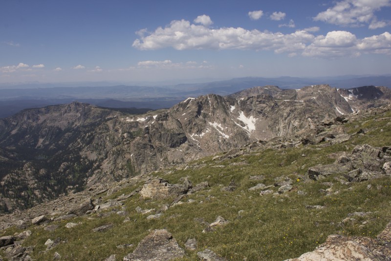
The west side of "Coney Island"
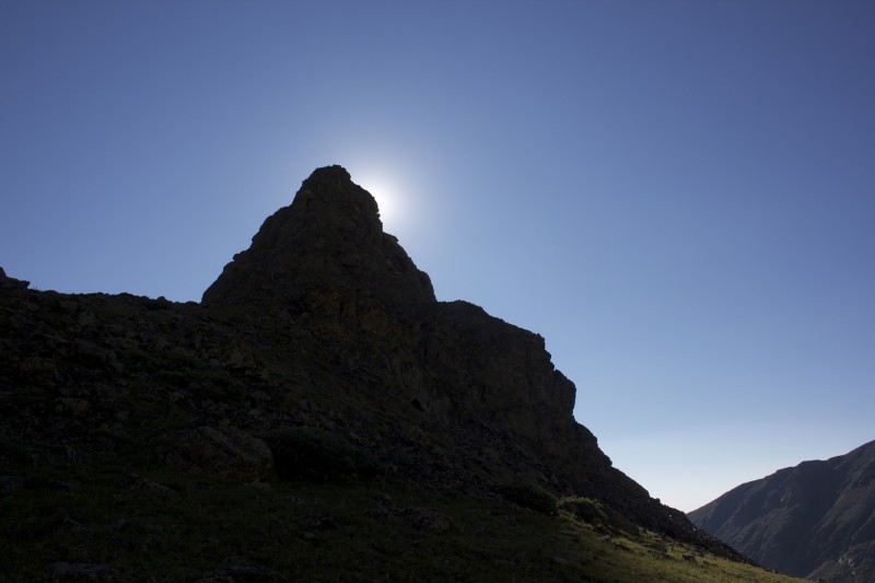
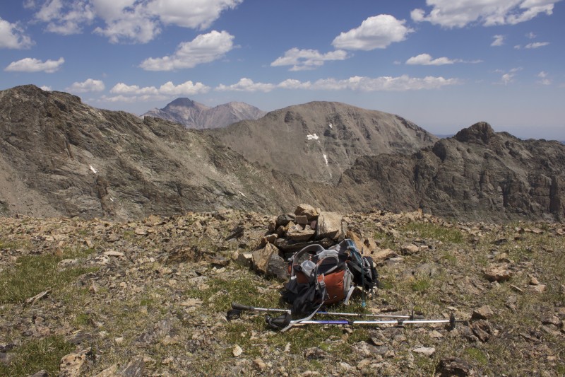
The mundane final pitch of "Algonquin. You'd never know what's about to appear in front of you...
Life is so ridiculously good
Eventually, I started off to the north. Sawtooth Mountain came quickly, and I passed my first few people of the day at Buchanan Pass before speeding up "Red Deer Mountain.". With skies still startlingly clear, I continued on to Point 12277, bypassing any minor scrambling on the left as I was solo and already quite a few miles in to my day. From apex of this barely unranked grassy lump, the views north of Ogallala and the Elks Tooth really opened up. The weather still looked good, so I decided to continue on to "Ooh La La."
Points north
A neat wind shelter on Sawtooth Mountain
"Red Deer Mountain" and "Ooh La La" barely visible at far left
Looking back at "Algonquin" from "Red Deer Mountain"
Apparently there's some controversy over naming. I guess I'm with LoJ.
The traverse to Point 12277
A closer look
The view north from Point 12277. Not too shabby.
The two plus mile stretch to what would be my highest peak of the day would be the most tedious since leaving the trail many hours earlier. The descent into the saddle went, as mentioned by Floyd in his trip report, straight down a neat grassy ramp flanked by rocky towers on both sides. The ascent up the other side was steep for a ways, but gave way to a long and gentle tundra walk up to "Ooh La La." This humble mountain, at least according to my totally subjective and likely oxygen deprived evaluation, offered views better than any of the day's preceding summits save "Algonquin," with Ogallala and Elks Tooth standing dramatically to the north, a number of rugged and attractive lower peaks off to the west, and Lone Eagle Cirque nestled in the heart of the Indian Peaks in the distance to the south. A startling shout interrupted my tired reverie and I turned to spy two tiny figures atop Ogallala. I briefly wondered if they'd done the imposing looking traverse from Elks Tooth, but then turned my attentions to the long hike back to the car.
The "Ooh La La"-12277 saddle
"Ooh La La" finally comes into view
To-do list items, part 1
To-do list items, part 2
To-do list items, part 3
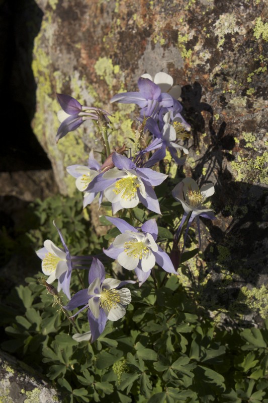
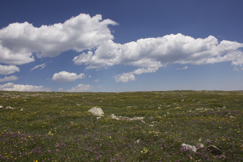
My descent was long, hot, and otherwise unremarkable. Having to re-ascend most of Point 12277 and "Red Deer Mountain" was somewhat unpleasant, but it hardly put a dent in the satisfaction I felt from finishing my business with "Algonquin" and experiencing a long and peaceful hike across grassy tundra carpeted appealingly with tiny wildflowers.
Thank you for reading!
This is pretty much what the inside of my brain looked like on the descent
Thumbnails for uploaded photos (click to open slideshow):
Great report and pics, Dan. Algonquin looks like it's bobbing in an ocean of peaks. Congrats on a solitude-filled romp through one of the state's best ranges!
Some of those traverses in there look mighty interesting. Nice job plucking away at the IPW/RMNP. Maybe not so much ”plucking” with a good day like that.
I agree that walk up Ohh La La is never-ending and Algonquin holds all sorts of surprises. I'm glad my TR helped and if the western side are all ”to-dos” then you have plenty of exciting journeys in your future. Nice trip report and that's a strong day!
Brian - I was definitely feeling the gain late in the day, but I hadn't realized that it was more than 5-6k until I started adding things up. Let's definitely get out - someday we'll both have a free Sunday again.
Matt - Let's try to get out in August, either on a Sunday or a Monday/Tuesday if one of your furlough days happens to fall that way
Greg - that's a good description for Algonquin. Good luck on Capitol this weekend!
Ryan - there are indeed some interesting looking traverses. Definitely will have to return for some of those...
Scot - I'm definitely looking forward to those western peaks. Part of me wants to try to get a large fraction of them in one epic long weekend, but part of me wants to break them up and enjoy returning multiple times.
Caution: The information contained in this report may not be accurate and should not be the only resource used in preparation for your climb. Failure to have the necessary experience, physical conditioning, supplies or equipment can result in injury or death. 14ers.com and the author(s) of this report provide no warranties, either express or implied, that the information provided is accurate or reliable. By using the information provided, you agree to indemnify and hold harmless 14ers.com and the report author(s) with respect to any claims and demands against them, including any attorney fees and expenses. Please read the 14ers.com Safety and Disclaimer pages for more information.
Please respect private property: 14ers.com supports the rights of private landowners to determine how and by whom their land will be used. In Colorado, it is your responsibility to determine if land is private and to obtain the appropriate permission before entering the property.


 My first unobstructed view of a few of my destinations")
 From the east ridge of")
")
 Paiute on the left, my initial ascent route on")
 Rugged.")
")
 Mine was just the second entry this year")
 The west side of")
")
 The mundane final pitch of")
")
 Life is so ridiculously good")
")
 Points north")
 A neat wind shelter on Sawtooth Mountain")
")
 Looking back at")
 Apparently there's some controversy over naming. I guess I'm with LoJ.")
 The traverse to Point 12277")
 A closer look")
 The view north from Point 12277. Not too shabby.")
 The")
")
 To-do list items, part 1")
 To-do list items, part 2")
 To-do list items, part 3")
")
 This is pretty much what the inside of my brain looked like on the descent")


