Download Agreement, Release, and Acknowledgement of Risk:
You (the person requesting this file download) fully understand mountain climbing ("Activity") involves risks and dangers of serious bodily injury, including permanent disability, paralysis, and death ("Risks") and you fully accept and assume all such risks and all responsibility for losses, costs, and damages you incur as a result of your participation in this Activity.
You acknowledge that information in the file you have chosen to download may not be accurate and may contain errors. You agree to assume all risks when using this information and agree to release and discharge 14ers.com, 14ers Inc. and the author(s) of such information (collectively, the "Released Parties").
You hereby discharge the Released Parties from all damages, actions, claims and liabilities of any nature, specifically including, but not limited to, damages, actions, claims and liabilities arising from or related to the negligence of the Released Parties. You further agree to indemnify, hold harmless and defend 14ers.com, 14ers Inc. and each of the other Released Parties from and against any loss, damage, liability and expense, including costs and attorney fees, incurred by 14ers.com, 14ers Inc. or any of the other Released Parties as a result of you using information provided on the 14ers.com or 14ers Inc. websites.
You have read this agreement, fully understand its terms and intend it to be a complete and unconditional release of all liability to the greatest extent allowed by law and agree that if any portion of this agreement is held to be invalid the balance, notwithstanding, shall continue in full force and effect.
By clicking "OK" you agree to these terms. If you DO NOT agree, click "Cancel"...
Pettingell Peak... the line we skied is in the center
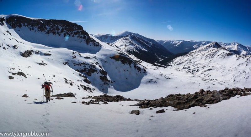
With the month of May quickly coming to a close already, I was anxious to finally be able to get out and kick off the ski mountaineering season. Tyler (tygrubb) and I decided on Pettingell Peak, for its ease of access and relatively short approach, making it a good "warm-up" for both of our first ski descents of the season.
Warm temperatures were in the forecast, so we began hiking from the Herman Gulch Trailhead at 4:45. My car thermometer read 32 degrees at the trailhead, and fortunately, we would soon discover that the snowpack had seen a solid freeze. The first mile or so of the trail was mostly dry, before running into intermittent snow for a while. We put our skins on after maybe two miles.
As the sun rose and we approached treeline, clear skies and top-notch scenery greeted us. We had a great view of The Citadel coming out of the valley, which had a number of ski tracks down its northeast face, and still looks to be in good condition.
The Citadel
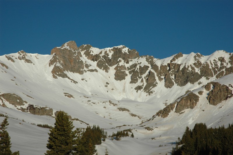
Another look at Pettingell
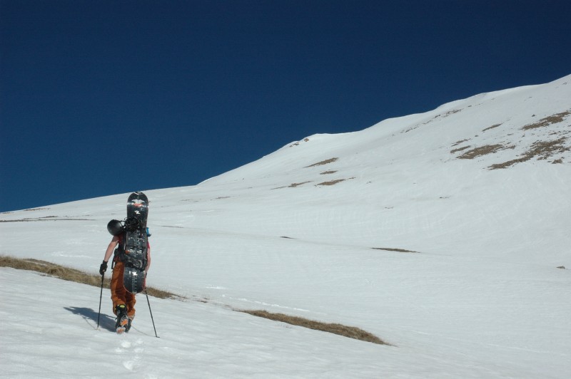
We opened up into a basin below and to the left of Herman Lake, and began a steeper ascent up toward the lake... we began skinning, but soon began to slip and slide on the hardpack, so we quickly decided to throw the skis/boards on our backs and get the crampons out and boot it the rest of the way to the summit.
We had a couple of small delays on the way up due to minor gear malfunctions... Tyler was having issues with a binding piece on his splitboard, and one of my crampons came apart. Fortunately, they were quick fixes since Tyler had packed some small zip-ties... something I never would have thought to pack in the backcountry, but it turns out they can be quite useful for a number of things.
Once our gear was fixed up, we skirted along the edge of still frozen-over Herman Lake, and began the real climb up to the summit of Pettingell... the first part of which was quite steep right above the lake.
Tyler climbing the first steep section above Herman Lake
Overall, we both felt pretty good for having not been out yet this year, but we weren't setting any speed records either. Luckily, even though the sun was very warm, the snowpack wasn't softening too quickly and we were up there early enough that we never felt rushed.
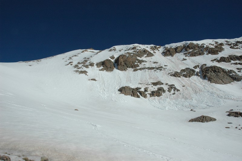
some wet slide debris on Pettingell... you can clearly tell it slid on the dust layer
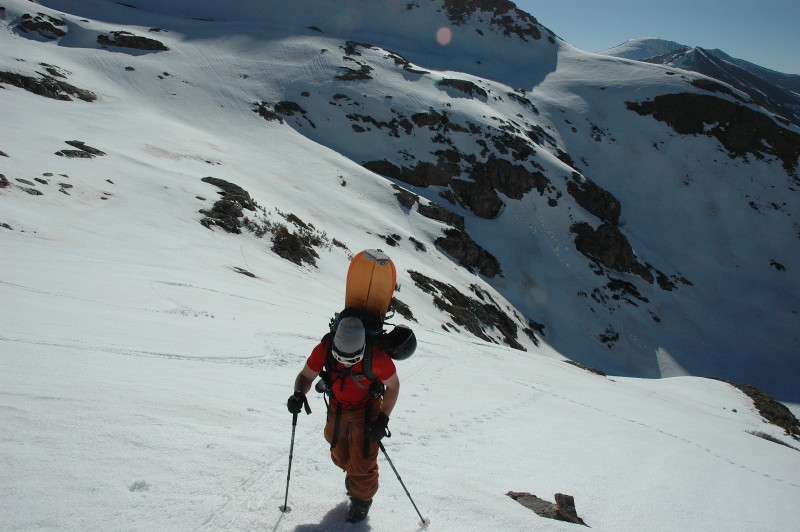
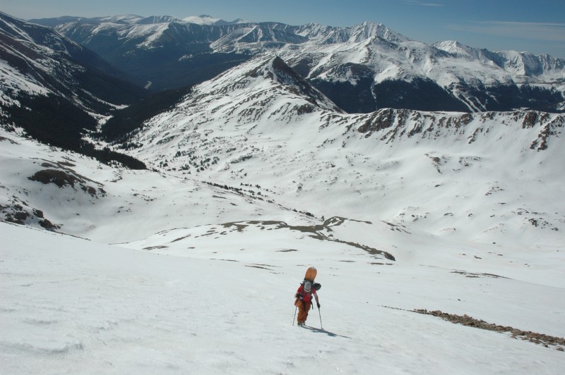
After the initial steep climb above the lake, the terrain mellowed out for a bit until we reached the bottom of Pettingell's southeast face. As we booted up this next slope toward the summit, we were definitely beginning to feel it. It was a take 10-15 steps, stop and catch your breath kind of deal as we got closer to the summit.
Getting ready to ascend Pettingell's SE face
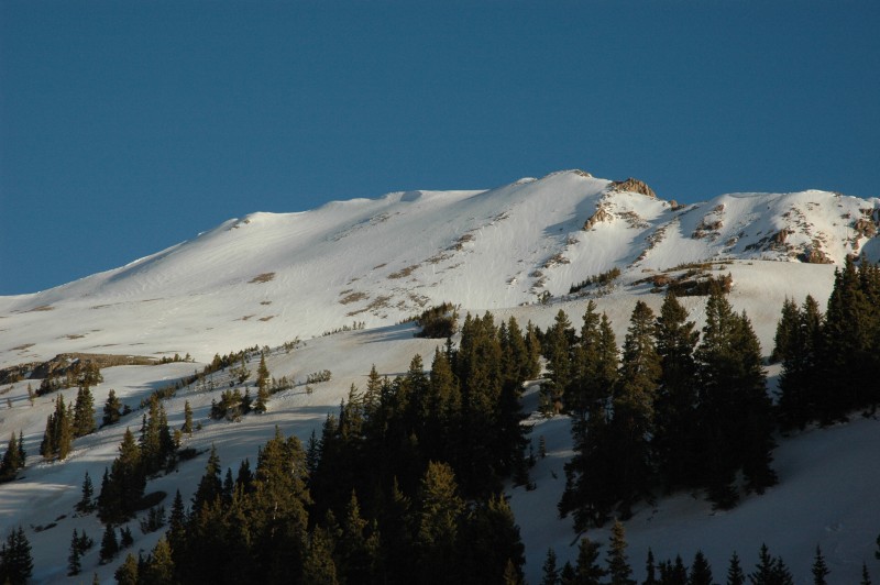
Bald Mtn near Breck looking good
View of Loveland Pass, and the site of the April 20th avalanche accident
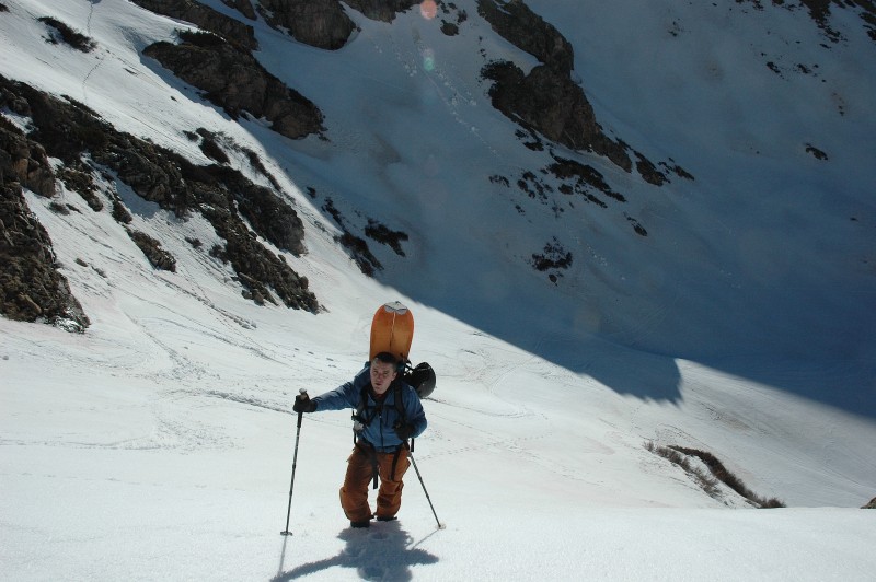
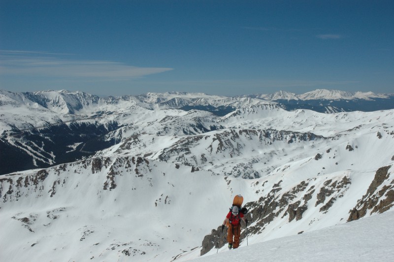
Tyler climbing
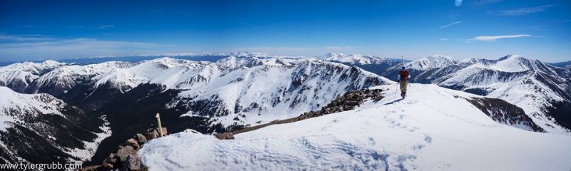
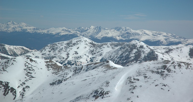
Eventually we reached a saddle just below the summit, and it was an easy 5-minute stroll along a ridge to the summit from there. The views from the top were incredible, especially with the surrounding ranges so well covered in snow. From the top we had great views of the Front Range (especially Torreys and Tuning Fork), Indian Peaks/RMNP, Gore Range, and the northern Sawatch, including Holy Cross. Pettingell is well positioned in a central location so that you really get a 360 panorama of big mountain ranges.
nearing the summit
summit ridge
We topped out shortly before 10 am, and the snow was still holding up just fine, so we took a nice break on the summit, ate some food and took some pictures.
Pettingell Peak summit
Torreys Peak... Tuning Fork looking good!
Longs Peak and the Indian Peaks
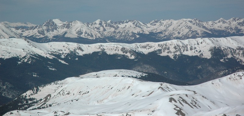
Gore Range
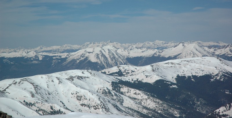
Buffalo Mtn view... and Holy Cross in the distance
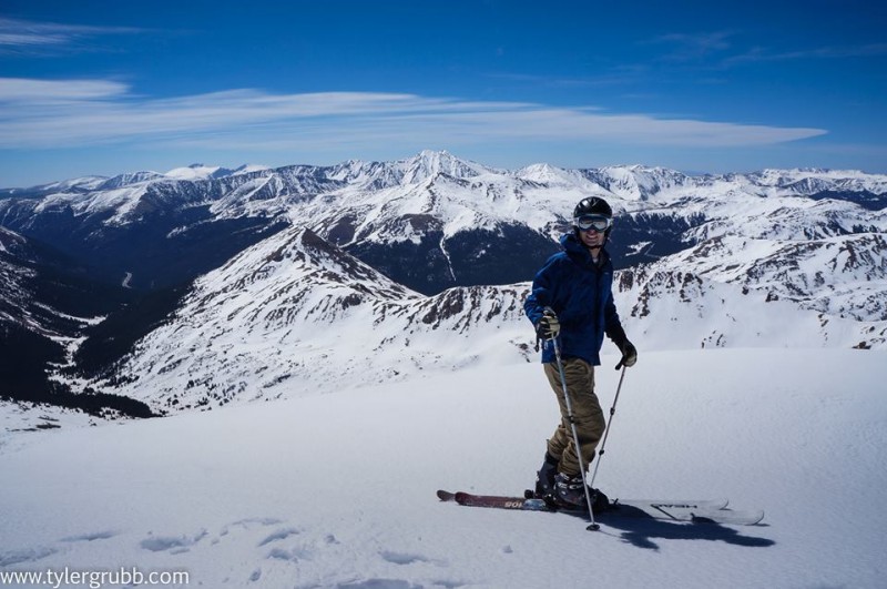
Ready for the fun part
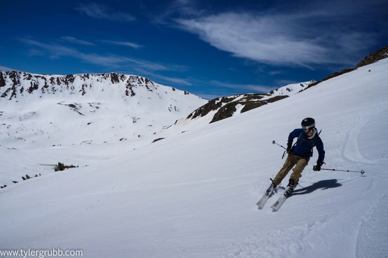
After our short break, the fun part began... skiing! Tyler snowboarded off the summit first back to the saddle, and I followed. We then started skiing the same face we climbed, before cutting left into the fun-looking chute we eyed on our ascent.
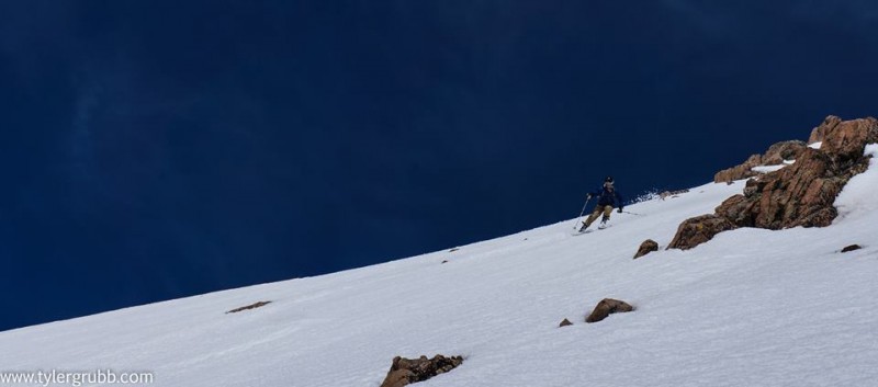
We caught the snow in absolutely perfect conditions... nice, soft, corn snow, but not too slushy. The descent was awesome... a nice, decently long and moderately steep (35-40 degree range) face... and the steeper section exiting out onto the lake was fun as well. Some pictures from the descent...
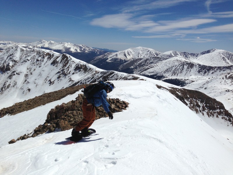
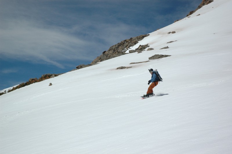
Tyler snowboarding off the summit
Here's a cool one Tyler came up with using his photo software
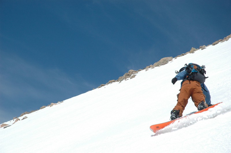
Tyler enjoying the corn turns
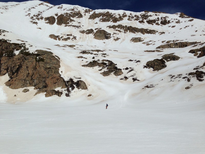
The exit out onto Herman Lake
Once we descended below the lake and back below treeline the trail quickly flattens out, and by then, the snow had turned to slush in the valley which, combined with the dust layer, was making for slow travel... more so for Tyler since he was snowboarding. Overall, though, the hike out was uneventful, and we were back at the car by 12:45.
It was an awesome day to be out in the mountains, and I'm definitely pumped to get some more ski descents in over the next month or so before the snow melts.
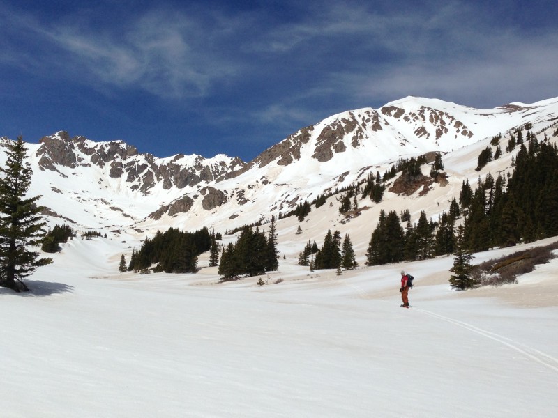
Looking back at the beautiful Herman Lake Basin
Thumbnails for uploaded photos (click to open slideshow):
Dave, I was also impressed with the snowpack, and yeah Citadel was definitely looking good. Hopefully we can get out there and ski soon!
bergsteigen, thanks for the comment. Snow is definitely holding up well in the Front Range, I think June is going to be a good ski month up here this year. Just read your TR, looks like you had quite a weekend!
Caution: The information contained in this report may not be accurate and should not be the only resource used in preparation for your climb. Failure to have the necessary experience, physical conditioning, supplies or equipment can result in injury or death. 14ers.com and the author(s) of this report provide no warranties, either express or implied, that the information provided is accurate or reliable. By using the information provided, you agree to indemnify and hold harmless 14ers.com and the report author(s) with respect to any claims and demands against them, including any attorney fees and expenses. Please read the 14ers.com Safety and Disclaimer pages for more information.
Please respect private property: 14ers.com supports the rights of private landowners to determine how and by whom their land will be used. In Colorado, it is your responsibility to determine if land is private and to obtain the appropriate permission before entering the property.
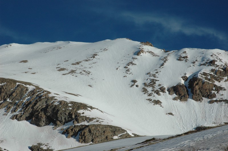

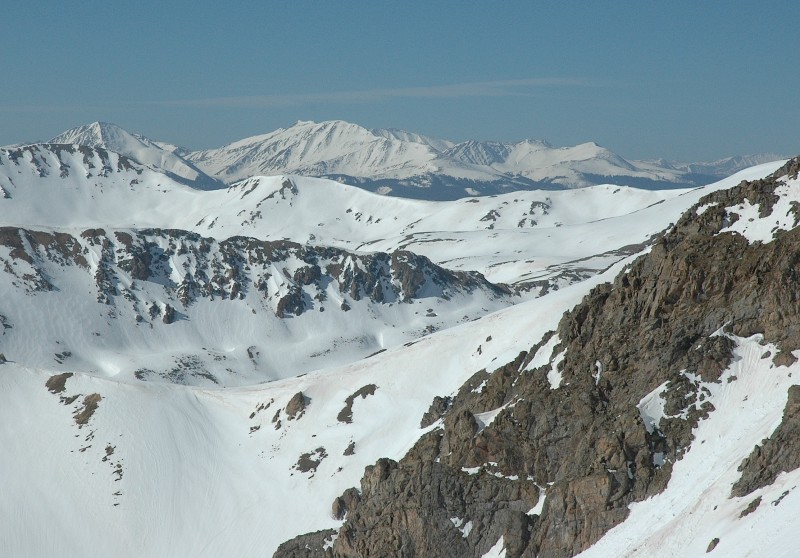


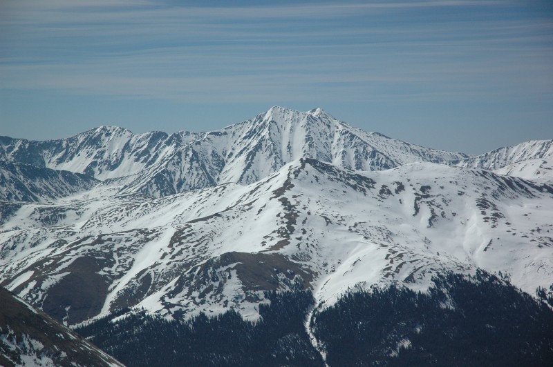


 Pettingell Peak... the line we skied is in the center")
 The Citadel")
 Another look at Pettingell")
 Tyler climbing the first steep section above Herman Lake")
")
")
 some wet slide debris on Pettingell... you can clearly tell it slid on the dust layer")
")
 Getting ready to ascend Pettingell's SE face")
 Bald Mtn near Breck looking good")
 View of Loveland Pass, and the site of the April 20th avalanche accident")
 Tyler climbing")
 nearing the summit")
 summit ridge")
 Pettingell Peak summit")
 Torreys Peak... Tuning Fork looking good!")
 Longs Peak and the Indian Peaks")
 Gore Range")
 Buffalo Mtn view... and Holy Cross in the distance")
 Ready for the fun part")
 Tyler snowboarding off the summit")
")
")
")
 Here's a cool one Tyler came up with using his photo software")
")
 Tyler enjoying the corn turns")
 The exit out onto Herman Lake")
 Looking back at the beautiful Herman Lake Basin")


