Download Agreement, Release, and Acknowledgement of Risk:
You (the person requesting this file download) fully understand mountain climbing ("Activity") involves risks and dangers of serious bodily injury, including permanent disability, paralysis, and death ("Risks") and you fully accept and assume all such risks and all responsibility for losses, costs, and damages you incur as a result of your participation in this Activity.
You acknowledge that information in the file you have chosen to download may not be accurate and may contain errors. You agree to assume all risks when using this information and agree to release and discharge 14ers.com, 14ers Inc. and the author(s) of such information (collectively, the "Released Parties").
You hereby discharge the Released Parties from all damages, actions, claims and liabilities of any nature, specifically including, but not limited to, damages, actions, claims and liabilities arising from or related to the negligence of the Released Parties. You further agree to indemnify, hold harmless and defend 14ers.com, 14ers Inc. and each of the other Released Parties from and against any loss, damage, liability and expense, including costs and attorney fees, incurred by 14ers.com, 14ers Inc. or any of the other Released Parties as a result of you using information provided on the 14ers.com or 14ers Inc. websites.
You have read this agreement, fully understand its terms and intend it to be a complete and unconditional release of all liability to the greatest extent allowed by law and agree that if any portion of this agreement is held to be invalid the balance, notwithstanding, shall continue in full force and effect.
By clicking "OK" you agree to these terms. If you DO NOT agree, click "Cancel"...
If you want to climb all of the 14,000 peaks of Colorado, eventually you are going to have to come to terms with the Lake Como Road, which provides access to Blanca Peak, Little Bear Peak, and Ellingwood Point. Due to the snow conditions, I didn't gain the summit of any of these peaks on this trip - nor did I plan to - the purpose of my hike was conditioning and sightseeing. But I found my hike up the Lake Como Road to be quite interesting.
The road begins at an elevation of 8,000 feet in the San Luis Valley east of Alamosa near the Great Sand Dunes, and climbs to Lake Como at 11,750. Some consider this road to be the roughest 4WD road in Colorado. The steep road consists of loose rock and occasional rock ledges several vertical feet high, which the 4WD community calls "Jaws 1", "Jaws 2", etc. Here's the first "Jaws" at 9,800 feet:
Yes, that's a road straight ahead.
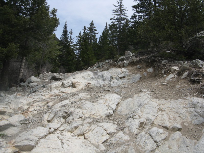
The first "Jaws" is mere child's play compared to what lies ahead:
Another "Jaws" at 10,400 feet.
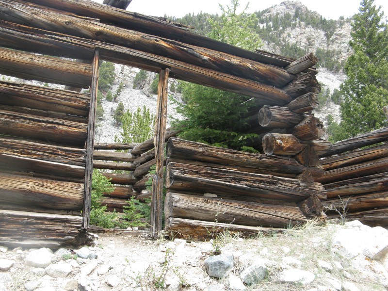
At 10,500 feet there are several abandoned cabins - "The Lake Como Hotel" - with dirt floors smooth enough to sleep on if you're not concerned about the rest of the cabin falling down on you: Cabins at 10,500.
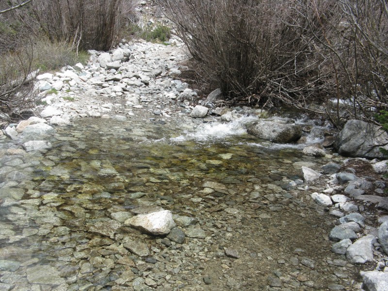
At 10,700 there is an easy water crossing. Just step on the rocks on the right: Water crossing at 10,700.
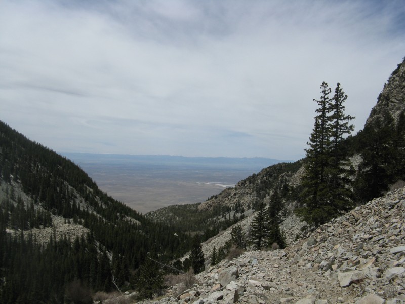
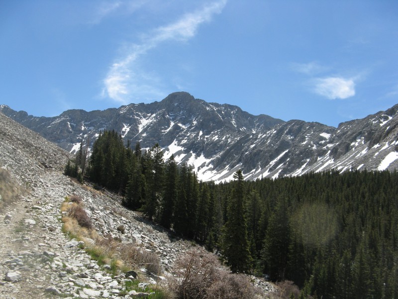
The arid San Luis Valley is a completely different ecosystem from the Sierra Blanca Massif: San Luis Valley from 11,000.
Eventually, Little Bear Peak comes into view: That's the road to the left.
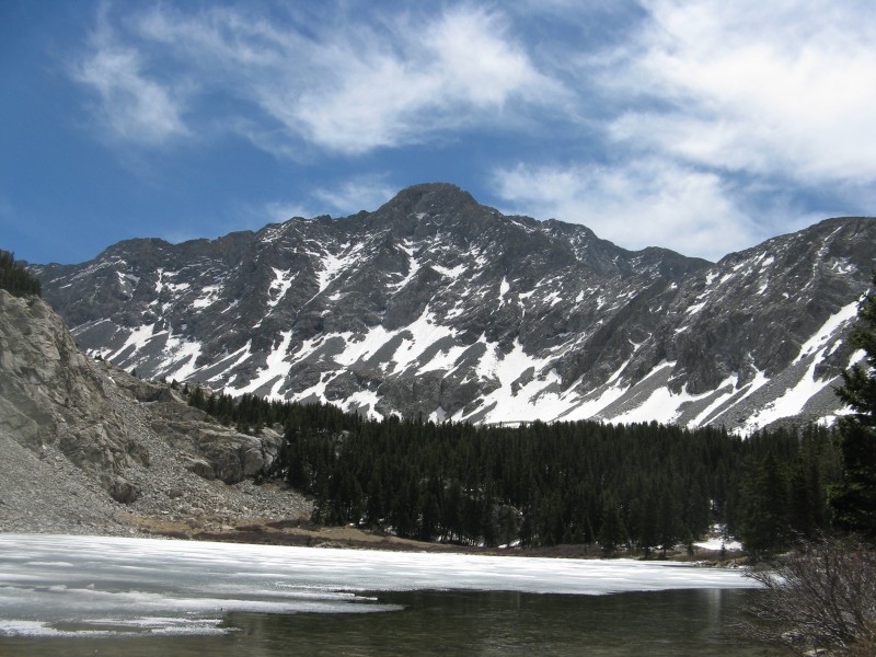
The view of Lake Como - still partially iced over in Late May - was mesmerizing: Lake Como, with Little Bear in the background.
Even if you don't gain a summit, the hike up the Lake Como Road is definitely worth the trip.
Thumbnails for uploaded photos (click to open slideshow):
I've done all the Blanca Massif peaks and never set one foot on that dang road. Blanca was from Huerfano side past the Gash Ridge to the Winchell Lakes. Now there's some scenery!
I guess for some their method of coming to terms with the Lake Como Road is to avoid it by creating their own route. You guys are amazing!
Caution: The information contained in this report may not be accurate and should not be the only resource used in preparation for your climb. Failure to have the necessary experience, physical conditioning, supplies or equipment can result in injury or death. 14ers.com and the author(s) of this report provide no warranties, either express or implied, that the information provided is accurate or reliable. By using the information provided, you agree to indemnify and hold harmless 14ers.com and the report author(s) with respect to any claims and demands against them, including any attorney fees and expenses. Please read the 14ers.com Safety and Disclaimer pages for more information.
Please respect private property: 14ers.com supports the rights of private landowners to determine how and by whom their land will be used. In Colorado, it is your responsibility to determine if land is private and to obtain the appropriate permission before entering the property.

 Yes, that's a road straight ahead.")
 Another")
 Cabins at 10,500.")
 Water crossing at 10,700.")
 San Luis Valley from 11,000.")
 That's the road to the left.")
 Lake Como, with Little Bear in the background.")


