The Castle - 9,691'
Mileage - 4.0 miles
Elevation Gain - 1,700'
Trailhead - Wellington Lake
Route - Southeast Gully (5.4) with South Chimney Summit option. (5.6)
Raiders - Brian (Brian Thomas), Britt (Globreal), Kevin (Kevin Baker), Dave (CarpeDM) and Derek
Preparing and Approach
The Castle lies on the far east side of the Lost Creek Wilderness, hovering over Wellington Lake. I've loved observing it from afar while hiking other peaks in the area, however I was never able to make my way up it. Main reason? It was tougher than most of the other LCW peaks. Thankfully, I had been somewhat successful in creating another "LCW Maniac" in Brian Thomas who brought back up the idea of climbing it. I was obviously up for it, and so was CarpeDM (who planned to lead), Globreal and Kevin Baker (who would be making his 3rd trip up.)
After meeting up in Morrison, 4 of us headed down to Wellington Lake. Kevin planned to meet us there, as he had an early morning appointment with an 8er in the area. To reach Wellington Lake, turn left (south) off of 285 at Wellington Lake Road right at the bottom of Crow Hill in Bailey. There is a sign for the lake at the intersection. The road quickly turns dirt and continues in a southern direction for 10 miles to the lake. The trailhead is on the SW side of the lake, however there is a use fee that must be paid at the Castle Mountain Recreation company office. There also appeared to be a heavy population of boy scouts in the vicinity of the lake. I believe the general rule for boy scouts is to never turn and run, and always make yourself appear large and scary. (Or maybe that's the rule for mountain lions....I confuse the two..)
After parking, we geared up and made our way along the trail. There was very little introduction, as the trail almost immediately headed up steeply west towards the base of the Castle. The views looking back at the lake and the impressive looking Castle during the quick ascent provided nice eye candy during our frequent breaks.

The Castle from near the trailhead at Wellington Lake.
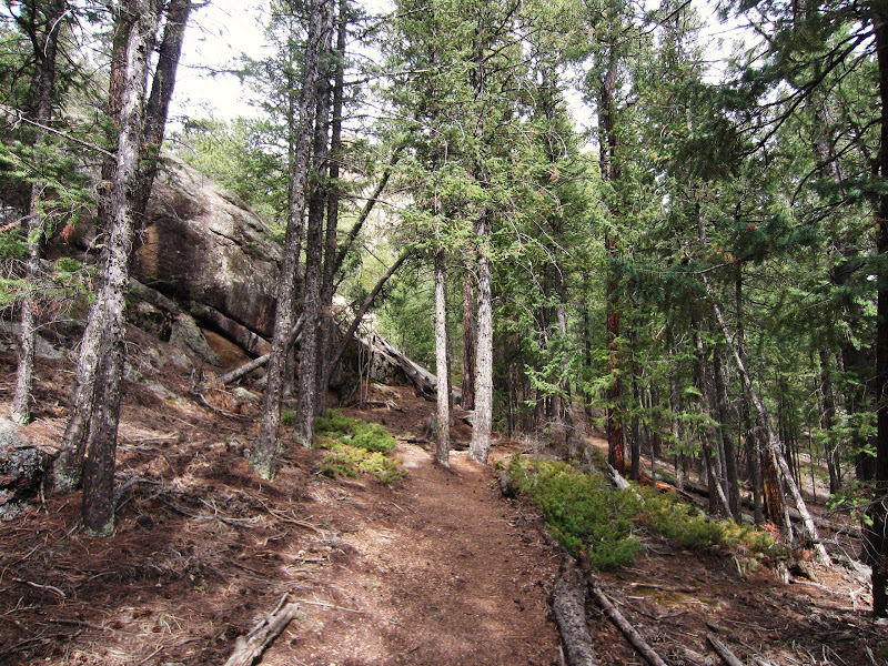
Starting up the nice trail near the boyscout camp.

Trail near the lake.

Looking back towards the trailhead and Wellington Lake from the trail.

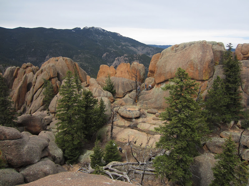
View of the Castle during the approach. Our route is the tree filled gully in the middle of the formation.

Nearer the cliff face, the trail got steeper and steeper. Quite a leg workout in such a short approach.

The trail faded close to the gully, but Kevin led us to the route start without any problem, having been here before.
The Climb
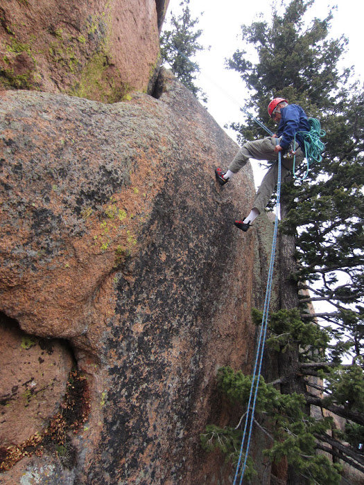
After a mile or so, the trail slowly faded near the base of the Castle. A bushwhack of a few hundred yards led us to the start of route. Roach rates this first 20 or so feet at 5.4, which seemed about right. Were it not for an inconveniently placed chock stone in the left gully, it would probably be closer to class 4. Most of us used the right crack, which provided a nice selection of holds. Once above the 10 foot move, the terrain eases to class 4. We all continued up the gully, each taking whatever route looked good. Plenty of rock hopping/scrambling fun to be had here! Eventually, we reached the top of the gully where we angled to our right (north) and scrambled a final short section to the hanging garden that was tucked between the 4 Castle summits.
The "hanging garden" (as named by Roach) is really just a large flat area centered amongst the many high points of the summit. Once in the garden, a couple of us took off to explore the eastern summit (class 3) and get a good view of the true western summit while others set up for the final pitch to the summit. The true summit has two feasible options for ascent: A tree route (5.4) and a chimney route (5.6). We all decided on the chimney route, which Kevin led up. Once above the chimney, the true highpoint is only a few feet away. One by one, we all made our way to the top where we enjoyed the airy perch.

The first 5.4 "pitch". The easier crack on the left is prevented by some overhanging rocks, so most of us used the right overhang.

Closer look at the right overhang crack.

Mr. Thomas shoeing up on the first ledge.

CarpeDM taking the lead.

Kevin above the short move, continuing his way up the gully.

Once above this short move, the difficulty eases to class 3/4.

The gully widened as we trekked higher, and we all scattered among our own individual paths up.

Top of the gully, just below the hanging garden.

Beware: Lots of thorns near the gully.

Ascending the East Summit.

Wellington Lake from the East (non-true) Summit.
Hanging garden and true (west) summit from the east summit. Part of the crew can be seen setting up for the final pitch to the summit. Windy Peak in the background.

Kevin begins the fun.

Success.

Britt follows after.

Summit of The Castle.

Lunch time.

Brian and Derek on the summit. Photo by CarpeDM

Rock garden off the west side of the summit.
The Descent
After 10-15 minutes, we all made our way back down to the garden via a rappel of the tree route. (A few of us thought the tree route looked fun, so we ended up re-climbing to the summit. We had time....so why not?) Otherwise we all wandered around the garden area checking out the sites. From a gap between the east and south summits, we were able to catch a good view of some other climbers (all much braver than I) ascending the "Throne Room" route up Castle's east face.
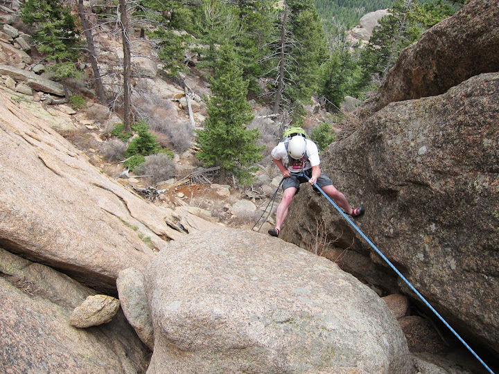
We spent close to 2.5 hours climbing and exploring around the summit of the Castle. Finally, we decided to pack it up and head back down. We left the garden and scrambled our way back down to the first pitch that we had ascended earlier that morning. We used a solid tree in the gully for an anchor and rappelled back to hiking ground. From there, the descent went quickly and we reached the trailhead just a short time before raindrops started to fall.
Rappelling the east side of the summit, aka the "Tree Route".

Dave checking out the tree route.

Reascending the summit via the "Tree Route".

Your standard Lost Creek Wilderness rocks.

Heading down, just below the hanging garden.

Climbers ascending the 5.10 "Throne Room" route.

Back above the first pitch, setting up a rappel.
Brian headed down. Photo by CarpeDM

Almost back to hiking boots...

Easy bushwhack back down to Wellington Lake.

So long Castle...thanks for the pleasant trip.

Googleearth image of the route.
|