Download Agreement, Release, and Acknowledgement of Risk:
You (the person requesting this file download) fully understand mountain climbing ("Activity") involves risks and dangers of serious bodily injury, including permanent disability, paralysis, and death ("Risks") and you fully accept and assume all such risks and all responsibility for losses, costs, and damages you incur as a result of your participation in this Activity.
You acknowledge that information in the file you have chosen to download may not be accurate and may contain errors. You agree to assume all risks when using this information and agree to release and discharge 14ers.com, 14ers Inc. and the author(s) of such information (collectively, the "Released Parties").
You hereby discharge the Released Parties from all damages, actions, claims and liabilities of any nature, specifically including, but not limited to, damages, actions, claims and liabilities arising from or related to the negligence of the Released Parties. You further agree to indemnify, hold harmless and defend 14ers.com, 14ers Inc. and each of the other Released Parties from and against any loss, damage, liability and expense, including costs and attorney fees, incurred by 14ers.com, 14ers Inc. or any of the other Released Parties as a result of you using information provided on the 14ers.com or 14ers Inc. websites.
You have read this agreement, fully understand its terms and intend it to be a complete and unconditional release of all liability to the greatest extent allowed by law and agree that if any portion of this agreement is held to be invalid the balance, notwithstanding, shall continue in full force and effect.
By clicking "OK" you agree to these terms. If you DO NOT agree, click "Cancel"...
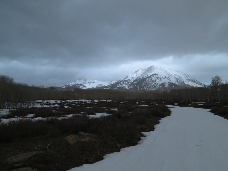
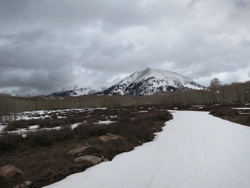
TH: La Sal Creek Road, east side, where the snow started
Route: La Sal Creek Rd to La Sal Pass, climb and ski middle finger chute
Mileage: 11.2
Elevation Gain: 4,336'
Partner: Solo
With my annual road trip to the SSA conference (Seismology) upcoming, I was scrambling to try and find a plan for what to do before hand. The weather in Colorado was windy on Sat, with a storm coming in Sat night into Sun. So my original plan to ski some San Juan 14ers/13ers went out the window. Instead, I tail-gaped Berthoud Pass Saturday with a ski tour and BBQ at the parking lot, then hitting some incredible powder on Sunday with friends. But that still left Monday and Tuesday before the conference. So I thought, hit Vail Pass along the way to Moab on Monday, then on Tuesday ski a La Sal peak near Moab. Little did I know the snow-pocalypse was going to happen on Monday! I stopped at Vail Pass after a white knuckled drive, to find almost no visibility as the snow was dumping fast and hard. Not exactly ideal conditions to BC ski an area I hadn't been to yet. Plus I was worried that even skiing for 2 hours, my car would be buried by the guy plowing the parking lot. Also, would CDOT close the pass in the mean time? F* it, let's drive to Moab and go to the brewery!
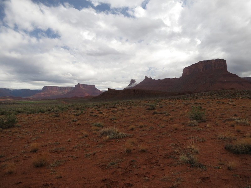
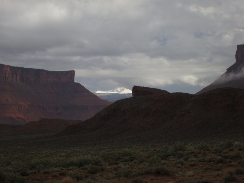
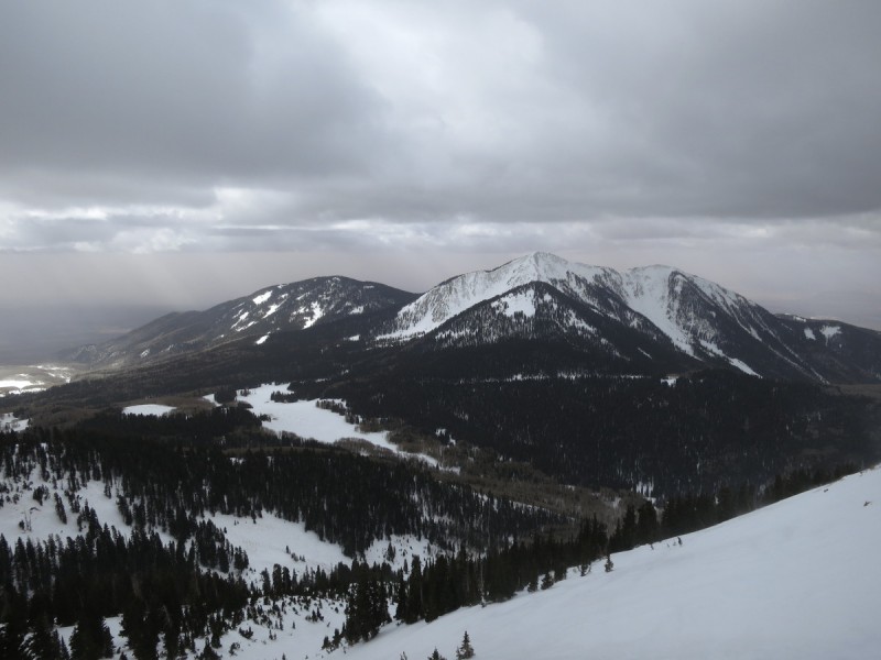
Once into Glenwood Canyon, the pervasive blizzard conditions, gave way to a downpour of rain. At least my car would be un-crusted from all the snow! As I entered Utah, I decided to take the other route to Moab, and was treated to the views of Castle Valley, and a glimpse of the snowy peaks of the La Sals.
Castle Valley First view of La Sals and Mt Tuk
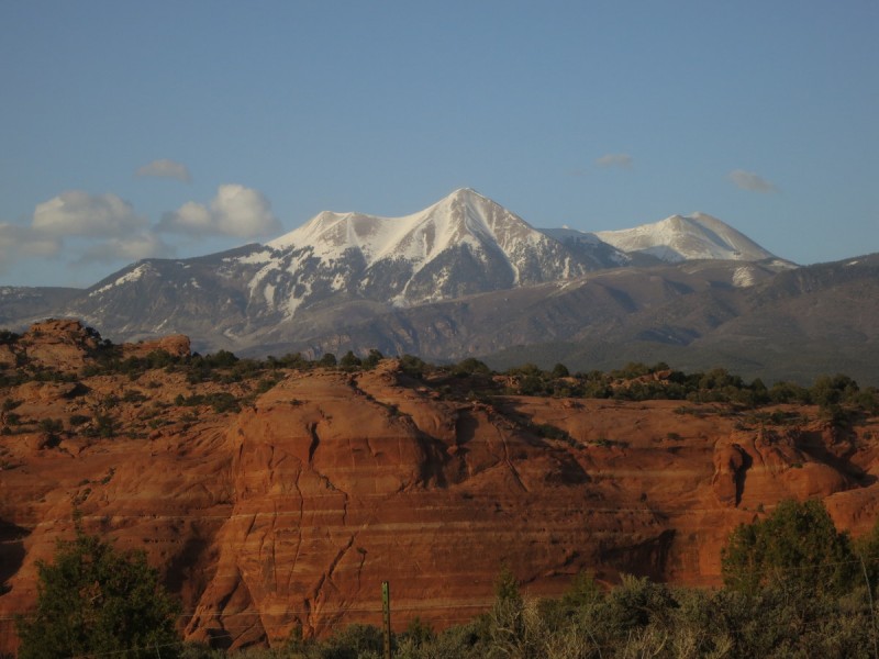
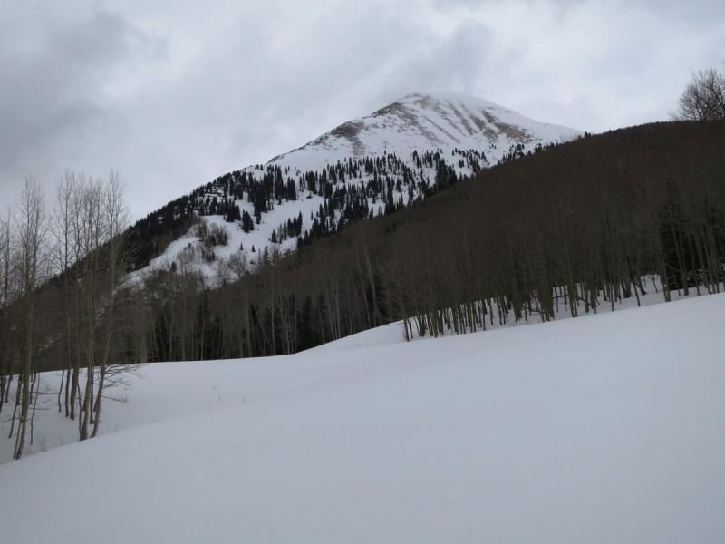
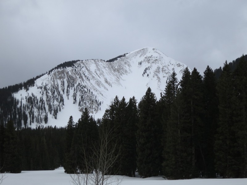
After a nice meal and beer at the Moab Brewery, I got my first good views of the peak I wanted to ski, Mt Tuk. Not having any beta on the peak, it was nice to see snow in the area, and that the summit looked white. The north face looks amazing, but skiing solo, I knew that was out. The SE face looked much more mellow on the topo, so now to see if it held any snow! Thankfully, as I drove around the La Sals to the south, and then to the east, the wind scoured ridges gave way to snowy lines that looked quite pleasing! Ah, the excitement of a trip with no beta!
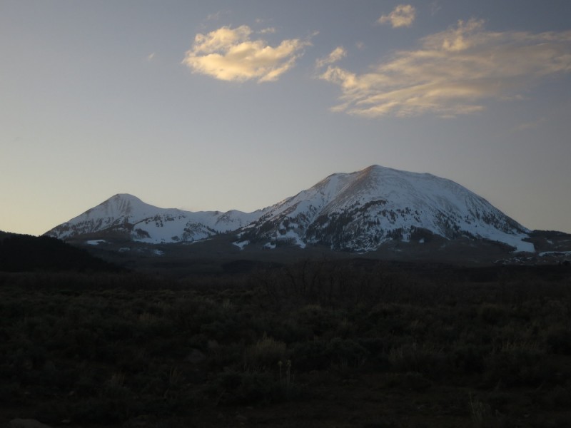
I was able to drive up the road past the winter TH, past the stream crossing and about another mile further, leaving me about 3.5 miles to La Sal Pass. I could have gone further (and a Tacoma did the next day), but I didn't want to get stuck on a Tuesday, as I was alone on the road. So I settled down for a decent sleep before tackling what I hoped would be a successful ski the next day.
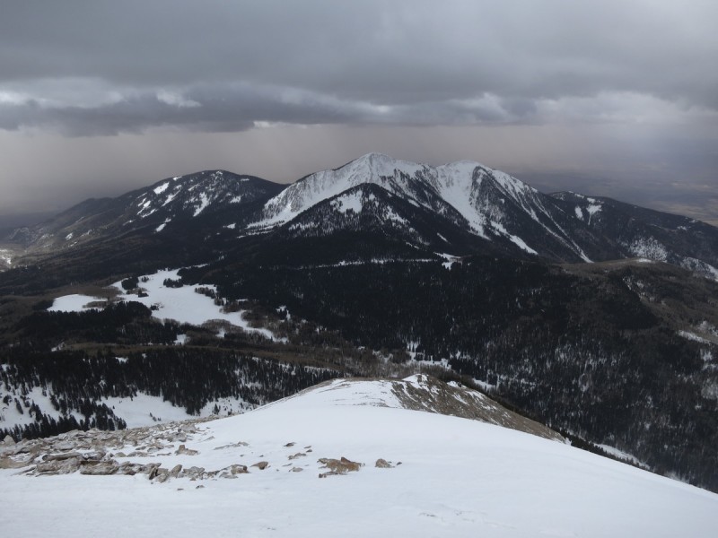
Middle La Sals from Moab View of Mt Tuk from SW Mt Tuk and Mt Peale
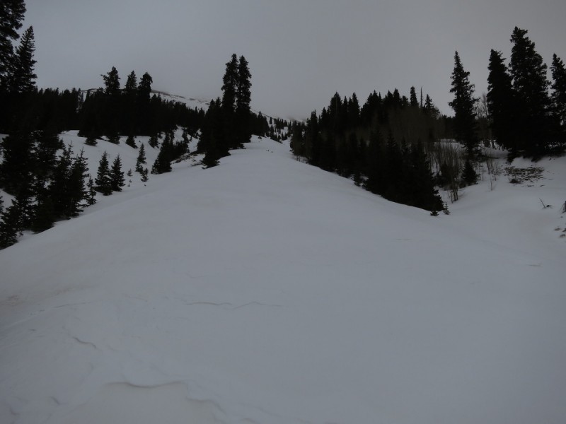
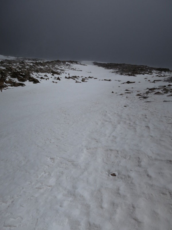
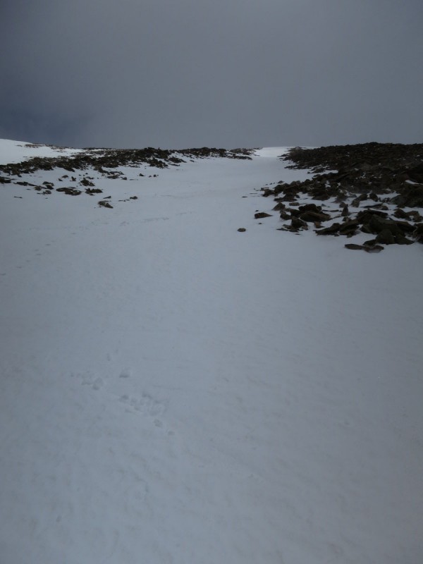
The night, while warm, did provide a good freeze of the snow. The first snow patches I encountered were reasonably solid, even low down in elevation. I booted up for maybe a quarter mile or so, before I started skinning. I only had to remove my skis once on the way up, though I did find a way around on the way back to avoid this hassle. The skin up to the pass went reasonably quick, and I got there around 8am, 2 hrs after I started.
Skinning up the road
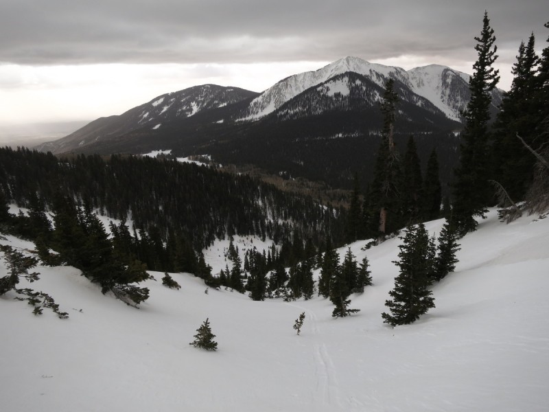
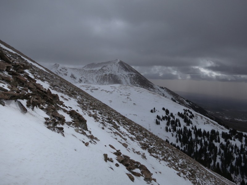
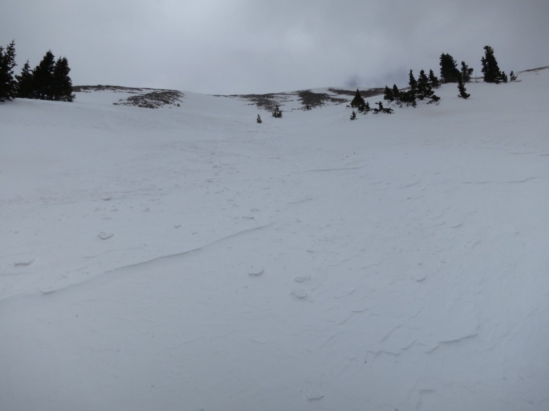
After the pass, I left the road, and started contouring around the ridge to get to the SE face of Mt Tuk. There is no advantage to going higher up, as the ridge above is rocky and sparse of snow (found this out on the return trip). From there, I spied a nice snowy path up to the chutes above. I skinned straight up the ~30 degree slope.
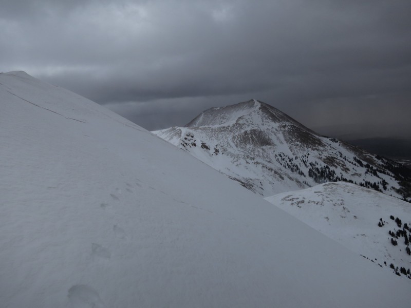
Hmmm, this looks like a nice snowy ridge feature to skin up! Looking back at South Mtn
With the cloud cover, I wasn't sure which finger/chute I wanted to take, but as I got closer, the middle one looked the best. The left one looked "technical" and the right one had a rocky exit. So middle one it was!
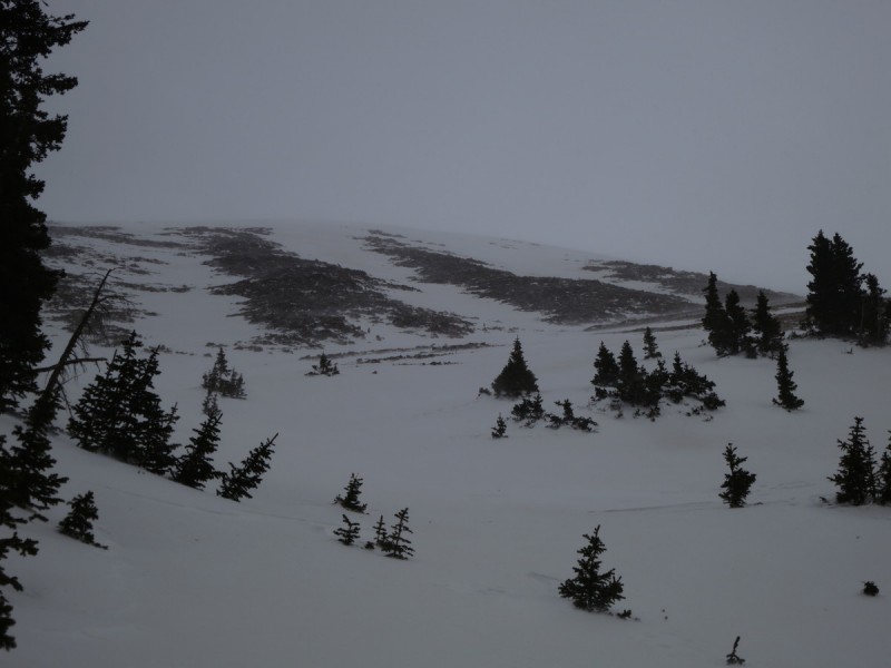
From this point on, the wind that I had heard howling all morning, made itself felt in full force above treeline. The climb was made a bit more interesting, as the wind gave me a "belay", as it pushed me into the snow slope. This was fairly nice, as the snow surface was bullet proof on the old snow, and only the toes of my ski boots penetrated. The storm snow provided better purchase into the snow, and was rather well bonded (at this elevation) to the old snow. I even took the plastic protector off my whippet to act as an ice ax on the climb. I didn't bring crampons, and while they would have been useful, I felt comfortable with just my whippet. The slope angle was mostly around 32-35 degrees, with the exit/summit area being a little more.
Getting closer to the 3 fingers - middle one looks nice! The sun peaks out through the clouds on South Mtn The middle finger! Mt Peale I see pink snow... yuk
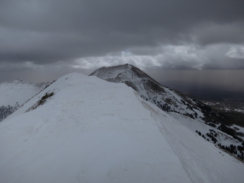
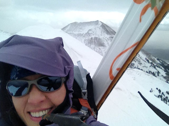
Approaching the summit, there appeared to be a massive cornice, and not wanting to plummet down the north face, I head over to the far west side, where I can see rocks. Once on the summit, I see that the cornice doesn't go over the edge, and would have been fine to walk along. That is, if the wind was less. As it was, I being buffeted by 50+ mph winds, and found it difficult to stand upright. So I snapped a few photos north and around, before dropping a few feet lower and anchoring myself in. Transitioning to ski mode was interesting, and a matter of gear-wind management.
View north from the summit Summit cornice-y area Pink dust clouds to the south... Me, getting beaten by the wind
Once on my skis, the wind gave me some extra push east as I dropped back to my finger chute of choice. Hard pack skiing awaited, with the storm snow giving the best turns. Below the finger chutes, the snow quality improved a lot, and I got in some great turns back down to the valley-ridge contour below.
My footprints taking a left turn to avoid what I thought could be a massive summit cornice Time to ski the middle finger! My skis, barely making a mark on the way down! Some lovely turns in the storm snow
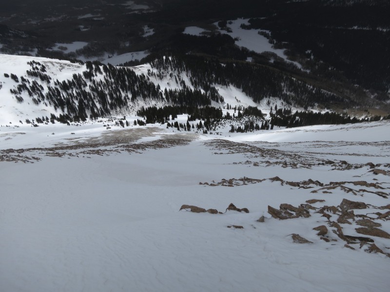
From the base of the SE face, the snow started to get a little warm along the way to the pass. The wind and cloud cover thankfully kept the snow just cold enough, that I didn't sink along my way down the road. There were quite a few more flat spots and uphills than I remembered on the way in, and I had to do a bit of skate skiing.
A look back at my ski route A parting shot of Mt Tuk, before the clouds swallowed it up again Hmmm, next project ski! Leaving the valley, as I entered - in the clouds
I got back to my car around 1pm, and knew I had just enough time to drive to Salt Lake City for the Icebreaker Reception with free food, beer & wine. Since what else does a ski mountaineering seismologist need to make the day complete?!
My GPS Tracks on Google Maps (made from a .GPX file upload):
Very Nice Climb! Tuk was my 1st LaSal peak, but a June climb, that cornice-y part was still there too, runs down the ridge toward Peale, made a nice steep snow climb. They like to play hide and seek those LaSals, very nice pics and timely for me too, plan to go up there in June again for the northern peaks
Mindy - It was intense up there! Tis the year to hit IT hard!
boudreaux - I've wanted to a ski a peak in the La Sals after seeing them last year from Arches, also with Taylorz's TR on it last year. I'll be back :wink:
FireOnTheMountain - They are fun and kinda remote! I hear the ridge from Peale to Tuk involves some scrambling...
that ridge has some class 4, I glissaded down the cornice to a saddle and started up a jagged ridgeline, dinner plate talus was a little difficult to manage. I did some ridge direct, but mostly traversed on the southside of the ridge to avoid some ugly steep couloirs on the northface. If you decide to do Mell, a couple of ridge points are unavoidable, and a nice steep finish. One of the points is Laurel. Wish I had pics, but that day the camera died on me!
Besides thinking that this was an impressive outing, I also wonder how the heck this mountain got such an unpronouncable name and I chuckled when I read ”now time to ski the middle finger.” Since i cannot pronounce the name of the mountain, ”Skiing the Middle Finger” is the title I've mentally given to this report.
Just solo'd the NE face yesterday, and was blown away by the high density of interesting terrain around Gold Basin. A pretty unique visual - 8,500 vert above the desert floor. Nice work getting the south side!
Caution: The information contained in this report may not be accurate and should not be the only resource used in preparation for your climb. Failure to have the necessary experience, physical conditioning, supplies or equipment can result in injury or death. 14ers.com and the author(s) of this report provide no warranties, either express or implied, that the information provided is accurate or reliable. By using the information provided, you agree to indemnify and hold harmless 14ers.com and the report author(s) with respect to any claims and demands against them, including any attorney fees and expenses. Please read the 14ers.com Safety and Disclaimer pages for more information.
Please respect private property: 14ers.com supports the rights of private landowners to determine how and by whom their land will be used. In Colorado, it is your responsibility to determine if land is private and to obtain the appropriate permission before entering the property.