| Report Type | Full |
| Peak(s) |
Mt. Flora - 13,129 feet Mt. Eva - 13,131 feet Parry Peak - 13,367 feet Mt. Bancroft - 13,262 feet James Peak - 13,272 feet |
| Date Posted | 03/31/2013 |
| Modified | 04/02/2013 |
| Date Climbed | 03/30/2013 |
| Author | letsgocu |
| Berthoud Pass to St Marry's Glacier Ridge Run Take 2 |
|---|
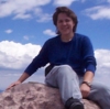
Berthoud Pass to St Marry's Glacier Ridge Run Take 2Mt Flora 13,146ft Mt Eva 13,130ft Parry Peak A 13,391ft Mt Bancroft 13,250ft (Unranked) James Peak 13,294ft Approximate Distance: 12 Miles Approximate Elevation Gain: 4,300ft Car Shuttle Start Location: Berthoud Pass Parking Lot End Location: St Marry's Glacier Parking Lot 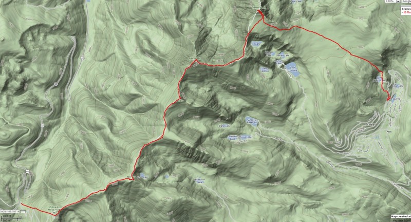 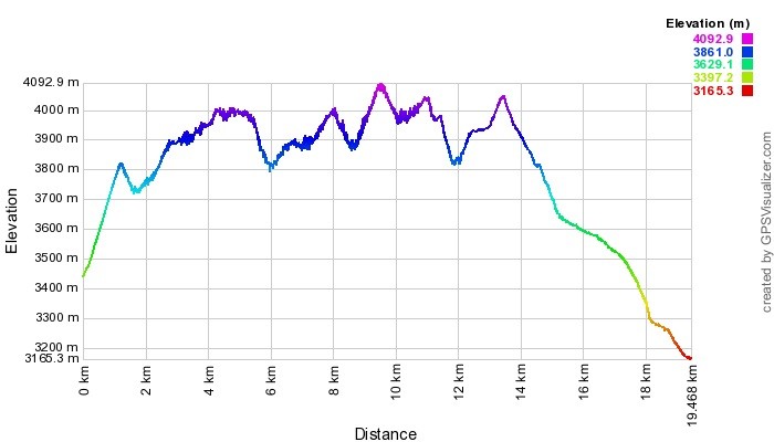 This all begun as an ambition for me to knock off several ranked peaks all at once, and now that winter was over and everyone wasn't stuck on "Snowflake Fever", I could turn peoples attention back to 13ers. This hike would require staging a car at St. Marry's Glacier, so no soloing. I was close to my goal of 100 summits in a 12 month period, 3 peaks would put me over the top, and this hike would net 4, so this was my hike of choice for the first weekend after Calendar winter ended. If you notice though, that is not the climb date listed in this TR. It wasn't for lack of trying that we didn't get this climb out of the way before we did, our first attempt was a week before on March 23rd, and included sdkiel as well. The weather forecast wasn't great. It called for a high of 5 degrees, sustained winds of 10-15mph sustained gusts to 20 with a significant chance of snow. We decided to give it the old college try and get out there. There was plenty of fresh powder when we reached the parking lot as it had just snowed about 10 inches the day before, and the parking lot was overrun by back country skiers. We geared up, including full our full compliment of AVI gear and set on up Colorado Mines Peak. Things were going pretty well until we reached the summit of Colorado Mines. I was so excited to see the structures at the summit to take some shelter behind from the wind. No dice though, the wind was swirling so bad it didn't set up any kind of a wind shadow. Shawn (sdkeil) happen to have an anemometer with him, and he reported that the temperature was -7 deg f, with a windchill of over -30 deg f for periods. Clearly the forecast regarding the winds, and there was very little visibility due to blowing snow. We decided at that point to listen to the little voice of our Mothers in our heads and head back down to Berthoud pass to live to climb another day. The 3 of us are all in preparations for a run on Denali in May, and those temperatures shouldn't have scared us off the mountain, but this was not the climb you want that much wind and no visibility. As we were descending the 1,200 ft back to the car we realized after retrieving the car staged at St Marry's there would be plenty of beer waiting for us in Idaho Springs, so we weren't too upset. 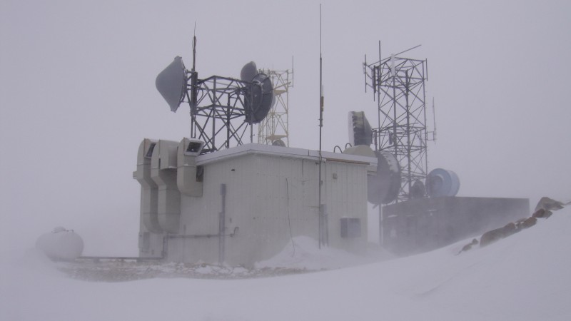 We watched the weather for the following week carefully as I was still eager to git this climb in, and things were shaping up much better for the 30th. I was pretty excited for this climb as I had two weeks in a row of no summits, including turning around on Capitol just before K2 due to weather 2 weeks prior. The Forecast showed sustained winds of 10-15mph sustained gusts to 22 with a 30% chance of snow, but 38 deg on the temperature. We got to the Berthoud Pass parking lot to a dawn with blue skies and much less skiers which we saw as a good sign. We were sands Shawn as he was on vacay this weekend, but Kelly and I threw on our AVI gear and headed up Colorado Mines Peak for the 2nd weekend. And conditions were great so far... 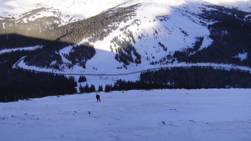 When we reached the summit of Colorado Mines Peak I realized that the wind forecast was a little off as it was much windier than I was expecting. I decided to reach into my bag for a balaclava and heavier gloves, but at this point things were looking much better than the previous week since it was about 20 degrees warmer to start with, and we could see our route over to Flora. 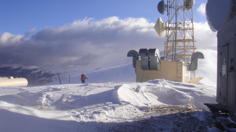 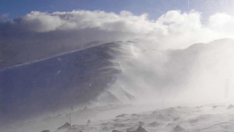 After reaching the summit of Mt Flora, we realized we were in for a windy day. The exposed summit of Flora left little to break the wind, which we estimated to be over 30mph sustained gusts to 4mph. This did however leave most of our route wind blown so we were still encouraged and we pressed on without much of a break. 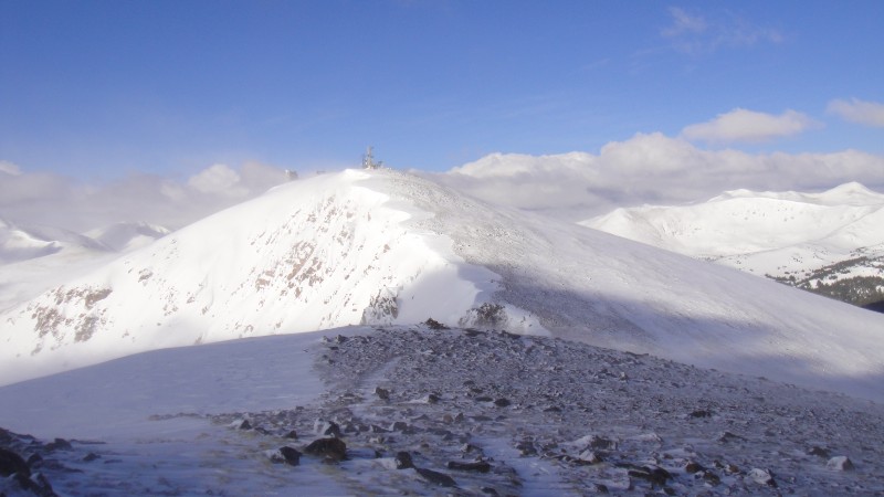 By the time I reached the summit of Eva the wind was taking its toll. There were places now where it was causing me to have to walk sideways to stay on course, and gusts that would throw me off balance. I kept thinking to my self that in not too long I would be to the point where it was less elevation gain to Continue Mission and there would be no other option but to succeed.  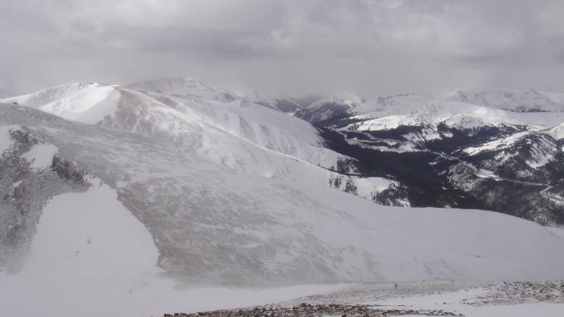 Once we got to the summit of Parry I stopped to reflect a bit as this was my 100th summit since I started counting on May 6th 2012, not including any unranked 13ers. Kelly figured that was worthy of a summit shot, which was somewhat difficult due to the wind, and the fact that we were newly socked in. But we got in a picture to remember the moment none the less. 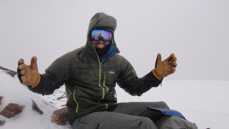 As we dropped down a bit below the clouds we could see the traverse between Bancroft and James. This is the only part of this climb that isn't low class 2. I was pretty happy to get a view of things before we were on it. I had assumed that when the clouds rolled in on Parry that we could have poor visibility the rest of the day. This traverse in the summer I am told is pretty straight forward with some ledges that get you around some spicy sections, and nothing more than low class 3. I was eager to see what things would look like in the winter. 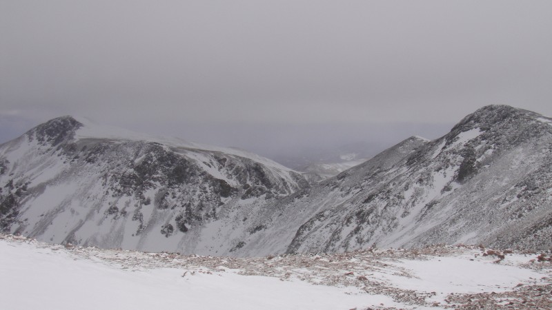 We made quick work of Bancroft as there is not much gain from Parry, and started our descent to the Bancroft James saddle just as the conditions started to deteriorate. 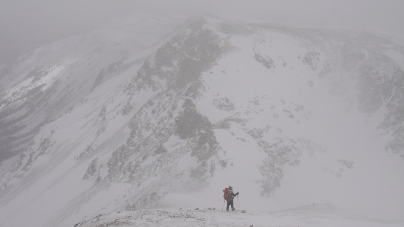 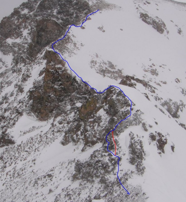 For a moment things cleared and I tried to snap a picture that would show a birds eye view of the traverse. Our route in Blue, a better way in Red. We decided right from the start to side hill a little bit on the rocks as there was a carin, but after a short time decided it was better to be on the ridge. At this point we decided to ditch the trekking poles in favor of axes. 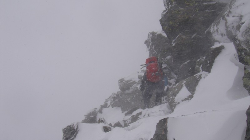 The ridge breaks a bit and there was a steep section that we decided to ascend as the snow on that slope was quite consolidated. This was the first slope of the year for me where the snow was consolidated enough to really get a good enough bite with an ice ax to kick steps in safely. Couloir season is just around the corner!!! 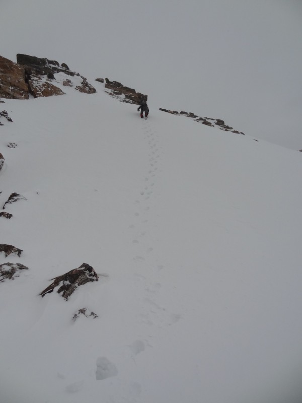 After our fun little steep snow climb it was back on the ridge which was pretty straight forward all the way to the upper plateau of James. 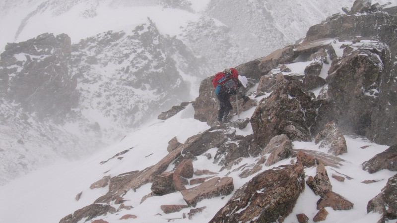 Once we were on the plateau of James we decided to stick right and follow the summer trail up the East Ridge of James to stay off the deep snow.  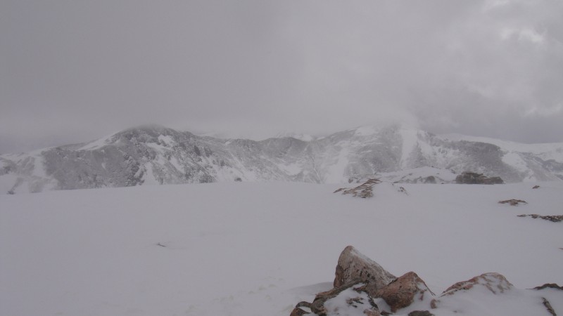 We descended mainly the summer trail down James toward the Glacier. We stayed a little bit high and traversed left before dropping into the flat area between James and the glacier to avoid having to regain any elevation. As we we were descending toward the flat area the weather took a turn and visibility dropped, and I even had to stop to put back on heavier gloves and goggles which I had just gotten rid of as we were descending. Visibility was down to very little but we kept getting glimpses of the rock outcropping that is just to the south of the top of the glacier so we new we were on the right track. We reached the glacier, I snapped a picture, and soon realized there wouldn't be much glasading as there was a pesky layer on top of the consolidated stuff that would cause resistance. Once we got down lower on the glacier when it got steeper we did get in a short slow glasade, it was nice none the less. 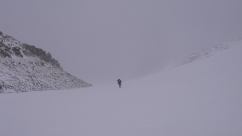 I was pretty happy to get somewhat of a glimpse of the lake meaning we were nearing the car. 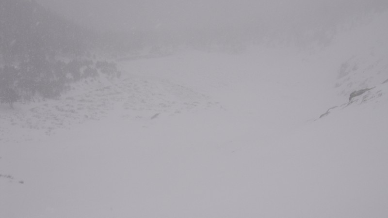 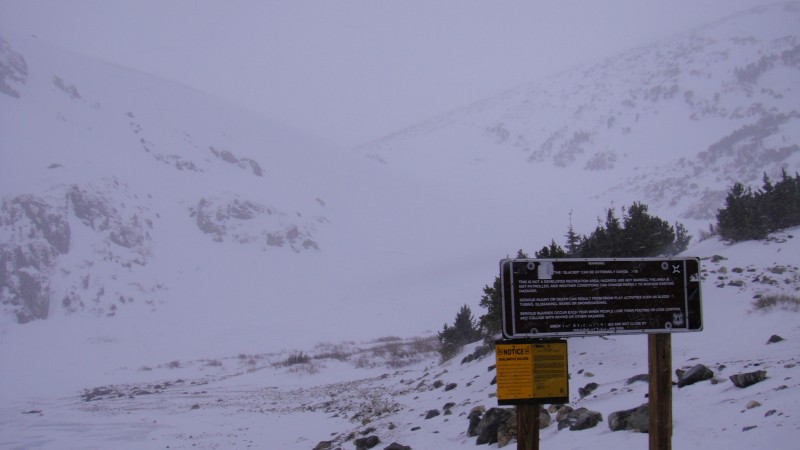 As we got down farther in the trees the sky turned blue in parts despite a gentle snow. The wind was gone by this point, and I couldn't help but to stop for a moment to take in the scenery. There had been very little of this entire climb where I had done much sightseeing due mostly to the wind, and wanting to just keep moving. I stripped off my gloves and hat, because after all it was a pretty warm early spring day without the wind, and walked the last few 100 feet through the trees enjoying the snow and the smells of wet pine trees. This was a great end to a well fought climb, but I was still happy to see the car. Kelly chuckled as we reached the parking lot noting the fact that we were the last care in the lot. We had seen signs of many others up around the glacier. I asked... "Does that mean we win?" Glad to have this one in the books, and glad to finally after almost 11 months of hard work to have my 100th summit... 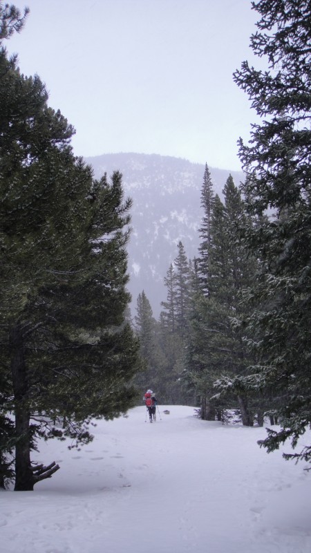 Thumbnails for uploaded photos (click to open slideshow):
|
| Comments or Questions | ||||||||||||
|---|---|---|---|---|---|---|---|---|---|---|---|---|
|
Caution: The information contained in this report may not be accurate and should not be the only resource used in preparation for your climb. Failure to have the necessary experience, physical conditioning, supplies or equipment can result in injury or death. 14ers.com and the author(s) of this report provide no warranties, either express or implied, that the information provided is accurate or reliable. By using the information provided, you agree to indemnify and hold harmless 14ers.com and the report author(s) with respect to any claims and demands against them, including any attorney fees and expenses. Please read the 14ers.com Safety and Disclaimer pages for more information.
Please respect private property: 14ers.com supports the rights of private landowners to determine how and by whom their land will be used. In Colorado, it is your responsibility to determine if land is private and to obtain the appropriate permission before entering the property.