Download Agreement, Release, and Acknowledgement of Risk:
You (the person requesting this file download) fully understand mountain climbing ("Activity") involves risks and dangers of serious bodily injury, including permanent disability, paralysis, and death ("Risks") and you fully accept and assume all such risks and all responsibility for losses, costs, and damages you incur as a result of your participation in this Activity.
You acknowledge that information in the file you have chosen to download may not be accurate and may contain errors. You agree to assume all risks when using this information and agree to release and discharge 14ers.com, 14ers Inc. and the author(s) of such information (collectively, the "Released Parties").
You hereby discharge the Released Parties from all damages, actions, claims and liabilities of any nature, specifically including, but not limited to, damages, actions, claims and liabilities arising from or related to the negligence of the Released Parties. You further agree to indemnify, hold harmless and defend 14ers.com, 14ers Inc. and each of the other Released Parties from and against any loss, damage, liability and expense, including costs and attorney fees, incurred by 14ers.com, 14ers Inc. or any of the other Released Parties as a result of you using information provided on the 14ers.com or 14ers Inc. websites.
You have read this agreement, fully understand its terms and intend it to be a complete and unconditional release of all liability to the greatest extent allowed by law and agree that if any portion of this agreement is held to be invalid the balance, notwithstanding, shall continue in full force and effect.
By clicking "OK" you agree to these terms. If you DO NOT agree, click "Cancel"...
Trailhead: North Halfmoon creek
Route: Fiascol (ascent), Friscol (descent)
Mileage: 12
Elevation gain: 4,683'
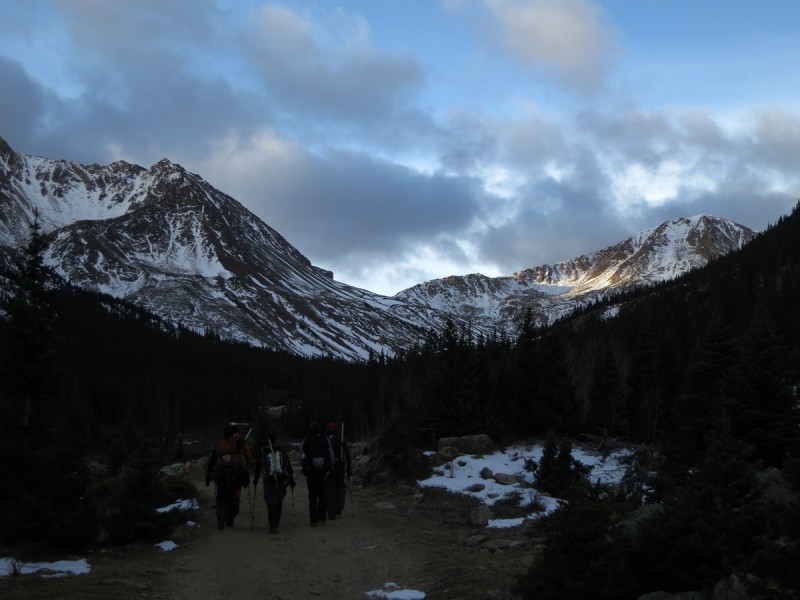
When Brian posted up this trio for Saturday, I thought, why not? I no longer need to save Centennials for anyone, so why turn down another opportunity to go with a group to climb them? Thankfully the wind forecast in the Northern Sawatch wasn't all that bad, so off I drove stupid early on Saturday morning to meet the group at the Elbert trailhead to carpool up to the 4WD trailhead.
The 6 of us piled into 2 vehicles and had no problems driving all the way to the trailhead. I had wondered which route Brian was planning, so when we started up the 4WD road to the southwest of the trailhead (between French and K 49), I didn't think too much of it. Though after a mile we had a quick discussion, and it turns out we meant to take the 4WD mining road 0.5 miles east of the trailhead. So we did some quick map research and found the Roach variation route that ascends a gully on the west side of the Casco - Frasco saddle. We'd add a bit of mileage to the day, but we would get to do a loop, which is always nice.
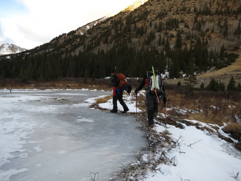
I think I even prefer the valley we went up, as the views were great, as the sun hit the peaks to the northwest. There was some ice in the meadows, that we had to detour around, but otherwise the road was a pretty easy ascent.
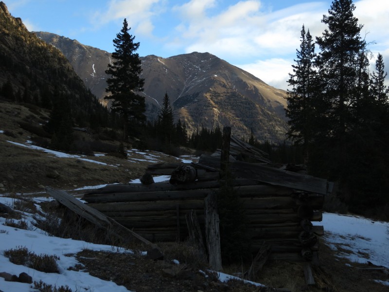
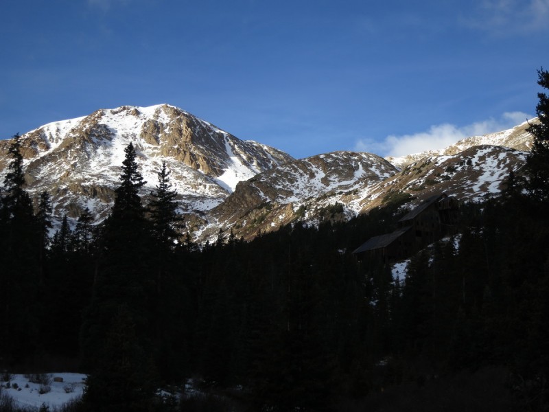
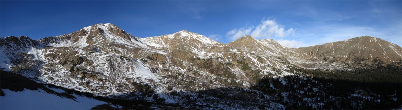
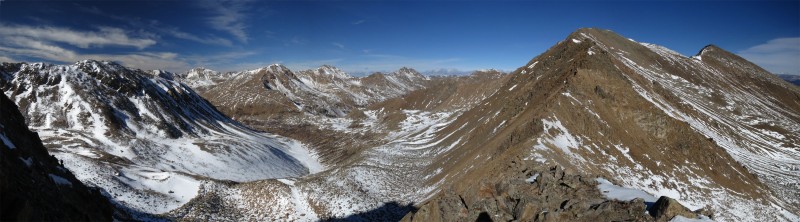
Hiking up the other road, Champion being hit by morning light Ice road Frozen beaver pond South ridge of Massive Champion and mine building Champion to K 49 pano First view of Casco
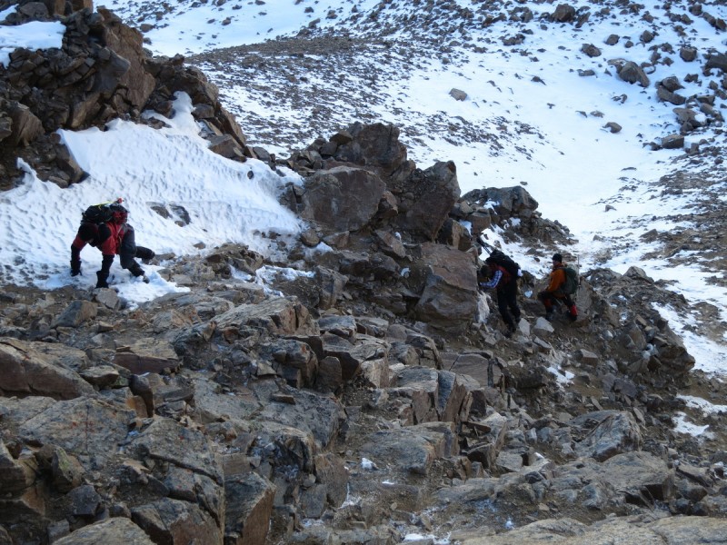
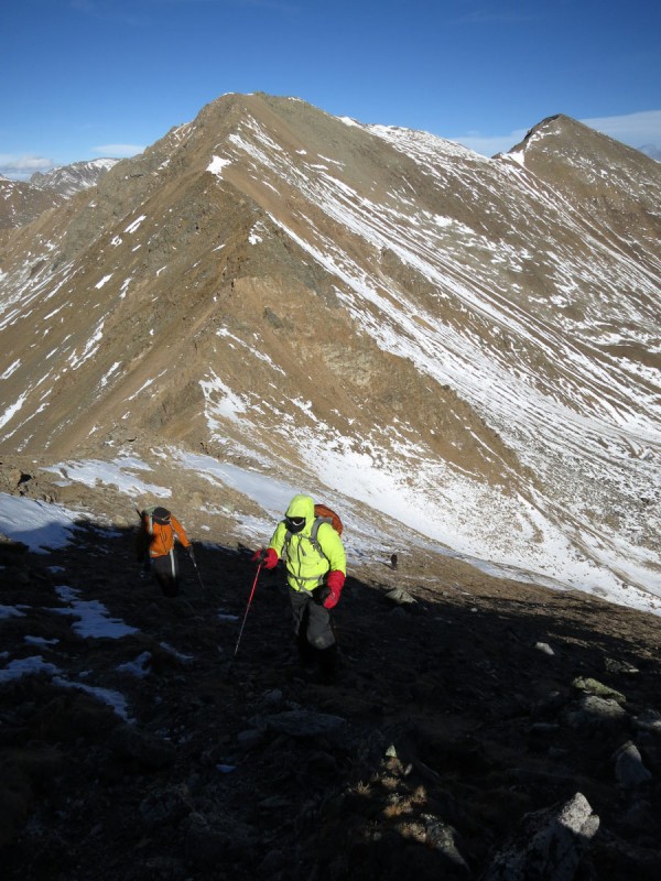
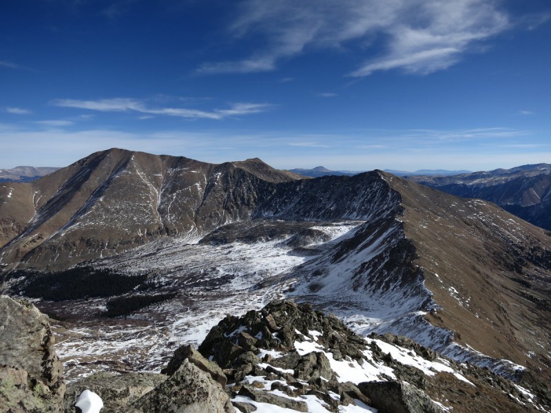
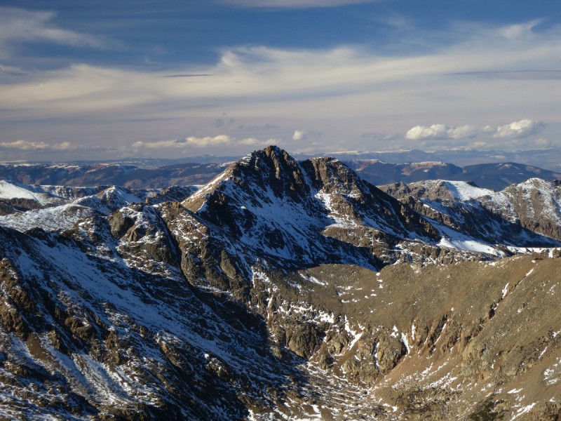
It took a while to do the end around and get our first view of Casco. From there we saw a nice ramp that would take us up to our ascent gully. We reconvened at the base of the gully later to be known as "The Ordeal", to discuss our options. Going up the center was a bit less steep, but it would be near impossible to not have every step slough rocks down on anyone below. We discussed fanning out laterally, but ended up deciding to take the more solid rock to the right side. It was a very loose class 3 ridge feature, that also proved difficult to not let rocks slip and fall down the slope. I managed to stop a few rock falls from above with my feet, but was not able to prevent more rocks coming down as I moved my feet. It's not a preferred route with a group. We spread out into two groups to allow the rockfall to go down different gullies as we went up. Steep and I scouted the best route on the traverse to the saddle, once the worst of the rockfall zones was exited. Steep went high, I went low, the rest of the group chose somewhere inbetween. We were all happy to finally reach the saddle and have the worst part of the route over for the day!
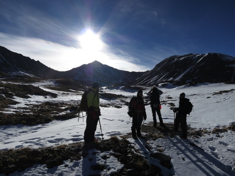
The approach on a nice ramp John in front of "The Ordeal" Ascending The Ordeal Steep scouting the higher traverse Pano from Casco - Frasco saddle
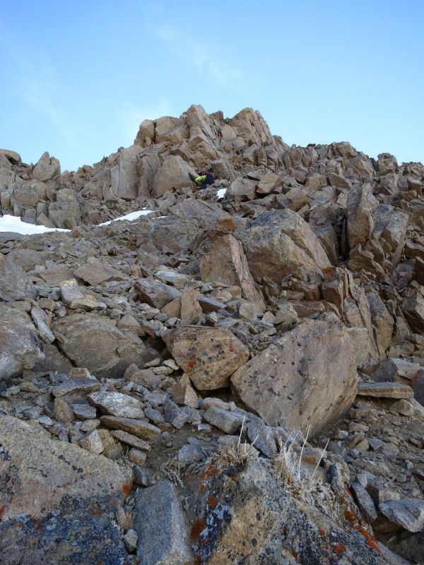
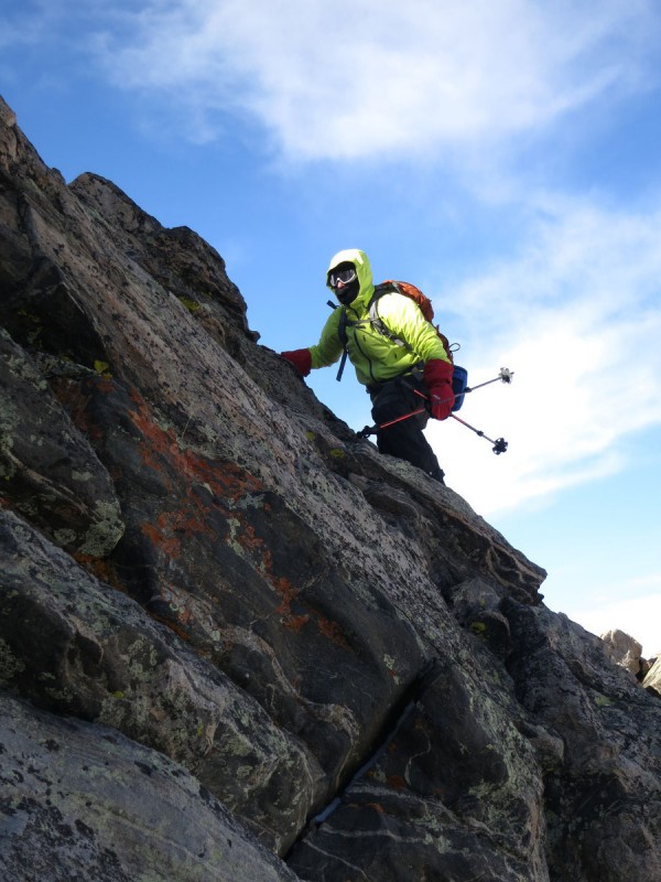
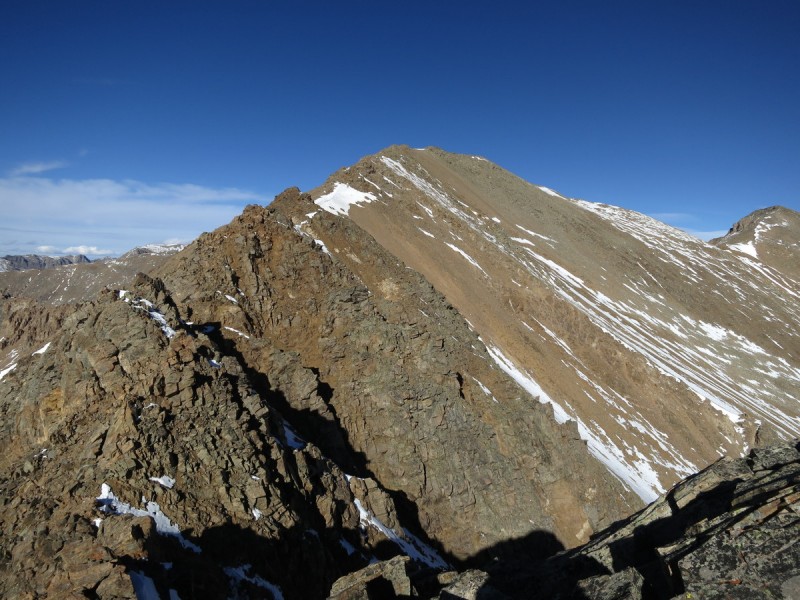
From the saddle, we followed the ridge, mostly to the east (left) on the way up. Sometimes the ridge proper was best, other times we stayed to the east. Steep wisely chose the ridge proper just below the summit for some class 4 slabby crack climbing, while I managed to find a class 5 mantle move to get up the east face section. I had hoped to find an easier way up for the group, but the snow must have hid the best route.
Ascending Casco, with Frasco and French in background Steep wisely choosing ridge proper
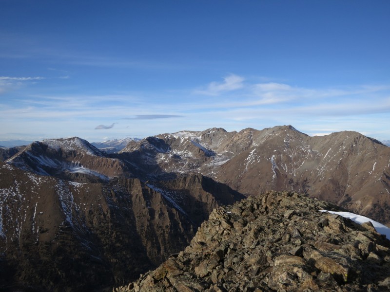
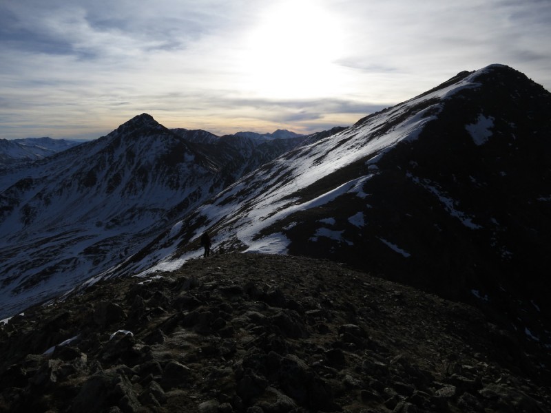
We topped out on Casco Peak much later than planned, but we knew the worst was behind us, and we only had a ridge run to go to complete the day.
Adam coming around the last rocks to the summit Lackawanna Elbert and Bull Hill I need longer arms! The ridge crack we found, snow must have hidden class 2+ route
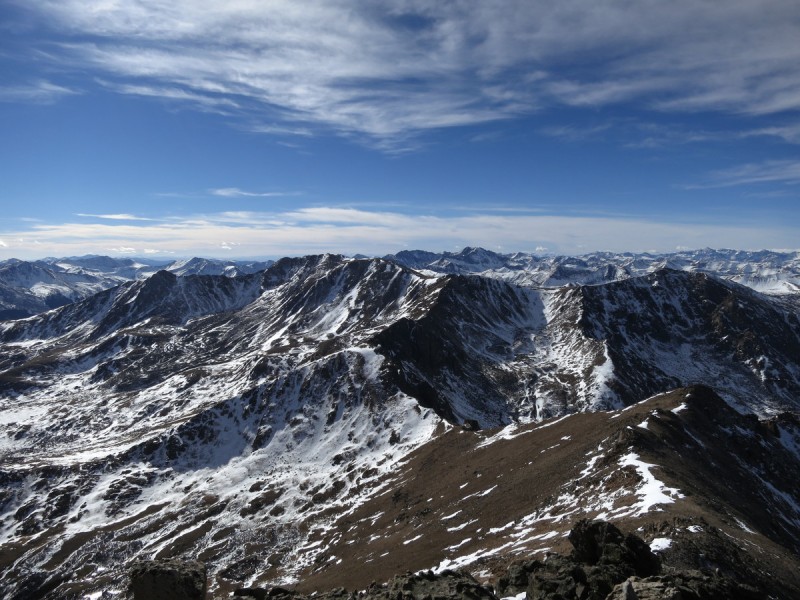
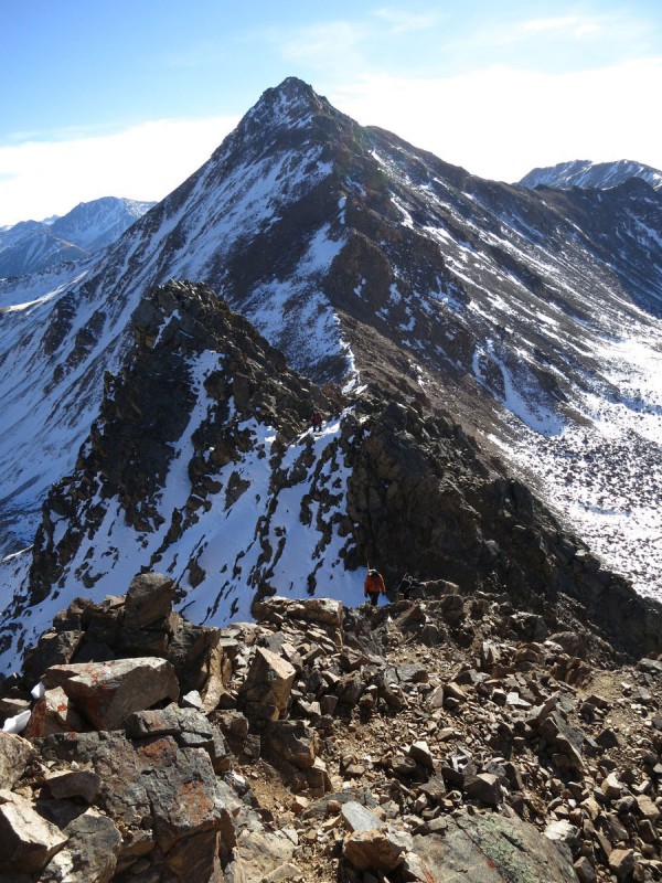
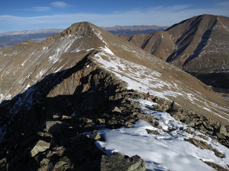
We made pretty quick work of the ridge traverse over to Frasco Benchmark. Plenty of rocky bumps along the way allowed for some nice photos of the route.
Ridge to Frasco BM Looking back at the ridge to Casco
We didn't stop for too long on the summit of Frasco Benchmark, as the day was getting long already, and we didn't want to spend much time on an unranked peak. So I snapped a couple photos of the long shadows and John handed out Sour Patch Kids.
Oh Deer!
John snaps a photo of me on Frasco BM - Photo Credit: fepic1
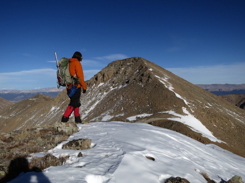
From Frasco the ridge run was quick and simple, and we topped out on French Mtn around 3-ish
Ridge to French John enroute to French Oklahoma - Massive
Summit shot on French - Photo Credit: fepic1
From here, we dropped down the French Frasco saddle, and decided to cut off a little mileage by not going directly to the end of the 4WD road that wound around the drainage, and instead just heading down the first gully and "bee-lining it" through the willows to find the road on the other side.
Sun is setting... Descending the French Frasco saddle Ruban blanc de la mort
Then we encountered ice, and more ice on the road. Parts were fine, but the lower section of the road as it switched back to the valley below was downright treacherous! The road would drop off to one side, and the ice flowed over it, so falling there would have been bad. So we ended up bushwhacking next to the road to find easier passage. We even found "secret ice". Ice that was hidden by a dusting of snow. Both Brian and I went down hard on this secret ice. My wrist is ok, but it stung at the time! Plenty of slips were had by all at some point. More fun came when we had to cross the creek at the end of the trip to get back to the main road. Since the creek wasn't frozen all the way through, and there were many gaping holes leading to watery danger. Upstream we went, until we found a reasonably solid crossing. Microspikes went on, and we slowly carefully crossed the creek.
Brian walking the ice in the valley - Photo Credit: Steep
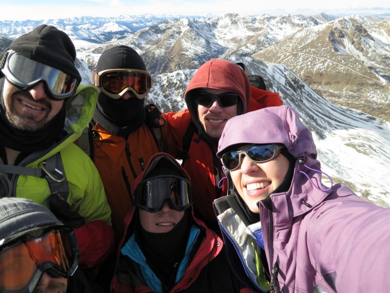
A great day out, even if we were all tired and exhausted by the end of it! Everyone earned their mountaineering stripes today! Especially as one participant only had Quandary, Grays and Torreys.
My GPS Tracks on Google Maps (made from a .GPX file upload):
Circuitous route but great views! Is that the "Fiascol" that you guys climbed? That's what Roach calls it at least. "Ordeal" is a good name for it too.
Thank you Otina for the trip report and leading us up the ordeal:)
I won't leave my camera at home again ! That ridge line from Casco to
Frasco was rugged .You took some great photos The views of the snow coverd Elks makes me more Excited for Winter.
Awesome group I hope to get out with everyone again
geojed - Yep, we climbed the Fiascol and descended the Friscol. I'll have to edit the TR now.
dmccool - Just don't forget your microspikes!
fepic1 - Thanks for keeping an eye on the rest of the group, while I tried to find a solid way through that crap!
MtnHub - With the wind and cold, I didn't think my camera would stay upright or on (batteries were mostly dead), so I had to do the arm extension shot. Need to keep practicing!
Caution: The information contained in this report may not be accurate and should not be the only resource used in preparation for your climb. Failure to have the necessary experience, physical conditioning, supplies or equipment can result in injury or death. 14ers.com and the author(s) of this report provide no warranties, either express or implied, that the information provided is accurate or reliable. By using the information provided, you agree to indemnify and hold harmless 14ers.com and the report author(s) with respect to any claims and demands against them, including any attorney fees and expenses. Please read the 14ers.com Safety and Disclaimer pages for more information.
Please respect private property: 14ers.com supports the rights of private landowners to determine how and by whom their land will be used. In Colorado, it is your responsibility to determine if land is private and to obtain the appropriate permission before entering the property.